It looks like you're using an Ad Blocker.
Please white-list or disable AboveTopSecret.com in your ad-blocking tool.
Thank you.
Some features of ATS will be disabled while you continue to use an ad-blocker.

Quake Watch 2013
page: 107share:
What exactly does a seismometer measure? Does it measure vibration or a combination of different energies from an event? It is all energy but I was
just wondering how elaborate the sensors are.
reply to post by Olivine
Of course what we don't know is the sensitivity of the recorders. If one is set to very sensitive then the screen sensitivity may be much lower for the same results.
The mV figure is only screen sensitivity.
If you can get the responses they may tell you little more. Here are the responses for ANMO
Of course what we don't know is the sensitivity of the recorders. If one is set to very sensitive then the screen sensitivity may be much lower for the same results.
The mV figure is only screen sensitivity.
If you can get the responses they may tell you little more. Here are the responses for ANMO
www.ldeo.columbia.edu/~ekstrom/Research/SWD/current/RADB_SWD_grd.html
2013 6 27 12 26 32.0 59.00 -31.00 33.0 4.8 REYKJANES RIDGE

reply to post by PuterMan
Puterman, I have no clue how to interpret those response figures, lol, but thank you for trying to educate me.
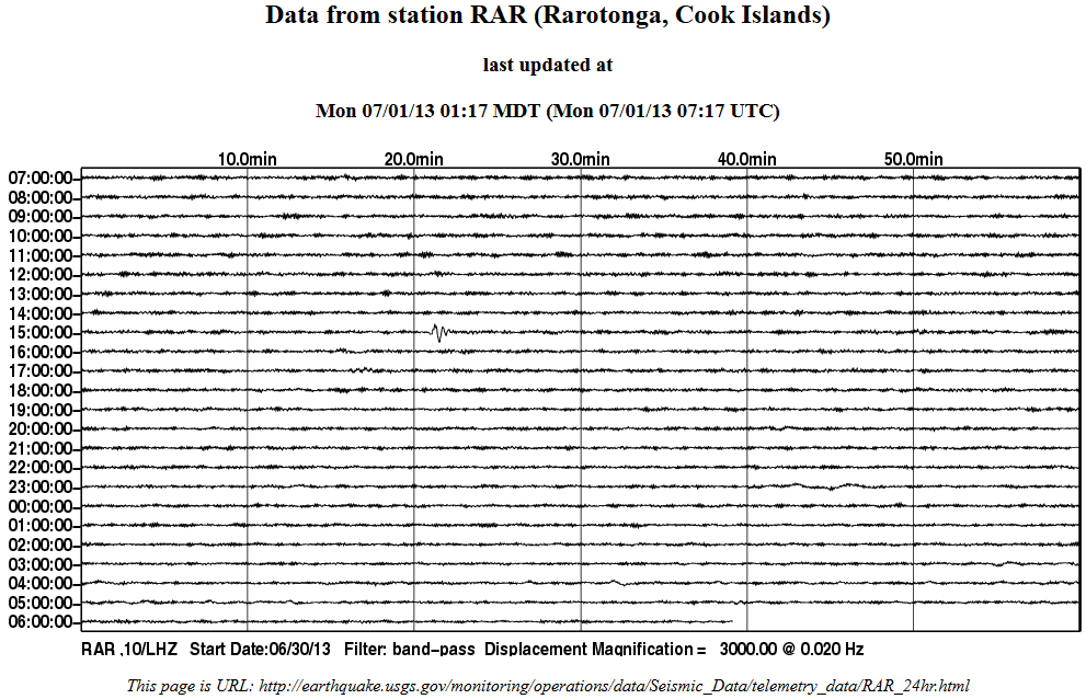
Just noting this small one, so that I can find it later.
Last night's Mag 3.9 west of Hollister, CA was the largest quake in the state over the past 30 days, and reported as "felt" by over 760 people.
Puterman, I have no clue how to interpret those response figures, lol, but thank you for trying to educate me.
Just noting this small one, so that I can find it later.
Last night's Mag 3.9 west of Hollister, CA was the largest quake in the state over the past 30 days, and reported as "felt" by over 760 people.
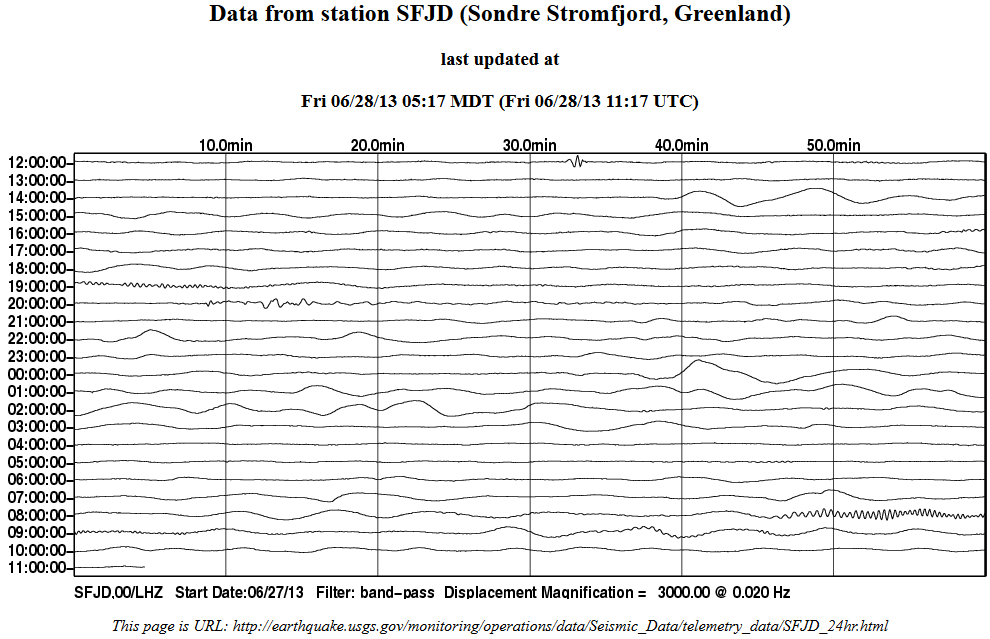
M5.0 - 42km NNE of Salyan, Nepal 2013-06-28 11:40:47 UTC
Event Time
2013-06-28 11:40:47 UTC
2013-06-28 17:25:47 UTC+05:45 at epicenter
2013-06-28 06:40:47 UTC-05:00 system time
Location
28.741°N 82.297°E depth=10.0km (6.2mi)
Nearby Cities
42km (26mi) NNE of Salyan, Nepal
58km (36mi) E of Dailekh, Nepal
66km (41mi) ENE of Birendranagar, Nepal
67km (42mi) N of Tulsipur, Nepal
318km (198mi) WNW of Kathmandu, Nepa
USGS
edit on 28-6-2013 by lurksoften because: (no reason
given)
not sure about the 4.7/ 4.9/ 5.0mb size the networks are estimating this quake
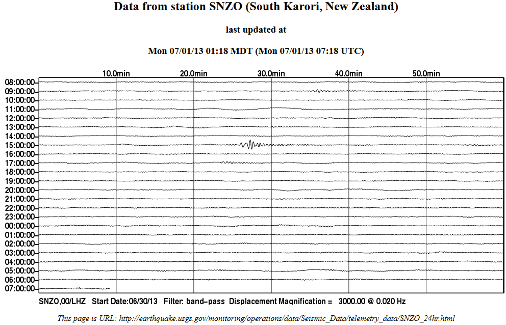
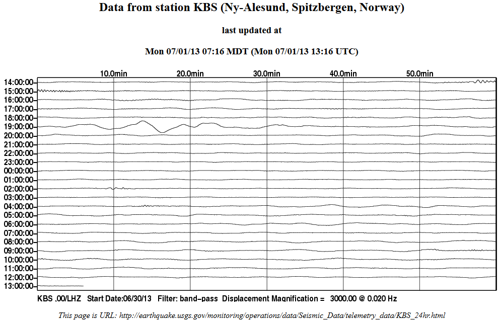
2013-06-28 07:45:22, 22.86°S , 171.30°E, 10, Southeast of Loyalty Islands
looks more like a 5.5 on SNZO
compare with these other SE of Loyalty Is traces on SNZO
24-03-2013, 5.2
06-03-2013, 5.6 and 5.4
and
17-03-2012. 5.3
and
4-03-2012, 5.7
even LDEO has it at 5.0. and they are usually 1- 2-3 decimals higher than the rest because they are Ms.
reply to post by muzzy
could be the conversion factor, all are mb except LDEO, and according to Geofons conversion table 4.7mb is 5.2Mw, and 5.0mb is 5.4Mw. Even 5.0Ms is 5.4Mw.
I think I'll need to mark my SNZO graphs with the magnitude types as well, its too confusing.
could be the conversion factor, all are mb except LDEO, and according to Geofons conversion table 4.7mb is 5.2Mw, and 5.0mb is 5.4Mw. Even 5.0Ms is 5.4Mw.
I think I'll need to mark my SNZO graphs with the magnitude types as well, its too confusing.
reply to post by muzzy
There are probably other threads on this Storm, but just in case you are like me and haven't read them on ATS.
Worst storm in Wellington for 45 years, harbour side rail knocked out for a week due to wave action on the ballast, traffic chaos all week, $NZ40million damage estimate, 30,000 without power on the Friday, down to 200 a week later.
Roofs blew off and trees down, roads closed, highest wind gust was 200km/hr.
No major damage here on our side.
reply to post by muzzy
EMSC and GFZ have it now
EMSC Reception Time 2013-06-29 07:12 UTC 10 hrs!
GSRAS and Useless still not showing it.
While I'm here again, 7 day update on the Forzone – Minucciano , Massa/Lucca/Carrara, Italy 21/06/2013, 5.2ML and aftershocks here
summary
1178 cumulative aftershocks 0-168hrs (7 days)
mag
UH......... OOOOOOOOOH!!!!
www.sott.net...
Doom on!!
Take two.......
www.registerguard.com...
Uh...oooooooh!!
Doom on!!
www.sott.net...
Doom on!!
Take two.......
www.registerguard.com...
Uh...oooooooh!!
Doom on!!
edit on 29-6-2013 by radpetey because: (no reason given)
Well.....excuuuuuuuse me!
Had no idea they were all filthy liars!
TAKE TWO....
www.registerguard.com...
Uh....oooooh!!
Doom on!!
Seems to me, that if the cascadia is going to unzip, it might as well start in this very area that these little shrimpies are washing up, belly up!
Just sayin'.
Had no idea they were all filthy liars!
TAKE TWO....
www.registerguard.com...
Uh....oooooh!!
Doom on!!
Seems to me, that if the cascadia is going to unzip, it might as well start in this very area that these little shrimpies are washing up, belly up!
Just sayin'.
edit on 29-6-2013 by radpetey because: (no reason given)
reply to post by radpetey
Here is another article with a bit more information. Krill Die-Off
This is happening along a 500+ km stretch of coast.
Best case scenario is that it was due to huge mating swarms near the surface being washed ashore, and this should be the end of it.
Second scenario is worse; low oxygen levels killing off the krill. Normally, the hypoxic water layers don't show up until later in the summer when the water temperature is higher.
From the article:
Sorry for the non-quake related detour, Muzzy. (or, is it related?)
Here is another article with a bit more information. Krill Die-Off
This is happening along a 500+ km stretch of coast.
Best case scenario is that it was due to huge mating swarms near the surface being washed ashore, and this should be the end of it.
Second scenario is worse; low oxygen levels killing off the krill. Normally, the hypoxic water layers don't show up until later in the summer when the water temperature is higher.
From the article:
Peterson said the water temperature right now is low enough that hypoxia wouldn’t be expected.
But, tests have returned unexpected results.
Joe Tyburczy, a researcher with the California Sea Grant extension office who has been looking into the dead krill with Peterson, said oceanographic cruises along the northern California coast did find lower oxygen levels than usually seen in Pacific Northwest waters.
“If it is hypoxia, there’s a possibility of implications for other species like crab,” he said.
Sorry for the non-quake related detour, Muzzy. (or, is it related?)
Originally posted by Olivine
reply to post by radpetey
Here is another article with a bit more information. Krill Die-Off
This is happening along a 500+ km stretch of coast.
Best case scenario is that it was due to huge mating swarms near the surface being washed ashore, and this should be the end of it.
Second scenario is worse; low oxygen levels killing off the krill. Normally, the hypoxic water layers don't show up until later in the summer when the water temperature is higher.
From the article:
Peterson said the water temperature right now is low enough that hypoxia wouldn’t be expected.
But, tests have returned unexpected results.
Joe Tyburczy, a researcher with the California Sea Grant extension office who has been looking into the dead krill with Peterson, said oceanographic cruises along the northern California coast did find lower oxygen levels than usually seen in Pacific Northwest waters.
“If it is hypoxia, there’s a possibility of implications for other species like crab,” he said.
Sorry for the non-quake related detour, Muzzy. (or, is it related?)
I feel ya... wouldn't hypoxia also effect other animals as well??\
I like the idea of them just being plum tuckered out form their endeavor to make the world go round one more time......hehehehe!
www.ldeo.columbia.edu/~ekstrom/Research/SWD/current/RADB_SWD_grd.html
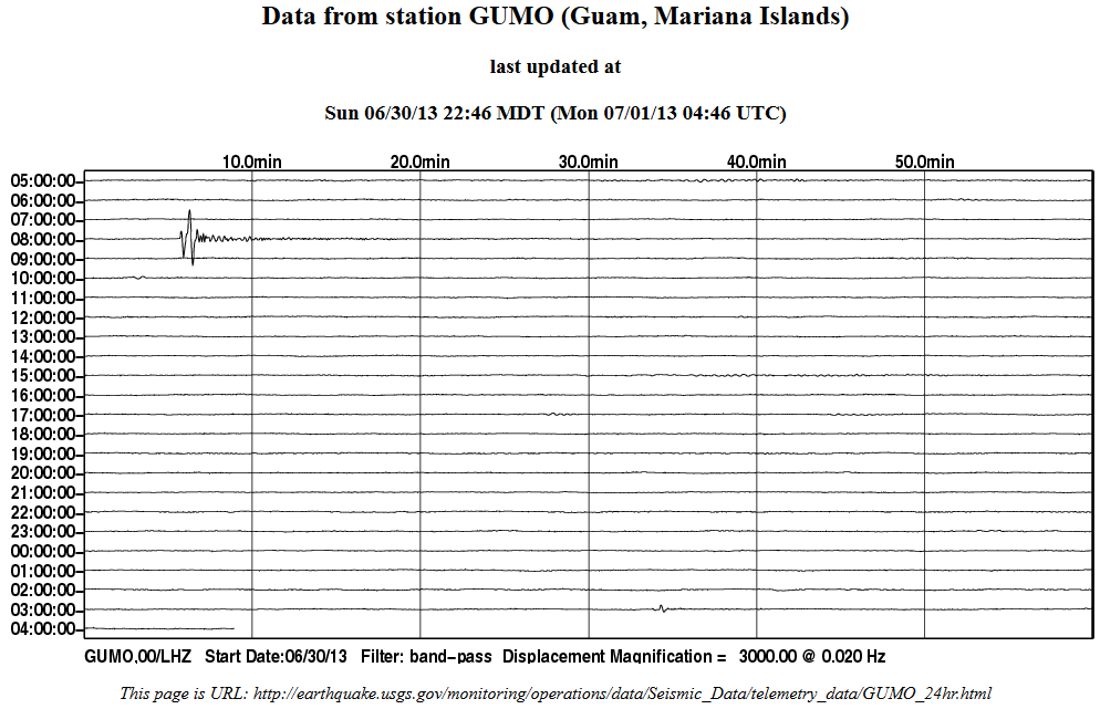
2013 6 30 8 5 12.0 12.25 143.75 33.0 4.8 SOUTH OF MARIANA ISLANDS

2013 6 30 15 13 44.0 -17.75 -176.25 33.0 4.9 FIJI ISLANDS REGION


Anyone having information about what causes the quakes in Oklahoma?
www.ldeo.columbia.edu/~ekstrom/Research/SWD/current/RADB_SWD_grd.html

2013 7 1 2 2 32.0 75.75 -60.25 33.0 4.9 BAFFIN BAY


reply to post by rickymouse
Looks like you got missed!
Basically it measures vibration/ground movement but that is a simplistic answer. There are many variations in ground movement. You possibly cannot call them all vibrations when you consider that some can have a wave length of hundreds of kilometres.
The P wave is a compression wave or pressure wave so it is a 'vibration', closest to a vibration from say a bedded engine, whereas the surface waves are long rolling 'vibrations'.
So yes it measures vibrations and a combination of energies. In the simplest terms however it measures how much the ground moves.
On this page you will find many links about seismometers that may help.
Just to add, when you see a seismogram in America registering an event it is indeed a fact that the ground has moved. Amongst those links on that page you will find Oklahoma Geological Survey Seismogram, Spectrogram, and Magnetogram Index
In particular on that page take a good look at 1999 AUG17, Turkey Earthquake.and more specifically the second and third paragraphs after the second diagram. These paragraphs describe this. Note that they call the P wave a push-pull wave, which what it is. A series of compressions and decompressions travelling at anything up to Mach 38 !!!! (Speed of sound is ~.34 km/sec and P wave can travel up to 13 km/sec in the mantle. These are not the damaging "vibrations" - the worst of which are the surface wave (Love - like ripples or Rayleigh which is a surface roll).
What exactly does a seismometer measure? Does it measure vibration or a combination of different energies from an event? It is all energy but I was just wondering how elaborate the sensors are.
Looks like you got missed!
Basically it measures vibration/ground movement but that is a simplistic answer. There are many variations in ground movement. You possibly cannot call them all vibrations when you consider that some can have a wave length of hundreds of kilometres.
The P wave is a compression wave or pressure wave so it is a 'vibration', closest to a vibration from say a bedded engine, whereas the surface waves are long rolling 'vibrations'.
So yes it measures vibrations and a combination of energies. In the simplest terms however it measures how much the ground moves.
On this page you will find many links about seismometers that may help.
Just to add, when you see a seismogram in America registering an event it is indeed a fact that the ground has moved. Amongst those links on that page you will find Oklahoma Geological Survey Seismogram, Spectrogram, and Magnetogram Index
In particular on that page take a good look at 1999 AUG17, Turkey Earthquake.and more specifically the second and third paragraphs after the second diagram. These paragraphs describe this. Note that they call the P wave a push-pull wave, which what it is. A series of compressions and decompressions travelling at anything up to Mach 38 !!!! (Speed of sound is ~.34 km/sec and P wave can travel up to 13 km/sec in the mantle. These are not the damaging "vibrations" - the worst of which are the surface wave (Love - like ripples or Rayleigh which is a surface roll).
edit on 1/7/2013 by PuterMan because: (no reason given)
new topics
-
A Warning to America: 25 Ways the US is Being Destroyed
New World Order: 1 hours ago -
President BIDEN's FBI Raided Donald Trump's Florida Home for OBAMA-NORTH KOREA Documents.
Political Conspiracies: 7 hours ago -
Maestro Benedetto
Literature: 9 hours ago -
Is AI Better Than the Hollywood Elite?
Movies: 9 hours ago
top topics
-
President BIDEN's FBI Raided Donald Trump's Florida Home for OBAMA-NORTH KOREA Documents.
Political Conspiracies: 7 hours ago, 27 flags -
Weinstein's conviction overturned
Mainstream News: 17 hours ago, 8 flags -
Gaza Terrorists Attack US Humanitarian Pier During Construction
Middle East Issues: 13 hours ago, 8 flags -
Massachusetts Drag Queen Leads Young Kids in Free Palestine Chant
Social Issues and Civil Unrest: 15 hours ago, 7 flags -
Las Vegas UFO Spotting Teen Traumatized by Demon Creature in Backyard
Aliens and UFOs: 12 hours ago, 6 flags -
Meadows, Giuliani Among 11 Indicted in Arizona in Latest 2020 Election Subversion Case
Mainstream News: 15 hours ago, 5 flags -
2024 Pigeon Forge Rod Run - On the Strip (Video made for you)
Automotive Discussion: 13 hours ago, 4 flags -
Is AI Better Than the Hollywood Elite?
Movies: 9 hours ago, 3 flags -
A Warning to America: 25 Ways the US is Being Destroyed
New World Order: 1 hours ago, 3 flags -
Maestro Benedetto
Literature: 9 hours ago, 1 flags
active topics
-
Gaza Terrorists Attack US Humanitarian Pier During Construction
Middle East Issues • 31 • : 5thHead -
New whistleblower Jason Sands speaks on Twitter Spaces last night.
Aliens and UFOs • 65 • : Jukiodone -
HORRIBLE !! Russian Soldier Drinking Own Urine To Survive In Battle
World War Three • 50 • : F2d5thCavv2 -
Russia Ukraine Update Thread - part 3
World War Three • 5732 • : F2d5thCavv2 -
The Acronym Game .. Pt.3
General Chit Chat • 7751 • : F2d5thCavv2 -
Salvador Dali's Moustaches
People • 28 • : zosimov -
Is AI Better Than the Hollywood Elite?
Movies • 17 • : ThePsycheaux -
The best Rice dish i've ever tasted... Kimchi Rice
Food and Cooking • 26 • : lamhaocc -
A Warning to America: 25 Ways the US is Being Destroyed
New World Order • 1 • : 727Sky -
Massachusetts Drag Queen Leads Young Kids in Free Palestine Chant
Social Issues and Civil Unrest • 15 • : tarantulabite1