It looks like you're using an Ad Blocker.
Please white-list or disable AboveTopSecret.com in your ad-blocking tool.
Thank you.
Some features of ATS will be disabled while you continue to use an ad-blocker.

What is going on with Google Earth? (Related to October 14th)
page: 26share:
Originally posted by CaptainMurphy
I really have no true proof to back this up but...I'm beginning to think we're being distracted from something else.
Bingo!
Perhaps they all want us to look in one direction while there is something going on in other direction. Perhaps instead of looking up at the skies on October 14th, we ought to look down on the ground, so to speak.
Originally posted by dhunter
Or maybe the NWO has ordered Google Earth to put it there to keep the ET peepers busy? (Maybe they even have agents HERE on ATS... and are enjoying the rambling and scrambling of us all?)
Og course they have
[edit on 9-10-2008 by Spooky Fox Mulder]
Originally posted by dhunter
Or maybe the NWO has ordered Google Earth to put it there to keep the ET peepers busy? (Maybe they even have agents HERE on ATS... and are enjoying the rambling and scrambling of us all?)
:
Of course we are here... it's the NO.1 conspiracy site.
It is continually changing shapes, from the old form to the new form, to the old form, What it looks like now (the object near the North Pole is
staying the same shape, but the one near the South Pole is changing) is same from Spooky Fox Mulder's pics on page 23...
Personally, I've given up now until there can be an official explanation or some real changes happen on Google map... I have to agree with the Canadian Election date on the 14 being a bit 'odd' I believe Harper has pushed back the election date... to the 14th! Why? How odd is that?
Personally, I've given up now until there can be an official explanation or some real changes happen on Google map... I have to agree with the Canadian Election date on the 14 being a bit 'odd' I believe Harper has pushed back the election date... to the 14th! Why? How odd is that?
It's only just occured to me (and it was so obvious) if these are "cloaked ships" why can't we see the clouds beneath?
Originally posted by Anonymous ATS
I think people are clutching at straws so desparately and want their to be aliens so badly that all reasoning and common sense has disappeared.
These are just graphical artifacts due to they way the images are internally stitched up. Why is this fact so hard to comprehend for people?
If you have any doubts, just watch the cloud images load up and you can see the images and image edges all connect up as the computer process the graphics.
Also Google Earth is far from live. I know for a fact the images of the Earth are always at least 6 months old if not older so the chances of live pics of the clouds is highly unlikely in my opinion.
Come on guys use your brains!! For a website that has members continuously stating "Deny Ignorance" all I am seeing at the moment is vast amounts of ignorance and the credibilty of this website is waning as a consequence.
Yes, the basic geographical layer of Google Earth can be 6 months old.
However the cloud and radar layers are not. They are updated continually.
To quote from Google Earth's weather information section:
Clouds Since the 1960s, the capability to view Earth's cloud patterns from space has been made possible from two main types of environmental satellites, geostationary Earth-orbiting and low Earth-orbiting satellites. At least five geostationary satellites positioned around the equator are capable of providing depictions of global weather patterns, updated every hour. From their vantage point 36,000 km above the equator, the sensors onboard geostationary satellites can't quite 'see' the very high latitudes near the north and south poles. Since their orbit flies over the high latitude regions over the north and south poles typically every 90 minutes, low Earth-orbiting satellite imagery is well-suited to complement the geostationary imagery and thereby provide total global coverage. Even so, such satellite data merging is complicated by the fact that each individual satellite observation represents a single 'snapshot' of the cloud patterns, each taken at slightly different times, whereas the underlying clouds themselves are constantly moving and evolving. In this depiction of global clouds, these satellite data are processed to discriminate clear (transparent) and cloudy areas. For cloudy areas, the brightness is approximated based upon the cloud top temperature relative to the surface temperature, as a proxy for the height of each cloud pixel. Due their location near the Earth's surface, low level clouds such as stratocumulus and stratus (fog) clouds may be poorly represented.
The imaging from Hurricane Norbet has been updated as I'm watching it.
The radar imaging layer is updated even more often, every 5 to 6 minutes. However this does not provide imaging over the poles.
So let me reassure people once more. The gaps in the weather layers are not new, and they are not unexpected.
They have been there as long as the weather layers have been there, and are inevitable using current weather imaging technology.
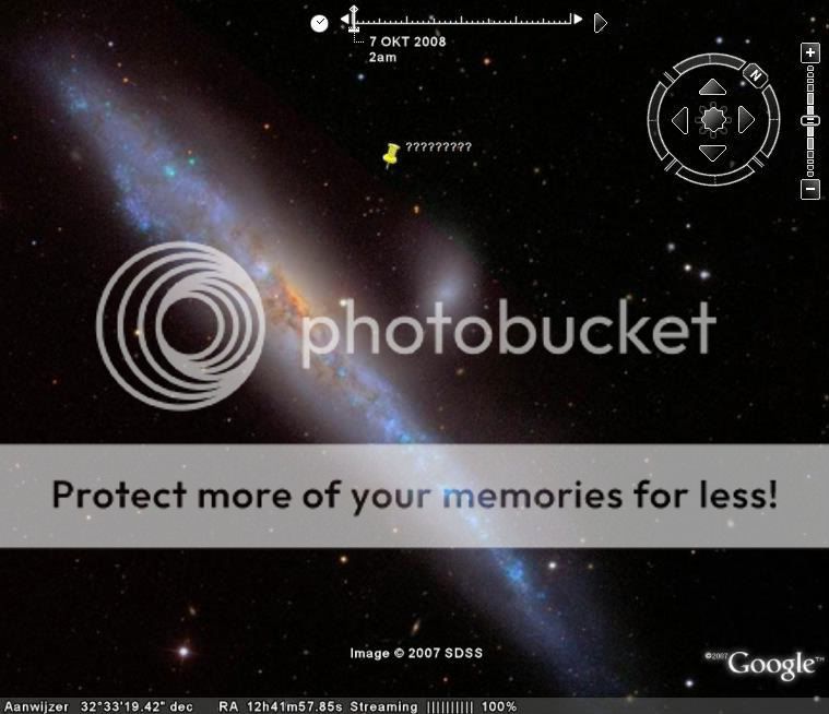
so what do you experts make of this formation? this time the shapes are "inside" the clouds..

apologies if this is perfectly common.
[edit on 9-10-2008 by isthisit]
apologies if this is perfectly common.
[edit on 9-10-2008 by isthisit]
Based on the amount of zoom used Google either stitches up the spheres with either 3 or 4 pointed polygons, as you zoom in more polygons are added to up the resolution on the sphere as you can see with the mock up above I have shown you how easily create a "intergalactic love ship" can be created within Google either by a mapping error, missing data or a merging polygon (these usually appear if you zoom out really far)
Please take my advice and stop making this community look stupid.
[edit] initial comments may have been a little harsh
[edit on 9/10/2008 by spitefulgod]
If you mean that a triangle looks like a triangle then you are right, but if you are saying that the proportions are the same then I think you are wrong, those two triangles do not look like having the same three angles.
Originally posted by Spooky Fox Mulder
Interesting. The triangle on Google Earth has exactly the same shape as the Irish UFO:
xaxa nice work spitefullord
i guess even for a believer like me u debunked it
haha special people that was awesome xD
i guess even for a believer like me u debunked it
haha special people that was awesome xD
Article from UFO Digest today about this phenomena.
She came out with a different theory why it was however.
URL: www.ufodigest.com...
All in all it is interesting.
She came out with a different theory why it was however.
URL: www.ufodigest.com...
All in all it is interesting.
Ok, debunkers get ready for this one. The knee jerk reaction when looking at these strange formations on Google Earth (North and South Pole) is that
it is a software glitch or a satellite issue.
Stay with me. Here's a link for the Monthly Global Cloud Sequences in Google Earth:
You have to download any of the periods (by month 2006-2008) and it will open Google Earth. Make sure you deactivate the WEATHER option or it will put the current weather on top of the weather from the previous period, showing you the current anomalies. I have not found anomalies in any of them and North and South Pole are filled 100%.
Comments please.
[edit on 9-10-2008 by manticore]
reply to post by manticore
oooooh. You're right! There are no anomalies. But wait, the clouds are being sucked into the holes at the north and south poles! Don't you think that's a little abnormal?
Why don't you guys just sit tight until the 14th. Quit wetting your shorts and bumping this thread everytime you see something "funny" going on with GE. If you're right, you're right. I'm sure everyone here will consider themselves forever in your debt for pointing this all out to us.
reply to post by Phage
I'm not saying they're spaceships. I'm just saying this is very strange and the satellite feed issue doesn't seem to hold water. You keep talking about Oct 14. Nowhere in my posts do I even allude to that.
You seem overly confident to debunk anything that comes your way without having any evidence to support it either.
reply to post by NorthernSoul
[It's only just occured to me (and it was so obvious) if these are "cloaked ships" why can't we see the clouds beneath? ]
Maybe the data is showing up as something else. Supposing those were cloaked ships, we naturally couldn't see them with the naked eye, but cameras might interpret them as something else... Maybe it shows up as a dark spot on photo data so instead of having that, they blank out the dark leaving us with the fixed landmass image.
That, or there is no satellite coverage of the area... but why the repeating geometric shapes? Why the silence on this by higher-up officials? They're either keeping a secret or just letting us waste our time.
reply to post by spitefulgod
[files.abovetopsecret.com...]
If this is the model used, how does a Pentagon appear at the poles, shouldn't it be pyramid 'splinters'?
[files.abovetopsecret.com...]
If this is the model used, how does a Pentagon appear at the poles, shouldn't it be pyramid 'splinters'?
Cloaked ships, cloud making sharp angle triangles and hexigon patterns....
..all of this should be ranked up there with the world's most rediculous assumptions program....
..oh wait..there isnt any such program.
Well, here is a producer's chance at creating one, all the raw material for such a show can be found right here at ATS!
Will someone please go out with a camera and take a snapshot of a cloud formation that has sharp angles and looks like a triangle.
Remember to catch one with the pointy tips and sharp angles!!!
Cheers!!!!
Hello, here's the latest GE image..I measured the figure again and this time looks more like a rectangle and surprisingly it still measures about 2k
miles..

I see hollywood has jumped on it... I just saw a commercial for somthing called Dead Space.... it showed a huge spaceship... and at the end of the
commercial.... showing..... you guessed it.. oct.14th.. they gotta love it.. lol
I give up, I thing this is probably why so many conspiracy theories reach the outside world, retardation winds over logic
I say it again..(please look at my image above)
RETARDATION WINS OVER LOGIC
I say it again..(please look at my image above)
RETARDATION WINS OVER LOGIC
new topics
-
President BIDEN's FBI Raided Donald Trump's Florida Home for OBAMA-NORTH KOREA Documents.
Political Conspiracies: 4 hours ago -
Maestro Benedetto
Literature: 6 hours ago -
Is AI Better Than the Hollywood Elite?
Movies: 6 hours ago -
Las Vegas UFO Spotting Teen Traumatized by Demon Creature in Backyard
Aliens and UFOs: 10 hours ago -
2024 Pigeon Forge Rod Run - On the Strip (Video made for you)
Automotive Discussion: 10 hours ago -
Gaza Terrorists Attack US Humanitarian Pier During Construction
Middle East Issues: 11 hours ago
top topics
-
President BIDEN's FBI Raided Donald Trump's Florida Home for OBAMA-NORTH KOREA Documents.
Political Conspiracies: 4 hours ago, 26 flags -
Krystalnacht on today's most elite Universities?
Social Issues and Civil Unrest: 16 hours ago, 9 flags -
Supreme Court Oral Arguments 4.25.2024 - Are PRESIDENTS IMMUNE From Later Being Prosecuted.
Above Politics: 16 hours ago, 8 flags -
Weinstein's conviction overturned
Mainstream News: 14 hours ago, 8 flags -
Gaza Terrorists Attack US Humanitarian Pier During Construction
Middle East Issues: 11 hours ago, 8 flags -
Massachusetts Drag Queen Leads Young Kids in Free Palestine Chant
Social Issues and Civil Unrest: 13 hours ago, 7 flags -
Las Vegas UFO Spotting Teen Traumatized by Demon Creature in Backyard
Aliens and UFOs: 10 hours ago, 6 flags -
Meadows, Giuliani Among 11 Indicted in Arizona in Latest 2020 Election Subversion Case
Mainstream News: 12 hours ago, 5 flags -
2024 Pigeon Forge Rod Run - On the Strip (Video made for you)
Automotive Discussion: 10 hours ago, 4 flags -
Is AI Better Than the Hollywood Elite?
Movies: 6 hours ago, 3 flags
active topics
-
President BIDEN's FBI Raided Donald Trump's Florida Home for OBAMA-NORTH KOREA Documents.
Political Conspiracies • 17 • : BingoMcGoof -
Gaza Terrorists Attack US Humanitarian Pier During Construction
Middle East Issues • 29 • : 19Bones79 -
Supreme Court Oral Arguments 4.25.2024 - Are PRESIDENTS IMMUNE From Later Being Prosecuted.
Above Politics • 90 • : Lumenari -
Las Vegas UFO Spotting Teen Traumatized by Demon Creature in Backyard
Aliens and UFOs • 12 • : KrustyKrab -
SHORT STORY WRITERS CONTEST -- April 2024 -- TIME -- TIME2024
Short Stories • 23 • : DontTreadOnMe -
Truth Social goes public, be careful not to lose your money
Mainstream News • 130 • : Astyanax -
Is AI Better Than the Hollywood Elite?
Movies • 13 • : Justoneman -
Hate makes for strange bedfellows
US Political Madness • 47 • : 19Bones79 -
-@TH3WH17ERABB17- -Q- ---TIME TO SHOW THE WORLD--- -Part- --44--
Dissecting Disinformation • 689 • : daskakik -
University of Texas Instantly Shuts Down Anti Israel Protests
Education and Media • 265 • : Astrocometus