It looks like you're using an Ad Blocker.
Please white-list or disable AboveTopSecret.com in your ad-blocking tool.
Thank you.
Some features of ATS will be disabled while you continue to use an ad-blocker.

Ancient 2500 yr Old Map Shows The Lost City of Atlantis is The Eye of The Sahara
page: 20share:
originally posted by: All Seeing Eye
a reply to: Byrd
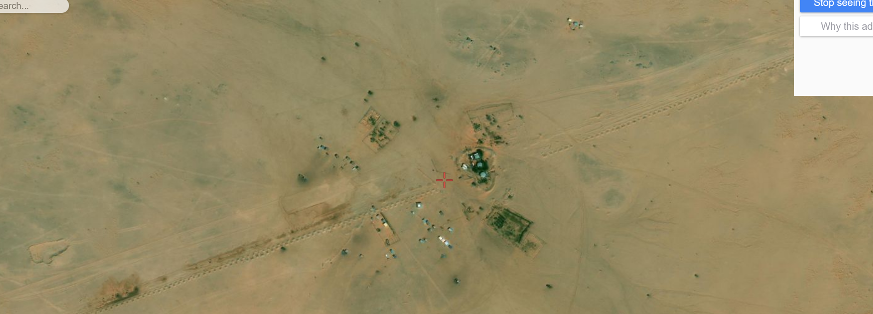
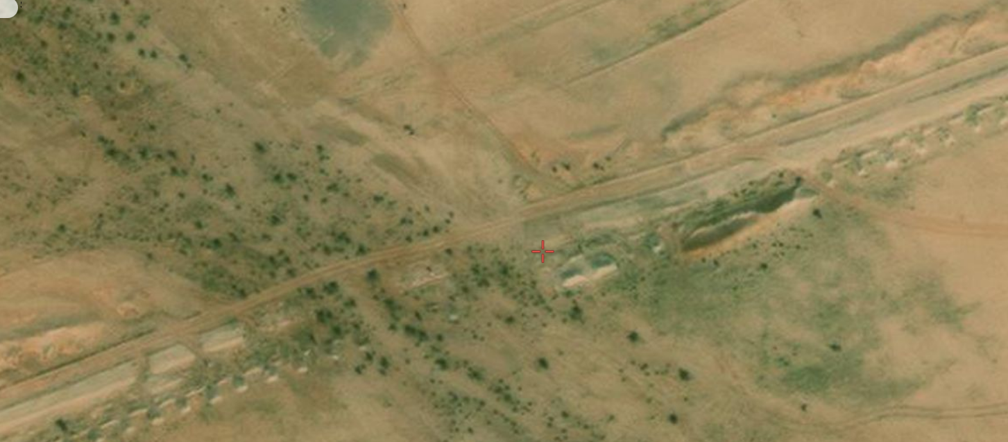
Military fencing is also plausible. It looked quite a bit like what I've seen elsewhere under the "desertifciation plantings" but I'm willing to go along with "military fencing."
You might want to consider "Looking" at it first, before just going along with it. It is broken in many place with civilian business, homes to ether side. Even "Settlements" dot the length. Also broken by many washes, past water flow(mud flow?)...
Which indicates it's modern, not old.
originally posted by: Byrd
originally posted by: All Seeing Eye
a reply to: Byrd
Now, for the math.
It is said there were 1200 ships in the Atlantis Fleet, manned by 200 sailors each. I can find no records of the dimensions of those ships. Maybe someone might, please supply them if you have them.
Let's start with that. WHO said it? Plato didn't. So who came up with that?
200 sailors is a mighty big crew, could be even larger if you include slaves.
Roughly the size of the crew of the submarine my son served on. It's about the same size crew as a Spanish galleon. HOWEVER... I'd still like to know where that number of ships and sailors came from (because I don't believe it. I think someone made it up within the past 30 years.)
At any rate, that is a large ship even in our day.
It's "average size" for a military ship in the 1700's. Midway class carriers have a crew of 4,500.
Now lets suppose those ships were docked to the "Causeway" nose in. And lets say each ship is at least, oh I don't know, lets say 150 ft, big crew, big ship.
Lets take and figure out how many feet are in that 62 miles, Easy math, 62mi X 5280ft = 327,360ft Now divide that by the width of the ship 150ft. So now, if the ships are docked touching side by side you could get 2,182 ships on that causeway.
(etcetera)
Anyone see any obvious errors?
The above is a theory, not fact. The facts will have to wait until someone can inspect the site.
Yes, I do, having been around shipyards and all that.
The only ships (ever) that go out and come back in to "park" every day are fishing vessels. Military vessels are sent places away from home. No nation would have every military ship in their fleet lurking in one spot for a number of logistical and tactical reasons.
Shanghai, which services more than 2,000 ships per month, has 125 docks and about 20 kilometers in length.
Your idea does not work -- and geologically there's no big layer of humus that accumulates around ports (garbage tossed into the water, other detritus. Ports are VERY messy and almost like garbage dumps with the amount of material you retrieve from the site.)
Your argument, once again is out of the original context. This was a Prehistoric Navy, not a contemporary global trade operation. But you do point out how history can be mutated and twisted, which is exactly what occurred with plato's "Box". No other views can, or allowed to be entertained.
Please, do not urge me to look away from any source for information, it won't reflect on me.
"So it was ordained that each such leader should provide for war the sixth part of a war-chariots equipment, so as to make up 10,000 chariots in all, together with two horses and mounted men; [119b] also a pair of horses without a car, and attached thereto a combatant with a small shield and for charioteer the rider who springs from horse to horse; and two hoplites; and archers and slingers, two of each; and light-armed slingers and javelin-men, three of each; and four sailors towards the manning of twelve hundred ships."
atlantisbolivia.org...
Plato's story is really good, but he did make mistakes, omissions. Intentional or by mistake, he wasn't perfect.
Agustin de Zarate, 1556, identified Plato's "years" as months
bringing the date of the war down to around 1110BC.
So now I read that what led to the destruction of Atlantis, was a civil war. Now, the New Atlantis is on the verge of the same thing. How history repeats itself, from ignorance, and box makers.
Even Frances Drake got a few things wrong, and some right.
"The New Atlantis" by Sir Francis Bacon, 1627...
YOU SHALL UNDERSTAND THAT ABOUT THREE THOUSAND YEARS AGO, or somewhat more, the Navigation of the world (specially for remote voyages) was greater than at this day…. Whether it was, that the example of the Ark, that saved the remnant of men from the Universal Deluge, gave men confidence to adventure upon the waters, or what it was; but such is the Truth. The Phoenicians, and specially the Tyrians, had great fleets. So had the Carthaginians their colony, which is yet further West. Towards the east the shipping of Egypt, and of Palestine was likewise great. China also, and the great Atlantis, (that you call America) which have now but junks, and canoes, abounded then in tall ships. At the same time, and an Age after, or more, the inhabitants of the great Atlantis did flourish…..Yet so much is true, that the said country of Atlantis, as well that of Peru then called Coya, and that of Mexico then called Tyrambel, were mighty and proud kingdoms, in arms, shipping, and riches so mighty as at one time (or at least within the space of 10 years) they both made two great expeditions, they of Tyrambel through the Atlantic to the Mediterranean Sea, and they of Coya through the South Sea…..But whether it were the ancient Athenians, that had the glory of the Repulse, and resistance of these forces, I can say nothing. But certain it is, there never came back, either ship, or man, from that voyage. But the Divine revenge overtook not long after those proud enterprises. For within less than the space of one hundred years, the Great Atlantis was utterly lost and destroyed not by a great earthquakes as your man saith (for that whole tract is little subject to earthquakes); but by a particular Deluge or Inundation. Those countries having, at that day, far greater rivers, and far higher mountains, to pour down waters, than any part of the Old World. But it is true, that the same inundation was not deep; not past forty feet in most places from the ground. So that although it destroyed man and beast generally, yet some few wild inhabitants of the wood escaped. For as for men, although they had buildings in many places, higher than the depth of the water, yet that inundation, though it were shallow, had a long continuance: whereby they of the Vale, that were not drowned, perished for want of food, and other things necessary. So as marvel you not at the thin population of America, nor at the rudeness and ignorance of the people…..and having in their mountain regions been used to clothe themselves with the skins of tigers, bears and great hairy goats, when after they came down into the valley, they found the intolerable heats which are there, and knowing no means of lighter apparel they were forced to begin the custom of going naked, which continueth to this day. Only they take great delight in the feathers of birds. So you see, by this main accident of Time, we lost our trafick with the Americas, with whom we had most commerce." Extracted from "New Atlantis" by Sir Francis Bacon, published posthumously in 1627.
South America was a region ruled over by Atlantis, and is not the location of the city capital.
Science, and history must remain flexible, otherwise, its just political science, political history.. But then again those who have been programed not to see that do humanity no service.
There actually is, a conspiracy of ignorance.
originally posted by: Byrd
originally posted by: All Seeing Eye
a reply to: Byrd
Military fencing is also plausible. It looked quite a bit like what I've seen elsewhere under the "desertifciation plantings" but I'm willing to go along with "military fencing."
You might want to consider "Looking" at it first, before just going along with it. It is broken in many place with civilian business, homes to ether side. Even "Settlements" dot the length. Also broken by many washes, past water flow(mud flow?)...
Which indicates it's modern, not old.
Can you try to share your logic for that position??? It indicates modern man built over, something that was already there...
edit on PMThursdayThursday thAmerica/ChicagoAmerica/Chicago1775 by All Seeing Eye because: (no reason given)
originally posted by: All Seeing Eye
Your argument, once again is out of the original context. This was a Prehistoric Navy, not a contemporary global trade operation.
However, what applies now applied back then. Navies do not spend their time in port and they don't berth every single ship they have.
Please, do not urge me to look away from any source for information, it won't reflect on me.
I don't think I'm being unreasonable when I ask where the figure of 2,000 ships for the navy came from. However, your quote satisfied me (I double checked it) and can confirm that Plato said 1200 ships. I'm not sure where the other 800 come from but I do see 1200 ships.
I'm not going to discuss Bacon because I haven't read him and until I see what his sources are, I'm not going to comment there.
However, it's still a fact that ships are strategic troops and if someone's got an empire, they don't park their triremes at home and glower at everyone. Ships are used to carry messengers, support staff (more secretaries for the governor of whatever land), supplies and so forth. You don't build a port with berths for every single ship you have because they're never going to be home at the same time and it's a waste of space and labor.
originally posted by: All Seeing Eye
originally posted by: Byrd
originally posted by: All Seeing Eye
a reply to: Byrd
Military fencing is also plausible. It looked quite a bit like what I've seen elsewhere under the "desertifciation plantings" but I'm willing to go along with "military fencing."
You might want to consider "Looking" at it first, before just going along with it. It is broken in many place with civilian business, homes to ether side. Even "Settlements" dot the length. Also broken by many washes, past water flow(mud flow?)...
Which indicates it's modern, not old.
Can you try to share your logic for that position??? It indicates modern man built over, something that was already there...
Well, experience, reading stuff on the Internet, and archaeological dig experience.
But mostly, looking at historical satellite imagery on Google Earth Pro, which shows that as of 2006 there were no such structures along any of the roads. Confirmed with 1985 data as well. The earliest satellite photo that they show up in is 2013.
Dig experience showed me that in West Texas (similar climate and less desertification) stuff gets buried by the sand pretty quickly and anything over a hundred years old can be an inch or more below the surface. The Sphinx, for example, was almost completely buried by sand within 1,500 years of Khufu's time (the famous Dream Stele of Thutmose IV talks about this) So ancient pillars would either have been buried beyond sight OR they'd have been a major tourist attraction.
They aren't listed as a tourist attraction.
Anthropological evidence: in ancient times, distances of travel were limited by the ability of the riding animals. In this case, camels travel at 3 miles/hour (ran into that figure two days ago) and travel about 20 miles per day. I remembered this figure because here in Texas the older towns along the cattle trails are about 20 miles apart...that's how far a herd travels in a day. Anything with a straight 60 mile distance is not ancient (they'd be detouring for wells, etc.)
Satellite imagery: I looked for historical images of the area.
edit on 29-7-2021 by Byrd because: (no reason given)
originally posted by: Byrd
originally posted by: All Seeing Eye
originally posted by: Byrd
originally posted by: All Seeing Eye
a reply to: Byrd
Military fencing is also plausible. It looked quite a bit like what I've seen elsewhere under the "desertifciation plantings" but I'm willing to go along with "military fencing."
You might want to consider "Looking" at it first, before just going along with it. It is broken in many place with civilian business, homes to ether side. Even "Settlements" dot the length. Also broken by many washes, past water flow(mud flow?)...
Which indicates it's modern, not old.
Can you try to share your logic for that position??? It indicates modern man built over, something that was already there...
Well, experience, reading stuff on the Internet, and archaeological dig experience.
But mostly, looking at historical satellite imagery on Google Earth Pro, which shows that as of 2006 there were no such structures along any of the roads. Confirmed with 1985 data as well. The earliest satellite photo that they show up in is 2013.
Dig experience showed me that in West Texas (similar climate and less desertification) stuff gets buried by the sand pretty quickly and anything over a hundred years old can be an inch or more below the surface. The Sphinx, for example, was almost completely buried by sand within 1,500 years of Khufu's time (the famous Dream Stele of Thutmose IV talks about this) So ancient pillars would either have been buried beyond sight OR they'd have been a major tourist attraction.
They aren't listed as a tourist attraction.
Anthropological evidence: in ancient times, distances of travel were limited by the ability of the riding animals. In this case, camels travel at 3 miles/hour (ran into that figure two days ago) and travel about 20 miles per day. I remembered this figure because here in Texas the older towns along the cattle trails are about 20 miles apart...that's how far a herd travels in a day. Anything with a straight 60 mile distance is not ancient (they'd be detouring for wells, etc.)
Satellite imagery: I looked for historical images of the area.
Again, the evidence does not represent your argument.
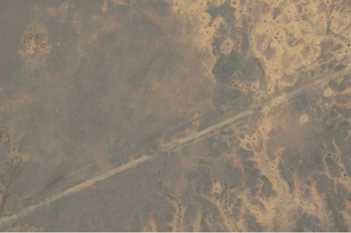
Google Earth started off with low quality imaging.
1985 image of a section of this construct. Blurry but can still see the line this construct produces.

Same area using the 2011 image. Through the years the quality of the images has improved, markedly.
Archeological digs, are unique. One size does not fit all. Each site must be surveyed for the type of site it is. You wouldn't approach a stone block the same way you would a mud brick, but I'm sure you understand that. There is a list of things to do and not do at this site, along with a list of items to look for.
20 miles per day
Sure, that would be the logical assumption, but you must allow for the unknown, which is hinted at with the technology that is being hinted at in the dialogs. Stepping outside the "evidence", no recovery of any of that has been identified, at least publicly. Did it, or does it actually exists? I'm going out on a limb in the following but. The Government has finally admitted Unidentified Flying Objects, are real. They can't tell you what it is, but I would suggest its absolutely not new. And I would also suggest that technology was present in Atlantis as a form of transportation, but not for the common man.
As far as in port or not all depends on what they were ordered to do, how to do it, and when to do it. I do agree with Sir Francis Bacon when he is discussing the transport globally, especially to South America, and he even came to the conclusion this area (South America) did not have the portage that would be required for such a fleet. So could there have been a time when they would all be at dock? It all depends on what they were commanded to do. I'm sure at times of peace the docks would be full.
If high Technology was present during those times, and there is no reason to believe it wasn't, it was not allowed for common man to use, or be educated in, except for a very very few. And even they were highly controlled.
Mummification is a common mans representation of a technology they saw, but not educated in. Similar to what happened in the Pacific after WWII with the "Cargo Cult". And I strongly suspect that any and all of that tech was withdrawn from the face of the earth just before the flood.
Troops, sailors, did not walk 62 miles every time they got back. They were posted, where they were. Orders, commanders, may have been transported via high tech.
originally posted by: Byrd
originally posted by: bloodymarvelous
originally posted by: Byrd
originally posted by: bloodymarvelous
Shu might not work.
Maybe the Berber god Antaeus would be a better fit? Still probably Atlas, but also son of Poseidon, and a king who was said to be buried at a site called Mzora, which may have some relationship with Stone Henge.
www.ancient-origins.net...
Since a lot of gods bled through between the Egyptians and the Berbers/Libyans, it would be hard to say what Antaeus' name was in Egypt.
No on that one. The Egyptians absolutely despised the Libyans. They were one of the traditional "nine bows" (evil enemies) and were often labeled "wretched." I feel pretty sure that the Libyans hated the Egyptians in equal measure.
Apparently there was still, nonetheless a lot of crossover.
www.ancient-origins.net...
Perhaps they were enemies in one epoch of history, and friends in another?
Or just as likely, they were a mixed people during the Green Sahara era, and some went to Egypt and settled there when the land dried up, carrying their beliefs with them.
While others stayed out in the areas that would later be Berber.
I would urge you to NOT have a lot of faith in articles on Ancient Origins. The writers there tend to treat ancient history as something that occurred for about 500 years all in one lump. In this case, there are a lot of problems with the information.
(it was also Herodotus who connected Heracles with Shu... which may have been correct for his time period, but that is around 500 BC and not earlier.)
If the Greeks treated their own gods, and the gods of other nations as being literally real, then having two separate gods holding up the sky would have been too big a contradiction to let pass.
They would probably ignore the other differences, in favor of keeping that similarity intact.
The Berbers are a newer group than the Egyptians.
Perhaps newer than the Egyptians, but not very new. They're considered to go back 10,000 years.
en.wikipedia.org...
Isis and Osiris are indisputably Egyptian, though Neith may have come through Libya. Amun is most definitely a deity from the south of Egypt, as is shown in a lot of material. The Libyans did become pharaohs at one time late in Egyptian history (third Intermediate Period) right before the Saites and Achminedads, but we're talking 700 BC and thereabouts.
Solon lived from 630 to 560 BC, so that puts him fairly close to the time of the Libyan Pharoahs, then.
en.wikipedia.org...
Maybe Atlantis was actually not an Egyptian tale?
The Berber deity associated (by the writer) with Heracles would still have to be a relatively recent one (500 BC) -- Heracles wasn't widely known or worshiped until around 600 BC, when his temples began appearing.
So take Ancient Origins articles with a huge cartload of salt and investigate the exact timelines. In this case, the answer would be "no"
Maybe the arrival of Hercules was when Antaeus' cult died? (Since Hercules killed him in the story)
Interestingly, that time frame coincides with the earliest examples of Berber writing.
en.wikipedia.org...
a reply to: All Seeing Eye
One thing you don't do is line up ships along a straight line. Mankind creates harbors to protect the ships and docks to pack them in. Without a harbor, you wouldn't have a fleet very long. They have two purposes one being repair and the second is a safe place to be docked. Look at ancient Egyptian and Roman ports. First, you build breakwaters then you build docks to allow you to put several boats in the same place.
The earliest known docks were those discovered in Wadi al-Jarf, an ancient Egyptian harbor, of Pharaoh Khufu, dating from c.2500 BC located on the Red Sea coast.
www.archaeology.org...
a reply to: bloodymarvelous
You can find whats left of the burial site (Stone Circle ) at
35°24'14.94"N 5°56'37.58"W Mzoura 1026 miles from the "Eye".
www.ancientpages.com...
Maybe the arrival of Hercules was when Antaeus' cult died? (Since Hercules killed him in the story)
Mzoura is largely absent from the historical record, but Life of Sertorius, Plutarch referred to what appears to be the mysterious stone circle in Morocco.
He wrote that Roman General Quintus Sertorius was told by local inhabitants about a site they knew as the tomb of the giant Antaeus who had been killed by Hercules.
According to mythology, the giant Antaeus was a son of Poseidon and Ge. The Greek word antaios which lies behind his name means “set-against” or “hostile.”
Antaneus was a wrestler in Libya, whose strength was invincible so long as he remained in contact with his mother earth. The strangers who came to his country were compelled to wrestle with him; the conquered were slain, and out of their skulls he built a house to Poseidon. Hercules discovered the source of his strength, lifted him up from the earth, and crushed him in the air.
You can find whats left of the burial site (Stone Circle ) at
35°24'14.94"N 5°56'37.58"W Mzoura 1026 miles from the "Eye".
www.ancientpages.com...
edit on AMFridayFriday thAmerica/ChicagoAmerica/Chicago0971 by All Seeing Eye because: (no reason given)
originally posted by: dragonridr
a reply to: All Seeing Eye
One thing you don't do is line up ships along a straight line. Mankind creates harbors to protect the ships and docks to pack them in. Without a harbor, you wouldn't have a fleet very long. They have two purposes one being repair and the second is a safe place to be docked. Look at ancient Egyptian and Roman ports. First, you build breakwaters then you build docks to allow you to put several boats in the same place.
The earliest known docks were those discovered in Wadi al-Jarf, an ancient Egyptian harbor, of Pharaoh Khufu, dating from c.2500 BC located on the Red Sea coast.
www.archaeology.org...
Already covered in a previous post.
originally posted by: Byrd
originally posted by: All Seeing Eye
a reply to: Byrd
Military fencing is also plausible. It looked quite a bit like what I've seen elsewhere under the "desertifciation plantings" but I'm willing to go along with "military fencing."
You might want to consider "Looking" at it first, before just going along with it. It is broken in many place with civilian business, homes to ether side. Even "Settlements" dot the length. Also broken by many washes, past water flow(mud flow?)...
Which indicates it's modern, not old.
I'm gonna go with buried pipeline for the win!
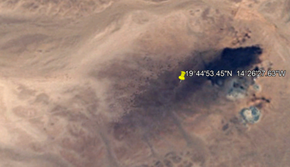
If you take the time to find the beginning and end of this feature it turns out to be a modern structure which supplies water to the Guelb Moghrein copper mine.
Start; 19.46839, -15.430033
Finish; 19.751288, -14.427577
5.6
The Guelb Moghrein mine has its own power station, using heavy fuel oil (HFO) as a fuel source.
Water is sourced from the Bennichab aquifer, 113 km to the southwest of the mine site. Water from this source is also supplied to the town of Akjoujt.
Guelb Moghrein Copper Gold Mine, Inchiri, Mauritania
MCM supplies drinking water to communities of Bennichab and Akjoujt and supplies through 21 taps along the pipeline (120km) water for livestock and nomadic communities.
Increasing access to water
edit on 30-7-2021 by Mike27 because: (no reason given)
originally posted by: All Seeing Eye
a reply to: Byrd
It is said there were 1200 ships in the Atlantis Fleet, manned by 200 sailors each. I can find no records of the dimensions of those ships. Maybe someone might, please supply them if you have them.
Anyone see any obvious errors?
Just a small one: you can't dock ships in the middle of a desert.
originally posted by: All Seeing Eye
Again, the evidence does not represent your argument.
Google Earth started off with low quality imaging.
1985 image of a section of this construct. Blurry but can still see the line this construct produces.
It doesn't, and your image from 2011 doesn't show them. Additionally, it doesn't show pillars with "boxes' around them.
Archeological digs, are unique. One size does not fit all. Each site must be surveyed for the type of site it is. You wouldn't approach a stone block the same way you would a mud brick, but I'm sure you understand that. There is a list of things to do and not do at this site, along with a list of items to look for.
"list of things to do and not do at this site along with a list of items to look for"
??????
Beg pardon, but have you ever actually been on a dig? "things to do and not do"??? "Items to look for"?????????
You have presented this as various things, including archaeological digs. These are not ancient items dug up from the landscape. There is no archaeological dig in any of the photos and no aftermath of a dig, either. In a dig, you don't just run up to a block sticking up out of the ground, excavate the ground right around it and then run to the next one. You'd fan out and there would be a continuous dig between the two pillars.
That's how it's done. You don't want to miss clues.
Nobody puts in a 60 mile dig, anyway. Not in a matter of a few years. As an example, look at the timeline of Gobekli Tepi... it's 20 years in and they've uncovered less than 20%. Some sites (Giza, Abydos, many others) are still working sites even after over 100 years of digging in the area.
Nor could your roadside attractions have been an ongoing project since the 1800's because every tour that came along that road would have commented on it and it'd be world famous by now.
Those pillars (which may either be anti-desertification or may be military) are new and not ancient things uncovered recently.
20 miles per day
Sure, that would be the logical assumption, but you must allow for the unknown, which is hinted at with the technology that is being hinted at in the dialogs.
The technology hinted in the dialog is Bronze Age. Athens rebelled against them and beat them.
Stepping outside the "evidence", no recovery of any of that has been identified, at least publicly. Did it, or does it actually exists? I'm going out on a limb in the following but. The Government has finally admitted Unidentified Flying Objects, are real. They can't tell you what it is, but I would suggest its absolutely not new. And I would also suggest that technology was present in Atlantis as a form of transportation, but not for the common man.
Technology doesn't exist in isolation. It's building blocks. We didn't just fall out of trees one day and then create digital watches the next day (or month or year or decade.) In order for an advanced technology, you need a lot of less advanced technology plus materials and that means new and better ways of getting those resources (machines instead of humans) and stuff like that leaves a huge global imprint (atmospheric changes, local changes, etc.)
In order to prove an 'advanced technology' you have to show that those resources and pieces existed.
As far as in port or not all depends on what they were ordered to do, how to do it, and when to do it. I do agree with Sir Francis Bacon when he is discussing the transport globally, especially to South America, and he even came to the conclusion this area (South America) did not have the portage that would be required for such a fleet. So could there have been a time when they would all be at dock?
No. Not even in the construction phase.
If high Technology was present during those times, and there is no reason to believe it wasn't, it was not allowed for common man to use, or be educated in, except for a very very few. And even they were highly controlled.
That's not a very good argument. If rapid transportation was available, they'd be using it to move supplies... instead of taking three days to walk something via camel or whatever down to the ship at the far end of the dock (and another reason for having shorter piers and docks... easier to quickly resupply ships en masse.)
Mummification is a common mans representation of a technology they saw, but not educated in. Similar to what happened in the Pacific after WWII with the "Cargo Cult". And I strongly suspect that any and all of that tech was withdrawn from the face of the earth just before the flood.
You've lost me here. Mummification is something that occurs naturally, like the mummies in Peru (which are fairly recent) And how did we get from discussing objects along a road to mummies? Let's go back to the road, please.
One issue at a time.
Troops, sailors, did not walk 62 miles every time they got back. They were posted, where they were. Orders, commanders, may have been transported via high tech.
I honestly don't see that working. Ships dock for cleaning and repair and resupply and the crew will leave for shore for awhile (otherwise you'd have a mutiny on your hands) leaving only the monkey watch aboard (technical term, there. Honest.) There's a lot of tensions among 200 people cooped up together for months at a time.
originally posted by: FatherLukeDuke
originally posted by: All Seeing Eye
a reply to: Byrd
It is said there were 1200 ships in the Atlantis Fleet, manned by 200 sailors each. I can find no records of the dimensions of those ships. Maybe someone might, please supply them if you have them.
Anyone see any obvious errors?
Just a small one: you can't dock ships in the middle of a desert.
You could dock 1200 camels, though, and camels are the "ships of the desert", right????
....I'll see myself out now.
originally posted by: Mike27
originally posted by: Byrd
originally posted by: All Seeing Eye
a reply to: Byrd
Military fencing is also plausible. It looked quite a bit like what I've seen elsewhere under the "desertifciation plantings" but I'm willing to go along with "military fencing."
You might want to consider "Looking" at it first, before just going along with it. It is broken in many place with civilian business, homes to ether side. Even "Settlements" dot the length. Also broken by many washes, past water flow(mud flow?)...
Which indicates it's modern, not old.
I'm gonna go with buried pipeline for the win!
If you take the time to find the beginning and end of this feature it turns out to be a modern structure which supplies water to the Guelb Moghrein copper mine.
Start; 19.46839, -15.430033
Finish; 19.751288, -14.427577
5.6
The Guelb Moghrein mine has its own power station, using heavy fuel oil (HFO) as a fuel source.
Water is sourced from the Bennichab aquifer, 113 km to the southwest of the mine site. Water from this source is also supplied to the town of Akjoujt.
Guelb Moghrein Copper Gold Mine, Inchiri, Mauritania
MCM supplies drinking water to communities of Bennichab and Akjoujt and supplies through 21 taps along the pipeline (120km) water for livestock and nomadic communities.
Increasing access to water
This sounds very reasonable, and would explain structures and locations. I'm off to do something else right now but will give it a look later.
a reply to: Byrd
Ill get to the rest in time.
It was shown as a example of the "Hidden" technology. Your suggesting the Egyptians did not mummify their elite dead, and it was natural?
You've lost me here. Mummification is something that occurs naturally, like the mummies in Peru (which are fairly recent) And how did we get from discussing objects along a road to mummies? Let's go back to the road, please.
One issue at a time.
Ill get to the rest in time.
originally posted by: Mike27
originally posted by: Byrd
originally posted by: All Seeing Eye
a reply to: Byrd
Military fencing is also plausible. It looked quite a bit like what I've seen elsewhere under the "desertifciation plantings" but I'm willing to go along with "military fencing."
You might want to consider "Looking" at it first, before just going along with it. It is broken in many place with civilian business, homes to ether side. Even "Settlements" dot the length. Also broken by many washes, past water flow(mud flow?)...
Which indicates it's modern, not old.
I'm gonna go with buried pipeline for the win!
If you take the time to find the beginning and end of this feature it turns out to be a modern structure which supplies water to the Guelb Moghrein copper mine.
Start; 19.46839, -15.430033
Finish; 19.751288, -14.427577
5.6
The Guelb Moghrein mine has its own power station, using heavy fuel oil (HFO) as a fuel source.
Water is sourced from the Bennichab aquifer, 113 km to the southwest of the mine site. Water from this source is also supplied to the town of Akjoujt.
Guelb Moghrein Copper Gold Mine, Inchiri, Mauritania
MCM supplies drinking water to communities of Bennichab and Akjoujt and supplies through 21 taps along the pipeline (120km) water for livestock and nomadic communities.
Increasing access to water
I appreciate the effort you are putting into the theory, supplying real research and records. But...
The evidence has to trump theory. In 1985 there was no Mine, and as your links suggest became a reality no earlier than 2004. And as such, no water supplied to the area.
1.2
The Guelb Moghrein copper-gold mine is 100% owned by Mauritanian Copper Mines (MCM), a
subsidiary of FQM. The mine is located 250 km northeast of the nation’s capital, Nouakchott, near
the town of Akjoujt. FQM acquired an 80% interest in the asset in 2004 and achieved commercial
production in 2006. In 2010, the Company increased its ownership in Guelb Moghrein to 100%
www.miningdataonline.com...
MCM supplies drinking water to communities of Bennichab and Akjoujt and supplies through 21 taps along the pipeline (120km) water for livestock and nomadic communities.
MCM has also equipped 21 existing water points in areas that do not directly benefit from Bennichab-Akjoujt pipeline.
Considering the mine closure which could result in shutting down the pumping of water from Bennichab, MCM and the Government have taken the initiative to try to develop new water sources that could be a sustainable alternative. To date, 13 boreholes were drilled by MCM; 5 of which for irrigation.
The water supply, is supplied by the mining company, when the mine closes, that service ends and the gov is going to have to come up with an alternative.
n addition to the Guelb Moghrein mining concession of 81 km2, valid until 2042,
If the construct was a pipe line for water would it not still be used as a source? The conclusion then must be, it isn't a water pipe line.
For the evidence. It was present in 1985, years before the mine was even thought of. So the idea of it being a water pipe line for the mine, is now out of context and not a logical choice.
1985 google image.
Addition: If, there is a pipeline present within this line of "what ever", then it wasn't the mining company that put it there. And the subject is not settled. It being a "Water Pipe Line" is not out of the question.
Now in saying that, there are ruins in Akjoujt. Some from the middle ages, but others far earlier.
edit on PMFridayFriday thAmerica/ChicagoAmerica/Chicago2072 by All Seeing Eye because: (no reason given)
a reply to: All Seeing Eye
Might want "look" a little deeper.
From that very same document ...
Might want "look" a little deeper.
From that very same document ...
ITEM 6 HISTORY
Prior Ownership 6.1
Copper-made tools and arrowheads dating from approximately 4000 to 6000 BC have been found in the Akjoujt area of Mauritania where Guelb Moghrein is located. Although exploitable quantities of copper were recognized in the 1930s it was not until the 1950s when serious development plans were undertaken. After the nation’s independence from France in 1960, companies such as Anglo American Corporation attempted development of the Guelb Moghrein deposit.
In the 1970s an open pit was developed and a TORCO (a high temperature oxide roast operation) commenced but had to close in 1977 due to technical difficulties and high fuel prices. The national mining corporation, SNIM, through its subsidiary MORAK attempted to recover gold. In 1999, after mining law reform, a Mauritanian chartered company (GEMAK) attempted to develop Guelb Moghrein, but did not proceed beyond the production of a feasibility study in 1997.
originally posted by: Mike27
a reply to: All Seeing Eye
Might want "look" a little deeper.
From that very same document ...
ITEM 6 HISTORY
Prior Ownership 6.1
Copper-made tools and arrowheads dating from approximately 4000 to 6000 BC have been found in the Akjoujt area of Mauritania where Guelb Moghrein is located. Although exploitable quantities of copper were recognized in the 1930s it was not until the 1950s when serious development plans were undertaken. After the nation’s independence from France in 1960, companies such as Anglo American Corporation attempted development of the Guelb Moghrein deposit.
In the 1970s an open pit was developed and a TORCO (a high temperature oxide roast operation) commenced but had to close in 1977 due to technical difficulties and high fuel prices. The national mining corporation, SNIM, through its subsidiary MORAK attempted to recover gold. In 1999, after mining law reform, a Mauritanian chartered company (GEMAK) attempted to develop Guelb Moghrein, but did not proceed beyond the production of a feasibility study in 1997.
I have edited the above post previously to reading this one. There is evidence of a water pipeline. But again, 1985 excludes this mining operation as being responsible for the line. The plot thickens.
The previous company may have dug the wells, and the present company took credit.. But one would wonder why it was necessary to go 62 miles? There are obvious locations for well far far closer.
Now that you point out 6000 - 4000 that does put it into the timeline of Atlantis.
new topics
-
German city in chaos as 'extremist' march sees calls for 'caliphate' and ISIS-style flags
Mainstream News: 10 minutes ago -
College protesters want amnesty.
US Political Madness: 1 hours ago -
Shocking moment four men 'try to force Jewish pedestrian into car boot' in North London
Breaking Alternative News: 5 hours ago -
The 'Censorship-Industrial Complex'. It is coming to a nation state near you, any time now...
New World Order: 5 hours ago -
BREAKING: Astrazeneca admits for the first time its vaccine can cause deaths and serious injuries
Medical Issues & Conspiracies: 9 hours ago
top topics
-
New Bombshell Evidence Strongly Suggests Trump was Set Up in Classified Docs Saga
US Political Madness: 14 hours ago, 36 flags -
BREAKING: Astrazeneca admits for the first time its vaccine can cause deaths and serious injuries
Medical Issues & Conspiracies: 9 hours ago, 12 flags -
Shocking moment four men 'try to force Jewish pedestrian into car boot' in North London
Breaking Alternative News: 5 hours ago, 9 flags -
One More Night at the Pig and Blanket (Time 2024)
Short Stories: 17 hours ago, 6 flags -
College protesters want amnesty.
US Political Madness: 1 hours ago, 3 flags -
The 'Censorship-Industrial Complex'. It is coming to a nation state near you, any time now...
New World Order: 5 hours ago, 1 flags -
German city in chaos as 'extremist' march sees calls for 'caliphate' and ISIS-style flags
Mainstream News: 10 minutes ago, 0 flags
active topics
-
Candidate TRUMP Now Has Crazy Judge JUAN MERCHAN After Him - The Stormy Daniels Hush-Money Case.
Political Conspiracies • 819 • : Oldcarpy2 -
College protesters want amnesty.
US Political Madness • 8 • : yeahright -
Gov Kristi Noem Shot and Killed "Less Than Worthless Dog" and a 'Smelly Goat
2024 Elections • 135 • : SideEyeEverything1 -
German city in chaos as 'extremist' march sees calls for 'caliphate' and ISIS-style flags
Mainstream News • 0 • : angelchemuel -
New Bombshell Evidence Strongly Suggests Trump was Set Up in Classified Docs Saga
US Political Madness • 46 • : Justoneman -
University of Texas Instantly Shuts Down Anti Israel Protests
Education and Media • 392 • : oldhead1967 -
Biden Banning Menthol Cigarettes - Good Health Move or Government Overreach?
US Political Madness • 94 • : Oldcarpy2 -
Shocking moment four men 'try to force Jewish pedestrian into car boot' in North London
Breaking Alternative News • 35 • : RAY1990 -
Hard evidence of a Royal plot on the US....if only i had proof.
ATS Skunk Works • 44 • : Oldcarpy2 -
Post A Funny (T&C Friendly) Pic Part IV: The LOL awakens!
General Chit Chat • 7141 • : baddmove