It looks like you're using an Ad Blocker.
Please white-list or disable AboveTopSecret.com in your ad-blocking tool.
Thank you.
Some features of ATS will be disabled while you continue to use an ad-blocker.

Geoengineering - caught in the act?
page: 1share:
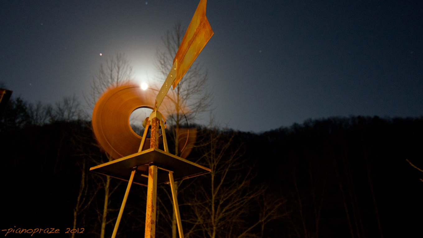
It was a crystal clear night. The moon was full and the temperature was very mild. I was out trying to make some art photographs capturing this
gorgeous night and beautiful big full moon.
Time: 8:35
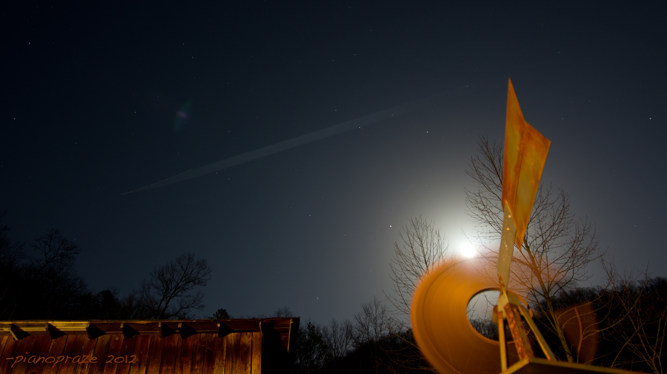
The night was perfectly clear without a cloud in the sky.
Time: 8:41
As I was shooting some annoying planes started flying by making huge contrails…
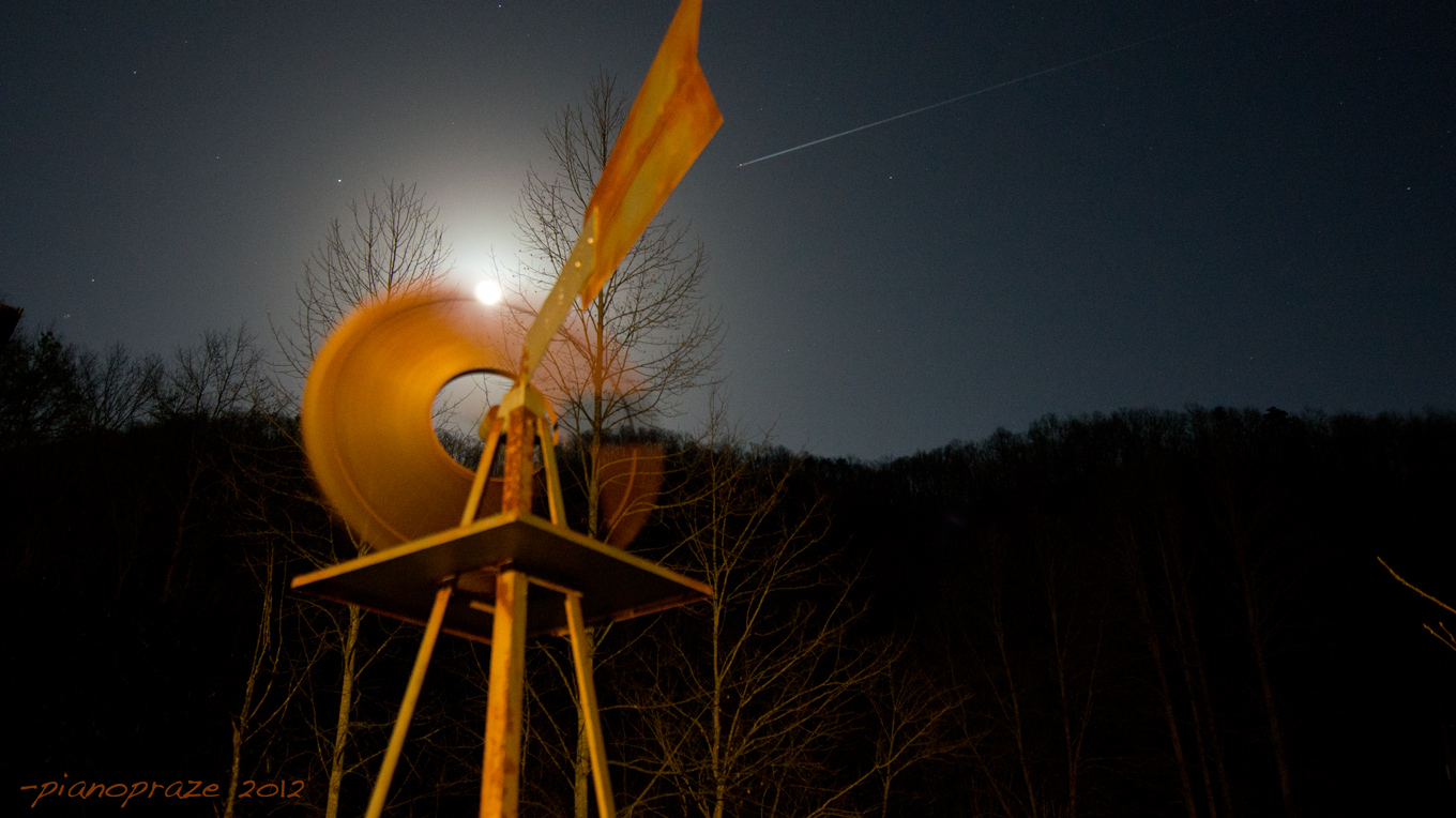
Time 8:43 – start of contrail formation
What was odd was there were others out planes not making contrails, but the atmosphere is very dynamic and one part of it can make them and others not so I didn’t think much of it…
…yet they kept coming - there were planes every direction I looked, easily 12 or more making these contrails and half a dozen others not making any lasting contrails. I had never seen so many planes at one time in this area.
Time: 8:43
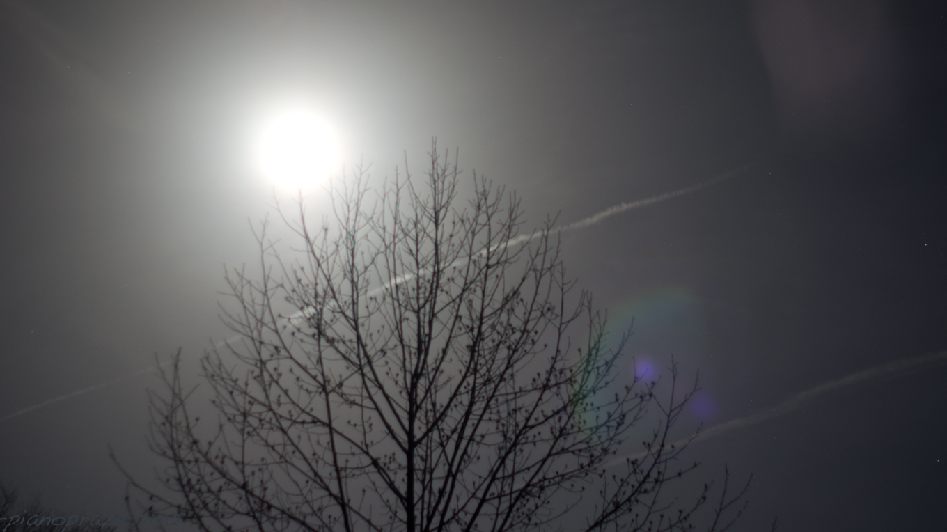
Then they started making patterns.
Time: 8:54
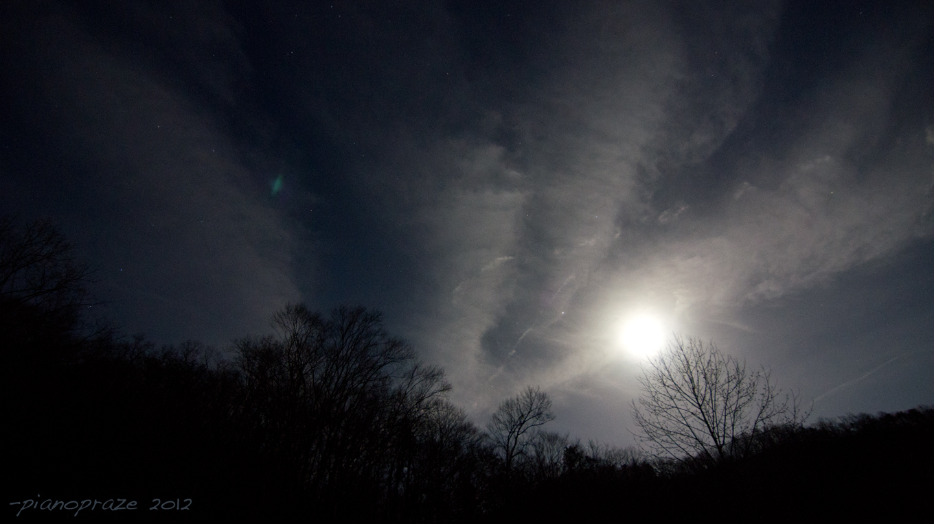
The sky started getting very hazy and as the contrails spread out.
Time: 9:04 – sky covered with contrails
These planes first started entering my shots at 8:43 and I abandoned trying to shoot because the sky was riddled with contrails by 9:08…. So within 20 minutes it went from perfectly clear to a crisscrossed mess of persistent contrails.

Time: 9:06
Time: 9:07
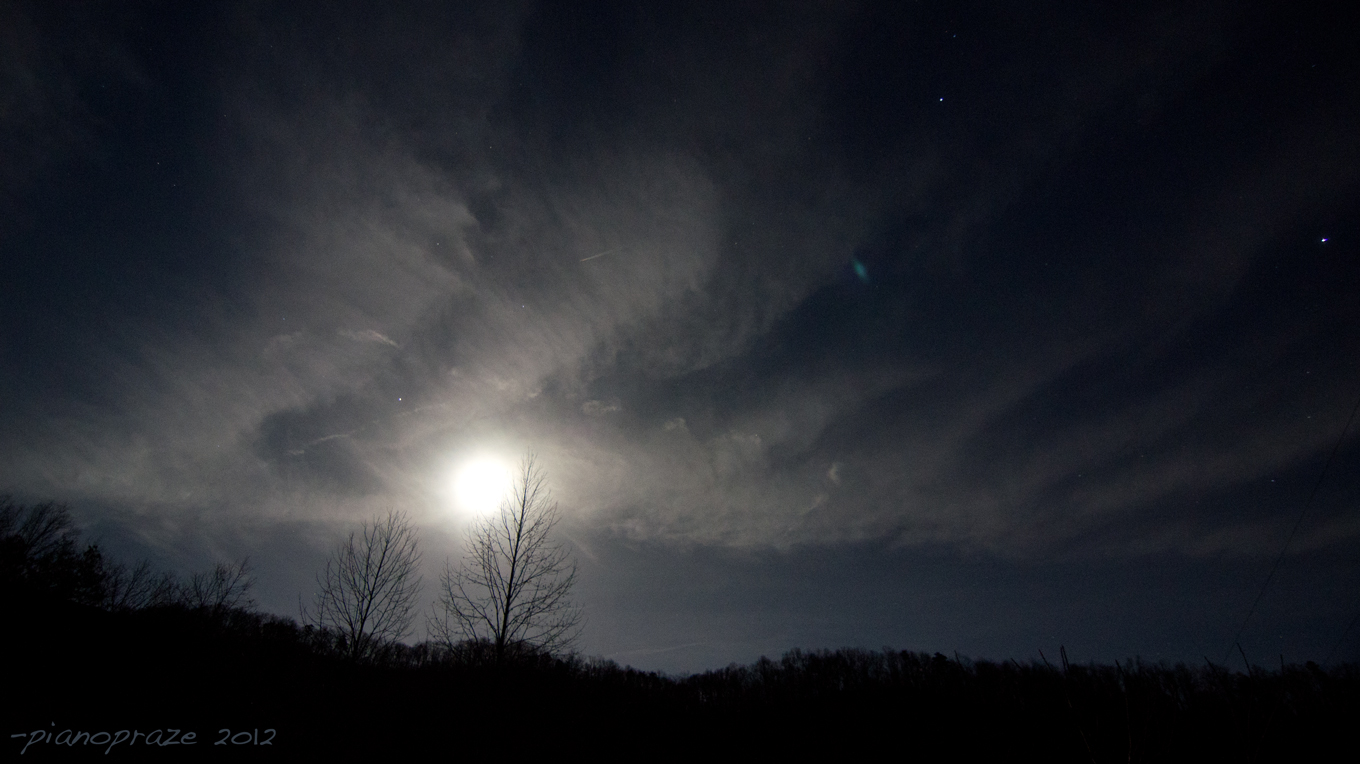
Time: 9:08
I came in and took a screen shot of the planes on the radar.
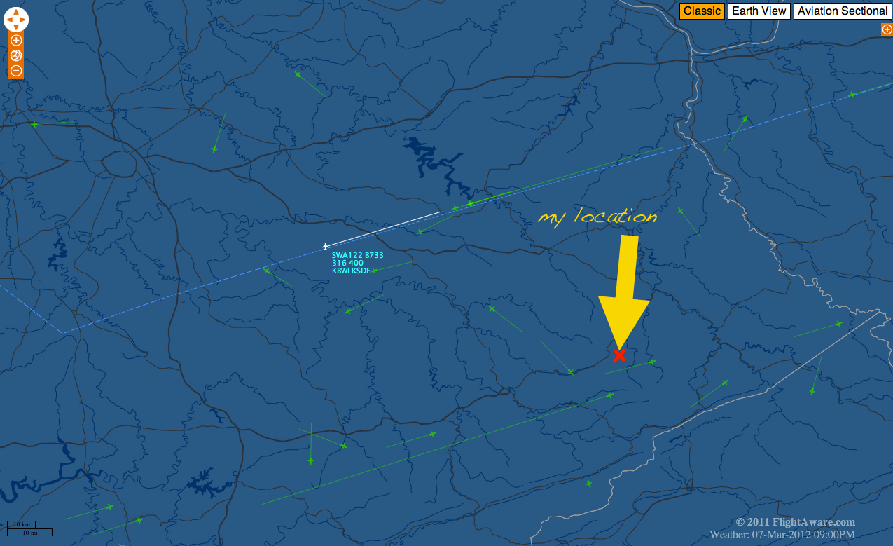
flightaware
There were a lot more planes flying than were on the radar. The ones that were not making the spreading contrails show on the radar, the ones that were making the spreading contrails are not shown.
Here is a Stellarium screen shot I took that shows the direction I was shooting it… I only thought to take this 40 minutes later so the moon is a little higher and more to the South than in my shots.
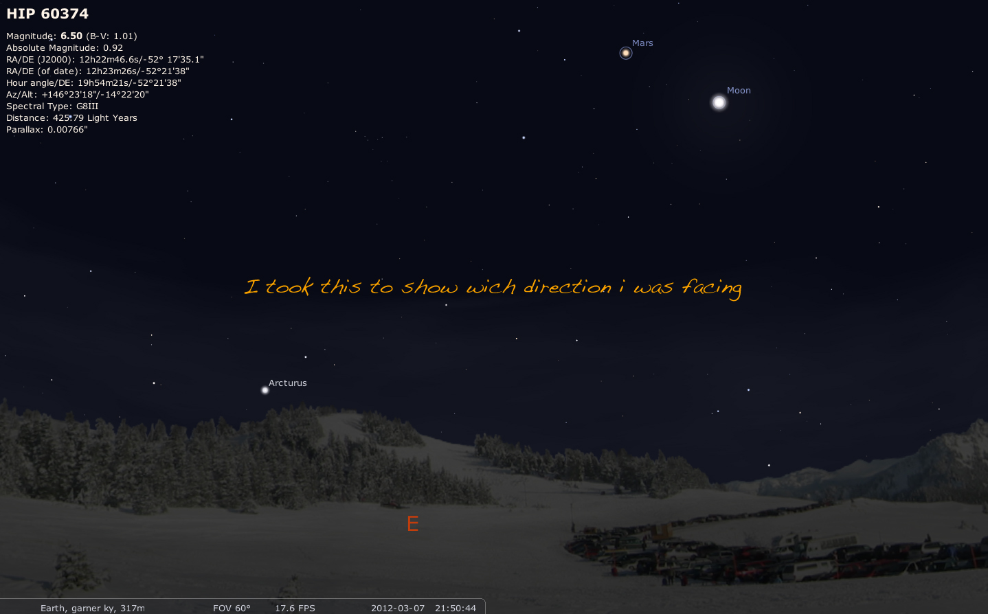
stellarium
This is proof positive there are planes making persistent contrails that are not on the radar.
I cannot prove these contrails are geoengineering. But it is highly suggestive to me given the circumstances.
I was not out to capture these photos… these planes intruded on my photo shoot of a beautiful night. I was shooting in RAW so I have 100 percent proof positive there is no fakery.
Also Checking NOAA’s weather balloon data the conditions were not present for the formation of contrails, the relative humidity in the 50's at the highest point:
NOAA
Raw data from 20k-30k feet:
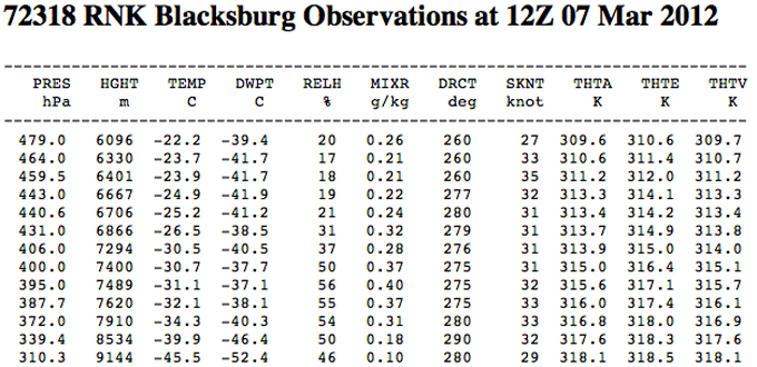
link with complete data
I’m sure the traditional Deny Everything group will be along shortly. But look at the evidence for yourself. I was facing pretty much east by south east for all these shots. It only took 20 minutes for them to cover the entire sky in crisscross patterns. Conditions were not right for contrail formation.
Here is a nice easy way to see: put the relative humidity between 20-56 percent as the data shows, then click "fly" and you will see the exact contrails the 3-6 non-persistent contrail planes were leaving. The 12 or so planes spreading these huge persistent contrails are off the chart well over 100 percent humidity on that applet... conditions that WERE NOT present.
Java applet showing conditions for contrail formation.
Time: 8:35
The night was perfectly clear without a cloud in the sky.
Time: 8:41
As I was shooting some annoying planes started flying by making huge contrails…
Time 8:43 – start of contrail formation
What was odd was there were others out planes not making contrails, but the atmosphere is very dynamic and one part of it can make them and others not so I didn’t think much of it…
…yet they kept coming - there were planes every direction I looked, easily 12 or more making these contrails and half a dozen others not making any lasting contrails. I had never seen so many planes at one time in this area.
Time: 8:43
Then they started making patterns.
Time: 8:54
The sky started getting very hazy and as the contrails spread out.
Time: 9:04 – sky covered with contrails
These planes first started entering my shots at 8:43 and I abandoned trying to shoot because the sky was riddled with contrails by 9:08…. So within 20 minutes it went from perfectly clear to a crisscrossed mess of persistent contrails.
Time: 9:06
Time: 9:07
Time: 9:08
I came in and took a screen shot of the planes on the radar.
flightaware
There were a lot more planes flying than were on the radar. The ones that were not making the spreading contrails show on the radar, the ones that were making the spreading contrails are not shown.
Here is a Stellarium screen shot I took that shows the direction I was shooting it… I only thought to take this 40 minutes later so the moon is a little higher and more to the South than in my shots.
stellarium
This is proof positive there are planes making persistent contrails that are not on the radar.
I cannot prove these contrails are geoengineering. But it is highly suggestive to me given the circumstances.
I was not out to capture these photos… these planes intruded on my photo shoot of a beautiful night. I was shooting in RAW so I have 100 percent proof positive there is no fakery.
Also Checking NOAA’s weather balloon data the conditions were not present for the formation of contrails, the relative humidity in the 50's at the highest point:
The relative humidity data from the RUC 40km model are suspect since 18 April, 2002. Forecasts since April 18, 2002 are suspect. To obtain a better estimate of potential contrail formation, examine the 'Individual level (mb)' results. Select a pressure value between 200 and 250 mb for the best estimate. Relative humidity values above 80% are good indicators of contrails in the new RUC data. You can use any pressure level , but the large values may be too warm for contrail formation.
NOAA
Raw data from 20k-30k feet:
link with complete data
I’m sure the traditional Deny Everything group will be along shortly. But look at the evidence for yourself. I was facing pretty much east by south east for all these shots. It only took 20 minutes for them to cover the entire sky in crisscross patterns. Conditions were not right for contrail formation.
Here is a nice easy way to see: put the relative humidity between 20-56 percent as the data shows, then click "fly" and you will see the exact contrails the 3-6 non-persistent contrail planes were leaving. The 12 or so planes spreading these huge persistent contrails are off the chart well over 100 percent humidity on that applet... conditions that WERE NOT present.
Java applet showing conditions for contrail formation.
reply to post by pianopraze
Great catch!
We see so many threads where they have daytime photos, so this is a real treat you've given us. Truly amazing the way the trails dissipate so quickly. I like the way you cross checked them with the radar imaging, too.
Maybe I missed it, but did you say what the wind was like that evening? Did it rain soon after?
Edit to Add: The moon was magnificent, wasn't it?
edit on 10-3-2012 by Afterthought because: (no reason given)
reply to post by pianopraze
Quite normal contrails.
And, I am puzzled because you added the screen shot from Flight Aware, but then said there were "more" airplanes than shown on Flight Aware?
I saw plenty in that screen grab. Since it was not interactive, I can not tell what each airplane's type and altitude was.
Also, keep in mind that Flight Aware, while basically "real time", does indeed have a slight time delay. I have researched it (by listening to ATC at airports, and then watching the flights that I hear on the radio compared to how they show up on Flight Aware) and found about an 8-minute delay in what's shown on Flight Aware, to actual "real time".
For a jet at cruise altitude, 8 minutes = anywhere from 50 to 60 miles distance.
(Edit)
Now, at the end of the OP, you had the radiosonde data, and wrote:
This is an odd thing to say, since I see very, very high humidity levels in that data.
But, you said (rightly, approximately) it is the data from 20,000 to 30,000 feet. You need to look more at the 30,000 feet and above. (**) This is the 300 mb level, and higher.
Contrails rarely form below about 28,000 feet
(**) Which I just did, by following the "full link"
Here, go look at your radiosonde data, then look at the Appleman Chart
NOTE the temperature at 300 mb, and above. Read the chart, following the temperature at the bottom, then moving up. Look at the area on the graph where the temp and altitude intersect.
Quite normal contrails.
And, I am puzzled because you added the screen shot from Flight Aware, but then said there were "more" airplanes than shown on Flight Aware?
I saw plenty in that screen grab. Since it was not interactive, I can not tell what each airplane's type and altitude was.
Also, keep in mind that Flight Aware, while basically "real time", does indeed have a slight time delay. I have researched it (by listening to ATC at airports, and then watching the flights that I hear on the radio compared to how they show up on Flight Aware) and found about an 8-minute delay in what's shown on Flight Aware, to actual "real time".
For a jet at cruise altitude, 8 minutes = anywhere from 50 to 60 miles distance.
(Edit)
Now, at the end of the OP, you had the radiosonde data, and wrote:
Conditions were not right for contrail formation.
This is an odd thing to say, since I see very, very high humidity levels in that data.
But, you said (rightly, approximately) it is the data from 20,000 to 30,000 feet. You need to look more at the 30,000 feet and above. (**) This is the 300 mb level, and higher.
Contrails rarely form below about 28,000 feet
(**) Which I just did, by following the "full link"
Here, go look at your radiosonde data, then look at the Appleman Chart
NOTE the temperature at 300 mb, and above. Read the chart, following the temperature at the bottom, then moving up. Look at the area on the graph where the temp and altitude intersect.
edit on Sat 10 March 2012 by ProudBird because: (no reason given)
Originally posted by ProudBird
reply to post by pianopraze
Quite normal contrails.
And, I am puzzled because you added the screen shot from Flight Aware, but then said there were "more" airplanes than shown on Flight Aware?
I saw plenty in that screen grab. Since it was not interactive, I can not tell what each airplane's type and altitude was.
Also, keep in mind that Flight Aware, while "real time", does indeed have a slight time delay. I have researched it (by listening to ATC at airports, and then watching the flights that I hear on the radio compared to how they show up on Flight Aware) and found about an 8-minute delay in what's shown on Flight Aware, to actual "real time".
For a jet at cruise altitude, 8 minutes = anywhere from 50 to 60 miles distance.
I took a screen shot as soon as I came in... no way to get an interactive, sorry.
Yes, when I came in there were A LOT more planes over head than were on flight aware. My understanding is this was not legal/possible so I don't know if they were military or what. I thought military were supposed to be on there also. It is possible that this was a military exercise and they did not show on flight aware.
Even given the slight delay there were easily 10 more planes visible than were listed on the radar. You can see from those screen shots of the individual contrails there were a lot more flying. That was just 20 minutes time.
reply to post by pianopraze
Maybe this is a dumb question and I'm not reading your other data properly, but what is making that blue light in the sky in the 9:08 photo and thereafter?
Maybe this is a dumb question and I'm not reading your other data properly, but what is making that blue light in the sky in the 9:08 photo and thereafter?
Originally posted by Afterthought
reply to post by pianopraze
Great catch!
We see so many threads where they have daytime photos, so this is a real treat you've given us. Truly amazing the way the trails dissipate so quickly. I like the way you cross checked them with the radar imaging, too.
Maybe I missed it, but did you say what the wind was like that evening? Did it rain soon after?
Edit to Add: The moon was magnificent, wasn't it?
edit on 10-3-2012 by Afterthought because: (no reason given)
Thank you for the kind words.
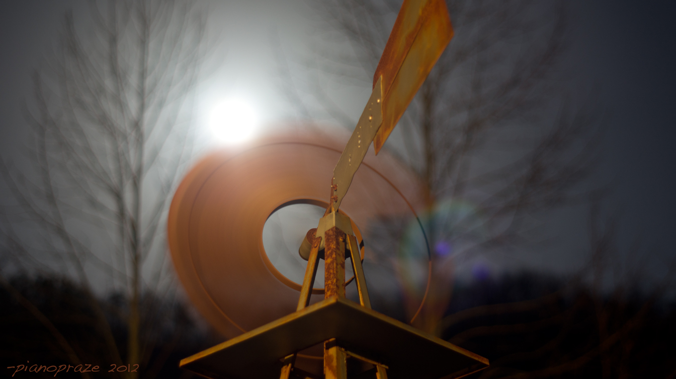
Wind was very light - less than 5 mph, just enough to get the windmill spinning off and on, sometimes no wind.
No it did not rain soon after
Originally posted by Afterthought
reply to post by pianopraze
Maybe this is a dumb question and I'm not reading your other data properly, but what is making that blue light in the sky in the 9:08 photo and thereafter?
That is lens flare from the very full and bright moon
edit on 10-3-2012 by pianopraze because: (no reason given)
reply to post by ProudBird
getting desperate now are we?
flight aware will not show covert military flights either
getting desperate now are we?
flight aware will not show covert military flights either
reply to post by pianopraze
it's gonna be veeeerrrrryyyy difficult
to make you out as being a kook
awesome job
F&S
it's gonna be veeeerrrrryyyy difficult
to make you out as being a kook
awesome job
F&S
Well done.
Are you sure your not up here at Lake Tahoe? Because that's how it happens here.
GORGEOUS Blue Skies. You can watch planes flying in all directions leaving a "scoach" of vapor errr contrail.
And then these other goshdarn planes leave trails that last forever and seem to dissipitate across the skyline leaving a goshdarn coating.
Those other goshdarn planes are just leaving contrails too at a certain elevation, but being as dumb as I am, I seem to notice they last a LOT longer in the sky,but I just don't understand science.
You'll NEVER win on ATS with people that want the proof of WHAT they are before you can claim you even see them. This discussion has gone on for over 8 years. As more info comes in it doesn't matter.
Until you have a confirmed source of who is spraying what and why?
They don't exist.
AND If you provided a good source? Bad source, so they don't exist.
Good pics though, you just don't understand the science behind what your looking at. (sneer)
reply to post by pianopraze
While the military flights might not show on Flight Aware, the term "military exercise" is a bit much. Could be as simple as transports en-route to somewhere, and/or tankers also en-route. Where they orbiting nearby? If so, then it would loosely qualify as an "exercise".
This reminds me of the "8 chemtrails" thread from a week or so back. In that case it was found to be the USAF Thunderbirds flying overhead, they had left one Air Show venue and were en-route to someplace else.
Yes, even an F-16 will make a contrail, when conditions are ripe.
It is possible that this was a military exercise and they did not show on flight aware.
While the military flights might not show on Flight Aware, the term "military exercise" is a bit much. Could be as simple as transports en-route to somewhere, and/or tankers also en-route. Where they orbiting nearby? If so, then it would loosely qualify as an "exercise".
This reminds me of the "8 chemtrails" thread from a week or so back. In that case it was found to be the USAF Thunderbirds flying overhead, they had left one Air Show venue and were en-route to someplace else.
Yes, even an F-16 will make a contrail, when conditions are ripe.
I have a few questions.....
If the Government was going to disperse chemicals etc why not always do them at night?
Where would these planes come from, how are they filled, how are these vast amounts of chemicals transported, made all in secret? When we are talking, what, 10,000s people involved with huge factories, huge specialized aircraft fleets, massive storage...... one needs to follow the strings to the source and not just look at the end result, if there is no string...then I would bet they are ALL just normal contrails.
Originally posted by ProudBird
reply to post by pianopraze
It is possible that this was a military exercise and they did not show on flight aware.
While the military flights might not show on Flight Aware, the term "military exercise" is a bit much. Could be as simple as transports en-route to somewhere, and/or tankers also en-route. Where they orbiting nearby? If so, then it would loosely qualify as an "exercise".
This reminds me of the "8 chemtrails" thread from a week or so back. In that case it was found to be the USAF Thunderbirds flying overhead, they had left one Air Show venue and were en-route to someplace else.
Yes, even an F-16 will make a contrail, when conditions are ripe.
All these planes were very high in the sky. They were not f-16, they were very large and very high.
I only offered military exercise as a possible logical explanation why they were not on flight aware, I make no claims that there was an operation.
They were not orbiting, they flew across in a checkerboard fashion leaving the entire sky form horizon to horizon in all directions covered with these persistent spreading contrails. These shots are all facing east and highlighted by the moon so easier to photograph. Thee planes were also to the N,W, and S.... They were flying at the same altitude as domestic flights as far as I could tell.
Originally posted by Xtrozero
I have a few questions.....
If the Government was going to disperse chemicals etc why not always do them at night?
Where would these planes come from, how are they filled, how are these vast amounts of chemicals transported, made all in secret? When we are talking, what, 10,000s people involved with huge factories, huge specialized aircraft fleets, massive storage...... one needs to follow the strings to the source and not just look at the end result, if there is no string...then I would bet they are ALL just normal contrails.
I can not answer your questions or prove anything beyond the data I have presented. But from the geoengineering papers I've read it would be much less needed - you seem to be engaging in hyperbole.
I presented the evidence that literally dropped into my lap as I was out making art.
Care to address my evidence instead of setting up straw men?
reply to post by pianopraze
Yes, I used that other thread (with an overly sensationalized title) as an example:
In that instance, all eight were on the same course, and they too were not orbiting.
Since you said the the flight you saw were not orbiting either, then they were simply large jets at high altitude en-route to somewhere, each on their own course to destination, and forming perfectly normal contrails.
Your link to the radiosonde was data from time 0000Z, 7 March 2012. Your photo session was at between 2030 and 2115 EST, correct? Same date, I presume? So, what was the actual date of those photos?
(Actually, thinking about it.....0000Z on 7 March is the day before...well, night before....in the Eastern time zone! So, 0000Z on the 7th is 1900 on the 6th, on the East Coast USA).
Zulu time (GMT) is five hours later then EST. So, the radiosonde data report from 0000Z means it was 1900 EST.
The atmosphere can change a lot in only one or two hours. But, this isn't even necessary, since the Appleman Chart clearly shows that at the temperatures recorded, contrails were likely.
That applet, I've seen it before, and it seems to need some tweaking.
Yes, I used that other thread (with an overly sensationalized title) as an example:
All these planes were very high in the sky. They were not f-16, they were very large and very high.
In that instance, all eight were on the same course, and they too were not orbiting.
Since you said the the flight you saw were not orbiting either, then they were simply large jets at high altitude en-route to somewhere, each on their own course to destination, and forming perfectly normal contrails.
Your link to the radiosonde was data from time 0000Z, 7 March 2012. Your photo session was at between 2030 and 2115 EST, correct? Same date, I presume? So, what was the actual date of those photos?
(Actually, thinking about it.....0000Z on 7 March is the day before...well, night before....in the Eastern time zone! So, 0000Z on the 7th is 1900 on the 6th, on the East Coast USA).
Zulu time (GMT) is five hours later then EST. So, the radiosonde data report from 0000Z means it was 1900 EST.
The atmosphere can change a lot in only one or two hours. But, this isn't even necessary, since the Appleman Chart clearly shows that at the temperatures recorded, contrails were likely.
That applet, I've seen it before, and it seems to need some tweaking.
edit on Sat 10 March 2012 by ProudBird because: (no reason
given)
reply to post by pianopraze
Very well done set of photographs!
Nice work Piano!
You cetainly caught quite a few planes off the radar, and they are the ones
that left trails, persistent contrails.
I wonder, they might be testing...who knows what?
Solar Radiation Management, could be Military Black Ops,
or even Biological testing...or spraying for Nile Virus, much of this
done at night!
www.youtube.com...
I would wager a bet if those contrails could be tested, we would find some type of
particulate matter, maybe even the type Edward Teller proposed using....
that can be used for SRM....his research papers can be found here:
www.geoengineeringwatch.org...
Further mentions of Tellers research here:
www.etcgroup.org...
And the concept of the Space Shade can be found here, on Wikipedia
en.wikipedia.org...
Then there would be the easy way to create the formations you have captured
in these photos, and thats adding sulfate to the fuel for the formation of stratospheric
aerosol...also for SRM.
Here, we can see the research papers on adding the sulfates to the fuel.
Efficient formation of stratospheric aerosol for climate engineering by emission
of condensible vapor from aircraft
Jeffrey R. Pierce
Department of Physics and Atmospheric Science, Dalhousie University, Halifax, Nova Scotia, Canada
effectiveness of stratospheric aerosol climate engineering through emission of non-condensable vapors such as SO2 is limited because the slow conversion to H2SO4 tends to produce aerosol particles that are too large; SO2 injection may be so inefficient that it is difficult to counteract the radiative forcing due to a CO2 doubling. Here we describe an alternate method in which aerosol is formed rapidly in the plume following injection of H2SO4, a condensable vapor, from an aircraft. This method gives better control of particle size and can produce larger radiative forcing with lower sulfur loadings than SO2 injection.
www.agu.org...
edit on 10-3-2012 by burntheships because: (no reason given)
reply to post by burntheships
And you would lose that bet.
Guaranteed.
I would wager a bet if those contrails could be tested, we would find some type of
particulate matter....
And you would lose that bet.
Guaranteed.
Originally posted by ProudBird
reply to post by pianopraze
Yes, I used that other thread (with an overly sensationalized title) as an example:
All these planes were very high in the sky. They were not f-16, they were very large and very high.
In that instance, all eight were on the same course, and they too were not orbiting.
Since you said the the flight you saw were not orbiting either, then they were simply large jets at high altitude en-route to somewhere, each on their own course to destination, and forming perfectly normal contrails.
Your link to the radiosonde was data from time 0000Z, 7 March 2012. Your photo session was at between 2030 and 2115 EST, correct? Same date, I presume?
Zulu time (GMT) is five hours later then EST. So, the radiosonde data report from 0000Z means it was 1900 EST.
The atmosphere can change a lot in only one or two hours. But, this isn't even necessary, since the Appleman Chart clearly shows that at the temperatures recorded, contrails were likely.
That applet, I've seen it before, and it seems to need some tweaking.
You are correct in your assumptions. March 7, times as noted on photos. NOAA launches weather balloons twice daily, I took the reading from the closest weather station... and one directly East a couple hundred miles in the direction i was shooting by good coincidence. The active map they make is from all the stations and is a fairly accurate portrayal of the weather over time... so NOAA says (and links provided) that the conditions were not present. Links are in OP.
Even if the app needs tweaking, and even if conditions varied... there was not enough variation to cause these persistent spreading contrails I observed and photographed. And there were planes in the approximate same strata forming contrails, and not forming contrails. So I would not say they were perfectly normal contrails when the conditions were not present and some were forming these huge persistent contrails and some were forming the contrails the app says they should have formed given the weather conditions.
reply to post by burntheships
You cannot tell that from the screen shot posted.
In fact, did you try to count the ones that were in that shot? I see eight, maybe nine possible candidates, just in that one screen grab.
Those airplanes are in motion, remember. You have to look at the ones that have passed overhead his location (based on their current positions in the screen shot), and the ones about to enter his field of view. Also, you see clearly that there are the east-west flights, and the northwest-southeast flights, too. Those match the angles of the contrails in the photos.
You cetainly caught quite a few planes off the radar, and they are the ones
that left trails, persistent contrails.
You cannot tell that from the screen shot posted.
In fact, did you try to count the ones that were in that shot? I see eight, maybe nine possible candidates, just in that one screen grab.
Those airplanes are in motion, remember. You have to look at the ones that have passed overhead his location (based on their current positions in the screen shot), and the ones about to enter his field of view. Also, you see clearly that there are the east-west flights, and the northwest-southeast flights, too. Those match the angles of the contrails in the photos.
reply to post by pianopraze
Don't know if you saw my edit.....as to the radiosonde date 7 March, @0000Z....that was data from nearly 24 hours before the evening of March 7, in the USA.
You are correct in your assumptions. March 7, times as noted on photos.
Don't know if you saw my edit.....as to the radiosonde date 7 March, @0000Z....that was data from nearly 24 hours before the evening of March 7, in the USA.
reply to post by ProudBird
Ms Long from Lawrence Livermore Labs....
"The Ships have been designed"..... "A Fleet of airplanes the size of SW Airlines."
www.youtube.com...
Its always so amusing to see the arguments that nothing is happening.
Billions and billions spent on research into SRM, Bill Gates opening his own SRM
company, designing specialty blimps for SRM delivery, and yeah...nothing is happening.
and nothing has ever happened.
If its a contract with the Goverment, they could just use military planes,
as suggested in this research paper...
climate.envsci.rutgers.edu...
Those planes might be doing this:
Modification of cirrus clouds to reduce global warming
Ms Long from Lawrence Livermore Labs....
"The Ships have been designed"..... "A Fleet of airplanes the size of SW Airlines."
www.youtube.com...
Its always so amusing to see the arguments that nothing is happening.
Billions and billions spent on research into SRM, Bill Gates opening his own SRM
company, designing specialty blimps for SRM delivery, and yeah...nothing is happening.
and nothing has ever happened.
If its a contract with the Goverment, they could just use military planes,
as suggested in this research paper...
4.1. Airplanes
Existing small jet fighter planes, like the F-15C Eagle (Figure 2a), are capable of flying into the lower stratosphere in the tropics, while in the Arctic, larger planes, such as the KC-135 Stratotanker or KC-10 Extender (Figure 2b), are capable of reaching the required altitude. ......
The Northrop Grumman RQ-4 Global Hawk can reach 20 km without a pilot but costs twice as much as an F-15C. Current designs have a payload of 1-1.5 tons. Clearly it is possible to design an autonomous specialized aircraft to loft sulfuric acid precursors into the lower stratosphere, but the current analysis focuses on existing aircraft.
Options for dispersing gases from planes include the addition of sulfur to the fuel, which would release the aerosol through the exhaust system of the plane, or the attachment of a nozzle to release the sulfur from its own tank within the plane, .......
The military has already manufactured more planes than would be required for this geoengineering scenario, potentially reducing the costs of this method. Since climate change is an important national security issue [Schwartz and Randall, 2003], the military could be directed to carry out this mission with existing aircraft at minimal additional cost. ...
Unlike the small jet fighter planes, the KC-135 and KC-10 are used to refuel planes mid-flight and already have a nozzle installed. In the tropics, one option might be for the tanker to fly to the upper troposphere, and then fighter planes would ferry the sulfur gas up into the stratosphere (Figure 2b). It may also be possible to have a tanker tow a glider with a hose to loft the exit nozzle into the stratosphere.
climate.envsci.rutgers.edu...
Those planes might be doing this:
Modification of cirrus clouds to reduce global warming
Fortunately the coldest cirrus have the highest ice supersaturation due to the dominance of homogeneous freezing nucleation. Seeding such cirrus with very efficient heterogeneous ice nuclei should produce larger ice crystals due to vapor competition effects, thus increasing OLR and surface cooling. Preliminary estimates of this global net cloud forcing are more negative than −2.8 W m−2 and could neutralize the radiative forcing due to a CO2 doubling (3.7 W m−2). A potential delivery mechanism for the seeding material is already in place: the airline industry. iopscience.iop.org...
edit on 10-3-2012 by burntheships because: (no reason given)
new topics
-
I sleep no more.
Philosophy and Metaphysics: 1 hours ago -
Canada caught red-handed manipulating live weather data and make it warmer
Fragile Earth: 1 hours ago -
Why Files Our Alien Overlords | How We Secretly Serve The Tall Whites
Aliens and UFOs: 2 hours ago -
Curse of King Tuts Tomb Solved
Ancient & Lost Civilizations: 4 hours ago -
What allies does Trump have in the world?
ATS Skunk Works: 4 hours ago
top topics
-
BIDEN Admin Begins Planning For January 2025 Transition to a New President - Today is 4.26.2024.
2024 Elections: 13 hours ago, 9 flags -
Big Storms
Fragile Earth: 14 hours ago, 8 flags -
Shocking Number of Voters are Open to Committing Election Fraud
US Political Madness: 17 hours ago, 7 flags -
Curse of King Tuts Tomb Solved
Ancient & Lost Civilizations: 4 hours ago, 6 flags -
Why Files Our Alien Overlords | How We Secretly Serve The Tall Whites
Aliens and UFOs: 2 hours ago, 6 flags -
Where should Trump hold his next rally
2024 Elections: 17 hours ago, 5 flags -
Canada caught red-handed manipulating live weather data and make it warmer
Fragile Earth: 1 hours ago, 5 flags -
What allies does Trump have in the world?
ATS Skunk Works: 4 hours ago, 2 flags -
I sleep no more.
Philosophy and Metaphysics: 1 hours ago, 1 flags
active topics
-
Post A Funny (T&C Friendly) Pic Part IV: The LOL awakens!
General Chit Chat • 7139 • : underpass61 -
Canada caught red-handed manipulating live weather data and make it warmer
Fragile Earth • 6 • : BeyondKnowledge3 -
Gov Kristi Noem Shot and Killed "Less Than Worthless Dog" and a 'Smelly Goat
2024 Elections • 74 • : Myhandle -
University of Texas Instantly Shuts Down Anti Israel Protests
Education and Media • 334 • : DBCowboy -
Curse of King Tuts Tomb Solved
Ancient & Lost Civilizations • 4 • : theatreboy -
A Warning to America: 25 Ways the US is Being Destroyed
New World Order • 31 • : JAY1980 -
Krystalnacht on today's most elite Universities?
Social Issues and Civil Unrest • 18 • : TheSingleBillie -
Where should Trump hold his next rally
2024 Elections • 25 • : network dude -
2024 Pigeon Forge Rod Run - On the Strip (Video made for you)
Automotive Discussion • 9 • : TheInvisibleRedneck -
Why Files Our Alien Overlords | How We Secretly Serve The Tall Whites
Aliens and UFOs • 4 • : sine.nomine