It looks like you're using an Ad Blocker.
Please white-list or disable AboveTopSecret.com in your ad-blocking tool.
Thank you.
Some features of ATS will be disabled while you continue to use an ad-blocker.

Quake Watch 2012
page: 8share:
Japan to install tsunami monitoring system at sea
currently at
www3.nhk.or.jp/daily/english/20120109_01.html with 1:21 min video

currently at
www3.nhk.or.jp/daily/english/20120109_01.html with 1:21 min video
The Japanese government will install a large scale tsunami monitoring system on the Pacific seabed to speed up it's warning process.
The education and science ministry plans to install an underwater cable near the Nippon Trench in the Pacific Ocean, seismometers on the seabed, and underwater tsunami detectors using hydraulic pressure sensors.
Seismometers and tsunami detectors will be installed by March 2013 in waters off the Boso Peninsula and the Sanriku Coast. The locations are north and south of the focus of the major earthquake that hit wide areas of northeastern Japan last year. Additional monitors will be put in place off the coast of Miyagi Prefecture and near the Nippon Trench, close to the focus of the 2011 earthquake.
A total of 150 locations will be positioned by March 2015.
Separately, the Meteorological Agency will install seismometers at 3 locations in waters about 400 kilometers off the northeastern coast some time this year. The data of the seismometers will be collected by satellites and will be used to detect a massive earthquake that is expected to occur east of the Nippon trench in the Pacific Ocean.
The data will help the Meteorological Agency release tsunami information or warnings.
Akira Nagai, the chief of the agency's tsunami monitoring division, said these systems will help the agency gather necessary data as they can monitor tsunami closer as they occur.
During the 2011 earthquake and tsunami, Japan's Meteorological Agency was able to monitor tsunami waves before they reached the Japanese coast, because of underwater global positioning systems off northeastern Japan.
Monday, January 09, 2012 05:24 +0900 (JST)
Copyright NHK (Japan Broadcasting Corporation) All rights reserved.
6.6 SANTA CRUZ ISLANDS
49KM deep
No tsunami threat
363 km (225 miles) E (93°) from Kira Kira, Solomon Islands
593 km (369 miles) ESE (103°) from HONIARA, Solomon Islands
1980 km (1230 miles) E (95°) from PORT MORESBY, Papua New Guinea
earthquake.usgs.gov...
49KM deep
No tsunami threat
363 km (225 miles) E (93°) from Kira Kira, Solomon Islands
593 km (369 miles) ESE (103°) from HONIARA, Solomon Islands
1980 km (1230 miles) E (95°) from PORT MORESBY, Papua New Guinea
earthquake.usgs.gov...
edit on 8-1-2012 by MoorfNZ because: (no reason given)
Magnitude 6.6 - SANTA CRUZ ISLANDS
2012 January 09 04:07:17 UTC
Details
Maps
Tsunami
Earthquake Details
This event has been reviewed by a seismologist.
Magnitude
6.6 (Preliminary magnitude — update expected within 15 minutes)
Date-Time
Monday, January 09, 2012 at 04:07:17 UTC
Monday, January 09, 2012 at 03:07:17 PM at epicenter
Location
10.595°S, 165.246°E
Depth
49.6 km (30.8 miles) set by location program
Region
SANTA CRUZ ISLANDS
Distances
363 km (225 miles) E (93°) from Kira Kira, Solomon Islands
593 km (369 miles) ESE (103°) from HONIARA, Solomon Islands
1980 km (1230 miles) E (95°) from PORT MORESBY, Papua New Guinea
Location Uncertainty
Error estimate not available
Parameters
NST= 17, Nph=0, Dmin=0 km, Rmss=0 sec, Gp= 86°,
M-type="moment" magnitude from initial P wave (tsuboi method) (Mi/Mwp), Version=B
Source
NOAA Pacific Tsunami Warning Center
Event ID
pt12009000
earthquake.usgs.gov...
Originally posted by SpaceJockey1
Only showing as a 6.1 on EMSC
Been quite a few days for a 6+ to occur.
By the looks of the Geonet drums there is another afterwards of similar size or closer to N.Island of NZ as ghosting 10 mins or so ago. www.geonet.org.nz...
reply to post by MoorfNZ
Yep, too close to be anything else.
I just refreshed the EMSC site and see it's now listed as 6.6
Yep, too close to be anything else.
I just refreshed the EMSC site and see it's now listed as 6.6
PTWC says no #tsunami alert following M6.6 earthquake in Solomon Islands.
No tsunami!
reply to post by MoorfNZ
Magnitude 5.4 - TONGA REGION
This one maybe?
It was nearly 40 minutes after the other one, so maybe not...
Magnitude 5.4 - TONGA REGION
Magnitude
5.4
Date-Time
Monday, January 09, 2012 at 03:43:33 UTC
Monday, January 09, 2012 at 03:43:33 PM at epicenter
Time of Earthquake in other Time Zones
Location
22.062°S, 173.863°W
Depth
36.5 km (22.7 miles)
Region
TONGA REGION
Distances
172 km (106 miles) SE of NUKU`ALOFA, Tonga
377 km (234 miles) S of Neiafu, Tonga
525 km (326 miles) ESE of Ndoi Island, Fiji
1974 km (1226 miles) NE of Auckland, New Zealand
Location Uncertainty
horizontal +/- 17.8 km (11.1 miles); depth +/- 10.2 km (6.3 miles)
Parameters
NST= 70, Nph= 71, Dmin=895 km, Rmss=0.47 sec, Gp=101°,
M-type=body wave magnitude (Mb), Version=7
Source
Magnitude: USGS NEIC (WDCS-D)
Location: USGS NEIC (WDCS-D)
Event ID
usc0007hrl
This one maybe?
It was nearly 40 minutes after the other one, so maybe not...
edit on 8-1-2012 by jadedANDcynical because: ?
reply to post by jadedANDcynical
The double ghosting is the Santa Cruz one.. there is one after
Added: And now another ghosting
The double ghosting is the Santa Cruz one.. there is one after
Added: And now another ghosting
edit on 8-1-2012 by MoorfNZ because: (no reason given)
ShakeOut, don't freak out, earthquake preparedness in 17 weeks
By Joe Dougherty, For the Deseret News Published: Sunday, Jan. 8, 2012 5:34 p.m. MST
www.deseretnews.com/article/705397019/ShakeOut-dont-freak-out-earthquake-preparedness-in-17-weeks.html
By Joe Dougherty, For the Deseret News Published: Sunday, Jan. 8, 2012 5:34 p.m. MST
www.deseretnews.com/article/705397019/ShakeOut-dont-freak-out-earthquake-preparedness-in-17-weeks.html
Utah is earthquake country. Every year, seismologists at the University of Utah record around 800 quakes. Most of them aren’t strong enough to be felt, but a few times a year some community in Utah gets the luck of the draw to have a shaker that rattles them for a few seconds.
It’s just a reminder that most of the state’s population lives right next to a sleeping giant.
The Wasatch Fault has a major earthquake about every 350 years. The last one was 350 years ago.
When I say major earthquake, I’m talking about a 7.0 — something that would cause thousands of deaths and injuries, disruption to utilities, building collapse and ruined transportation. Initially, we would see chaos and destruction — a catastrophe.
So we plan, prepare and train while Mother Nature has given us time. You can, too.
On April 17 at 10:15 a.m., the state of Utah will hold the first statewide earthquake drill, the largest of its kind ever to be held in the state.
It’s called the Great Utah ShakeOut.
(...)
Originally posted by PuterMan
...isn't mostly correct....guesses wildly....has no system that is based on fact....depends on coincidence
Hey now, I didn't say that he's my go-to source or anything. He offers nothing totally tangible and concrete, but I do find his video's interesting, especially opposed to a lot of others.
Well (1) when you cite Chile, Mid-Atlantic ridge, Ecuador, New Zealand, Tonga etc as possible areas you are pretty darn sure to be right most of the time. It is bit like saying "there will be seismic events in California" or "tomorrow there will be an earthquake in the ring of fire". These people are all the same. I gave up proving the cali site wrong as it happened every day - got a bit boring really.
This is true, regarding those areas, but he doesn't always drive a stake into the most seismic active locations. I've seen him go all around, but I get ya.
Now I am always happy to be proved wrong so if you can show the connections then I would be very happy to take a look, even if only because logically in an electric universe there should be some effect one might expect. I would also like someone to explain just how this can trigger earthquakes. Sorry but "OMG a CME! There will be a Mag 8" does not cut it. I need reasons why this might be.
Well, I mean, realistically most aren't that naive anymore. This guy tends to say, "I am expecting a 7.0 magnitude earthquake" a lot like he has a total clue, and I see the weakness there as well, I usually just listen to his solar assessment and follow through with the areas he marks down for observation to which I keep a close eye on in combination with watching the magnetosphere. There's not much more to do other than that, unless one wants to digest each opinion of his as an absolute, and some do.
I am not saying you have not seen this increase, but can you substantiate it? Unfortunately I do not have time to cover all the areas I would like to cover so it would be useful if someone else could keep track of these and see if there is in fact a connection. The person on YT is not researching anything. He just has a bee in his bonnet and depends on apparent synchronicity due to happenstance. In that video he admitted nothing occurred - with excuses.
Not currently, no, not based upon enough seismic activity as of recently, not so much as back in August to September if my mind serves me correct. I will certainly keep my eye on it and post whenever I see a reasonable seismic uptick worth discussion.
No, it just bends the crust by up to 55mm twice a day. Do solar flares do that?
That is something! I did not know that.
reply to post by SpaceJockey1
Just a reminder that mb is the first value published, and almost always the first value by EMSC. The 6.1 was the mb value derived from the P wave. A few minutes/hours later comes the Mw value based on the S waves. EMSC are now showing Mw 6.6.
It is not a case of ONLY 6.1, just a different scale.
Just a reminder that mb is the first value published, and almost always the first value by EMSC. The 6.1 was the mb value derived from the P wave. A few minutes/hours later comes the Mw value based on the S waves. EMSC are now showing Mw 6.6.
It is not a case of ONLY 6.1, just a different scale.
Santa Cruz.
My latest post on this stated:
That may be to come yet.
Guess the system may work then. Early days yet but interesting.
Sanata Cruz still has (according to the 'model') the potential for a Mag 7.75 (I think that is what she told me - oops wrong sort of model)
If you want an eyeful of some sexymodels graphs of the stress,
see here
My latest post on this stated:
This has changed and there is the possibility of a large quake in the immediate future based on the pattern of the FE areas.
Based on the above I flag Santa Cruz as a red zone for a 7.5 to 7.8 in the next year.
That may be to come yet.
Guess the system may work then. Early days yet but interesting.
Sanata Cruz still has (according to the 'model') the potential for a Mag 7.75 (I think that is what she told me - oops wrong sort of model)
If you want an eyeful of some sexy
edit on 9/1/2012 by PuterMan because: (no reason
given)
That poor earthquake is only just fresh from it's watery resting place and USGS is beating it over the head already.
Watch that one go down - but wait and see if it takes 8 days. 6.4 looks like the target.
Body Wave Moment Mw 6.3
Centroid Moment Mw 6.4
WPhase Moment Mw 6.4
Watch that one go down - but wait and see if it takes 8 days. 6.4 looks like the target.
Body Wave Moment Mw 6.3
Centroid Moment Mw 6.4
WPhase Moment Mw 6.4
edit on 9/1/2012 by PuterMan because: to fix a tag
reply to post by PuterMan
My biggest concern is the Canary Islands. What are your thoughts on the landslide prediction? Do you think it has any merit at all?
My biggest concern is the Canary Islands. What are your thoughts on the landslide prediction? Do you think it has any merit at all?
reply to post by Jerisa
Here is Puterman's reply to me about what I think you are concernred about:
Here is Puterman's reply to me about what I think you are concernred about:
Originally posted by PuterMan
reply to post by jadedANDcynical
By contrast, megatsunamis are caused by giant landslides and other impact events. Underwater earthquakes or volcanic eruptions do not normally generate such large tsunamis, but landslides next to bodies of water resulting from earthquakes can, since they cause a massive amount of displacement.
Yes of course I am aware of Alaska and of Wikipedia's statement. Note first that Alaska did not produce a global tsunami, it was local.
As far as I am concerned Wikipedia has jumped on the doom wagon and what they are saying is in my opinion incorrect. (Now there's a surprise - Wikipedia may be wrong! )
I subscribe to the theory that massive landslides produce very large local tsunamis but do not have far reaching effects on a global scale.
You should have a read of Dr. GEORGE PARARAS-CARAYANNIS if you have not already done so.
With regard to this an ATS member commented to me:
I can tell you right off the bat what the problem with the original "mega-tsunami" theory was. It was based on dropping a pile of dirt into a tank full of water. And a smooth, rectangular, enclosed tank at that. Such a set-up is about as far from the reality of the situation as you can get while still managing to remain a convincing demonstration.
Puterman... you don't know who I am, but I would certainly endorse the speculation of George Pararas-Carayannis. His is certainly more founded than that of the people who decided dropping rocks at one end of a plexiglass tank was a good idea.
Post source
Consider the length of the fault slip that is involved in a mega-quake. We are talking,huge distances. Banda Aceh for example:
The earthquake ruptured a surface of at least 400 km long and 100km wide, with an average slip of 10-15 meters, and local maximum of 20-25 meters
Report on Banda Aceh mega-thrust earthquake, December 26, 2004
OK it is not going to be all of that but the basic maths 400 x 100 x 0.1 = 4,000 cu km. Sort of makes Cumbre Veija look a bit small.
The mechanism is also vastly different.
edit on 26/7/2011 by PuterMan because: Darn tags!
Edit to add:
re: Landslide != global tsunami maker
For those not into computer /maths speak != is not equal to. 'Landslide is not equal to global tsunami maker'
The statement is correctedit on 26/7/2011 by PuterMan because: (no reason given)
reply to post by jadedANDcynical
I feel sort of redundant!!
Glad to see you could still dig that up. Yes exactly what I would have said --- oh wait a minute I did
I feel sort of redundant!!
Glad to see you could still dig that up. Yes exactly what I would have said --- oh wait a minute I did
reply to post by PuterMan
If what is suspected to have happened in Fiordland, NZ since the 1980's (multiple Mag 6's putting more and more stress on the offshore part of the Alpine Fault ending in a 7.8Mw quake) is happening at Santa Cruz then yes a big 7 is on the cards.
Looking at your graph can you explain how you work out Energy TJ / Stress TJ /Stress Equiv please.
It looks like only 7's release the stress build up, whereas 6's just add to the build up long term, with a slight release at the time of the 6.
edit on 9-1-2012 by muzzy because: missed an n
just added another NZ graph to the end of QuakeWatch2011
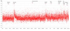
*this is just a thumbnail to tease, the full size image is linked to on the 2011 Reply
Not sure if its the incomplete data for the last 2 months or what, but the graph shows an overall upward trend in the magnitudes of NZ earthquakes (less low 2's, more 3's and 4's) since the Sumner quake of July 13th.
Note this is ALL of New Zealand, not just Canterbury.
edit on 9-1-2012 by muzzy because: (no reason given)
reply to post by jadedANDcynical
Thank you ...both? lol You have answered my question and won an argument for me that I had last night!
Thank you ...both? lol You have answered my question and won an argument for me that I had last night!
new topics
-
A Warning to America: 25 Ways the US is Being Destroyed
New World Order: 4 hours ago -
President BIDEN's FBI Raided Donald Trump's Florida Home for OBAMA-NORTH KOREA Documents.
Political Conspiracies: 10 hours ago -
Maestro Benedetto
Literature: 11 hours ago -
Is AI Better Than the Hollywood Elite?
Movies: 11 hours ago
top topics
-
President BIDEN's FBI Raided Donald Trump's Florida Home for OBAMA-NORTH KOREA Documents.
Political Conspiracies: 10 hours ago, 28 flags -
A Warning to America: 25 Ways the US is Being Destroyed
New World Order: 4 hours ago, 9 flags -
Gaza Terrorists Attack US Humanitarian Pier During Construction
Middle East Issues: 16 hours ago, 8 flags -
Las Vegas UFO Spotting Teen Traumatized by Demon Creature in Backyard
Aliens and UFOs: 15 hours ago, 6 flags -
2024 Pigeon Forge Rod Run - On the Strip (Video made for you)
Automotive Discussion: 16 hours ago, 4 flags -
Is AI Better Than the Hollywood Elite?
Movies: 11 hours ago, 3 flags -
The functionality of boldening and italics is clunky and no post char limit warning?
ATS Freshman's Forum: 17 hours ago, 1 flags -
Maestro Benedetto
Literature: 11 hours ago, 1 flags
active topics
-
Cars and Coffee - Knoxville, TN 2023
Automotive Discussion • 12 • : adamfrank -
President BIDEN's FBI Raided Donald Trump's Florida Home for OBAMA-NORTH KOREA Documents.
Political Conspiracies • 20 • : theatreboy -
A Warning to America: 25 Ways the US is Being Destroyed
New World Order • 6 • : theatreboy -
Supreme Court to decide if states can control fate of social media
Education and Media • 14 • : SMMPanelPro -
Gaza Terrorists Attack US Humanitarian Pier During Construction
Middle East Issues • 35 • : Lazy88 -
Definitive 9.11 Pentagon EVIDENCE.
9/11 Conspiracies • 426 • : Lazy88 -
Alternate Electors vs Fake Electors - What is the Difference.
2024 Elections • 117 • : ADVISOR -
-@TH3WH17ERABB17- -Q- ---TIME TO SHOW THE WORLD--- -Part- --44--
Dissecting Disinformation • 691 • : Imbackbaby -
Victoria government has cancelled the commmonwealth games, no money.
Regional Politics • 3 • : nazaretalazareta -
When an Angel gets his or her wings
Religion, Faith, And Theology • 22 • : AcrobaticDreams1