It looks like you're using an Ad Blocker.
Please white-list or disable AboveTopSecret.com in your ad-blocking tool.
Thank you.
Some features of ATS will be disabled while you continue to use an ad-blocker.

Photoshopped clouds near Area 51 hiding something?
page: 2share:
I think we have kind of drifted off-topic here, but if st111 wants an accurate timeline for Area 51, I suggest he looks here:
www.dreamlandresort.com...
For more detailed information, look here:
www.dreamlandresort.com...
There is ample evidence to show continuous usage of the Groom Lake facility from 1955 to the present.
www.dreamlandresort.com...
For more detailed information, look here:
www.dreamlandresort.com...
There is ample evidence to show continuous usage of the Groom Lake facility from 1955 to the present.
Thanks for letting us know that all the research we have ever done is wrong. with no proof of your claims.
The 2nd of those is the main reason for this site. to be able to pool knowledge to create proof.
The 2nd of those is the main reason for this site. to be able to pool knowledge to create proof.
Originally posted by Digital_Reality
I just don't know. All I do know is that image is what I get in the shadow of the cloud when I adjust the hue, saturation and light. It shows up in many different colors as you adjust. I have found it in PhotoshopCS2 and in Paint Shop ProX. Look for yourself its there.
Wow, you done good, dude. You done really good.
That cloud and a few around it are producing pitch black shadows and in an atmosphere that's not possible because light diffuses. I'd noticed this once before but with your enhancements it makes the anomaly abundantly clear.
And to check the veracity of my statement one need only look at clouds around the globe on Google Earf. You will notice that all shadows produced by clouds are slightly to very transparent.
So Lear is a Rooster after all...
well, I hope no one comes to snuff the Rooster, cause ya know he ain't gonna die.
So, Mr Digital Reality, please U2U me next monf to remind me that you need a vote, I'm all out right now.
Originally posted by gfad
Originally posted by st111
P.S area 51 although being still designated secret hasn`t had anything secret going on since the 50`s.
Think about it.
I think you are the one that needs to think!!
Check your facts before you post complete rubbish.
The base wasn't built until 1955!!!!!!!
Maybe you all misread by post.See above that 1955 is in the 50`s.Writing 50`s is a shorter way to write fifties.
I haven`t written an actual date.I do believe the base has been operational before the 1955 time it was said to be built.I also believe that the base hasn`t been operational for Secret developments for a long time, including the dates previously posted.
I understood exactly what you meant, its just you are so wrong I cant believe you are continuing this.
The timeline I posted and the articles shadowhawk linked to are backed by decades of research, scouring through records and personal interviews. You have nothing to back up your timeline as it is simply incorrect.
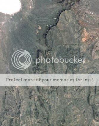
Here is a photo of Groom Lake taken in 1952. Please explain why there is nothing there but an old army gunnery range if the base was active before 1955.
The timeline I posted and the articles shadowhawk linked to are backed by decades of research, scouring through records and personal interviews. You have nothing to back up your timeline as it is simply incorrect.
Here is a photo of Groom Lake taken in 1952. Please explain why there is nothing there but an old army gunnery range if the base was active before 1955.
OP, what are the coordinates for the area you've found? I would like to check ti for myself in google earth. It could possibly be just a regular
image, since not all the images on google earth are taken at the same time, but in grids at different times.
Originally posted by gfad
Here is a photo of Groom Lake taken in 1952. Please explain why there is nothing there but an old army gunnery range if the base was active before 1955.
Maybe the image is false.
Top secret
Think about it.
I base my beliefs on the law of the US govt covering Disclosure of Top Secret information and the procedures involved in releasing such data into the public domain.
Executive order 12958 in 1995, which mandated that 25yr old documents be automatically declassified unless excempt for National Security or other reasons.But you still can`t rush down to the National Archives.The fifty archivists can process 40 million pages a year, but now they face 400 million.Amongst them are records from the Fifties and Sixties.
Documents currently in the public domain are more than 80 % chance to be false.
[edit on 17-2-2007 by st111]
Originally posted by gfad
The F-22 was flown at Groom Lake in 2001.
gfad,
The F-22 Raptor was (and still is) being tested at Edwards AFB. California. There have Never been any Raptors at Groom Lake. Groom Lake is used only for Black Projects. The ATF program was first anounced to the Public in 1981. In 1986 when the US Airforce announced that Lockheed was one of two companies being awarded a contract for a prototype Avdanced Tactical Fighter.
Air Force F-22 Facts Sheet
Tim
Tim, there has been at least one Raptor at Area 51. I know as much as you do that Groom Lake is used for tests of a classified nature, and the F-22s
RCS is closely guarded classified information. In 2001 the Raptor flew from Groom Lake through the Dynamic Coherent Measurement System (DYCOMS, or
project 100), which is basically a flying RCS range.
Originally posted by gfad
Tim, there has been at least one Raptor at Area 51. I know as much as you do that Groom Lake is used for tests of a classified nature, and the F-22s RCS is closely guarded classified information. In 2001 the Raptor flew from Groom Lake through the Dynamic Coherent Measurement System (DYCOMS, or project 100), which is basically a flying RCS range.
Can you provide (not google searched web sites) documented evidence of a govt type proving these statements.
Originally posted by Flyer
If they were going to put fake clouds over something, wouldn't it make more sense to put the actual cloud over the sensitive area rather than a shadow?
No because the shadows are darker...
Really interesting finds here, OP. Those dark areas within the shadows are intriguing.
Originally posted by st111
Can you provide (not google searched web sites) documented evidence of a govt type proving these statements.
In a word ... No
Originally posted by gfad
In a word ... No
Thanks for an honest reply.
You don`t get that often here.Most people get defensive when asked for proof of there statements.
Thanxs
For st111, Ghost01 and gfad:
There actually is some documented evidence that the fourth F-22A was used for RCS testing at Groom Lake. It didn't necessarily have to land at the test site since it was simply flying through the DYCOMS airborne RCS range.
As far as I am concerned, I think this justifies the statement that "the F-22A was tested at Groom Lake." That doesn't mean the entire test program, just the in-flight RCS measurements.
The source for this information is publicly available and not classified, but I don't want to call undue attention and eliminate this source as a future reference.
I did find this searching around: www.thehowlandcompany.com...
^--- armed-services.senate.gov... Page 11.
Of course I guess that's not much help now that I look at it... wow... and I'm contributing to the off-topicness..
On January 31, 2001,
Aircraft 4004 completed the LRIP exit criterion that required initiation of RCS flight test on an
open-air range
^--- armed-services.senate.gov... Page 11.
Of course I guess that's not much help now that I look at it... wow... and I'm contributing to the off-topicness..
Heres a snap of the same area in yahoo maps. There are no photoshoped clouds and no secrets bases. I'm not saying the clouds are or aren't
photoshoped, but the theory that they are photoshoped certainly has less credibility. Even if they were photoshoped there's absolutely no reason why
they would be. Can anyone explain why the clouds would be photoshoped? If you cant explain why they are photoshoped then I'd appreciate it if you
just quietly walk away from this one because you're not really exposing anything here.
If it so secret why does everyone kknow about itÉ I see a rectangle shape sorta, we all know they are hiding secret weapons.
You're proving nothing with the Yahoo maps image. Keep in mind that a lot of these images are old satellite images.
There was a show on the History channel not long ago. They were talking with a guy who runs a company that takes photos using a satellite for the public. He said he was contacted by the military/government and was told that he'd have to give them every detail about his satellite and when it would fly over certain areas. He said it was pretty clear they were very interested in when it would be over one certain area and that was Groom Lake. He said they wouldn't be clear on why, but the guy on the other end was joking about it and saying things like "It's a secret and we'd have to kill you *laughs* Most people aren't stupid, they know what it is that's out there. I just can't talk about it."
The owner of the company said he looked around and the military does this with any company that has satellites in space. When it's over Groom Lake the military has the right to take over that satellite if they feel the need to. What's that mean? They have complete control over those satellites. If they want to add some clouds to certain photos to hide something, they could easily do it and the companies would have no clue they did it.
About the cloud photos. The simple size of the shadows and how pitch black they are shows how completely fake it is. In order for a cloud to have a shadow that large and black it would have to be very VERY low to the ground to do that. I'm talking like only a couple hundred feet. For a cloud that's very low.
The reason they don't hide it with the cloud itself, but with a shadow is also obvious. Clouds aren't solid, you can see through them and using something like Photoshop would allow you to see clear through it using filters. It's the same thing done with many images of Mars in Lears photos. They use a lot of shadow to hide things because the shadow is a lot darker, but in doing that they also make a lot of mistakes bcause shadows also aren't solid and very transparent. Which is why you can still clearly see something beneath the shadow. The person editiing these photos knows that if it were a solid black shadow it would be too obvious something was edited out. So they make it just transparent enough that most people wouldn't question it and take it as a real shadow.
Did I make my point clear enough? Didn't mean to rant on about it just wanted to make it clear what I was talking about.
Originally posted by nightmare_david
You're proving nothing with the Yahoo maps image. Keep in mind that a lot of these images are old satellite images.
There was a show on the History channel not long ago. They were talking with a guy who runs a company that takes photos using a satellite for the public. He said he was contacted by the military/government and was told that he'd have to give them every detail about his satellite and when it would fly over certain areas. He said it was pretty clear they were very interested in when it would be over one certain area and that was Groom Lake. He said they wouldn't be clear on why, but the guy on the other end was joking about it and saying things like "It's a secret and we'd have to kill you *laughs* Most people aren't stupid, they know what it is that's out there. I just can't talk about it."
The owner of the company said he looked around and the military does this with any company that has satellites in space. When it's over Groom Lake the military has the right to take over that satellite if they feel the need to. What's that mean? They have complete control over those satellites. If they want to add some clouds to certain photos to hide something, they could easily do it and the companies would have no clue they did it.
About the cloud photos. The simple size of the shadows and how pitch black they are shows how completely fake it is. In order for a cloud to have a shadow that large and black it would have to be very VERY low to the ground to do that. I'm talking like only a couple hundred feet. For a cloud that's very low.
The reason they don't hide it with the cloud itself, but with a shadow is also obvious. Clouds aren't solid, you can see through them and using something like Photoshop would allow you to see clear through it using filters. It's the same thing done with many images of Mars in Lears photos. They use a lot of shadow to hide things because the shadow is a lot darker, but in doing that they also make a lot of mistakes bcause shadows also aren't solid and very transparent. Which is why you can still clearly see something beneath the shadow. The person editiing these photos knows that if it were a solid black shadow it would be too obvious something was edited out. So they make it just transparent enough that most people wouldn't question it and take it as a real shadow.
Did I make my point clear enough? Didn't mean to rant on about it just wanted to make it clear what I was talking about.
Can you show me any shred of evidence that a base exist there?
Originally posted by Shadowhawk
As far as I am concerned, I think this justifies the statement that "the F-22A was tested at Groom Lake." That doesn't mean the entire test program, just the in-flight RCS measurements.
That I believe! Almost all inflight RCS testing is done at Groom Lake.
I was taking the phrase "the F-22A was tested at Groom Lake." to mean that you were saying the test fleet was housed there at one point. This seems to be a simple miscommunication! Thanks for clearing that up.
Tim
new topics
-
Israeli strikes on southern Gaza city of Rafah kill 22, mostly children, as US advances aid package
Middle East Issues: 6 hours ago -
Really Unexplained
Paranormal Studies: 11 hours ago -
The Vaccine Injured
Medical Issues & Conspiracies: 11 hours ago
top topics
-
Leading Surgeon from Al-Shifa Hospital Dies in Israeli Custody
Middle East Issues: 14 hours ago, 8 flags -
The Vaccine Injured
Medical Issues & Conspiracies: 11 hours ago, 4 flags -
Really Unexplained
Paranormal Studies: 11 hours ago, 4 flags -
Israeli strikes on southern Gaza city of Rafah kill 22, mostly children, as US advances aid package
Middle East Issues: 6 hours ago, 4 flags
active topics
-
Prophets versus priests; - Getting God's help
Religion, Faith, And Theology • 9 • : Tresky -
Farmers jailed without due process
General Conspiracies • 17 • : BernnieJGato -
For Votes - President BIDEN Opens ObamaCare Health Ins to Illegal Aliens Eff Nov 1st 2024.
2024 Elections • 22 • : BeyondKnowledge3 -
Official denial
Diseases and Pandemics • 28 • : annonentity -
Zionists of ATS assemble
Political Issues • 146 • : DBCowboy -
Israeli strikes on southern Gaza city of Rafah kill 22, mostly children, as US advances aid package
Middle East Issues • 91 • : DBCowboy -
France makes abortion a constitutional right in historic vote
Other Current Events • 296 • : DBCowboy -
Hard evidence of a Royal plot on the US....if only i had proof.
ATS Skunk Works • 96 • : stonerwilliam -
Really Unexplained
Paranormal Studies • 23 • : KnowItAllKnowNothin -
UN Estimates Rebuilding Gaza Will Cost Up To 40 Billion Dollars
Middle East Issues • 103 • : DBCowboy