It looks like you're using an Ad Blocker.
Please white-list or disable AboveTopSecret.com in your ad-blocking tool.
Thank you.
Some features of ATS will be disabled while you continue to use an ad-blocker.

Hi, new guy here with some screenshots of something weird I found on google maps!
page: 4share:
reply to post by brianporter
that's exactly what I was thinking lol... I forgot exactly where I took the screenshot but it is lying near to the first screenshot.
the bing map seems to have better detail for this region.
that's exactly what I was thinking lol... I forgot exactly where I took the screenshot but it is lying near to the first screenshot.
the bing map seems to have better detail for this region.
these are also viewable on the maps, located along the stretch of road called "the Pipeline" between the two towns mentioned.
they are gas stations...
they are gas stations...
dabucnut
Hello all...my two cents on this is based on my time spent in the "big sandbox" during the First Gulf War, Desert Shield/Storm.
I was an Infantryman with the 101st Airborne Div(Air Assault) and we spent a lot of time crisscrossing the desert in our helicopters.
I believe what we see in these pictures is the remains of the hundreds or thousands of troop encampments, ammunition supply points, hospitals, fighting positions, artillery battery's, etc.
We dug in at every location we were at during the build up and often had the help of heavy equipment from our engineer support units to dig/push up berms for our hummers. The Armor units around us had considerably more extensive trenches and fighting positions as well. The extent of these emplacements was hard to describe but keep in mind that just in my division there were over 5000 vehicles, 450+ rotorcraft, and 25,000 troops. And the coalition forces numbered over 750,000 troops in theater. That's lots of tents, bunkers, trenches, chow tents, latrines, support facilities, shops, and so on... spread out all over the country.
Again, just my opinion.
Cheers!
That was the response that I got from the Google Earth Community as well, 101st.
Several units from the 101st AD, including the 1st and 2nd Armored Divisions, as well as the UK 1st AD used this site and several other surrounding ground positions as base OPS in Desert Storm '91. More recent uses of these armored vehicle emplacements I would have to pour through maps to find, but that is as ancient as these sites are - about 10-24 years.
Anomaly84
Hey, I was just messing around on google maps and I came across some weird 'structures' in the sands in Saudi Arabia.
Does anyone have any idea what these are?
postimg.org...
postimg.org...
postimg.org...
postimg.org...
postimg.org...
Cheers!
These look like trenches dug as firing positions for training soldiers.
Anomaly84
Hey, I was just messing around on google maps and I came across some weird 'structures' in the sands in Saudi Arabia.
Does anyone have any idea what these are?
postimg.org...
postimg.org...
postimg.org...
postimg.org...
postimg.org...
Cheers!
You can find similar looking fortification at area 51 where they had tank and infantry division dug in during war game trainings and bombing practices. I can't see even in the zoom if there are camouflaged sand tents there or not.
edit on 3-12-2013 by ChesterJohn because: (no reason given)
Aleister
reply to post by Anomaly84
Look at that, your thread is now the number one thread on the main page. Nice work noob!
huh, what?
reply to post by mikegrouchy
Turns out that these OP images are actually military related from Dessert Storm in '91, and are right outside of Syria.
Turns out that these OP images are actually military related from Dessert Storm in '91, and are right outside of Syria.
Text Purplereply to post by Anomaly84
Hi! To me, they like very crude red clay maps except they appear to also be some sort of divination/prophecy looking marks especially the 1st one..... someone's crude red clay prophesying/divined ideology, may be that of a child's ideology, someone who definitely not an artist or architect that had just been thrown in to new position as an Oracle type or someone asked to draw descriptions of a dream ( Most likely a child or mostly blind person ) of bldg's & land mainly and possibilities of it.
Or it is just and most likely a hoax to gets a laugh out of serious ATS-er's ideas on something made up & recent.
I'll choose the last as it is not said where these are or from. Why not give the URL's for these?
Highly suspicious.
ThankQ for the free entertainment though you are not a new guy by a long shot compared to other OP's.....
reply to post by Anomaly84
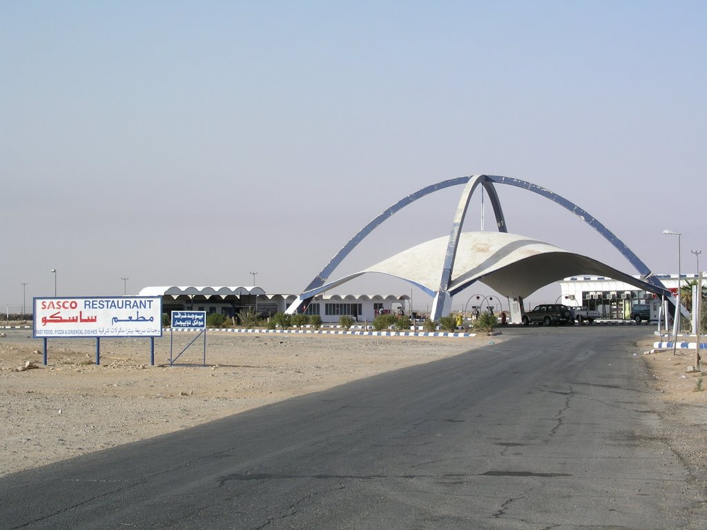
Coordinates for Google Earth are: 29.491291,43.912954
It's just outside Rafha, Saudi Arabia, just south of the Iraq border. Looks like a military emplacement to me, complete with tank laagers. maybe something left over from Gulf War I.
Coordinates for Google Earth are: 29.491291,43.912954
It's just outside Rafha, Saudi Arabia, just south of the Iraq border. Looks like a military emplacement to me, complete with tank laagers. maybe something left over from Gulf War I.
reply to post by Anomaly84
Ladies and Gentlemen,
I really truly believe after viewing these pictures that you are looking at ancient remains of the Biblical Exodus of the Hebrew Children. The REAL Mount Sinai "IS" in Saudi Arabia, as they took that circuitous route. It's my understanding that the Saudi Mount Sinai is the place where God's glory came down and rested on the top of the mountain. It is blackened because of it.
The markings look more angelic, as in angel's wings, than like eyelashes as one writer wrote.
I've already sent these to Biblical Prophecy Teacher and Scholar Perry Stone to get his take on these.
When and IF I hear back from him, I'll let you all know!
This is a most magnificent find, if these images are what I believe them to be!
More proof that the Biblical narration is quite simply SO MUCH MORE than mere oral traditions.
Baruch ha Shem!

maceov
reply to post by Anomaly84
Ladies and Gentlemen,
I really truly believe after viewing these pictures that you are looking at ancient remains of the Biblical Exodus of the Hebrew Children. The REAL Mount Sinai "IS" in Saudi Arabia, as they took that circuitous route. It's my understanding that the Saudi Mount Sinai is the place where God's glory came down and rested on the top of the mountain. It is blackened because of it.
The markings look more angelic, as in angel's wings, than like eyelashes as one writer wrote.
I've already sent these to Biblical Prophecy Teacher and Scholar Perry Stone to get his take on these.
When and IF I hear back from him, I'll let you all know!
This is a most magnificent find, if these images are what I believe them to be!
More proof that the Biblical narration is quite simply SO MUCH MORE than mere oral traditions.
Baruch ha Shem!

reply to post by maceov
Is this the same Perry Stone who sells
"The Lords Supper" on his website that is alleged to cure any sickness or Disease but won't offer a refund to the poor dumb fools that buy it and then get even more sick? Yeah he's a real scholar and gentleman and true representative of Christ's teachings!
Is this the same Perry Stone who sells
"The Lords Supper" on his website that is alleged to cure any sickness or Disease but won't offer a refund to the poor dumb fools that buy it and then get even more sick? Yeah he's a real scholar and gentleman and true representative of Christ's teachings!
reply to post by Anomaly84
Might want to check out any Army bases in the vicinity. Looks like berms were pushed up by a bulldozer, can see the blade marks.
During the first gulf war, Iraq hid their tanks and artillery pieces in bermed areas that look the same.
Could be Saudi does training and war games in the area. Hell, could be remnants of the gulf war. Don't know how close this is to Iraq.
reply to post by Anomaly84
Having spent some time in that Country they look familiar to me. We called them Kabul's, a defensive structure built out of sand by using bull dozers to make berms around vehicles.
The questions is where in Saudi did these show up, I can go back in my information I have from back when I was there and see if they are them. Some of the structures are interesting but soldiers had plenty time on their hands back then.
Rosinitiate
Cool pics. This one reminds me of a fort with watch towers or look out points in all 4 corners. Then a series of squares forming a line. Perhaps where shops and wares were sold. Interesting nonetheless.
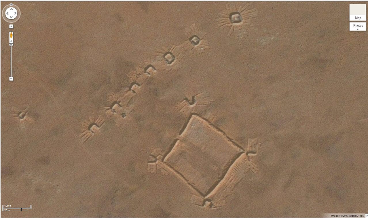
This photo reminds me a lot of a "hasty position" or "layover" for an armored unit although it's lacking flank positions ( of course they may not use typical NATO tactics).
Ascension
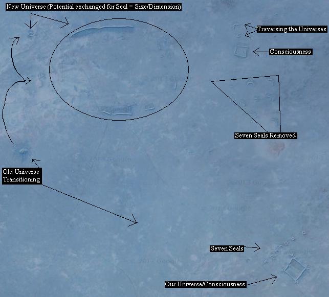
1st Image Coordinates
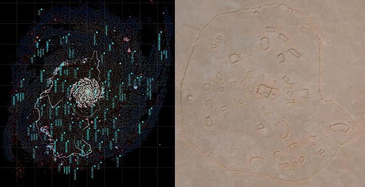
Milky Way Galaxy - Our Galaxy - Life on Earth Facing Ascension
2nd Coordinate Image
Milky Way Image Link
Milky Way Galaxy - Our Galaxy - Destroyed by Collision with Nibiru (Not the Andromeda Galaxy that is being alluded to)
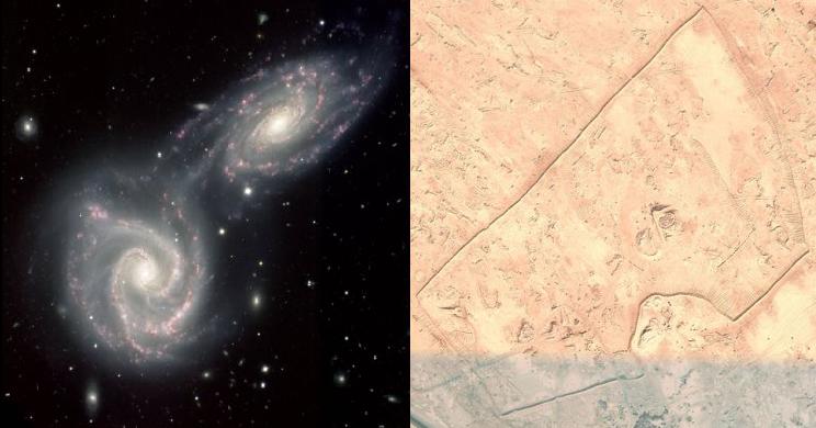
3rd Coordinate Image
890 will be carried away without tears, in the near future, by a calamity. As I was going to say the destruction and ascension of the human race is clear, this is what the extraterrestrials have told ... us. Now. The Universe has alluded to our ability instigated by me, to perceive the new earth or more in an like environment. We must be grateful for this opportunity, and on these terms wait patiently for our gifts that are soon to come to us.
1st Image Coordinates
Milky Way Galaxy - Our Galaxy - Life on Earth Facing Ascension
2nd Coordinate Image
Milky Way Image Link
Milky Way Galaxy - Our Galaxy - Destroyed by Collision with Nibiru (Not the Andromeda Galaxy that is being alluded to)
3rd Coordinate Image
890 will be carried away without tears, in the near future, by a calamity. As I was going to say the destruction and ascension of the human race is clear, this is what the extraterrestrials have told ... us. Now. The Universe has alluded to our ability instigated by me, to perceive the new earth or more in an like environment. We must be grateful for this opportunity, and on these terms wait patiently for our gifts that are soon to come to us.
edit on 15-12-2013 by sighstars because: minor edits
new topics
-
President BIDEN's FBI Raided Donald Trump's Florida Home for OBAMA-NORTH KOREA Documents.
Political Conspiracies: 3 hours ago -
Maestro Benedetto
Literature: 5 hours ago -
Is AI Better Than the Hollywood Elite?
Movies: 5 hours ago -
Las Vegas UFO Spotting Teen Traumatized by Demon Creature in Backyard
Aliens and UFOs: 8 hours ago -
2024 Pigeon Forge Rod Run - On the Strip (Video made for you)
Automotive Discussion: 9 hours ago -
Gaza Terrorists Attack US Humanitarian Pier During Construction
Middle East Issues: 9 hours ago -
The functionality of boldening and italics is clunky and no post char limit warning?
ATS Freshman's Forum: 10 hours ago -
Meadows, Giuliani Among 11 Indicted in Arizona in Latest 2020 Election Subversion Case
Mainstream News: 11 hours ago -
Massachusetts Drag Queen Leads Young Kids in Free Palestine Chant
Social Issues and Civil Unrest: 11 hours ago
top topics
-
President BIDEN's FBI Raided Donald Trump's Florida Home for OBAMA-NORTH KOREA Documents.
Political Conspiracies: 3 hours ago, 24 flags -
Krystalnacht on today's most elite Universities?
Social Issues and Civil Unrest: 14 hours ago, 9 flags -
University of Texas Instantly Shuts Down Anti Israel Protests
Education and Media: 17 hours ago, 8 flags -
Weinstein's conviction overturned
Mainstream News: 13 hours ago, 8 flags -
Supreme Court Oral Arguments 4.25.2024 - Are PRESIDENTS IMMUNE From Later Being Prosecuted.
Above Politics: 14 hours ago, 8 flags -
Massachusetts Drag Queen Leads Young Kids in Free Palestine Chant
Social Issues and Civil Unrest: 11 hours ago, 7 flags -
Gaza Terrorists Attack US Humanitarian Pier During Construction
Middle East Issues: 9 hours ago, 7 flags -
Las Vegas UFO Spotting Teen Traumatized by Demon Creature in Backyard
Aliens and UFOs: 8 hours ago, 6 flags -
Meadows, Giuliani Among 11 Indicted in Arizona in Latest 2020 Election Subversion Case
Mainstream News: 11 hours ago, 5 flags -
2024 Pigeon Forge Rod Run - On the Strip (Video made for you)
Automotive Discussion: 9 hours ago, 4 flags
active topics
-
President BIDEN's FBI Raided Donald Trump's Florida Home for OBAMA-NORTH KOREA Documents.
Political Conspiracies • 13 • : AwakeNotWoke -
Hate makes for strange bedfellows
US Political Madness • 47 • : 19Bones79 -
-@TH3WH17ERABB17- -Q- ---TIME TO SHOW THE WORLD--- -Part- --44--
Dissecting Disinformation • 689 • : daskakik -
University of Texas Instantly Shuts Down Anti Israel Protests
Education and Media • 265 • : Astrocometus -
Gaza Terrorists Attack US Humanitarian Pier During Construction
Middle East Issues • 27 • : ToneD -
Reason of the Existence
The Gray Area • 21 • : BingoMcGoof -
Supreme Court Oral Arguments 4.25.2024 - Are PRESIDENTS IMMUNE From Later Being Prosecuted.
Above Politics • 85 • : Sookiechacha -
Chris Christie Wishes Death Upon Trump and Ramaswamy
Politicians & People • 24 • : nugget1 -
New whistleblower Jason Sands speaks on Twitter Spaces last night.
Aliens and UFOs • 63 • : pianopraze -
SETI chief says US has no evidence for alien technology. 'And we never have'
Aliens and UFOs • 74 • : Justoneman