It looks like you're using an Ad Blocker.
Please white-list or disable AboveTopSecret.com in your ad-blocking tool.
Thank you.
Some features of ATS will be disabled while you continue to use an ad-blocker.

Two Quakes in Utah at the same time tonight 4.8 and 4.2 / UPDATE: 4.8 downgraded to 4.3
page: 110
share:
Thursday April 12 2012, 03:29:22 UTC 48 minutes ago Utah 4.2 0.8 USGS Feed
Thursday April 12 2012, 03:29:22 UTC 48 minutes ago Utah 4.3 0.8 USGS Feed
quakes.globalincidentmap.com...
Thursday April 12 2012, 03:29:22 UTC 48 minutes ago Utah 4.3 0.8 USGS Feed
quakes.globalincidentmap.com...
edit on 11-4-2012 by kennvideo because: (no reason given)
edit on
11-4-2012 by kennvideo because: (no reason given)
edit on 11-4-2012 by kennvideo because: UPDATE
edit on 11-4-2012 by
kennvideo because: UPDATE
Damn, it seems like a significant quake is poppin' off every hour or so.
Strange days indeed.
Strange days indeed.
Had to change title and update first post because two occured in Utah AT THE SAME TIME!!!!!
I mentioned it in my oregon and canada quake threads. Something is crazy and i have a wierd feeling madrid is coming close to going too, if all this
ground underneath is adjusting and moving, well then what says its not gona happen.
Automated systems do that.
Early reports are mostly generated by software, thats what you're seeing now.
It is VERY common to see such "multiple" reports early on, before the data gets reviewed by humans.
Early reports are mostly generated by software, thats what you're seeing now.
It is VERY common to see such "multiple" reports early on, before the data gets reviewed by humans.
edit on 11-4-2012 by alfa1 because: (no reason given)
I don't know if it is truly so strange to have such a rapid series of earthquakes all over the place, or if we're just more keen to talk about them
now than in the past.
Maybe we're about to finally be enlightened by the mole-people.
Maybe we're about to finally be enlightened by the mole-people.
one or two, wonder what the mag will be closer to, if/when they update it to one.
i only saw 4.1
yeah regardless, why so shallow. and in Utah?
who felt it??
too many sizeable quakes for one 24hr period! and its not even over yet..
theextinctionprotocol.wordpress.com...< br />
one in Georgia, too?
i only saw 4.1
yeah regardless, why so shallow. and in Utah?
who felt it??
too many sizeable quakes for one 24hr period! and its not even over yet..
theextinctionprotocol.wordpress.com...< br />
one in Georgia, too?
Originally posted by alfa1
Automated systems do that.
Early reports are mostly generated by software, thats what you're seeing now.
It is VERY common to see such "multiple" reports early on, before the data gets reviewed by humans.
edit on 11-4-2012 by alfa1 because: (no reason given)
I will keep an eye on that, thank you for the info Alfa
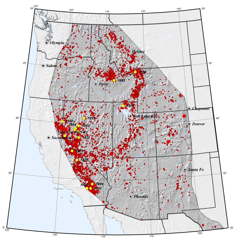
Here is the map with the location and a link to more info. And they are very shallow as well. All this activity is going to cause alot of worry and
speculation. We can only wait and see what happens in the next 24 hours.
Earthqaukes Last 30 Days Iris


Earthqaukes Last 30 Days Iris
www.iris.edu...
North atlantic off coast of Nova Scotia
Southern mid Atlantic ridge also
North atlantic off coast of Nova Scotia
Southern mid Atlantic ridge also
edit on 11-4-2012 by timetothink because: (no reason given)
Wonder if there is something going on with the sun or because we just got over a full moon. My friend in Kentucky has got a freeze warning
tonight...
And like no one is telling us anything? And I'm not a conspiracy guy, nor do I believe in flying saucers, global warming or many of the fashionable things to believe in...
And like no one is telling us anything? And I'm not a conspiracy guy, nor do I believe in flying saucers, global warming or many of the fashionable things to believe in...
The 4.8 was just downgraded, but still showing two at the same time:
Thursday April 12 2012, 03:29:22 UTC 41 minutes ago Utah 4.2 0.8 USGS Feed
Type: Earthquake
45 minutes ago
Magnitude: 4.2
DateTime: Thursday April 12 2012, 03:29:22 UTC
Region: Utah
Depth: 0.8 km
Source: USGS Feed
Thursday April 12 2012, 03:29:22 UTC 41 minutes ago Utah 4.3 0.8 USGS Feed
Type: Earthquake
46 minutes ago
Magnitude: 4.3
DateTime: Thursday April 12 2012, 03:29:22 UTC
Region: Utah
Depth: 0.8 km
Source: USGS Feed
Originally posted by kennvideo
Wonder if there is something going on with the sun or because we just got over a full moon. My friend in Kentucky has got a freeze warning tonight...
And like no one is telling us anything? And I'm not a conspiracy guy, nor do I believe in flying saucers, global warming or many of the fashionable things to believe in...
if our lunar activity has a significant impact on us.
and if our solar activity has a huge impact on us,
then just fathom how much our galactic activity does!
For those keeping score like me, here are the last 24 hours:
Update time = Thu Apr 12 4:00:11 UTC 2012
MAG UTC DATE-TIME
y/m/d h:m:s LAT
deg LON
deg DEPTH
km Region
MAP 4.3 2012/04/12 03:29:22 37.811 -112.106 0.8 UTAH
MAP 2.5 2012/04/12 03:00:28 57.227 -153.963 47.0 KODIAK ISLAND REGION, ALASKA
MAP 5.0 2012/04/12 02:54:45 1.223 91.774 14.8 NORTH INDIAN OCEAN
MAP 4.8 2012/04/12 02:42:43 3.529 92.693 27.7 OFF THE WEST COAST OF NORTHERN SUMATRA
MAP 4.5 2012/04/12 02:29:41 41.998 -65.994 15.8 NORTH ATLANTIC OCEAN
MAP 3.4 2012/04/12 02:03:47 66.695 -143.897 0.2 NORTHERN ALASKA
MAP 2.6 2012/04/12 01:34:01 59.929 -153.250 175.6 SOUTHERN ALASKA
MAP 4.7 2012/04/12 00:50:36 2.558 92.302 10.0 OFF THE WEST COAST OF NORTHERN SUMATRA
MAP 4.7 2012/04/12 00:30:03 4.445 92.859 29.2 OFF THE WEST COAST OF NORTHERN SUMATRA
MAP 2.9 2012/04/12 00:07:05 38.798 -122.808 4.1 NORTHERN CALIFORNIA
--------------------------------------------------------------------------------
MAG UTC DATE-TIME
y/m/d h:m:s LAT
deg LON
deg DEPTH
km Region
MAP 5.5 2012/04/11 23:56:34 1.798 89.670 13.9 NORTH INDIAN OCEAN
MAP 4.6 2012/04/11 23:28:44 -20.363 -177.712 535.7 FIJI REGION
MAP 4.6 2012/04/11 23:18:50 3.089 92.839 10.2 OFF THE WEST COAST OF NORTHERN SUMATRA
MAP 6.5 2012/04/11 22:55:11 18.272 -102.732 20.0 MICHOACAN, MEXICO
MAP 5.4 2012/04/11 22:51:59 2.897 89.597 14.7 NORTH INDIAN OCEAN
MAP 5.9 2012/04/11 22:41:47 43.593 -127.557 10.2 OFF THE COAST OF OREGON
MAP 4.9 2012/04/11 22:35:34 2.488 90.185 14.8 OFF THE WEST COAST OF NORTHERN SUMATRA
MAP 5.0 2012/04/11 22:15:26 0.514 92.443 13.8 OFF THE WEST COAST OF NORTHERN SUMATRA
MAP 4.2 2012/04/11 22:02:50 51.508 -176.673 35.6 ANDREANOF ISLANDS, ALEUTIAN IS., ALASKA
MAP 3.0 2012/04/11 21:53:23 59.218 -154.654 197.9 SOUTHERN ALASKA
MAP 5.0 2012/04/11 21:36:09 1.787 90.927 15.0 NORTH INDIAN OCEAN
MAP 3.2 2012/04/11 21:23:40 51.251 -178.168 18.3 ANDREANOF ISLANDS, ALEUTIAN IS., ALASKA
MAP 4.7 2012/04/11 21:02:50 0.717 92.407 15.2 OFF THE WEST COAST OF NORTHERN SUMATRA
MAP 2.9 2012/04/11 20:50:59 18.088 -67.480 11.6 MONA PASSAGE, PUERTO RICO
MAP 3.6 2012/04/11 20:03:14 19.075 -68.615 165.3 DOMINICAN REPUBLIC REGION
MAP 5.5 2012/04/11 19:04:20 1.202 92.090 10.3 OFF THE WEST COAST OF NORTHERN SUMATRA
MAP 5.4 2012/04/11 18:54:46 2.496 92.712 14.3 OFF THE WEST COAST OF NORTHERN SUMATRA
MAP 2.5 2012/04/11 16:32:14 18.731 -68.225 104.0 DOMINICAN REPUBLIC REGION
MAP 5.1 2012/04/11 16:04:24 3.426 92.860 10.8 OFF THE WEST COAST OF NORTHERN SUMATRA
MAP 5.1 2012/04/11 15:46:53 2.987 92.249 21.6 OFF THE WEST COAST OF NORTHERN SUMATRA
MAP 5.0 2012/04/11 15:09:26 2.969 90.062 13.1 OFF THE WEST COAST OF NORTHERN SUMATRA
MAP 5.3 2012/04/11 14:54:29 1.336 91.841 11.9 NORTH INDIAN OCEAN
MAP 5.3 2012/04/11 14:34:19 1.504 90.894 14.4 NORTH INDIAN OCEAN
MAP 5.0 2012/04/11 14:26:27 2.287 92.385 9.4 OFF THE WEST COAST OF NORTHERN SUMATRA
MAP 5.0 2012/04/11 14:18:45 2.569 92.296 10.3 OFF THE WEST COAST OF NORTHERN SUMATRA
MAP 5.2 2012/04/11 14:08:41 1.147 92.158 9.6 OFF THE WEST COAST OF NORTHERN SUMATRA
MAP 5.5 2012/04/11 13:58:07 1.493 90.889 13.7 NORTH INDIAN OCEAN
MAP 5.3 2012/04/11 13:42:40 2.159 93.597 11.0 OFF THE WEST COAST OF NORTHERN SUMATRA
MAP 4.6 2012/04/11 13:39:56 0.600 91.889 10.0 NORTH INDIAN OCEAN
MAP 4.6 2012/04/11 13:32:35 1.905 89.578 10.0 NORTH INDIAN OCEAN
MAP 5.0 2012/04/11 13:19:38 2.345 90.302 20.4 OFF THE WEST COAST OF NORTHERN SUMATRA
MAP 5.1 2012/04/11 13:15:28 4.614 90.764 5.3 OFF THE WEST COAST OF NORTHERN SUMATRA
MAP 4.8 2012/04/11 13:12:05 -18.479 -175.498 245.2 TONGA
MAP 4.5 2012/04/11 13:10:07 0.890 92.382 10.0 OFF THE WEST COAST OF NORTHERN SUMATRA
MAP 3.4 2012/04/11 13:06:31 62.560 -150.133 174.1 CENTRAL ALASKA
MAP 5.1 2012/04/11 12:37:48 2.528 92.602 10.0 OFF THE WEST COAST OF NORTHERN SUMATRA
MAP 5.1 2012/04/11 12:21:58 3.136 92.775 9.9 OFF THE WEST COAST OF NORTHERN SUMATRA
MAP 5.1 2012/04/11 12:10:53 1.385 92.639 10.4 OFF THE WEST COAST OF NORTHERN SUMATRA
MAP 5.7 2012/04/11 11:53:37 2.929 89.534 14.9 NORTH INDIAN OCEAN
MAP 5.3 2012/04/11 11:52:29 0.989 91.942 14.9 NORTH INDIAN OCEAN
MAP 5.4 2012/04/11 11:34:02 0.743 92.865 15.5 OFF THE WEST COAST OF NORTHERN SUMATRA
MAP 5.4 2012/04/11 11:29:00 -56.847 -27.966 259.0 SOUTH SANDWICH ISLANDS REGION
I live in SoCal and have literally slept through 4.0 - 4.8 quakes.
They're not that big of a deal. I suppose someone who has never felt a quake would panic, but that magnitude is really just a hiccup.
They're not that big of a deal. I suppose someone who has never felt a quake would panic, but that magnitude is really just a hiccup.
reply to post by PaxVeritas
I'm in Daytona and in the 70's when I was a kid we had a small one that my Dad felt but I slept though it.
I'm in Daytona and in the 70's when I was a kid we had a small one that my Dad felt but I slept though it.
reply to post by kennvideo
Better source with more info.
Depth is still at zero so the real info is not in yet.
Historical Seismicity
For context on today -
Average numbers per year.
8 and higher 1
7 - 7.9 15
6 - 6.9 134
5 - 5.9 1319
4 - 4.9 13,000
(estimated)
3 - 3.9 130,000
(estimated)
2 - 2.9 1,300,000
(estimated)
Factor in the lesser magnitudes and if memory serves it's one every 6 seconds.
Better source with more info.
Depth is still at zero so the real info is not in yet.
The Intermountain seismic belt (ISB) is a prominent north-south-trending zone of recorded seismicity in the Intermountain West. A modern catalog of instrumentally located earthquakes in Utah begins in mid-1962, and historical earthquake records date back to the 1850s. The ISB in southern Utah is characterized by scattered seismicity with locally dense clusters of small- to moderate-sized earthquakes. The largest earthquake in the ISB in southern Utah was a M6.5 earthquake in 1901 in Richfield. A group of three M5 and 6 earthquakes occurred in Elsinore in the Sevier Valley in 1921. To the south in southwestern Utah, a damaging earthquake (M5.9) occurred in 1992 near St. George. Earthquake swarms (clusters of earthquakes with no outstanding main shocks) of maximum magnitude 3 to 4 are common in the area.
Because moderate and large earthquakes are likely, expected levels of strong ground shaking are relatively high. Ground shaking from a M5 earthquake can cause significant damage at distances up to 10 km (6 miles), and a M7 at distances up to 50 km (30 miles) and more. Geologic site conditions such as deep sediment-filled basins may locally amplify and prolong ground shaking.
Historical Seismicity
For context on today -
Average numbers per year.
8 and higher 1
7 - 7.9 15
6 - 6.9 134
5 - 5.9 1319
4 - 4.9 13,000
(estimated)
3 - 3.9 130,000
(estimated)
2 - 2.9 1,300,000
(estimated)
Factor in the lesser magnitudes and if memory serves it's one every 6 seconds.
Originally posted by PosterNutbag
Damn, it seems like a significant quake is poppin' off every hour or so.
Strange days indeed.
See my post above this one. Nothing strange at all going on. It's just that the information is so easy to get now. Remember averages cover long time spans and not every year is the same. However this year looks quite normal.
new topics
-
Putin, Russia and the Great Architects of the Universe
ATS Skunk Works: 2 minutes ago -
A Warning to America: 25 Ways the US is Being Destroyed
New World Order: 4 hours ago -
President BIDEN's FBI Raided Donald Trump's Florida Home for OBAMA-NORTH KOREA Documents.
Political Conspiracies: 10 hours ago -
Maestro Benedetto
Literature: 11 hours ago -
Is AI Better Than the Hollywood Elite?
Movies: 11 hours ago
top topics
-
President BIDEN's FBI Raided Donald Trump's Florida Home for OBAMA-NORTH KOREA Documents.
Political Conspiracies: 10 hours ago, 28 flags -
A Warning to America: 25 Ways the US is Being Destroyed
New World Order: 4 hours ago, 9 flags -
Gaza Terrorists Attack US Humanitarian Pier During Construction
Middle East Issues: 16 hours ago, 8 flags -
Las Vegas UFO Spotting Teen Traumatized by Demon Creature in Backyard
Aliens and UFOs: 15 hours ago, 6 flags -
2024 Pigeon Forge Rod Run - On the Strip (Video made for you)
Automotive Discussion: 16 hours ago, 4 flags -
Is AI Better Than the Hollywood Elite?
Movies: 11 hours ago, 3 flags -
The functionality of boldening and italics is clunky and no post char limit warning?
ATS Freshman's Forum: 17 hours ago, 1 flags -
Maestro Benedetto
Literature: 11 hours ago, 1 flags -
Putin, Russia and the Great Architects of the Universe
ATS Skunk Works: 2 minutes ago, 0 flags
active topics
-
Hate makes for strange bedfellows
US Political Madness • 49 • : network dude -
Putin, Russia and the Great Architects of the Universe
ATS Skunk Works • 1 • : RussianTroll -
Truth Social goes public, be careful not to lose your money
Mainstream News • 131 • : burritocat -
Cars and Coffee - Knoxville, TN 2023
Automotive Discussion • 12 • : adamfrank -
President BIDEN's FBI Raided Donald Trump's Florida Home for OBAMA-NORTH KOREA Documents.
Political Conspiracies • 20 • : theatreboy -
A Warning to America: 25 Ways the US is Being Destroyed
New World Order • 6 • : theatreboy -
Supreme Court to decide if states can control fate of social media
Education and Media • 14 • : SMMPanelPro -
Gaza Terrorists Attack US Humanitarian Pier During Construction
Middle East Issues • 35 • : Lazy88 -
Definitive 9.11 Pentagon EVIDENCE.
9/11 Conspiracies • 426 • : Lazy88 -
Alternate Electors vs Fake Electors - What is the Difference.
2024 Elections • 117 • : ADVISOR
10