It looks like you're using an Ad Blocker.
Please white-list or disable AboveTopSecret.com in your ad-blocking tool.
Thank you.
Some features of ATS will be disabled while you continue to use an ad-blocker.

Civilization on this Planet
page: 7share:
Originally posted by golemina
mainstream 'science' STILL views Earth as the center of the universe ( )... STILL view humanity as the only provable 'intelligent' life in the universe ( )... [edit on 30-11-2006 by golemina]
I am not sure how far I am allowed to do this without being inappropriate for this area, but am I allowed to correct fact?
"Mainstream" science does nto view the earth at the centre of anything. "Mainstream" science adopts the view that the Universe is presumed isotropic and homogenous, which means that no point is the centre point and no point is ultimately much different from any other.
Also, as with regard to intelligent life, "mainstream" science simply adopts the mathemtical tool of probability. The problem with probability is that a sample of one tells you nothing. If I give you a paper bag and tell you there are an unspecified number of objects in (without telling you if they are randomly-selected) it and you pull, say, an eel out of it, what is the probability that there are more eels in it? The answer is that you have no idea becuase a sample of one tells you nothing. If you start pulling out lots of eels then you can start to infer that maybe eels are quite common in the bag. What "mainstream" science says is that intelligent life is completely possible, but cannot make any firm statement about how probable it is, as we only have an empirical sample of one (us). This is why "mainstream" science is spending so much money on searching for life and signs of life extraterrestrially, and trying to understand how life could begin. If we can demonstrate that the sample is not a sample of one, then we can start to work out how probable it is. Not before.
I hope that was a relevant interjection....
Best wishes.
Rob.
The maps are interesting. From what I have read of them though, even if you discount the huge anomoloy of the peninsular, the coastline being depicted
is the current subglacial coastline. NOT the coastline of an ice-free Antarctica.
The weight of the ice on Anterctica is estimated to have suppressed the continent by hundreds of metres. This means that if the ice were to leave the centre then the continent would rise hugely. This would in turn lead to a completely different coastline shape. The maps - broadly and not terribly accurately (they wouldn't get a very good exam mark!) - show the coastline as it is now (with the continent sunk by the weight of ice). The maps - if they present any surface features at all - show the centre of the continent as blank. This suggests that the continent was still covered in ice.
I think it seems more or less obvious that the continent may well have been known to people in previous times. We know America was known to and inhabited by European Vikings a thousand years ago, we see evidence of cultural links between Ancient Egypt and South America (tobacco in Egyptian tombs). Aside form these, we know humans had "discovered" places like Australia long before Europeans "discovered" it (again) by the simple fact that there were humans there when we "discovered" it! We know that cartography in an age when travel was not at all easy was not as important as today. After all what practical use is a map of the other sde of the world when you cannot go there? Cartography got lost. it's no big deal. What the maps imply is that at some time the past a great deal of the ocean ice arond Antartica was not there, and that the coasts may have been free from ice, and that on some occasions people did venture out there and have a look at it.
I don't think this is a great mystery or something particularly indicative of anything spooky going on. It just indicates that the sea ice melted from time to time in the past. It doesn't mean the continent was not still an ice-bound inhospitable place. it's just a shame we don't know when the exemplar they copied from was made, and therefore how long it has taken for the sea ice to build up again.
[edit on 1-12-2006 by d60944]
Originally posted by d60944
I am not sure how far I am allowed to do this without being inappropriate for this area, but am I allowed to correct fact?
"Mainstream" science does nto view the earth at the centre of anything. "Mainstream" science adopts the view that the Universe is presumed isotropic and homogenous, which means that no point is the centre point and no point is ultimately much different from any other.
redshift is said to be an indicator of (receding) velocity, how come there are no examples of significant blueshift? why would everything recede from us if we weren't located at the center (of .. the universe? ?? )
They don't explicitly say that because they'd expose themselves as the klowns they are.
Originally posted by snafu7700
excellent additions all.....thanks especially to telos for the maps!
essan....why would you expect a map drawn from many older maps to be perfect? if it's real, then it would be a copy of a copy of a copy, etc. as you mentioned, either way it's showing information that according to modern wisdom, they just shouldnt have had at that point. so what is your explanation for the maps?
There are 2 possibilities - either they were entirely speculative (it was commonly believed that a southern continent might exist, even though no-one had seen it) or - as this is Skunkworks - maybe someone did map Antarctica. Not an ice free Antarctica though, but one in which the extend of pack-ice was taken as being the coastline. That might explain why the West Antarctic Peninsular is missing. Look at the line for the average extent of sea ice in this map:-
I do think the Buache map is rather more speculative though.
Originally posted by Long Lance
Originally posted by d60944
I am not sure how far I am allowed to do this without being inappropriate for this area, but am I allowed to correct fact?
"Mainstream" science does nto view the earth at the centre of anything. "Mainstream" science adopts the view that the Universe is presumed isotropic and homogenous, which means that no point is the centre point and no point is ultimately much different from any other.
redshift is said to be an indicator of (receding) velocity, how come there are no examples of significant blueshift? why would everything recede from us if we weren't located at the center (of .. the universe? ?? )
They don't explicitly say that because they'd expose themselves as the klowns they are.
While it is possible that the earth realy is at the centre of the universe, science refuses to accept that explanation as being infinitely improbable. It is precisely because science refuses to believe that the earth is in the centre of the universe that it concludes that everything must be receding from everything else (i.e. the physics and conditions we observe on earth are the same everywhere in the universe, on average).
To allow you to see how the earth is neither at the centre, not believed to be at the centre by science, imagine this: If you draw a three dots on the surface of a balloon and then inflate the balloon (before it pops), then you will note that every dot is receding from every other dot at a rate proportional to its distance from the other dot, although none are at any kind of "centre". And none are moving towards other ones. Every single point in the universe, no matter where you are, is receding from every other point at a rate proportional to its distance from it. That is what is meant when it is said that the universe is expanding.
Cheers.
Rob.
There is no way essan that you can accept the idea that the map can be genuine can't you?
Anyway I'm not a specialist and can't argue about how accurate is this map. At this point is more then normal that I have to refer to sources and people who have that knowldege. But I'm an educated man and what I read I found very understandable and meaningful.
My sources so far have been from Hapgood who maybe wasn't entirely correct in his Earth Crust Dissplacement theory (you as a geologist should now much more then I do) but thank God he extendet his expanation in something that is easy for all of us to understand and draw our own conclusions.
Lets point out some little things:
Few of the maps mentioned above even though some say that don't depict Antarctica shore line or the mainland still have some remarkable features impossible to achieve in the time when those maps were made. And I'm talking about the general world survey that as far as our knowledge about last 2000 years of human history goes is impossible.
I'm refering to Turk Hadji Ahmed in 1559, a cartographer, who made a map that shows details that could have been based only on accurate world surveys conducted during the last Ice Age. The strangest and most immediately striking feature of Hadji Ahmed’s compilation is that it shows quite plainly a strip of territory, almost 1000
miles wide, connecting Alaska and Siberia. Such a ‘land-bridge’, as geologists refer to it, did once exist (where the Bering Strait is now) but was submerged beneath the waves by rising sea levels at the end of the last Ice Age.
It is probably unnecessary to add that no one on earth in Roman times, when Ptolemy drew his map, had the slightest suspicion that ice ages could once have existed in northern Europe. Nor did anyone in the fifteenth century (when the map was rediscovered) possess such knowledge. Indeed, it is impossible to see how the remnant glaciers and other features shown on Ptolemy’s map could have been surveyed, imagined or invented by any known civilization prior to our own.
Here is the answer for your coment about the acuracy of the map:
I'm not done
Anyway I'm not a specialist and can't argue about how accurate is this map. At this point is more then normal that I have to refer to sources and people who have that knowldege. But I'm an educated man and what I read I found very understandable and meaningful.
My sources so far have been from Hapgood who maybe wasn't entirely correct in his Earth Crust Dissplacement theory (you as a geologist should now much more then I do) but thank God he extendet his expanation in something that is easy for all of us to understand and draw our own conclusions.
Lets point out some little things:
Few of the maps mentioned above even though some say that don't depict Antarctica shore line or the mainland still have some remarkable features impossible to achieve in the time when those maps were made. And I'm talking about the general world survey that as far as our knowledge about last 2000 years of human history goes is impossible.
I'm refering to Turk Hadji Ahmed in 1559, a cartographer, who made a map that shows details that could have been based only on accurate world surveys conducted during the last Ice Age. The strangest and most immediately striking feature of Hadji Ahmed’s compilation is that it shows quite plainly a strip of territory, almost 1000
miles wide, connecting Alaska and Siberia. Such a ‘land-bridge’, as geologists refer to it, did once exist (where the Bering Strait is now) but was submerged beneath the waves by rising sea levels at the end of the last Ice Age.
The rising sea levels were caused by the tumultuous melting of the icecap
which was rapidly retreating everywhere in the northern hemisphere by around 10,000 BC. It is therefore interesting that at least one ancient map appears to show southern Sweden covered with remnant glaciers of the kind that must indeed have been prevalent then in these latitudes.
The remnant glaciers are on Claudius Ptolemy’s famous Map of the North. Originally compiled in the second century AD, this remarkable work from the last great geographer of classical antiquity was lost for hundreds of years and rediscovered in the fifteenth century.
It is probably unnecessary to add that no one on earth in Roman times, when Ptolemy drew his map, had the slightest suspicion that ice ages could once have existed in northern Europe. Nor did anyone in the fifteenth century (when the map was rediscovered) possess such knowledge. Indeed, it is impossible to see how the remnant glaciers and other features shown on Ptolemy’s map could have been surveyed, imagined or invented by any known civilization prior to our own.
The implications of this are obvious. So, too, are the implications of another map, the ‘Portolano’ of Iehudi Ibn Ben Zara, drawn in the year 1487. This chart of Europe and North Africa may have been based on a source even earlier than Ptolemy’s, for it seems to show glaciers much farther south than Sweden (roughly on the same latitude as England in fact) and to depict the Mediterranean, Adriatic and Aegean Seas as they might have looked before the melting of the European ice-cap. Sea level would, of course, have been significantly lower than it is today. It is
therefore interesting, in the case for instance of the Aegean section of the map, to note that a great many more islands are shown than currently exist.33 At first sight this seems odd. However, if ten or twelve thousand years have indeed elapsed since the era when Ibn Ben Zara’s source map was made, the discrepancy can be simply explained: the missing islands must have been submerged by rising sea levels at the end of the last Ice Age.
Here is the answer for your coment about the acuracy of the map:
We saw that the Mercator World Map of 1569 included an accurate portrayal of the coasts of Antarctica as they would have looked thousands of years ago when they were free of ice. Interestingly enough, this same map is considerably less accurate in its portrayal of another region, the west coast of South America, than an earlier (1538) map also drawn by Mercator.
The reason for this appears to be that the sixteenth-century geographer based the earlier map on the ancient sources which we know he had at his disposal, whereas for the later map he relied upon the observations and measurements of the first Spanish explorers of western South America. Since those explorers had supposedly brought the latest information back to Europe, Mercator can hardly be blamed for following them. In so doing the accuracy of his work declined: instruments capable
of finding longitude did not exist in 1569, but appear to have been used to prepare the ancient source documents Mercator consulted to produce his 1538 map
I'm not done
Let's consider something else which IMO is a very important clue of the anciety of the sources used to draw those maps. I'm refering to what I would
call The Mysteries of Longitude.
The current internationally accepted prime meridian is an imaginary curve drawn from the North Pole to the South Pole passing through the Royal Observatory at Greenwich, London. Greenwich therefore stands at o° longitude while New York, for example, stands at around 74° west, and Canberra, Australia, at roughly 150° east.
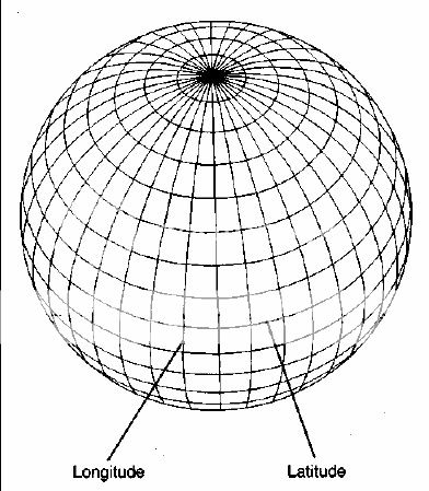
It would be possible to write an elaborate explanation of longitude and of what needs to be done to fix it precisely for any given point on the earth’s surface. What we are concerned with here, however, is not so much technical detail as the accepted historical facts about humanity’s growing knowledge of the mysteries of longitude. Among these facts, this is the most important: until a breakthrough invention in the eighteenth century, cartographers and navigators were unable to fix longitude with
any kind of precision. They could only make guesses which were usually inaccurate by many hundreds of miles, because the technology had not yet been developed to allow them to do the job properly.
This is just a reminder that in order to make a very good map you need at least three key ingredients: great journeys of discovery; first-class mathematical and cartographic skills; sophisticated chronometers.
Then we have the so called Zeno Map of 1380 A.D. that is another enigma. Covering a vast area of the north as far as Greenland, it locates a great many widely scattered
places at latitudes and longitudes which are ‘amazingly correct’. It is unbelivable that anyone in the fourteenth century could have found accurate latitudes for these places, to say nothing of accurate longitudes.
And then is another thing that got really my attention. There are many different kinds of projection. Mercator’s, still used in atlases today, is perhaps the most familiar. Others are dauntingly referred to as Azimuthal, Stereographic, Gnomonic, Azimuthal
Equidistant, Cordiform, and so on, but it is unnecessary to go into this any further here. We need only note that all successful projections require the use of sophisticated mathematical techniques of a kind supposedly unknown in the ancient world (particularly in the deepest antiquity before 4000 BC when there was allegedly no human civilization at all, let alone one capable of developing and using advanced mathematics and geometry).
[edit on 1-12-2006 by Telos]
The current internationally accepted prime meridian is an imaginary curve drawn from the North Pole to the South Pole passing through the Royal Observatory at Greenwich, London. Greenwich therefore stands at o° longitude while New York, for example, stands at around 74° west, and Canberra, Australia, at roughly 150° east.
It would be possible to write an elaborate explanation of longitude and of what needs to be done to fix it precisely for any given point on the earth’s surface. What we are concerned with here, however, is not so much technical detail as the accepted historical facts about humanity’s growing knowledge of the mysteries of longitude. Among these facts, this is the most important: until a breakthrough invention in the eighteenth century, cartographers and navigators were unable to fix longitude with
any kind of precision. They could only make guesses which were usually inaccurate by many hundreds of miles, because the technology had not yet been developed to allow them to do the job properly.
Latitude north or south of the equator did not pose such a problem: it could be worked out by means of angular measurements of the sun and stars taken with relatively simple instruments. But to find longitude equipment of an altogether different and superior calibre was needed, which could combine position measurements with time measurements. Throughout the span of known history the invention of such equipment had remained beyond the capacities of scientists, but by the beginning of the eighteenth century, with rapidly increasing sea traffic, a mood of
impatience and urgency had set in. In the words of an authority on the period, ‘The search for longitude overshadowed the life of every man afloat, and the safety of every ship and cargo. Accurate measurement seemed an impossible dream and “discovering the longitude” had become a stock phrase in the press like “pigs might fly”.
What was needed, above all else, was an instrument that would keep the time (at the place of departure) with perfect accuracy during long sea journeys despite the motion of the ship and despite the adverse conditions of alternating heat and cold, wet and dry. ‘Such a Watch’, as Isaac Newton told the members of the British government’s official Board of Longitude in 1714, ‘hath not yet been made’.
This is just a reminder that in order to make a very good map you need at least three key ingredients: great journeys of discovery; first-class mathematical and cartographic skills; sophisticated chronometers.
These inexplicably precise latitudes and longitudes are found in the same
general category of documents that contain the advanced geographical knowledge I have outlined.
The Piri Reis Map of 1513, for example, places South America and Africa in the correct relative longitudes,11 theoretically an impossible feat for the science of the time. But Piri Reis was candid in admitting that his map was based on far earlier sources. Could it have been from one of these sources that he derived his accurate longitudes? Also of great interest is the so-called ‘Dulcert Portulano’ of AD 1339
which focuses on Europe and North Africa. Here latitude is perfect across huge distances and the total longitude of the Mediterranean and Black Seas is correct to within half a degree.
Then we have the so called Zeno Map of 1380 A.D. that is another enigma. Covering a vast area of the north as far as Greenland, it locates a great many widely scattered
places at latitudes and longitudes which are ‘amazingly correct’. It is unbelivable that anyone in the fourteenth century could have found accurate latitudes for these places, to say nothing of accurate longitudes.
The Oronteus Finaeus World Map also commands attention: it successfully places the coasts of Antarctica in correct latitudes and relative longitudes and finds a remarkably accurate area for the continent as a whole. This reflects a level of geographical knowledge not available until the twentieth century. The Portolano of lehudi Ibn Ben Zara is another map notable for its accuracy where relative latitudes and longitudes are concerned. Total longitude between Gibraltar and the Sea of Azov is accurate to half a degree, while across the map as a whole average errors of longitude are less than a degree
And then is another thing that got really my attention. There are many different kinds of projection. Mercator’s, still used in atlases today, is perhaps the most familiar. Others are dauntingly referred to as Azimuthal, Stereographic, Gnomonic, Azimuthal
Equidistant, Cordiform, and so on, but it is unnecessary to go into this any further here. We need only note that all successful projections require the use of sophisticated mathematical techniques of a kind supposedly unknown in the ancient world (particularly in the deepest antiquity before 4000 BC when there was allegedly no human civilization at all, let alone one capable of developing and using advanced mathematics and geometry).
[edit on 1-12-2006 by Telos]
The collection of the ancient maps have been submitted to the Massachusetts Institute of Technology for evaluation by Professor Richard Strachan. The
general conclusion was obvious, but he wanted to know precisely what level of mathematics would have been required to draw up the original source
documents. On 18 April 1965 Strachan replied that a very high level of mathematics indeed would have been necessary. Some
of the maps, for example, seemed to express ‘a Mercator type projection’ long before the time of Mercator himself. The relative complexity of this projection (involving latitude expansion) meant that a trigonometric coordinate transformation method must have been used.
Then we have another important discovery made by Hapgood; a chinese map copied from an earlier original on to a stone pillar in AD 1137. This map incorporates precisely the same kind of high quality information about longitudes as the others. It has a similar grid and was drawn up with the benefit of spherical trigonometry. Indeed, on close examination, it shares so many features with the European and Middle Eastern maps that only one explanation seems adequate: it and they must have stemmed from a common source.
This material I brought here deals oonly with the maps. What if we start taking in consideration other artifacts and koncepts or things discovered that don'n fit at all with the humanity time line and 'knowledge' so strictly imposed by the orthodox science. It makes you think, doesn't it?
of the maps, for example, seemed to express ‘a Mercator type projection’ long before the time of Mercator himself. The relative complexity of this projection (involving latitude expansion) meant that a trigonometric coordinate transformation method must have been used.
Other reasons for deducing that the ancient map-makers must have
been skilled mathematicians were as follows:
1 The determination of place locations on a continent requires at least geometric
triangulation methods. Over large distances (of the order of 1000 miles) corrections
must be made for the curvature of the earth, which requires some understanding of
spherical trigonometry.
2 The location of continents with respect to one another requires an understanding of
the earth’s sphericity, and the use of spherical trigonometry.
3 Cultures with this knowledge, plus the precision instruments to make the required
measurements to determine location, would most certainly use their mathematical
technology in creating maps and charts. Strachan’s impression that the maps, through generations of copyists, revealed the handiwork of an ancient, mysterious and technologically advanced civilization, was shared by reconnaissance experts from the US Airforce to whom Hapgood submitted the evidence. Lorenzo Burroughs,
chief of the 8th Reconnaissance Technical Squadron’s Cartographic Section at Westover Air Base, made a particularly close study of the Oronteus Finaeus Map. He concluded that some of the sources upon which it was based must have been drawn up by means of a projection similar to the modern Cordiform Projection. This, said Burroughs: suggests the use of advanced mathematics. Further, the shape given to the Antarctic Continent suggests the possibility, if not the probability, that the original
source maps were compiled on a stereographic or gnomonic type of projection
involving the use of spherical trigonometry.
We are convinced that the findings made by you and your associates are valid, and
that they raise extremely important questions affecting geology and ancient history...
Then we have another important discovery made by Hapgood; a chinese map copied from an earlier original on to a stone pillar in AD 1137. This map incorporates precisely the same kind of high quality information about longitudes as the others. It has a similar grid and was drawn up with the benefit of spherical trigonometry. Indeed, on close examination, it shares so many features with the European and Middle Eastern maps that only one explanation seems adequate: it and they must have stemmed from a common source.
We seem to be confronted once again by a surviving fragment of the scientific knowledge of a lost civilization. More than that, it appears that this civilization must have been at least in some respects as advanced as our own and that its cartographers had ‘mapped virtually the entire globe with a uniform general level of technology, with similar methods, equal knowledge of mathematics, and probably the same sorts of instruments’.
This material I brought here deals oonly with the maps. What if we start taking in consideration other artifacts and koncepts or things discovered that don'n fit at all with the humanity time line and 'knowledge' so strictly imposed by the orthodox science. It makes you think, doesn't it?
Because of where this thread is, I will hypothesize without doing much backgrond work....
For me the issue of longitude is not a probem for getting maps to be approximately correct. No one is claiming these maps were 100% correct, merely that they show some features which are approximately correct.
Ok. Take the latitude thing as being a given. It is easy to measure. To get a satisfactory E-W distance between two objects is the problem. That is all longitude ultimately is. I can think of several ways of doing this. I think there may be the danger of mixing up the ability to measure longitude on land (a matter of how many miles east to west), with that on sea (where you have no way to measure a "fixed place" from where to start to measure the east-west).
Longitude on the high seas does require an accurate timekeeping device. As as my (basic) knowledge of older cultures goes, I thought that the main thing was that they sailed hugging the coastlines though, which provide reference points all the time.
The complicating issue is that of the earth's rounded surface. It is no secret that it was widely accepted that the earth was spherical (more or less) in ancient times. It is a myth that the "flat earth" was believed in until the Enlightenment. Ancient Greeks meausred the cicumference and diameter of it, and they are just the first whose written record happened to be preserved and handed down.
Given the ability to meaure east-west on land, the habit of sailing within sight of coast, which one could set foot on and then take accurate E-W readings, the knowldege of the earth's circumference (ie. by how much the distance around the world E-W shrinks as you go north or south) then you can get a pretty good estimate map without recourse to the complexities of mapping longitude on the high seas.
I stress, that, exceptionally, this is mere speculation on my part, but it all sounds reasonable to me.
It is complex maths, but the thing with this sort of maths is that ultimately it's no more than an expression of logic. I don't want to presume that people a few millennia ago were any less clever than we are now. Surely they had the same brains. Technology and discovery are emphatically not the same as intelligence.
[edit on 1-12-2006 by d60944]
Originally posted by d60944
For me the issue of longitude is not a probem for getting maps to be approximately correct. No one is claiming these maps were 100% correct, merely that they show some features which are approximately correct.
Hold on, no one is claiming that these maps were 100 % correct but considering the time when this maps where maide then this is an exeptional feat, isn't it? Merely show features? No offense but did you read my post carefully?
Ok. Take the latitude thing as being a given. It is easy to measure. To get a satisfactory E-W distance between two objects is the problem. That is all longitude ultimately is. I can think of several ways of doing this. I think there may be the danger of mixing up the ability to measure longitude on land (a matter of how many miles east to west), with that on sea (where you have no way to measure a "fixed place" from where to start to measure the east-west).
Longitude on the high seas does require an accurate timekeeping device. As as my (basic) knowledge of older cultures goes, I thought that the main thing was that they sailed hugging the coastlines though, which provide reference points all the time.
The complicating issue is that of the earth's rounded surface. It is no secret that it was widely accepted that the earth was spherical (more or less) in ancient times. It is a myth that the "flat earth" was believed in until the Enlightenment. Ancient Greeks meausred the cicumference and diameter of it, and they are just the first whose written record happened to be preserved and handed down.
Given the ability to meaure east-west on land, the habit of sailing within sight of coast, which one could set foot on and then take accurate E-W readings, the knowldege of the earth's circumference (ie. by how much the distance around the world E-W shrinks as you go north or south) then you can get a pretty good estimate map without recourse to the complexities of mapping longitude on the high seas.
I stress, that, exceptionally, this is mere speculation on my part, but it all sounds reasonable to me.
I agree, this is all mere speculation. I'll stress again:
Other reasons for deducing that the ancient map-makers must have been skilled mathematicians were as follows:
1 The determination of place locations on a continent requires at least geometric
triangulation methods. Over large distances (of the order of 1000 miles) corrections
must be made for the curvature of the earth, which requires some understanding of
spherical trigonometry.
2 The location of continents with respect to one another requires an understanding of
the earth’s sphericity, and the use of spherical trigonometry.
3 Cultures with this knowledge, plus the precision instruments to make the required
measurements to determine location, would most certainly use their mathematical
technology in creating maps and charts.
It is complex maths, but the thing with this sort of maths is that ultimately it's no more than an expression of logic. I don't want to presume that people a few millennia ago were any less clever than we are now. Surely they had the same brains. Technology and discovery are emphatically not the same as intelligence.
I agree, and I always emphasized the respect I have for the ancient but... we're not talking about intelligence and brain. We're talking about pure knowledge. Let's not confuse these things.
As for the maps and what they depict I don't understand the tendency to find always things to dismiss their importance and not to take seriously their acuracy and the time being made. To me this is where the speculation starts.
[edit on 1-12-2006 by Telos]
Originally posted by d60944
Longitude on the high seas does require an accurate timekeeping device. As as my (basic) knowledge of older cultures goes, I thought that the main thing was that they sailed hugging the coastlines though, which provide reference points all the time.
this is not directed at you d60944, but at the scientists who have led you to believe it. it is generally accepted by modern science that seafaring men "hugged the coastlines" because there were deathly afraid of falling off of the edge of the world. anyone who truly believes this has very little to no understanding of sailing or sailors. ask yourself this question: what is the most dangerous part of sailing? answer: being close in to the coast. just about anything that can sink your ship is located in and around the world's coastlines. the absolute safest place for any seagoing vessel is at sea. when hurricanes are approaching the US mainland, what does the navy do with all the ships in port? send them as far out to sea as possible. why? because it's the safest place to ride out the storm. but, of course, portraying ancient sailors as idiots who were afraid to venture out into the safer deep water is the only way to make sense of the current theories regarding our past history.
[edit on 1-12-2006 by snafu7700]
and by the way....WATS for Telos. you have obviously researched these maps a great deal.....thanks for including them on this thread.
Originally posted by Telos
There is no way essan that you can accept the idea that the map can be genuine can't you?
There's no way I can accept that it's an accurate depiction of Antarctica
(In the same way that I refuse to accept that a chair is really an elephant )
Originally posted by d60944
To allow you to see how the earth is neither at the centre, not believed to be at the centre by science, imagine this: If you draw a three dots on the surface of a balloon and then inflate the balloon (before it pops), then you will note that every dot is receding from every other dot at a rate proportional to its distance from the other dot, although none are at any kind of "centre". And none are moving towards other ones. Every single point in the universe, no matter where you are, is receding from every other point at a rate proportional to its distance from it. That is what is meant when it is said that the universe is expanding.
Ok, you are of course right, my post was incomplete, because i failed to mention the observation of 'walls in space' and the so called 'fingers of god' on certain diagrams, pointing towards - you guessed it - us.
f-ex.
(shortest) www.journals.uchicago.edu...:10.1086/310567&erFrom=1127095131248252708Guest
archive.ncsa.uiuc.edu...
www.astr.ua.edu...
and i quote (1st link):
We investigate a distortion in redshift space that causes galaxies to appear to lie in walls concentric about the observer, forming a rough bull's-eye pattern...
i won't go into later devised models which are supposed to explain that strange fact, because few if any of these hypotheses ever predicted anything.... imvho, redshift is intrinsic, but that's OT, isn't it?
Originally posted by Essan
There's no way I can accept that it's an accurate depiction of Antarctica
(In the same way that I refuse to accept that a chair is really an elephant )
umm, show me any map of the americas anytime before the 17th century that is accurate.
Though of course it is granted that the nature of this entire thread is totally speculative...
Props MUST be given to Telos... Superior work!
But more important than that quality thought underlying the premise(s) you support.
So too, we must attempt to ground the way we work/interact with premises in play such as REALLY describing what occurred in Tunguska...
And the ultimate outside frame of reference of how man views himself with regards to the totality of what surrounds him...
Tunguska:
>'Simple. There was no crater left because there was no ground impact. It exploded above the earth's surface. Why is it so hard to accept the idea that the comet came in and exploded over the surface of Tunguska, and felled trees in every direction?'
Hello? Calling basic physics. Basic physics are you there?
No seriously... Objects are either dense enough to penetrate the Earth's atmosphere... In which case there WOULD be an impact site...
Or they aren't... In which case their WOULD NOT be the effects of such a powerful explosive wave... Irrefutably superior in size to well known nuclear weapons actually used against humans.
The basic premise underlying this theory is simply NOT supported by the prevailing body of thought that comets are these in effect dirty snowballs devoid of any real mass..
Common sense conjecture mandates that comets are not frozen bodies of water congealed around some proverbial grain of sand... But are instead relatively massive celestial bodies.
>'"Mainstream" science does nto view the earth at the centre of anything. "Mainstream" science adopts the view that the Universe is presumed isotropic and homogenous, which means that no point is the centre point and no point is ultimately much different from any other.'
Marketing glossy explanations ALWAYS sound good.
Unfortunately, that's what that is.
EVERYTHING mainstream science touches is tainted with the primitiveness of the in total frame of reference that we seem to bring to the process...
AND when you crack the veneer of the vaporous shroud that encloses almost all of our substanstial schools of thought...
You can't help but notice that we are a little light on details... A little light on substantive proof... almost exclusively relying on the most unsubstantiated wildest of conjectures.
A concrete example is our so called search for extraterrestial life...
It relys on SETI.
Go look at SETI. Take the time and TRULY look into it's most basic details.
It's a big laugh... AND a supreme embarassment to our cummulative intellect...
Then, we'll talk.
Originally posted by Essan
There's no way I can accept that it's an accurate depiction of Antarctica
(In the same way that I refuse to accept that a chair is really an elephant )
I can see that In a certain way is like when you see that the Emperor is not wearing clothes and your comment would be; yes but this doesn't prove that he is naked.
I brought materials in this thread that don't deal only with how accurate is depicted Antarctica. And you still grabb Antarctica as the main point of your denial. That doesn't help and is the most comon behavior that I see with egyptologist and scholars when they are confronted with controversial artifacts which can't be explained within the boundaries of the today science.
Anyway is your opinion and I respected as such. What is more important is sharing the information and discussing together. Different opinions make the thread more interesting.
Originally posted by golemina
Tunguska:
>'Simple. There was no crater left because there was no ground impact. It exploded above the earth's surface. Why is it so hard to accept the idea that the comet came in and exploded over the surface of Tunguska, and felled trees in every direction?'
Hello? Calling basic physics. Basic physics are you there?
No seriously... Objects are either dense enough to penetrate the Earth's atmosphere... In which case there WOULD be an impact site...
Or they aren't... In which case their WOULD NOT be the effects of such a powerful explosive wave... Irrefutably superior in size to well known nuclear weapons actually used against humans.
The basic premise underlying this theory is simply NOT supported by the prevailing body of thought that comets are these in effect dirty snowballs devoid of any real mass..
Common sense conjecture mandates that comets are not frozen bodies of water congealed around some proverbial grain of sand... But are instead relatively massive celestial bodies.
I don't think the kinds of dynamics involved in the scenario are those that we are familiar with in everyday life, and so an appeal to "common sense" and highschool physics is not ultimately going to provde the answers. An appeal to actual observation is possibly useful. The study of the explosive breakup of Comet Shoemaker-Levy when it entered Jupiter allowed some progress to be made on this kind of high-energy collision. There is no ground on Jupiter for a comet (fragment) to crash into, and yet the entry resulted in explosive results in the atmosphere. There are various plausible models of how the heating and energetics of material as a body passes through atmosphere could lead to it simply exploding under the pressures before a ground impact on earth. But - if you don't like models - at least we have the observation on Jupiter for this kind of thing. I'm afraid that your either-or situation just does not work in practice, and we have seen it to be the case.
Incidentally, frozen water IS very heavy stuff. You portray a ball of ice as if it was light and insignificant, and compare it to what you call a "relatively massive celestial body". So you accept we know how large a comet is? The mass of a comet made wholly of iron (the most dense material found in space) would have a mass of just over seven times greater than one made of ice, which is not a great deal. It is not even one factor of ten difference. I don't know what other kind of hyper-dense material we might think a comet might be made of.
>'"Mainstream" science does nto view the earth at the centre of anything. "Mainstream" science adopts the view that the Universe is presumed isotropic and homogenous, which means that no point is the centre point and no point is ultimately much different from any other.'
Marketing glossy explanations ALWAYS sound good.
Is that your way of saying you don't agree? Or that you just find the language dense? Do you adopt the view that we should instead believe the world is at the centre of the universe? Your comments about redshifts confused me too. Either you are saying that we are clearly at the centre, or you are saying that the measuring equipment is wrong, or that the interpretation of redshift is wrong.
EVERYTHING mainstream science touches is tainted with the primitiveness of the in total frame of reference that we seem to bring to the process...
AND when you crack the veneer of the vaporous shroud that encloses almost all of our substanstial schools of thought...
You can't help but notice that we are a little light on details... A little light on substantive proof... almost exclusively relying on the most unsubstantiated wildest of conjectures.
A concrete example is our so called search for extraterrestial life...
It relys on SETI.
Go look at SETI. Take the time and TRULY look into it's most basic details.
It's a big laugh... AND a supreme embarassment to our cummulative intellect...
I don't know what you are trying to say here. Are you saying that we don't know anything? If so, are you proposing an alternative approach, or just preferring not to have an approach? If you could explain perhaps?
As for science, the only kinds of theories that get any kind of serious consideration are those that predict as yet untested results. The idea is then to concoct the experiment or search for the effect and see if it is as predicted by the theory. A correct prediction will lend strength to the theory. An incorrect one will require the theory to be changed or abandoned. What else IS proof after all?
I don't think that is intellectually dishonest? Please help us understand what you are getting at.
Cheers.
Originally posted by snafu7700
but, of course, portraying ancient sailors as idiots who were afraid to venture out into the safer deep water is the only way to make sense of the current theories regarding our past history.
[edit on 1-12-2006 by snafu7700]
But at least there is some archival proof that they did do this. There is afaik no proof they set sail on the high seas as a matter of course. In fact the remains of ships we have are the remains of craft that would not have been large enough to undertake long transoceanic journeys. There is not enough storage space for food and water on them for a start.
I am not sure I understood what you objected in my post about knowledge vs intelligence? Mathematics is not really knowledge. It is logic. The ability to work out a logic puzzle. Even threee-dimensional geometry is maths. It is not something discovered by observation, but something one has to envision and then work out how to express it logically (aka mathematically). I don't know what pieces of pure knowledge you think it would require an ancient culture to be able to perform advanced mathematics. I am not disagreeing that ancient cultures may well have been able to perform advanced mathematics. What I am disagreeing with is that there is any need for them to have possessed some kind of knowledge that we say they could not have possessed in order to do so.
The maps speak for themselves. They were able to map things, to varying degrees of accuracy. But I don't see whay that should be so significant. What are you trying to prove from it? ET-aided cartography?
Cheers.
[edit on 2-12-2006 by d60944]
Originally posted by d60944
The maps speak for themselves. They were able to map things, to varying degrees of accuracy. But I don't see whay that should be so significant. What are you trying to prove from it? ET-aided cartography?
Cheers.
Why not? Why to dismiss something so advance for their stage of civilization? Or when we can't explain rationaly something we have to say there is nothing so significant but at the same time we still insist that the ancient were primitive and couldn't have done things that our modern civilization was able to do only that last 2 centuries?
Isn't that double standart???? Isn't that condemnation without investigation? Why not to open our minds and start seeing the things around as they are, not as we are?
new topics
-
President BIDEN's FBI Raided Donald Trump's Florida Home for OBAMA-NORTH KOREA Documents.
Political Conspiracies: 1 hours ago -
Maestro Benedetto
Literature: 3 hours ago -
Is AI Better Than the Hollywood Elite?
Movies: 3 hours ago -
Las Vegas UFO Spotting Teen Traumatized by Demon Creature in Backyard
Aliens and UFOs: 6 hours ago -
2024 Pigeon Forge Rod Run - On the Strip (Video made for you)
Automotive Discussion: 7 hours ago -
Gaza Terrorists Attack US Humanitarian Pier During Construction
Middle East Issues: 8 hours ago -
The functionality of boldening and italics is clunky and no post char limit warning?
ATS Freshman's Forum: 9 hours ago -
Meadows, Giuliani Among 11 Indicted in Arizona in Latest 2020 Election Subversion Case
Mainstream News: 9 hours ago -
Massachusetts Drag Queen Leads Young Kids in Free Palestine Chant
Social Issues and Civil Unrest: 9 hours ago -
Weinstein's conviction overturned
Mainstream News: 11 hours ago
top topics
-
President BIDEN's FBI Raided Donald Trump's Florida Home for OBAMA-NORTH KOREA Documents.
Political Conspiracies: 1 hours ago, 13 flags -
Krystalnacht on today's most elite Universities?
Social Issues and Civil Unrest: 12 hours ago, 9 flags -
University of Texas Instantly Shuts Down Anti Israel Protests
Education and Media: 15 hours ago, 8 flags -
Supreme Court Oral Arguments 4.25.2024 - Are PRESIDENTS IMMUNE From Later Being Prosecuted.
Above Politics: 12 hours ago, 8 flags -
Gaza Terrorists Attack US Humanitarian Pier During Construction
Middle East Issues: 8 hours ago, 7 flags -
Weinstein's conviction overturned
Mainstream News: 11 hours ago, 7 flags -
Massachusetts Drag Queen Leads Young Kids in Free Palestine Chant
Social Issues and Civil Unrest: 9 hours ago, 7 flags -
Meadows, Giuliani Among 11 Indicted in Arizona in Latest 2020 Election Subversion Case
Mainstream News: 9 hours ago, 5 flags -
Las Vegas UFO Spotting Teen Traumatized by Demon Creature in Backyard
Aliens and UFOs: 6 hours ago, 4 flags -
2024 Pigeon Forge Rod Run - On the Strip (Video made for you)
Automotive Discussion: 7 hours ago, 3 flags
active topics
-
University of Texas Instantly Shuts Down Anti Israel Protests
Education and Media • 263 • : cherokeetroy -
Is AI Better Than the Hollywood Elite?
Movies • 9 • : 5thHead -
Massachusetts Drag Queen Leads Young Kids in Free Palestine Chant
Social Issues and Civil Unrest • 13 • : ToneD -
Gaza Terrorists Attack US Humanitarian Pier During Construction
Middle East Issues • 26 • : nugget1 -
British TV Presenter Refuses To Use Guest's Preferred Pronouns
Education and Media • 168 • : Annee -
Manly P. Hall says Freemasonry is a religion?
Secret Societies • 22 • : Therealbeverage -
One Flame Throwing Robot Dog for Christmas Please!
Weaponry • 11 • : Therealbeverage -
HORRIBLE !! Russian Soldier Drinking Own Urine To Survive In Battle
World War Three • 48 • : Therealbeverage -
The Good News According to Jesus - Episode 1
Religion, Faith, And Theology • 3 • : Therealbeverage -
Weinstein's conviction overturned
Mainstream News • 23 • : Therealbeverage