It looks like you're using an Ad Blocker.
Please white-list or disable AboveTopSecret.com in your ad-blocking tool.
Thank you.
Some features of ATS will be disabled while you continue to use an ad-blocker.

Mandela Effect - The World Map How We Remember It!
page: 1share:
The user Dudemo5 requested more Mandela Effect threads... ..so I decided to do one I've
been wanting to do for some time now.
Before we start:
1. I use "Effected" as a short term for "People affected by the Mandela Effect". Yes I know the difference between 'affect' and 'effect' - I didn't coin the term.
2. Yes I know the difference between a map projection (flat map) and a globe's portrayal.
Lets prologue..
As you might know, Effected people remember the locations of the continents and their proportions differently than the way they are today. I've been wanting to show the un-Effected how the world used to look - so I finally took the time to create it, but first a little background..
I'm a bit of a map geek, and keep a globe on my desk (thank you Kissy!). My desktop background was the world map for years. My dad is a map freak and has traveled far more extensively than I have. Growing up there were maps everywhere.. I fondly remember buying him a super large fancy world map for father's day - it's still on the wall today. He has a ship's porthole on the wall with a Phuket island image inside (an inside joke), etc.
I'm an artist by nature and have a knack for remembering shapes and proportions. Other artists will know what I mean about being able to glance at a scene then correctly recreate distance between objects, correctly portraying object dimensions, etc.. When you see those objects every day or study them closely those objects stick in your head.
Now let's dig in..
We'll be using a greyscale flat map because it's much easier to gimp. You should know it's Q&D, so it didn't take me all day. It's a very close approximation - not a CAD drawing.
Here is how the world looks today (look it up if you don't believe me):

WTF!? There are many, many issues with this. When I first saw the new layout it brought a tear to my eye. It was like I short-circuited for a few minutes. I'm sure other Effected people have their WTF moments - this was mine.
Here is how myself and many Effected remember it:

Much better - though I could of gotten the notch of eastern Africa a little better.
Here's a gif illustrating the primary differences:

Here are the differences in detail loosely from left to right, top to bottom..
1. The Arctic existed as a permanent landmass.
2. Alaska was slightly smaller, the Bering Strait was much smaller.
3. Baja California was smaller and didn't extend as far south.
4. Florida hooked more to the west.
5. Cuba was much smaller.
6. The Panama Canal ran east and west not north and south!
7. South America was slightly smaller and definitely further west! The eastern coast was larger, and the western bulge was smaller.
8. Iceland was much smaller. Greenland was much larger.
9. Bye bye Slavbalard or whatever your called.
10. The Strait Of Gibraltar was much larger.
11. France's shape is back to normal - Sicily is smaller and further from France.
12. South Africa's western coast was larger (though looking at the rendition now I see I didn't get the coast very well, the inward jut should be slightly larger). Madagascar was smaller.
13. There was less land and more sea between Egypt and Jordan.
14. The Sea between Jordan and Sudan was bigger.
15. Saudi Arabia was overall slightly smaller.
16. Sri Lanka was much smaller.
17. The Russian landmass extended less to the north.
18. Japan was smaller, and further down the coast without doubt.
19. Malaysia and Indonesia were a little smaller.
20. New Zealand was above Australia.
21. Papua New Guinea was a little smaller, and the Gulf Of Carpentaria was much smaller.
22. There was no such thing as the "Southern Ocean".
23. Antarctica was much smaller!
Lastly (not shown on map) I'm pretty sure Korea's northern border didn't intersect Russia, only China. Also Mongolia was a province in China, not a country, it was also smaller than it's shown today.
In closing..
Yes - I'm aware of how the continents fit into Pangea.
Yes - I know the way the map now is the way it's always been, that's the problem. You might need foreknowledge of the Mandela Effect is to understand this post. lol
Yes, I'm well educated (it's been stated here that Effected must be stupid, not so).
Yes, I'm aware of how memory works. Are you aware of the difference between memory and knowledge? Do you need to look at a map to get to work everyday - or do you "know".
No, I don't know what caused the Mandela Effect.
No, I'm not going to stop trying to talk about it with other Effected people.
You should know that no amount of forum drudgery will ever change my mind. I make these posts for the other Effected folks that come here (I wish they'd be more vocal, but I'm not surprised - not everyone can handle ridicule).
Here's the kicker.. I'm willing to bet many Effected remember the map approximately how I do. How can that be, that we all have the same memory?
I'll be sending the corrected map out to the Effected community - so look for it in your favorite ME reddits and youtube circles soon.
Thanks for reading!
Before we start:
1. I use "Effected" as a short term for "People affected by the Mandela Effect". Yes I know the difference between 'affect' and 'effect' - I didn't coin the term.
2. Yes I know the difference between a map projection (flat map) and a globe's portrayal.
Lets prologue..
As you might know, Effected people remember the locations of the continents and their proportions differently than the way they are today. I've been wanting to show the un-Effected how the world used to look - so I finally took the time to create it, but first a little background..
I'm a bit of a map geek, and keep a globe on my desk (thank you Kissy!). My desktop background was the world map for years. My dad is a map freak and has traveled far more extensively than I have. Growing up there were maps everywhere.. I fondly remember buying him a super large fancy world map for father's day - it's still on the wall today. He has a ship's porthole on the wall with a Phuket island image inside (an inside joke), etc.
I'm an artist by nature and have a knack for remembering shapes and proportions. Other artists will know what I mean about being able to glance at a scene then correctly recreate distance between objects, correctly portraying object dimensions, etc.. When you see those objects every day or study them closely those objects stick in your head.
Now let's dig in..
We'll be using a greyscale flat map because it's much easier to gimp. You should know it's Q&D, so it didn't take me all day. It's a very close approximation - not a CAD drawing.
Here is how the world looks today (look it up if you don't believe me):
WTF!? There are many, many issues with this. When I first saw the new layout it brought a tear to my eye. It was like I short-circuited for a few minutes. I'm sure other Effected people have their WTF moments - this was mine.
Here is how myself and many Effected remember it:
Much better - though I could of gotten the notch of eastern Africa a little better.
Here's a gif illustrating the primary differences:
Here are the differences in detail loosely from left to right, top to bottom..
1. The Arctic existed as a permanent landmass.
2. Alaska was slightly smaller, the Bering Strait was much smaller.
3. Baja California was smaller and didn't extend as far south.
4. Florida hooked more to the west.
5. Cuba was much smaller.
6. The Panama Canal ran east and west not north and south!
7. South America was slightly smaller and definitely further west! The eastern coast was larger, and the western bulge was smaller.
8. Iceland was much smaller. Greenland was much larger.
9. Bye bye Slavbalard or whatever your called.
10. The Strait Of Gibraltar was much larger.
11. France's shape is back to normal - Sicily is smaller and further from France.
12. South Africa's western coast was larger (though looking at the rendition now I see I didn't get the coast very well, the inward jut should be slightly larger). Madagascar was smaller.
13. There was less land and more sea between Egypt and Jordan.
14. The Sea between Jordan and Sudan was bigger.
15. Saudi Arabia was overall slightly smaller.
16. Sri Lanka was much smaller.
17. The Russian landmass extended less to the north.
18. Japan was smaller, and further down the coast without doubt.
19. Malaysia and Indonesia were a little smaller.
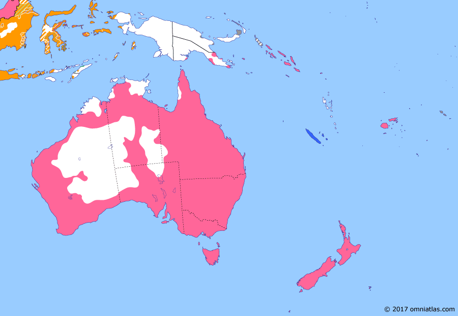
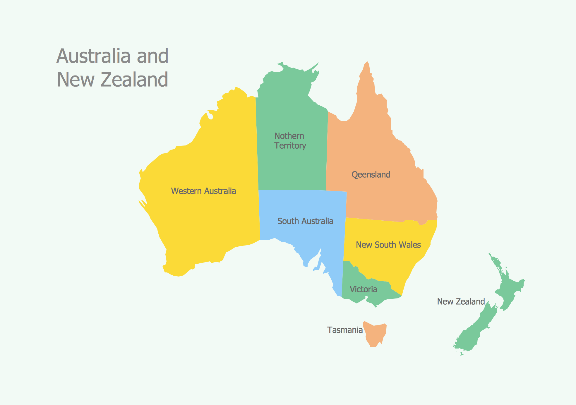
20. New Zealand was above Australia.
21. Papua New Guinea was a little smaller, and the Gulf Of Carpentaria was much smaller.
22. There was no such thing as the "Southern Ocean".
23. Antarctica was much smaller!
Lastly (not shown on map) I'm pretty sure Korea's northern border didn't intersect Russia, only China. Also Mongolia was a province in China, not a country, it was also smaller than it's shown today.
In closing..
Yes - I'm aware of how the continents fit into Pangea.
Yes - I know the way the map now is the way it's always been, that's the problem. You might need foreknowledge of the Mandela Effect is to understand this post. lol
Yes, I'm well educated (it's been stated here that Effected must be stupid, not so).
Yes, I'm aware of how memory works. Are you aware of the difference between memory and knowledge? Do you need to look at a map to get to work everyday - or do you "know".
No, I don't know what caused the Mandela Effect.
No, I'm not going to stop trying to talk about it with other Effected people.
You should know that no amount of forum drudgery will ever change my mind. I make these posts for the other Effected folks that come here (I wish they'd be more vocal, but I'm not surprised - not everyone can handle ridicule).
Here's the kicker.. I'm willing to bet many Effected remember the map approximately how I do. How can that be, that we all have the same memory?
I'll be sending the corrected map out to the Effected community - so look for it in your favorite ME reddits and youtube circles soon.
Thanks for reading!
Where did you get the old version? I thought when we merged into a new timeline the old versions disappeared? Also, Greenland has always been a single
landmass, not two as shown in the "old" version.
All the evidence I needed to dismiss is contained in the fact that the USA and Canada are unchanged in the "Effected" version. (With the exception of
the Alaskan 'tendril', which is only slightly longer and so not really different).
It's almost as if the entire "Effected" version of the map was reassembled from memory by people who had never looked closely at any continent on the entire planet other than the one they already lived on (!)
It's almost as if the entire "Effected" version of the map was reassembled from memory by people who had never looked closely at any continent on the entire planet other than the one they already lived on (!)
a reply to: 3NL1GHT3N3D1
A discussion with the statement "XYZ has always been *whatever*" is futile in threads like this, because they just show the truth in OPs posting. I tried, but all I got was "SEE?! THIS IS WHAT I AM TALKING ABOUT! NOT IN __MY__ TIMELINE".
And seriously, this "old" map seems way out of it. Nice work, by the way. Many points are different, but sometimes in subtle ways.
OP, could you tell us about the USS Nautilus? Because that submarine became famous for diving all the way under the arctic ice and traverse it. What happened to it in your imaginatio.. sorry, timeline?
a reply to: 3NL1GHT3N3D1
a reply to: audubon
Neither of you read what I wrote. For shame.. lol
See if you can answer your own question, and recheck US changes.
ETA:
a reply to: ManFromEurope
You're asking me to tell you a story you just told us?
a reply to: Nothin
Look closer? Is image comprehension a thing?
a reply to: audubon
Neither of you read what I wrote. For shame.. lol
See if you can answer your own question, and recheck US changes.
ETA:
a reply to: ManFromEurope
You're asking me to tell you a story you just told us?
a reply to: Nothin
Look closer? Is image comprehension a thing?
edit on 6-10-2017 by Pearj because: it's sadly required in these situations.
originally posted by: Pearj
Neither of you read what I wrote. For shame.. lol
See if you can answer your own question, and recheck US changes.
Oh, OK, the "Effected" version has California a bit smaller. It's such an absolutely microscopic difference that I didn't notice it on the map .gif
Still a lot of old bull though. The US is so overwhelming unaltered that it's really picking gnat-sh1t out of pepper to claim it has been "Effected."
Well, for me this map example is weak... except for a weird specific memory/dream of S. America being 900 km's or so further West (nervous
chuckle).
Alternative memories have been in the strange lore long before the "Mandela" moniker was attached to it... but even IF consciousness can jump around realities, geographical variances of this magnitude don't make much sense... but admit none of it makes much sense, and so who knows?
But I'll stick to the handful of dead/undead actors, Chic to Chick Filet and "dilemna" as the stronger ones, (nervous chuckle, again).
I dont see Cuba on the second map , The Cuba missile Crisis is a big event in recent history , did it happen in your timeline ?
(I'm having trouble with uploading images at present, which makes this post a bit more interactive than I intended. Please bear with me on this.)
Recently, and I can't remember where, I saw a social media post by some R-word who thought Alaska was a very big island somewhere south of California. It soon came to light that he believed this because he had seen a map of the USA in an old schoolbook in which Alaska was shown in an inset, as seen in this illustration.
I reckon something very similar is going on with the New Zealand in the "Effected" map in this thread.
In real proportions, Australia and New Zealand are this far apart:
- but the above was fiddly for mapmakers, back in the days of printed atlases, because if you preserve the proportions, you have to make the whole of AU and NZ fit on a two-page spread. This isn't great for accurately portraying the Australian interior - and NZ is waaay too small to be useful to anyone.
So what atlas-publishers used to do is put NZ as an inset, like so (1958 example):
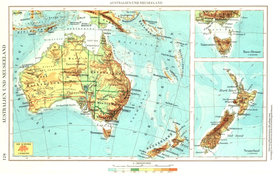
You see where I'm going with this.
There's a really widespread memory of NZ looking like it was in a very different position once-upon-a-time, and that's because there was a popular atlas (or several popular atlases) that depicted NZ in an inset, somewhere on the page that didn't reflect its real position.
People are remembering the overall layout of the map, but not in sufficient detail to realise that the position of NZ was just for convenience, rather than as a true representation.
I'm willing to bet that this was a very popular geography textbook from back in the day, and that's where this otherwise bizarre false memory has originated.
Here's the closest I could find to what I'm describing, from Wikipedia so it shows that the same map-making shortcut is still useful today - NZ appears to be hundreds of miles north-west of where it should be.
The visual layout is being remembered, the technical details of the cartographic layout have been forgotten.
Recently, and I can't remember where, I saw a social media post by some R-word who thought Alaska was a very big island somewhere south of California. It soon came to light that he believed this because he had seen a map of the USA in an old schoolbook in which Alaska was shown in an inset, as seen in this illustration.
I reckon something very similar is going on with the New Zealand in the "Effected" map in this thread.
In real proportions, Australia and New Zealand are this far apart:
- but the above was fiddly for mapmakers, back in the days of printed atlases, because if you preserve the proportions, you have to make the whole of AU and NZ fit on a two-page spread. This isn't great for accurately portraying the Australian interior - and NZ is waaay too small to be useful to anyone.
So what atlas-publishers used to do is put NZ as an inset, like so (1958 example):
You see where I'm going with this.
There's a really widespread memory of NZ looking like it was in a very different position once-upon-a-time, and that's because there was a popular atlas (or several popular atlases) that depicted NZ in an inset, somewhere on the page that didn't reflect its real position.
People are remembering the overall layout of the map, but not in sufficient detail to realise that the position of NZ was just for convenience, rather than as a true representation.
I'm willing to bet that this was a very popular geography textbook from back in the day, and that's where this otherwise bizarre false memory has originated.
Here's the closest I could find to what I'm describing, from Wikipedia so it shows that the same map-making shortcut is still useful today - NZ appears to be hundreds of miles north-west of where it should be.
The visual layout is being remembered, the technical details of the cartographic layout have been forgotten.
a reply to: ManFromEurope
∆This∆
OP, could you tell us about the USS Nautilus? Because that submarine became famous for diving all the way under the arctic ice and traverse it. What happened to it in your imaginatio.. sorry, timeline?
∆This∆
a reply to: Pearj
No. He is asking how the Nautilus traversed the northern polar ice cap if there was a landmass there, as your 'old' map shows.
You're asking me to tell you a story you just told us?
No. He is asking how the Nautilus traversed the northern polar ice cap if there was a landmass there, as your 'old' map shows.
edit on
b000000312017-10-06T19:02:04-05:0007America/ChicagoFri, 06 Oct 2017 19:02:04 -0500700000017 by butcherguy because: Fixed typo
PS to my previous.
Here is a map by a Mandela Believer, showing where s/he believes NZ "used to be."
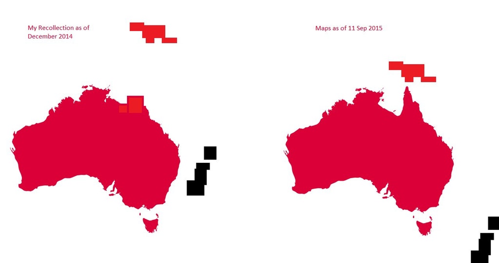
As you can see. ironically s/he has reproduced the map-making problem I'm describing.
In the "new" (post-Mandela) map, NZ almost falls off the edge of the page... but in the old "real" map, NZ fits into a nice neat oblong because it sits snugly up against the coast of Australia - which in real terms would mean the two were about 300km apart, rather than the 4,000km apart that they are in reality.
Here is a map by a Mandela Believer, showing where s/he believes NZ "used to be."
As you can see. ironically s/he has reproduced the map-making problem I'm describing.
In the "new" (post-Mandela) map, NZ almost falls off the edge of the page... but in the old "real" map, NZ fits into a nice neat oblong because it sits snugly up against the coast of Australia - which in real terms would mean the two were about 300km apart, rather than the 4,000km apart that they are in reality.
Ok, so a few points.
Im a Mandela Effect believer because in addition to many of the big ones that have effected everyone, there have been some really crazy ones in my personal life that are.. for a lack of a better word.. HUGE.
1. The way you drew Africa on YOUR map is how Africa was drawn like 1,000 years ago. Old old old maps, from like the 12-13-1400s give Africa a similar shape to what you drew. That being said, Africa, the way it shows now on maps is the way I remember it, only, it should be larger.
2. One thing that looks right to me on your map is the "uncurling" of the US. In the "now map" you showed, Northern America looks to be rotated too much at an angle, yours has it more straight up and down and it looks more correct to me.
3. Most things on the modern "Real" map look 100% correct to me, so Im sorry Im notsharing your Mandela effect.
4. There is one MAJOR thing in this modern map AND your map that are severely bothering me! I also love maps, I have one up on my wall at home, on my desk at work, etc, I play around on google maps all the time....
NEW ZEALAND IS SUPPOSED TO BE DIRECTLY SOUTH OF AUSTRALIA WITH TASMANIA TO THE EAST OF IT!!
Im am flabbergasted that in both maps you show me above New Zealand is East of Australia or North.. That is really bothering me. I may be having a Mandela Effect on that!
a reply to: Lucidparadox
I put it to you that you have simply got their names mixed up. Tasmania (AKA "Van Dieman's Land") is just off Australia's southern coast, and New Zealand is due east of Tasmania.
NEW ZEALAND IS SUPPOSED TO BE DIRECTLY SOUTH OF AUSTRALIA WITH TASMANIA TO THE EAST OF IT!!
I put it to you that you have simply got their names mixed up. Tasmania (AKA "Van Dieman's Land") is just off Australia's southern coast, and New Zealand is due east of Tasmania.
OP --
How do you fit all of the countries of Central America into that tiny little bridge of land in your "correct" map?
Also, the west coast of Africa makes no sense to my memory, because as school children we all knew that Eastern South America looked like it fit almost perfectly into western Africa -- like a puzzle piece. Your map does not have that same look.
Another thing...The islands of the southern Caribbean southeast of Hispaniola (such as Trinidad and Tobago, Grenada, and Barbados) should be near the coast of Venezuela (I've been to Trinidad and Tobago about 25 years ago, and it was very near to Venezuela). On your Mandela map, those islands look to be where they should be relative to Hispaniola, but Venezuela is no longer anywhere near them.
edit on 6/10/2017 by Soylent Green Is People because: (no reason given)
knewknewa reply to: Pearj
Hmmm... You and I definitely experienced two different timelines.
I dont personally believe in the Mandella Effect per se, but there have been a few things where I just knew they are different now from the way i remember them. So I do believe you remember the globe in that way.
Hmmm... You and I definitely experienced two different timelines.
I dont personally believe in the Mandella Effect per se, but there have been a few things where I just knew they are different now from the way i remember them. So I do believe you remember the globe in that way.
new topics
-
Fun with extreme paints
Interesting Websites: 31 minutes ago -
CIA is alleged to be operat social media troll frms in Kyiv
ATS Skunk Works: 1 hours ago -
Rainbow : Stargazer
Music: 2 hours ago -
I sleep no more.
Philosophy and Metaphysics: 4 hours ago -
Canada caught red-handed manipulating live weather data and make it warmer
Fragile Earth: 4 hours ago -
Why Files Our Alien Overlords | How We Secretly Serve The Tall Whites
Aliens and UFOs: 6 hours ago -
Curse of King Tuts Tomb Solved
Ancient & Lost Civilizations: 7 hours ago -
What allies does Trump have in the world?
ATS Skunk Works: 7 hours ago
top topics
-
Canada caught red-handed manipulating live weather data and make it warmer
Fragile Earth: 4 hours ago, 15 flags -
BIDEN Admin Begins Planning For January 2025 Transition to a New President - Today is 4.26.2024.
2024 Elections: 16 hours ago, 10 flags -
Big Storms
Fragile Earth: 17 hours ago, 9 flags -
Why Files Our Alien Overlords | How We Secretly Serve The Tall Whites
Aliens and UFOs: 6 hours ago, 9 flags -
Curse of King Tuts Tomb Solved
Ancient & Lost Civilizations: 7 hours ago, 7 flags -
What allies does Trump have in the world?
ATS Skunk Works: 7 hours ago, 3 flags -
CIA is alleged to be operat social media troll frms in Kyiv
ATS Skunk Works: 1 hours ago, 2 flags -
I sleep no more.
Philosophy and Metaphysics: 4 hours ago, 1 flags -
Fun with extreme paints
Interesting Websites: 31 minutes ago, 1 flags -
Rainbow : Stargazer
Music: 2 hours ago, 0 flags
active topics
-
Where should Trump hold his next rally
2024 Elections • 26 • : lilzazz -
Canada caught red-handed manipulating live weather data and make it warmer
Fragile Earth • 21 • : YourFaceAgain -
Supreme Court Oral Arguments 4.25.2024 - Are PRESIDENTS IMMUNE From Later Being Prosecuted.
Above Politics • 108 • : Sookiechacha -
University of Texas Instantly Shuts Down Anti Israel Protests
Education and Media • 348 • : Threadbarer -
Rainbow : Stargazer
Music • 2 • : Hakaiju -
Fun with extreme paints
Interesting Websites • 1 • : Encia22 -
Biden "Happy To Debate Trump"
2024 Elections • 53 • : SchrodingersRat -
President BIDEN's FBI Raided Donald Trump's Florida Home for OBAMA-NORTH KOREA Documents.
Political Conspiracies • 42 • : SchrodingersRat -
CIA is alleged to be operat social media troll frms in Kyiv
ATS Skunk Works • 8 • : pianopraze -
Why Files Our Alien Overlords | How We Secretly Serve The Tall Whites
Aliens and UFOs • 7 • : Degradation33