It looks like you're using an Ad Blocker.
Please white-list or disable AboveTopSecret.com in your ad-blocking tool.
Thank you.
Some features of ATS will be disabled while you continue to use an ad-blocker.

China Lake CA Warfare Center Makes Lava Flow
page: 14
share:
In 1966, US Military flooded Ho Chi Minh, Vietnam with excess rain.
53 years now in 2019, they are apparently making LAVA FLOW!
For China Lake Military Base's 76-year long history, it may take many sources for intel, so here are a couple-
2016:
www.cia.gov...
U-2 Support for Weather Modification Experiments
2016:
newspunch.com...
US Military Create California Earthquake Using Seismic Weapon
1949-2025
www.wired.com...
So military weather mod program has been active at China Lake Naval Warfare Center in CA since 1949.
And their vision is 'mesoscale' weather control by 2025, for 'operations'.
Wonder what sort of operations by now in 2019 and 'by 2025', considering back in '66 those operations were to flood the Ho Chi Minh Trail back during Vietnam war?
Surely they've come a long way, already.
53 years now in 2019, they are apparently making LAVA FLOW!
For China Lake Military Base's 76-year long history, it may take many sources for intel, so here are a couple-
2016:
www.cia.gov...
U-2 Support for Weather Modification Experiments
2016:
newspunch.com...
US Military Create California Earthquake Using Seismic Weapon
1949-2025
www.wired.com...
A military in-house newspaper calls "weather modification" an "area of China Lake preeminence. Between 1949 and 1978, China Lake developed concepts, techniques, and hardware that were successfully used in hurricane abatement, fog control, and drought relief. Military application of this technology was demonstrated in 1966 when Project Popeye was conducted to enhance rainfall to help interdict traffic on the Ho Chi Minh Trail." (Here's a picture of China Lake's "Cold Cloud Modification System." In 1980, the United States ratified a treaty banning military weather manipulation. But every once in a while, someone in the armed forces floats the idea of doing it again. "Our vision is that by 2025 the military could influence the weather on a mesoscale [theater-wide] or microscale [immediate local area] to achieve operational capabilities," a 1996 Air Force-commissioned study reads.
So military weather mod program has been active at China Lake Naval Warfare Center in CA since 1949.
And their vision is 'mesoscale' weather control by 2025, for 'operations'.
Wonder what sort of operations by now in 2019 and 'by 2025', considering back in '66 those operations were to flood the Ho Chi Minh Trail back during Vietnam war?
Surely they've come a long way, already.
a reply to: letni
Cloud seeding is used in a lot of places. It's used in fairly large scale around the Olympics. There's no actual proof that it works, but it's still used.
The weather control by 2025 was a document written by the War College as part of their curriculum. It was designed to show the types of technologies we might see in the future. It never was an official policy document.
a reply to: Zaphod58
Still used! If it doesn’t work then what an incredible waste of resources. Or it does works so they are still using it.
Cloud seeding is used in a lot of places. It's used in fairly large scale around the Olympics. There's no actual proof that it works, but it's still used.
Still used! If it doesn’t work then what an incredible waste of resources. Or it does works so they are still using it.
a reply to: Observationalist
That's just it though. Would it have rained where it did? Or somewhere else? There's no real way to know how effective it really is. It appears to work so they keep doing it. But no one knows how effective it really is.
That's just it though. Would it have rained where it did? Or somewhere else? There's no real way to know how effective it really is. It appears to work so they keep doing it. But no one knows how effective it really is.
***Nevermind, I see what you're trying to convey***
Posted here..
By member: LookingatMars
www.abovetopsecret.com...
"California earthquake crack can be seen in satellite image"
Posted here..
By member: LookingatMars
www.abovetopsecret.com...
"California earthquake crack can be seen in satellite image"
edit on 9-7-2019 by Bigburgh because: (no reason given)
edit on 9-7-2019 by Bigburgh because: (no reason given)
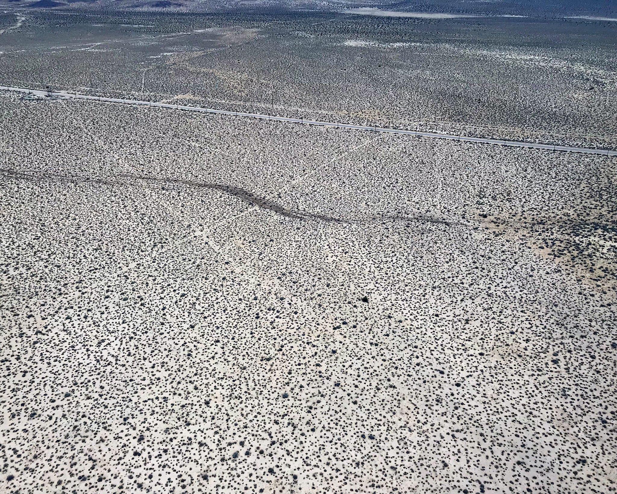
Dutchsinse is saying its a 100 ft wide by 2 mile long crack that was created by the 7.1 equake.
USGS Data Analyst Reveals A “New Supervolcano” Is Forming Under China Lake In California
Large chamber of magma discovered beneath China Lake / Coso /Ridgecrest, indicative of a new super volcano forming. This would explain the earthquake swarm in area recently. FEMA and National Guard remain silent, as MSM diverts attention away from Chinal Lake operations with A51 bait, instead.
Large chamber of magma discovered beneath China Lake / Coso /Ridgecrest, indicative of a new super volcano forming. This would explain the earthquake swarm in area recently. FEMA and National Guard remain silent, as MSM diverts attention away from Chinal Lake operations with A51 bait, instead.
peculiar how mil is claiming 5 BILLION DOLLARS in damage to China Lake facilities will now force permanent CLOSURE.
allowing mad science experiments (like eq generation & weather war) to continue indefinitely there while the public is distracted to area 51 which is so like 51 years ago!
allowing mad science experiments (like eq generation & weather war) to continue indefinitely there while the public is distracted to area 51 which is so like 51 years ago!
The problem with your story is we have ATS members that live at china lake.
I live less then 100 feet from the base fence and my brother works on base with the public works department.
I use to be a federal security officer on the base.
I am now retired but still have a lot of contacts on base.
You could destroy everything on base, and they would not close it as it would still be a great bombing range.
new topics
-
A Warning to America: 25 Ways the US is Being Destroyed
New World Order: 12 minutes ago -
America's Greatest Ally
General Chit Chat: 57 minutes ago -
President BIDEN's FBI Raided Donald Trump's Florida Home for OBAMA-NORTH KOREA Documents.
Political Conspiracies: 5 hours ago -
Maestro Benedetto
Literature: 7 hours ago -
Is AI Better Than the Hollywood Elite?
Movies: 7 hours ago -
Las Vegas UFO Spotting Teen Traumatized by Demon Creature in Backyard
Aliens and UFOs: 11 hours ago -
2024 Pigeon Forge Rod Run - On the Strip (Video made for you)
Automotive Discussion: 11 hours ago
top topics
-
President BIDEN's FBI Raided Donald Trump's Florida Home for OBAMA-NORTH KOREA Documents.
Political Conspiracies: 5 hours ago, 26 flags -
Krystalnacht on today's most elite Universities?
Social Issues and Civil Unrest: 17 hours ago, 9 flags -
Gaza Terrorists Attack US Humanitarian Pier During Construction
Middle East Issues: 12 hours ago, 8 flags -
Supreme Court Oral Arguments 4.25.2024 - Are PRESIDENTS IMMUNE From Later Being Prosecuted.
Above Politics: 17 hours ago, 8 flags -
Weinstein's conviction overturned
Mainstream News: 15 hours ago, 8 flags -
Massachusetts Drag Queen Leads Young Kids in Free Palestine Chant
Social Issues and Civil Unrest: 14 hours ago, 7 flags -
Las Vegas UFO Spotting Teen Traumatized by Demon Creature in Backyard
Aliens and UFOs: 11 hours ago, 6 flags -
Meadows, Giuliani Among 11 Indicted in Arizona in Latest 2020 Election Subversion Case
Mainstream News: 14 hours ago, 5 flags -
2024 Pigeon Forge Rod Run - On the Strip (Video made for you)
Automotive Discussion: 11 hours ago, 4 flags -
Is AI Better Than the Hollywood Elite?
Movies: 7 hours ago, 3 flags
active topics
-
Massachusetts Drag Queen Leads Young Kids in Free Palestine Chant
Social Issues and Civil Unrest • 15 • : tarantulabite1 -
A Warning to America: 25 Ways the US is Being Destroyed
New World Order • 0 • : charlest2 -
America's Greatest Ally
General Chit Chat • 1 • : BingoMcGoof -
How ageing is" immune deficiency"
Medical Issues & Conspiracies • 35 • : annonentity -
HORRIBLE !! Russian Soldier Drinking Own Urine To Survive In Battle
World War Three • 49 • : Freeborn -
Gaza Terrorists Attack US Humanitarian Pier During Construction
Middle East Issues • 30 • : Asher47 -
Electrical tricks for saving money
Education and Media • 8 • : anned1 -
Is AI Better Than the Hollywood Elite?
Movies • 16 • : 5thHead -
Hate makes for strange bedfellows
US Political Madness • 48 • : Terpene -
President BIDEN's FBI Raided Donald Trump's Florida Home for OBAMA-NORTH KOREA Documents.
Political Conspiracies • 17 • : BingoMcGoof
4