It looks like you're using an Ad Blocker.
Please white-list or disable AboveTopSecret.com in your ad-blocking tool.
Thank you.
Some features of ATS will be disabled while you continue to use an ad-blocker.

Quake Watch 2016
page: 43share:
a reply to: MamaJ
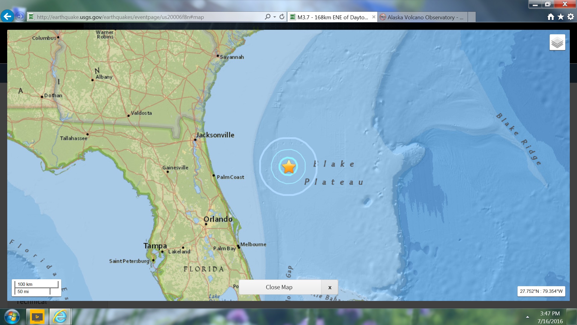
Lot of activity in that area.
earthquake.usgs.gov...#
Seems like maybe some stress release for other area's.
Just wanted to add: This is near Walker Lk, which as far as I can see, has some residential area just east.
I am praying this doesn't cause landslides.
Lot of activity in that area.
earthquake.usgs.gov...#
Seems like maybe some stress release for other area's.
Just wanted to add: This is near Walker Lk, which as far as I can see, has some residential area just east.
I am praying this doesn't cause landslides.
edit on 7-7-2016 by crappiekat because: to add
edit on 7-7-2016 by crappiekat
because: (no reason given)
a reply to: crappiekat
I found this pretty cool link to EQ potential around Hawthorne NV.
According to the probablity map on the page,
it has the potential to kick off up to a 7.8
with 100% certainty of a 5.0 or bigger within 50 years.
In 1997 that area had a 4.4 a 3.9 and a 4.5 all in one day.
Anyways, lots of info on the surrounding area on the link.
I had fun looking at it.
www.homefacts.com...
I found this pretty cool link to EQ potential around Hawthorne NV.
According to the probablity map on the page,
it has the potential to kick off up to a 7.8
with 100% certainty of a 5.0 or bigger within 50 years.
In 1997 that area had a 4.4 a 3.9 and a 4.5 all in one day.
Anyways, lots of info on the surrounding area on the link.
I had fun looking at it.
Hawthorne, NV has a very high earthquake risk, with a total of 2,432 earthquakes since 1931. The USGS database shows that there is a 97.39% chance of a major earthquake within 50km of Hawthorne, NV within the next 50 years. The largest earthquake within 30 miles of Hawthorne, NV was a 7.1 Magnitude in 2016.
www.homefacts.com...
one in Western Australia, the same area as the 5.0 and 5.1 in May
www.ga.gov.au...
Date and Time
UTC: 08 July 2016 @ 09:40:51
Location Norseman, WA. (Reported Felt).
Coordinates: -32.420, 122.447
Depth: 16 km
Magnitude
Mb: 5.5
www.abc.net.au...
A 5.5-magnitude earthquake has struck about 16 kilometres underground in Western Australia's south.
According to GeoScience Australia the tremor occurred at 5.40pm in the Norseman area, 720 kilometres east of Perth.
The epicentre was beneath an uninhabited area, in the Dundas Nature Reserve.
Geoscience Australia said any damage would only have been within a 22-kilometre radius, but the tremor could be felt up to 278 kilometres away.
Just got home from work and notice this one.
It happened at 9:41 EST.
earthquake.usgs.gov...
Not real big. But interesting. There was also a smaller one.
earthquake.usgs.gov...
And as far as I can see a couple more 4's.
It happened at 9:41 EST.
earthquake.usgs.gov...
Not real big. But interesting. There was also a smaller one.
earthquake.usgs.gov...
And as far as I can see a couple more 4's.
edit on 10-7-2016 by crappiekat because: to add link
Just saw these.
Another set of doubles 10 minutes apart.
6.4
33km NW of Rosa Zarate, Ecuador
2016-07-11 02:11:06 (UTC)
35.0 km
5.9
32km NW of Rosa Zarate, Ecuador
2016-07-11 02:01:12 (UTC)
35.0 km
Source: earthquake.usgs.gov...
WOQ
Another set of doubles 10 minutes apart.
6.4
33km NW of Rosa Zarate, Ecuador
2016-07-11 02:11:06 (UTC)
35.0 km
5.9
32km NW of Rosa Zarate, Ecuador
2016-07-11 02:01:12 (UTC)
35.0 km
Source: earthquake.usgs.gov...
WOQ
Swarm Southeast of Honshu, Japan
TimeUTC, Lat, Long, Depth
2016-07-11 10:31:10, 4.7, 33.29°N, 139.36°E, 14
2016-07-11 08:39:40, 4.7, 33.36°N, 139.33°E, 11
2016-07-11 08:33:04, 4.7, 33.36°N, 139.33°E, 10
2016-07-11 07:58:33, 4.6, 33.46°N, 139.54°E, 10
2016-07-11 06:44:51, 4.3, 33.38°N, 139.31°E, 10
2016-07-11 06:22:00, 4.9, 33.36°N, 139.33°E, 10
geofon.gfz-potsdam.de...
and probably more,
can be seen on NIED map select Chubu and Kinki Regions Last 24 hours
www.hinet.bosai.go.jp...
NIED Prelimianery data is showing 44 events in the area, but not that big, range between 2.5 and 4.4
nothing on JMA
will have to wait a couple of days
looks like the JMA region will be NEAR HACHIJOJIMA ISLAND
edit on 0700000019219216 by muzzy because: (no reason given)
originally posted by: Darkblade71
a reply to: crappiekat
Hawthorne, NV has a very high earthquake risk, with a total of 2,432 earthquakes since 1931. The USGS database shows that there is a 97.39% chance of a major earthquake within 50km of Hawthorne, NV within the next 50 years. The largest earthquake within 30 miles of Hawthorne, NV was a 7.1 Magnitude in 2016.
www.homefacts.com...
I had to read that last bit twice '''The largest earthquake within 30 miles of Hawthorne, NV was a 7.1 Magnitude in 2016.''
edit on 12-7-2016 by paradisepurple because: .
a reply to: muzzy
the first data is in from NIED/JMA on this Nr Hachijojima Is series
I'm going to call it a Swarm for now, 4.9 is the biggest quake, but it didn't occur until 8:34hrs of M3 and M2 "foreshocks" (#13)
Not as dramatic as first looked, JMA saying 4.9, 4.4, 4.4, 4.3 the biggest events
mag2= 55 , mag3= 24 , mag4= 4, total energy released= 566.123 TTNT
But I'm getting different data from the Reviewed JMA than what they are showing on the quake_local_index public pages which had 5.2, 4.6, 4.4, 4.6
It might just be a short one, like that one OFF S NIIGATA PREF of 27/06/2016 M4.5 and 4.6 with 81 aftershocks, which I didn't bother to post.
So here is the map for the first 17:11:08 (hh:mm:ss) after first event
my map
I will add the 100-trace Continuous Waveforms later.
a reply to: muzzy
LOL!!!
Just got home from work and saw this.
According to this publication, it was a 7.2. and it happened in 1932.
www.reviewjournal.com...
Back in the day, they just didn't have the technology to really determine the exact mag.
You also have to take into consideration, that the area was not as populated as today.
I did see that, but I just overlooked it, realizing it was an error. Sorry, I guess I should have acknowledged it.
earthquake.usgs.gov...
I trust USGS.
Still an interesting site.
Just to add: The date is also different. One says 20th of Dec, the other says the 21st.
edit on 12-7-2016 by crappiekat because: to
add
edit on 12-7-2016 by crappiekat because: to add link
Nat Geo reports; huge unknown fault found in Burma/India
news.nationalgeographic.com...
***If the new study’s models are correct, the region—home to more than 140 million people—could be sitting atop an active megathrust fault, the same kind of geologic feature that caused the catastrophic magnitude 9.0 earthquake in Japan in 2011.
What’s more, the models suggest that the fault is stuck and has been accumulating stress for more than 400 years, since before the Mughals made the Bangladeshi city of Dhaka the regional capital in the early 1600s.
That means an area more than 124 miles (200 kilometers) wide may be spring-loaded with significant levels of tectonic strain, the researchers warn today in Nature Geoscience. If the entire fault were to give way at once, the team estimates that it could spawn earthquakes up to magnitude 9.0, causing vast devastation in a region underprepared for seismic catastrophes.***
here's hoping...nothing happens
Out of Africa
M 5.1 - 62km N of Msanga, Tanzania
Time2016-07-13 03:01:15 (UTC)
Location5.488°S 35.953°E
Depth10.0 km
M 5.1 - 62km N of Msanga, Tanzania
Time2016-07-13 03:01:15 (UTC)
Location5.488°S 35.953°E
Depth10.0 km
Kermadec Islands Region
TimeUTC, Mag, Lat, Long,Depth
2016-07-13 13:04:26, 6.1, 27.85°S, 176.66°W, 10
2016-07-13 12:58:24, 5.0, 27.80°S, 176.82°W, 116
2016-07-13 12:18:35, 5.6, 28.38°S, 176.23°W, 44
2016-07-13 12:11:12, 6.3, 28.02°S, 176.47°W, 10
2016-07-13 11:57:01, 6.0, 28.00°S, 176.87°W, 20
geofon.gfz-potsdam.de...
messy RAO graph
somewhat clearer SNZO graph
RAO IRIS graph
I have marked some of them on the IRIS graph
There is one on the Red line, at 12:07ish looks like a 5.0/5.1, neither network has registered, I left it blank for now.
The 12:58:24, 5.0 looks bigger than that on the graph (Black Line 3 )
USGS show another 5.0 at 13:16:40 which shows on the graph, generally USGS are 0.3 points down on the 6.0/6.1 GFZ magnitudes
and there has been another one at about 14:24 (blue line) which I have left blank, looks like 5.0/5.1 based on the size of the other 5.0's
marked IRIS
TimeUTC, Mag, Lat, Long,Depth
2016-07-13 13:04:26, 6.1, 27.85°S, 176.66°W, 10
2016-07-13 12:58:24, 5.0, 27.80°S, 176.82°W, 116
2016-07-13 12:18:35, 5.6, 28.38°S, 176.23°W, 44
2016-07-13 12:11:12, 6.3, 28.02°S, 176.47°W, 10
2016-07-13 11:57:01, 6.0, 28.00°S, 176.87°W, 20
geofon.gfz-potsdam.de...
messy RAO graph
somewhat clearer SNZO graph
RAO IRIS graph
edit on
0700000019419416 by muzzy because: (no reason given)
I have marked some of them on the IRIS graph
There is one on the Red line, at 12:07ish looks like a 5.0/5.1, neither network has registered, I left it blank for now.
The 12:58:24, 5.0 looks bigger than that on the graph (Black Line 3 )
USGS show another 5.0 at 13:16:40 which shows on the graph, generally USGS are 0.3 points down on the 6.0/6.1 GFZ magnitudes
and there has been another one at about 14:24 (blue line) which I have left blank, looks like 5.0/5.1 based on the size of the other 5.0's
marked IRIS
edit on
0700000019419416 by muzzy because: back to bed, try and get some sleep, bit of a storm going on here, rain and wind 2:00-3:30am
a reply to: muzzy
I didn't think the 4.9 was it .........
11:17 JST 14 Jul 2016, 33.4N, 139.3E, 10 km, 5.2, Hachijojima Kinkai
www.jma.go.jp...
I didn't think the 4.9 was it .........
11:17 JST 14 Jul 2016, 33.4N, 139.3E, 10 km, 5.2, Hachijojima Kinkai
www.jma.go.jp...
Those M6'ish Kermadec quakes yesterday must have sucked the energy out of the Aus/Pac tectonic plate interface
only 3 M1's and 21 M2's in NZ today (UTC)
has been quiet for a while though
only 3 M1's and 21 M2's in NZ today (UTC)
has been quiet for a while though
new topics
-
Where should Trump hold his next rally
Politicians & People: 41 seconds ago -
Shocking Number of Voters are Open to Committing Election Fraud
US Political Madness: 44 minutes ago -
Gov Kristi Noem Shot and Killed "Less Than Worthless Dog" and a 'Smelly Goat
2024 Elections: 1 hours ago -
Falkville Robot-Man
Aliens and UFOs: 1 hours ago -
James O’Keefe: I have evidence that exposes the CIA, and it’s on camera.
Whistle Blowers and Leaked Documents: 2 hours ago -
Australian PM says the quiet part out loud - "free speech is a threat to democratic dicourse"...?!
New World Order: 3 hours ago -
Ireland VS Globalists
Social Issues and Civil Unrest: 3 hours ago -
Biden "Happy To Debate Trump"
Mainstream News: 4 hours ago -
RAAF airbase in Roswell, New Mexico is on fire
Aliens and UFOs: 4 hours ago -
What is the white pill?
Philosophy and Metaphysics: 5 hours ago
top topics
-
A Warning to America: 25 Ways the US is Being Destroyed
New World Order: 14 hours ago, 21 flags -
Blast from the past: ATS Review Podcast, 2006: With All Three Amigos
Member PODcasts: 6 hours ago, 11 flags -
Biden "Happy To Debate Trump"
Mainstream News: 4 hours ago, 8 flags -
Mike Pinder The Moody Blues R.I.P.
Music: 6 hours ago, 7 flags -
James O’Keefe: I have evidence that exposes the CIA, and it’s on camera.
Whistle Blowers and Leaked Documents: 2 hours ago, 5 flags -
What is the white pill?
Philosophy and Metaphysics: 5 hours ago, 5 flags -
Australian PM says the quiet part out loud - "free speech is a threat to democratic dicourse"...?!
New World Order: 3 hours ago, 5 flags -
Ireland VS Globalists
Social Issues and Civil Unrest: 3 hours ago, 4 flags -
RAAF airbase in Roswell, New Mexico is on fire
Aliens and UFOs: 4 hours ago, 4 flags -
Putin, Russia and the Great Architects of the Universe
ATS Skunk Works: 9 hours ago, 3 flags
active topics
-
University of Texas Instantly Shuts Down Anti Israel Protests
Education and Media • 299 • : CriticalStinker -
Where should Trump hold his next rally
Politicians & People • 0 • : charlest2 -
Candidate TRUMP Now Has Crazy Judge JUAN MERCHAN After Him - The Stormy Daniels Hush-Money Case.
Political Conspiracies • 806 • : Annee -
The functionality of boldening and italics is clunky and no post char limit warning?
ATS Freshman's Forum • 14 • : Encia22 -
MULTIPLE SKYMASTER MESSAGES GOING OUT
World War Three • 99 • : cherokeetroy -
Gov Kristi Noem Shot and Killed "Less Than Worthless Dog" and a 'Smelly Goat
2024 Elections • 25 • : FlyersFan -
Falkville Robot-Man
Aliens and UFOs • 4 • : Kurokage -
Shocking Number of Voters are Open to Committing Election Fraud
US Political Madness • 1 • : YourFaceAgain -
-@TH3WH17ERABB17- -Q- ---TIME TO SHOW THE WORLD--- -Part- --44--
Dissecting Disinformation • 700 • : Thoughtful3 -
Putin, Russia and the Great Architects of the Universe
ATS Skunk Works • 26 • : RussianTroll