It looks like you're using an Ad Blocker.
Please white-list or disable AboveTopSecret.com in your ad-blocking tool.
Thank you.
Some features of ATS will be disabled while you continue to use an ad-blocker.

Area 51 Google Earth
page: 12
share:
Well, I did as the announcement asked and searched area 51 google earth. There were a a lot of threads, but none that featured these. I found them
very interesting, so here's a thread. If it's old new, just tell me and I'll delete it. I'm new, as you can probably tell.
FIRST UP: The mysterious star of David. Coordinates:
37°24'5.31"N
116°52'4.38"W
You can get to it easily by making a new placemark and entering those coordinates. Notice how detailed, yet geometrically imperfect it is.
Theories:
1. A bunch of hippies went out and carved it. Well, maybe, but it's suspiciously close to both Area 51 itself and a weird shaped airstrip.
2. Bombing target. It's pretty small and very detailed to be a bomb target, but, well, maybe someone up there's an anti-Semite.
3. Well, the only other thing I could think of was some kind of signal. Post if you have anything else.
SECOND: The mysterious... thing. Coordinates:
37°39'58.01"N
116° 1'32.33"W
You'll notice a couple things about it. It's huge, for one - each side of the triangle 1.2 kilometers. Another - there's a number 3 above the circles. Where are two and one? It's also oriented directly north. Inside all of the PERFECT circles is this weird, block-lettered O/half moon that's a little malformed and slightly off-center. What's that about? Is it some sort of sign, like what some people think is on the dollar bill?
Theories:
1. Bomb target. Explained in more detail later.
2. The ever popular "something to do with aliens".
THIRD: Crashed plane/missile. Coordinates:
37°35'18.70"N
116°14'46.17"W
What seems to be either a crashed plane or missile. It's 40 feet long, but it looks more like a missile to me.
Theories:
1. An enemy plane shot down.
2. A crashed missile, aiming for the glyph described in 2. If you look, it's fairly close to and pointed directly at the glyph. It makes sense to me that they were testing warheads, using the glyph as a target, and one of them crashed. The glyph is definitely big enough to be seen on satellite, so that would help with making a trajectory. This also ties into 4.
FOURTH: Pockmarks. Coordinates:
37°35'33.29"N
116°12'5.28"W
Right between the glyph and the missile is a scattering of pockmarks that look like impact marks to me.
Theories:
1. More crashed missiles? Unlikely - there are no explosion marks. On the other hand, the crashed missile in 3 didn't explode.
2. Something nonexplosive used for trajectory testing? Maybe. They do look like little craters.
3. Just rocks: Doubt it. The shadows conflict with each other.
4. Just innocent holes: Also doubt it. A little trail is run through them, suggesting people might have driven to pick something up.
EDIT:
IF you look, some of them are holes while others are protrusions. At one point there are four identical protrusions all in a row, with some kind of dirt line/road running around them. Cameras? Sentries of some kind?
FIFTH: Silos, crops. Coordinates:
37°39'6.23"N
115°46'30.75"W
And:
37°54'41.02"N
116°47'30.43"W
Theories:
1. These look most like irrigation fields, but it's unlikely. Why are there so few? Why are they so spread apart? And why in the Nevada Desert, right outside or in Area 51?
2. Silos of some sort? Maybe. The second set are very close to what seems to be a storage facility. They could also be oil tanks. Or storage for airplane fuel.
SIXTH: Swimming pool?
37°17'54.28"N
115°47'30.44"W
Yes, that's right. On the other side of Groom Lake from the main part of Area 51, on the side of the road, there is a 200 foot wide swimming pool. I mean, what.
Theories:
None.
All right, I'm done. Post your theories, additions, anything. Also inform me if I'm going against the rules in any way.
EDIT 1: Well, it's far enough away from Area 51 to just be a junkyard, but there is a junkyard, pretty close to Area 51. I read that the Area is 390 square kilometers, though. Anyway,
37°51'45.70"N
118° 6'5.61"W
[edit on 21-9-2007 by stormchaser]
[edit on 21-9-2007 by stormchaser]
[edit on 21-9-2007 by stormchaser]
You Wrote: FIFTH: Silos, crops. Coordinates:
37°39'6.23"N 115°46'30.75"W
And: 37°54'41.02"N 116°47'30.43"W
These look a lot like huge waste water treatment ponds.
To give you a idea about how big they are, look at the waste water treatment plant for Merced, California Population about 76,000. They have 5 ponds which are about 37 yards across.
Each one of the sites you found are about 862 yards or almost ½ mile across.
Here is a place I found. 37°15'13.26"N 120°31'27.73"W
Odd place for a few buildings and a well maintained runway with no hanger. If you look to the east of the runway you will see 4 squares. Those are “typical” waste water treatment ponds, they should handle about 800-1000 people by their size.
The green circle fields to the south west of the runway look like they have been overlaid over what is really there. If you look at the one at the 12 O’clock position, the edges do not match up. If you look at the one at the 9 O’clock position, you can almost make something out under the “green” area. Also look at the road coming in from the top it looks like it goes under the green.
Anyway, just M2C….
reply to post by stormchaser
Did you notice the strange looking 'roads' just north of the first location (the star)?
37°25'51"N
116°51'9"W
Fun post. I always enjoy flying around on Google Earth. So many sights to see.
Did you notice the strange looking 'roads' just north of the first location (the star)?
37°25'51"N
116°51'9"W
Fun post. I always enjoy flying around on Google Earth. So many sights to see.
This is north of the strange looking roads, and those are strange looking roads btw.
Theres two black circles about two thousand three hundred feet wide each, and whats the base right next to it by the lake?
37.925378, -116.774197
Theres two black circles about two thousand three hundred feet wide each, and whats the base right next to it by the lake?
37.925378, -116.774197
This one's quite interesting too, it seems to be a small pyramid:
37° 5'46.21"N, 116° 5'38.65"W.
looks like there is an entrance to something underground next to it as well.
In fact here it is:
The thing in the bottom right corner, though, I have no idea what that is.
37° 5'46.21"N, 116° 5'38.65"W.
looks like there is an entrance to something underground next to it as well.
In fact here it is:
The thing in the bottom right corner, though, I have no idea what that is.
All of these have been discussed in previous threads. Simulated surafe-to-air missile sites ("Star of David"), mock airfileds, bomb targets, etc.
The picture in the previous post is thge Big Explosives Experimental facility (BEEF) at the Nevada Test Site.
If you seach ATS, you should find discussions of all of them and more.
The picture in the previous post is thge Big Explosives Experimental facility (BEEF) at the Nevada Test Site.
If you seach ATS, you should find discussions of all of them and more.
AREA 51 has just been updated on Google earth.
There are a few clear changes (some buildings gone but some new ones built). There is ALOT of construction going on around the area now, much more than before, south of the main complex accommodation buildings there is a new large building being built.
The resolution on the new images is much closer and clearer and cover's a much larger area around Area 51. On the mountains to the west if you fallow the roads they lead to buildings that just end in the mountains.
Everyone might want to have a look and see what they can find, oh and that swimming pool someone above spotted has now been drained.
Could have luck finding something new.
Happy Hunting
Mikey
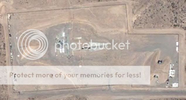
what runway?
I see a wate treatment plant.
nothing else no runway
no hidden areas
just a poo plant
reply to post by Topgun-21
I see a wate treatment plant.
nothing else no runway
no hidden areas
just a poo plant
reply to post by Topgun-21
Best info about the Groom Facility
I've found on the net :
DreamlandResort
Incredible site.
Lots of things to read and see.
Enjoy,
Lex
I've found on the net :
DreamlandResort
Incredible site.
Lots of things to read and see.
Enjoy,
Lex
new topics
-
Putin, Russia and the Great Architects of the Universe
ATS Skunk Works: 56 minutes ago -
A Warning to America: 25 Ways the US is Being Destroyed
New World Order: 5 hours ago -
President BIDEN's FBI Raided Donald Trump's Florida Home for OBAMA-NORTH KOREA Documents.
Political Conspiracies: 11 hours ago
top topics
-
President BIDEN's FBI Raided Donald Trump's Florida Home for OBAMA-NORTH KOREA Documents.
Political Conspiracies: 11 hours ago, 28 flags -
A Warning to America: 25 Ways the US is Being Destroyed
New World Order: 5 hours ago, 10 flags -
Gaza Terrorists Attack US Humanitarian Pier During Construction
Middle East Issues: 17 hours ago, 8 flags -
Las Vegas UFO Spotting Teen Traumatized by Demon Creature in Backyard
Aliens and UFOs: 16 hours ago, 7 flags -
2024 Pigeon Forge Rod Run - On the Strip (Video made for you)
Automotive Discussion: 17 hours ago, 4 flags -
Is AI Better Than the Hollywood Elite?
Movies: 12 hours ago, 3 flags -
Maestro Benedetto
Literature: 12 hours ago, 1 flags -
Putin, Russia and the Great Architects of the Universe
ATS Skunk Works: 56 minutes ago, 1 flags
active topics
-
Skinwalker Ranch and the Mystery 1.6GHz Signal
Aliens and UFOs • 144 • : brodby -
A Warning to America: 25 Ways the US is Being Destroyed
New World Order • 11 • : brodby -
European court rules human rights violated by climate inaction
Fragile Earth • 62 • : iaylyan -
What in the S.E.O. hell is this?
General Chit Chat • 27 • : reannamurphy -
Putin, Russia and the Great Architects of the Universe
ATS Skunk Works • 7 • : RussianTroll -
"We're All Hamas" Heard at Columbia University Protests
Social Issues and Civil Unrest • 286 • : FlyersFan -
President BIDEN's FBI Raided Donald Trump's Florida Home for OBAMA-NORTH KOREA Documents.
Political Conspiracies • 21 • : CriticalStinker -
SETI chief says US has no evidence for alien technology. 'And we never have'
Aliens and UFOs • 75 • : Hecate666 -
Las Vegas UFO Spotting Teen Traumatized by Demon Creature in Backyard
Aliens and UFOs • 13 • : FlyersFan -
Mood Music Part VI
Music • 3105 • : BrucellaOrchitis
2