It looks like you're using an Ad Blocker.
Please white-list or disable AboveTopSecret.com in your ad-blocking tool.
Thank you.
Some features of ATS will be disabled while you continue to use an ad-blocker.

Several neat screenshots of Mars
page: 1share:
I decided to roam around Google Mars and ran across this neat feature and thought I'd take some screen shots and share them
enjoy
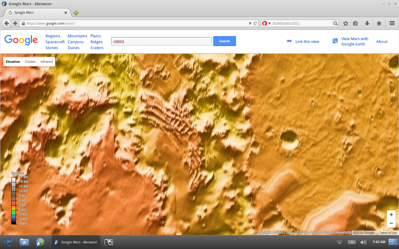
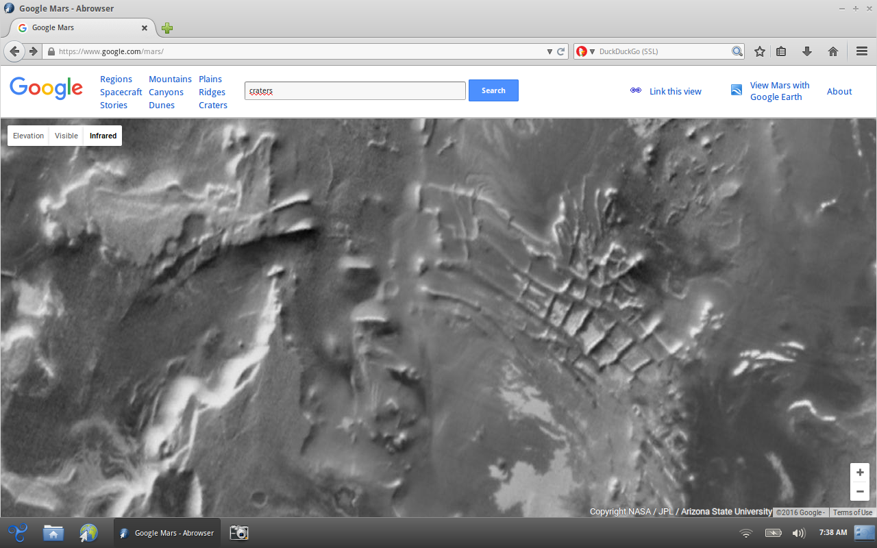
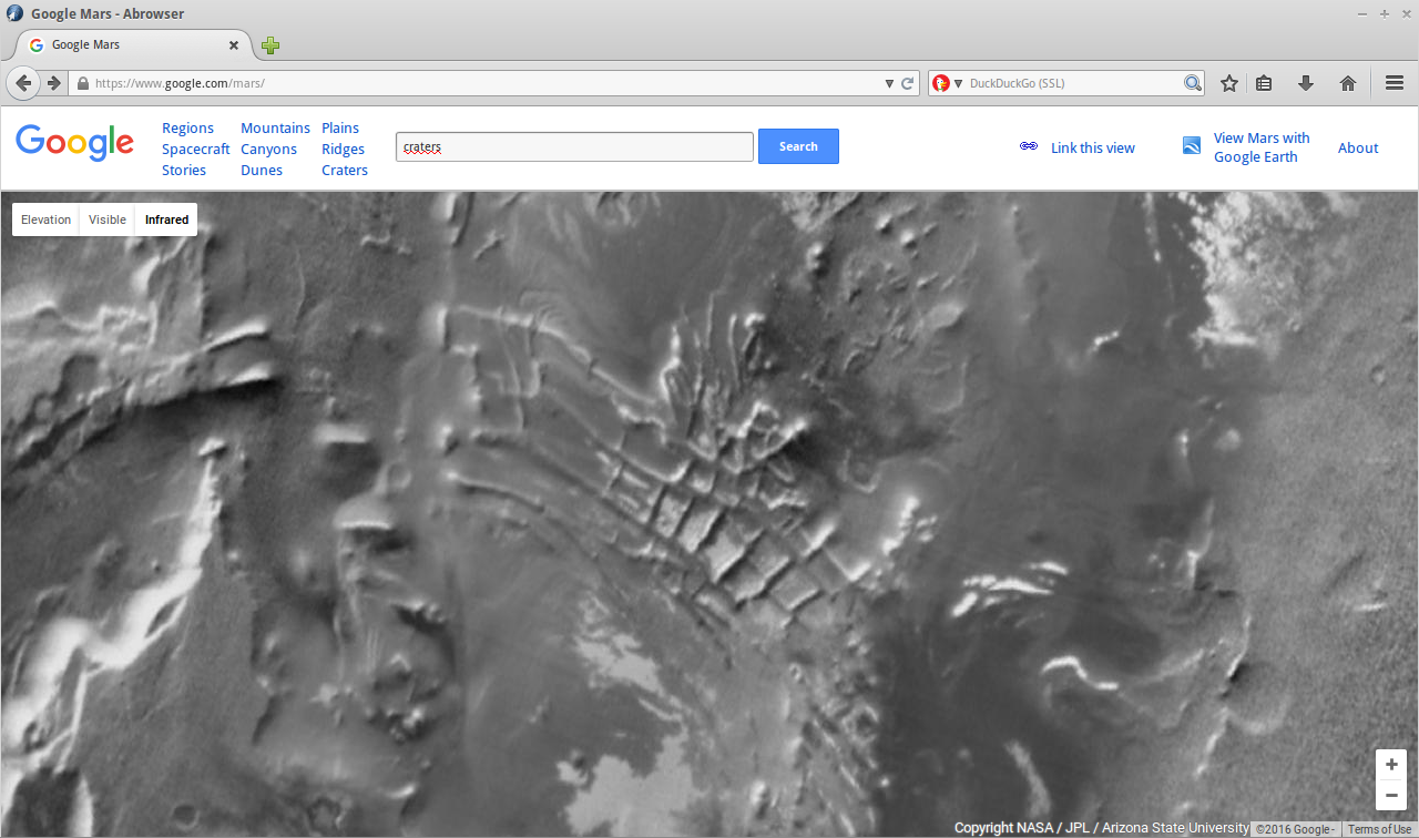
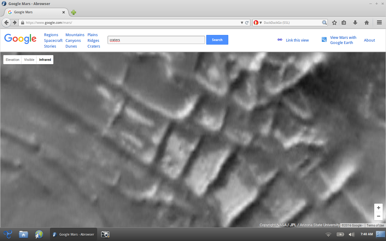
enjoy
a reply to: BigBrotherDarkness
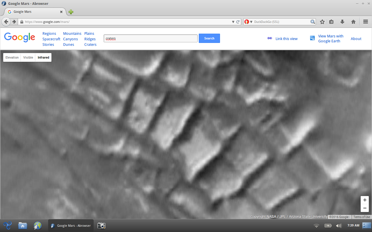
Thank you for posting this! I've spotted this feature a few years ago, but couldn't find it again. For those who want to look it up themselves, the coordinates are: -81.451575 -63.841552
I wonder what natural processes could have created it, and of course I can't help but compare it to the aerial shots of ruins on Earth.
This feature is discussed in this ATS thread: www.abovetopsecret.com...
It's called "Inca city" by NASA: www.msss.com...
Regional view from the Mars Reconaissance Orbiter context (CTX) camera shows layered polar deposits (bottom right) and suggests that Inca City has been exposed as overlying smooth layers are peeled away by erosion. (CTX image P07_003928_0816_XI_81S064W — Credit: NASA/JPL/MSSS)
The high-rez HiRISE camera shows great detail: hirise-pds.lpl.arizona.edu...
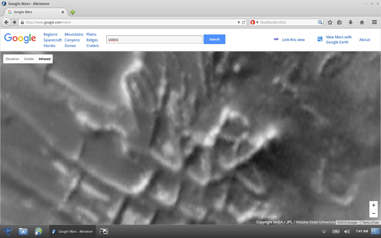
edit on 7-9-2016 by wildespace because: (no reason given)
a reply to: BigBrotherDarkness
Cool stuff.
ArMap posted this link in the older thread.
Angustus Labyrinthus!
Hopefully members will drop by with similar images from different places.
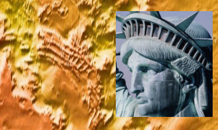
ETA - before I even saw the 'Inca City' connection, I had some pareidolia at work and couldn't help seeing an Inca-style guy in ceremonial headdress
Cool stuff.
ArMap posted this link in the older thread.
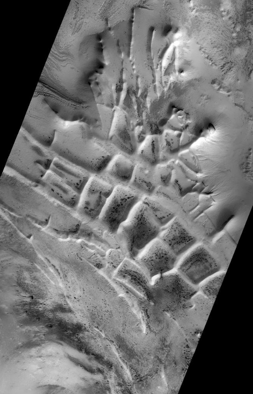
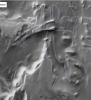
The Mars Global Surveyor (MGS) Mars Orbiter Camera (MOC) has provided new information about the "Inca City" ridges, though the camera's images still do not solve the mystery. The new information comes in the form of a MOC red wide angle context frame taken in mid-southern spring, shown above left and above right. The original Mariner 9 view of the ridges is seen at the center. The MOC image shows that the "Inca City" ridges, located at 82°S, 67°W, are part of a larger circular structure that is about 86 km (53 mi) across. It is possible that this pattern reflects an origin related to an ancient, eroded meteor impact crater that was filled-in, buried, then partially exhumed. In this case, the ridges might be the remains of filled-in fractures in the bedrock into which the crater formed, or filled-in cracks within the material that filled the crater. Or both explanations could be wrong. While the new MOC image shows that "Inca City" has a larger context as part of a circular form, it does not reveal the exact origin of these striking and unusual martian landforms.
Angustus Labyrinthus!
Wiki
In 2002 the camera on Mars Global Surveyor revealed that the 'Inca City' was part of a large circular structure that was 86 km in diameter. So the shape meant that it was probably caused by an asteroid impact which cracked the crust. Later, magma flowed along the cracks. When the magma cooled, hard, erosion resistant walls of rock (dikes) formed. The crater was covered over, then partially exhumed. The hard walls of rock were left standing as softer surrounding material eroded away.[3]
Hopefully members will drop by with similar images from different places.
ETA - before I even saw the 'Inca City' connection, I had some pareidolia at work and couldn't help seeing an Inca-style guy in ceremonial headdress

edit on 9.7.2016 by Kandinsky because: (no reason given)
a reply to: Kandinsky
Cool thanks for the addition... I find it interesting how images can either convex or concave when looking at them long enough... like staring at moon craters where they start looking like domes and going yeah that's enough vision is going inverted :p
But yeah additions of other areas of geographic are obviously more than welcome.
edit on 7-9-2016 by BigBrotherDarkness because: (no reason
given)
a reply to: wildespace
Looks to be part of an ancient crater rim. Complete the arc. See it?
I wonder what natural processes could have created it, and of course I can't help but compare it to the aerial shots of ruins on Earth.
Looks to be part of an ancient crater rim. Complete the arc. See it?
originally posted by: Kandinsky
a reply to: BigBrotherDarkness
ETA - before I even saw the 'Inca City' connection, I had some pareidolia at work and couldn't help seeing an Inca-style guy in ceremonial headdress
Here's the pareidolia i see:
Anyone that wants to feel free to yell... You maniacs!
originally posted by: gortex
a reply to: Kandinsky
Hopefully members will drop by with similar images from different places.
My favourite from the Valles Marineris , there may be explanations for it but to me it's an ancient ruin.
Doesn't look like any photo from Mars that I've seen. So what is it exactly? Got the original source?
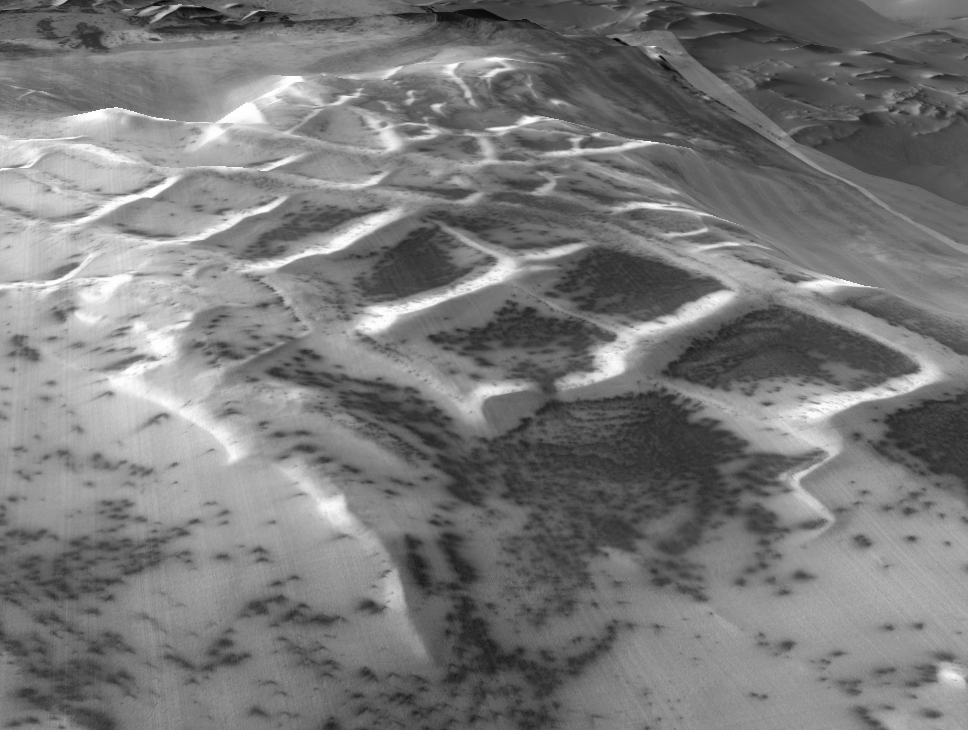
It looks like digital terrain thing with an image wrapped over it. The step-like features are most probably image and digital elevation artifacts. www.abovetopsecret.com...
edit on 7-9-2016 by wildespace because: (no reason given)
originally posted by: gortex
a reply to: Kandinsky
Hopefully members will drop by with similar images from different places.
My favourite from the Valles Marineris , there may be explanations for it but to me it's an ancient ruin.
That is without doubt created. Millions of years have eroded it down, but no way that is naturally occurring.
The pyramids here will be the longest remaining monument to remember humans by long after our extinction. I wonder if the TTSNBS forums (Things that should never be said) will have their fair share of skeptics to say "NAww it's just a mountain, like, really odd shaped yeah?"
in 5 million years on planet mooboo...
Google Earth allows oblique views, so here's one of the Inca city, looking North:
Looking South:
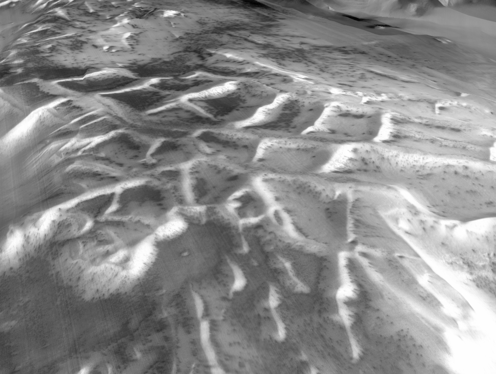
Elevation has been exagerrated x2 in both images.
By moving the view slightly sideways, I was also able to make this stereo image for viewing with red-cyan glasses (red-green or red-blue ones will also work), and without any elevation exagerration:
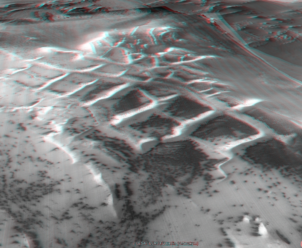
All in all, it definitely looks natural.
Looking South:
Elevation has been exagerrated x2 in both images.
By moving the view slightly sideways, I was also able to make this stereo image for viewing with red-cyan glasses (red-green or red-blue ones will also work), and without any elevation exagerration:
All in all, it definitely looks natural.
originally posted by: savemebarry
originally posted by: gortex
a reply to: Kandinsky
Hopefully members will drop by with similar images from different places.
My favourite from the Valles Marineris , there may be explanations for it but to me it's an ancient ruin.
That is without doubt created. Millions of years have eroded it down, but no way that is naturally occurring.
It's digital elevation artifacts, due to the low resolution. I've seen such step-like patterns in other low-rez digital elevation images.
Anyone can get me the precise coordinates for it? I want to hunt down some high-rez images.
a reply to: wildespace
Kandinsky gave them in his post but here they are again
Kandinsky gave them in his post but here they are again
the coordinates are: -81.451575 -63.841552
originally posted by: BigBrotherDarkness
a reply to: wildespace
Kandinsky gave them in his post but here they are again
the coordinates are: -81.451575 -63.841552
Sorry, I meant coordinates for that red "temple" image.
Very cool pics! And thank the Gods it's not another pareidolia party😒 "look this rock is an alien velociraptor skull"
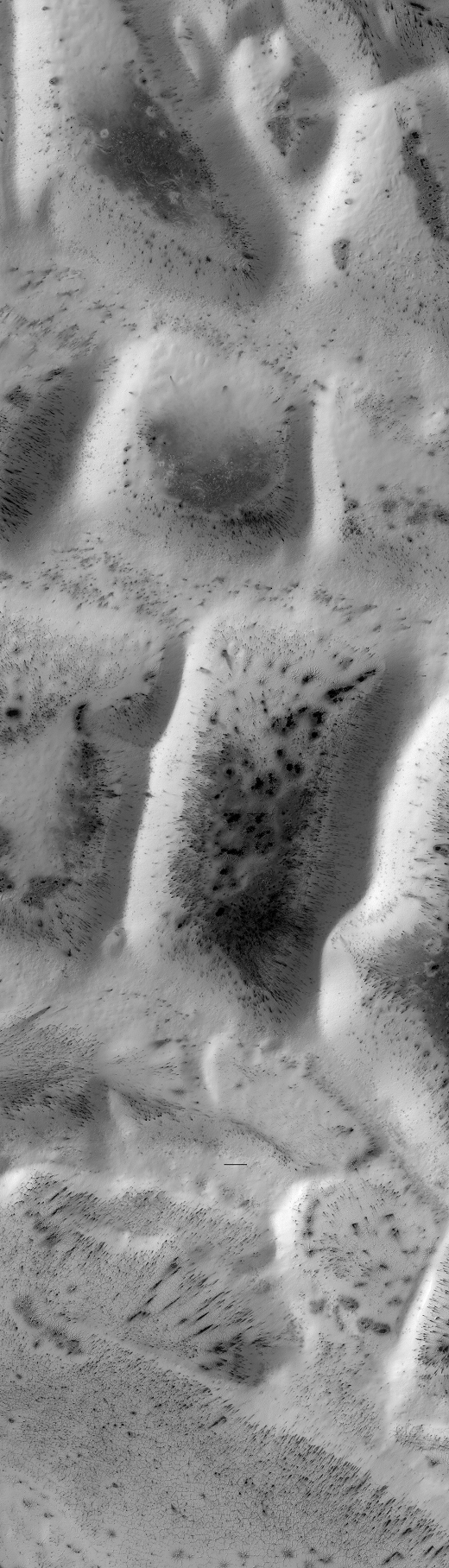
MRO's HiRISE camera has covered the "Inca city" many times over, at around 25 cm/pixel resolution.
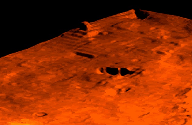
As this feature is near the south pole, it's covered in CO2 frost a lot of the time. In spring, some of the frost sublimates, exposing dark streaks (which, theoretically, could contain some briny moisture). This frosty-white look with dark "fans" and "spiders" creates a very beautiful scene, I think. Quite different from the red planet that we're used to seeing.
Here's one such HiRISE image, in true colours: hirise-pds.lpl.arizona.edu...
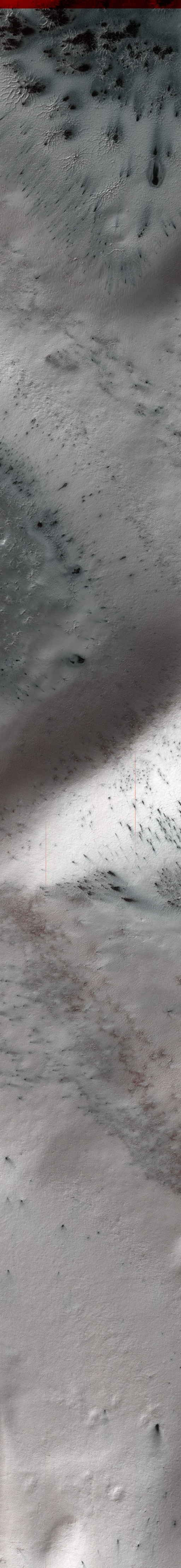
originally posted by: wildespace
Anyone can get me the precise coordinates for it? I want to hunt down some high-rez images.
Not precise, but based on this page I think the coordinates are close to 4°44'27.50"N - 36°30'40.98"W.
new topics
-
Only two Navy destroyers currently operational as fleet size hits record low
Military Projects: 6 hours ago -
George Stephanopoulos and ABC agree to pay $15 million to settle Trump defamation suit
Mainstream News: 11 hours ago
top topics
-
George Stephanopoulos and ABC agree to pay $15 million to settle Trump defamation suit
Mainstream News: 11 hours ago, 17 flags -
Only two Navy destroyers currently operational as fleet size hits record low
Military Projects: 6 hours ago, 7 flags
active topics
-
-@TH3WH17ERABB17- -Q- ---TIME TO SHOW THE WORLD--- -Part- --44--
Dissecting Disinformation • 3692 • : BrucellaOrchitis -
Mood Music Part VI
Music • 3735 • : BrucellaOrchitis -
A Bunch of Maybe Drones Just Flew Across Hillsborough County
Aircraft Projects • 83 • : charlyv -
The Mystery Drones and Government Lies
Political Conspiracies • 72 • : tarantulabite1 -
Only two Navy destroyers currently operational as fleet size hits record low
Military Projects • 1 • : alwaysbeenhere2 -
A priest who sexually assaulted a sleeping man on a train has been jailed for 16 months.
Social Issues and Civil Unrest • 30 • : alwaysbeenhere2 -
They Know
Aliens and UFOs • 86 • : ianmoone3 -
George Stephanopoulos and ABC agree to pay $15 million to settle Trump defamation suit
Mainstream News • 11 • : WeMustCare -
President-Elect DONALD TRUMP's 2nd-Term Administration Takes Shape.
Political Ideology • 331 • : WeMustCare -
Nov 2024 - Former President Barack Hussein Obama Has Lost His Aura.
US Political Madness • 15 • : WeMustCare