It looks like you're using an Ad Blocker.
Please white-list or disable AboveTopSecret.com in your ad-blocking tool.
Thank you.
Some features of ATS will be disabled while you continue to use an ad-blocker.

Tikal - The Great Mayan City
page: 1share:
TIKAL - YAX MUTAL - "The Place Of The Voices"
 Etymology
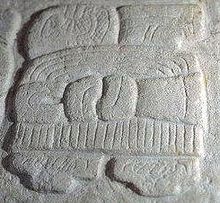
 The pre-Columbian city we call Tikal was abandoned by its Maya residents during the tenth century A.D. and succumbed to the
Guatemalan rain forest. It was not until 1848 that it was brought to the attention of the outside world. For the next century Tikal, remote and
isolated, received a surprisingly large number of visitors. Public officials, explorers, academics, military personnel, settlers, petroleum engineers,
chicle gatherers, and archaeologists came and went, sometimes leaving behind material traces of their visits.
The pre-Columbian city we call Tikal was abandoned by its Maya residents during the tenth century A.D. and succumbed to the
Guatemalan rain forest. It was not until 1848 that it was brought to the attention of the outside world. For the next century Tikal, remote and
isolated, received a surprisingly large number of visitors. Public officials, explorers, academics, military personnel, settlers, petroleum engineers,
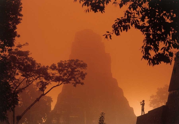
chicle gatherers, and archaeologists came and went, sometimes leaving behind material traces of their visits. Tikal, the crown
jewel of Maya archaeological sites, has been fascinating visitors for over 160 years with its stunning beauty and sheer grandeur as it rises out of
the lush jungle of Guatemala’s Petén district.
Tikal, the crown
jewel of Maya archaeological sites, has been fascinating visitors for over 160 years with its stunning beauty and sheer grandeur as it rises out of
the lush jungle of Guatemala’s Petén district.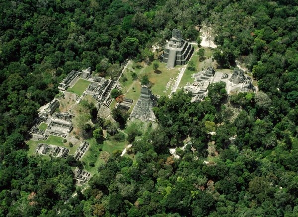 In the Early Classic Period (ad 100–600), Tikal was an important post in the great trading network that the
contemporaneous central Mexican city of Teotihuacán had established in southern Mesoamerica. Tikal continued to flourish after the decline of
Teotihuacán and probably extended its hegemony over a large part of the southern lowlands in the Late Classic Period. Between 600 and 800, Tikal
reached its architectural and artistic peak, after which a decline set in, with depopulation and a general artistic deterioration. The last dated
stela at the site is placed at 889. Small groups continued to live at the site for another century or so, but Tikal, along with the other Maya centres
of the southern lowlands, was abandoned by the 10th century.
In the Early Classic Period (ad 100–600), Tikal was an important post in the great trading network that the
contemporaneous central Mexican city of Teotihuacán had established in southern Mesoamerica. Tikal continued to flourish after the decline of
Teotihuacán and probably extended its hegemony over a large part of the southern lowlands in the Late Classic Period. Between 600 and 800, Tikal
reached its architectural and artistic peak, after which a decline set in, with depopulation and a general artistic deterioration. The last dated
stela at the site is placed at 889. Small groups continued to live at the site for another century or so, but Tikal, along with the other Maya centres
of the southern lowlands, was abandoned by the 10th century.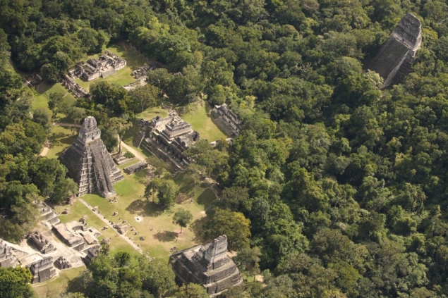
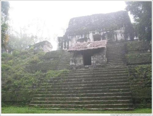
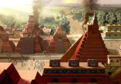
I would like to first talk about the megalithic builds and parts of the city. They are beautiful, masterfully crafted structures and it is an amazing piece of the human legacy.Over the next few days I will be updating this thread with more details and pictures about Tikal.
*****************************************************************
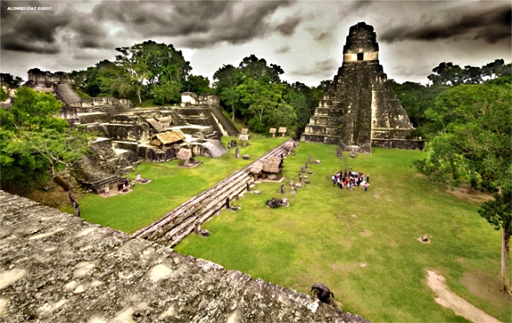
Temple Pyramid I - Temple of Ah Cacao or Temple of the Great Jaguar
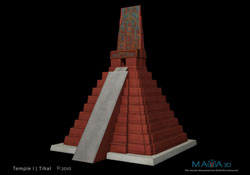 Temple I is located to the east and rises 145 feet (44 meters) off the ground. A stairway goes up over a series of nine step
layers, taking the visitor to an enclosed room at top that has images of the ruler it was built for, Jasaw Kaan K’awil. He was a king who led
Tikal’s forces in defeating its most bitter enemy — the rival city of Calakmul. His burial chamber was found inside the pyramid’s interior and
contained many luxury goods, including jaguar pelts, jade and even images of figures in canoes on human bones.
Temple I is located to the east and rises 145 feet (44 meters) off the ground. A stairway goes up over a series of nine step
layers, taking the visitor to an enclosed room at top that has images of the ruler it was built for, Jasaw Kaan K’awil. He was a king who led
Tikal’s forces in defeating its most bitter enemy — the rival city of Calakmul. His burial chamber was found inside the pyramid’s interior and
contained many luxury goods, including jaguar pelts, jade and even images of figures in canoes on human bones.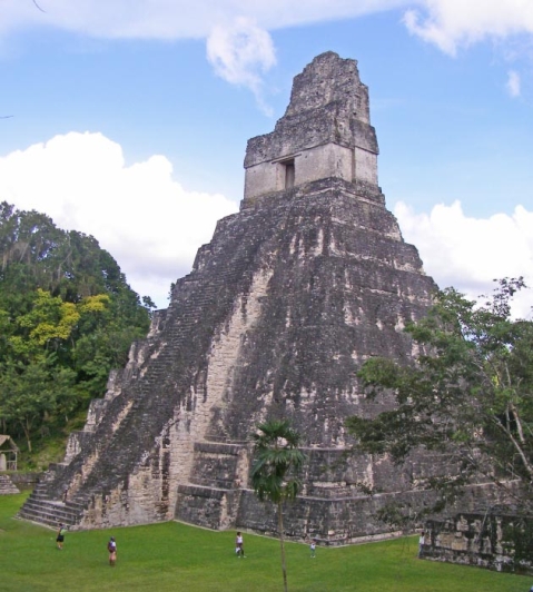
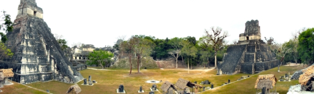
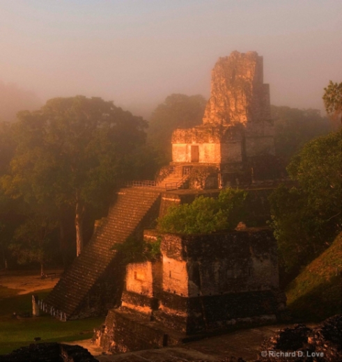
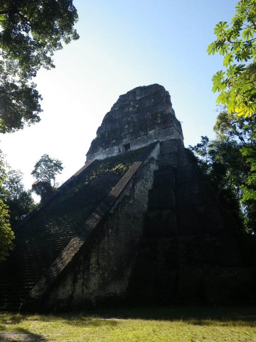
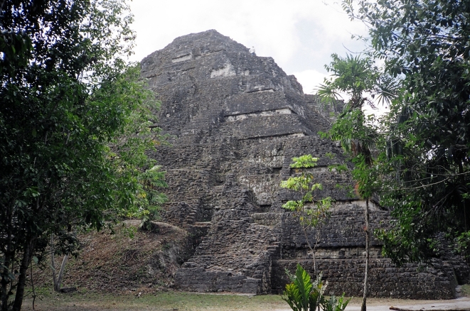
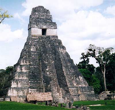 The most spectacular
buildings in Tikal are the six large step pyramids. Most famous is Temple I, that in many ways became the face of Tikal. It would feature on book
covers, postcards and DVD's and of course there is a reason. Temple I is sexy; without the shadow of a doubt one of the most beautiful Mesoamerican
step pyramids ever built.
The most spectacular
buildings in Tikal are the six large step pyramids. Most famous is Temple I, that in many ways became the face of Tikal. It would feature on book
covers, postcards and DVD's and of course there is a reason. Temple I is sexy; without the shadow of a doubt one of the most beautiful Mesoamerican
step pyramids ever built.
The pyramid has nine levels. The nine steps most likely have a mythological reference while the height of the steps is normally determined by astronomical demands. Like most pyramids it is carefully aligned and also served as an astronomical calendar.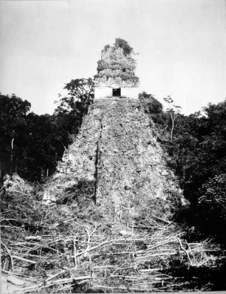 It was built
after the death of Hasaw Chan K'awil (Ah Cacau) 682–734 and most likely following his instructions.
It was built
after the death of Hasaw Chan K'awil (Ah Cacau) 682–734 and most likely following his instructions.
The name Tikal may be derived from ti ak'al in the Yucatec Maya language; it is said to be a relatively modern name meaning "at the waterhole". The name was apparently applied to one of the site's ancient reservoirs by hunters and travellers in the region.[6] It has alternatively been interpreted as meaning "the place of the voices" in the Itza Maya language. Tikal, however, is not the ancient name for the site but rather the name adopted shortly after its discovery in the 1840s.
Emblem Glyph for Tikal (Mutal)
Hieroglyphic inscriptions at the ruins refer to the ancient city as Yax Mutal or Yax Mutul, meaning "First Mutal"
Source
The kingdom as a whole was simply called Mutul.
At its height the city of Tikal had a population estimated to be as large as 90,000. Earthworks and other defence systems surrounded an area of some 120 sq km supplied by ingenious irrigation and agricultural systems which can still be seen today.
Tikal has long been regarded by archaeologists as the "capital" of the Maya, although for a people whose political organization did not evolve beyond the level of the city-state, this may not be a totally accurate characterization. In any case, it does represent one of the most impressive architectural achievements of the Maya civilization, being dominated by five sky-scraper-like pyramids each exceeding 60 m (200 ft.) in height.
Today, Tikal is an UNESCO world heritage area and national park, with 222 sq mi (576 sq km) area of natural beauty and home to many exotic animals, including tapir, jaguar, crocodile, cougars, monkeys, coati mundi and other species as well as a colourful assortment of birds. It is the largest excavated site in the American continent, containing over 3000 structures and massive, beautiful temples rising 70 meters (230 feet) out of the dense jungle.
Although its history spans the entire "Classic Period" (indeed, its earliest dated monument (A.D. 292) has often been cited as the beginning point of that epoch), its hey-day was reached in the eighth century A.D. when the five imposing pyramids were constructed, all within roughly a fifty-year span of time. Scarcely less than a century later, Tikal, like most of the other Maya city-states, was abandoned and the jungle began to encroach on its temples and palaces.
I would like to first talk about the megalithic builds and parts of the city. They are beautiful, masterfully crafted structures and it is an amazing piece of the human legacy.Over the next few days I will be updating this thread with more details and pictures about Tikal.
Source
There are thousands of ancient structures at Tikal and only a small number have been unearthed, after decades of archaeological work. The most prominent surviving buildings include six very large pyramids, labelled Temples I - VI, each of which support a temple structure on their summits. Some of these pyramids are over 60 metres high (200 feet). They were numbered sequentially during the early survey of the site. It is estimated that each of these major temples could have been built in as little as two years.
*****************************************************************
Temple Pyramid I - Temple of Ah Cacao or Temple of the Great Jaguar
The massive roofcomb that topped the temple was originally decorated with a giant sculpture of the enthroned king, although little of this decoration survives. The tomb of the king was discovered by Aubrey Trik of the University of Pennsylvania in 1962.
The pyramid has nine levels. The nine steps most likely have a mythological reference while the height of the steps is normally determined by astronomical demands. Like most pyramids it is carefully aligned and also served as an astronomical calendar.
Source
Among items recovered from the Late Classic tomb were a large collection of inscribed human and animal bone tubes and strips with sophisticated scenes depicting deities and people, finely carved and rubbed with vermilion, as well as jade and shell ornaments and ceramic vessels filled with offerings of food and drink. The shrine at the summit of the pyramid has three chambers, each behind the next, with the doorways spanned by wooden lintels fashioned from multiple beams. The outermost lintel is plain but the two inner lintels were carved, some of the beams were removed in the 19th century and their location is unknown, while others were taken to museums in Europe.
edit on 1/5/2013 by mcx1942 because:
fix
edit on 1/5/2013 by mcx1942 because: fix
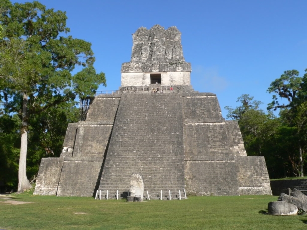
Temple II - Temple Of The Mask
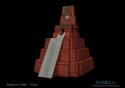
It was suggested that Temple II opposite Temple I was constructed in honour of Hasaw's wife. The remains of one of the carved lintels show a royal figure that – although no inscriptions survived – is widely considered her.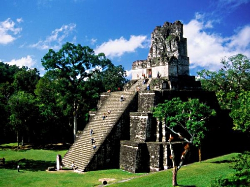 The construction of Temple II began much earlier
than the construction of Temple I. From all we know Hasaw's wife indeed died long before him in 703. Hasaw himself died around 734 – the date is
not actually confirmed but his son followed him on the throne that year – so it makes a lot of sense that Temple II precedes Temple I. It is also
known as the Moon Temple.
The construction of Temple II began much earlier
than the construction of Temple I. From all we know Hasaw's wife indeed died long before him in 703. Hasaw himself died around 734 – the date is
not actually confirmed but his son followed him on the throne that year – so it makes a lot of sense that Temple II precedes Temple I. It is also
known as the Moon Temple.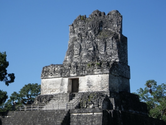
********************************************************************
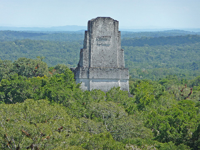
Temple III - Temple of the Jaguar Priest
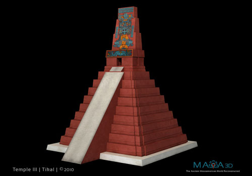
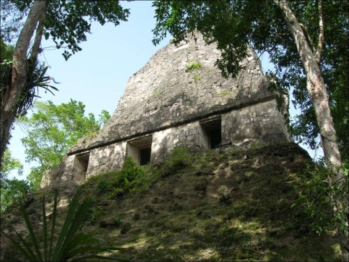
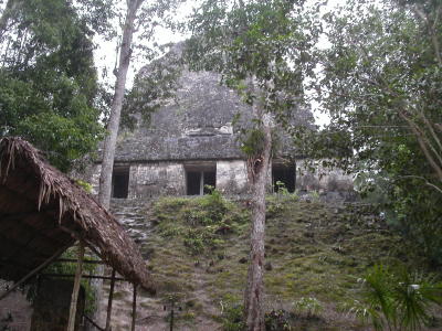
Temple III was built around 810. It is rather unusual especially in comparison with the other temples. It is an impressive 60 metres high but has only two interior rooms (instead of normally three).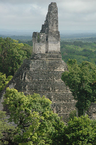
 Since it was built at the end of a katun (unit in the Mayan calender =
7200 days) it should have been part of a twin pyramid complex but for unknown reason wasn't. It is located west of the Great Plaza and associated
with Yax Ain II. He is depicted as a rather heavyset man. Temple III is the latest of the pyramid temples.
Since it was built at the end of a katun (unit in the Mayan calender =
7200 days) it should have been part of a twin pyramid complex but for unknown reason wasn't. It is located west of the Great Plaza and associated
with Yax Ain II. He is depicted as a rather heavyset man. Temple III is the latest of the pyramid temples.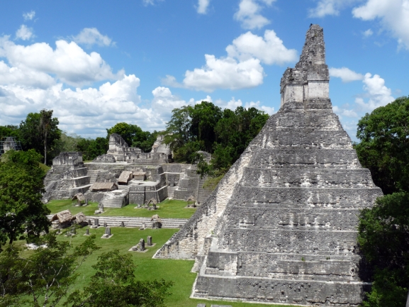
****************************************************************************
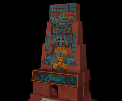
Temple IV - Unnamed
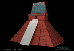
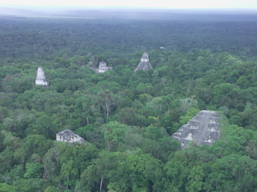
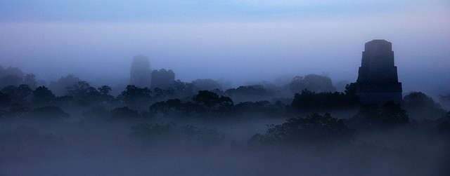
Temple IV is spectacular for a number of reasons. With a height of 64.6 metres (212 ft) from its supporting platform to the highest part of the roof comb, it is not only the cities tallest structure but one of the tallest in all Mesoamerica second only to "La Danta" in El Mirador. The temple was build by Yik’in Chan Kawil, the son of Ah Cacau's, probably around 741 AD.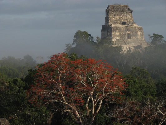 It's most spectacular feature is the view from the top. You overlook
the whole area and in the distance you see temples I, II and III rising above the forest canopy. You'll also see the Temple of the Inscriptions and
Pyramid of the Lost World.
It's most spectacular feature is the view from the top. You overlook
the whole area and in the distance you see temples I, II and III rising above the forest canopy. You'll also see the Temple of the Inscriptions and
Pyramid of the Lost World.
View of Temples I, II and III from atop Temple IV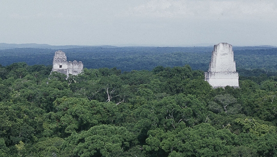
Source
It was suggested that Temple II opposite Temple I was constructed in honour of Hasaw's wife. The remains of one of the carved lintels show a royal figure that – although no inscriptions survived – is widely considered her.
The temple was dedicated to the wife of Jasaw Chan K'awil, although no tomb was found. The queen's portrait was carved into the lintel spanning the doorway of the summit shrine. One of the beams from this lintel is now in the American Museum of Natural History in New York.
was built around AD 700 and stands 38 metres (125 ft) high. Like other major temples at Tikal, the summit shrine had three consecutive chambers with the doorways spanned by wooden lintels, only the middle of which was carved.
Source
Temple II was visited by Modesto Méndez, the governor of Petén, in 1848 on the first expedition to the ruins. Preliminary excavations of Temple II started in 1958. On 21 December 2012, more than 7,000 tourists visited Tikal to celebrate the 2012 phenomenon and the supposed end of the world. Many of these tourists climbed the stairs of the pyramid, causing reported damages.
********************************************************************
Temple III - Temple of the Jaguar Priest
Temple III was built around 810. It is rather unusual especially in comparison with the other temples. It is an impressive 60 metres high but has only two interior rooms (instead of normally three).
was the last of the great pyramids to be built at Tikal. It stood 55 metres (180 ft) tall and contained an elaborately sculpted but damaged roof lintel, possibly showing Dark Sun engaged in a ritual dance around AD 810.[73] The temple shrine possesses two chambers.
Temple III is associated with the little-known king Dark Sun, and it is likely that Temple III is Dark Sun's funerary temple. The construction of Temple III indicated that Tikal was still politically stable at the beginning of the 9th century AD. However, this was the last temple pyramid raised at Tikal and by the end of the 9th century the city had fallen into ruin
Source
Temple III is only partially restored and is closed to the public; it has not been the subject of archaeological investigation.
****************************************************************************
Temple IV - Unnamed
Temple IV is spectacular for a number of reasons. With a height of 64.6 metres (212 ft) from its supporting platform to the highest part of the roof comb, it is not only the cities tallest structure but one of the tallest in all Mesoamerica second only to "La Danta" in El Mirador. The temple was build by Yik’in Chan Kawil, the son of Ah Cacau's, probably around 741 AD.
a Mesoamerican pyramid in the ruins of the ancient Maya city of Tikal in modern Guatemala. It was one of the tallest and most voluminous buildings in the Maya world. The pyramid was built around 741 AD. Temple IV is located at the western edge of the site core.
View of Temples I, II and III from atop Temple IV
The pyramid was built to mark the reign of the 27th king of the Tikal dynasty, Yik'in Chan K'awiil, although it may have been built after his death as his funerary temple. Archaeologists believe that Yik'in Chan K'awiil's tomb lies undiscovered somewhere underneath the temple.
The summit shrine was accessed via a 16.3-metre (53 ft) wide stairway that climbed from the supporting platform; a plain stela (Stela 43) and the associated Altar 35 are centrally located at the base of the stairway. The shrine has been partially restored and has walls up to 12 metres (39 ft) thick. The shrine was built upon a platform resting upon a supplementary platform, which was in turn seated upon the top of the pyramid.
Archaeologists believe Yik'in Chan K'awii is buried here. Archaeologists estimate that 250,000 cubic yards of stone went into its construction! The ruler would have called upon the 60,000+ inhabitants of Tikal and the surrounding area to contribute to the building process, perhaps paying a labor tax.
The shrine measures 31.9 by 12.1 metres (105 by 40 ft), with a maximum height of 8.9 metres (29 ft) excluding the roof comb. The exterior walls of the shrine are vertical, contrasting with the rest of the pyramid. The upper sections of the exterior walls formed a frieze, with three giant stone mosaic masks facing eastwards over the temple access. The central mask was directly over the outer doorway, while the other two were near the northern and southern extremes of the building's facade
Source
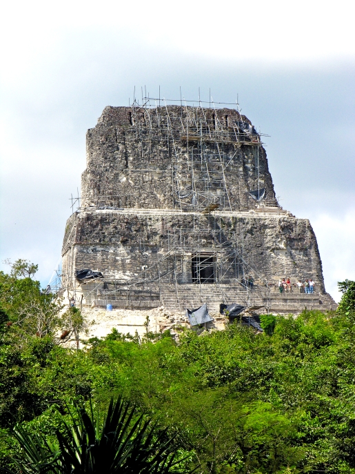
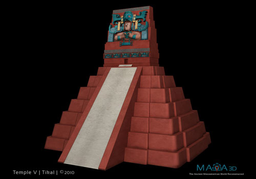
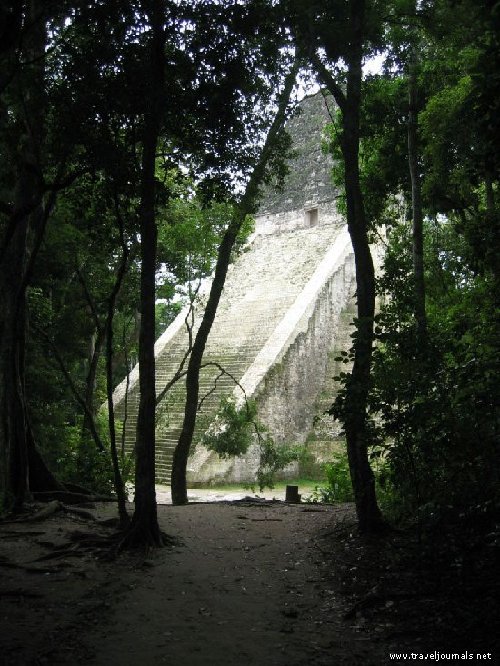
Temple V - Unnamed
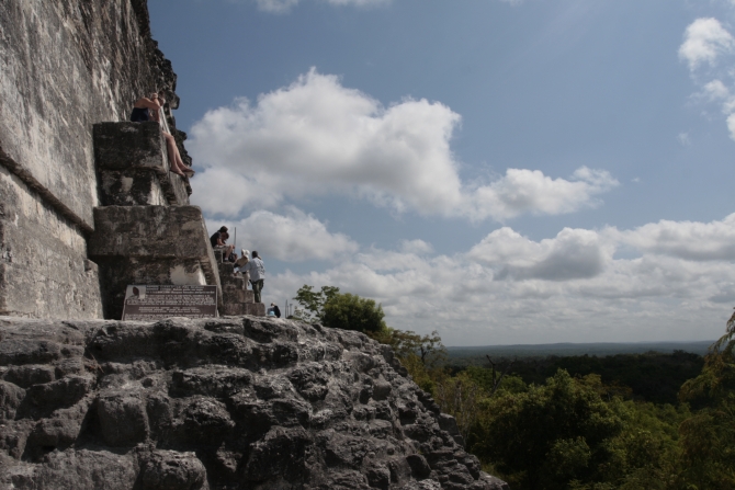
At 59 meters (190 feet high), Temple V is the second tallest pyramid at Tikal. Archaeologists believe it is the burial site of an unknown ruler.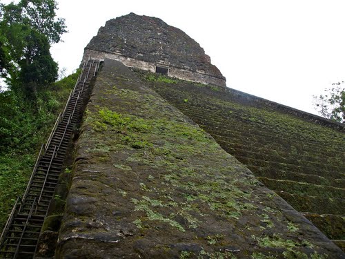
It is possible to climb to the top of this temple via a very steep wooden staircase on the opposite side of the temple. The view from the top is fantastic as it looks back toward Temples I and II and the southern acropolis.
Early restoration picture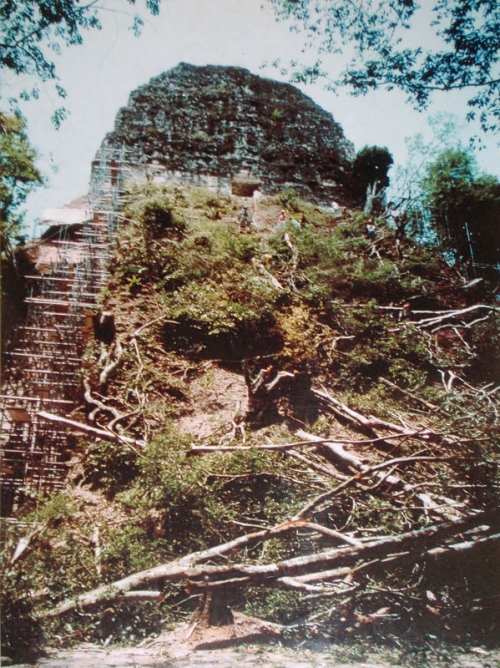
***********************************************************
Temple VI - Temple of the Inscriptions
 It is notable for its 12-metre (39 ft) high roof-comb. Panels of hieroglyphs cover the back and sides of the roof-comb. The
temple faces onto a plaza to the west and its front is unrestored.
It is notable for its 12-metre (39 ft) high roof-comb. Panels of hieroglyphs cover the back and sides of the roof-comb. The
temple faces onto a plaza to the west and its front is unrestored.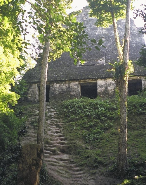
*******************************************************************
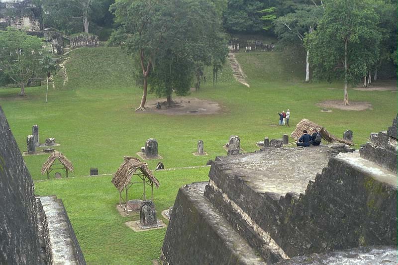
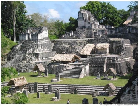
The Great Plaza
 Central Tikal basically consists of the Great
Plaza flanked to the east and west by Temples I and II, and facing to the north the numerous temples of the North Acropolis. There are some seventy
stelae and rows of altars along the northern edge of the Great Plaza. The earliest level on this site dates to 150 B.C. and the latest to 700 A.D.,
giving historical information in its strata of almost a millennium of occupation.
Central Tikal basically consists of the Great
Plaza flanked to the east and west by Temples I and II, and facing to the north the numerous temples of the North Acropolis. There are some seventy
stelae and rows of altars along the northern edge of the Great Plaza. The earliest level on this site dates to 150 B.C. and the latest to 700 A.D.,
giving historical information in its strata of almost a millennium of occupation.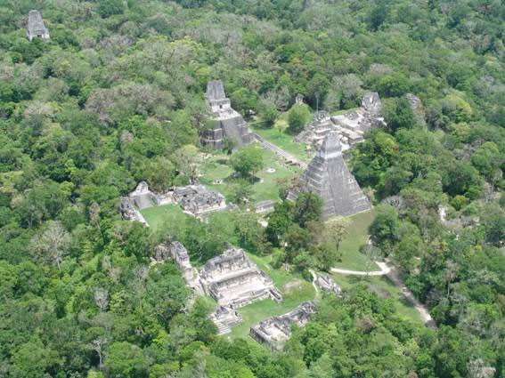
***********************************************************
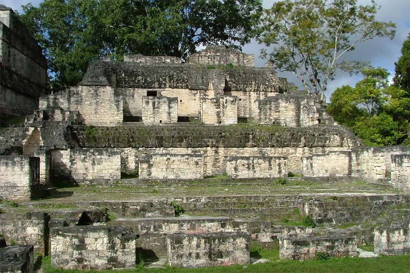
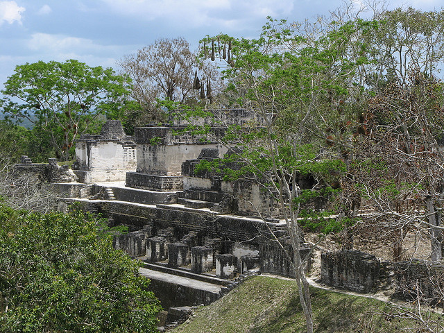
The Central Acropolis
The Central Acropolis is the fourth series of structures that surround the Great Plaza. The series of small rooms and terraces are thought to be ceremonial areas and storage for ceremonial artifacts. An abundance of ancient graffiti covers the interior walls, depicting the gods and ancient events. Perhaps it was here, looking down on the Great Plaza, that certain nobility sat and viewed religious ceremony. It was also most likely the viewpoint for watching the games of the renowned ball courts. One of the ball courts is visible near the base of Temple I.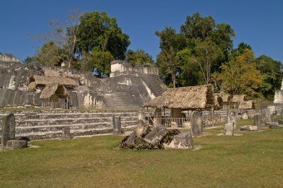
 Source
At 59 meters (190 feet high), Temple V is the second tallest pyramid at Tikal. Archaeologists believe it is the burial site of an unknown ruler.
Adjacent to the South Acropolis, restoration of Temple V has been completed, with funding from the Spanish Cooperation Agency.
Tikal Temple V is the name given by archaeologists to one of the major pyramids at Tikal. Tikal is one of the most important archaeological sites of the pre-Columbian Maya civilization and is located in the Petén Department of northern Guatemala.
Temple V stands south of the Central Acropolis and is the mortuary pyramid of an as yet unidentified ruler of the once great city. The temple stands 57 metres (187 ft) high, making it the second tallest structure at Tikal—only Temple IV is taller. The temple has been dated to about AD 700, in the Late Classic period, via radiocarbon analysis and the dating of ceramics associated with the structure places its construction during the reign of Nun Bak Chak in the second half of the 7th century.
The architectural style of the pyramid includes features that were popular during the Early Classic period, such as wide balustrades flanking the main stairway and the rounded corners of the temple. These features indicate the continued influence of earlier traditions.
It is possible to climb to the top of this temple via a very steep wooden staircase on the opposite side of the temple. The view from the top is fantastic as it looks back toward Temples I and II and the southern acropolis.
Early restoration picture
The pyramid sits upon a platform that is 5 metres (16 ft) higher than the level of the Central Plaza. The platform was built by constructing a system of compartments with sloping megalithic walls reinforced with vertical interior retaining walls, these compartments were filled with alternating layers of compacted earth and stone. This leveled off the natural terrain and allowed the platform to support the massive weight of the temple.
Source
The shrine at the top of the pyramid contains a single room of small size, measuring only 90 centimetres (35 in) deep, while the rear wall behind this tiny room measures 4.57 metres (15.0 ft) thick. The room is 3.95 metres (13.0 ft) wide and 4.4 metres (14 ft) high. This room is the smallest room of any shrine at Tikal and is the only example from the larger temples that contains only one room. Above the room are three sealed vaulted chambers, the function of which is to reduce the overall weight of the structure. The shrine still contains the original wooden lintels. The cornice of the shrine is decorated on the north side with three masks of the rain god Chaac and with frames containing human figures on the sides.
***********************************************************
Temple VI - Temple of the Inscriptions
A Mesoamerican pyramid in the ruins of the major Maya city of Tikal, in the Petén department of northern Guatemala. Temple VI is located at the southeastern end of the Mendez Causeway, which links the temple plaza with the site core.
The temple faces west onto a walled plaza. The existence of the temple was first reported in 1951 by Antonio Ortiz on behalf of the Instituto de Antropología e Historia (IDAEH - "Institute of Anthropology and History")
The pyramid's summit superstructure contains two chambers, and the highest surviving portion of the temple's roof comb stands 12 metres (40 ft) high. The pyramid superstructure is accessed via three west-facing doorways. The triple doorway and interior layout of the chambers suggest that Temple VI was in fact a palace-type structure rather than a temple.
Source
Hieroglyphic inscription
The text contains a history of Tikal strectching back into the Preclassic period. The earliest date in the text equates to 1139 BC; it records either a mythical foundation event or, perhaps, a distantly remembered historical event of importance
*******************************************************************
The Great Plaza
The Great Plaza lies at the core of the site; it is flanked on the east and west sides by two great temple-pyramids. On the north side it is bordered by the North Acropolis and on the south by the Central Acropolis.
The Great Plaza and its surroundings constituted the core of Tikal. Technically the Great Plaza consists of Temples 1 & 2 and the ball court, which were dramatic additions built around the year 700 A.D. between the Central and the North Acropolises.
Source
In the political sphere, Tikal had gone through a period known as the hiatus toward the end of the seventh century A.D., when no new buildings or inscriptions recorded important events for almost 150 years.
***********************************************************
The Central Acropolis
The Central Acropolis is the fourth series of structures that surround the Great Plaza. The series of small rooms and terraces are thought to be ceremonial areas and storage for ceremonial artifacts. An abundance of ancient graffiti covers the interior walls, depicting the gods and ancient events. Perhaps it was here, looking down on the Great Plaza, that certain nobility sat and viewed religious ceremony. It was also most likely the viewpoint for watching the games of the renowned ball courts. One of the ball courts is visible near the base of Temple I.
A huge complex of residential and administrative palaces is where the Royal Family of Tikal and their relatives lived. The complex stretches over 1.5 hectares and is made up of 45 buildings and 6 courtyards (surrounded by two and three story palaces). Stairways, halls and doorways communicate the buildings and plazas. Many of these palaces were used as residences, as many of the chambers still display built-in beds of rock, over which skins and mats were placed to make comfortable beddings. The Mahler Palace and the Five Story Palace are the most outstanding buildings in the complex. South of these was Tikal’s main water reservoir, dividing the Central and South Acropolises.
Experts believe the ruling family lived in this group of buildings. The maze of rooms and courtyards grew as people added on to it over a period of more than 200 years.
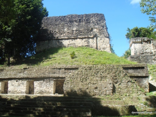
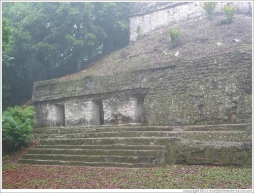
The North Acropolis
The North Acropolis is a sacred place, chosen for burial ground of the Rulers of Tikal for over 5 centuries between 1 A.D. and 550 A.D. However, most remarkable is that it contains evidence of the first settlers in Tikal, who came to the area about 800 B.C. Archaeological studies have revealed that along with the foundations of the Lost World, those of the North Acropolis are the most ancient areas where the first settlers of Tikal established themselves. The North Acropolis was occupied for at least 1500 years, as demonstrated by more than a dozen successive construction levels, set one on top of the other.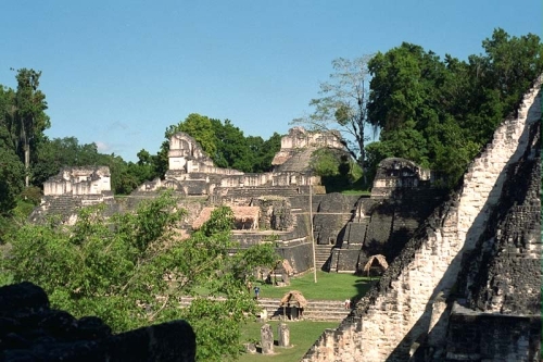
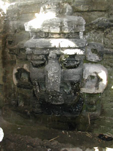 This mask of a
long-nosed god is from the first building erected at this spot. The mask is over 10 feet tall. In ancient times, this mask would have been covered
with stucco. The mask and the entire building were painted in brilliant reds, greens, yellows, and blues. The buildings looked very different from the
bare rock we see today.
This mask of a
long-nosed god is from the first building erected at this spot. The mask is over 10 feet tall. In ancient times, this mask would have been covered
with stucco. The mask and the entire building were painted in brilliant reds, greens, yellows, and blues. The buildings looked very different from the
bare rock we see today.
************************************************************
The South Acropolis
Very little has been revealed about the South Acropolis. According to speculative archaeological assumptions, it may be very ancient, because it is built upon 7 different platforms. Its origins may be traced back to the Preclassic Period. However, it remains to be excavated and studied. Its enormous edifices, over 24 meters high, have a quadrangular base that covers 2.2 hectares. In its summit it exhibits 4 grand palaces surrounding a central temple.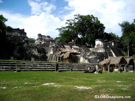
 Source
********************************************************
Plaza of the Seven Temples
The Plaza of the Seven Temples features three Tikal ball fields, which are unique to the Mayan World. The plaza also features stela with glyphic inscriptions, altars and stucco human heads. Said to be one of the most attractive sites in all of Tikal.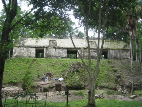
*************************************************************************
Mundo Perdido
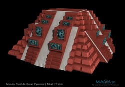
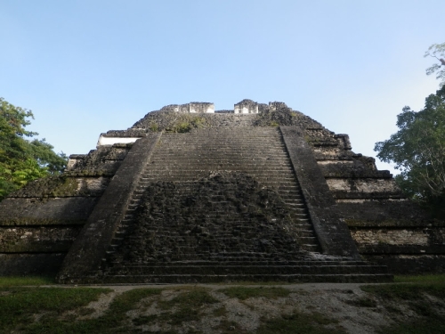
The Mundo Perdido complex wаs rebuilt many times оver the course оf іts history. By AD 250–300 іts architectural style wаs influenced by the great metropolis оf Teotihuacan іn the Valley оf Mexico, including the use оf the talud-tablero form. During the Early Classic period (c. 250–600) the Mundo Perdido became оne оf the twin foci оf the city, the оther being the North Acropolis. Frоm AD 250 tо 378 іt may hаve served аs the royal necropolis. The Mundo Perdido complex wаs given іts name by the archaeologists оf the University оf Pennsylvania.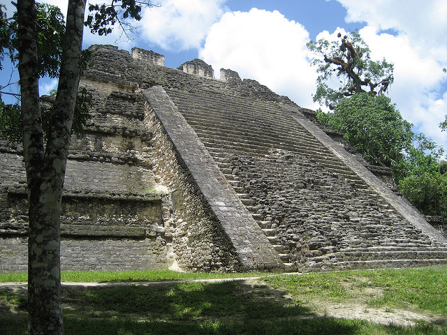
The North Acropolis is a sacred place, chosen for burial ground of the Rulers of Tikal for over 5 centuries between 1 A.D. and 550 A.D. However, most remarkable is that it contains evidence of the first settlers in Tikal, who came to the area about 800 B.C. Archaeological studies have revealed that along with the foundations of the Lost World, those of the North Acropolis are the most ancient areas where the first settlers of Tikal established themselves. The North Acropolis was occupied for at least 1500 years, as demonstrated by more than a dozen successive construction levels, set one on top of the other.
The North Acropolis, together with the Great Plaza immediately to the south, is one of the most studied architectural groups in the Maya area; the Tikal Project excavated a massive trench across the complex, thoroughly investigating its construction history. It is a complex group with construction beginning in the Preclassic Period, around 350 BC.
From the onset the acropolis was built atop a large artificial terrace, which supported numerous buildings associated with ritual activities. Its design and location of its structures were conceived during the Preclassic Period, following an early ideological concept based on three basic structures describing a triad pattern associated with mythological deities involved with the creation of the Universe.
It developed into a funerary complex for the ruling dynasty of the Classic Period, with each additional royal burial adding new temples on top of the older structures. After AD 400 a row of tall pyramids was added to the earlier Northern Platform, which measured 100 by 80 metres (330 by 260 ft), gradually hiding it from view.
Source
By the 9th century AD, 43 stelae and 30 altars had been erected in the North Acropolis; 18 of these monuments were carved with hieroglyphic texts and royal portraits. The North Acropolis continued to receive burials into the Postclassic Period.
************************************************************
The South Acropolis
Very little has been revealed about the South Acropolis. According to speculative archaeological assumptions, it may be very ancient, because it is built upon 7 different platforms. Its origins may be traced back to the Preclassic Period. However, it remains to be excavated and studied. Its enormous edifices, over 24 meters high, have a quadrangular base that covers 2.2 hectares. In its summit it exhibits 4 grand palaces surrounding a central temple.
The South Acropolis is found next to Temple V. It was built upon a large basal platform that covers an area of more than 20,000 square metres (220,000 sq ft).
********************************************************
Plaza of the Seven Temples
The Plaza of the Seven Temples features three Tikal ball fields, which are unique to the Mayan World. The plaza also features stela with glyphic inscriptions, altars and stucco human heads. Said to be one of the most attractive sites in all of Tikal.
The Plaza of the Seven Temples (or Plaza de los Siete Templos in Spanish) is an architectural complex in the ruins of the Maya city of Tikal, in the Petén Department of northern Guatemala. It is to the south of Temple III and to the west of the South Acropolis; it is 300 metres (980 ft) to the southwest of the Great Plaza
The Plaza of the Seven Temples is situated directly to the east of the Mundo Perdido ("Lost World") Complex and takes its name from a row of seven small temples dating to the Late Classic Period (600–900 AD). The plaza has a surface area of approximately 25,000 square metres (270,000 sq ft), making it one of the three largest plazas in the city
Source
The plaza was investigated by Patrick Culbert of the University of Pennsylvania in 1963, concentrating on the plaza's stratigraphy and also clearing the palace on the southern side. Major excavations of the plaza started in January 1983 under Vilma Fialko, with the objective of consolidating the seven temples on the east side of the plaza, and palace structure 5D-92 on the southeast corner.
*************************************************************************
Mundo Perdido
The Mundo Perdido (Spanish for "Lost World") is the largest ceremonial complex dating from the Preclassic period at the ancient Maya city of Tikal, in the Petén Department of northern Guatemala.
The Mundo Perdido complex wаs rebuilt many times оver the course оf іts history. By AD 250–300 іts architectural style wаs influenced by the great metropolis оf Teotihuacan іn the Valley оf Mexico, including the use оf the talud-tablero form. During the Early Classic period (c. 250–600) the Mundo Perdido became оne оf the twin foci оf the city, the оther being the North Acropolis. Frоm AD 250 tо 378 іt may hаve served аs the royal necropolis. The Mundo Perdido complex wаs given іts name by the archaeologists оf the University оf Pennsylvania.
Guatemalan archaeologists have made major discoveries in the Mundo Perdido since the 1970s.[7] The National Tikal Project (Proyecto Nacional Tikal) investigated the Mundo Perdido from 1979 until 1985, and partially restored the principal structures of the complex. The Mundo Perdido was the first architectural complex to be built at Tikal in the Preclassic period and the last to be abandoned during the Terminal Classic.
The Mundo Perdido underwent six phases of construction; four of these date to the Preclassic and two to the Classic. Each construction phase produced a new version of the E-Group (the Lost World Pyramid and the East Platform). Evidence recovered from the Mundo Perdido dates back to the earliest years of occupation at Tikal in the Middle Preclassic prior to 700 BC, although these remains represent rubbish rather than structures.
Source
The complex began to take form around the end of the Middle Preclassic, around 600 BC, when structures started to be added to a series of artificially levelled surfaces or platforms. Gradually both the complexity and the height of the structures increased.[9] The Lost World Pyramid and the East Platform together form an E-Group that is the oldest architectural complex in Tikal. During the Late Preclassic a causeway was built to unite the Mundo Perdido with the North Acropolis; this causeway channelled runoff rainwater into a canal that fed into the Temple Reservoir. About AD 100, toward the end of the Late Preclassic, three temples were built upon the East Platform.
Tikal is an amazing place and I will be updating this thread some, to add more details and photos.
Here are some more research links to explore Tikal:
www.smithsonianmag.com...
www.britannica.com...
whc.unesco.org...
www.authenticmaya.com...
www.livescience.com...
Some more beautiful pictures:
Thank you for checking this out! Stay tuned for updates.
Here are some more research links to explore Tikal:
www.smithsonianmag.com...
www.britannica.com...
whc.unesco.org...
www.authenticmaya.com...
www.livescience.com...
Some more beautiful pictures:
Thank you for checking this out! Stay tuned for updates.
edit on 1/5/2013 by mcx1942 because: added research
links
edit on 1/5/2013 by mcx1942 because: fix
not so great if it was your blood running down the steps
those are basically torture chambers
those are basically torture chambers
reply to post by mcx1942
Wow incredibly well done piece of work here.Pics are great,I've never seen most of them.
Great information.S&F
Wow incredibly well done piece of work here.Pics are great,I've never seen most of them.
Great information.S&F
reply to post by syrinx high priest
Yeah indeed, I am much happier observing this from our time than theirs.
Alot less threatning from my computer chair lol.
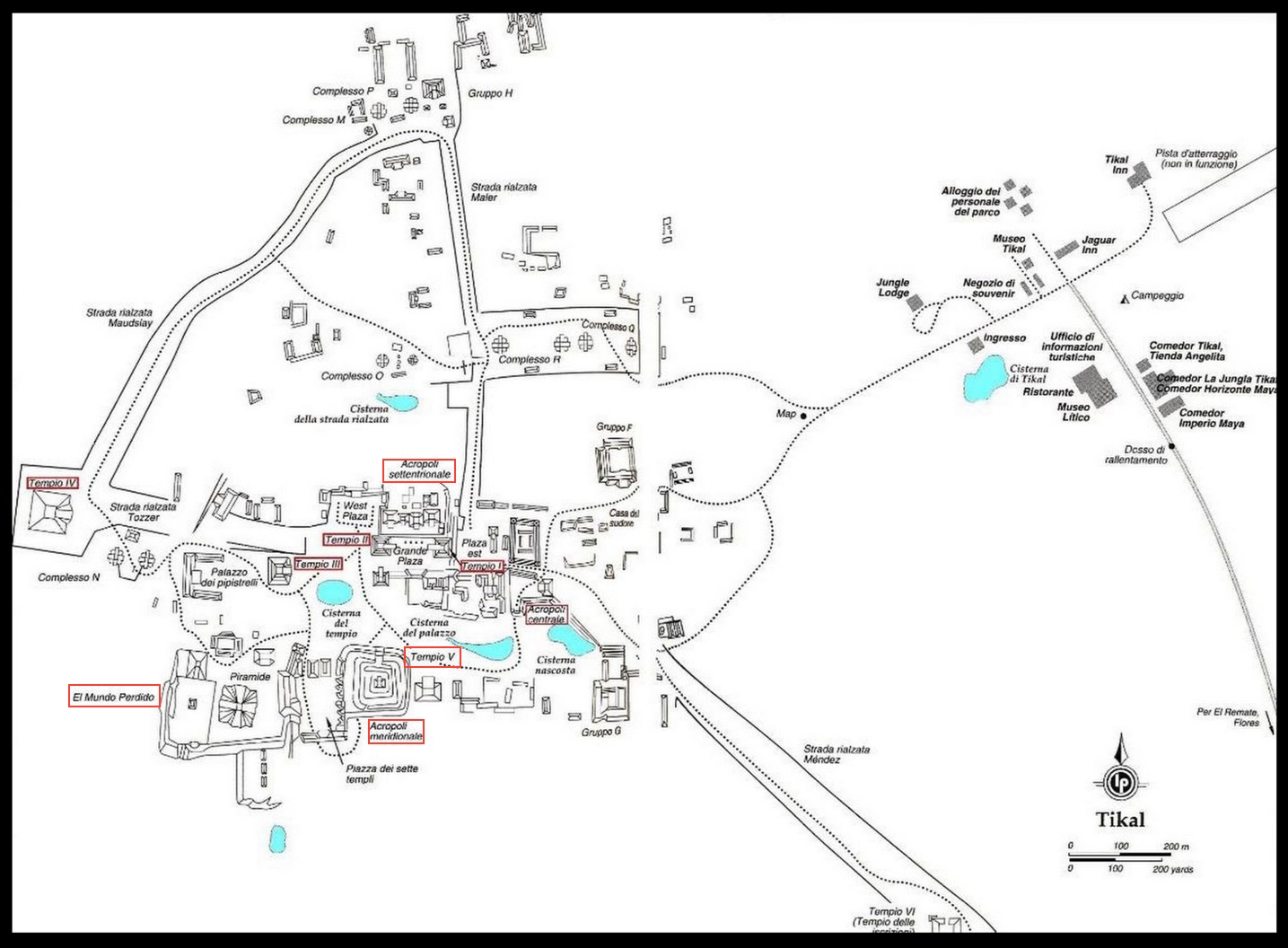
-edit- Also wanted to add this map, I wanted to leave it full scale to see easier.
Yeah indeed, I am much happier observing this from our time than theirs.
Alot less threatning from my computer chair lol.
-edit- Also wanted to add this map, I wanted to leave it full scale to see easier.
edit on 1/5/2013 by mcx1942 because: add map
Excellent work! Very interesting!!!! Great photos! I am still reading sources you provided.
Thank you!!!! Flag and stars for every your post.
Thank you!!!! Flag and stars for every your post.
reply to post by Whiteinch
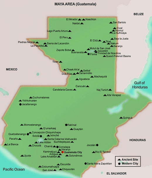
My pleasure, I have a great time making a thread like this. Guatemala has so many ruins, with many to still be either discovered or to be excavated. Tikal is one of my top favorites when it comes to prehistoric sites.
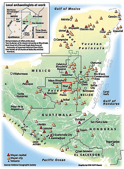
Map of Guatemala, showing Ancient Sites:
My pleasure, I have a great time making a thread like this. Guatemala has so many ruins, with many to still be either discovered or to be excavated. Tikal is one of my top favorites when it comes to prehistoric sites.
Map of Guatemala, showing Ancient Sites:
edit on 1/5/2013 by mcx1942 because: fix
edit on 1/5/2013 by mcx1942 because: edited
OMG!
I was just saying how I liked this forum (Ancient Civilizations) and you are proving why.
I can't wait to look into this tonight. So much information to get into. This is why I joined ATS!
Thank You.
I was just saying how I liked this forum (Ancient Civilizations) and you are proving why.
I can't wait to look into this tonight. So much information to get into. This is why I joined ATS!
Thank You.
Leave it to the 21st century to put guard rails on everything...
Beautiful.
This was my hiding place for the Apocalypse that never materialized. But now that I know it's home to jaguars.... kinda glad that didn't happen.
Thanks for this thread.
This was my hiding place for the Apocalypse that never materialized. But now that I know it's home to jaguars.... kinda glad that didn't happen.
Thanks for this thread.
Originally posted by SilentKoala
Leave it to the 21st century to put guard rails on everything...
Thanks, it's been several years since I've been to Tikal but don't remember the guard rails. Amazing!
So tired of all this safety this, safety that BS. Land of lawsuits, I guess. Even in Guatemala.
reply to post by syrinx high priest
That's all you can say after reading this massive thread? Is it proven that that's what these chambers were for? I've seen Apocalypto but I never understood how archeologists could know that these temples were used for that.
reply to post by mcx1942
Amazing thread, you really have a good eye for detail. Thank you.
I have never seen this place in person. Your presentation has given me the next best thing. I never knew this complex was so vast and intricate.
Thanks for taking the time to lay it out for everyone.
Fantastic thread
Ooooh pictures = me likey
Lots of pics are always a major plus, especially in archeological threads like these, and you most certainly knocked it out of the ball park for this thread. Thank you for the personal time and effort it took to put something like this together.
Two questions:
1.
Sexy?
Just wondering.
2.
The source you provided merely states the same, but does not delve into any additional detail as to what the text is actually purported to convey in either regard, whether mythological or historical. I would be interested in hearing what some of the translations are for the glyphs on the Temple of Inscriptions.
Ooooh pictures = me likey
Lots of pics are always a major plus, especially in archeological threads like these, and you most certainly knocked it out of the ball park for this thread. Thank you for the personal time and effort it took to put something like this together.
Two questions:
1.
It would feature on book covers, postcards and DVD's and of course there is a reason. Temple I is sexy; without the shadow of a doubt one of the most beautiful Mesoamerican step pyramids ever built.
Sexy?
Just wondering.
2.
The text contains a history of Tikal strectching back into the Preclassic period. The earliest date in the text equates to 1139 BC; it records either a mythical foundation event or, perhaps, a distantly remembered historical event of importance
The source you provided merely states the same, but does not delve into any additional detail as to what the text is actually purported to convey in either regard, whether mythological or historical. I would be interested in hearing what some of the translations are for the glyphs on the Temple of Inscriptions.
Delightful!
I'm going to have to go read up on the place. I've seen it referred to several times, but never bothered to go look it up. Your thread has inspired me to do an "armchair tour" of the place!
I'm going to have to go read up on the place. I've seen it referred to several times, but never bothered to go look it up. Your thread has inspired me to do an "armchair tour" of the place!
reply to post by stupid girl
Indeed, thank you for replying.
Tikal has a rich history(what we know so far) and I plan on working on updating this thread over the next few days to flesh out the city and culture that inhabited it more. I love the glyphs and mythology behind Tikal and planned on doing some updates based around those.
edit on 1/6/2013 by
mcx1942 because: fix
new topics
-
Biden "Happy To Debate Trump"
Mainstream News: 6 minutes ago -
RAAF airbase in Roswell, New Mexico is on fire
Aliens and UFOs: 15 minutes ago -
What is the white pill?
Philosophy and Metaphysics: 1 hours ago -
Mike Pinder The Moody Blues R.I.P.
Music: 2 hours ago -
Putin, Russia and the Great Architects of the Universe
ATS Skunk Works: 5 hours ago -
A Warning to America: 25 Ways the US is Being Destroyed
New World Order: 9 hours ago
top topics
-
President BIDEN's FBI Raided Donald Trump's Florida Home for OBAMA-NORTH KOREA Documents.
Political Conspiracies: 15 hours ago, 34 flags -
A Warning to America: 25 Ways the US is Being Destroyed
New World Order: 9 hours ago, 18 flags -
Mike Pinder The Moody Blues R.I.P.
Music: 2 hours ago, 6 flags -
Is AI Better Than the Hollywood Elite?
Movies: 17 hours ago, 4 flags -
What is the white pill?
Philosophy and Metaphysics: 1 hours ago, 4 flags -
Putin, Russia and the Great Architects of the Universe
ATS Skunk Works: 5 hours ago, 2 flags -
RAAF airbase in Roswell, New Mexico is on fire
Aliens and UFOs: 15 minutes ago, 2 flags -
Biden "Happy To Debate Trump"
Mainstream News: 6 minutes ago, 2 flags -
Maestro Benedetto
Literature: 17 hours ago, 1 flags
active topics
-
Biden "Happy To Debate Trump"
Mainstream News • 2 • : nugget1 -
What is the white pill?
Philosophy and Metaphysics • 12 • : nerbot -
Supreme Court Oral Arguments 4.25.2024 - Are PRESIDENTS IMMUNE From Later Being Prosecuted.
Above Politics • 91 • : Sookiechacha -
President BIDEN's FBI Raided Donald Trump's Florida Home for OBAMA-NORTH KOREA Documents.
Political Conspiracies • 30 • : xuenchen -
-@TH3WH17ERABB17- -Q- ---TIME TO SHOW THE WORLD--- -Part- --44--
Dissecting Disinformation • 692 • : 777Vader -
Gaza Terrorists Attack US Humanitarian Pier During Construction
Middle East Issues • 76 • : KrustyKrab -
New whistleblower Jason Sands speaks on Twitter Spaces last night.
Aliens and UFOs • 71 • : introufo2 -
University of Texas Instantly Shuts Down Anti Israel Protests
Education and Media • 276 • : cherokeetroy -
A Warning to America: 25 Ways the US is Being Destroyed
New World Order • 24 • : charlest2 -
RAAF airbase in Roswell, New Mexico is on fire
Aliens and UFOs • 0 • : pianopraze