It looks like you're using an Ad Blocker.
Please white-list or disable AboveTopSecret.com in your ad-blocking tool.
Thank you.
Some features of ATS will be disabled while you continue to use an ad-blocker.

Quake Watch 2012
page: 261share:
reply to post by pheonix358
Not getting at your comment, but these things are always a matter of perception and frequently our perceptions are incorrect. You are not alone in this - I do it myself.
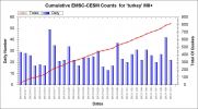
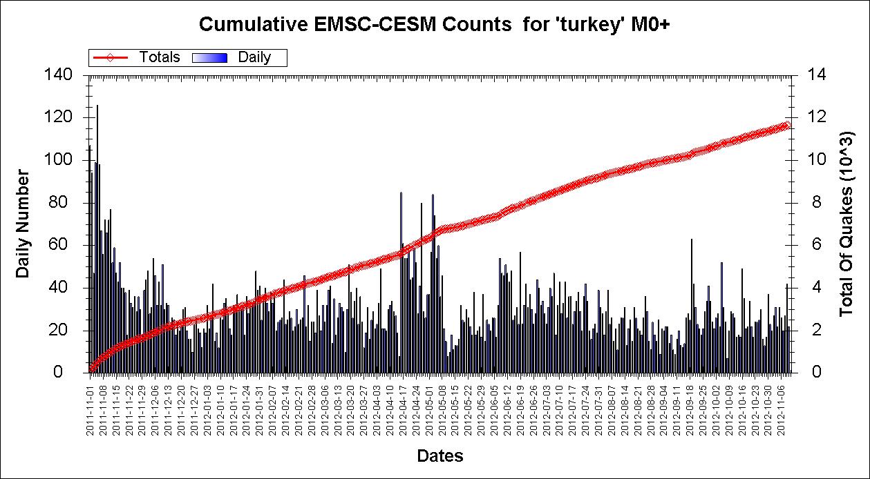
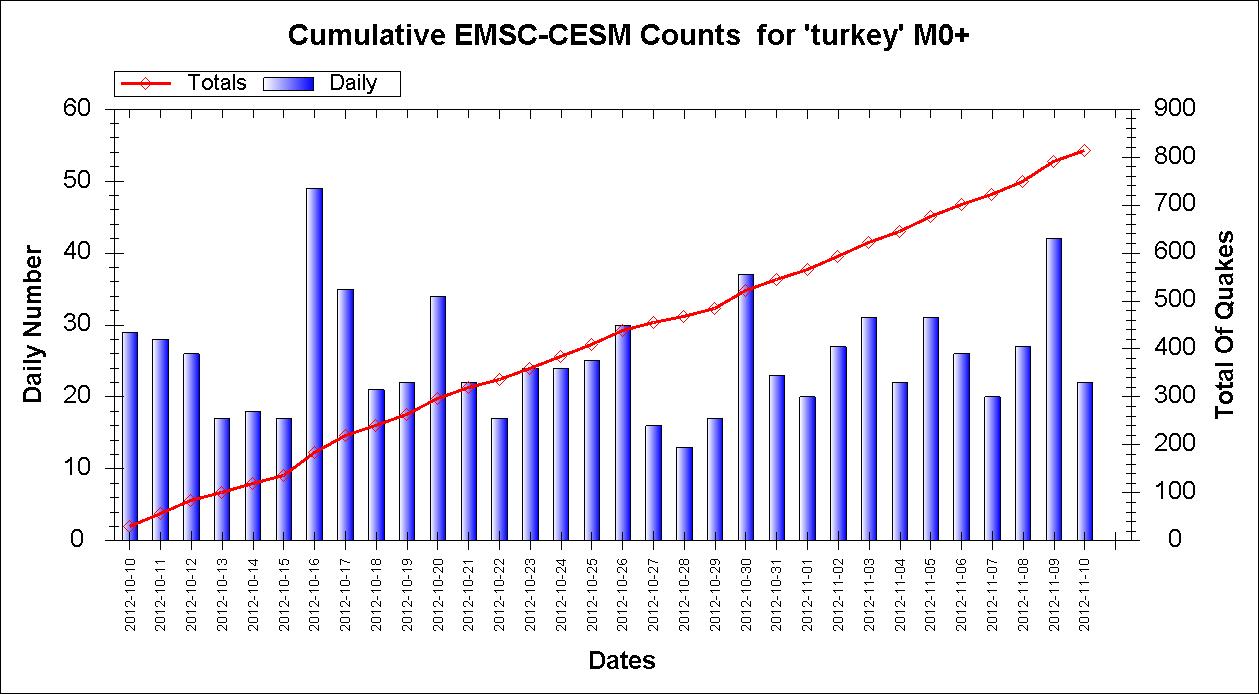
One year ago Turkey was MUCH busier
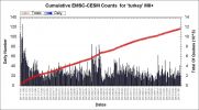
And over the past month? Well pretty steady in terms of numbers anyway.
Not getting at your comment, but these things are always a matter of perception and frequently our perceptions are incorrect. You are not alone in this - I do it myself.
One year ago Turkey was MUCH busier
And over the past month? Well pretty steady in terms of numbers anyway.
reply to post by FreebirdGirl
There was a mag 3.5 in 2011 (30.080, -88.001).....found it
That is about 7.5km from the one to which you are referring. At 230 or so kilometres from the quake to the Deepwater area I think it is unlikely that this quake has any connection at all to that. If something was cracking up in the Deepwater area then we would be seeing quakes around, and spreading out from, that site but we are not seeing that.
It is also around 297 kilometres from the earthquake to the sink hole so again I think it very unlikely that there is a connection between the two.
I still of course maintain that the whole of the main US 'basin' is connected via shale deposits, but I believe that the earthquake in the bay is isolated. It may even be worth seeing if there is an off-shore rig close by.
There was a mag 3.5 in 2011 (30.080, -88.001).....found it
Prov,Date/Time UTC,Latitude,Longitude,Magnitude,Depth(Km),Location
usgs,2011-02-18 23:15:34, 30.180, -87.847, 3.5, 5.0, Western Florida
That is about 7.5km from the one to which you are referring. At 230 or so kilometres from the quake to the Deepwater area I think it is unlikely that this quake has any connection at all to that. If something was cracking up in the Deepwater area then we would be seeing quakes around, and spreading out from, that site but we are not seeing that.
It is also around 297 kilometres from the earthquake to the sink hole so again I think it very unlikely that there is a connection between the two.
I still of course maintain that the whole of the main US 'basin' is connected via shale deposits, but I believe that the earthquake in the bay is isolated. It may even be worth seeing if there is an off-shore rig close by.
edit on 10/11/2012 by PuterMan because: Amended a sentence because the grammar was bad and the resident grammar nazi 'suggested' it should be
changed.
Who was Juan de Fuca?
Read more at: Just who was Juan de Fuca
When one sees the name ‘Juan de Fuca’, one might assume that he was a Spanish explorer of some kind in the area. Well, one out of three ain’t bad. Much as Cristóbal Colón was the Spanish translation of the Italian name Cristoforo Colombo (the man known in English as Christopher Columbus), ‘Juan de Fuca’ was the Spanish translation of the Greek name Ioánnis Fokás (Phokás) (although nobody in English called him ‘John Fouke’). Fokás came from the largest of Greece’s Ionian Islands , Kefelonia, born there in 1536. Fokás’ name is often given as Apóstolos Valeriános by many, if not most, sources, but this appears to be mostly a nickname based upon his origins in the Kefelonian village of Valeriános (as for Apóstolos, it may be a baptismal name). How Fokás came to be in the service of Spain is unknown, but his island background would likely have served to introduce him to seafaring at an early age, and Spain had commercial trading relations with the Ionian Islands which resulted in many Ionians joining Spanish ships. It is believed Fokás was in the Spanish fleet before his 20th birthday.
Read more at: Just who was Juan de Fuca
NO link just passing on some breaking reports of a 4.3 in eastern Kentucky..
Seen on FNC...
thread on this event found here:
www.abovetopsecret.com...
Seen on FNC...
thread on this event found here:
www.abovetopsecret.com...
edit on Sat, 10 Nov 2012 11:43:23 -0600 by JacKatMtn because: add link to relevant thread..
The Centennial List has 100 years of archived earthquakes.
ha!
how about 1007 years worth?
the map below contains all 691 Mag 5+ quakes recorded in the CPTI11, the 2011 version of the Parametric Catalogue of Italian Earthquakes. Milano, Bologna from 1005AD to 2005AD and the ISIDe – Italian Seismological Instrumental and Parametric Data-Base 2006-2012, both hosted by INGV.
Italy 1005AD to 2012AD interactive map
contains quite a few quakes in Austria, Switzerland, Croatia and Slovenia as well
thats just part of the 1005-2006 CPTI11 cataloq, it has quakes down to 3.5 Mw (which I find strange that they go that low in Mw) a total of 2985 events.
I put that map next to Utsu's Italy map to see what he missed, quite a few actually, mostly Mag 6's, and some of his locations differ a bit. I'd take the CPTI11 as the definitive catalog, as it was published after Utsu did most of his research work, his web page hosted by IISEE hasn't really kept up to its promise to keep it updated.
eqarchives.italy
edit on 10-11-2012 by muzzy because: (no reason given)
oblique-normal faulting
earthquake.usgs.gov/earthquakes/eqarchives/fm/neic_c000dqhx_rmt.php
earthquake.usgs.gov/earthquakes/eqarchives/fm/neic_c000dqhx_rmt.php
USGS/SLU Regional Moment Solution
EASTERN KENTUCKY
12/11/10 17:08:13.01
Epicenter: 37.110 -82.969
MW 4.2
USGS/SLU REGIONAL MOMENT TENSOR
Depth 16 No. of sta:105
Moment Tensor; Scale 10**15 Nm
Mrr=-0.67 Mtt= 1.89
Mpp=-1.22 Mrt=-0.85
Mrp= 0.87 Mtp= 1.44
Principal axes:
T Val= 2.53 Plg= 9 Azm=161
N -0.04 56 265
P -2.49 32 65
Best Double Couple:Mo=2.5*10**15
NP1:Strike=109 Dip=75 Slip= -30
NP2: 208 61 -162
reply to post by JacKatMtn
Strange, I came on to say here is a petroleum map of Kentucky showing all the wells.
Peppered with them so it is.
Strange, I came on to say here is a petroleum map of Kentucky showing all the wells.
Peppered with them so it is.
Originally posted by PuterMan
reply to post by JacKatMtn
Strange, I came on to say here is a petroleum map of Kentucky showing all the wells.
Peppered with them so it is.
SON OF A BISCUIT EATER!!!!!
How is there any foundation left to hold up buildings in KY?! That's terrible!!!!!
ha! is that the best you can do muzzy
how about 2229 years of data !
Italy 217BC to 2012AD 5+ interactive map
same map on the eqarchives.italy page
how about 2229 years of data !
Italy 217BC to 2012AD 5+ interactive map
same map on the eqarchives.italy page
6.9 Mynamar
EMSC
On land. Not heavily populated but there could be casualties
[Map]
More in a moment
Location in Google Maps
Derived from Event Data Source: USGS
Powered by QVSData
Magnitude M 6.9
Region MYANMAR
Date time 2012-11-11 01:12:37.0 UTC
Location 23.21 N ; 96.01 E
Depth 10 km
Distances 137 km NW Mandalay (pop 1,208,099 ; local time 07:42:37.0 2012-11-11)
60 km NW Mogok (pop 90,843 ; local time 07:42:37.0 2012-11-11)
EMSC
On land. Not heavily populated but there could be casualties
[Map]
More in a moment
Magnitude 7.0 - Myanmar
Location in Google Maps
- Date-Time: Sunday, November 11, 2012 @ 01:12:46 UTC
- Earthquake location: 22.530°N, 95.964°E,
- Earthquake depth: 33.7 km
- Distances:
27km (16mi) E of Shwebo, Myanmar
62km (38mi) NNW of Mandalay, Myanmar
69km (42mi) SW of Mogok, Myanmar
72km (44mi) N of Sagaing, Myanmar
308km (191mi) N of Nay Pyi Taw, Myanmar
- Event ID: pt12316000
Derived from Event Data Source: USGS
Powered by QVSData
edit on 10/11/2012 by PuterMan because: (no reason given)
reply to post by PuterMan
Here is some info from Earthquake Report...
Who is next?
earthquake-report.com...
And USGS coming in with a 7.0
earthquake.usgs.gov...
Here is some info from Earthquake Report...
Very dangerous earthquake in Myanmar A very dangerous earthquake just occurred in Myanmar. The preliminary Magnitude is M6.7 ! at a depth of 30 km. If these parameters are confirmed, we have to call this earthquake extremely dangerous.
Who is next?
earthquake-report.com...
And USGS coming in with a 7.0
MAG UTC DATE-TIME y/m/d h:m:s LAT deg LON deg DEPTH km Region MAP 7.0 2012/11/11 01:12:46 22.530 95.964 33.7 MYANMAR
earthquake.usgs.gov...
reply to post by MamaJ
EMSC just dropped it to 6.0mb???????????????????????????????????? WTH is that all about?
I guess it will go up again.It did. Now at 6.6 Mw like the Masters
No point in showing the nearest seismo the trace looks very small but it is 1 millions counts which is the most I have ever seem on a siesmo.
Oh here it is anyway MHIT.TM..BHZ.2012.316 not very impressive until you take the scaling into account.
Location in Google Maps
Derived from Event Data Source: USGS
Powered by QVSData
This is the US network version.


Not good the top ones.
EMSC just dropped it to 6.0mb???????????????????????????????????? WTH is that all about?
I guess it will go up again.It did. Now at 6.6 Mw like the Masters
No point in showing the nearest seismo the trace looks very small but it is 1 millions counts which is the most I have ever seem on a siesmo.
Oh here it is anyway MHIT.TM..BHZ.2012.316 not very impressive until you take the scaling into account.
Prov,Date/Time UTC,Latitude,Longitude,Magnitude,Depth(Km),Location
usgs,2012-11-11 01:12:38, 23.029, 95.926, 6.6, 10.0, Myanmar
emsc,2012-11-11 01:12:38, 22.945, 95.952, 5.9, 2.0, Myanmar
usgs,2012-11-11 01:12:46, 22.530, 95.964, 7.0, 33.7, Myanmar (Pacific tsunami centre. This will be deleted)
Magnitude 6.6 - Myanmar
Location in Google Maps
- Date-Time: Sunday, November 11, 2012 @ 01:12:38 UTC
- Earthquake location: 23.029°N, 95.927°E,
- Earthquake depth: 10.0 km
- Distances:
56km (34mi) NNE of Shwebo, Myanmar
60km (37mi) WNW of Mogok, Myanmar
117km (72mi) N of Mandalay, Myanmar
123km (76mi) NNW of Maymyo, Myanmar
364km (226mi) N of Nay Pyi Taw, Myanmar
- Event ID: usc000dqqw
Derived from Event Data Source: USGS
Powered by QVSData
This is the US network version.
MMI City Name Population
VI Shwebo 88k
V Mogok 90k
IV Mandalay 1,208k
IV Maymyo 117k
IV Sagaing 78k
IV Monywa 182k
IV Kyaukse 50k
IV Myingyan 141k
IV Bhamo 47k
IV Pakokku 126k
IV Mawlaik 44k
IV Meiktila 177k
IV Lashio 131k
IV Wangjing 7k
IV Thoubal 44k
IV Chauk 90k
IV Moirang 17k
IV Mayang Imphal 22k
IV Imphal 223k
IV Yamethin 59k
IV Yenangyaung 110k
IV Myitkyina 90k
IV Falam 5k
IV Kakching 30k
IV Yairipok 8k
IV Churachandpur 47k
IV Taunggyi 160k
IV Lakhipur 12k
IV North Vanlaiphai 3k
IV Khawhai 2k
IV Haka 0
IV Lumding 25k
III Kohima 92k
III Saiha 22k
III Maibong 8k
III Mahur 7k
III Haflong 39k
III Phek 15k
Not good the top ones.
edit on 10/11/2012 by PuterMan because: (no reason given)
edit on 10/11/2012 by PuterMan because: (no reason given)
Maybe a 6.1 aftershock
2012-11-11 10:54:43, 22.670, 95.870, 6.1, 10.0, Myanmar Map
These details have just come in from GFZ Potsdam but no one else has them yet.
Cannot get that link to show. Working now. Interesting - the curly braces were stopping it [Map] but Map works.
Yes - Here is the EMSC version just in
www.emsc-csem.org...
ETA: Now changed to 5.4 mb ?? No sign of USGS yet.
I am finding this very odd. It is now 11:23 UTC but nothing on USGS at all. The RED (Rapid Earthquake Display) has later quakes
Derived from publicly available data provided by USGS
Generated by the QVSData program RED system
Just came in to the RED list as a Mag 5.8
Derived from publicly available data provided by USGS
Generated by the QVSData program RED system
Location in Google Maps
Derived from Event Data Source: USGS
Powered by QVSData
2012-11-11 10:54:43, 22.670, 95.870, 6.1, 10.0, Myanmar Map
These details have just come in from GFZ Potsdam but no one else has them yet.
Cannot get that link to show. Working now. Interesting - the curly braces were stopping it [Map] but Map works.
Yes - Here is the EMSC version just in
www.emsc-csem.org...
ETA: Now changed to 5.4 mb ?? No sign of USGS yet.
I am finding this very odd. It is now 11:23 UTC but nothing on USGS at all. The RED (Rapid Earthquake Display) has later quakes
Magnitude,Date/Time,Location
Mag 0.9 - November 11 11:14:20 6km W of Cobb, California
Mag 1.4 - November 11 11:11:18 7km WSW of Calipatria, California
Mag 1.6 - November 11 11:01:29 19km NW of Covelo, California
Mag 2.3 - November 11 10:41:41 52km WNW of Anchor Point, Alaska
Mag 4.3 - November 11 10:32:15 97km SW of Jiquilillo, Nicaragua
Mag 0.9 - November 11 10:24:58 9km WNW of Cobb, California
Derived from publicly available data provided by USGS
Generated by the QVSData program RED system
Just came in to the RED list as a Mag 5.8
Magnitude,Date/Time,Location
Mag 0.9 - November 11 11:14:20 6km W of Cobb, California
Mag 1.4 - November 11 11:11:18 7km WSW of Calipatria, California
Mag 1.6 - November 11 11:01:29 19km NW of Covelo, California
Mag 5.8 - November 11 10:54:42 29km NE of Shwebo, Myanmar
Mag 2.3 - November 11 10:41:41 52km WNW of Anchor Point, Alaska
Mag 4.3 - November 11 10:32:15 97km SW of Jiquilillo, Nicaragua
Derived from publicly available data provided by USGS
Generated by the QVSData program RED system
Magnitude 5.8 - Myanmar
Location in Google Maps
- Date-Time: Sunday, November 11, 2012 @ 10:54:42 UTC
- Earthquake location: 22.757°N, 95.901°E,
- Earthquake depth: 9.8 km
- Distances:
29km (18mi) NE of Shwebo, Myanmar
63km (39mi) WSW of Mogok, Myanmar
88km (54mi) NNW of Mandalay, Myanmar
97km (60mi) N of Sagaing, Myanmar
334km (207mi) N of Nay Pyi Taw, Myanmar
- Event ID: usc000dqvg
Derived from Event Data Source: USGS
Powered by QVSData
edit on 11/11/2012 by PuterMan because: (no reason given)
reply to post by PuterMan
earthquake-report.com... is now saying dozens feared dead from the Mayanmar Quake....Over a hundred homes have been damaged or destroyed and the I felt it reports were scary!!
PM, do you find it strange Kentucky has not had but three aftershocks or am I missing something. Also, is there a fault line associated with the KY quake or do you suspect drilling as cause?
Originally posted by PuterMan
reply to post by sageturkey
One thing concerns me greatly. You really should not spend so much time driving on the wrong side of the road!
Haha PM you had me there for a second, I thought to myself "Was I on the wrong side of the road?"
Originally posted by Olivine
I have to say, I'm with Puterman; how on earth did you stay on the road?!! Toward the beginning when you were travelling through the burned area and the hairpin curve, I thought, "there must be a passenger filming this". Later on, it was obvious I was wrong!
That reminds me of something that my former spouse told me on time about my ability to multi-task while behind the wheel
I don't text and drive, but I suppose this wasn't much safer Uh-oh, in filming this did I just implicate myself in a case of distracted driving???
PM, I agree that it was much busier last year - I'm sure that just being there had a huge effect on my perception of any increase in activity. I'm so fascinated (terrified?) by the place that I have to admit I had a bit of uneasiness. The little voice in the back of my head was saying "What are you doing here? Run away - Far away! "
reply to post by MamaJ
Drilling or mining. I personally think it is possibly mining related but there are a number of wells there.
See the map on my post here
PM, do you find it strange Kentucky has not had but three aftershocks or am I missing something. Also, is there a fault line associated with the KY quake or do you suspect drilling as cause?
Drilling or mining. I personally think it is possibly mining related but there are a number of wells there.
See the map on my post here
new topics
-
BIDEN Admin Begins Planning For January 2025 Transition to a New President - Today is 4.26.2024.
2024 Elections: 4 hours ago -
Big Storms
Fragile Earth: 5 hours ago -
Where should Trump hold his next rally
2024 Elections: 8 hours ago -
Shocking Number of Voters are Open to Committing Election Fraud
US Political Madness: 9 hours ago -
Gov Kristi Noem Shot and Killed "Less Than Worthless Dog" and a 'Smelly Goat
2024 Elections: 9 hours ago -
Falkville Robot-Man
Aliens and UFOs: 10 hours ago -
James O’Keefe: I have evidence that exposes the CIA, and it’s on camera.
Whistle Blowers and Leaked Documents: 10 hours ago -
Australian PM says the quiet part out loud - "free speech is a threat to democratic dicourse"...?!
New World Order: 11 hours ago
top topics
-
James O’Keefe: I have evidence that exposes the CIA, and it’s on camera.
Whistle Blowers and Leaked Documents: 10 hours ago, 17 flags -
Australian PM says the quiet part out loud - "free speech is a threat to democratic dicourse"...?!
New World Order: 11 hours ago, 15 flags -
Blast from the past: ATS Review Podcast, 2006: With All Three Amigos
Member PODcasts: 14 hours ago, 14 flags -
Biden "Happy To Debate Trump"
2024 Elections: 12 hours ago, 13 flags -
Ireland VS Globalists
Social Issues and Civil Unrest: 12 hours ago, 10 flags -
Mike Pinder The Moody Blues R.I.P.
Music: 15 hours ago, 9 flags -
BIDEN Admin Begins Planning For January 2025 Transition to a New President - Today is 4.26.2024.
2024 Elections: 4 hours ago, 8 flags -
What is the white pill?
Philosophy and Metaphysics: 14 hours ago, 6 flags -
Shocking Number of Voters are Open to Committing Election Fraud
US Political Madness: 9 hours ago, 6 flags -
Big Storms
Fragile Earth: 5 hours ago, 6 flags
active topics
-
Falkville Robot-Man
Aliens and UFOs • 10 • : billxam1 -
Gov Kristi Noem Shot and Killed "Less Than Worthless Dog" and a 'Smelly Goat
2024 Elections • 64 • : cherokeetroy -
What is the white pill?
Philosophy and Metaphysics • 23 • : TheDiscoKing -
BIDEN Admin Begins Planning For January 2025 Transition to a New President - Today is 4.26.2024.
2024 Elections • 21 • : worldstarcountry -
University of Texas Instantly Shuts Down Anti Israel Protests
Education and Media • 317 • : CriticalStinker -
Ditching physical money
History • 23 • : worldstarcountry -
Australian PM says the quiet part out loud - "free speech is a threat to democratic dicourse"...?!
New World Order • 9 • : ScarletDarkness -
-@TH3WH17ERABB17- -Q- ---TIME TO SHOW THE WORLD--- -Part- --44--
Dissecting Disinformation • 704 • : 777Vader -
Mood Music Part VI
Music • 3113 • : MRTrismegistus -
One Flame Throwing Robot Dog for Christmas Please!
Weaponry • 12 • : worldstarcountry