It looks like you're using an Ad Blocker.
Please white-list or disable AboveTopSecret.com in your ad-blocking tool.
Thank you.
Some features of ATS will be disabled while you continue to use an ad-blocker.

Area 51 - Google Earth updated photo
page: 1share:
Hmm let`s refrain that.
"Not so new pictures of Area 51".
Must have had a v. old version of G.E.
"Not so new pictures of Area 51".
Must have had a v. old version of G.E.
Sweet. Oh yeah: you can also check out 51 from google maps, if you didn't already know. They NEVER update their photos though
I have some pics I ripped off of G.E.
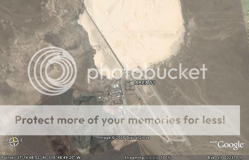
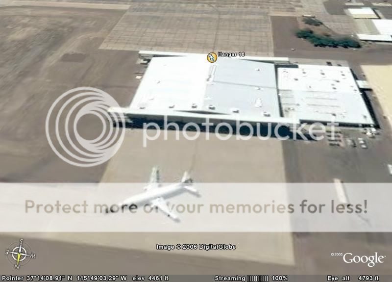
Main Base:
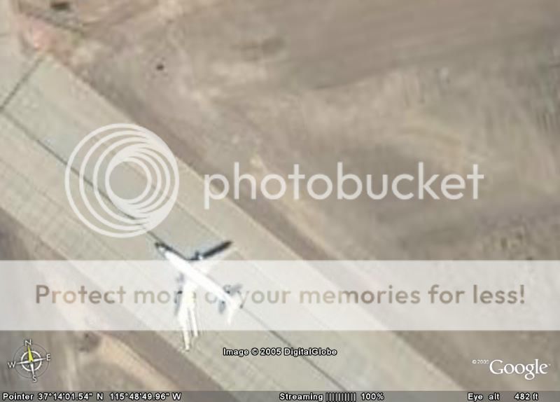
What I assume is a JANET craft:
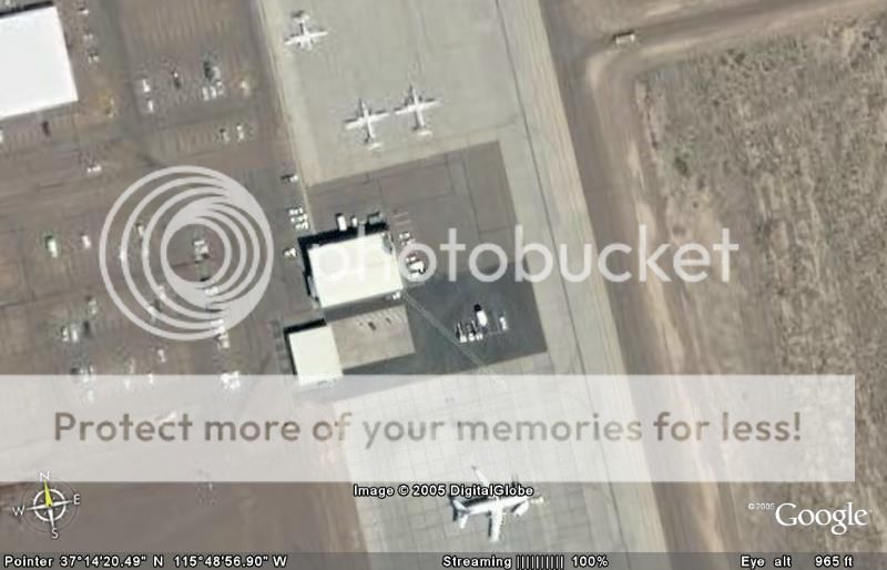
Three more JANETs:
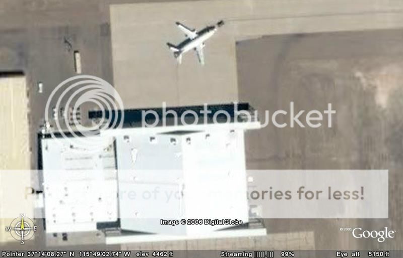
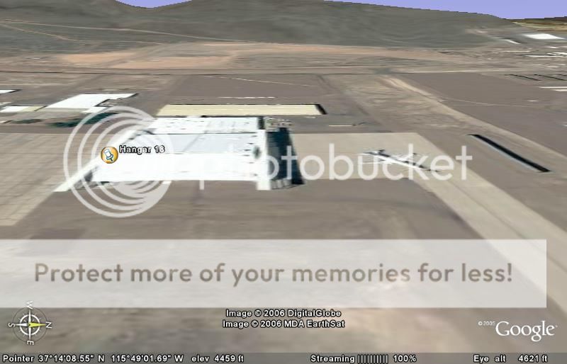
A Project Leaving Hangar 18:
Another angle:
Another Angle:
Another Angle:
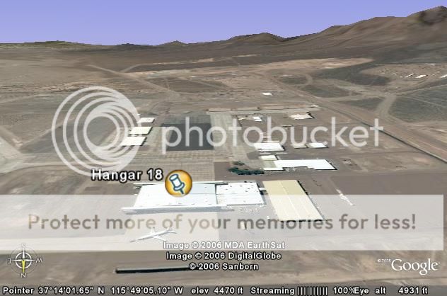
Main Base:
What I assume is a JANET craft:
Three more JANETs:
A Project Leaving Hangar 18:
Another angle:
Another Angle:
Another Angle:
These photos are undated. Many people think the Copyright date is the date of the pictures. It's almost like stock footage...taken from space.
I am currently downloading an updated version of Google Earth, Google Earth-0762. hopefully it will have some updated photos along with updated
programming.
how exactly did you guys get those phots to zoom in like that? I've just downloaded google earth and wherever I zoom in on is completely blurry.
Anything I can do to get photos like you guys?
Anything I can do to get photos like you guys?
you have to wait for it to load, and you must be connected to the internet. once they are loaded you can view them offline.
Originally posted by kurtcobainuk
how exactly did you guys get those phots to zoom in like that? I've just downloaded google earth and wherever I zoom in on is completely blurry.
Anything I can do to get photos like you guys?
On the bottom, you can see the an area that says "streaming" when the photo is fuzzy, the streaming is usually low, like 1-50%. When the image is 100% it should be clear. The program needs to have the internet to stream.
If the photos stream from the net, then why is there a need to download new versions of GE? Wouldn't it just update when you connect to the same
spot after the GE server has new pics?
Very interesting that Google Maps has decided to take special photos of Area 51. You notice that just Area 51 is high res and the rest of the area is
still bad? Any other military type govt facilities now in High Res?
Discovery ran a program on people funding research using satellite images of 51 about a year before the first GE was released. Funding like this
obviously would be for something more detailed than the standard stuff that is pretty much available for most of the globe.
Space Imaging currently has a satellite using half-meter imaging. This means that they can see something on the ground at least 19 inches long. Too
bad Space Imaging does not allow a Google Earth-like program.
[edit on 2/28/2006 by TheRanchMan]
[edit on 2/28/2006 by TheRanchMan]
Wonder what this is supposed to represent?
Kinda looks like the mud monster off of Scooby Doo!
(sorry, I have kids that hog the tv.......)

This is just south of the hangers at 37`12'45.99" N x 115`48'53.69" W
Kinda looks like the mud monster off of Scooby Doo!
(sorry, I have kids that hog the tv.......)
This is just south of the hangers at 37`12'45.99" N x 115`48'53.69" W
On the first one of the topicstarter, do i see the black helicopter that are sighted when a ufo is seen or when someone has to get intimidated not to
tell about a sighting? they sure look like it.
The light spot on the photo in, i think the 1st reply to the topicstarter, suggests something under it.. and i never really got the point of these strange designs the roads are built...
The light spot on the photo in, i think the 1st reply to the topicstarter, suggests something under it.. and i never really got the point of these strange designs the roads are built...
I looked around the area immediately surrounding Area 51 and found a lot of odd stuff. There are a lot of green circles that I'm assuming cover real
circles on the ground (as they cover trees and brush with green splotches due to bad resolution).
I just wonder what's under these green circles. Also, in the photo I've attached, there are four green circles when you view from afar, but when you zoom in they become sand colored and pitch black circles. The area they cover is immense. You can see roads and buildings and/or vehicles near the circles.

The oddest thing of all was the turqouise and white structure (city?) that is northwest of Area 51. I marked it with a circle. Cannot for the life of me figure out what that is. If anyone can shed some light.
I was also looking at the face that a poster indicated (above). That object is drawn onto the ground, and it's immense. It really does look like a face.
Would love to hear from anyone who knows what the hell is going on in Nevada around there. That blue and white structure I pointed out looks like Shambhala...
I just wonder what's under these green circles. Also, in the photo I've attached, there are four green circles when you view from afar, but when you zoom in they become sand colored and pitch black circles. The area they cover is immense. You can see roads and buildings and/or vehicles near the circles.
The oddest thing of all was the turqouise and white structure (city?) that is northwest of Area 51. I marked it with a circle. Cannot for the life of me figure out what that is. If anyone can shed some light.
I was also looking at the face that a poster indicated (above). That object is drawn onto the ground, and it's immense. It really does look like a face.
Would love to hear from anyone who knows what the hell is going on in Nevada around there. That blue and white structure I pointed out looks like Shambhala...
First off, those photos are from like 2001 I believe, some parts from 2004. They're not new at all. Google Earth and Google Maps update themselves,
there's an update about once every six months or so (there's already been a huge one this year). Area 51 is not going to be updated soon, so do not
be expecting anything.
The green and black circles are crops. Look them up, you'll find about a million what are these circles topics. The brown ones are land without crops that will have crops. The big structure is really either a town or a base.
The green and black circles are crops. Look them up, you'll find about a million what are these circles topics. The brown ones are land without crops that will have crops. The big structure is really either a town or a base.
new topics
-
Where should Trump hold his next rally
2024 Elections: 2 hours ago -
Shocking Number of Voters are Open to Committing Election Fraud
US Political Madness: 2 hours ago -
Gov Kristi Noem Shot and Killed "Less Than Worthless Dog" and a 'Smelly Goat
2024 Elections: 3 hours ago -
Falkville Robot-Man
Aliens and UFOs: 3 hours ago -
James O’Keefe: I have evidence that exposes the CIA, and it’s on camera.
Whistle Blowers and Leaked Documents: 4 hours ago -
Australian PM says the quiet part out loud - "free speech is a threat to democratic dicourse"...?!
New World Order: 5 hours ago -
Ireland VS Globalists
Social Issues and Civil Unrest: 5 hours ago -
Biden "Happy To Debate Trump"
2024 Elections: 6 hours ago -
RAAF airbase in Roswell, New Mexico is on fire
Aliens and UFOs: 6 hours ago -
What is the white pill?
Philosophy and Metaphysics: 7 hours ago
top topics
-
A Warning to America: 25 Ways the US is Being Destroyed
New World Order: 16 hours ago, 21 flags -
James O’Keefe: I have evidence that exposes the CIA, and it’s on camera.
Whistle Blowers and Leaked Documents: 4 hours ago, 12 flags -
Blast from the past: ATS Review Podcast, 2006: With All Three Amigos
Member PODcasts: 8 hours ago, 12 flags -
Australian PM says the quiet part out loud - "free speech is a threat to democratic dicourse"...?!
New World Order: 5 hours ago, 10 flags -
Biden "Happy To Debate Trump"
2024 Elections: 6 hours ago, 10 flags -
Mike Pinder The Moody Blues R.I.P.
Music: 8 hours ago, 8 flags -
Ireland VS Globalists
Social Issues and Civil Unrest: 5 hours ago, 5 flags -
RAAF airbase in Roswell, New Mexico is on fire
Aliens and UFOs: 6 hours ago, 5 flags -
What is the white pill?
Philosophy and Metaphysics: 7 hours ago, 5 flags -
Putin, Russia and the Great Architects of the Universe
ATS Skunk Works: 11 hours ago, 4 flags
active topics
-
Where should Trump hold his next rally
2024 Elections • 9 • : visitedbythem -
President BIDEN's FBI Raided Donald Trump's Florida Home for OBAMA-NORTH KOREA Documents.
Political Conspiracies • 35 • : Threadbarer -
Candidate TRUMP Now Has Crazy Judge JUAN MERCHAN After Him - The Stormy Daniels Hush-Money Case.
Political Conspiracies • 813 • : WeMustCare -
University of Texas Instantly Shuts Down Anti Israel Protests
Education and Media • 309 • : cherokeetroy -
Remember These Attacks When President Trump 2.0 Retribution-Justice Commences.
2024 Elections • 58 • : WeMustCare -
2024 Pigeon Forge Rod Run - On the Strip (Video made for you)
Automotive Discussion • 8 • : WhitewaterSquirrel -
Gov Kristi Noem Shot and Killed "Less Than Worthless Dog" and a 'Smelly Goat
2024 Elections • 28 • : cherokeetroy -
Shocking Number of Voters are Open to Committing Election Fraud
US Political Madness • 5 • : AwakeNotWoke -
The Acronym Game .. Pt.3
General Chit Chat • 7756 • : bally001 -
RAAF airbase in Roswell, New Mexico is on fire
Aliens and UFOs • 8 • : Skinnerbot