It looks like you're using an Ad Blocker.
Please white-list or disable AboveTopSecret.com in your ad-blocking tool.
Thank you.
Some features of ATS will be disabled while you continue to use an ad-blocker.

Papoose Lake (S-4) Area
page: 2share:
First of all, on the subject of Bob Lazar, it has been proven time and time again that he is a complete liar. He fabricated academic qualifications to
boost his status and make his little story about S-4 all the more plausible. He claimed to have attended MIT, but there is no record of him being
there, he says this was because the government wiped his records but did the government also creep into the room of every former student and change
their yearbooks as well? Because guess what, he doesnt appear in them either!
Ok, what you have found SkepticGreek is NOT evidence, its anecdotes. You are basing your beliefs on the story of one man, who has been proven to be a liar.
Evidence is the stuff that ShadowHawk and others use. The Groom Lake Standard Operating Procedures, the Cammo Dude Handbook, other declassified documents and more. Another form of evidence is Satellite images. They tend not to be of very high res around the Papoose Lake area yet I think they are of high enough resolution that you would be able to see the "good dirt road" that Lazar describes. In other sources he also described a concrete area surrounded by a wire fence. There is no sign that any of these things exist.
I'm totally open to listening to anyone talk about S-4 if they have new information or evidence that hasnt been noticed before, but the fact is all the people on this board believe it exists because of the fabrications of one man, ten years ago. Don't you find it odd that nothing more has come to light since then?
Originally posted by SkepticGreek74
It isn't even necessary to go look for these places. A quick yahoo search on S4(on the first page too!) and I already found enough evidence(not proof) to contradict your theories!
Ok, what you have found SkepticGreek is NOT evidence, its anecdotes. You are basing your beliefs on the story of one man, who has been proven to be a liar.
Evidence is the stuff that ShadowHawk and others use. The Groom Lake Standard Operating Procedures, the Cammo Dude Handbook, other declassified documents and more. Another form of evidence is Satellite images. They tend not to be of very high res around the Papoose Lake area yet I think they are of high enough resolution that you would be able to see the "good dirt road" that Lazar describes. In other sources he also described a concrete area surrounded by a wire fence. There is no sign that any of these things exist.
I'm totally open to listening to anyone talk about S-4 if they have new information or evidence that hasnt been noticed before, but the fact is all the people on this board believe it exists because of the fabrications of one man, ten years ago. Don't you find it odd that nothing more has come to light since then?
Originally posted by SkepticGreek74
I already found enough evidence(not proof) to contradict your theories!
Here is some interesting excerpts I found on one site alone:
Lazar described the facility to Timothy Good as being built into the base of the Papoose Range, with 9 hangar doors sloped at about a 60 degree angle. He said the doors had a sand-like texture coating to them, and Gene Huff later said the doors were rollup type doors. There were 9 of the hangar bays in all.
Per Lazar, the disc he described as the "Sport Model" had an approximate diameter of 52'. Allowing for adequate work clearance, it's reasonable to assume a hangar bay would be at least 70' wide. So for 9 bays, the overall length of the facility would have to be at least 630', maybe more.
On the "Billy Goodman Happening" radio show, Lazar described the dirt road the bus took to S-4 as a "good dirt road." When a caller asked him if the facility was underground, he replied, "No, it's not underground; it's just butt up against the side of a little mountain, a little hill kind of, but it's kind of inside the mountain."
Just by reading these 3 exerpts from www.darkgovernment.com... you can see why spotting these buildings would be such a daunting task!
SkepticGreek74,
Look over all your excerpts here again! Read them carefully and you will see that you have just proven what I said in my origional post: All of Your Evidence is Based SOLELY on the words of One Person: Bob Lazar
The Problem with S-4 is that if you take Lazar out of the story, you have no story! It's like a court case with only 1 Witness and No Other Evidence! I Applaud your effort to do your own research, however, in the future beware of a story that is based on only one source of information, especially a person who has been discredited for years!
Tim
whats the point looking for enterences from these satallite pictures isnt it obvious that if such a location existed (s4) the government would do
everything in its power to keep that location concealed and would not allow satallite imagery to show any signs of the base if it exists??
Originally posted by g60kg
whats the point looking for enterences from these satallite pictures isnt it obvious that if such a location existed (s4) the government would do everything in its power to keep that location concealed and would not allow satallite imagery to show any signs of the base if it exists??
Why would they? They never took any steps to disguise the base at Groom Lake from satellites even thought they denied that it existed for decades. The government tracks all satellites so they know when one is flying overhead and hide all secret projects in hangars.
Originally posted by gfad
Why would they? They never took any steps to disguise the base at Groom Lake from satellites even thought they denied that it existed for decades. The government tracks all satellites so they know when one is flying overhead and hide all secret projects in hangars.
Maybe they learnt from their mistakes with groom lake and figured out that a better way to avoid detection is firstly by having hangers built into the rock and camoed and secondly never allowing any satallite imagery to be released unless it has been checked and perhaps edited now this is just a theory but I think it is beleivable especially since most of us are willing to beleive in underground bases etc etc without having much or any proof of them existing
Firstly, alot of people on these boards DON'T believe in underground bases, including me. Personally I don't see the point and I'm yet to see any
viable evidence of them.
Secondly how could the government "check and perhaps edit" every satellite image when alot of them are taken by either private companys or Russian sats?
Finally I'd like to know what "mistakes" they made at Groom Lake. As far as we know a black project has NEVER been observed and identified at Groom Lake. What does this tell us? It tells us that although Area 51 may have been in the news alot and has entered the public conciousness, its still probably the most secure place on the planet for testing secret aircraft and doesn't need replacing with S-4.
Originally posted by gfad
Firstly, alot of people on these boards DON'T believe in underground bases, including me. Personally I don't see the point and I'm yet to see any viable evidence of them.
Secondly how could the government "check and perhaps edit" every satellite image when alot of them are taken by either private companys or Russian sats?
Finally I'd like to know what "mistakes" they made at Groom Lake. As far as we know a black project has NEVER been observed and identified at Groom Lake. What does this tell us? It tells us that although Area 51 may have been in the news alot and has entered the public conciousness, its still probably the most secure place on the planet for testing secret aircraft and doesn't need replacing with S-4.
Whether a sat image is taken by a private company or russian intelligence I beleive the US government has the power and influence to make sure whatever they dont want us to see does not get seen
The mistakes that I was referring to was not whether or not any X projects had been compromised but maybe they thought its silly trying to deny the existance of a base when the base is clearly visable for all to see. Maybe they thought if they actually visably hide the base no one would come with their telescopic lenses trying to take a peek
If S4 exists I dont beleive its to replace groom lake maybe the work carried out at s4 is to sinister that is why it is hidden the way it is (if it exists ofcourse)
Originally posted by g60kg
Whether a sat image is taken by a private company or russian intelligence I beleive the US government has the power and influence to make sure whatever they dont want us to see does not get seen
Ok now lets be realistic!! How is the US Gov going to get to edit a satellite photo taken by Russian intel?
Originally posted by g60kg
The mistakes that I was referring to was not whether or not any X projects had been compromised but maybe they thought its silly trying to deny the existance of a base when the base is clearly visable for all to see. Maybe they thought if they actually visably hide the base no one would come with their telescopic lenses trying to take a peek
Oh sorry I was under the impression that the reason Groom Lake was so remote was to hide the black projects
Area 51 isn't there just to be denied, it has a purpose and is a fully functioning military base. Obviously what is important is not its deniability, but its ability to protect the secrets within.
Originally posted by gfad
Why would they? They never took any steps to disguise the base at Groom Lake from satellites even thought they denied that it existed for decades. The government tracks all satellites so they know when one is flying overhead and hide all secret projects in hangars.
gfad,
Groom Lake dates back to around the late 40's/earily 50's! Back when the CIA first built the base out at Groom Lake, there were no spy satellites yet. Think about it, why did the CIA rely on spy planes for photo intelligence?
The answer is because there was nothing else! The Russian didn't launch Sputinick until 1957. You have to consider the time when it was built. The base also expanded rapidly. By the time the first spy sattelite reached orbit, the base was too big to hide from sattelites.
Tim
The base at Groom Lake was founded in 1955, not the late 40s.
The first declassified american spy satellite was launched in 1959 and the first declassified russian spy satellite was launched in 1962. It is possible others were tested before these dates.
In 1959 the base was not "too big to hide". It was a single runway with 3 hangars and a handfull of (probably less than 10) small buildings. Also at the beginning of 1959 the base was not active, it was in caretaker status and as far as we know was not being used for any testing. It was not until 1960 that the base began its massive growth to cope with the arrival of project OXCART.
When the base was effectively rebuilt in 1960 I am sure the CIA knew the Russians were researching or preparing to launch a military spy satellite. I think if they so wanted they could have made efforts to hide the base from prying eyes but they didn't. Why? Because as long as the classified tests are safely in hangars nothing can be found out from satellite images.
Originally posted by gfad
The base at Groom Lake was founded in 1955, not the late 40s.
1955 is when the U-2 first flew from Groom Lake. I couldn't remember when they started building at the base. Thanks for the correction.
The first declassified american spy satellite was launched in 1959 and the first declassified russian spy satellite was launched in 1962. It is possible others were tested before these dates.
Dulely noted! My point is that when groom Lake was origionaly build, Spy Satallites didn't exist yet.
When the base was effectively rebuilt in 1960 I am sure the CIA knew the Russians were researching or preparing to launch a military spy satellite. I think if they so wanted they could have made efforts to hide the base from prying eyes but they didn't. Why? Because as long as the classified tests are safely in hangars nothing can be found out from satellite images.
Fair enough! I'll concede to you on that point.
Tim
Hi all,
First post, have been reading with some interest. My point on the S-4 facility is either naive or simple.. Surely if there was a large underground base located there, would there not be a need for large amounts of electricity supply, is there not a way of locating the supply that must run to the lake or even find out who supplies the electricity to the area.. If there is a large electric supply to the area, and if it is crossed checked against large military bases output of electric supply then maybe it would support the fact that there is alot of action going on below the surface???
First post, have been reading with some interest. My point on the S-4 facility is either naive or simple.. Surely if there was a large underground base located there, would there not be a need for large amounts of electricity supply, is there not a way of locating the supply that must run to the lake or even find out who supplies the electricity to the area.. If there is a large electric supply to the area, and if it is crossed checked against large military bases output of electric supply then maybe it would support the fact that there is alot of action going on below the surface???
The only way to solve this is getting the best pic's of the spot of the hangers in s-4
reply to post by FredT
Phil Schneider also spoke of the S4 facility and also Dan Burisch. Both accounts were consistent. However there is something at Sector 4 [s4]. Structures can clearly be seen at one location near the top of the mountain range as well as multiple dead end roads going into the mountain.
The US Government recently proposed that Iran is hiding a nuclear testing facility beneath a mountain in Natanz based on the fact that a road is clearly seeing going up into the mountain that stops suddenly. Yet when the US Government had been approached with the same allegation regarding Sector 4 a number of times, they replied that this was not evidence of any facility at Groom Lake.
So, if the US Government can allege that the Iranians have a mountain complex based on the fact it has a dead end road headed into it, surely by their own argument there must be something at Groom Lake, then.
Incidentally, the Groom Lake facility was founded in the 1940's, but its purpose was not what it is alleged to be now and it was incredibly small. Then, after the alleged events at Roswell, the base was expanded heavily, which would have taken place during the 1950's to accomodate the Roswell craft as well as the Nine other craft they recieved during the Reticulan/Human treaty of 1970 [this is consistent with Lazar's report that part of the base seemed very new to him, and that he could still smell the paint].
[edit on 10-10-2008 by James Random]
There area radar and communications facilities in the vicinity of Papoose Mountain and Papoose lake but none near the location identified as the
so-called "saucer hangars." There is not even enough of a hillside adjacent to the lakebed to accommodate the nine hangar doors.
The was no facility of any kind at Groom Lake (Area 51) until the Watertown airstrip was constructed in April 1955. Prior to that time, the lakebed was part of a gunnery range. Workers had to remove a large amount of debris, spent shells, projectiles, etc., while building the airfield.
Watertown consisted of three small hangars, a warehouse, small control tower, dormitory trailers, and a 5,000-foot paved runway. It was nearly abandoned in the summer of 1957 when the U-2 operations moved out. In 1958, it was officially added to the Nevada Test Site as Area 51. The following year, EG&G built a radar test range at Groom Lake. The major expansion of facilities did not occur until 1960 when the base was built-up for Project OXCART, testing of the Lockheed A-12. It has grown considerably since then with the advent of foreign materiel evaluation programs, development of stealth aircraft, and other requirements.
reply to post by Shadowhawk
But Sector 4 is huge. Its not entirely limited to the mountain range itself, much of it extends as far as beneath area 51 itself. But the bulk of the activity remains near the mountain complex.
As for the so-called Saucer hangars, nobody would be able to predict where they are, though I would suspect that it would be very deep beneath the ground with no external entrance that leads topside.
The purpose of the Project involving the [alleged] alien craft was to take them under our control for the purposes of flight. The aim is [was] to study the technology within them and apply this to terrestrial technologies such as aircraft, systems and other applications. Therefore the matter of requiring a launch bay-type hanger is moot, since nobody can possibly pilot the craft without a working knowledge of the craft's systems. Therefore.
Also, it is likely that the [alleged] craft were set down some way away from Sector 4 Itself (possiby area 51, but not likely) and then transported by road vehicle to the Sector 4 facility and taken into it through a standard acced depot rather than a hanger and stored in a large warehouse.
The reason I suggest that the craft were set down nowhere near Area 51 or Sector 4 is based on the Government 'Need to know' policy. It is certain that not everyone in Area 51 or Sector 4 knows about the origin of the craft or even the existence of the craft at all, so they would want to keep this consistent and also limit 'contact' with those who do know about it to only a few authorized personell. It is probably likely that the craft were set down and the trucks came much later to pick them up from a remote location.
Originally posted by James Random
As for the so-called Saucer hangars, nobody would be able to predict where they are, though I would suspect that it would be very deep beneath the ground with no external entrance that leads topside.
This is the spot, as identified by Bob Lazar, of the supposed saucer hangars (37°6'51.69"N 115°50'18.54"W):
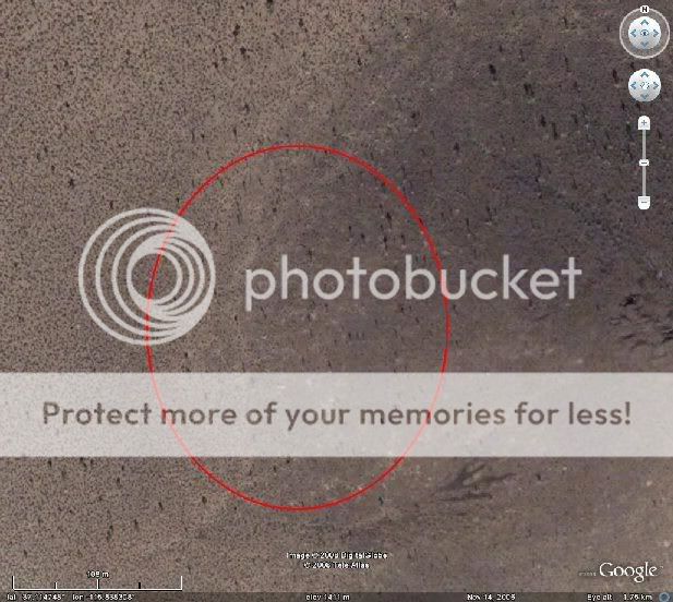
I have pored over this area in GE many, many times, and can see no indication of "hangars". There are also no obvious roads in or out of the immediate area.
However, what we now know about the willingness to "tweak" images by Google Earth staff, I'm not surprised that nothing shows up at that site.
Originally posted by James Random
...
Structures can clearly be seen at one location near the top of the mountain range as well as multiple dead end roads going into the mountain.
...
Are these the structures and the roads you are talking about on the mountain?

Full image link
This is located just southwest of Area 51 and is the clearest one. The road at the bottom, leading left, continues out of the mountain and links up with another road approximately 1.5 - 2 miles away. That connecting road also leads into the mountain (as well as away) and also seems to lead to nowhere. Please click the full image link as for some reason it's cropped the end of the road (which is to the right):

Full image link
There's also a third one, very close to the east of the road in the first picture. This one comes straight out of the southern side of Area 51 and into the mountain.

Full image link
I've had to put full image links under the pictures because they seem to keep being cropped to fit the page. Apologies if there's an easier way to show the images. This is my first post
The third road intrigues me the most. Where it stops seems very blurred and not at all part of the landscape, but then I'm probably clutching at straws there.
Anyway, make of that what you will.
reply to post by Rade On Earth
Get the cellar ... the lake has disappeared because he was spray idiot!
Get the cellar ... the lake has disappeared because he was spray idiot!
new topics
-
BIDEN Admin Begins Planning For January 2025 Transition to a New President - Today is 4.26.2024.
2024 Elections: 3 hours ago -
Big Storms
Fragile Earth: 5 hours ago -
Where should Trump hold his next rally
2024 Elections: 7 hours ago -
Shocking Number of Voters are Open to Committing Election Fraud
US Political Madness: 8 hours ago -
Gov Kristi Noem Shot and Killed "Less Than Worthless Dog" and a 'Smelly Goat
2024 Elections: 9 hours ago -
Falkville Robot-Man
Aliens and UFOs: 9 hours ago -
James O’Keefe: I have evidence that exposes the CIA, and it’s on camera.
Whistle Blowers and Leaked Documents: 10 hours ago -
Australian PM says the quiet part out loud - "free speech is a threat to democratic dicourse"...?!
New World Order: 11 hours ago -
Ireland VS Globalists
Social Issues and Civil Unrest: 11 hours ago
top topics
-
James O’Keefe: I have evidence that exposes the CIA, and it’s on camera.
Whistle Blowers and Leaked Documents: 10 hours ago, 17 flags -
Australian PM says the quiet part out loud - "free speech is a threat to democratic dicourse"...?!
New World Order: 11 hours ago, 15 flags -
Blast from the past: ATS Review Podcast, 2006: With All Three Amigos
Member PODcasts: 14 hours ago, 13 flags -
Biden "Happy To Debate Trump"
2024 Elections: 12 hours ago, 13 flags -
Ireland VS Globalists
Social Issues and Civil Unrest: 11 hours ago, 10 flags -
Mike Pinder The Moody Blues R.I.P.
Music: 14 hours ago, 8 flags -
BIDEN Admin Begins Planning For January 2025 Transition to a New President - Today is 4.26.2024.
2024 Elections: 3 hours ago, 7 flags -
What is the white pill?
Philosophy and Metaphysics: 13 hours ago, 6 flags -
Shocking Number of Voters are Open to Committing Election Fraud
US Political Madness: 8 hours ago, 6 flags -
Big Storms
Fragile Earth: 5 hours ago, 6 flags
active topics
-
Gov Kristi Noem Shot and Killed "Less Than Worthless Dog" and a 'Smelly Goat
2024 Elections • 63 • : GENERAL EYES -
Mood Music Part VI
Music • 3113 • : MRTrismegistus -
BIDEN Admin Begins Planning For January 2025 Transition to a New President - Today is 4.26.2024.
2024 Elections • 20 • : BustedBoomer -
One Flame Throwing Robot Dog for Christmas Please!
Weaponry • 12 • : worldstarcountry -
RAAF airbase in Roswell, New Mexico is on fire
Aliens and UFOs • 13 • : Ophiuchus1 -
President BIDEN's FBI Raided Donald Trump's Florida Home for OBAMA-NORTH KOREA Documents.
Political Conspiracies • 40 • : BingoMcGoof -
Australian PM says the quiet part out loud - "free speech is a threat to democratic dicourse"...?!
New World Order • 7 • : 19Bones79 -
It takes One to Be; Two to Tango; Three to Create.
Philosophy and Metaphysics • 8 • : Compendium -
Big Storms
Fragile Earth • 16 • : rickymouse -
James O’Keefe: I have evidence that exposes the CIA, and it’s on camera.
Whistle Blowers and Leaked Documents • 14 • : 19Bones79