It looks like you're using an Ad Blocker.
Please white-list or disable AboveTopSecret.com in your ad-blocking tool.
Thank you.
Some features of ATS will be disabled while you continue to use an ad-blocker.

Flying Lasers Reveal Buried Historical Structures
page: 1share:
This is becoming a new trend among archaeologist, and i love it.
Using satellits,high altitude Laser Measurements and drones to discover the history buried underground and impossible to see from groundlevel.
It has been done for many years but they keep getting better as they discover new and better/easier ways of doing it.
And nice to see that drones are not only used to spy on us
news.vanderbilt.edu...
There is ofcause a limit to how deep they can penetrate, but still cool stuff is brought to the surface, and more of history is revealed, and i think we will all love to see this used in some of the more interesting parts of the world like Egypt, South America and such, as they are allready doing.
www.spiegel.de...
Slide the bar pictures
More pictures inside
A team with the Irish research project "Discovery Programme" scanned the already heavily researched area with lasers
finding a number of small mounds, possible burial sites and Stone Age earthworks. The map was practically filled with points of potential archaeological interest, shown here in red. The green dots indicate already known sites.
Some info on Google earth archeology, and some linky inside.
www.dailygalaxy.com...
archaeology.about.com...
Using satellits,high altitude Laser Measurements and drones to discover the history buried underground and impossible to see from groundlevel.
It has been done for many years but they keep getting better as they discover new and better/easier ways of doing it.
And nice to see that drones are not only used to spy on us
news.vanderbilt.edu...
There is ofcause a limit to how deep they can penetrate, but still cool stuff is brought to the surface, and more of history is revealed, and i think we will all love to see this used in some of the more interesting parts of the world like Egypt, South America and such, as they are allready doing.
www.spiegel.de...
Slide the bar pictures
Archaeology is being revolutionized by remote-scanning techniques that use lasers to detect otherwise invisible ground features. The technology digitally extracts vegetation for a clean image of the earth's surface. Archaeologists in Germany have already discovered thousands of new sites.

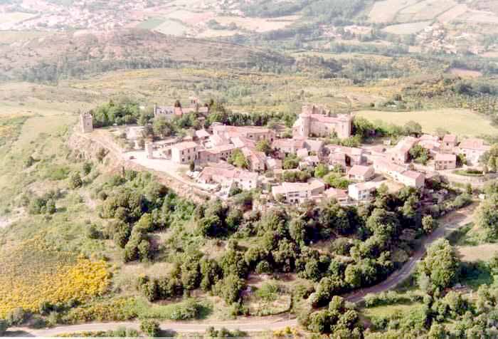
The Boyne Valley in Ireland, for example, contains three prehistoric monuments that are part of the Brú na Bóinne UNESCO World Heritage Site . A team with the Irish research project "Discovery Programme" scanned the already heavily researched area with lasers, finding a number of small mounds, possible burial tombs and Stone Age earthworks. The map was practically filled with points of potential archaeological interest.
More pictures inside

A team with the Irish research project "Discovery Programme" scanned the already heavily researched area with lasers

finding a number of small mounds, possible burial sites and Stone Age earthworks. The map was practically filled with points of potential archaeological interest, shown here in red. The green dots indicate already known sites.

Some info on Google earth archeology, and some linky inside.
www.dailygalaxy.com...
archaeology.about.com...
edit on 11-8-2012 by Mianeye because: (no reason given)
edit on 11-8-2012 by Mianeye because: Spelling and such
It would be interesting to see them do it in the area of Rennes le Chateau in France.
edit on 11-8-2012 by ALF88 because: (no reason given)
reply to post by ALF88
That is one good suggestion right there
Google Earth coordinates: 42°55′41″N 2°15′48″E
www.crystalinks.com...
Other link with more of the mysteries
Google Earth coordinates: 42°55′41″N 2°15′48″E
www.crystalinks.com...
Other link with more of the mysteries
Rennes Le Chateau, is located in Languedoc, France an unspoiled area of southern France. There are many mysteries surrounding Rennes Le Chateau that link with the Holy Grail, the Ark of Noah, the Ark of the Covenant and the treasures of the Temple of Solomon. These mysteries have baffled researchers for hundreds of years.
edit on 11-8-2012 by Mianeye because: (no reason given)
edit on 11-8-2012 by
Mianeye because: (no reason given)
edit on 11-8-2012 by Mianeye because: (no reason given)
I would love to see what kind of imagery we've got of the bottom of the oceans
Originally posted by Mianeye
This is becoming a new trend among archaeologist, and i love it.
Using satellits,high altitude Laser Measurements and drones to discover the history buried underground and impossible to see from groundlevel.
It has been done for many years but they keep getting better as they discover new and better/easier ways of doing it.
And nice to see that drones are not only used to spy on us
news.vanderbilt.edu...
There is ofcause a limit to how deep they can penetrate, but still cool stuff is brought to the surface, and more of history is revealed, and i think we will all love to see this used in some of the more interesting parts of the world like Egypt, South America and such, as they are allready doing.
www.spiegel.de...
Slide the bar pictures
Archaeology is being revolutionized by remote-scanning techniques that use lasers to detect otherwise invisible ground features. The technology digitally extracts vegetation for a clean image of the earth's surface. Archaeologists in Germany have already discovered thousands of new sites.
The Boyne Valley in Ireland, for example, contains three prehistoric monuments that are part of the Brú na Bóinne UNESCO World Heritage Site . A team with the Irish research project "Discovery Programme" scanned the already heavily researched area with lasers, finding a number of small mounds, possible burial tombs and Stone Age earthworks. The map was practically filled with points of potential archaeological interest.
More pictures inside
A team with the Irish research project "Discovery Programme" scanned the already heavily researched area with lasers
finding a number of small mounds, possible burial sites and Stone Age earthworks. The map was practically filled with points of potential archaeological interest, shown here in red. The green dots indicate already known sites.
Some info on Google earth archeology, and some linky inside.
www.dailygalaxy.com...
archaeology.about.com...
edit on 11-8-2012 by Mianeye because: (no reason given)edit on 11-8-2012 by Mianeye because: Spelling and such
This is an important thread, wether people believe the A.A. theory nor not, this will speed up the process of understanding who made the megalithic stones hopefully.
Thank you so much. This is precisely the kind of story that got me addicted to ATS. Well done. This may lead to the truth about Ireland being the
cradle of civilization.
Originally posted by zarp3333
Thank you so much. This is precisely the kind of story that got me addicted to ATS. Well done. This may lead to the truth about Ireland being the cradle of civilization.
Completely agree and want to 2nd that.
This is why I came here too
Fantastic find.
It is an interesting and exciting method being used to find things we seem to overlook, and there is countless possibilities that it could be used to
find places, lost in Antiquity, but I think this was noted within The Legendary Lost City of
"Ciudad Blanca" Found Under Tropical Forest in Honduras which was posted just two months ago.
And this article itself, was presented there as well. in late July.
Just noting, using the Search Engine does make things easier. Even the Title you offered is noted.
Next we'll be finding out they used this tech, to possibly find Ciudad Blanca.
Ciao
Shane
And this article itself, was presented there as well. in late July.
Just noting, using the Search Engine does make things easier. Even the Title you offered is noted.
Next we'll be finding out they used this tech, to possibly find Ciudad Blanca.
Ciao
Shane
reply to post by Shane
I get your point, and must admit that i didn't do a search, i just tried with my titel and it did find the thread you just linked, so i can't
excuse with "the search engine on ATS sucks" It works fine...
Anyway, a lot of threads get lost in the forum jungel of ATS, so a thread on it's own about this case i guess is allright, i have seen worse duplicates in here. You made the post in the other thread, so thats why you noticed, no one else would have
But thanks for the other link, i missed that one somehow
edit on 11-8-2012 by Mianeye because: (no reason given)
Am i the only one here thinking of project blue beam? The conspiracy theory mentions archaeological finds becore the grand event.
Especially since one of these pictures looks a lot like anomalies on the moon or mars that ats people say "omg aoien moon base" about...lol
Regardless, this is cool...
Especially since one of these pictures looks a lot like anomalies on the moon or mars that ats people say "omg aoien moon base" about...lol
Regardless, this is cool...
Very interesting! Can you imagine this tech in 10-20 years time? It will probably be able to spot unfound oil wells, perhaps gold rich lands which
will be snapped up on the cheap because of insider information.
I want it! :
I want it! :
Originally posted by Qumulys
Very interesting! Can you imagine this tech in 10-20 years time? It will probably be able to spot unfound oil wells, perhaps gold rich lands which will be snapped up on the cheap because of insider information.
I want it! :
Sure, I can see it as the Tool of ATF, going through out the States searching for caches of Weapons when they are coming to take your Guns away from you.
I think though, the imagery is specific to noting "disturbances" in the "Original Landscape" apposed to an Xray.
They would be able to find spots where something occurred at this spot and we can see the area effected, and the outline it is presenting.
I do not think they will be able to peer through the earth to find, say a 1200 LBS nugget of Gold, only 1 mile down in the ground. Sure it would be nice, but I don't think it will work that way.
But I am no Scientist or Technician, so I maybe completely wrong.
Ciao
Shane
reply to post by Mianeye
No, don't worry too much. I likely would have started a separate thread for the subject in July, if the neigh sayers about using this Tech, didn't provoke me to respond with a few examples of how this is working elsewhere in the Other Thread.
As your thread is noting now.
Ciao
Shane
No, don't worry too much. I likely would have started a separate thread for the subject in July, if the neigh sayers about using this Tech, didn't provoke me to respond with a few examples of how this is working elsewhere in the Other Thread.
As your thread is noting now.
Ciao
Shane
I seen a documentary where they were finding possible candidates for ancient pyramids using similar tech.
They found several mountains in mexico that have angles that are suspicious of being man made.
They found several mountains in mexico that have angles that are suspicious of being man made.
S & F
Thank you for posting this info.
Hopefully more shall be revealed elsewhere in the world. I'm sure there is a lot more than we know yet to be discovered.
Thank you for posting this info.
Hopefully more shall be revealed elsewhere in the world. I'm sure there is a lot more than we know yet to be discovered.
I don't see this technology being permitted to unveil any authentic archeology that might further awaken us. Instead I see a few insignificant finds
followed by the big one, a false find that discredits the history of all religions and ushers in the new world religion.
Now the serpent was more subtle and crafty than any living creature of the field which the Lord God had made. And he [Satan] said to the woman, Can it
really be that God has said, You shall not eat from every tree of the garden?
Genesis 3:1
Satan has been deceiving many from the beginning!
7 For the mystery of lawlessness (that hidden principle of rebellion against constituted authority) is already at work in the world, [but it is] restrained only until he who restrains is taken out of the way.
8 And then the lawless one (the antichrist) will be revealed and the Lord Jesus will slay him with the breath of His mouth and bring him to an end by His appearing at His coming.
9 The coming [of the lawless one, the antichrist] is through the activity and working of Satan and will be attended by great power and with all sorts of [pretended] miracles and signs and delusive marvels—[all of them] lying wonders—
10 And by unlimited seduction to evil and with all wicked deception for those who are perishing (going to perdition) because they did not welcome the Truth but refused to love it that they might be saved.
11 Therefore God sends upon them a misleading influence, a working of error and a strong delusion to make them believe what is false,
12 In order that all may be judged and condemned who did not believe in [who refused to adhere to, trust in, and rely on] the Truth, but [instead] took pleasure in unrighteousness.
reply to post by ResearchEverything777
Why are you trolling so many threads here?
What's your point?
Why are you trolling so many threads here?
What's your point?
new topics
-
Putin, Russia and the Great Architects of the Universe
ATS Skunk Works: 2 hours ago -
A Warning to America: 25 Ways the US is Being Destroyed
New World Order: 6 hours ago
top topics
-
President BIDEN's FBI Raided Donald Trump's Florida Home for OBAMA-NORTH KOREA Documents.
Political Conspiracies: 12 hours ago, 29 flags -
A Warning to America: 25 Ways the US is Being Destroyed
New World Order: 6 hours ago, 12 flags -
Las Vegas UFO Spotting Teen Traumatized by Demon Creature in Backyard
Aliens and UFOs: 17 hours ago, 7 flags -
Is AI Better Than the Hollywood Elite?
Movies: 13 hours ago, 3 flags -
Maestro Benedetto
Literature: 13 hours ago, 1 flags -
Putin, Russia and the Great Architects of the Universe
ATS Skunk Works: 2 hours ago, 1 flags
active topics
-
University of Texas Instantly Shuts Down Anti Israel Protests
Education and Media • 272 • : burritocat -
Gaza Terrorists Attack US Humanitarian Pier During Construction
Middle East Issues • 40 • : WeMustCare -
Cats Used as Live Bait to Train Ferocious Pitbulls in Illegal NYC Dogfighting
Social Issues and Civil Unrest • 24 • : NoviceStoic4 -
A Warning to America: 25 Ways the US is Being Destroyed
New World Order • 13 • : 2025yuga -
Is AI Better Than the Hollywood Elite?
Movies • 19 • : GENERAL EYES -
Weinstein's conviction overturned
Mainstream News • 27 • : brodby -
ChatGPT Beatles songs about covid and masks
Science & Technology • 24 • : iaylyan -
The Acronym Game .. Pt.3
General Chit Chat • 7754 • : bally001 -
Nearly 70% Of Americans Want Talks To End War In Ukraine
Political Issues • 96 • : andy06shake -
Rupert Murdoch engaged at 92
People • 8 • : brodby