It looks like you're using an Ad Blocker.
Please white-list or disable AboveTopSecret.com in your ad-blocking tool.
Thank you.
Some features of ATS will be disabled while you continue to use an ad-blocker.

Every One Speaks about HAARP, but did you know...
page: 3share:
Originally posted by TheWretched
Interesting thread, but the point of listing all these is?????
1) Because it's preliminary work
2) Because many people are not aware of all these facilities and are interested
3) Because I wanted to
The first linking is already shown in the OP... perhaps you missed it
"The results of these dedicated engine burns have been recorded using the VHF and UHF radars at Arecibo, Puerto Rico; Kwajalein, Marshall Islands; Millstone Hill, Massachusetts; and Jicamarca, Peru."
The fact that they are officially listed as a frequency does not mean that they cannot be tuned to other uses Point in fact is Arecibo... even I never knew it was capable of Incoherent Scatter emissions
I also said I have a LOT of material to present and quite frankly the time it takes me to present it properly will take a LONG time... There are many documents and papers showing how these facilities are uses in conjunction with each other for specific purposes...
Lots of nice pictures. Too bad they're lacking in explanations of the installations do. You use the words "HAARP like" a lot. What does that mean
exactly? HAARP uses radar so does that mean all radar installations are "HAARP like"? You include early warning radars and radio telescopes in your
list. What on Earth are you calling a "shield"? If you're going to catalog all of the radio telescopes and long range radar on the planet, you are
going to be a very busy Zorgon.
Out of all those installations, 4 of them seem have ionospheric heaters; HAARP, SURA, HIPAS, EISCAT. Maybe some of the rest do most most are strictly radar installations.
So there are four installations which have the ability to create a "planetary shield"? All of the heaters affect an area of the ionosphere. HAARP is capable of heating an area of less than 2,000 square kilometers. I see that SURA puts out a lot more power than HAARP but HIPAS and EISCAT are pretty wimpy (in the kilowatt range). So to allow for SURA's 190mw output, lets just double, no, lets increase by tenfold HAARP's capability and use that for all of the stations in the your "global network". Call it 80,000 square kilometers of the ionosphere.
The surface of the Earth covers 150,000,000 sq km. But since the "surface" of the ionosphere which is affected by these sites are at altitudes of 100km and higher the area is greater than that. Not much of a shield if all you get is .05% coverage. Let's speculate even more and say there are 10 times as many installations that we know about (and we've already increased their capabilities 10 times). Now we have .5% coverage. The total coverage of all of these "shield" generators (speculation included) would cover less than 10% of the continental US (if they were in the right locations).
There is no shield.
[edit on 9/26/2009 by Phage]
[edit on 9/26/2009 by Phage]
Originally posted by TheWretched
Many of the ones you have listed are nothing but observatories for looking into the stars. Some are nothing but radar stations.
If you believe THAT then you haven't read anything about them So much for your 'expertise' Most of the ones listed came form EISCAT and HAARP OFFICIAL websites
I haven't even listed all yet..but the antennas at
Kiruna, Sweden
Longyearbyen, Svalbard (Spitsbergen), Norway
Sodankylä, Finland
Søndre Strømfjord, Greenland
Ramfjordmoen, near Tromsø, Norway
Are most certainly used for Ionosphere manipulation and research which is after all THE POINT of these facilities and hence the thread

[edit on 26-9-2009 by zorgon]
Originally posted by C0bzz they do not work like HAARP does although they use the ionosphere.
JORN is listed for other uses in the Australian Defense program dealing with 'Electronic Warfare' In fact I posted a link to the DSTO (Department of Defence, Australios Electronic Warfare department... Hence its inclusion in the list of sites I am studying
OTH Radars are also use for weather studies, specificaly by the NOAA. While I have not yet included them, nor will in this thread, the fact that they are using them for weather related research makes them of interest to me...
www.etl.noaa.gov...
Considering my research is based on the weapon capabilities (even if merely defensive as both Tesla and Eastlund wanted) and possible weather manipulation it would be foolish to discoount anything at this point :d
But thanks for those sites...
AN/TPS-71 ROTHR.
AN/FPS-118
Did not have those on my list yet...
Of course there are other uses for JORN
Precisely Which is why I am researching it
Originally posted by autowrench
Did anyone happen to watch the History Channel last night?
Okay that does it!!
I need someone to check my system for leaks NOVA did that to me on Astrospies as well
OR
"The Universe is unfolding as it should"
Serendipity... the truth shall come out
[edit on 26-9-2009 by zorgon]
This explains why in the movie "contact" the SETI administrators were having so much trouble. After their best efforts at tuning the equipment to
pick up subtle ET intelligence signatures, all they heard was an out of balance washing machine.
Thats is massive amount of work Zorgon SnF to you M8
I only just heard about Haarp a few months ago and been telling friends about it. Now I have an excellent link to email and update people with your information. More information in one link than anywhere I have found on the internet....
Thanks again....
I only just heard about Haarp a few months ago and been telling friends about it. Now I have an excellent link to email and update people with your information. More information in one link than anywhere I have found on the internet....
Thanks again....
reply to post by zorgon
Hello Zorgon. I always enjoy your threads.
I was going to do a thread on this and perhaps still will, but since I haven't yet I figured I would throw these up for your opinion.
While scanning Google Earth one day while studying the crust, particularly under that oceans of the earth I came upon these. I found it interesting as Ascension Island is on a major fault.
I am newly prescribed to the growing earth theory after seeing a presentation of how all of the earths plates fit together when the earth is shrunken down and after seeing the record of all of the newer mantle being on the ocean floor with the dry land being the oldest (from core samples).
I believe that perhaps these instruments may work as a magnetic field that is holding the world from expanding too rapidly, but that is another thing. I believe in the growing earth, but not as a sphere. I'm not sure yet, but not a sphere. That really doesn't matter, let me get to the pics.
These are pictures of Ascension Island. This island as you probably know is home to many NASA rocket launches and also supports a runway that could be used by the shuttle for landing. It is under control of Great Brittan.
Pic 1
[atsimg]http://files.abovetopsecret.com/images/member/6bbc63112728.jpg[/atsimg]
Pic 2
[atsimg]http://files.abovetopsecret.com/images/member/2a8f849f7f74.jpg[/atsimg]
Pic 3
Weird pads with White cars parked on them in certain corners of the pad...
[atsimg]http://files.abovetopsecret.com/images/member/fde12651331b.jpg[/atsimg]
Pic 4
More weird pads with white cars...
[atsimg]http://files.abovetopsecret.com/images/member/48a10ba0bb4d.jpg[/atsimg]
Pic 5
"Scully, the truth is out their...."
[atsimg]http://files.abovetopsecret.com/images/member/1aa046da9bb0.jpg[/atsimg]
Pic 6
"Higher and Higher, you love, (Keeps on liften), Liften higher"...
[atsimg]http://files.abovetopsecret.com/images/member/62bd99f4cf1a.jpg[/atsimg]
Peace
[edit on 26-9-2009 by letthereaderunderstand]
Why's there nowhere in the UK?
Or are we just too primitive to be involved?
Or are we just too primitive to be involved?
Hi again Zorgon.
Oh YEAH ! ! The famous geometry we can see in the Earth, Saturn,
Jupiter, Mars, etc. . . and almost all "balls". . . even water drops ! !
You are in my leagues, man.
[ Parallel topic: go see your "REAL chemtrails" thread. . . B-) ]
Blue skies.
Originally posted by zorgon
This one uses Sacred Geometry in the antenna layout. Anyone familiar with sacred geometry will see the potential of this installation
Oh YEAH ! ! The famous geometry we can see in the Earth, Saturn,
Jupiter, Mars, etc. . . and almost all "balls". . . even water drops ! !
You are in my leagues, man.
[ Parallel topic: go see your "REAL chemtrails" thread. . . B-) ]
Blue skies.
Sacred geometry ?
Of course any really tall antenna structure requires guy wires to prevent it from falling down. These are usually arranged radially and always slope down from the vertical mast to anchor points located in the ground.
You can have three, four, or even more of these guy wires arranged in some regular geometric pattern.
I suppose you could also say these guy wires may also resemble perfect pyramid structures too.
Maybe all radio antenna guy wires are all based on secret Egyptian mystic magic ? Anyone that rigs a sail boat is using evil and secret occult knowledge to hold up his mast.
Or maybe some engineer just decided to build his guy wires that way because it is structurally sound, mechanically efficient and has been proven to work ?
I know this is a conspiracy forum, but some of the speculative theories suggested here go way beyond the ridiculous.
Originally posted by Phage
Too bad they're lacking in explanations of the installations do.
You know what? That actually pisses me off... but I will let it slide...
Every post I made on each Location has the link to my webpage associated with each location which has d DETAILED information on every spot with links to data, papers and whatever else I have available. There is not room in this thread for all that data.
Debunk all you want but I haven't even started making the connections. If YOU think you can do better or produce the material faster be my guest.
Its easy enough being a naysayer but when you start saying the data isn't there when it is clearly attached at the bottom of each post I say FOUL PLAY
Also all I have done so far is present the sites... haven't made any claims about any of them yet so STUFF IT
Originally posted by C0bzz
Some links for further reading...
www.etl.noaa.gov...
From your link...
Other applications of OTH radar
* Hurricane Tracking and Forecasting
* Numerical Weather Prediction
* Space Weather Forecasts
* Marine Weather Forecasts
* Pollution Control
* Fisheries Oceanography
* Air-traffic control
* Search and Rescue
* Calibration and Validation of Satellite Ocean Sensors
* Shortwave Radio Forecasting
* Climate Change
* Marine Weather Research
* Coastal Wave Forecasting
* Ionospheric Research
* Iceberg Tracking
So according to the OFFICIAL NOAA website the OTH Radar CAN be used for Climate Control and Ionospheric Research, though I admit that Pollution Control seems an odd function
reply to post by Silver Shadow
Any clever observant can see that what we see there
are the roads that run to the antenaS ! ! !
They have NOTHING to do with the guide wires to those posts/antenas !
Look intelligently at the photo, and we even SEE the SHADOWs
of the posts/antenas.
Your answer completly shows that you totaly don't know what WE,
the adults here, [ Zorgon & those who KNOW ] are talking about !
Blue skies.
Originally posted by Skallagrimsson
...and a new mini-HAARP has been built this year in Andøy, Norway.
Not so mini is seems Thanks for pointing that one out :up I had that location listed in the IRIS arrays but the AIRIS is on the other side of the island
ALWIN MST Radar
Andøya, Norway
+69° 17' 54.41", +16° 2' 31.48"
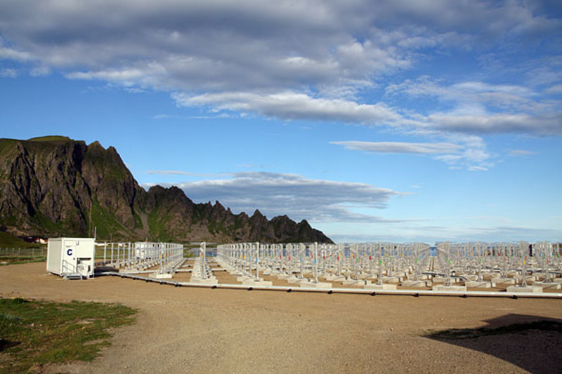
The view of the radar towards ARR (photo: K. Dahle)
The Leibniz-Institute of Atmospheric Physics in Kühlungsborn, Germany (IAP) is installing a new powerful VHF radar on the North-Norwegian island Andøya (69.30°N, 16.04°E) in 2009. The new radar replaces the existing ALWIN radar which has been operated continuously on Andøya for more than 10 years.
The goal of the new system is the investigation of horizontal structures of Polar Mesosphere Summer Echoes (PMSE) caused by mesospheric ice clouds. Three-dimensional structures of the wind field and turbulent parameters determined from the radar data will be used to compare the detected PMSE distribution in detail with wind and turbulence variations caused by wave activity.
The new ALWIN radar is a monostatic radar with an active phased array antenna. Its operational frequency is 53.5 MHz and the maximum peak power is approximately 800 kW. The system is composed of an active phased array antenna designed by IAP consisting of 433 Yagi antennas and an identical number of transceiver modules. The radar hardware is designed and manufactured by Genesis Software Pty Ltd.
The nearly circular array with a diameter of approximately 90 m corresponding to an aperture of ~6300m2 results in a very symmetric antenna radiation pattern with a half power beam width of 3.6°, a directive gain of 33.5 dBi and an almost symmetric first side lobe with more than 17 dB suppression with respect to the main lobe.
The new ALWIN radar will start with a 16-channel data acquisition system with 25 meter sampling resolution and 16-bit digitization specified which will be upgraded to 64 channels in the final stage.
The high flexibility of the new system allows classical Doppler beam swinging as well as experiments with simultaneously formed multiple beams and the use of modern interferometric applications for improved studies of the Arctic atmosphere from the troposphere up to the lower thermosphere with high spatiotemporal resolution.
The installation of the antenna array will be finished in the first week of August 2009. The radar control and data acquisition hardware as well as 145 transceiver modules will be installed in September 2009. The initial expansion stage will use an antenna beam with a beam width comparable to the old ALWIN system but with symmetrical side lobes and free beam steering capability. The second expansion stage is scheduled for spring 2010 with the goal to observe the upcoming PMSE season with full power.
SOURCE: Andøya Rocket Range
www.rocketrange.no...
ALOMAR Observatory Location of the New Array

Old Array is here
+69° 17' 54.45", +16° 2' 31.56"
ALOMAR Observatory Lasers

The Andoya Imaging Riometer for Ionospheric Studies
AIRIS
+69° 8' 45.60", +16° 1' 44.40"

Gloria - Global Riometer Array
The AIRIS is a part of the Global Riometer Array (Gloria) which is an international collaborative program for scientific investigation of the role of particle precipitation in the sun-earth connection. In partucular it aims at an improved understanding of the coupling mechanism between the solar wind, magnetsophere and the ionosphere. There are currently over 20 imaging riometer arrays worldwide.
reply to post by zorgon
Apologies. It's obvious you've put a lot of work into it. I obviously misunderstood your intent.
The problem is that there is such a thing as too much information. You provide some specifications about frequencies power output but you don't say anything about what these numbers represent. You say these installations are part of a "global shield" against missiles and solar radiation but provide no information about how the shield works. In the blitz of data you include radio telescopes, "telsa generators", and EWR installations; implying that they are all part of this "shield". Like I said, are going to show us every radio telescope and radar installation on the planet?
Instead of just throwing out a mountain of raw data (some of which seems to be noise) why not provide some sort of distillation and some conclusions? Instead of pages of impressive pictures, how about some explanations of what it all means?
Originally posted by C-JEAN
reply to post by Silver Shadow
Any clever observant can see that what we see there
are the roads that run to the antenaS ! ! !
They have NOTHING to do with the guide wires to those posts/antenas !
Look intelligently at the photo, and we even SEE the SHADOWs
of the posts/antenas.
Your answer completly shows that you totaly don't know what WE,
the adults here, [ Zorgon & those who KNOW ] are talking about !
Blue skies.
All I know is over forty years in radio communications and electronics. I have personally built and maintained large private and government antenna installations. They build roads to where they need to go, to and around the mast, buildings, and guy system.
In bad weather and soft or rocky ground you need to get tools, vehicles and equipment around your antenna installation for repairs and maintenance . The road pattern reflects that need.
What would be the purpose of building a road system according to sacred geometry that goes nowhere ? What would that accomplish exactly ?
You claim to be an adult, but how many years experience do you have working with large radio antenna systems ?
Zorgon has put a lot of work into this, and he deserves a lot of credit.
But please try to be realistic.
Around the world are many many many THOUSANDS of radio broadcast transmitters, radiating popular music, news, and other entertainment in many languages.
Are we to assume they are all interconnected and used for some sinister purpose ?
Or is it that people just like listening to the radio ?
reply to post by Phage
Many of the cold dry facts about how the United states used the Arecibo dish during the cold war are available with a little search engine work. Anyone that knows the details of how any or all of these sites are networked, and their specific capabilities has signed a non disclosure agreement and would not be able to comment on a public forum like ATS. Its much more interesting to wildly speculate about these installations anyways, look how the public flocked to the movie Contact.
Many of the cold dry facts about how the United states used the Arecibo dish during the cold war are available with a little search engine work. Anyone that knows the details of how any or all of these sites are networked, and their specific capabilities has signed a non disclosure agreement and would not be able to comment on a public forum like ATS. Its much more interesting to wildly speculate about these installations anyways, look how the public flocked to the movie Contact.
new topics
-
God's Righteousness is Greater than Our Wrath
Religion, Faith, And Theology: 2 hours ago -
Electrical tricks for saving money
Education and Media: 5 hours ago -
VP's Secret Service agent brawls with other agents at Andrews
Mainstream News: 6 hours ago -
Sunak spinning the sickness figures
Other Current Events: 7 hours ago -
Nearly 70% Of Americans Want Talks To End War In Ukraine
Political Issues: 7 hours ago -
Late Night with the Devil - a really good unusual modern horror film.
Movies: 9 hours ago -
Cats Used as Live Bait to Train Ferocious Pitbulls in Illegal NYC Dogfighting
Social Issues and Civil Unrest: 10 hours ago
top topics
-
VP's Secret Service agent brawls with other agents at Andrews
Mainstream News: 6 hours ago, 9 flags -
Florida man's trip overseas ends in shock over $143,000 T-Mobile phone bill
Social Issues and Civil Unrest: 17 hours ago, 8 flags -
Cats Used as Live Bait to Train Ferocious Pitbulls in Illegal NYC Dogfighting
Social Issues and Civil Unrest: 10 hours ago, 8 flags -
Electrical tricks for saving money
Education and Media: 5 hours ago, 4 flags -
Bobiverse
Fantasy & Science Fiction: 17 hours ago, 3 flags -
HORRIBLE !! Russian Soldier Drinking Own Urine To Survive In Battle
World War Three: 14 hours ago, 3 flags -
Nearly 70% Of Americans Want Talks To End War In Ukraine
Political Issues: 7 hours ago, 3 flags -
Sunak spinning the sickness figures
Other Current Events: 7 hours ago, 3 flags -
Late Night with the Devil - a really good unusual modern horror film.
Movies: 9 hours ago, 2 flags -
The Good News According to Jesus - Episode 1
Religion, Faith, And Theology: 12 hours ago, 1 flags
active topics
-
Nearly 70% Of Americans Want Talks To End War In Ukraine
Political Issues • 12 • : Asher47 -
VP's Secret Service agent brawls with other agents at Andrews
Mainstream News • 39 • : Asher47 -
Electrical tricks for saving money
Education and Media • 4 • : Lumenari -
Cats Used as Live Bait to Train Ferocious Pitbulls in Illegal NYC Dogfighting
Social Issues and Civil Unrest • 19 • : WeMustCare -
New whistleblower Jason Sands speaks on Twitter Spaces last night.
Aliens and UFOs • 54 • : Ophiuchus1 -
DONALD J. TRUMP - 2024 Candidate for President - His Communications to Americans and the World.
2024 Elections • 514 • : WeMustCare -
The Acronym Game .. Pt.3
General Chit Chat • 7744 • : bally001 -
Truth Social goes public, be careful not to lose your money
Mainstream News • 128 • : Astyanax -
Sunak spinning the sickness figures
Other Current Events • 5 • : glen200376 -
SETI chief says US has no evidence for alien technology. 'And we never have'
Aliens and UFOs • 44 • : MikeDeGrasseTyson