It looks like you're using an Ad Blocker.
Please white-list or disable AboveTopSecret.com in your ad-blocking tool.
Thank you.
Some features of ATS will be disabled while you continue to use an ad-blocker.

Hollow Earth on Google Earth? See yourself.
page: 2share:
Well, since plenty of people have reached the south pole and returned without being swalloed, I´ll assume there is no "hollow earth" entrance
there.
However, does anyone know why they differntiate between south pole, magnetic south pole and ceremonial south pole (where travellers and tourists are channelled to to take pictures in front of flags)?
It seems suspicious to me that no tourists ever even come close to the actual south pole. And if they do, there´s an american facility waiting for them before they reach it.
Also, after more than half a decade, dont you think google earth would finally get some normal images for the region instead of this blurry stuff? They could have figured that enough people are interested in remote areas.
Why is it taking so long to get high--res pictures?????
The south pole has been photographed by satellites since half a century so its not like there are no pictures available.
For obvious reasons..... they dont want us to see whats there or not there. you know what i mean
Professormp3
Professormp3
When google earth first came out the resolution was much better than it is today. I dont think they are going to make it any higher.
maps.live.com...
Google Earth is becoming like Youtube, a complete resource, in and of itself.
While I'm waiting for Google Earth to finish loading, do these anomalies appear on any other Digital Maps?
en.wikipedia.org...
The Ceremonial and Geographical South Poles aren't to far apart. Duno the specifics for why there are two of them.
[edit on 16-11-2008 by RuneSpider]
Surely this is just the contours of the bottom the map?
I mean, I dont know too much how these things work, but it just looks like the standard problem you would get if you tried to map a 2d image onto a sphere - at the poles, the top and bottom edge would wrap to a single point.
And since gmaps patches a whole bunch of 2d maps together while at the same time following this curvature, sounds reasonable.
WOW!
I thought I was the only person who saw this
at first I was just bored surfing around but I was thinking of doing some mroe extreme climbing and decided to look at elevations to summit on the south pole.
when I saw this it blew my mind! There was to much to take in at once so I bookmarked it in my favorite places so I could check back on it and look more into it. When I looked more into it I noticed what appeared to be some kind of structures located within the dome. Due to their geometric shape that is foreign to the rest of the topography I can deduce with certainty there is some type of staging area for research or an invasion from the images I see.
Can you use a joystick to work googleearth with more fluid movements left/right, zoom/pan etc?
I'm not sure why no one ever bothered to post pics, but here they are. It looks quite perfect, and it is about 160 miles across. I'm not sure how
this would come about through satellite data composition errors.
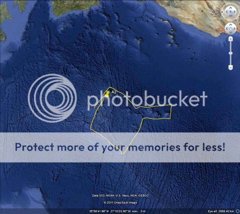


What I found most strange, aside from the obvious, is that you cannot get any closer to the pole than about 3 km.. anywhere else you can get damn near nose to the earth...
What I found most strange, aside from the obvious, is that you cannot get any closer to the pole than about 3 km.. anywhere else you can get damn near nose to the earth...
Hello, I am new to Above Top Secret.
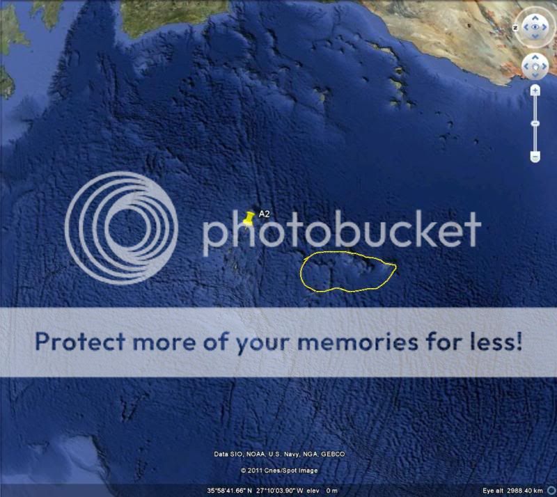
As I was searching at your coordinates I didn't find anything. But, I've searched a little bit further than that and found this:
It looks like a big snake if you turn the picture. What the hell is this? I could not be simple mountain rocks, I don't see this alignment no where in Antarctica,
PS. How do I add the picture as you did above?
edit on 18-11-2010 by andybgr because: asking the question at the bottom
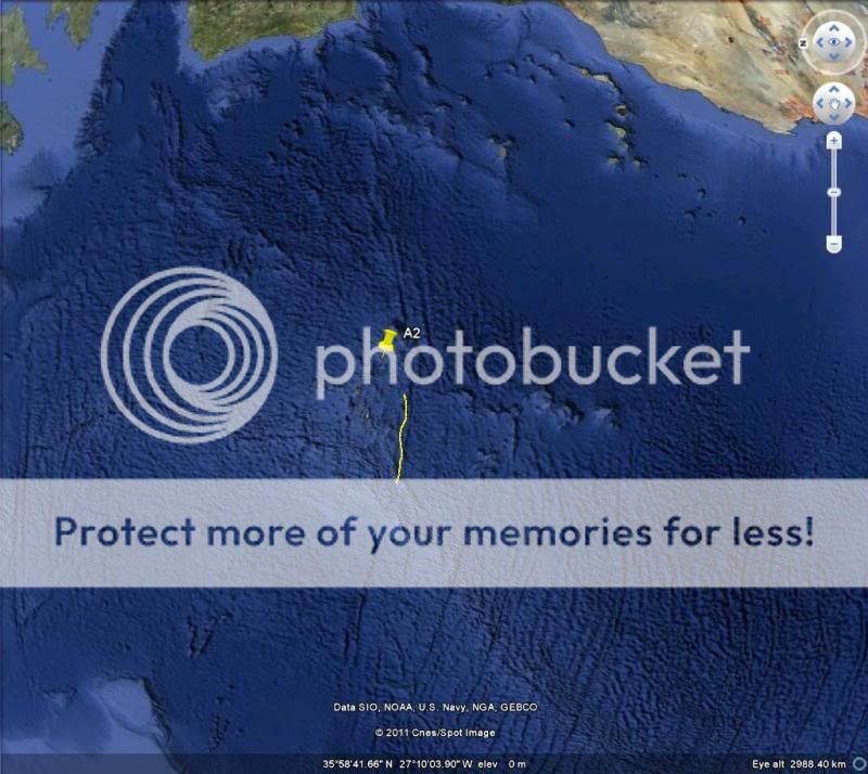
I had doubts at first since I've tried in the past to zoom in to the very south pole looking for hollow earth stuff. But... You're right. It took
some patience to get the pole centered in Google Earth, but once I did I kept going, and going, and going some more. And then these things came into
view. I've stopped at this point to post a screenshot, then I'm going back to Google Earth to investigate more. Thanks!
a little off topic but apperently theres a google maps "pro" that can zoom in closer. is this true?
2nd
2nd
people are free to travel to the poles, in fact quite a few people have, and of all the stories they tell, they never mention big holes.
google earth is not reality!
google earth is not reality!
I took a break and a few ideas formed a connection in my mind. Bear with me, as this sounds crazy. First I was thinking about the hollow earth theory
and what came to mind were the following things
1.Verses in Genesis in the Bible
2.Contact juggling
3.The TV show "Lost"
Now... you may be wondering how these items are connected to one another. I'll elaborate. And keep in mind that I'm not spouting Bible verses without just cause. I view the early books of the Bible as a myth that's been handed down through the millennia. Like Gilgamesh, Genesis describes the last remembered global cataclysm. These cataclysms are cyclic. But that's beside the point for the time being. I'll get back to that shortly.
First:
King James Bible
Genesi 1:2
And the earth was without form, and void; and darkness [was] upon the face of the deep. And the Spirit of God moved upon the face of the waters.
Genesi 1:6
And God said, Let there be a firmament in the midst of the waters, and let it divide the waters from the waters
Genesis 7:1
In the six hundredth year of Noah's life, in the second month, the seventeenth day of the month, the same day were all the fountains of the great deep broken up, and the windows of heaven were opened.
Contact juggling involves the use of spheres with a viscous substance contained within the spheres.
And then there's Lost. Remember how the island was explained as being a "cork" of sorts, keeping something out of the world?
OK. What if the earth really is hollow, and within it's sphere are vast underground oceans. What if the opening to these oceans lies under the ice of Antarctica, and what if 26,000 years or so ago some outside force?/incoming celestial body?/event? caused the ice to melt such that the underground oceans flooded the planet. Perhaps the axis of the earth's rotation was tilted enough by the effects of such a nearby incoming celestial body as to rotate the earth such that Antarctica's icecap melted, thus releasing "all the fountains of the great deep..." while at the same time "the windows of heaven were opened." The windows of heaven opening may refer to incoming strikes from the mass of debris this incoming celestial body would be pulling along with it vis a vis the film "Armageddon." Then 13,000 years ago the object returned (think of the long elliptical orbit of so-called Niburu), changing our axis of rotation again, rotating the earth such that Antarctica froze up again. Think of Atlantis sinking beneath the sea. This little idea of mine explains the flood, the hollow earth theory, the Nemisis/Niburu theory as well as the Atlantis theory.
OK. Let the assault begin
seriously, it's too blurry. i cant see anything,PLEASE POST SCREEN SHOTS, if you don't we'll have no choice but to pass you off as a hoaxer.
Originally posted by Xtrozero
Go to the very center of the south pole and start to zoom in. As you do you will see a dark spot grow where all the Long lines converge to. Keep zooming in on that dark spot and it turns into a tunnel and as you keep zooming you come to dots that are labeled when you put your mouse on them different camps and bases.
That what you see are just panoramio photos.

Originally posted by Skyfloating
I still havent seen a good explanation of why the north and south pole pictures are taken in a way that looks like there´s a suction into holes though. Its like the google-earth makers are trying to play into the hands of the hollow-earthers
Just the contrary,always less they show.
For 4 years I was finding anomalies on both poles down to the latitude of 78 32. They are following my posts and soon after those anomalies would disappear.If you wander why to that latitude, I could tell you that is the rim of the holes on the poles.No wander that on Antarctica all the biggest and more important bases Mc Murdo,Winson, Vostoc and Weddell are around those latitude in a circle spread around Antarctica.The holes are just 95 nm in diameter ,inner span.
Scott-Amundsen polar base of course is not on the S.pole.I have proved that with many photos from that base where the sun shades angles are well over 23.5 deg the maximum it could be there on 21st Dec.
Searching for always more those photos,once I mailed to the producer of some photos ,if he could send me some more.He was U.S. scientist at Scott-Amundsen base around 1996,and responsible for important programs.He asked me what do I need those photos for, and I told him directly that I think that that base is not on the pole.He of course assured me that it is definitely on the pole.He said he was responsible among other to follow polar satellite Nimbus.I asked him if innocently where did he see that satellite,in zenith strait over the pole.I repeated the question and asked him did he measure the angle.He was little annoyed and just said ,strait in zenith.That was the end of our mails and it was enough for me .If he sow Nimbus satellite strait in zenith that means he was not on the pole as Nimbus satellite like many other and even the newest NOAA satellites are passing 10 -11 deg off the poles.It is not possible to have the orbit strait over the pole for the simple reason that their orbit, even if 700 kms high over the Earth,would be destabilized in polar region.In the beginning they tried to do that and lost several satellites.
At present new Google Earth has also one anomalie on S.pole only.
new topics
-
God's Righteousness is Greater than Our Wrath
Religion, Faith, And Theology: 4 hours ago -
Electrical tricks for saving money
Education and Media: 7 hours ago -
VP's Secret Service agent brawls with other agents at Andrews
Mainstream News: 8 hours ago -
Sunak spinning the sickness figures
Other Current Events: 9 hours ago -
Nearly 70% Of Americans Want Talks To End War In Ukraine
Political Issues: 9 hours ago -
Late Night with the Devil - a really good unusual modern horror film.
Movies: 11 hours ago
top topics
-
VP's Secret Service agent brawls with other agents at Andrews
Mainstream News: 8 hours ago, 9 flags -
Cats Used as Live Bait to Train Ferocious Pitbulls in Illegal NYC Dogfighting
Social Issues and Civil Unrest: 12 hours ago, 8 flags -
Electrical tricks for saving money
Education and Media: 7 hours ago, 4 flags -
HORRIBLE !! Russian Soldier Drinking Own Urine To Survive In Battle
World War Three: 16 hours ago, 3 flags -
Nearly 70% Of Americans Want Talks To End War In Ukraine
Political Issues: 9 hours ago, 3 flags -
Sunak spinning the sickness figures
Other Current Events: 9 hours ago, 3 flags -
Late Night with the Devil - a really good unusual modern horror film.
Movies: 11 hours ago, 2 flags -
The Good News According to Jesus - Episode 1
Religion, Faith, And Theology: 14 hours ago, 1 flags -
God's Righteousness is Greater than Our Wrath
Religion, Faith, And Theology: 4 hours ago, 0 flags
active topics
-
SETI chief says US has no evidence for alien technology. 'And we never have'
Aliens and UFOs • 45 • : andy06shake -
Sunak spinning the sickness figures
Other Current Events • 7 • : xWorldxGonexMadx -
HORRIBLE !! Russian Soldier Drinking Own Urine To Survive In Battle
World War Three • 33 • : Degradation33 -
How ageing is" immune deficiency"
Medical Issues & Conspiracies • 34 • : angelchemuel -
Nearly 70% Of Americans Want Talks To End War In Ukraine
Political Issues • 13 • : Freeborn -
Mood Music Part VI
Music • 3101 • : ThatSmellsStrange -
VP's Secret Service agent brawls with other agents at Andrews
Mainstream News • 41 • : ThatSmellsStrange -
New whistleblower Jason Sands speaks on Twitter Spaces last night.
Aliens and UFOs • 55 • : baablacksheep1 -
Cats Used as Live Bait to Train Ferocious Pitbulls in Illegal NYC Dogfighting
Social Issues and Civil Unrest • 20 • : Asher47 -
Electrical tricks for saving money
Education and Media • 4 • : Lumenari