It looks like you're using an Ad Blocker.
Please white-list or disable AboveTopSecret.com in your ad-blocking tool.
Thank you.
Some features of ATS will be disabled while you continue to use an ad-blocker.

Absolute Proof the Earth is Round NOT Flat!
page: 153share:
Got lost in other threads sorry I have not been paying as much attention as I should.
Couple links that do not seem to link but totally do and prove at least that the shape of the earth is inconclusive.
986km
What is this
Furthest we have been is the moon no where near far enough to see the entirety of earth.
We have yet to leave our atmosphere into "space" so the only thing capable of showing pictures are "probes" which have been exposed with the "mar" photos to be from place on earth.when your words say one thing but mean another
No proof either way but far more data points to the round earth being a farce constructed by Not A Zpace Igency.


a reply to: turbonium1
Couple links that do not seem to link but totally do and prove at least that the shape of the earth is inconclusive.
Distance away from earth to see it as a full disk
986km
It seems to me that you have calculated the distance to the horizon rather than the altitude.
The altitude would be rsin(60∘)−r=r×0.1547=986 km.
1966 possibly could have seen it wide but not tall????
From within spacecraft the windows would restrict field of view, but in 1966 on gemini-11 mission Richard Gordon did a spacewalk at altitude of 1369km where the Earth would be 110 degrees across. The field of view of his helmet may have been sufficient to include the full width but probably not the full height of the disc. Astronauts on Apollo 8 photographed Earthrise from first lunar orbit in 1968. The Earth is 2 degrees across at that distance. In theory they could have seen Earth disk on outward journey through a window if it pointed in right direction, but 3 of 5 windows were fogged and they did not see it until they came round from far side of moon. Picture is from Gemini-11.
What is this
Layers of Earth's Atmosphere
Furthest we have been is the moon no where near far enough to see the entirety of earth.
We have yet to leave our atmosphere into "space" so the only thing capable of showing pictures are "probes" which have been exposed with the "mar" photos to be from place on earth.when your words say one thing but mean another
Note that the atmosphere still exists beyond the Karman line; in fact, tiny particles of the exosphere (the outermost layer of the atmosphere) can be found 10,000 kilometers above the surface of Earth! From that perspective, the International Space Station, which orbits at only 330-435 kilometers above the Earth, isn’t even worthy of its name.
So, it’s not that the atmosphere ends at the Karman line, it’s simply that at that altitude, it becomes too insignificant to support flights that rely on ‘air quality’. Here’s a fun fact: you don’t have to fly beyond the Karman line to officially be considered an ‘astronaut’; according to the US Air Force’s definition of an ‘astronaut’, all you have to do is fly more than 50 miles (80 km) above mean sea level to earn that title!
No proof either way but far more data points to the round earth being a farce constructed by Not A Zpace Igency.
a reply to: turbonium1
edit on 1/15/2022 by CrazyFox because: clarity
a reply to: CrazyFox
You must as incoherent as turbo.
To you then.
originally posted by: neutronflux
a reply to: turbonium1
Sputnik was real, and validated. You realize this, right?
Comets travel about the planets, around the sun, and smash into the sun and planets. Why can’t humans travel the path of comets
Between Russia changing the night sky with Sputnik, and coming and going comets that smash into things, I guess the night sky does change.
originally posted by: neutronflux
a reply to: turbonium1
There’s a reason why it was derived the signals from Sputnik were from a moving satellite…
What are these objects that are added to the visible “heavens” and actively broadcast and provide services like satellite internet, satellite phone, and weather data?
You must as incoherent as turbo.
To you then.
originally posted by: neutronflux
a reply to: turbonium1
Sputnik was real, and validated. You realize this, right?
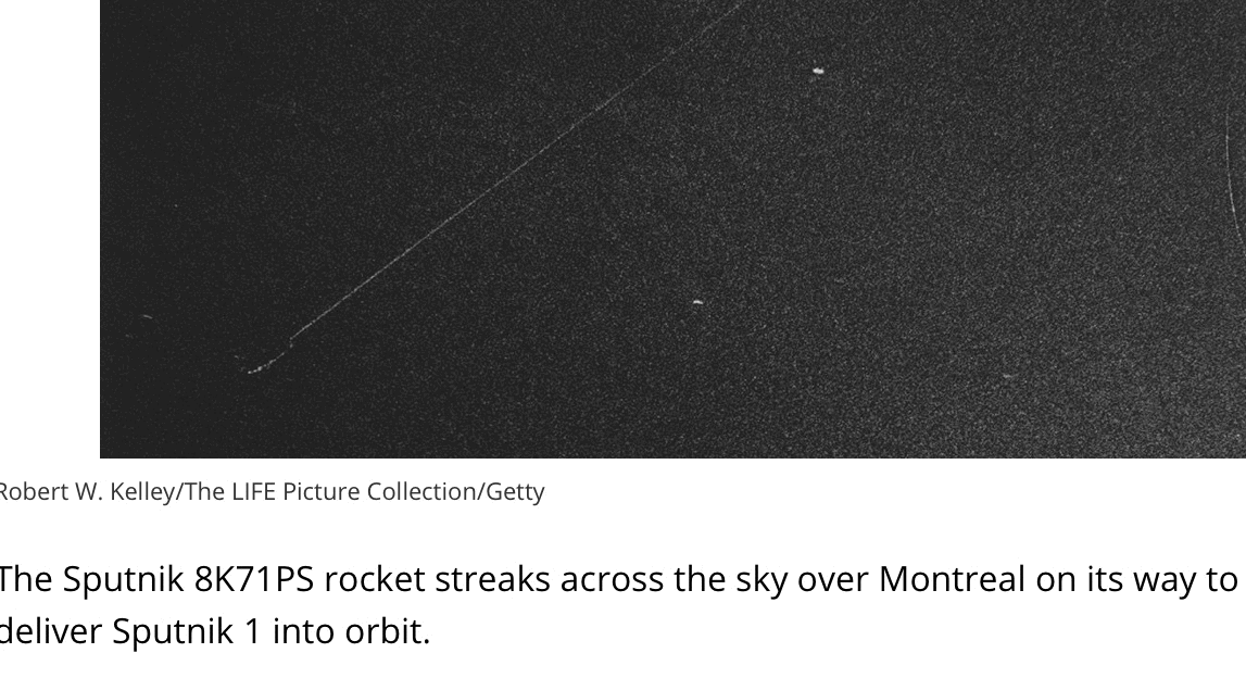
Most Sputnik spotters
Though Sputnik 1 was small, it was quite reflective and therefore visible from Earth through a pair of binoculars (and perhaps even with the naked eye, if you had good vision and knew exactly where to look).
Many people reported seeing the satellite overhead in late 1957, but experts think most of these sightings actually involved the R-7. The rocket's 85-foot-long (26 m) core stage also reached orbit, and it was covered with reflective panels to make tracking it easier. This rocket body fell back to Earth on Dec. 2, 1957, according to Zak.
www.space.com...
Comets travel about the planets, around the sun, and smash into the sun and planets. Why can’t humans travel the path of comets
Between Russia changing the night sky with Sputnik, and coming and going comets that smash into things, I guess the night sky does change.
originally posted by: neutronflux
a reply to: turbonium1
There’s a reason why it was derived the signals from Sputnik were from a moving satellite…
How tracking Sputnik inspired GPS
As the satellite approach overhead, the frequency of the single increased, and as it got further away, the frequency decreased. Or put another way, the signal seemed to become stronger as satellite got closer and then weaker as the spacecraft receded in the distance- a phenomenon known as the Doppler effect.
www.theglobeandmail.com...
Meet the amateur astronomers who track secretive spy satellites for fun
www.popsci.com...
The satellites themselves are visible for the same reason the moon shines in the sky. They reflect light from the sun, and that makes them visible from the ground. Some missions have tried to obscure their satellites from view, but those efforts haven’t been successful (that we know of, of course).
“The whole idea that you can keep these satellites secret is a little bit silly,” Langbroek says. “Some of them are easily visible with the naked eye in an urban environment. It’s similar to parking an aircraft carrier in front of the Golden Gate Bridge and thinking you can keep it secret.”
Satellite watchers have different ways of tracking their prey. Some use telescopes or binoculars to take the measurements, just like the Project Moonwatch participants. Others are more high-tech. “I mostly use photography and very sensitive video to make measurements of satellite positions,” Langbroek says.
What are these objects that are added to the visible “heavens” and actively broadcast and provide services like satellite internet, satellite phone, and weather data?
a reply to: CrazyFox
You do release there is man made objects in orbit around the earth that have changed the night sky and providing services such as satellite TV, relay messages around the world, satellite phone, satellite internet, GPS, weather satellites.
Sorry. To ignore or not realize human kind has a presence and equipment in space around the earth is delusional.
edit on 15-1-2022 by neutronflux because: Added and fixed
Double post
edit on 15-1-2022 by neutronflux because: (no reason given)
a reply to: CrazyFox
And it’s documented that you have posted blatantly false information under false pretext. Go back under your bridge.
originally posted by: neutronflux
a reply to: CrazyFox
2nd video? No commercial flights? The video is crap within its first 30 seconds…
Already debunked for you…
originally posted by: neutronflux
a reply to: CrazyFox
From this very thread….
www.abovetopsecret.com...
This is what I am attacking.
The above is a total fabrication.
Like comets, the Antarctic is well studied, mapped, and documented.
And.Yes Turbo, you can even go the South Pole. Even you.
With numerous expeditions record.
Like the all women’s expedition.
Like double amputees and veterans making the trip.
Like the deaf making the trip.
Or this stout soul
Documented cases of trips to the South Pole
And it’s documented that you have posted blatantly false information under false pretext. Go back under your bridge.
originally posted by: neutronflux
a reply to: CrazyFox
2nd video? No commercial flights? The video is crap within its first 30 seconds…
Already debunked for you…
originally posted by: neutronflux
a reply to: CrazyFox
From this very thread….
www.abovetopsecret.com...
This is what I am attacking.
How can they pretend a massive continent exists on Earth, without a shred of proof for it? They claim it's off-limits to fly over it side to side, over the 'south pole', and spew out ridiculous excuses why it's off-limits for anyone to fly over it, or explore it all.
The above is a total fabrication.
Like comets, the Antarctic is well studied, mapped, and documented.
And.Yes Turbo, you can even go the South Pole. Even you.
Antarctica is on!
www.expeditions.com... =%25epid!%7C%25eaid!%7C0&utm_term=south%20pole%20tour&gclaw.ds&gclid=EAIaIQobChMI2-KUsfbN8wIVBWxvBB0r-QraEAAYASAAEgJMu_D_BwE
We are excited to announce that we will be operating the following expeditions in Antarctica for the 2021-22 season, beginning in November: Journey to Antarctica: The White Continent; Antarctica, South Georgia & The Falklands; and Antarctica & Patagonia: Legendary Ice & Epic Fjords.
1. Fly the Drake & Cruise Antarctica
The most popular way to fly to Antarctica, these trips combine the comfort and expediency of flying with all the benefits of then exploring Antarctica by small expedition ship.
Flies to Antarctica in just 2 hours, avoiding Drake Passage
Well suited to anxious sailors or travellers short on time
Operates December - February only
Tried & tested operation over 13 years
Typically 8 days from $10,000 per person
www.swoop-antarctica.com... hgvfN8wIVum1vBB0ksgt9EAAYAiAAEgJBiPD_BwE
With numerous expeditions record.
Like the all women’s expedition.
Like double amputees and veterans making the trip.
Like the deaf making the trip.
Or this stout soul
Aron Anderson the first person to reach the South Pole in a wheelchair
3:07 min
My playlist
Share
Published torsdag 22 december 2016 kl 10.06
On Wednesday Aron Anderson from Stockholm became the first person in the world to reach the South Pole in a wheelchair.
He’s spent 21 days, 10 hours a day, crossing the Antarctic ice on a wheelchair with skiis, a trek of 640 kilometers. The temperature along the way, in the Antarctic summer, averaged 30 degrees below zero Celsius.
The expedition, called Pole of Hope, is part of a campaign to raise money to fight cancer among children in Sweden.
Dave Russell made contact with Aron Anderson right after he reached the South Pole, and asked what the biggest challenge has been:
“There were many, but the first one was to get out on the polar plateau,” Aron Anderson says. “That was a climb of around 2000 meters, which was really really hard. Then after that, I ski only using my arms, and the glide on the snow here is really hard.”
sverigesradio.se...
Documented cases of trips to the South Pole
edit on 15-1-2022 by neutronflux because: Fixed
How high up are they? If there are in any of our atmospjere then as posted prior they are to low to see.
CGI does not count
I am just making points that conflict with your indoctrination so I understand your need to label.
So of these devices have you personally seen the raw feed from any of them or just the cgi that has been released in the past century from the not a space agency
You do realize that everything on the TV is fake right. They even have disclaimers but people ignore them and accept it as gospel.
At least we are not aguiing anymore about how difficult it is to even get to antartica let alone the itrnl approvals needed.
Denying ignorance is never delusional.
I am not whatever a flat earther (disc) is I just remember when I was young learning at some school will some really old (one might say ancient) instructors viewing realms and dimensions but never a ball of water spining around and around.
Spiritual training may solve all your hostility, certainly cannot hurt. Perhaps a lesson in civility is in order but not this post as I just want to go here
a reply to: neutronflux
edit on 1/15/2022 by CrazyFox because: clarity
a reply to: CrazyFox
Don’t change the subject like a little coward.
You realize Russia put a satellite in orbit and changed the night sky, and history.
And no matter the amount of your delusion will change that. No matter how much lying propaganda you cite will change that.
Sputnik was real, and validated. You realize this, right?
Comets travel about the planets, around the sun, and smash into the sun and planets. Why can’t humans travel the path of comets
Between Russia changing the night sky with Sputnik, and coming and going comets that smash into things, I guess the night sky does change.
originally posted by: neutronflux
a reply to: turbonium1
There’s a reason why it was derived the signals from Sputnik were from a moving satellite…
What are these objects that are added to the visible “heavens” and actively broadcast and provide services like satellite internet, satellite phone, and weather data?
Don’t change the subject like a little coward.
You realize Russia put a satellite in orbit and changed the night sky, and history.
And no matter the amount of your delusion will change that. No matter how much lying propaganda you cite will change that.
Sputnik was real, and validated. You realize this, right?
Most Sputnik spotters
Though Sputnik 1 was small, it was quite reflective and therefore visible from Earth through a pair of binoculars (and perhaps even with the naked eye, if you had good vision and knew exactly where to look).
Many people reported seeing the satellite overhead in late 1957, but experts think most of these sightings actually involved the R-7. The rocket's 85-foot-long (26 m) core stage also reached orbit, and it was covered with reflective panels to make tracking it easier. This rocket body fell back to Earth on Dec. 2, 1957, according to Zak.
www.space.com...
Comets travel about the planets, around the sun, and smash into the sun and planets. Why can’t humans travel the path of comets
Between Russia changing the night sky with Sputnik, and coming and going comets that smash into things, I guess the night sky does change.
originally posted by: neutronflux
a reply to: turbonium1
There’s a reason why it was derived the signals from Sputnik were from a moving satellite…
How tracking Sputnik inspired GPS
As the satellite approach overhead, the frequency of the single increased, and as it got further away, the frequency decreased. Or put another way, the signal seemed to become stronger as satellite got closer and then weaker as the spacecraft receded in the distance- a phenomenon known as the Doppler effect.
www.theglobeandmail.com...
Meet the amateur astronomers who track secretive spy satellites for fun
www.popsci.com...
The satellites themselves are visible for the same reason the moon shines in the sky. They reflect light from the sun, and that makes them visible from the ground. Some missions have tried to obscure their satellites from view, but those efforts haven’t been successful (that we know of, of course).
“The whole idea that you can keep these satellites secret is a little bit silly,” Langbroek says. “Some of them are easily visible with the naked eye in an urban environment. It’s similar to parking an aircraft carrier in front of the Golden Gate Bridge and thinking you can keep it secret.”
Satellite watchers have different ways of tracking their prey. Some use telescopes or binoculars to take the measurements, just like the Project Moonwatch participants. Others are more high-tech. “I mostly use photography and very sensitive video to make measurements of satellite positions,” Langbroek says.
What are these objects that are added to the visible “heavens” and actively broadcast and provide services like satellite internet, satellite phone, and weather data?
Where are the pictures.
The video I showed was purty.
One day when I was working I felt the sudden impulse to google Nazi Antartica and George Bush and every time I try to climb out of that rabbit hole the side collapses and I tumble deeper than before I tried to climb out. Realms Dimensions
Barricades to new realms. Since the volume of water is lesser than a solid there should be no worry about the polar "ice caps" melting causing widespread flooding so perhaps the desire to keep the "ice wall" in place is to deny humans paradise. oh and with the its easy to go to antartica garbage unless you prove it is so easy by actually coing there yourself finding whatever the heck you think it will prove and take a photo of you holing an ats flag. Until then you are adding nothing to the topic and simply behaving delusionally as you expect someone else to do something that is easy to do according to you... so flag or
a reply to: neutronflux
edit on 1/15/2022
by CrazyFox because:
a reply to: CrazyFox
You are all over the place. For the sake of of not moving goalposts, keeping your propaganda BS to a minimum, and cited a well documented event…
Sputnik was real, and validated. You realize this, right?
Comets travel about the planets, around the sun, and smash into the sun and planets. Why can’t humans travel the path of comets
Between Russia changing the night sky with Sputnik, and coming and going comets that smash into things, I guess the night sky does change.
originally posted by: neutronflux
a reply to: turbonium1
There’s a reason why it was derived the signals from Sputnik were from a moving satellite…
What are these objects that are added to the visible “heavens” and actively broadcast and provide services like satellite internet, satellite phone, and weather data?
You are all over the place. For the sake of of not moving goalposts, keeping your propaganda BS to a minimum, and cited a well documented event…
Sputnik was real, and validated. You realize this, right?
Most Sputnik spotters
Though Sputnik 1 was small, it was quite reflective and therefore visible from Earth through a pair of binoculars (and perhaps even with the naked eye, if you had good vision and knew exactly where to look).
Many people reported seeing the satellite overhead in late 1957, but experts think most of these sightings actually involved the R-7. The rocket's 85-foot-long (26 m) core stage also reached orbit, and it was covered with reflective panels to make tracking it easier. This rocket body fell back to Earth on Dec. 2, 1957, according to Zak.
www.space.com...
Comets travel about the planets, around the sun, and smash into the sun and planets. Why can’t humans travel the path of comets
Between Russia changing the night sky with Sputnik, and coming and going comets that smash into things, I guess the night sky does change.
originally posted by: neutronflux
a reply to: turbonium1
There’s a reason why it was derived the signals from Sputnik were from a moving satellite…
How tracking Sputnik inspired GPS
As the satellite approach overhead, the frequency of the single increased, and as it got further away, the frequency decreased. Or put another way, the signal seemed to become stronger as satellite got closer and then weaker as the spacecraft receded in the distance- a phenomenon known as the Doppler effect.
www.theglobeandmail.com...
Meet the amateur astronomers who track secretive spy satellites for fun
www.popsci.com...
The satellites themselves are visible for the same reason the moon shines in the sky. They reflect light from the sun, and that makes them visible from the ground. Some missions have tried to obscure their satellites from view, but those efforts haven’t been successful (that we know of, of course).
“The whole idea that you can keep these satellites secret is a little bit silly,” Langbroek says. “Some of them are easily visible with the naked eye in an urban environment. It’s similar to parking an aircraft carrier in front of the Golden Gate Bridge and thinking you can keep it secret.”
Satellite watchers have different ways of tracking their prey. Some use telescopes or binoculars to take the measurements, just like the Project Moonwatch participants. Others are more high-tech. “I mostly use photography and very sensitive video to make measurements of satellite positions,” Langbroek says.
What are these objects that are added to the visible “heavens” and actively broadcast and provide services like satellite internet, satellite phone, and weather data?
a reply to: CrazyFox
Do you have any proof Russia did not successfully place a man made satellite Sputnik in orbit around the earth?
What was the documented changes to the night sky?
What was the documented and verified object by sight and it’s active broadcasting?
Do you have any proof Russia did not successfully place a man made satellite Sputnik in orbit around the earth?
What was the documented changes to the night sky?
What was the documented and verified object by sight and it’s active broadcasting?
a reply to: CrazyFox
By the why. I was in the navy, and it was practical to treat the earth as the sphere it is.
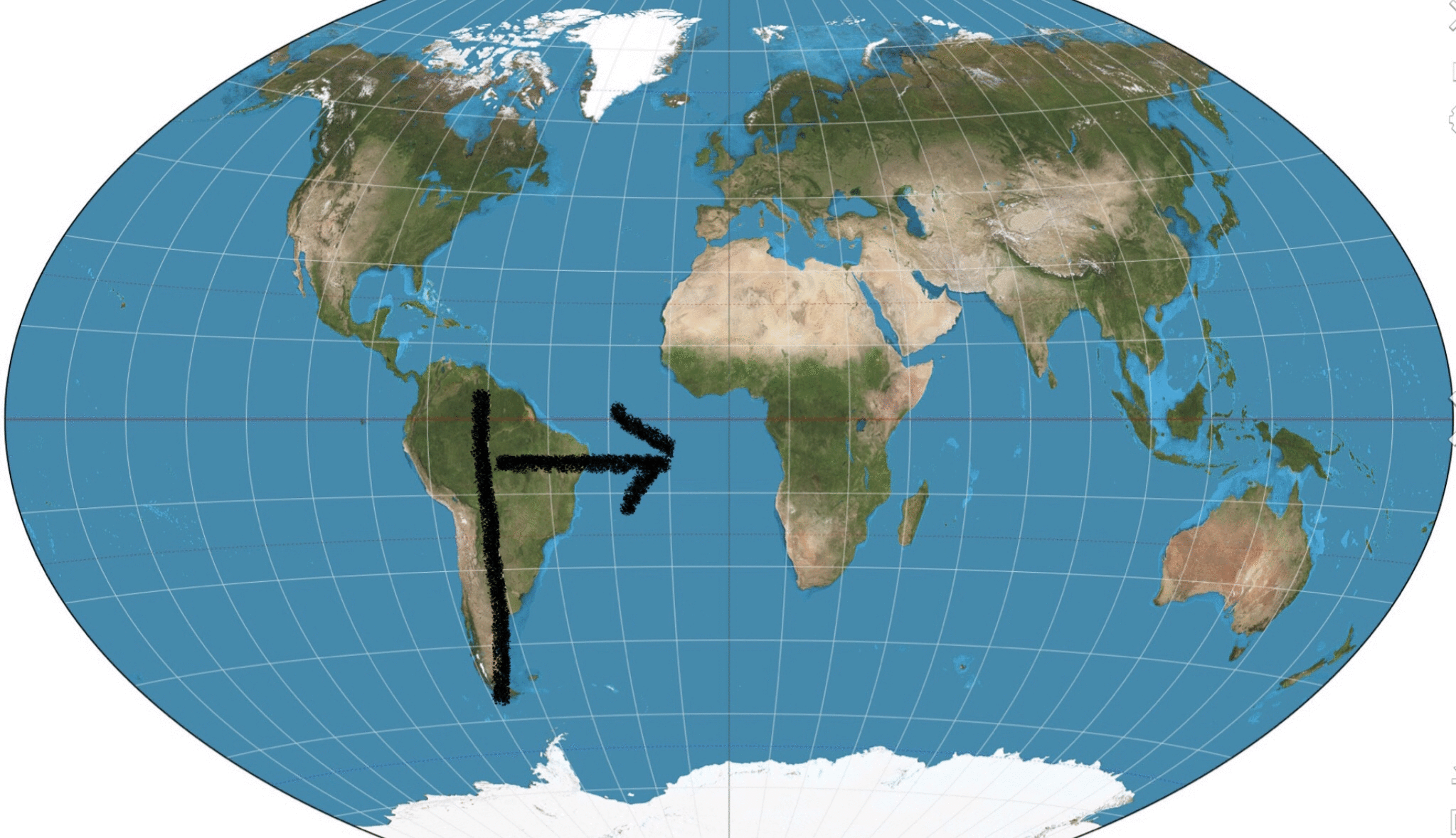
If you travel out of South America on the route drawn, you don’t end up in Antarctica.
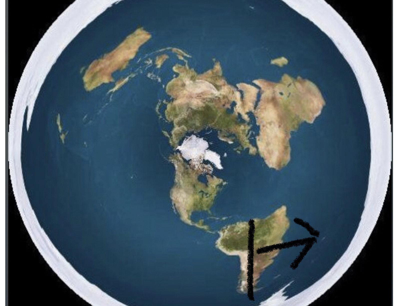
You travel to Africa
If the US Navy treated the earth as flat, its ships would get lost, would not be able to stay on station, would have inefficient fuel usage, and be at a serious tactical disadvantage.
What navy has a tactical advantage, and able to arrive on station faster and more efficiently because they treat the earth as flat vs spherical. None, because it’s practical to treat the earth for the sphere it is.
By the why. I was in the navy, and it was practical to treat the earth as the sphere it is.
If you travel out of South America on the route drawn, you don’t end up in Antarctica.
You travel to Africa
If the US Navy treated the earth as flat, its ships would get lost, would not be able to stay on station, would have inefficient fuel usage, and be at a serious tactical disadvantage.
What navy has a tactical advantage, and able to arrive on station faster and more efficiently because they treat the earth as flat vs spherical. None, because it’s practical to treat the earth for the sphere it is.
Random
Not moving goalposts just posting data
Currently trying to disprove agharti with fet (not disc floating in space) but as described in the bibllical sense. Couple of good friends from high school were in navy thank you for your service
Back on Topic in the Navy did you ever get to fly out 986km above the earth in order to see the entirety of the "globe?"
Did you navigate using flat maps?


a reply to: neutronflux
Not moving goalposts just posting data
Currently trying to disprove agharti with fet (not disc floating in space) but as described in the bibllical sense. Couple of good friends from high school were in navy thank you for your service
Back on Topic in the Navy did you ever get to fly out 986km above the earth in order to see the entirety of the "globe?"
Did you navigate using flat maps?
a reply to: neutronflux
a reply to: CrazyFox
Sigh.
Not chasing after propaganda.
Can you you address the USSR satellite Sputnik is a document and verified case of man changing the night sky and placing a man made object in orbit.
Can you address:
originally posted by: neutronflux
a reply to: CrazyFox
By the why. I was in the navy, and it was practical to treat the earth as the sphere it is.
If you travel out of South America on the route drawn, you don’t end up in Antarctica.
You travel to Africa
If the US Navy treated the earth as flat, its ships would get lost, would not be able to stay on station, would have inefficient fuel usage, and be at a serious tactical disadvantage.
What navy has a tactical advantage, and able to arrive on station faster and more efficiently because they treat the earth as flat vs spherical. None, because it’s practical to treat the earth for the sphere it is.
———-
I am guessing not because your a coward here to troll.
A blog is sometimes called a blogsphere but are not a giant ball.
What about the oosphere the atmosphere the topisphere etc etc.
Lots of sphericals in relation to earth.
Why are maps flat?
Every try navigating with a globe to get to the grocery store man it is pert near impossible if you do not already know the way.
I have no need to address low orbit space junk as it does not have the capacity to provide an image of the earth at the distance it is from the earth. That was pointed out in my post until you show an unaltered image taken from a greater distance than any sattelite currently is then you have nothing to prove the earth is round except cgi.
Perhaps it is a gyroscope ffs. no one knows you can have all the eq the best of the best minds and still no one has been out of our atmosphere ffs so until that happens neither side wins but round is looking more preposterous by the minute.
a reply to: neutronflux
a reply to: CrazyFox
You
Where did the picture come from that claims it’s a nasa photo? And cite where it was from less than 20 miles above. Taking a picture of a planet 7,917.5 mi in diameter. You’ll find the ratio is off, and the picture is a actual from a greater distance?
Anyway..
How about a third party documented event?
Does my cited and linked to third party evidence count as much as your uncited random propaganda with no way to verify its hasn’t been manipulated?
You
[pic]az61e33575.JPG
Where did the picture come from that claims it’s a nasa photo? And cite where it was from less than 20 miles above. Taking a picture of a planet 7,917.5 mi in diameter. You’ll find the ratio is off, and the picture is a actual from a greater distance?
Anyway..
How about a third party documented event?
From 100,000 Feet Above, a Camera Recorded Incredible Footage
www.ndtv.com...
Does my cited and linked to third party evidence count as much as your uncited random propaganda with no way to verify its hasn’t been manipulated?
a reply to: CrazyFox
You
No. The question is why there isn’t one master flat map. Instead of numerous map projections with different strengths and weaknesses.
And. Again…
This map will get you lost if you travel south of the equator because of the introduced errors of trying to fit a spherical earth on a flat map.
This map will get you need to go for most of the earth. But still has errors, and those errors are greater in margin as you get closer to the poles. Again, from trying to project a spherical earth on a flat surface.
You
Why are maps flat?
No. The question is why there isn’t one master flat map. Instead of numerous map projections with different strengths and weaknesses.
Map Projections
Anyone who has done a significant amount of practical navigation around the earth can tell you that there are different ways to represent the earth on a piece of paper, i.e. what we call maps. (There’s a difference between maps and nautical charts that ships use at sea. But that’s beyond the scope of this discussion.)
The are many different approaches to challenge representing a spherical object on a flat plane (i.e. a printed paper map) for use in a practical environment, like for shipboard navigation. The technical name for each of these approaches is called a “map projection”.
Because they represent the spherical earth in a flat plane, all map projections contain some kind of distortion.
For example, the most common map projection used was developed in 1569 by a Flemish cartographer named Gerardus Mercator and is called the “mercator projection.” This map projection is widely used in large part because it depicts compass courses as straight lines.
The mercator projection basically “projects” the spherical earth onto a cylinder and then unrolls the cylinder to lay it flat. This causes increasing distortion as one gets closer to the north and south poles along the top and bottom edges of the map when the whole earth is depicted.. With the mercator projection the shapes stay the same, but the area of the shape increases significantly towards the poles. Because of this distortion, land masses like Greenland and Antarctica appear far larger on these maps than they really are.
Even with this distortion, the mercator projection makes for an incredibly useful map.
The “azimuthal equidistant projection” is another map projection with some interesting properties. This map picks a point on the globe and then spreads the earth out from a sphere to a plane around that point creating a circular map. The distortions with this projection get bigger as the distance from the center of the circle increases. The distortions are pretty severe at the outer edges of the map circle when depicting large areas like the entire planet.
One useful property of this map projection is that all straight lines which pass through the center point of the projection are great circle routes. We’ll discuss the importance of those in a moment.
But the main reason I mention this one is because flat earth proponents tend to use one particular azimuthal equidistant projection. They invariably show the earth as a azimuthal equidistant projection centered on the North Pole.
They explain away the massive distortion of how this map depicts Antarctica by claiming everyone who has ever been there and reported back is in on the conspiracy to convince the rest of us that the world isn’t really flat. Regardless, they can’t explain how massively distorted Australia is with their map.
When we understand that all map projections are simply a way to depict a sphere on a flat piece of paper, we realize that their insistance that a particular projection is the only accurate way to map the earth makes proponents of a flat earth look a little silly.
newcreeations.org...
And. Again…
This map will get you lost if you travel south of the equator because of the introduced errors of trying to fit a spherical earth on a flat map.
This map will get you need to go for most of the earth. But still has errors, and those errors are greater in margin as you get closer to the poles. Again, from trying to project a spherical earth on a flat surface.
Mad Mike
a reply to: neutronflux
Now Why is our galaxy a disc and not a sphere
a reply to: neutronflux
Mike Hughes, born on February 9, 1956 and died in Barstow, California on February 22, 2020, was an American limousine driver and stuntman, considered by the press to be an amateur astronaut, known for his homemade rockets (the last of which caused his death) and for trying to prove the idea of a flat Earth.
In 2016, Hughes launches a fundraiser for a rocket and raises $310. Announcing that his goal would be to prove that the Earth is flat, he enjoys the support of the Flat Earth Society and the Platist community and receives $7,875 in sponsorship. The announced aim of his initiative is to produce a photo of the entire Earth in the form of a flat disc. After the stuntman’s death, sources close to him claim that he used Flat Earth as a means of promoting his funding, without being a true supporter.
On 22 February 2020, at the age of 64, Hughes died near Barstow, California, after the rocket he was flying crashed near Barstow, California when his parachutes accidentally stalled on take-off.
Now Why is our galaxy a disc and not a sphere
There are spherical galaxies, they tend to be smaller ones and are just a group of stars and gas. Too widely distributed to pull themselves together into a smaller sphere but without enough angular momentum to spin into a disk.
edit on 1/15/2022 by CrazyFox because: 986 km
a reply to: CrazyFox
The navy work around was to use celestial navigation and use a series of small area charts to minimize errors. The modern navel has replaced celestial navigation with GPS and navigation computers.
Anyway…
The navy work around was to use celestial navigation and use a series of small area charts to minimize errors. The modern navel has replaced celestial navigation with GPS and navigation computers.
Anyway…
Celestial Navigation
For me, the celestial navigation I did as a merchant mariner is really the definitive proof I need to know that the earth is spherical instead of a flat disk. Proponents of the flat earth conspiracy absolutely cannot refute the reality of celestial navigation.
As an interesting side note, those who advocate the flat earth like to claim that everyone thought the earth was flat until about 500 years or so ago. That is simply not true because the first person to accurately calculate the circumference of the earth was Eratosthenes in 240 BC. That’s significantly earlier than the 1500 AD time frame they often reference.
Yet there is a reason why the flat earth folks will use the 1500’s as the time when the spherical earth model began to gain prominence.
It’s because that is when mariners started figuring out how to make the first reasonably accurate calculations of their positions using celestial navigation. Latitude was much easier to calculate than Longitude because the lines of Latitude run roughly parallel to the rotation axis of the spherical earth. However, it took a few hundred more years before mariners were able to accurately calculate their Longitude.
Turns out they figured out the math involved to calculate Longitude fairly early on. However, they had a problem. Because the lines of Longitude run perpendicular to the spherical earth’s rotation, the Longitude calculation requires a way to keep very accurate time aboard ships. Pendulums don’t swing accurately when they are subject to the motion of the sea. It wasn’t until clock-making technology increased enough in roughly the 1700’s that celestial navigation fully matured.
The British were the first to master shipboard clock technology. It gave them a significant advantage in both war and trade, and therefore contributed to the rapid growth of their empire. I’ve been to the Royal Observatory in Greenwich, London, and have seen some of these early shipboard clocks first hand.
The only way the math required for accurate celestial navigation positions works out the way we calculate it is because the earth is spherical. If the earth was flat like some believe, celestial navigation would be based on plane trigonometry instead of spherical trigonometry. And if that were the case, I would be explaining to you that the earth must be flat. But it’s not. It’s a sphere.
Math does not lie.
Therefore, the fact that the spherical trigonometry based math required for celestial navigation produces accurate determinations of one’s position on the earth is definitive proof that the earth is spherical.
Celestial navigation truly makes proponents of the flat earth model look silly.
newcreeations.org...
new topics
-
Biden--My Uncle Was Eaten By Cannibals
US Political Madness: 34 minutes ago -
"We're All Hamas" Heard at Columbia University Protests
Social Issues and Civil Unrest: 35 minutes ago -
The good, the Bad and the Ugly!
Diseases and Pandemics: 2 hours ago -
Russian intelligence officer: explosions at defense factories in the USA and Wales may be sabotage
Weaponry: 4 hours ago -
African "Newcomers" Tell NYC They Don't Like the Free Food or Shelter They've Been Given
Social Issues and Civil Unrest: 5 hours ago -
Russia Flooding
Other Current Events: 7 hours ago -
MULTIPLE SKYMASTER MESSAGES GOING OUT
World War Three: 7 hours ago -
Two Serious Crimes Committed by President JOE BIDEN that are Easy to Impeach Him For.
US Political Madness: 8 hours ago -
911 emergency lines are DOWN across multiple states
Breaking Alternative News: 8 hours ago -
Former NYT Reporter Attacks Scientists For Misleading Him Over COVID Lab-Leak Theory
Education and Media: 10 hours ago
top topics
-
Go Woke, Go Broke--Forbes Confirms Disney Has Lost Money On Star Wars
Movies: 15 hours ago, 13 flags -
Pro Hamas protesters at Columbia claim hit with chemical spray
World War Three: 11 hours ago, 11 flags -
Elites disapearing
Political Conspiracies: 13 hours ago, 9 flags -
African "Newcomers" Tell NYC They Don't Like the Free Food or Shelter They've Been Given
Social Issues and Civil Unrest: 5 hours ago, 8 flags -
Freddie Mercury
Paranormal Studies: 15 hours ago, 7 flags -
911 emergency lines are DOWN across multiple states
Breaking Alternative News: 8 hours ago, 6 flags -
Two Serious Crimes Committed by President JOE BIDEN that are Easy to Impeach Him For.
US Political Madness: 8 hours ago, 5 flags -
A Personal Cigar UFO/UAP Video footage I have held onto and will release it here and now.
Aliens and UFOs: 13 hours ago, 5 flags -
Biden--My Uncle Was Eaten By Cannibals
US Political Madness: 34 minutes ago, 5 flags -
Former NYT Reporter Attacks Scientists For Misleading Him Over COVID Lab-Leak Theory
Education and Media: 10 hours ago, 4 flags
active topics
-
Russian intelligence officer: explosions at defense factories in the USA and Wales may be sabotage
Weaponry • 111 • : Kurokage -
"We're All Hamas" Heard at Columbia University Protests
Social Issues and Civil Unrest • 1 • : TheSingleBillie -
African "Newcomers" Tell NYC They Don't Like the Free Food or Shelter They've Been Given
Social Issues and Civil Unrest • 10 • : marg6043 -
Biden--My Uncle Was Eaten By Cannibals
US Political Madness • 7 • : Encia22 -
Joe Biden and Donald Trump are both traitors
2024 Elections • 62 • : Xtrozero -
Nirvana - Immigrant Song
Music • 8 • : PHYSIC2X -
Go Woke, Go Broke--Forbes Confirms Disney Has Lost Money On Star Wars
Movies • 17 • : PHYSIC2X -
A Personal Cigar UFO/UAP Video footage I have held onto and will release it here and now.
Aliens and UFOs • 11 • : PHYSIC2X -
Elites disapearing
Political Conspiracies • 24 • : PHYSIC2X -
Pro Hamas protesters at Columbia claim hit with chemical spray
World War Three • 13 • : PHYSIC2X