It looks like you're using an Ad Blocker.
Please white-list or disable AboveTopSecret.com in your ad-blocking tool.
Thank you.
Some features of ATS will be disabled while you continue to use an ad-blocker.

new tectonic fault system possibly identified s.e. of new zealand
page: 17
share:
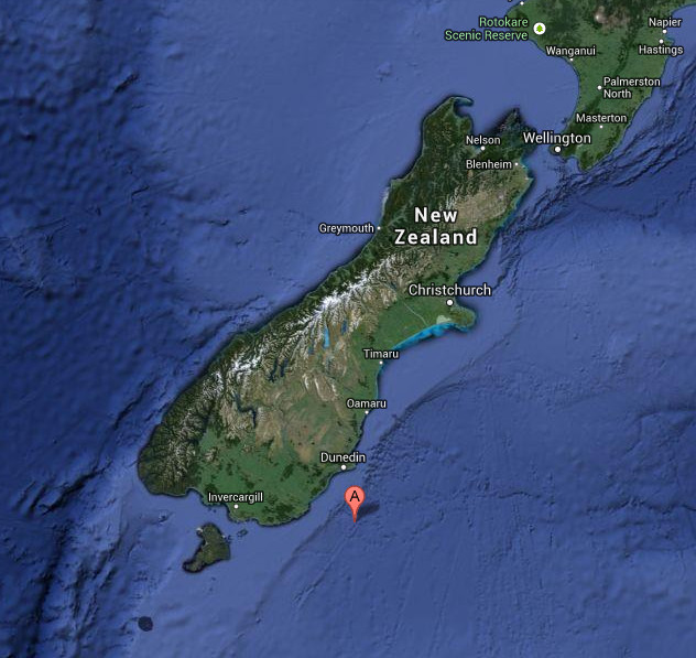
An Otago geologist's draft manuscript suggests there's a tectonic fault system off the South Island's east coast potentially comparable in size to the Alpine Fault.
the alpine fault is the one that made the country, it's pretty big..
University of Otago geologist Phil Ford has privately written a draft proposal, as yet unpublished, detailing the possibility of the major South Island intra-plate fault, with possible seismic and tsunami hazard implications...
"A strike length of greater than 1000km is clear, more than comparable with the Alpine Fault at about 800km south-southwest of the South Island"..
He said the potential of that suggested system warranted immediate research and if shown to be an active fault system then the scale must be "very significant" given a potential overall length of 1600km.
"If the proposed system is accepted by the New Zealand geological fraternity then early notice of serious tsunami vulnerability needs to be passed to governing authorities and civil defence organisations."
and i thought i lived in a nice quiet peaceful country.. i think maybe it's time to move xD
stuff
edit on 1-8-2013 by tachyonmind because: (no
reason given)
A potential length of 1600km is freaking HUGE! Considering the CSZ isn't even that long - is this one a subduction zone though? If it is, the
potential for disaster if that whole length unzipped would be ridiculous! S&F, thanks for sharing! Looking forward to seeing what Muzzy thinks about
this too!
reply to post by tachyonmind
They neatly side step the fact that a fault that length has Mag 9+ potential by only mentioning tsunamis.
Thank you for bringing this to our attention. S&F. I will put a link to this in the Quake Watch thread.
Here is a quake yesterday that I noticed that appears to be on that potential fault
2013-08-01 14:19:44, -46.631, 170.716, 4.1, 12.5, Off E. Coast Of S. Island.
then early notice of serious tsunami vulnerability needs to be passed to governing authorities and civil defence organisations.
They neatly side step the fact that a fault that length has Mag 9+ potential by only mentioning tsunamis.
Thank you for bringing this to our attention. S&F. I will put a link to this in the Quake Watch thread.
Here is a quake yesterday that I noticed that appears to be on that potential fault
2013-08-01 14:19:44, -46.631, 170.716, 4.1, 12.5, Off E. Coast Of S. Island.
edit on 2/8/2013 by PuterMan because: (no reason given)
reply to post by tachyonmind
Don't be surprised of course if this gets buried because the Church Of Geology, New Zealand Chapel, disagrees.
Ve haf vays off making zis disappear.
Don't be surprised of course if this gets buried because the Church Of Geology, New Zealand Chapel, disagrees.
Unpublished manuscripts needed peer review and publication in a reputable journal before being accepted as official, he said.
Ve haf vays off making zis disappear.
reply to post by PuterMan
thanks for the info puterman, i'll be watching the quake watch thread more closely now and i'll update if there's any news on the submission.
mwahaha! i vould velcome ze challenge.. xD
thanks for the info puterman, i'll be watching the quake watch thread more closely now and i'll update if there's any news on the submission.
Ve haf vays off making zis disappear.
mwahaha! i vould velcome ze challenge.. xD
edit on 2-8-2013 by tachyonmind because: (no reason given)
reply to post by bkaust
No it isn't a subduction zone but that does not matter. The potential of a fault is based on it's dimensions and it does not matter if it is in a subduction zone or not.
Cascadia may be a subduction zone with Mag 9 potential but then you must consider the shorter New Madrid SZ which has documented Mag 8+ and is intra-plate.
Even though this would be intra-plate the length gives it the Mag 9 potential if it all went at once.
edit on 2/8/2013 by PuterMan because: rats!! well spelling actually!
I wonder what his theory is based on?
the continental shelf? matches with his lines, but that doesn't necessarily mean its a Fault there
recent quakes there in July?, that one P'man posted has been deleted from the database since, which raises the question of reliability of the data from Geonet. All quake entries are preliminary until analyzed by a geologist, and often the automatic SeisComp3 system developed by Geofon and introduced by Geonet in Sept 2012 has proven to be erroneous.
The quakes in that region mentioned can be seen on my map of July 2013
2013/month
If one checks the other years (2012 and 2009) from the drop down tabs at the top of the page, one can see ....................... not much
except one quake on 28/5/2012,
also deleted (just did a new search of the database now)
NIWA is mentioned in the story, well that is the end of the investigation right here, they are a closed shop, you can't even get into the NZ offshore faults database without signing a secrecy document (Chris Crowe of Christchurch Live told me)
Phil Ford may be right, but how can anyone possibly comment when the facts are not presented.
the continental shelf? matches with his lines, but that doesn't necessarily mean its a Fault there
recent quakes there in July?, that one P'man posted has been deleted from the database since, which raises the question of reliability of the data from Geonet. All quake entries are preliminary until analyzed by a geologist, and often the automatic SeisComp3 system developed by Geofon and introduced by Geonet in Sept 2012 has proven to be erroneous.
The quakes in that region mentioned can be seen on my map of July 2013
2013/month
If one checks the other years (2012 and 2009) from the drop down tabs at the top of the page, one can see ....................... not much
except one quake on 28/5/2012,
REF: 3713212
LAT/LONG: -45.16927 172.15179
UTC: 2012/5/28 2:51:41
NZST: 2012/5/28 14:51:41
DEPTH: 211 km
MAG: 5.019 ML
LOCATION: os E of Oamaru, Otago
also deleted (just did a new search of the database now)
NIWA is mentioned in the story, well that is the end of the investigation right here, they are a closed shop, you can't even get into the NZ offshore faults database without signing a secrecy document (Chris Crowe of Christchurch Live told me)
Phil Ford may be right, but how can anyone possibly comment when the facts are not presented.
new topics
-
Las Vegas UFO Spotting Teen Traumatized by Demon Creature in Backyard
Aliens and UFOs: 3 hours ago -
2024 Pigeon Forge Rod Run - On the Strip (Video made for you)
Automotive Discussion: 4 hours ago -
Gaza Terrorists Attack US Humanitarian Pier During Construction
Middle East Issues: 4 hours ago -
The functionality of boldening and italics is clunky and no post char limit warning?
ATS Freshman's Forum: 5 hours ago -
Meadows, Giuliani Among 11 Indicted in Arizona in Latest 2020 Election Subversion Case
Mainstream News: 6 hours ago -
Massachusetts Drag Queen Leads Young Kids in Free Palestine Chant
Social Issues and Civil Unrest: 6 hours ago -
Weinstein's conviction overturned
Mainstream News: 7 hours ago -
Supreme Court Oral Arguments 4.25.2024 - Are PRESIDENTS IMMUNE From Later Being Prosecuted.
Above Politics: 9 hours ago -
Krystalnacht on today's most elite Universities?
Social Issues and Civil Unrest: 9 hours ago -
Chris Christie Wishes Death Upon Trump and Ramaswamy
Politicians & People: 10 hours ago
top topics
-
Krystalnacht on today's most elite Universities?
Social Issues and Civil Unrest: 9 hours ago, 9 flags -
Supreme Court Oral Arguments 4.25.2024 - Are PRESIDENTS IMMUNE From Later Being Prosecuted.
Above Politics: 9 hours ago, 8 flags -
Weinstein's conviction overturned
Mainstream News: 7 hours ago, 7 flags -
University of Texas Instantly Shuts Down Anti Israel Protests
Education and Media: 12 hours ago, 6 flags -
Massachusetts Drag Queen Leads Young Kids in Free Palestine Chant
Social Issues and Civil Unrest: 6 hours ago, 5 flags -
Gaza Terrorists Attack US Humanitarian Pier During Construction
Middle East Issues: 4 hours ago, 5 flags -
Meadows, Giuliani Among 11 Indicted in Arizona in Latest 2020 Election Subversion Case
Mainstream News: 6 hours ago, 5 flags -
Las Vegas UFO Spotting Teen Traumatized by Demon Creature in Backyard
Aliens and UFOs: 3 hours ago, 3 flags -
Chris Christie Wishes Death Upon Trump and Ramaswamy
Politicians & People: 10 hours ago, 2 flags -
2024 Pigeon Forge Rod Run - On the Strip (Video made for you)
Automotive Discussion: 4 hours ago, 2 flags
active topics
-
University of Texas Instantly Shuts Down Anti Israel Protests
Education and Media • 203 • : cherokeetroy -
Las Vegas UFO Spotting Teen Traumatized by Demon Creature in Backyard
Aliens and UFOs • 8 • : Macenroe82 -
British TV Presenter Refuses To Use Guest's Preferred Pronouns
Education and Media • 163 • : rigel4 -
SHORT STORY WRITERS CONTEST -- April 2024 -- TIME -- TIME2024
Short Stories • 23 • : DontTreadOnMe -
Meadows, Giuliani Among 11 Indicted in Arizona in Latest 2020 Election Subversion Case
Mainstream News • 13 • : xuenchen -
-@TH3WH17ERABB17- -Q- ---TIME TO SHOW THE WORLD--- -Part- --44--
Dissecting Disinformation • 684 • : daskakik -
Any one suspicious of fever promotions events, major investor Goldman Sachs card only.
The Gray Area • 10 • : Caver78 -
Chris Christie Wishes Death Upon Trump and Ramaswamy
Politicians & People • 21 • : WhitewaterSquirrel -
Supreme Court Oral Arguments 4.25.2024 - Are PRESIDENTS IMMUNE From Later Being Prosecuted.
Above Politics • 78 • : chr0naut -
The Acronym Game .. Pt.3
General Chit Chat • 7750 • : bally001
7