It looks like you're using an Ad Blocker.
Please white-list or disable AboveTopSecret.com in your ad-blocking tool.
Thank you.
Some features of ATS will be disabled while you continue to use an ad-blocker.

Nazca Lines – River Trip
page: 11
share:
Theories on how and why the lines of Nazca were formed are abundant on ATS, and probably represent a good cross-section of the variety of academic &
philosophical explanations found throughout modern civilization.
While my theories on these matters are not as resolute as others’, study of “the lines” appears to have yielded a perspective I’ve not seen covered in other threads (or elsewhere).
In the picture below, derived from Google Earth at coordinates 14*41’41.99” S 75*07’10.36” W, with an image date of 8/16/2011, the two plateaus most often referred to in discussions of the “Nazca Lines” are highlighted in red outlines.
The town of Palpa is located at the northern (upper) extreme, and the town of Nazca in the southeastern (lower right) portion.
(files.abovetopsecret.com... )
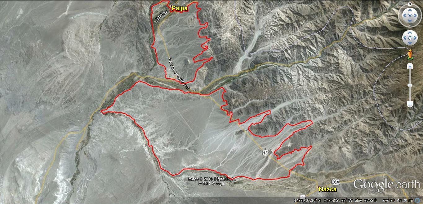
If it is not apparent because of the size of the “picture”, there are four prominent river valleys involved in this scene. In the picture below, they are identified as follows:
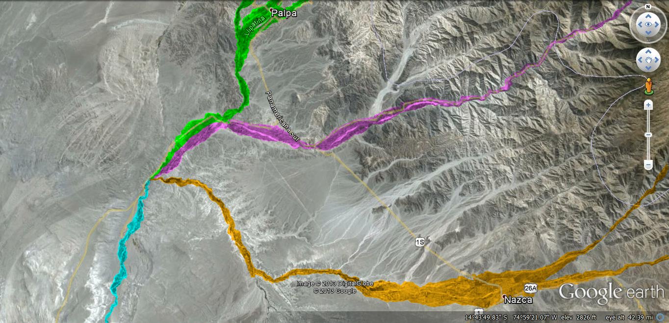
1. Highlighted in green, coming from the north, and following the west side of what I will call “The Palpa plateau”,
2. Highlighted in pink, flowing east-west between The Palpa plateau and what we’ll call “The Nazca plateau”,
3. Highlighted in orange, flowing generally east-west, and forming the southern boundary of The Nazca plateau, and
4. Highlighted in blue, beginning at the western extent of The Nazca plateau, and flowing generally south-southwest from there.
(files.abovetopsecret.com... )
The more exciting Nazca lines center around the animal (& other) figures situated amid some rather large geometric complexes on The Nazca plateau.
As has been noted in numerous other threads, modern academia attributes said “long straight lines” to a culture (or even “successive cultures”) situated between a few centuries B.C. and perhaps 600 A.D.
In keeping with “modern academia”’s tendency to interpret archaeological data (mankind’s history) without straying too far from either “Biblical” or “Darwinian” guidelines…and thus, with an eye to the generally accepted history of South America’s indigenous peoples & cultures…we are told that the lines were the result of religious pilgrimages, or for the purpose of religious ceremonies &/or worship.
Kantzveldt has an interesting take on such an explanation in this thread…
www.abovetopsecret.com...
One key feature of many (if not most) of the major geographic configurations found on the plateaus and surrounds, that I have not seen discussed, are the lines that extend from the configurations…
Thus – how do they figure in to the whole picture?
To discuss or consider the centerpiece of a puzzle, without considering its context, will almost always leave one with an incomplete (and/or inaccurate) understanding.
To consider or discuss just what I’ve found in/on the plateaus and their surrounds would require volumes…so, we will begin with something simple…
The map, below – which identifies five stops on our River Trip…
( files.abovetopsecret.com... )
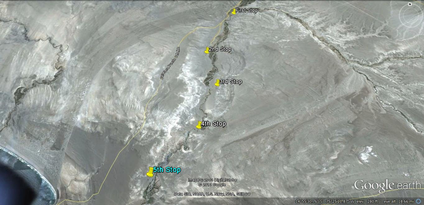
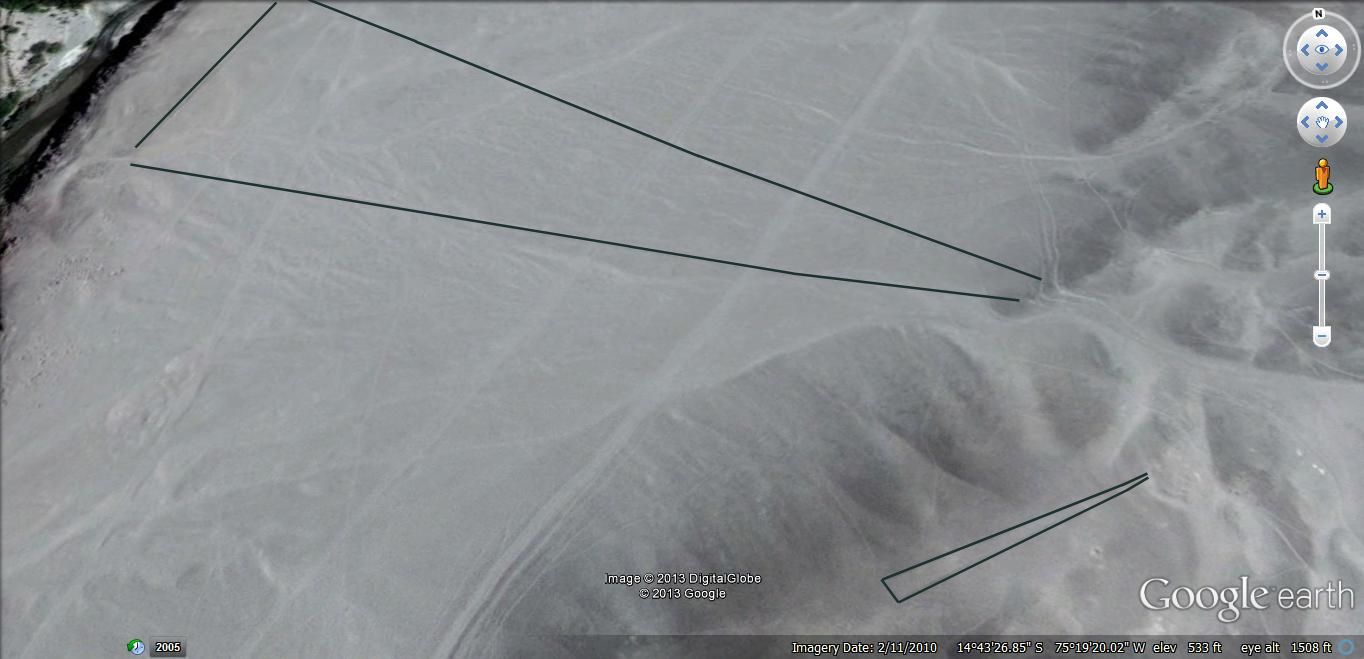
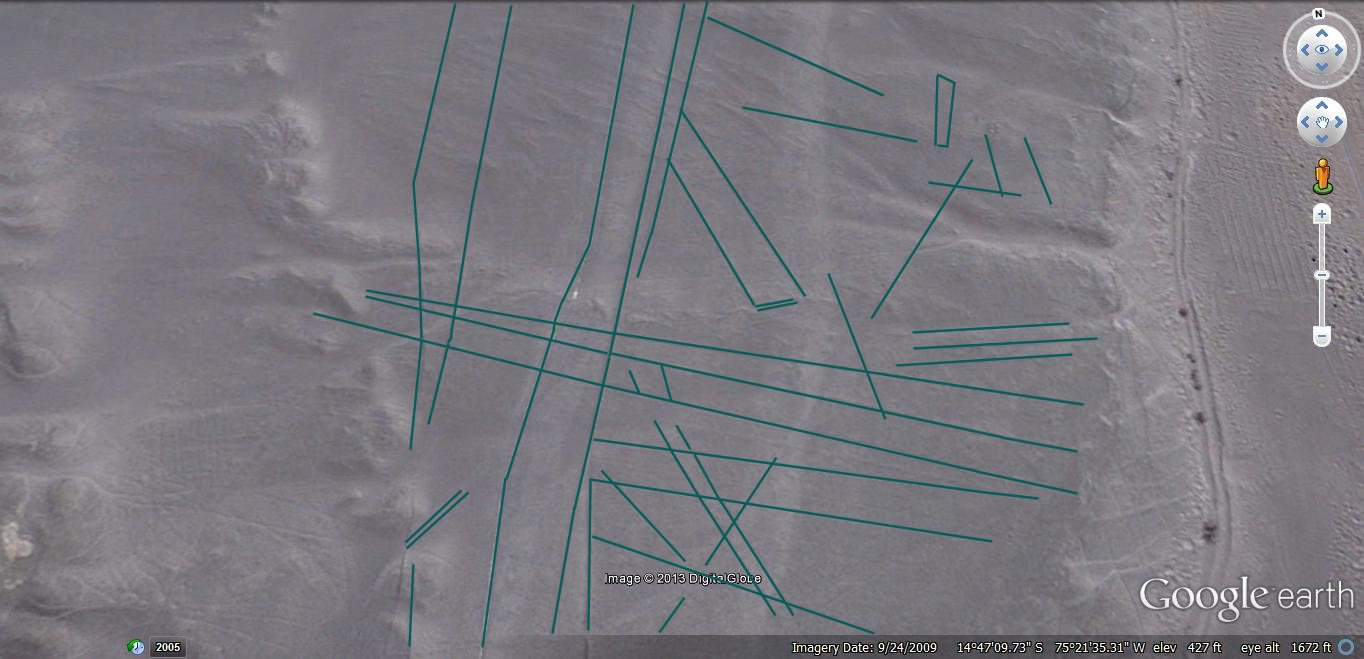
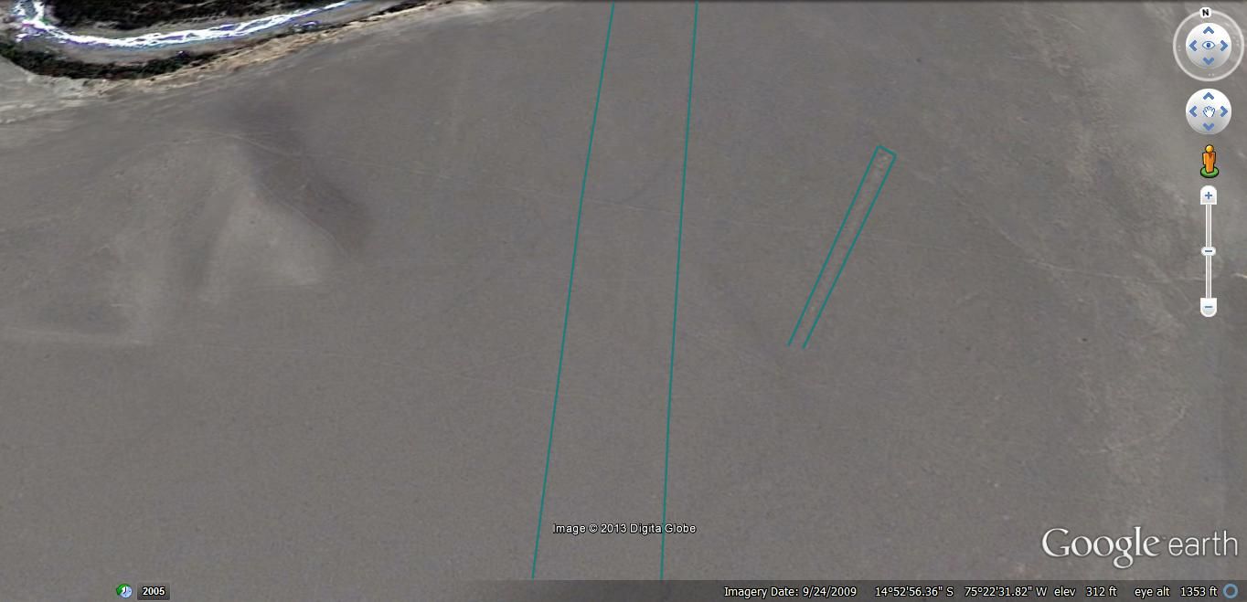
First Stop - A close-up of at least one of the features of interest… This is found at 14*43’26.85” S 75*19’20.02” W, and is situated on the east or southeast side of the “river”.
(files.abovetopsecret.com... )
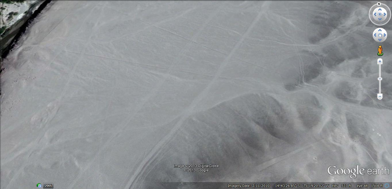
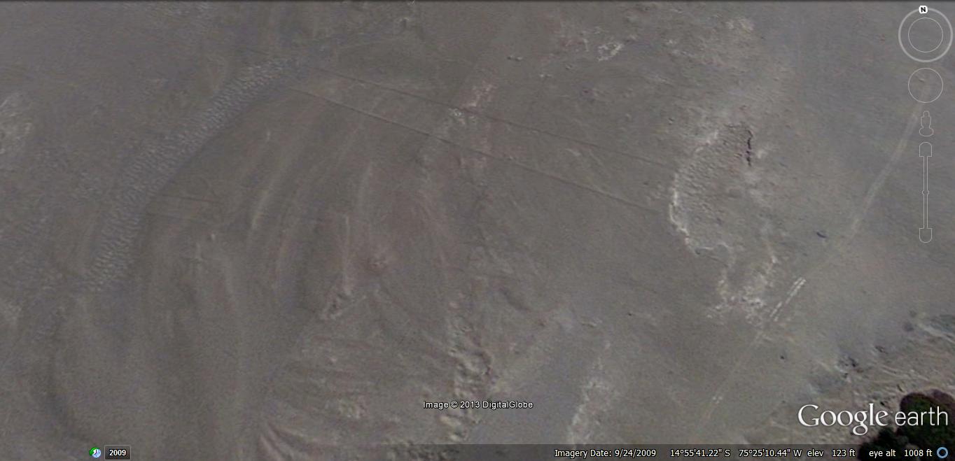
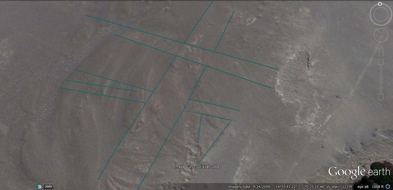
In case it is difficult to identify the features of interest…the following “picture” has been modified for your convenience.
(files.abovetopsecret.com... )
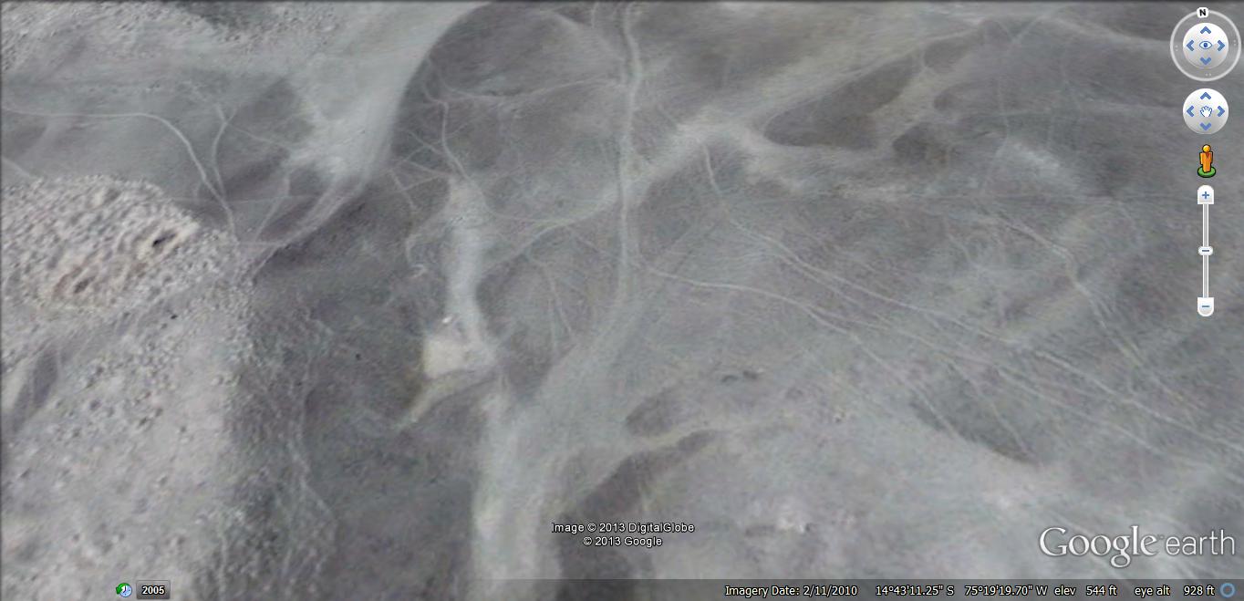
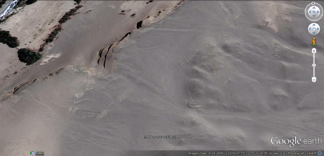
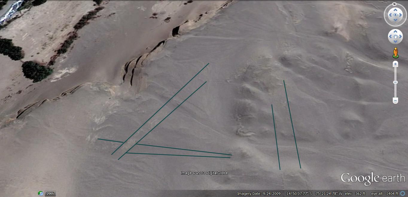
As you’ll note, I have not highlighted all potentially-relevant “lines”…but, in case you don’t have the time or interest to do some searching of your own (on Google Earth – or otherwise), here is another “picture” taken just north of the first…and is followed with another that outlines what I count “relevant”…
(files.abovetopsecret.com... )
(files.abovetopsecret.com... )
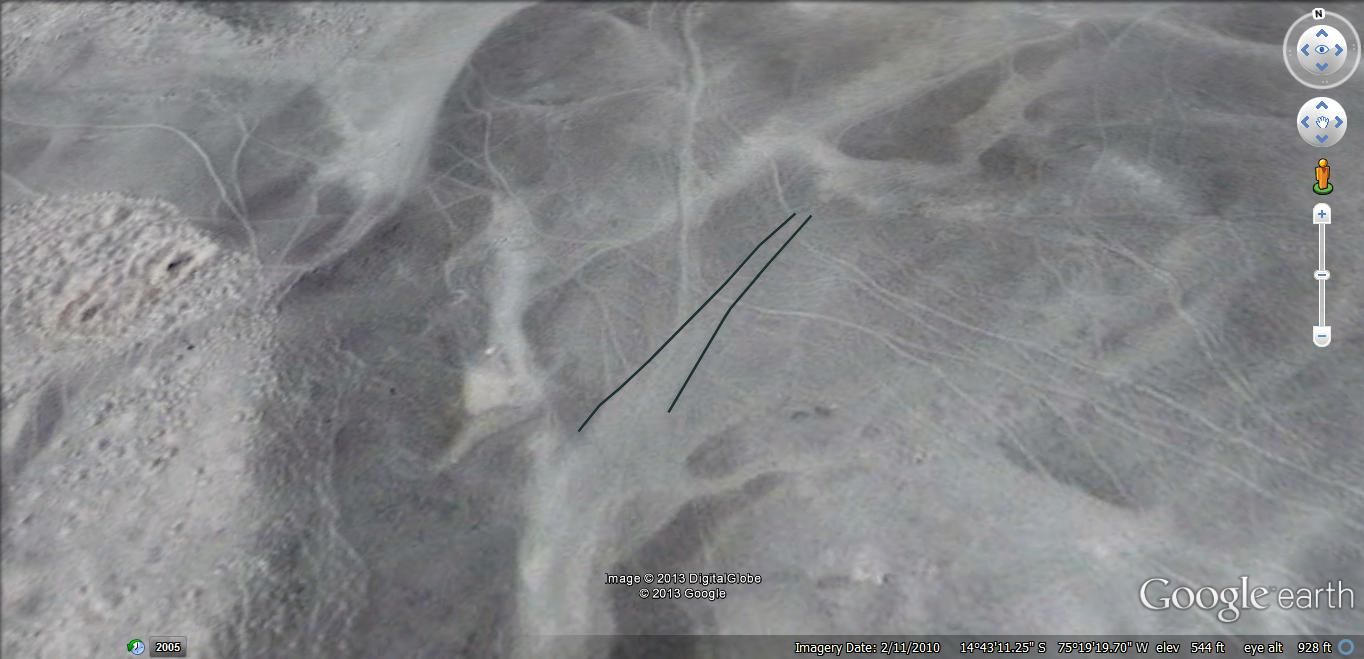
As can be seen in the un-touched “picture”, geologic progress/creep has worked to obscure some of the “features”. It is not my intent to go into that piece of the puzzle in this OP. Perhaps another time…
While there are many more “features” in and around this “First Stop”, it would take too long and too much effort to start identifying and addressing them, here…
So – on to the 2nd Stop…
(files.abovetopsecret.com... )
Just for kicks – I’ve outlined more than just the “big” structures…
(files.abovetopsecret.com... )
And…on to the 3rd Stop…
(files.abovetopsecret.com... )
…and one with some features outlined…
(files.abovetopsecret.com... )
And…to the 4th Stop…
(files.abovetopsecret.com... )
…and…outlines…
(files.abovetopsecret.com... )
And…if anyone is still following this – you may be wondering at “the point?”…
… Let’s take a look at the 5th Stop…and I’ll try to explain…
( files.abovetopsecret.com... )
…outlines…
( files.abovetopsecret.com... )
If it wasn’t apparent, the progress of the journey, from First to 5th Stops, heads toward the coast.
We could make another stop before getting to the coast, with the same tell-tale “features” as the previous stops…but, that shouldn’t be necessary for the purpose of this thread.
At the coast, there are more “features” that I believe prove that those who placed the “lines” along the river-valley leading to the Nazca & Palpa plateaus, also attempted to mark the entrance for sea-faring trade-traffic.
One of the more interesting questions “the Nazca lines” presents to me, is – “Why do they extend so far away?”
If you look more closely at “where” each of these “Stops” along the ocean-going river valley are stationed…you will find that they each have a significant “staging” area. They are not cramped by steep mountains on all sides…
In other words – there’s room to do…something BIG.
If you “follow the lines” into the surrounding lands (generally – mountainous), you will find abundant evidence of mining. In my opinion, the mining can be differentiated between “ancient” and “contemporary”…and, perhaps in another thread, we can explore those differences.
Nevertheless – If, indeed, these “Stops” along the river, were staging areas…we would probably, generally assume that they would be for the purpose/s of loading/unloading some kind of boat or barge, as any other kind of wheeled cart/vehicle would have to travel “back up the mountain/s”, since there are numerous stretches along the river valley that would be impassable with reliable consistency.
If that “assumption” is accurate – we might want to consider that this river was once much wider and/or deeper…as watercraft carrying any quantities of mined goods would need enough water to displace to navigate the trip back to the coast.
Looking forward to your feedback & thoughts…
Thanks for your time and consideration.
While my theories on these matters are not as resolute as others’, study of “the lines” appears to have yielded a perspective I’ve not seen covered in other threads (or elsewhere).
In the picture below, derived from Google Earth at coordinates 14*41’41.99” S 75*07’10.36” W, with an image date of 8/16/2011, the two plateaus most often referred to in discussions of the “Nazca Lines” are highlighted in red outlines.
The town of Palpa is located at the northern (upper) extreme, and the town of Nazca in the southeastern (lower right) portion.
(files.abovetopsecret.com... )
If it is not apparent because of the size of the “picture”, there are four prominent river valleys involved in this scene. In the picture below, they are identified as follows:
1. Highlighted in green, coming from the north, and following the west side of what I will call “The Palpa plateau”,
2. Highlighted in pink, flowing east-west between The Palpa plateau and what we’ll call “The Nazca plateau”,
3. Highlighted in orange, flowing generally east-west, and forming the southern boundary of The Nazca plateau, and
4. Highlighted in blue, beginning at the western extent of The Nazca plateau, and flowing generally south-southwest from there.
(files.abovetopsecret.com... )
The more exciting Nazca lines center around the animal (& other) figures situated amid some rather large geometric complexes on The Nazca plateau.
As has been noted in numerous other threads, modern academia attributes said “long straight lines” to a culture (or even “successive cultures”) situated between a few centuries B.C. and perhaps 600 A.D.
In keeping with “modern academia”’s tendency to interpret archaeological data (mankind’s history) without straying too far from either “Biblical” or “Darwinian” guidelines…and thus, with an eye to the generally accepted history of South America’s indigenous peoples & cultures…we are told that the lines were the result of religious pilgrimages, or for the purpose of religious ceremonies &/or worship.
Kantzveldt has an interesting take on such an explanation in this thread…
www.abovetopsecret.com...
One key feature of many (if not most) of the major geographic configurations found on the plateaus and surrounds, that I have not seen discussed, are the lines that extend from the configurations…
Thus – how do they figure in to the whole picture?
To discuss or consider the centerpiece of a puzzle, without considering its context, will almost always leave one with an incomplete (and/or inaccurate) understanding.
To consider or discuss just what I’ve found in/on the plateaus and their surrounds would require volumes…so, we will begin with something simple…
The map, below – which identifies five stops on our River Trip…
( files.abovetopsecret.com... )
First Stop - A close-up of at least one of the features of interest… This is found at 14*43’26.85” S 75*19’20.02” W, and is situated on the east or southeast side of the “river”.
(files.abovetopsecret.com... )
In case it is difficult to identify the features of interest…the following “picture” has been modified for your convenience.
(files.abovetopsecret.com... )
As you’ll note, I have not highlighted all potentially-relevant “lines”…but, in case you don’t have the time or interest to do some searching of your own (on Google Earth – or otherwise), here is another “picture” taken just north of the first…and is followed with another that outlines what I count “relevant”…
(files.abovetopsecret.com... )
(files.abovetopsecret.com... )
As can be seen in the un-touched “picture”, geologic progress/creep has worked to obscure some of the “features”. It is not my intent to go into that piece of the puzzle in this OP. Perhaps another time…
While there are many more “features” in and around this “First Stop”, it would take too long and too much effort to start identifying and addressing them, here…
So – on to the 2nd Stop…
(files.abovetopsecret.com... )
Just for kicks – I’ve outlined more than just the “big” structures…
(files.abovetopsecret.com... )
And…on to the 3rd Stop…
(files.abovetopsecret.com... )
…and one with some features outlined…
(files.abovetopsecret.com... )
And…to the 4th Stop…
(files.abovetopsecret.com... )
…and…outlines…
(files.abovetopsecret.com... )
And…if anyone is still following this – you may be wondering at “the point?”…
… Let’s take a look at the 5th Stop…and I’ll try to explain…
( files.abovetopsecret.com... )
…outlines…
( files.abovetopsecret.com... )
If it wasn’t apparent, the progress of the journey, from First to 5th Stops, heads toward the coast.
We could make another stop before getting to the coast, with the same tell-tale “features” as the previous stops…but, that shouldn’t be necessary for the purpose of this thread.
At the coast, there are more “features” that I believe prove that those who placed the “lines” along the river-valley leading to the Nazca & Palpa plateaus, also attempted to mark the entrance for sea-faring trade-traffic.
One of the more interesting questions “the Nazca lines” presents to me, is – “Why do they extend so far away?”
If you look more closely at “where” each of these “Stops” along the ocean-going river valley are stationed…you will find that they each have a significant “staging” area. They are not cramped by steep mountains on all sides…
In other words – there’s room to do…something BIG.
If you “follow the lines” into the surrounding lands (generally – mountainous), you will find abundant evidence of mining. In my opinion, the mining can be differentiated between “ancient” and “contemporary”…and, perhaps in another thread, we can explore those differences.
Nevertheless – If, indeed, these “Stops” along the river, were staging areas…we would probably, generally assume that they would be for the purpose/s of loading/unloading some kind of boat or barge, as any other kind of wheeled cart/vehicle would have to travel “back up the mountain/s”, since there are numerous stretches along the river valley that would be impassable with reliable consistency.
If that “assumption” is accurate – we might want to consider that this river was once much wider and/or deeper…as watercraft carrying any quantities of mined goods would need enough water to displace to navigate the trip back to the coast.
Looking forward to your feedback & thoughts…
Thanks for your time and consideration.
I don't see any water in those rivers. I think a better term would be washes. Rivers are sort of permanent features. Washes the result intermittent flows and flash flooding. That's what it looks like to me. Just the sort of thing to occur in arid terrain.
If it is not apparent because of the size of the “picture”, there are four prominent river valleys involved in this scene.
Doesn't look so navigable. Pretty steep in the hills. When water flows there it would be flowing fast!
edit on 6/1/2013 by Phage because: (no
reason given)
Originally posted by Phage
I don't see any water in those rivers. I think a better term would be washes. Rivers are sort of permanent features. Washes the result intermittent flows and flash flooding. That's what it looks like to me. Just the sort of thing to occur in arid terrain.
Doesn't look so navigable. Pretty steep in the hills. When water flows there it would be flowing fast!
Agreed, generally speaking.
They actually seem more like "rock flows"...but, that's another topic.
If you're referring primarily to the "river-valleys" coming out of the mountains, there are some evidences of "water flow", when zoomed-in, but it doesn't look navigable above a certain point.
In fact - good portions of that "river-valley" flowing south through Coyungo are skimpy on water, as well.
reply to post by WanDash
The washes in the flatter areas are fed by the valleys. Check the elevations. Those valleys are steep.
The washes in the flatter areas are fed by the valleys. Check the elevations. Those valleys are steep.
reply to post by WanDash
hello, interesting conclusions,,,,,
i am always searching viking remains around here, (i live in a location where 2000 vikings fought with us)
and my search zone is pretty hard to determine sometimes because the ocean was 70 meters higher than now,..
that was a almost thousand years ago,,,,
and nazca is several thousand years so there really is no telling where water flowed,
some places sink while others elevate,,,,
you may be on to something here,,,,
now i started to think that maybe they could have been used as irrigation and drainage for fields?
as we have squared and round fields, maybe they had monkey shaped fields,,,
--just a thought--
edit on 2-6-2013 by solve because: just a thought
Originally posted by Phage
reply to post by WanDash
The washes in the flatter areas are fed by the valleys. Check the elevations. Those valleys are steep.
I am familiar with the terrain/s and elevations.
Perhaps it was not obvious-enough in the OP, as to "which" river-valley is being referenced.
The water course is "followable" (evident) all the way from the ocean to at least The Palpa plateau...and, aside from places where the water is obscured by vegetation or other causes, it appears to be running as rivers do.
The First Stop is south of where the "river valley" highlighted in orange meets the one highlighted in green & pink.
If it were not for the fact that the same features found on the plateaus (and elsewhere) are likewise found along this route...and additionally - found at areas such as were shown in the OP (probably needed some shots from a higher altitude to convey that perspective)...all the way to the outlet to the Pacific - I would not have come to this conclusion.
edit on 6/2/2013 by WanDash because: clarification
Originally posted by solve
...hello, interesting conclusions,,,,,
i am always searching viking remains around here, (i live in a location where 2000 vikings fought with us)
and my search zone is pretty hard to determine sometimes because the ocean was 70 meters higher than now,..
that was a almost thousand years ago,,,,
and nazca is several thousand years so there really is no telling where water flowed,
some places sink while others elevate,,,,
you may be on to something here,,,,
..."searching Viking remains"...sounds like fun. Any luck so far?
Appreciate your consideration!
reply to post by WanDash
no not yet,,, many others have found amazingly well preserved bones and swords etc...
i will have a metal detector later in the summer, so thats going to increase my chances, of finding something..
no not yet,,, many others have found amazingly well preserved bones and swords etc...
i will have a metal detector later in the summer, so thats going to increase my chances, of finding something..
Originally posted by solve
...no not yet,,, many others have found amazingly well preserved bones and swords etc...
i will have a metal detector later in the summer, so thats going to increase my chances, of finding something..
Good Luck!
Maybe you'll find some well-preserved mead too.
The OP asked (or - hoped) for feedback...and, Phage contributed with observations regarding the improbable navigation of the river in question.
I concur - as did the OP - that such navigation would not have been practically achieved with the river in a state of fill & flow as contemporary
evidences illustrate.
solve offered a thumbs-up to the possibility of such an explanation, if the conditional requirement proposed in the OP were in effect during the times/ages when the "the Nazca lines" were implemented and/or "in use".
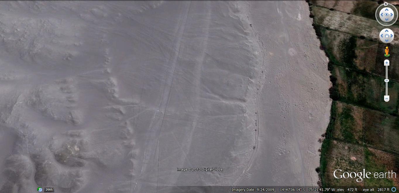
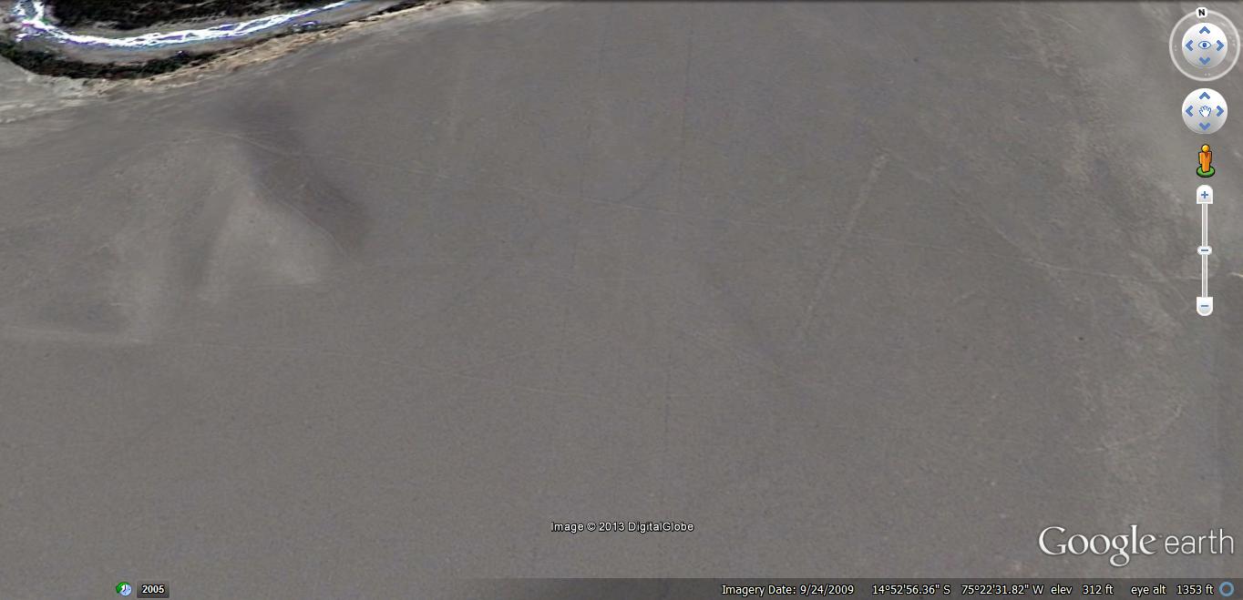
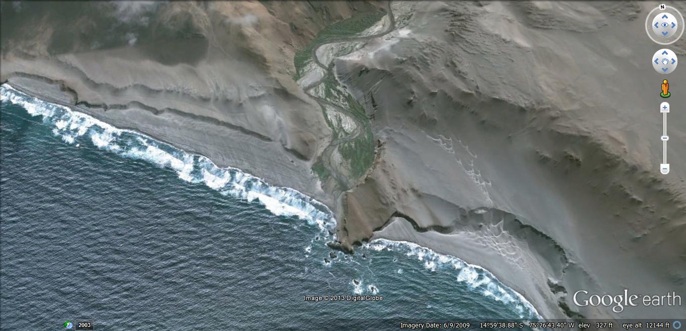
For visual reference - here is a view of the outlet/inlet where the "river valley" meets the Pacific Ocean...
( files.abovetopsecret.com... )
For those looking only for "ships from the sky"...I know, this explanation does not sit well.
For those looking only for explanations of "shaman (or other religious) rituals"...this may be repulsive.
For those looking only for explanations that conclude "this was done by ancestral mankind, with the rudimentary tools and procedures/methods available at that time"...this is less than appealing...because it extends the business, cultural & industrial complex to more and more distant locales (and/or communities)...
The evidences all the way down this "river valley" illustrate that it was the same culture (group), using the same methods and procedures, and with (apparently) the same "motivation/s" as that of the Palpa & Nazca plateaus (and their environs).
Moving significantly further away, one can find evidences that seem to show other groups/cultures attempting to mimic the "effects"...but with much more brute and/or inexact results.
Not saying that all of the "lines" in and/or around the Nazca & Palpa plateaus are "exact"...but, there is an apparent standard that seems to autograph the product/s.
A question that might arise from this (and other evidences) is - which came first -- Nazca/Palpa (and its surroundings)...or...along the river valley?
Likewise - were they mining the region long before the artistic & geometric displays of the Nazca and Palpa plateau's were even a consideration? (the geometric symbols "point" to significant mining areas)
Thanks again for your time.
solve offered a thumbs-up to the possibility of such an explanation, if the conditional requirement proposed in the OP were in effect during the times/ages when the "the Nazca lines" were implemented and/or "in use".
For visual reference - here is a view of the outlet/inlet where the "river valley" meets the Pacific Ocean...
( files.abovetopsecret.com... )
For those looking only for "ships from the sky"...I know, this explanation does not sit well.
For those looking only for explanations of "shaman (or other religious) rituals"...this may be repulsive.
For those looking only for explanations that conclude "this was done by ancestral mankind, with the rudimentary tools and procedures/methods available at that time"...this is less than appealing...because it extends the business, cultural & industrial complex to more and more distant locales (and/or communities)...
The evidences all the way down this "river valley" illustrate that it was the same culture (group), using the same methods and procedures, and with (apparently) the same "motivation/s" as that of the Palpa & Nazca plateaus (and their environs).
Moving significantly further away, one can find evidences that seem to show other groups/cultures attempting to mimic the "effects"...but with much more brute and/or inexact results.
Not saying that all of the "lines" in and/or around the Nazca & Palpa plateaus are "exact"...but, there is an apparent standard that seems to autograph the product/s.
A question that might arise from this (and other evidences) is - which came first -- Nazca/Palpa (and its surroundings)...or...along the river valley?
Likewise - were they mining the region long before the artistic & geometric displays of the Nazca and Palpa plateau's were even a consideration? (the geometric symbols "point" to significant mining areas)
Thanks again for your time.
I find it interesting that this speculation always starts out with
* look at Google Earth.
* come up with an idea.
It never seems to start out with
* who lives there that are descendants of the original people?
* what are there legends?
* which are the original lines and which are NOT part of the lines (created by modern people and intersecting the lines)?
* which are natural features?
* what was the landscape like when the lines were created (based on pollen data)?
* what art and artifacts were left that relate to the lines?
* what is already known about the above questions?
There's interesting material out there, including specific things about the figures and lines and how they relate to the culture of the time.
Originally posted by Byrd
I find it interesting that this speculation always starts out with
* look at Google Earth.
* come up with an idea.
Thanks for the input.
Seems you've "put words in my mouth", here.
The "speculation", as you put it, was tempered with "evidences" (which, you apparently discount).
And - to top it off - this was merely an "excursion" away from the hub of interest, that showed something I've not seen discussed anywhere... If the resources (you allude to later) cover this aspect, I would be grateful if you would point me in said direction (I've not found them, yet).
It never seems to start out with
* who lives there that are descendants of the original people?
* what are there legends?
* which are the original lines and which are NOT part of the lines (created by modern people and intersecting the lines)?
* which are natural features?
* what was the landscape like when the lines were created (based on pollen data)?
* what art and artifacts were left that relate to the lines?
* what is already known about the above questions?
While I could spend time defending my choice over what should have been important to OPEN the discussion with -- I have no defense. It was simply a way of presenting data I find interesting, such that others could discuss &/or speculate, as well.
I agree - I want to know "which" are those created by "more modern" people, and which were original.
It can get confusing.
There's interesting material out there, including specific things about the figures and lines and how they relate to the culture of the time.
Yes - there are tons of materials out there... volumes... and all with "different" takes and conclusions.
Thanks again, for joining the discussion.
new topics
-
Maestro Benedetto
Literature: 21 minutes ago -
Is AI Better Than the Hollywood Elite?
Movies: 29 minutes ago -
Las Vegas UFO Spotting Teen Traumatized by Demon Creature in Backyard
Aliens and UFOs: 3 hours ago -
2024 Pigeon Forge Rod Run - On the Strip (Video made for you)
Automotive Discussion: 4 hours ago -
Gaza Terrorists Attack US Humanitarian Pier During Construction
Middle East Issues: 5 hours ago -
The functionality of boldening and italics is clunky and no post char limit warning?
ATS Freshman's Forum: 6 hours ago -
Meadows, Giuliani Among 11 Indicted in Arizona in Latest 2020 Election Subversion Case
Mainstream News: 6 hours ago -
Massachusetts Drag Queen Leads Young Kids in Free Palestine Chant
Social Issues and Civil Unrest: 7 hours ago -
Weinstein's conviction overturned
Mainstream News: 8 hours ago -
Supreme Court Oral Arguments 4.25.2024 - Are PRESIDENTS IMMUNE From Later Being Prosecuted.
Above Politics: 9 hours ago
top topics
-
Krystalnacht on today's most elite Universities?
Social Issues and Civil Unrest: 10 hours ago, 9 flags -
Supreme Court Oral Arguments 4.25.2024 - Are PRESIDENTS IMMUNE From Later Being Prosecuted.
Above Politics: 9 hours ago, 8 flags -
Weinstein's conviction overturned
Mainstream News: 8 hours ago, 7 flags -
Gaza Terrorists Attack US Humanitarian Pier During Construction
Middle East Issues: 5 hours ago, 7 flags -
University of Texas Instantly Shuts Down Anti Israel Protests
Education and Media: 12 hours ago, 6 flags -
Massachusetts Drag Queen Leads Young Kids in Free Palestine Chant
Social Issues and Civil Unrest: 7 hours ago, 6 flags -
Meadows, Giuliani Among 11 Indicted in Arizona in Latest 2020 Election Subversion Case
Mainstream News: 6 hours ago, 5 flags -
Las Vegas UFO Spotting Teen Traumatized by Demon Creature in Backyard
Aliens and UFOs: 3 hours ago, 3 flags -
2024 Pigeon Forge Rod Run - On the Strip (Video made for you)
Automotive Discussion: 4 hours ago, 2 flags -
Any one suspicious of fever promotions events, major investor Goldman Sachs card only.
The Gray Area: 14 hours ago, 2 flags
active topics
-
Is AI Better Than the Hollywood Elite?
Movies • 2 • : 5thHead -
Gaza Terrorists Attack US Humanitarian Pier During Construction
Middle East Issues • 25 • : CarlLaFong -
University of Texas Instantly Shuts Down Anti Israel Protests
Education and Media • 217 • : marg6043 -
VP's Secret Service agent brawls with other agents at Andrews
Mainstream News • 57 • : Guyfriday -
Mood Music Part VI
Music • 3102 • : Hellmutt -
Las Vegas UFO Spotting Teen Traumatized by Demon Creature in Backyard
Aliens and UFOs • 9 • : Ophiuchus1 -
British TV Presenter Refuses To Use Guest's Preferred Pronouns
Education and Media • 164 • : Annee -
Maestro Benedetto
Literature • 0 • : BrotherKinsMan -
Massachusetts Drag Queen Leads Young Kids in Free Palestine Chant
Social Issues and Civil Unrest • 11 • : marg6043 -
Electrical tricks for saving money
Education and Media • 7 • : chr0naut
1