It looks like you're using an Ad Blocker.
Please white-list or disable AboveTopSecret.com in your ad-blocking tool.
Thank you.
Some features of ATS will be disabled while you continue to use an ad-blocker.

The ‘Nazca’ Lines Of Alaska
page: 1share:
We’ve all heard of the mysterious Nazca Lines in Peru crisscrossing each other, some perfectly straight running over hills and valleys and other
that look like ‘airstrips’ cut out on mountains. Here’s an interesting thread on this….
More Mysterious Nazca Lines From Space
Now here are more mysterious lines photographed in Alaska over a "restricted military zone" by ‘anonymous’.
According to him, they stopped at Anchorage, Alaska, to refuel before crossing over the North Pacific to Tokyo. Whilst returning, bad weather caused their pilot to divert from flying back to Anchorage to refuel and he and two of the other passengers on board were forced to refuel in Canada. To avoid the storm, they had to travel over the extreme northern parts of Alaska and Canada.
The pilot requested the new route and was told that he would be heading into some sort of "restricted military zone." To his amazement, they were soon being escorted by a pair of what appeared to be Navy jets. He saw the terrain crisscrossed by a vast network of perfectly straight lines that extended for many miles and took several pictures with his 35mm camera. It was in the summer and so there was no snow.
Here is the photograph…
Courtesy: Viewzone
Like in Nazca, these perfectly straight lines seem to extend several miles over varied terrain and yet look dead straight where otherwise they should have been seen following the natural terrain configuration!
And more mysterious is the fact that this plane was being escorted by Navy jets over the area to probably ensure they don’t deviate towards some secret location!
Any guesses what these might be? An ELF grid for communications? Or the handiwork of some ancient civilization for purposes unknown?
www.viewzone.com...
www.viewzone.com...
More Mysterious Nazca Lines From Space
Now here are more mysterious lines photographed in Alaska over a "restricted military zone" by ‘anonymous’.
According to him, they stopped at Anchorage, Alaska, to refuel before crossing over the North Pacific to Tokyo. Whilst returning, bad weather caused their pilot to divert from flying back to Anchorage to refuel and he and two of the other passengers on board were forced to refuel in Canada. To avoid the storm, they had to travel over the extreme northern parts of Alaska and Canada.
The pilot requested the new route and was told that he would be heading into some sort of "restricted military zone." To his amazement, they were soon being escorted by a pair of what appeared to be Navy jets. He saw the terrain crisscrossed by a vast network of perfectly straight lines that extended for many miles and took several pictures with his 35mm camera. It was in the summer and so there was no snow.
Here is the photograph…

Courtesy: Viewzone
Like in Nazca, these perfectly straight lines seem to extend several miles over varied terrain and yet look dead straight where otherwise they should have been seen following the natural terrain configuration!
And more mysterious is the fact that this plane was being escorted by Navy jets over the area to probably ensure they don’t deviate towards some secret location!
Any guesses what these might be? An ELF grid for communications? Or the handiwork of some ancient civilization for purposes unknown?
www.viewzone.com...
www.viewzone.com...
reply to post by OrionHunterX
That's pretty cool.
Hopefully some member here knows something about it or can dig up some more information.
I don't remember ever hearing about anything like this in Alaska.
I'm on my phone now but I'll see what I can find later when I can get on a computer.
Can someone get on Google Earth and see if they can figure out exactly where this is?
reply to post by OrionHunterX
They could be used as sattellite callibration maybe-They look similar to lines which criss cross part of the Nevada desert,which is also a military zone and I seem to remember reading on ATS that those were something to do with the tuning/callibaration of sattellites in space.
They could be used as sattellite callibration maybe-They look similar to lines which criss cross part of the Nevada desert,which is also a military zone and I seem to remember reading on ATS that those were something to do with the tuning/callibaration of sattellites in space.
Originally posted by Silcone Synapse
reply to post by OrionHunterX
They could be used as sattellite callibration maybe-They look similar to lines which criss cross part of the Nevada desert,which is also a military zone and I seem to remember reading on ATS that those were something to do with the tuning/callibaration of sattellites in space.
'Tuning/calibration of satellites in space'? But these lines are miles long!! Why would anyone take the effort to make such lines, some of which are a 100m broad just to tune satellites? Whatever happened to our computers?
And as I mentioned, how come these lines are so perfectly straight even whilst going over hills and valleys? They show no signs whatsoever of following the terrain configuration.
Reminds me of this satellite image at Nazca. Note that these lines are also perfectly straight even whilst going over varied terrain.

ETM+/Landsat 7 (10/11/02).
Source: Landsat USGS gallery
edit on 12-5-2013 by OrionHunterX because: (no reason given)
Originally posted by OrionHunterX
Originally posted by Silcone Synapse
reply to post by OrionHunterX
They could be used as sattellite callibration maybe-They look similar to lines which criss cross part of the Nevada desert,which is also a military zone and I seem to remember reading on ATS that those were something to do with the tuning/callibaration of sattellites in space.
'Tuning/calibration of satellites in space'? But these lines are miles long!! Why would anyone take the effort to make such lines, some of which are a 100m broad just to tune satellites? Whatever happened to our computers?
And as I mentioned, how come these lines are so perfectly straight even whilst going over hills and valleys? They show no signs whatsoever of following the terrain configuration.
Reminds me of this satellite image at Nazca. Note that these lines are also perfectly straight even whilst going over varied terrain.
ETM+/Landsat 7 (10/11/02).
Source: Landsat USGS galleryedit on 12-5-2013 by OrionHunterX because: (no reason given)
Exactly...my point.
Where are the people that constructed these things??? These things had to be a major effort...no one is talking??? I love walking around Google Earth and RSOE_EDIS...I find weird things all the time.
edit on 12-5-2013 by AFewGoodWomen because: (no reason given)
Originally posted by OrionHunterX
Originally posted by Silcone Synapse
reply to post by OrionHunterX
They could be used as sattellite callibration maybe-They look similar to lines which criss cross part of the Nevada desert,which is also a military zone and I seem to remember reading on ATS that those were something to do with the tuning/callibaration of sattellites in space.
'Tuning/calibration of satellites in space'? But these lines are miles long!! Why would anyone take the effort to make such lines, some of which are a 100m broad just to tune satellites? Whatever happened to our computers?
And as I mentioned, how come these lines are so perfectly straight even whilst going over hills and valleys? They show no signs whatsoever of following the terrain configuration.
Reminds me of this satellite image at Nazca. Note that these lines are also perfectly straight even whilst going over varied terrain.
ETM+/Landsat 7 (10/11/02).
Source: Landsat USGS galleryedit on 12-5-2013 by OrionHunterX because: (no reason given)
That looks like a massive funnel-web spider's den
reply to post by OrionHunterX
I've never heard of these lines being in Alaska and the fact that they're there raises some very intriguing questions indeed. I also find it odd that so many of these sites are in places under governmental control with restricted airspace overhead.
Great find! F&S for the OP.
I've never heard of these lines being in Alaska and the fact that they're there raises some very intriguing questions indeed. I also find it odd that so many of these sites are in places under governmental control with restricted airspace overhead.
Great find! F&S for the OP.
the photo in the OP was used as an introduction to viewzone's HAARP story.
it's a good read, if you can find it.
it's a good read, if you can find it.
Maybe large cracks in a very big glacier?
Interesting for sure.
Interesting for sure.
reply to post by OrionHunterX
I'm wondering if these lines and the Nazca lines line up or have some commonality, such as certain lines pointing in the same direction. I don't really have the knowledge or programs to do a comparison.
Interesting find! S&F
I'm wondering if these lines and the Nazca lines line up or have some commonality, such as certain lines pointing in the same direction. I don't really have the knowledge or programs to do a comparison.
Interesting find! S&F
Perhaps these things follow along ley lines.
Maybe someone was tracking energy grids.
Maybe someone was tracking energy grids.
That other photo really does look like a spiders web...I doubt thats for sattellite tuning being the size it is.
Wow,who knows what it is.
Does anyone remember a recent thread in which a user had mapped out the Nazca lines using certain software?
If anyone knows-please link here-we may be able to get he or she to use the software on these Alaska lines.
I shall look in my post history,I may have posted in that thread.
This post,was I think the ATS member who maps the Nazca lines-they end up looking like sci fi blueprints:
www.abovetopsecret.com...
I have sent a PM,asking for he/she to check out this thread.
www.abovetopsecret.com...
I have sent a PM,asking for he/she to check out this thread.
edit on 12/5/2013 by Silcone Synapse because: extra words added
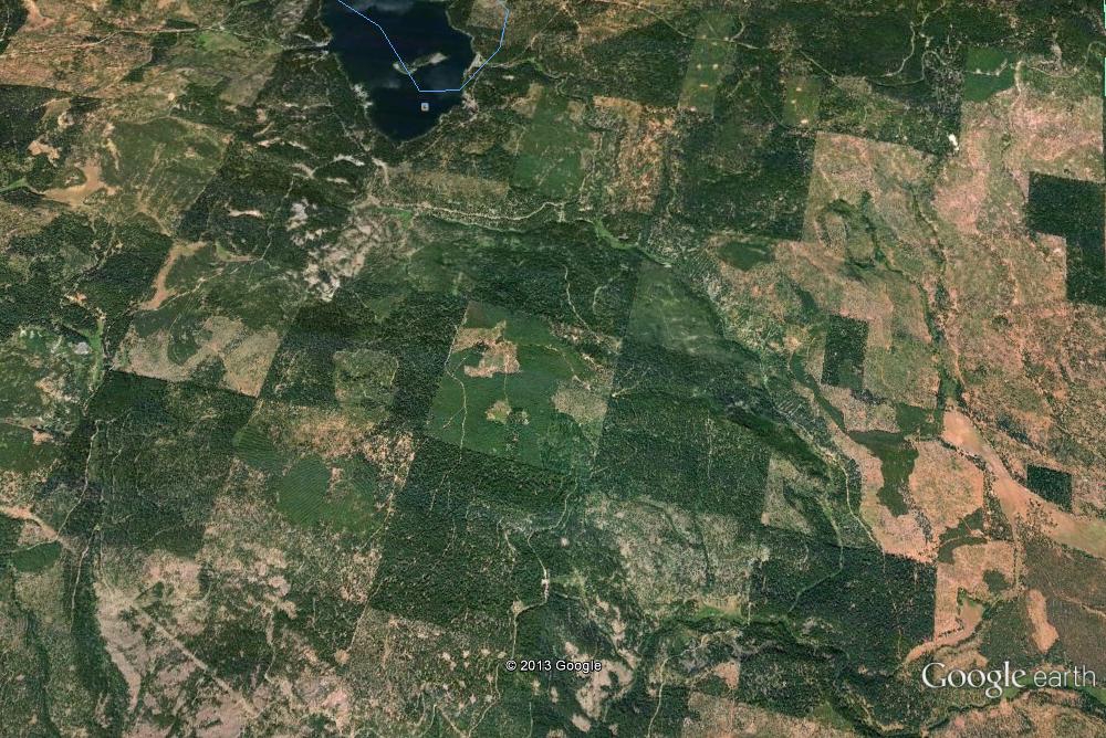
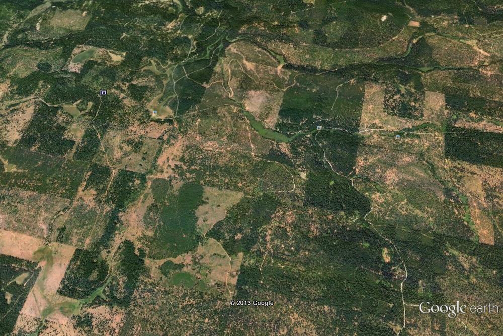
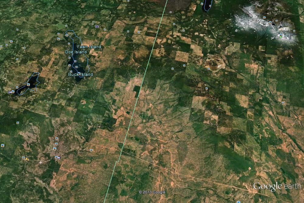
Is any coordinates available for this area shown in the map?
So that we can check these areas if possible?
So that we can check these areas if possible?
I don't see anything that mysterious.
Could easily be logging areas/roads, found some other examples on Google Earth below in higher quality.
From the US
From South America
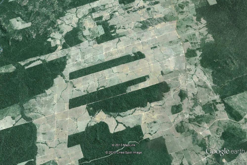
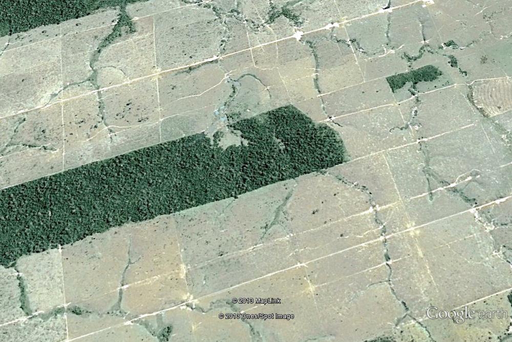
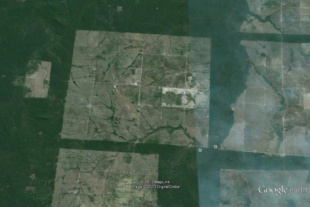
Could easily be logging areas/roads, found some other examples on Google Earth below in higher quality.
From the US
From South America
edit on 12-5-2013 by Mianeye because: Adding more pics
edit on 12-5-2013 by Mianeye because: (no
reason given)
good find s & f for that i have never heard of those lines in alaska before and i dont buy the we cut them with chainsaws for mineral testing . when i
first got a computer i looked up area 51 the old photos from the 60 s and swear that i saw pictures on the ground looking to the left .
i wish i had saved it because i have never seen it again but it did stoke my curiosity
i wish i had saved it because i have never seen it again but it did stoke my curiosity
If you look closer, it's snowmachines trails, very wide, could they have taking the pic over where the paths are of Iditarod or iron man? Chewed out
terrain from lines of telephone or electric lines, cities all over the world have straight lines.
So what?
No mystery
So what?
No mystery
Here's some strange lines in the Norwegian sea:
goo.gl...
They are basically one long track that zig-zags through an underwater valley. I thought they might be drag-lines from anchors, or maybe the trawling path of a fishing boat, or even some underwater survey.
But the width of each line is 1 km.
goo.gl...
They are basically one long track that zig-zags through an underwater valley. I thought they might be drag-lines from anchors, or maybe the trawling path of a fishing boat, or even some underwater survey.
But the width of each line is 1 km.
That is done with sonar, propably a geological survey of that mountainous Valley you see there, you can even see when the ship decided to go home
Originally posted by stormcell
Here's some strange lines in the Norwegian sea:
goo.gl...
They are basically one long track that zig-zags through an underwater valley. I thought they might be drag-lines from anchors, or maybe the trawling path of a fishing boat, or even some underwater survey.
But the width of each line is 1 km.
edit on 12-5-2013 by Mianeye because: (no reason given)
new topics
-
Soros distributes flyers in Mexico telling illegals to vote for Joe once they enter our Republic.
US Political Madness: 6 minutes ago -
The Baloney aka BS Detection Kit
Social Issues and Civil Unrest: 4 hours ago -
Suspected Iranian agent working for Pentagon while U.S. coordinated defense of Israel
US Political Madness: 5 hours ago -
How does my computer know
Education and Media: 8 hours ago
top topics
-
Suspected Iranian agent working for Pentagon while U.S. coordinated defense of Israel
US Political Madness: 5 hours ago, 12 flags -
USO 10 miles west of caladesi island, Clearwater beach Florida
Aliens and UFOs: 12 hours ago, 9 flags -
The Baloney aka BS Detection Kit
Social Issues and Civil Unrest: 4 hours ago, 3 flags -
How does my computer know
Education and Media: 8 hours ago, 2 flags -
Soros distributes flyers in Mexico telling illegals to vote for Joe once they enter our Republic.
US Political Madness: 6 minutes ago, 2 flags
active topics
-
NPR Employs 87 Democrats in Editorial Positions
US Political Madness • 41 • : WeMustCare -
Marjorie Taylor Greene Files Motion to Vacate Speaker Mike Johnson
US Political Madness • 47 • : Threadbarer -
Soros distributes flyers in Mexico telling illegals to vote for Joe once they enter our Republic.
US Political Madness • 2 • : WeMustCare -
How does my computer know
Education and Media • 14 • : AwakeNotWoke -
God is watching.
Politicians & People • 25 • : Kurokage -
US and Israel Reportedly Conclude Most Hostages Still Held in Gaza Are Dead
War On Terrorism • 150 • : FlyersFan -
Running Through Idiot Protestors Who Block The Road
Rant • 53 • : JAY1980 -
Suspected Iranian agent working for Pentagon while U.S. coordinated defense of Israel
US Political Madness • 10 • : TheSemiskepticII -
It has begun... Iran begins attack on Israel, launches tons of drones towards the country
World War Three • 631 • : YourFaceAgain -
Mandela Effect - It Happened to Me!
The Gray Area • 100 • : TheMichiganSwampBuck