It looks like you're using an Ad Blocker.
Please white-list or disable AboveTopSecret.com in your ad-blocking tool.
Thank you.
Some features of ATS will be disabled while you continue to use an ad-blocker.

US Superstorm Threat Launches Mass Evacuations (Thread Will Include Updates)
page: 5share:
I'm unfortunately going to be one of the ones right underneath this thing living in Pennsylvania. We spent a lot of yesterday and today hauling
things out of the basement and getting the generator working. The bad thing is, I'm going back to campus to ride out this storm all alone. I would
stay here, but the university so far has only cancelled classes tomorrow but not Tuesday or any days later this week. If I don't leave tomorrow and
get back there, I'll be stranded here with assignments due and a test coming up. It's one of those moments where if you don't get moving and get it
done, then you'll lose your chance.
I'm actually pretty terrified. This is the worst storm I've seen in my two decades on this planet so far and my first actual full out hurricane. Me being alone will make it much worse but I feel that I'll be safer on campus in a brick dormitory rather than an old house surrounded by trees in the country. The way I see it, I'll have better shelter and will be closer to medical services in case something goes awry. I hate leaving my family behind to fend for themselves if this gets really bad and feel guilty about it but I'm sort of in survival mode myself now and only worrying about getting by at this point. :/ I mean, am I a bad person for feeling the "all for one and one for all" feeling right now?
I'm actually pretty terrified. This is the worst storm I've seen in my two decades on this planet so far and my first actual full out hurricane. Me being alone will make it much worse but I feel that I'll be safer on campus in a brick dormitory rather than an old house surrounded by trees in the country. The way I see it, I'll have better shelter and will be closer to medical services in case something goes awry. I hate leaving my family behind to fend for themselves if this gets really bad and feel guilty about it but I'm sort of in survival mode myself now and only worrying about getting by at this point. :/ I mean, am I a bad person for feeling the "all for one and one for all" feeling right now?
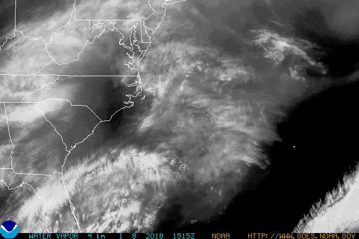
Here's the current location of Sandy:
Monday and Tuesday are going to be rough, as Sandy makes landfall.
Monday and Tuesday are going to be rough, as Sandy makes landfall.
reply to post by Myomistress
No, you're not. Just be safe, and be careful.
You're much better off than the people directly on the coast.
No, you're not. Just be safe, and be careful.
You're much better off than the people directly on the coast.
Sandy sure is a destructive little b*tch... First Jamaica, then Cuba, and now the US... She sure knows how to find the land....
Does anyone else believe that this storm may be getting over hyped? Calling it a Frankenstorm or the storm of the century/perfect storm, the experts sure are putting a lot of pressure on Sandy to deliver...
Does anyone else believe that this storm may be getting over hyped? Calling it a Frankenstorm or the storm of the century/perfect storm, the experts sure are putting a lot of pressure on Sandy to deliver...
I'm watching my twitter feed and some interesting things are starting to be posted.
Here is a video from Norfolk
WTKR.com
I have friends who are over in NY at the moment on a holiday about to board a cruise ship, they are aren't too scared as they live in North Qld, Australia and have been through many major Cyclones in the last 20 years, but they did say that it will be interesting to go through a large storm on the cruise ship.
Here is a video from Norfolk
WTKR.com
Raw Video: Boush Street and Olney Road in Norfolk as the tide comes in Sunday night
I have friends who are over in NY at the moment on a holiday about to board a cruise ship, they are aren't too scared as they live in North Qld, Australia and have been through many major Cyclones in the last 20 years, but they did say that it will be interesting to go through a large storm on the cruise ship.
There certainly is a lot of hype, but they've seen similar conditions before, and the outcome has never been good. I do think there may be a bit of
extra fear mongering, but if it's as bad as they predict, then they can't say they didn't warn us.
edit on 28-10-2012 by DejaVuAgain because:
must be filled out? then why have I seen left blank on so many edits?
Originally posted by jhn7537
Does anyone else believe that this storm may be getting over hyped?
Not at all. Here is a look at the wind field of Hurricane Sandy.
Source: www.wunderground.com...
I have been watching Hurricanes for awhile now, and I do not recall a wind field this large with any other storm. Not Rita, Katrina, Andrew, Hugo, nor Floyd, have had winds this far out from the center. This equates to a lot of water being pushed around by the winds.
To put it in perspective; if you took a glass of water, filled it to the top and blew on the water as hard as you could, you would see the water ripple around the center of where your breath hit it the surface. That's exactly what Sandy is doing, but on a much greater and complex scale.
The storm surge that Sandy may produce, which may or may not be worse because of the tides caused by a full moon could be the worst seen in awhile.
If you go back to page 4, you'll see that coastal areas are already being affected by surge and the storm is still a ways off, so no this storm is not being over hyped, it is one monster of a storm, and is on a collision course with an Arctic air mass which can cause even more trouble as it stalls over New England.
reply to post by majesticgent
Thanks for the map, but the legend makes no sense if the maximum winds are 75mph with gusts of 90mph then wouldn't that make them hurricane force? If so then why isn't any of that area red? I know you didn't make it, but it is confusing.
Thanks for the map, but the legend makes no sense if the maximum winds are 75mph with gusts of 90mph then wouldn't that make them hurricane force? If so then why isn't any of that area red? I know you didn't make it, but it is confusing.
reply to post by majesticgent
But the wind speeds are relatively slow compared to some of the bad category 4/5 storms we've seen of the recent past...
I don't pretend to be some hurricane expert, so if I'm WAY off base here, I'm sorry... I just know how the media loves to grab a story like this and run with it. But who knows, maybe it will be as bad as advertised
edit on 28-10-2012 by jhn7537 because: (no reason given)
I plan on TRYING to be safe tomorrow. I'm going to be staying with a friend that wants to have a party but I'll at least be indoors out of all of
this weather. If I stay with him, I'll be sure to take a safety kit with me in case there's no getting back to my dorm later on because of the
weather. Just stuff I feel I'll need there to be safe and comfortable in my surroundings. I dunno, I just feel in danger going this mostly alone but
it's time to grow up and learn how to take care of myself and what better way to do that than in a disaster situation?
reply to post by DejaVuAgain
The sustained tropical storm force winds extend out where you see the yellow, the hurricane force winds are probably only centered around the eye wall. They don't count gusts as a part of the sustained wind field map.
The sustained tropical storm force winds extend out where you see the yellow, the hurricane force winds are probably only centered around the eye wall. They don't count gusts as a part of the sustained wind field map.
Pretty cool clip I just found on Twitter of the storm from an elevation of 22,300 miles up
edit on 28-10-2012 by jhn7537 because: (no reason given)
reply to post by majesticgent
I think if you blew on the water in the glass you would end up with about 2/3 left in the glass.
So yeah there is going to be a lot of water moving around.
Yasi
Above is a link to anther really big system. TC Yasi.
Oh edit to add, here is Yasi overlayed on the USA. Covering it!
Yasi Covering USA
What is the barometric pressure of Sandy?
To put it in perspective; if you took a glass of water, filled it to the top and blew on the water as hard as you could, you would see the water ripple around the center of where your breath hit it the surface.
I think if you blew on the water in the glass you would end up with about 2/3 left in the glass.
So yeah there is going to be a lot of water moving around.
Yasi
Above is a link to anther really big system. TC Yasi.
Oh edit to add, here is Yasi overlayed on the USA. Covering it!
Yasi Covering USA
What is the barometric pressure of Sandy?
edit on 28-10-2012 by magma because: (no reason given)
reply to post by jhn7537
That is true, but the larger the wind field, the more volume of water the storm brings in with it. Those other storms may have had a higher storm surge at it's peak, but Sandy has been moving water along with it even when it was a Cat 1 and Cat 2 storm and that water has to stop somewhere.
I'll re-post a blurb from an earlier thread.
Hopefully that explains why the surge with Sandy is much more dangerous than the winds, and people shouldn't get lured into complacency because the Hurricane doesn't have high wind speeds.
We're feeling the effects of the pressure difference of the two storms all the way in Georgia by way of cold gusty winds.
That is true, but the larger the wind field, the more volume of water the storm brings in with it. Those other storms may have had a higher storm surge at it's peak, but Sandy has been moving water along with it even when it was a Cat 1 and Cat 2 storm and that water has to stop somewhere.
I'll re-post a blurb from an earlier thread.
Originally posted by majesticgent
This afternoon's 3:30 pm EDT H*Wind analysis from NOAA's Hurricane Research Division put the destructive potential of Sandy's winds at a modest 2.8 on a scale of 0 to 6. However, the destructive potential of the storm surge was record high: 5.8 on a scale of 0 to 6.This is a higher destructive potential than any hurricane observed since 1969, including Category 5 storms like Katrina, Rita, Wilma, Camille, and Andrew. The previous highest destructive potential for storm surge was 5.6 on a scale of 0 to 6, set during Hurricane Isabel of 2003. Sandy is now forecast to bring a near-record storm surge of 6 - 11 feet to Northern New Jersey and Long Island Sound, including the New York City Harbor. This storm surge has the potential to cause many billions of dollars in damage if it hits near high tide at 9 pm EDT on Monday. The full moon is on Monday, which means astronomical high tide will be about 5% higher than the average high tide for the month. This will add another 2 - 3" to water levels.
... If the peak surge arrives near Monday evening's high tide at 9 pm EDT, a portion of New York City's subway system could flood, resulting in billions of dollars in damage. I give a 50% chance that Sandy's storm surge will end up flooding a portion of the New York City subway system.
Hopefully that explains why the surge with Sandy is much more dangerous than the winds, and people shouldn't get lured into complacency because the Hurricane doesn't have high wind speeds.
We're feeling the effects of the pressure difference of the two storms all the way in Georgia by way of cold gusty winds.
This storm has very interesting timing. Depending on the destruction of the storm, it will be interesting to see how Obama handle this (likely)
national disaster... Especially a week before the election.... Very very interesting timing...
reply to post by jhn7537
I agree. Especially if you put any stock into haarpstatus.com. Have seen some debunkers here, but it seems unusual that it's been cranked up all week over New England/New York. Especially with never before seen levels of intensity the last few days. Not sure what to believe at this point.
I agree. Especially if you put any stock into haarpstatus.com. Have seen some debunkers here, but it seems unusual that it's been cranked up all week over New England/New York. Especially with never before seen levels of intensity the last few days. Not sure what to believe at this point.
Originally posted by DejaVuAgain
reply to post by jhn7537
I agree. Especially if you put any stock into haarpstatus.com. Have seen some debunkers here, but it seems unusual that it's been cranked up all week over New England/New York. Especially with never before seen levels of intensity the last few days. Not sure what to believe at this point.
I guess since Katrina (and the other major storms) its always better to be safe than sorry... Just hopefully the people of the East coast are better prepared (and less stubborn) than the people from New Orleans who refused to leave when evacuations were called
This is a post to all the people who maybe affected by Sandy and are posting updates.
If your power goes out, no more posts, you may need your battery more than ever. One phone call could save your life or even that one twitter or facebook post. You maybe without power for an extended period of time.
People are payed wages to cover these types of events and have the gear to be on the road in them. Let those people document the event while its in progress.
If you have any old spare mobile phones that will work with your current sim card. I would suggest pulling them out and charging them up just in case.
PLEASE STAY SAFE. My thoughts are with you all. Godspeed to you all.
edit on 28-10-2012 by TheKingsVillian because: (no reason given)
new topics
-
Sunak spinning the sickness figures
Other Current Events: 20 minutes ago -
Nearly 70% Of Americans Want Talks To End War In Ukraine
Political Issues: 31 minutes ago -
Late Night with the Devil - a really good unusual modern horror film.
Movies: 2 hours ago -
Cats Used as Live Bait to Train Ferocious Pitbulls in Illegal NYC Dogfighting
Social Issues and Civil Unrest: 3 hours ago -
The Good News According to Jesus - Episode 1
Religion, Faith, And Theology: 5 hours ago -
HORRIBLE !! Russian Soldier Drinking Own Urine To Survive In Battle
World War Three: 7 hours ago -
Bobiverse
Fantasy & Science Fiction: 10 hours ago -
Florida man's trip overseas ends in shock over $143,000 T-Mobile phone bill
Social Issues and Civil Unrest: 10 hours ago
top topics
-
Florida man's trip overseas ends in shock over $143,000 T-Mobile phone bill
Social Issues and Civil Unrest: 10 hours ago, 8 flags -
SETI chief says US has no evidence for alien technology. 'And we never have'
Aliens and UFOs: 14 hours ago, 7 flags -
Cats Used as Live Bait to Train Ferocious Pitbulls in Illegal NYC Dogfighting
Social Issues and Civil Unrest: 3 hours ago, 7 flags -
This is our Story
General Entertainment: 17 hours ago, 4 flags -
Former Labour minister Frank Field dies aged 81
People: 12 hours ago, 4 flags -
Bobiverse
Fantasy & Science Fiction: 10 hours ago, 3 flags -
Late Night with the Devil - a really good unusual modern horror film.
Movies: 2 hours ago, 2 flags -
HORRIBLE !! Russian Soldier Drinking Own Urine To Survive In Battle
World War Three: 7 hours ago, 2 flags -
The Good News According to Jesus - Episode 1
Religion, Faith, And Theology: 5 hours ago, 0 flags -
Nearly 70% Of Americans Want Talks To End War In Ukraine
Political Issues: 31 minutes ago, 0 flags
active topics
-
President BIDEN Vows to Make Americans Pay More Federal Taxes in 2025 - Political Suicide.
2024 Elections • 111 • : Irishhaf -
How ageing is" immune deficiency"
Medical Issues & Conspiracies • 30 • : annonentity -
Remember These Attacks When President Trump 2.0 Retribution-Justice Commences.
2024 Elections • 55 • : Zanti Misfit -
SETI chief says US has no evidence for alien technology. 'And we never have'
Aliens and UFOs • 36 • : anthelion -
Breaking Baltimore, ship brings down bridge, mass casualties
Other Current Events • 481 • : firerescue -
Truth Social goes public, be careful not to lose your money
Mainstream News • 124 • : lilzazz -
British TV Presenter Refuses To Use Guest's Preferred Pronouns
Education and Media • 145 • : Annee -
Nearly 70% Of Americans Want Talks To End War In Ukraine
Political Issues • 2 • : Consvoli -
Sunak spinning the sickness figures
Other Current Events • 0 • : annonentity -
Cats Used as Live Bait to Train Ferocious Pitbulls in Illegal NYC Dogfighting
Social Issues and Civil Unrest • 9 • : ImagoDei