It looks like you're using an Ad Blocker.
Please white-list or disable AboveTopSecret.com in your ad-blocking tool.
Thank you.
Some features of ATS will be disabled while you continue to use an ad-blocker.

What is this in the desert of California?
page: 2share:
LOoks like in 2009 The landing spot for the ship was just finished. 2010 looks like a ship like teh one off star trek is parked.
reply to post by jerryznv
ha tricked you all its the virgin mary in my soup spoon.
just kidding. i didnt see that be for thanks for pointing it out
ha tricked you all its the virgin mary in my soup spoon.
just kidding. i didnt see that be for thanks for pointing it out
this is a few miles due south from my OP
this looks like a weapon test site. the same aircraft and row of cars.... most of one row vanishes over the year, but the only odd things are did the aircraft fly there get flown or driven there. since all i see is a short dirt runway then the aircraft with and with out the bunker, and you dont see any progressive damage over the years just the big lot to the direct west used to store random odd crap. a recent image shows two new blue half moon shaped tarps with what looks like boxes. check your own google earth or where ever you get your satellite images from and post here if you can just to get a broad spectrum of what this "stuff" might be. more so on the OP if you could.
this looks like a weapon test site. the same aircraft and row of cars.... most of one row vanishes over the year, but the only odd things are did the aircraft fly there get flown or driven there. since all i see is a short dirt runway then the aircraft with and with out the bunker, and you dont see any progressive damage over the years just the big lot to the direct west used to store random odd crap. a recent image shows two new blue half moon shaped tarps with what looks like boxes. check your own google earth or where ever you get your satellite images from and post here if you can just to get a broad spectrum of what this "stuff" might be. more so on the OP if you could.
edit on 8-3-2012 by omegacorps because: (no reason given)
Originally posted by omegacorps
this is a few miles due south from my OP
this looks like a weapon test site. the same aircraft and row of cars.... most of one row vanishes over the year, but the only odd things are did the aircraft fly there get flown or driven there. since all i see is a short dirt runway then the aircraft with and with out the bunker, and you dont see any progressive damage over the years just the big lot to the direct west used to store random odd crap. a recent image shows two new blue half moon shaped tarps with what looks like boxes. check your own google earth or where ever you get your satellite images from and post here if you can just to get a broad spectrum of what this "stuff" might be. more so on the OP if you could.
edit on 8-3-2012 by omegacorps because: (no reason given)
Targets for sure...probably for tank artillery...not aerial bombing practice (could be used for aerial runs with dummy bombs I suppose)!
Same sort of things in Indian Springs Nevada...you'll see targets like these set up everywhere!
My inner jerk says Cobra command hq. But really I agree with a target for testing munitions. The black looks like the tarp used to create retention
ponds by constructions sights. Its most likely a pile of sand w black tarp for a visual target.
Welcome to Naval Air Weapons Station China Lake
www.cnic.navy.mil...

Installation Information NAWS China Lake is located in the Western Mojave Desert region of California, approximately 150 miles north of Los Angeles. The installation is the Navy's largest single landholding, representing 85 percent of the Navy’s land for RDAT&E use and 38 percent of the Navy’s land holdings worldwide. In total, its two ranges and main site cover more than 1.1 million acres, an area larger than the state of Rhode Island.
www.cnic.navy.mil...
edit on 8-3-2012 by zorgon because: (no reason given)
reply to post by zorgon
this has been established already.
where is not the question
the question is what.....
this has been established already.
where is not the question
the question is what.....
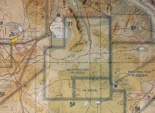
Following the road to the right you come to a section on the map marked "Naval Weapons Center, China Lake".
Following the road to the left you come to an area with a lot of trailers lined up next each other.
I think for gauging the size we can try to estimate the size of the road. Most likely heavy equipment like bull dozers and tractor trailers access this road. They need at least 10' feet clearance in each direction.
I would estimate that the road is about 20' feet wide. So the structures in question are probably much much larger than 10m -33ft
I have no clue what it is but I think it's safe to say it is part of the "Naval Weapons facilities".
Following the road to the left you come to an area with a lot of trailers lined up next each other.
Originally posted by omegacorps
as i looked around the desert there for objects to compair to i would say 10m- 33ft
I think for gauging the size we can try to estimate the size of the road. Most likely heavy equipment like bull dozers and tractor trailers access this road. They need at least 10' feet clearance in each direction.
I would estimate that the road is about 20' feet wide. So the structures in question are probably much much larger than 10m -33ft
I have no clue what it is but I think it's safe to say it is part of the "Naval Weapons facilities".
** face palms **
ok we get its china lake.
its like me saying " hay guys look look a ufo at area 51"
then the feed back i get is ......"yep thats area 51"
let us move past where it is please?
and on to what it might be.
its a weapon test range. ok
throw some weapons that might
require that type of a test set up.
with little to no damage.
thats why i said testing cavitation.
type of bomb/missile
en.wikipedia.org...
but its a NAVY test range they have the whole damn ocean for
a cavitation test.
why build a day spa on a weapons test range?
I think the area is used for weapons testing. They do all types of weapons testing including shallow water tests.
They appear to be mounds of sand. Which is often used to stop bullets after they've hit their target.
They are also doing special systems tests. Could be a decoy / battlefield target or radar beacon
www.globalsecurity.org...
archive.clui.org...
A Brief History of China Lake
They appear to be mounds of sand. Which is often used to stop bullets after they've hit their target.
They are also doing special systems tests. Could be a decoy / battlefield target or radar beacon
www.globalsecurity.org...
www.globalsecurity.org...
Range Signal Density Enhancement System (RSDE). Provides a more realistic battlefield RF environment, in which both hostile and friendly emitters are represented with modern signal types.
Located at the Naval Air Warfare Center, China Lake, CA, RSDE is capable of generating 128 signals simultaneously with pulse densities in excess of five million pulses per second. RSDE supported the testing of the Navy's towed decoy and an EW suite on the Air Force's F-16. RSDE will be available to support additional planned testing on the F-14D, V-22 Osprey, and F/A-18E/F.
archive.clui.org...
A vast weapons development facility and testing range. Almost every munition in the US arsenal has been tested within this 1,723 square mile (more than a million acre) facility. Numerous laboratories and test ranges, located mostly in the north area of China Lake, support weapons development. In the southern portion of the reservation are electronic ranges that support training and weapons proving. China Lake is part of the Navy's Western Test Range complex, along with White Sands and Point Mugu. The base employs about 5,500 people, with an additional 2,500 more local contractors, and the annual budget is near $750 million.
A Brief History of China Lake
edit on 8-3-2012 by ThirdRock69 because: (no reason
given)
edit on 9-3-2012 by ThirdRock69 because: (no reason given)
reply to post by omegacorps
That is pretty interesting I'll be keeping an eye on this thread!
Keep up the good work. Btw you ever get a chance their is something crazy out in the desert of arz there on google earth. Look through out the mesa's should be around the hopi reservations. Sorta looks like a serpent of some sort on a mountain top.
Only found it once. I need to look for it again sometime.
reply to post by 1Sun3Mud6
well at the end of the hopi reservation north side any way there is a coal mine a big one
well at the end of the hopi reservation north side any way there is a coal mine a big one
reply to post by omegacorps
What I'm talking about looks like something you'd see on ancient aliens!
What I'm talking about looks like something you'd see on ancient aliens!
Edit to retract my statement. I thought I saw jet/rocket testing areas in 2 of the photos but now I don't think that is what they were.. Now I am
left with only guessing that they were artillery / bombing sites.
edit on 9-3-2012 by Cassey222 because: (no reason given)
new topics
-
Boston Dynamics say Farewell to Atlas
Science & Technology: 35 seconds ago -
I hate dreaming
Rant: 41 minutes ago -
Is the origin for the Eye of Horus the pineal gland?
Philosophy and Metaphysics: 2 hours ago -
Man sets himself on fire outside Donald Trump trial
Mainstream News: 2 hours ago -
Biden says little kids flip him the bird all the time.
2024 Elections: 2 hours ago -
The Democrats Take Control the House - Look what happened while you were sleeping
US Political Madness: 3 hours ago -
Sheetz facing racial discrimination lawsuit for considering criminal history in hiring
Social Issues and Civil Unrest: 3 hours ago -
In an Historic First, In N Out Burger Permanently Closes a Location
Mainstream News: 5 hours ago -
MH370 Again....
Disaster Conspiracies: 5 hours ago -
Are you ready for the return of Jesus Christ? Have you been cleansed by His blood?
Religion, Faith, And Theology: 8 hours ago
top topics
-
In an Historic First, In N Out Burger Permanently Closes a Location
Mainstream News: 5 hours ago, 14 flags -
The Democrats Take Control the House - Look what happened while you were sleeping
US Political Madness: 3 hours ago, 10 flags -
Thousands Of Young Ukrainian Men Trying To Flee The Country To Avoid Conscription And The War
Other Current Events: 15 hours ago, 8 flags -
A man of the people
Medical Issues & Conspiracies: 10 hours ago, 8 flags -
Man sets himself on fire outside Donald Trump trial
Mainstream News: 2 hours ago, 7 flags -
Biden says little kids flip him the bird all the time.
2024 Elections: 2 hours ago, 6 flags -
4 plans of US elites to defeat Russia
New World Order: 12 hours ago, 4 flags -
Is the origin for the Eye of Horus the pineal gland?
Philosophy and Metaphysics: 2 hours ago, 4 flags -
Are you ready for the return of Jesus Christ? Have you been cleansed by His blood?
Religion, Faith, And Theology: 8 hours ago, 3 flags -
Sheetz facing racial discrimination lawsuit for considering criminal history in hiring
Social Issues and Civil Unrest: 3 hours ago, 3 flags
active topics
-
The Democrats Take Control the House - Look what happened while you were sleeping
US Political Madness • 26 • : ImagoDei -
Boston Dynamics say Farewell to Atlas
Science & Technology • 0 • : gortex -
Thousands Of Young Ukrainian Men Trying To Flee The Country To Avoid Conscription And The War
Other Current Events • 30 • : Consvoli -
12 jurors selected in Trump criminal trial
US Political Madness • 96 • : WeMustCare -
Post A Funny (T&C Friendly) Pic Part IV: The LOL awakens!
General Chit Chat • 7127 • : underpass61 -
Man sets himself on fire outside Donald Trump trial
Mainstream News • 26 • : OnlyYouKnow2 -
Putin Compares Himself to Jesus Promoting Traditional Values Against the Satanic West
Mainstream News • 74 • : DumbNut -
Biden says little kids flip him the bird all the time.
2024 Elections • 11 • : Disgusted123 -
I hate dreaming
Rant • 2 • : FlyersFan -
America's Infant Mortality Rate Increases for the First Time in 20 Years
Medical Issues & Conspiracies • 22 • : BasicResearchMethods