It looks like you're using an Ad Blocker.
Please white-list or disable AboveTopSecret.com in your ad-blocking tool.
Thank you.
Some features of ATS will be disabled while you continue to use an ad-blocker.

Volcano Watch 2012 !
page: 9share:
hisz.rsoe.hu...
hisz.rsoe.hu...
map
hisz.rsoe.hu...
MT. BAKER
hisz.rsoe.hu...
Volcano Activity in Colombia on Tuesday, 29 May, 2012 at 14:20 (02:20 PM) UTC. Description Colombian volcanologists indicated that the likelihood of an eruption at the Nevado del Ruiz volcano has increased, after an earthquake Tuesday morning in cental Colombia. Local authorities have raised the alert level from yellow to orange following a report issued by the Manizales Volcanological and Seismological Observatory. An orange alert does not mean an eruption is imminent. Web cameras in the area “show the emission of ash,” which “has been felt in the area surrounding the volcano,” according to Seismologic and Volcanic Observation director Gloria Patricia Cortes, who also noted the impact on city of Manizales and municipality of Villamaria. Cortes said that relief agencies in the area are prepped for immediate action, in case of emergency. “The recommendation now is to use masks in the city of Manizales because of the persistent rain of ashes,” said Cortes, who also said that she did not expect a lava flow but did not rule out that the emission of ash could continue for some time. According to officials, small amounts of ash could be dispersed from the volcano to remote areas depending on wind direction and strength. The volcano has been fluctuating at high activity levels for the past several months and was lowered to alert level yellow earlier this month. The last eruption of the volcano in 1985 killed an estimated 25,000 people and destroyed the town of Armero.
hisz.rsoe.hu...
map
hisz.rsoe.hu...
Wednesday, 30 May, 2012 at 03:11 UTC Description Air operations were suspended today at four airports in Colombia due to the emission of gases and ashes from the Nevado del Ruiz volcano, located on the border between the departments of Caldas and Tolima. In this regard the Deputy Director of Civil Aeronautics, Colonel Carlos Silva, said that there are restrictions in the airports of Manizales, Armenia, Pereira and Cartago. According to Silva there is evidence of the presence of ashes on runways of those cities´ airports, so the suspension will remain in effect until the danger has passed. On Tuesday, the Nevado del Ruiz volcano registered an unusual increase in activity, which prompted authorities to order the orange alert or level 2, which means a likely eruption in days or weeks.
MT. BAKER
hisz.rsoe.hu...
Volcano Activity in USA on Tuesday, 29 May, 2012 at 16:14 (04:14 PM) UTC. Description As the summer months approach, officials want to remind those who go out to Mt. Baker that they are skiing and snowboarding and camping on an active volcano. May is volcano awareness month, and Carolyn Driedger with the U.S. Geological Survey says the biggest threat from a Baker eruption would be volcanic mud flows. She says those who live in volcano hazard zones around Mt. Baker need to have a plan to get to higher ground. Driedger says officials are confident they will see some warning signs before an eruption on Mt. Baker. West of Baker, the towns of Glacier, Maple Falls, Deming, Everson and Sumas all lie in the pathway for eruption-related mud flows.
Great, did anyone else see this report? Just to fuel our paranoia, it would appear that Super Volcanoes can form and erupt in as little as hundreds of
years!
Supervolcanoes can grow in as little as hundreds of years
Supervolcanoes can grow in as little as hundreds of years

Does anyone else see what I see?
Or am I imagining things?
edit on 31-5-2012 by ericblair4891 because: (no reason given)
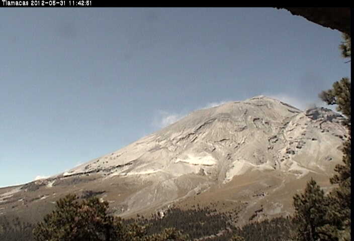
Hi Eric - do you mean the crack in the rockline ? as if the whole middle front could be lifting off from pressure underneath ? Could be shade ? But it
could also look uplifted ...hmmmm or was it the doggy face you could see?
reply to post by slidingdoor
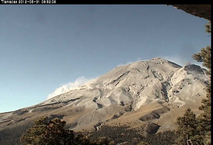
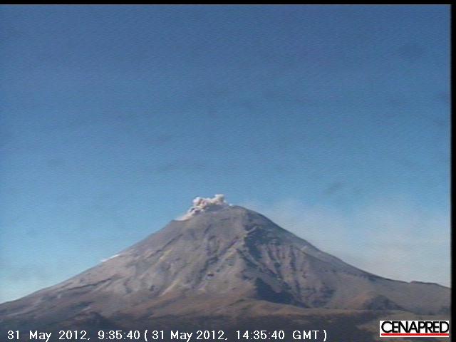
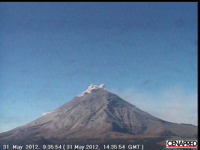
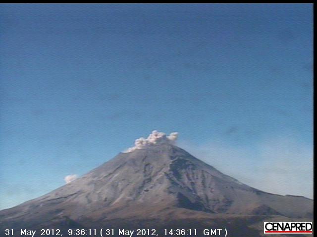
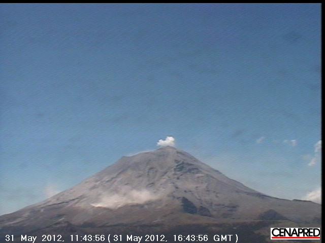
No. It has nothing to do with the cracks or shadows. Or, even uplift. The only real way to know if there's uplift is if it is so pronounced it impossible to deny. Or, you have a map with elevation changes from tiltmeters and GPS. I should look for that information if available. And damn. Puterman is offline. I wanted him to visit and give his opinion because he told me he was keeping files of Popo's webcams. I wanted to double check with him before I panic people and become a fear monger. Right now I'm having trouble figuring out up from down. I have dyslexia and when I get excited it gets worse and I can't tell left from right. North east. etc..... i'm so dumb
The reason I'm not giving my opinon or hints is that I want objective opinions. I won't be able to contain myself for very long. Especially if there's more developments.
edit on 31-5-2012 by ericblair4891 because: (no reason given)
I understand - wouldn't want to be accused of leading the witness blah ....well the very first thing (s) which jumped out were the large clump of
white behind the mountain which I assumed is fluffy clouds and a small steaming at the top - but across the top , so, covering a large width....hmmm
c'mon Puterman chime in
reply to post by slidingdoor
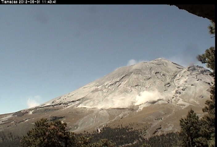
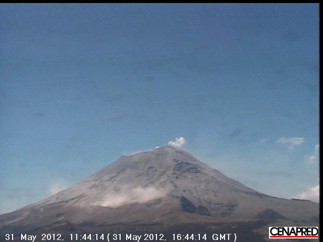
I'll post some of the most recent shots I gots. I'm on the verge of having a freak out so be patient. I'd animate a movie if I was adept with all this techy stuff. Two weeks ago I couldn't post captured pictures. Now I rock, but I'm slow.
Keeping looking back at this post as I add new shots.
Make sure you check the times because these are most recent and then additional pictures will be from earlier this morning.
edit on 31-5-2012 by ericblair4891 because: (no reason given)
reply to post by ericblair4891
Eric I wanted to say thank you. MSM has nothing regarding Popo. I truly appreciate you keep informed and the pictures are great.
reply to post by ericblair4891
I was but the weather was so bad I stopped and did not pick it up again.
Not quite sure which area you are talking about so let me have a read through. I can compare with a graphics program if any lift is large enough.
And damn. Puterman is offline. I wanted him to visit and give his opinion because he told me he was keeping files of Popo's webcams.
I was but the weather was so bad I stopped and did not pick it up again.
Not quite sure which area you are talking about so let me have a read through. I can compare with a graphics program if any lift is large enough.
reply to post by AuntB
The mainstream has one recent article. Otherwise, they have not been watching too closely. Here's one.
www2.wnct.com...
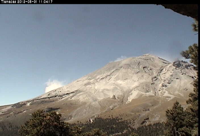
And I figured out that there are landslides of ash. Lots and lots of ash and when the mountain shakes, there's ashy avalanches. They are then blown in the wind.
I'll post a sequence which clearly shows it's ash being kicked up into the air away from the crater.
Thanks Puterman, but I think I solved the mystery. Yes, the weather is horrible and it has almost caused me to give up trying to view the volcano and match the activity to the seismos. The webcam is mostly obsured, and the seismos are whacky. So, it's been fun.

The mainstream has one recent article. Otherwise, they have not been watching too closely. Here's one.
www2.wnct.com...
And I figured out that there are landslides of ash. Lots and lots of ash and when the mountain shakes, there's ashy avalanches. They are then blown in the wind.
I'll post a sequence which clearly shows it's ash being kicked up into the air away from the crater.
Thanks Puterman, but I think I solved the mystery. Yes, the weather is horrible and it has almost caused me to give up trying to view the volcano and match the activity to the seismos. The webcam is mostly obsured, and the seismos are whacky. So, it's been fun.
edit on 31-5-2012 by ericblair4891 because: (no reason given)
reply to post by ericblair4891
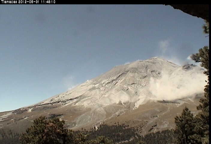
I think some of the visual effects may be being caused by shadow. Two of you pictures together.
Those seismos are nuts. That should not be able to happen. There were signals coming in in a position before ones that had already been displayed. That is very wrong.
I think some of the visual effects may be being caused by shadow. Two of you pictures together.
Those seismos are nuts. That should not be able to happen. There were signals coming in in a position before ones that had already been displayed. That is very wrong.
edit on 31/5/2012 by PuterMan because: (no reason given)
reply to post by PuterMan
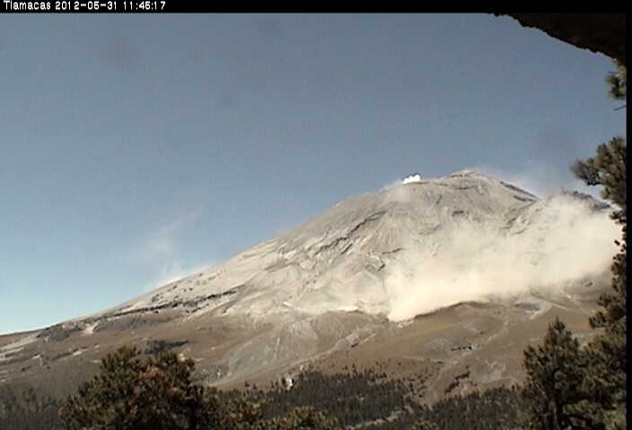
Do you see that big puff of stuff on the east flank? That's from a slide.
I believe the prevailing winds blow most of the ash to the south-south east. So, the eastern flank must have a substantial amount of ash build up. Later, I'm going to try and post a whole load of pictures on the Popo thread I started awhile back. I screwed it up by removing photos. So, I've left it alone. If you want, maybe you can have a look later and take some of them to make a bit of an animation. I think then you'll see the ash being kick up when the mountian shakes. I may try and make my own, but I doubt it.
Edit...
I'm now going to make a bit of a confession. I confess. I thought there was a new vent opening up on the eastern flank. I'm still wondering about it. Several times this morning there was ash rising from the side of the mountain crater down about a few hundred meters. Several of the shots show it originating from the volcano and it was not part of the cloud deck that was rolling along behing the mountain. The clouds rarely came infront of the two shot looking at the north side. It was confusing but I could tell the difference after watching it long enough to know. I honestly thought Popo was going to pull a Mt St Helen kind of lateral eruption. Whew. I am wrong. It's good to be wrong sometimes.
edit on 31-5-2012 by ericblair4891 because: (no reason given)
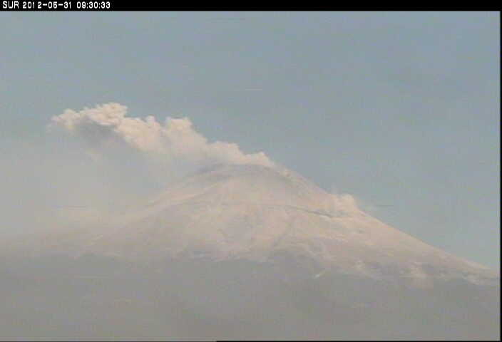
Sourec: Ice Age Now
Just when I am not watching it!
Looks quiet enough at present
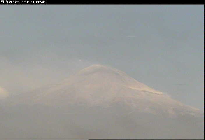
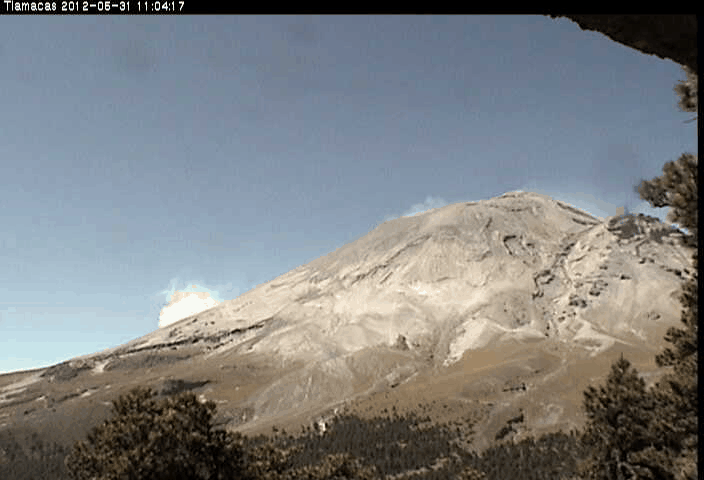
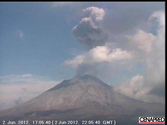
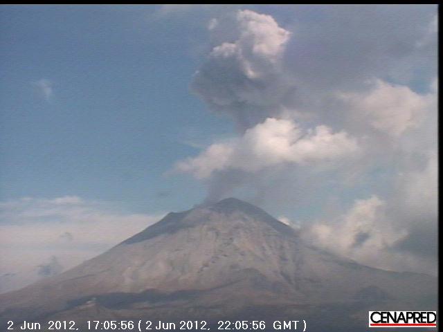
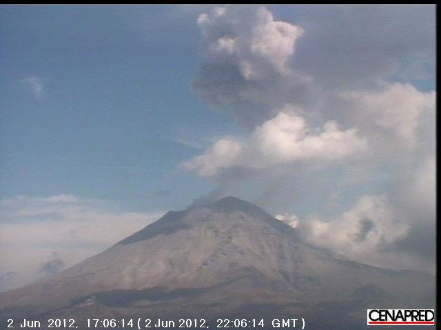
Tlamacas webcam
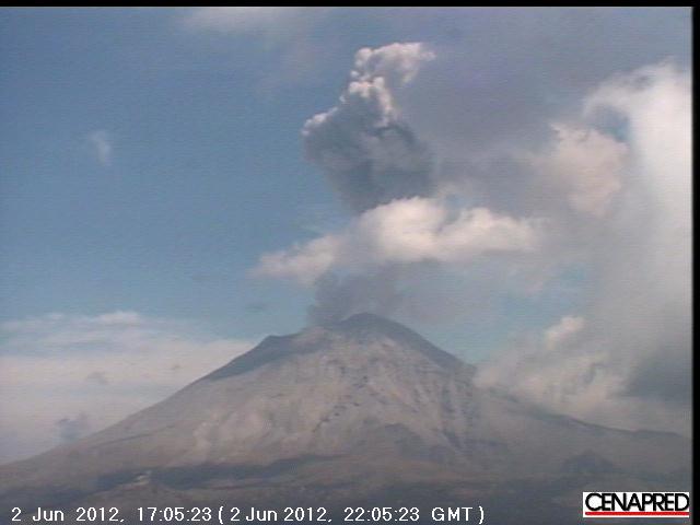
Looks as if it was a single blast
BBC News video of blast
Popocatepetl Volcano (Popo) blasted a tower of ash today over nearby towns and villages prompting authorities to consider the possibility of evacuations.
Just when I am not watching it!
Looks quiet enough at present
Tlamacas webcam
Looks as if it was a single blast
BBC News video of blast
edit on 2/6/2012 by PuterMan because: to add off site content
I tried to put my you tube video up on this post but couldn't figure it out. Oh well. At least I figured out how to make a video for Popo. It shows a
pretty good ash exhalation. Mostly Popo give off steam and light ash. This burst of very dark. Later it got cloudy and I missed the most explosive
one. It had a quake show up on seismo that was vigorous. I'll post picture of the that one even though it's not clear you can see how high up it
went.
www.youtube.com...
here's some more
www.youtube.com...
www.youtube.com...
www.youtube.com...
here's some more
www.youtube.com...
www.youtube.com...
edit on 2-6-2012 by ericblair4891 because: (no reason given)
Popo is spewing not a lot, but very steady ash right now. Looks cool on the cam.
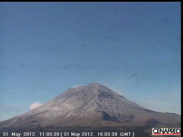
www.cenapred.unam.mx...
www.cenapred.unam.mx...
reply to post by Flavian
I had seen this news this morning. I was tempted to post it in the Yellowstone topic.
It sounded to me that they were referring to the formation of the original pool of magma. Anyway, it's interesting info to chew on.
I had seen this news this morning. I was tempted to post it in the Yellowstone topic.
It sounded to me that they were referring to the formation of the original pool of magma. Anyway, it's interesting info to chew on.
I made a vid of Popo's activity from this morn.
www.youtube.com...
www.youtube.com...
edit on 3-6-2012 by ericblair4891 because: (no reason given)
reply to post by ericblair4891
Tlamacas camera is still down
I found a couple more hovever.
qvsdata.wordpress.com...
Tlamacas camera is still down
I found a couple more hovever.
qvsdata.wordpress.com...
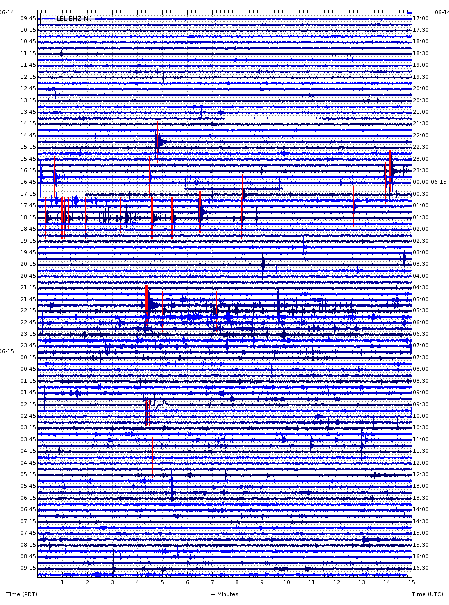
I just noticed that Mt. Lassen, the southern most volcano in the Cascades chain, had a swarm of 15 small earthquakes in the past day.
Here is a screenshot of the locations, with the most recent events listed below:
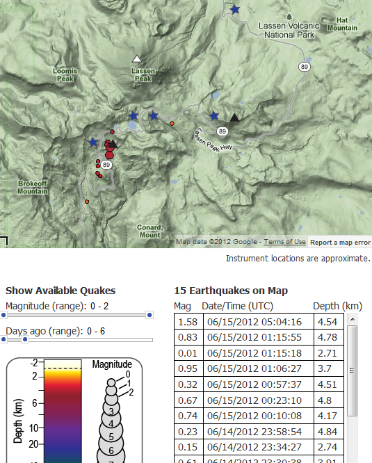
If you go the the CalVO Lassen Monitoring Page you can scroll down to graphically see the depths over time. They seem to be clustered between 2.5 and 4.5 km deep.
You can also click on the seismic stations (black triangles) to see a snapshot of the past 24hrs activity. The LEL station (at the summit, nearest the center of the swarm) shows that the activity has slowed, but not completely dried up.
Here is a thumbnail of LEL:
Lassen seems to do this every few months or so, but it's fun to see if anything develops...
Here is a webcam. It's beautiful.
Here is a screenshot of the locations, with the most recent events listed below:
If you go the the CalVO Lassen Monitoring Page you can scroll down to graphically see the depths over time. They seem to be clustered between 2.5 and 4.5 km deep.
You can also click on the seismic stations (black triangles) to see a snapshot of the past 24hrs activity. The LEL station (at the summit, nearest the center of the swarm) shows that the activity has slowed, but not completely dried up.
Here is a thumbnail of LEL:
Lassen seems to do this every few months or so, but it's fun to see if anything develops...
Here is a webcam. It's beautiful.
edit on 6/15/2012 by Olivine
because: add link
new topics
-
Ode to Artemis
General Chit Chat: 38 minutes ago -
Ditching physical money
History: 3 hours ago -
One Flame Throwing Robot Dog for Christmas Please!
Weaponry: 4 hours ago -
Don't take advantage of people just because it seems easy it will backfire
Rant: 4 hours ago -
VirginOfGrand says hello
Introductions: 5 hours ago -
Should Biden Replace Harris With AOC On the 2024 Democrat Ticket?
2024 Elections: 5 hours ago -
University student disciplined after saying veganism is wrong and gender fluidity is stupid
Education and Media: 8 hours ago -
Geddy Lee in Conversation with Alex Lifeson - My Effin’ Life
People: 9 hours ago -
God lived as a Devil Dog.
Short Stories: 9 hours ago -
Police clash with St George’s Day protesters at central London rally
Social Issues and Civil Unrest: 11 hours ago
top topics
-
Hate makes for strange bedfellows
US Political Madness: 14 hours ago, 20 flags -
Who guards the guards
US Political Madness: 17 hours ago, 13 flags -
University student disciplined after saying veganism is wrong and gender fluidity is stupid
Education and Media: 8 hours ago, 12 flags -
Police clash with St George’s Day protesters at central London rally
Social Issues and Civil Unrest: 11 hours ago, 9 flags -
TLDR post about ATS and why I love it and hope we all stay together somewhere
General Chit Chat: 12 hours ago, 7 flags -
Should Biden Replace Harris With AOC On the 2024 Democrat Ticket?
2024 Elections: 5 hours ago, 5 flags -
Don't take advantage of people just because it seems easy it will backfire
Rant: 4 hours ago, 4 flags -
One Flame Throwing Robot Dog for Christmas Please!
Weaponry: 4 hours ago, 4 flags -
God lived as a Devil Dog.
Short Stories: 9 hours ago, 3 flags -
Ditching physical money
History: 3 hours ago, 3 flags
active topics
-
Should Biden Replace Harris With AOC On the 2024 Democrat Ticket?
2024 Elections • 43 • : YourFaceAgain -
British TV Presenter Refuses To Use Guest's Preferred Pronouns
Education and Media • 125 • : Annee -
University student disciplined after saying veganism is wrong and gender fluidity is stupid
Education and Media • 22 • : ImagoDei -
Who guards the guards
US Political Madness • 4 • : kwaka -
Hundreds of teenagers flood into downtown Chicago, smashing car windows
Other Current Events • 109 • : 777Vader -
New whistleblower Jason Sands speaks on Twitter Spaces last night.
Aliens and UFOs • 44 • : pianopraze -
"We're All Hamas" Heard at Columbia University Protests
Social Issues and Civil Unrest • 263 • : YourFaceAgain -
Remember These Attacks When President Trump 2.0 Retribution-Justice Commences.
2024 Elections • 50 • : Asher47 -
Ode to Artemis
General Chit Chat • 0 • : BrotherKinsMan -
-@TH3WH17ERABB17- -Q- ---TIME TO SHOW THE WORLD--- -Part- --44--
Dissecting Disinformation • 635 • : cherokeetroy