It looks like you're using an Ad Blocker.
Please white-list or disable AboveTopSecret.com in your ad-blocking tool.
Thank you.
Some features of ATS will be disabled while you continue to use an ad-blocker.

Quake Watch 2012
page: 228share:
Originally posted by aLLeKs
It is somehow strange, because I never had such a feeling, but somehow I have the feeling there will be another bigger or even big one in Japan within this year.....
I cant tell you why, it is just a feeling. Maybe it is just because I miss my Japanese girlfriend a lot at the moment and will not see her the rest of the year...
Because Mt. Fuji is ticking timebomb. Its feared that 2011 mega-quake caused rising pressure in Mt. Fuji. Its speculated that pressure in magma chamber could be 1,6 megapascals higher that before. Japan have to prepare for its eruption, though it appears to be sleeping right now, showing no activity at all. Its very unpredictable volcano, and Fuji we see today is just 10 000 years old, formed in mega-eruption of older Fuji. It has erupted 16 times after 781. Sometimes it has erupted very frequently, but its known that there was once 400-year gab between eruptions. Lats eruption was in 1707, in November there was very violent earthquake, then in December it erupted.
I know, Mt Fuji is one reason I decided, that I want study geology after I finish my current engineering studies.
(But probably I will just go back working in Japan , I don't want to study anymore)
But thanks anyway for your summary
(But probably I will just go back working in Japan , I don't want to study anymore)
But thanks anyway for your summary
reply to post by Thebel
I was siting here and thinking to myself - How in the heck to you measure the pressure in a volcano?
So having considered corks and complex arrangements to monitor the movement of the cork and a gauge of course
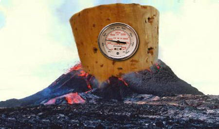
.... I thought Dr Klemetti may know.......
Doooom! The Perception of Volcano Research by the Media
Dr Klemetti continues further about Fuji, and then moves on to Santorini.
I was siting here and thinking to myself - How in the heck to you measure the pressure in a volcano?
So having considered corks and complex arrangements to monitor the movement of the cork and a gauge of course
.... I thought Dr Klemetti may know.......
Doooom! The Perception of Volcano Research by the Media
Fuji, Japan
News like this has the tendency to reappear when you least expect it, like a zombie in a horror movie. Just after the Sendai earthquake in March 2011, I had to try to dispel some rumors that Fuji was going to erupt because it “always” erupts after a very large subduction earthquake in Japan. Guess what? It doesn’t. So, why do we suddenly have all this “news” claiming otherwise? Well, some well-meaning researchers in Japan claim that the Sendai (and following) earthquakes exerted pressure on the magma chamber, which will lead to an eruption. Within days, the news was “Mt. Fuji will blow due to new tectonic pressures that are higher than when the volcano last erupted more than 300 years ago. Estimates say the eruption will affect more than 400,000 people and cost over $30 billion.“ Now, much of the primary information on this is in Japanese, but from what I can gather, the study looked at how much additional stress any magma body under Fuji may have felt during the earthquakes.
Dr Klemetti continues further about Fuji, and then moves on to Santorini.
....love the piccy!
Love Mr Klemetti...almost as much as you Puters!
Rainbows
Jane
Love Mr Klemetti...almost as much as you Puters!
Rainbows
Jane
Magnitude ML 4.2
Region PORTUGAL
Date time 2012-09-24 21:52:50.0 UTC
Location 37.58 N ; 8.37 W
Depth 11 km
Distances 419 km NW Rabat (pop 1,655,753 ; local time 21:52:50.0 2012-09-24)
115 km SE Setúbal (pop 117,110 ; local time 22:52:50.0 2012-09-24)
45 km N Silves (pop 10,917 ; local time 22:52:50.0 2012-09-24)
22 km E Odemira (pop 5,830 ; local time 22:52:50.0 2012-09-24)
Source parameters provided by another agency
EMSC
Rainbows
Jane
4.8 earthquake, 20km ENE of Fatualam, Indonesia. Sep 25 11:08 at epicenter (13m ago, depth 21km).
2012-09-25 03:08:13 UTC
2012-09-25 11:08:13 UTC+08:00 at epicenter
2012-09-24 23:08:13 UTC-04:00 system time
Nearby Cities
20km (12mi) ENE of Fatualam, Indonesia
26km (16mi) E of Kefamenanu, Indonesia
39km (24mi) SSW of Atambua, Indonesia
68km (42mi) NE of Soe, Indonesia
133km (83mi) SW of Dili, East Timor
5.0 earthquake, 51km NNW of Hihifo, Tonga. Sep 24 15:06 at epicenter (17m ago, depth 122km)
2012-09-25 03:06:54 UTC
2012-09-24 15:06:54 UTC-12:00 at epicenter
2012-09-24 23:06:54 UTC-04:00 system time
Nearby Cities
51km (32mi) NNW of Hihifo, Tonga
291km (181mi) SW of Apia, Samoa
361km (224mi) WSW of Tafuna, American Samoa
365km (227mi) WSW of Pago Pago, American Samoa
639km (397mi) NNE of Nuku`alofa, Tonga
5.2 earthquake, South of the Fiji Islands. Sep 25 17:37 at epicenter (21m ago, depth 565km)
2012-09-25 05:37:52 UTC
2012-09-25 17:37:52 UTC+12:00 at epicenter
2012-09-25 01:37:52 UTC-04:00 system time
Nearby Cities
557km (346mi) SSW of Ndoi Island, Fiji
753km (468mi) SW of Nuku`alofa, Tonga
776km (482mi) S of Suva, Fiji
826km (513mi) S of Nadi, Fiji
967km (601mi) S of Lambasa, Fiji
2012-09-25 05:37:52 UTC
2012-09-25 17:37:52 UTC+12:00 at epicenter
2012-09-25 01:37:52 UTC-04:00 system time
Nearby Cities
557km (346mi) SSW of Ndoi Island, Fiji
753km (468mi) SW of Nuku`alofa, Tonga
776km (482mi) S of Suva, Fiji
826km (513mi) S of Nadi, Fiji
967km (601mi) S of Lambasa, Fiji
reply to post by kennvideo
not sure why but i am seeing that as 5.7 not 5.0
Earthquake Details
This event has been reviewed by a seismologist.
Magnitude
5.7
Date-Time
Tuesday, September 25, 2012 at 03:06:52 UTC
Tuesday, September 25, 2012 at 04:06:52 PM at epicenter
Time of Earthquake in other Time Zones
Location
15.472°S, 173.923°W
Depth
104.5 km (64.9 miles)
Region
TONGA
Distances
52 km (32 miles) NNW of Hihifo, Tonga
290 km (180 miles) SW of Apia, Samoa
361 km (224 miles) WSW of Tafuna, American Samoa
365 km (226 miles) WSW of Pago Pago, American Samoa
Location Uncertainty
horizontal +/- 15.9 km (9.9 miles); depth +/- 6 km (3.7 miles)
Parameters
NST=397, Nph=416, Dmin=288.3 km, Rmss=0.68 sec, Gp= 50°,
M-type=teleseismic moment magnitude (Mw), Version=9
Source
Magnitude: USGS NEIC (WDCS-D)
Location: USGS NEIC (WDCS-D)
Event ID
usc000cvd1
USGS
5.1 earthquake, 33km S of Khanabad, Afghanistan. Sep 25 13:03 at epicenter ( depth 34km).
2012-09-25 08:33:01 UTC
2012-09-25 13:03:01 UTC+04:30 at epicenter
2012-09-25 04:33:01 UTC-04:00 system time
Nearby Cities
33km (21mi) S of Khanabad, Afghanistan
35km (22mi) N of Nahrin, Afghanistan
48km (30mi) SE of Kunduz, Afghanistan
50km (31mi) SW of Taloqan, Afghanistan
205km (127mi) N of Kabul, Afghanistan
Originally posted by lurksoften
reply to post by kennvideo
not sure why but i am seeing that as 5.7 not 5.0
Earthquake Details
This event has been reviewed by a seismologist.
Magnitude
5.7
Date-Time
Tuesday, September 25, 2012 at 03:06:52 UTC
Tuesday, September 25, 2012 at 04:06:52 PM at epicenter
Time of Earthquake in other Time Zones
Location
15.472°S, 173.923°W
Depth
104.5 km (64.9 miles)
Region
TONGA
Distances
52 km (32 miles) NNW of Hihifo, Tonga
290 km (180 miles) SW of Apia, Samoa
361 km (224 miles) WSW of Tafuna, American Samoa
365 km (226 miles) WSW of Pago Pago, American Samoa
Location Uncertainty
horizontal +/- 15.9 km (9.9 miles); depth +/- 6 km (3.7 miles)
Parameters
NST=397, Nph=416, Dmin=288.3 km, Rmss=0.68 sec, Gp= 50°,
M-type=teleseismic moment magnitude (Mw), Version=9
Source
Magnitude: USGS NEIC (WDCS-D)
Location: USGS NEIC (WDCS-D)
Event ID
usc000cvd1
USGS
You are correct... it was changed...
4.7 earthquake, MINDANAO, PHILIPPINES. Sep 25 09:59 at epicenter (depth 49km).
2012-09-25 09:59:18 UTC
2012-09-25 17:59:18 UTC+08:00 at epicenter
2012-09-25 05:59:18 UTC-04:00 system time
Nearby Cities
62km (39mi) E of General Luna, Philippines
102km (63mi) NE of Tandag, Philippines
124km (77mi) E of Placer, Philippines
135km (84mi) E of Surigao, Philippines
817km (508mi) SE of Manila, Philippines
4.9 earthquake, 60km E of General Luna, Philippines. Sep 25 18:41 at epicenter (depth 58km)
2012-09-25 10:41:27 UTC
2012-09-25 18:41:27 UTC+08:00 at epicenter
2012-09-25 06:41:27 UTC-04:00 system time
Nearby Cities
60km (37mi) E of General Luna, Philippines
89km (55mi) NE of Tandag, Philippines
120km (75mi) E of Placer, Philippines
133km (83mi) E of Surigao, Philippines
824km (512mi) SE of Manila, Philippines
edit on 25-9-2012 by kennvideo because: info
It's now been 20 days, almost three weeks since the 7.6 mag quake hit Costa Rica. And since that time there have only been 2 quakes recorded with
USGS that have been 6 mag or over. One on the 8th Sept (6) and one on the 14th Sept (6.2)... seems to be a quiet period!
USGS
USGS
mag 4.4 California area...
earthquake.usgs.gov...
PRELIMINARY EARTHQUAKE PARAMETERS
MAGNITUDE - 4.4
TIME - 0715 AKDT SEP 25 2012
0815 PDT SEP 25 2012
1515 UTC SEP 25 2012
LOCATION - 39.1 NORTH 123.3 WEST
105 MILES/169 KM NW OF SACRAMENTO CALIFORNIA
105 MILES/169 KM NW OF SAN FRANCISCO CALIFORNIA
DEPTH - 3 MILES/5 KM
earthquake.usgs.gov...
At 9.26am on Wednesday 26 September [9:26-26:9]*, more than 1.3 million people will participate in the New Zealand ShakeOut earthquake drill, the
first ShakeOut drill held nationwide in any country!
www.shakeout.govt.nz...
Not sure if I should unclip my safety harness and come down off the roof or just ride it out
guess I'll be like the other 3,141,098 kiwis who don't bother.
www.shakeout.govt.nz...
Not sure if I should unclip my safety harness and come down off the roof or just ride it out
guess I'll be like the other 3,141,098 kiwis who don't bother.
4.9 earthquake, 86km SW of False Pass, Alaska. Sep 25 07:48 at epicenter (depth 35km).
2012-09-25 15:48:45 UTC
2012-09-25 04:48:45 UTC-11:00 at epicenter
2012-09-25 11:48:45 UTC-04:00 system time
Nearby Cities
90km (56mi) SSW of False Pass, Alaska
1152km (716mi) SW of Anchorage, Alaska
1184km (736mi) SW of Knik-Fairview, Alaska
1499km (931mi) SW of College, Alaska
1872km (1163mi) W of Whitehorse, Canada
5.4 earthquake, 68km ENE of `Ohonua, Tonga. Sep 25 06:33 at epicenter (depth 29km).
2012-09-25 18:33:05 UTC
2012-09-25 06:33:05 UTC-12:00 at epicenter
2012-09-25 14:33:05 UTC-04:00 system time
Nearby Cities
68km (42mi) ENE of `Ohonua, Tonga
91km (57mi) E of Nuku`alofa, Tonga
827km (514mi) ESE of Suva, Fiji
843km (524mi) SSW of Tafuna, American Samoa
844km (524mi) SE of Lambasa, Fiji
edit on 25-9-2012 by kennvideo because: info
I just called John Moore today. He told me that the information about nibiru arriving at its closest point on September 26 and causing earthquakes may
be incorrect. He even said that nibiru may not exist. I wonder why he's flip flopping around so much.
5.2 earthquake, 42km SSW of Honiara, Solomon Islands. Sep 26 06:42 at epicenter (depth 27km).
2012-09-25 19:42:32 UTC
2012-09-26 06:42:32 UTC+11:00 at epicenter
2012-09-25 15:42:32 UTC-04:00 system time
Nearby Cities
42km (26mi) SSW of Honiara, Solomon Islands
608km (378mi) SE of Arawa, Papua New Guinea
1021km (634mi) SE of Kokopo, Papua New Guinea
1025km (637mi) E of Alotau, Papua New Guinea
42km (26mi) SSW of Honiara, Solomon Islands
Earthquake Details
This event has been reviewed by a seismologist.
Magnitude
6.2
Date-Time
Tuesday, September 25, 2012 at 23:45:26 UTC
Tuesday, September 25, 2012 at 05:45:26 PM at epicenter
Location
24.835°N, 110.152°W
Depth
10.1 km (6.3 miles)
Region
GULF OF CALIFORNIA
Distances
75 km (47 miles) N (11°) from La Paz, Baja California Sur, Mexico
154 km (96 miles) E (98°) from Constitución, Baja California Sur, Mexico
155 km (96 miles) SW (220°) from Ahome, Sinaloa, Mexico
1086 km (675 miles) SE (140°) from Tijuana, Baja California, Mexico
Location Uncertainty
horizontal +/- 13.7 km (8.5 miles); depth +/- 1.9 km (1.2 miles)
Parameters
NST=441, Nph=441, Dmin=470.9 km, Rmss=1.12 sec, Gp= 68°,
M-type=regional moment magnitude (Mw), Version=A
Source
Magnitude: USGS NEIC (WDCS-D)
Location: USGS NEIC (WDCS-D)
Event ID
usc000cw0l
USGS
new topics
-
Hate makes for strange bedfellows
US Political Madness: 24 minutes ago -
Who guards the guards
US Political Madness: 3 hours ago -
Has Tesla manipulated data logs to cover up auto pilot crash?
Automotive Discussion: 4 hours ago -
whistleblower Captain Bill Uhouse on the Kingman UFO recovery
Aliens and UFOs: 9 hours ago
top topics
-
Lawsuit Seeks to ‘Ban the Jab’ in Florida
Diseases and Pandemics: 17 hours ago, 22 flags -
CIA botched its handling of sexual assault allegations, House intel report says
Breaking Alternative News: 14 hours ago, 10 flags -
whistleblower Captain Bill Uhouse on the Kingman UFO recovery
Aliens and UFOs: 9 hours ago, 10 flags -
Deadpool and Wolverine
Movies: 12 hours ago, 4 flags -
1980s Arcade
General Chit Chat: 12 hours ago, 4 flags -
Who guards the guards
US Political Madness: 3 hours ago, 4 flags -
Teenager makes chess history becoming the youngest challenger for the world championship crown
Other Current Events: 13 hours ago, 3 flags -
Hate makes for strange bedfellows
US Political Madness: 24 minutes ago, 2 flags -
Has Tesla manipulated data logs to cover up auto pilot crash?
Automotive Discussion: 4 hours ago, 1 flags
active topics
-
IDF Intel Chief Resigns Over Hamas attack
Middle East Issues • 37 • : TheWoker -
whistleblower Captain Bill Uhouse on the Kingman UFO recovery
Aliens and UFOs • 10 • : vance2 -
Candidate TRUMP Now Has Crazy Judge JUAN MERCHAN After Him - The Stormy Daniels Hush-Money Case.
Political Conspiracies • 646 • : Threadbarer -
"We're All Hamas" Heard at Columbia University Protests
Social Issues and Civil Unrest • 216 • : Vermilion -
MULTIPLE SKYMASTER MESSAGES GOING OUT
World War Three • 93 • : Oldcarpy2 -
Republican Voters Against Trump
2024 Elections • 281 • : Justoneman -
Hate makes for strange bedfellows
US Political Madness • 1 • : Edumakated -
Who guards the guards
US Political Madness • 1 • : JAY1980 -
British TV Presenter Refuses To Use Guest's Preferred Pronouns
Education and Media • 109 • : Consvoli -
They Killed Dr. Who for Good
Rant • 66 • : Lazy88