It looks like you're using an Ad Blocker.
Please white-list or disable AboveTopSecret.com in your ad-blocking tool.
Thank you.
Some features of ATS will be disabled while you continue to use an ad-blocker.

Quake Watch 2012
page: 185share:
This may interest some, tectonics applied to economy/geopolitics.
DOD, U.S. Agencies Help Afghanistan Exploit Mineral Wealth
By Cheryl Pellerin
American Forces Press Service
www.defense.gov/news/newsarticle.aspx?id=117330
DOD, U.S. Agencies Help Afghanistan Exploit Mineral Wealth
By Cheryl Pellerin
American Forces Press Service
www.defense.gov/news/newsarticle.aspx?id=117330
WASHINGTON, July 30, 2012 – Officials from the Defense Department and the U.S. Geological Survey gathered this month at Afghanistan’s U.S. Embassy to unveil what the director of a DOD task force called a “treasure map” of the nation’s mineral resources.
At the event, James Bullion of the Defense Department’s Task Force for Business and Stability Operations, or TFBSO, shared the podium with USGS Director Marcia McNutt, who described a new remote-sensing technology that has made it possible, for the first time, she said, to map more than 70 percent of the country’s surface and identify potential high-value deposits of copper, gold, iron, and other minerals.
(...)
“Hyperspectral data uses the reflectance of light and uses the fact that different minerals reflect light in different wavelength bands,” McNutt explained. “Every mineral has its own signature or fingerprint.”
Hyperspectral imaging characterizes minerals only on the surface of the Earth, not underground where the minerals are mined. The technology wouldn’t work well in countries where forests, grasses and soil cover the ground, but it’s perfect for Afghanistan. Over 50 million years, the slow-motion collision of Iran and Eurasian tectonic plates beneath Afghanistan formed rugged, rocky mountains out of what used to be mineral-laden subsurface rock.
The hyperspectral instrument “can be used in a place where there’s no vegetative cover, and Afghanistan happens to have almost no vegetation and it is resource-laden,” McNutt explained. “And because of plate tectonic properties, … it has been tectonically uplifted and tectonically unroofed to reveal at the surface the mother lode of resources.”
Over 43 days and 23 flights, USGS flew nearly 23,000 miles, collecting data that covered 170,000 square miles.
(...)
hisz.rsoe.hu...
Have never seen a quake labelled as (location) 'North Pole' before. Probably just me! I hope Santa and the Elves are OK. Sucks to be Santa with all the ice melting. I wonder if Star Dust Castle has floatation devices. I am just feeling a little whimsical! (84° 26.520, 1° 49.686)
Some interesting quakes happening.
P
edit on 1-8-2012 by pheonix358 because: I filled it out. Why must it be filled out. I hate forms that say must be filled out. Is this
the confessional.
I have created a seperate blog for Japan to use the NIEC data, style is the same as eqarchives, in fact its called
eqarchivesj
visitors are welcome
be the first, I just published it
On there you will find maps showing preliminary data from NIEC (which I have to download each day), similar numbers, seems the Ryukyu Islands data comes in later, like in New Zealand the Fiordland data comes in a few days behind the rest.
I think the NIEC preliminary data is like NZ's Geonet Rapid, not sure though it will be 4 days before I can get the reviewed data and compare them.
Hense the 4 day gap between 26th and 30th maps.
I've done this so I can limit the number of maps, in this case 10 per page,so they load without timeouts and delays.
The header says earthquake archives - "summary", or "results" I'm not sure which, I have no clue about Japanese script, got the script off a NIEC tab on their web page, don't they write right to left rather than English left to right?
anyone here can confirm what it says for sure?
.
visitors are welcome
be the first, I just published it
On there you will find maps showing preliminary data from NIEC (which I have to download each day), similar numbers, seems the Ryukyu Islands data comes in later, like in New Zealand the Fiordland data comes in a few days behind the rest.
I think the NIEC preliminary data is like NZ's Geonet Rapid, not sure though it will be 4 days before I can get the reviewed data and compare them.
Hense the 4 day gap between 26th and 30th maps.
I've done this so I can limit the number of maps, in this case 10 per page,so they load without timeouts and delays.
The header says earthquake archives - "summary", or "results" I'm not sure which, I have no clue about Japanese script, got the script off a NIEC tab on their web page, don't they write right to left rather than English left to right?
anyone here can confirm what it says for sure?
edit on 1-8-2012 by muzzy because: (no reason given)
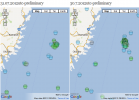
bit of a swram going off os Kamaishi, Iwate Prefecture,
Honshu, NE of Sendai, not sure if these are aftershocks of a mag 5+ earlier than 22nd July, will have to process some more data to find out 
.
edit on 1-8-2012 by muzzy because: (no reason given)
What are some of your thoughts on this little swarm off the coast of Oregon??
Some of the depths are at zero....data error
This seems to be right inside the subduction area....potential yikes???
earthquake.usgs.gov...
Some of the depths are at zero....data error
This seems to be right inside the subduction area....potential yikes???
earthquake.usgs.gov...
usgs=5.1 2012/08/01 09:24:43 -35.837 -179.720 48.2 EAST OF THE NORTH ISLAND, NEW ZEALAND
geofon=2012-08-01 09:24:52 5.0 35.76°S 179.54°E 80 C Off E. Coast of N. Island, N.Z.
ldeo= 2012 8 1 9 24 40.0 -35.50 -179.50 33.0 5.2 EAST OF NORTH ISLAND, N.Z.
geoau=5.3 01 August 2012 @ 09:24:59 -36.374 178.781 107 AUST Off East Coast of New Zealand.
Geonet = not showing, either GeonetRapid or magma search
maybe will be added later
got to go do some work, been raining on and off for 3 days , might get an whole afternoon in this week
edit on 1-8-2012 by muzzy because:
stuffed up the tags
reply to post by pheonix358
Noticed that as well.
Just wondering, is there a statistical analyses on the amount of quakes in the north in northern summer, and same for the south in southern summer, if that makes sense?
In other words, does the Earth's nearest pole to the Sun present any stastical difference on the likelehood of an earthquake occuring at any time of the year?
Is there any statistical analyses of quakes, their hemisphere and time of year?
reply to post by petethespark
Yes half an analysis has been done,
No it makes no difference what time of year.
NZ is only part of the Southern Hemisphere, but its the most southern country
Numbers count and Energy released graphs 2009-2012
Yes half an analysis has been done,
No it makes no difference what time of year.
NZ is only part of the Southern Hemisphere, but its the most southern country
Numbers count and Energy released graphs 2009-2012
edit on 1-8-2012 by muzzy because: (no reason given)
Pretty good size quake hit, somewhere near Peru/Ecuador, not sure, lot of stations down for me....waiting on USGS report. Stay tuned.... might be
6+
EDIT: yup. 6.1
earthquake.usgs.gov...
At a moderate depth of 143 km that should help, but that is still a powerful quake.
Hmm...that's epicentered pretty close to some communities and near a river. This might not be good.
Edit: I think the 6.3 P.N.G. listed by USGS is a mistake. I saw it. Totally disagree.
Edit more: Ha, the record edit post!
Seriously, the situation directly north of New Zealand on the zone does not look good with those quakes. Lookout.
EDIT: yup. 6.1
earthquake.usgs.gov...
edit on Thu Aug 2nd 2012 by TrueAmerican because: (no reason
given)
At a moderate depth of 143 km that should help, but that is still a powerful quake.
Hmm...that's epicentered pretty close to some communities and near a river. This might not be good.
edit on Thu Aug 2nd 2012 by TrueAmerican
because: (no reason given)
Edit: I think the 6.3 P.N.G. listed by USGS is a mistake. I saw it. Totally disagree.
edit on Thu Aug 2nd 2012 by TrueAmerican because: (no
reason given)
That's coming down in mag, almost for sure.edit on Thu Aug 2nd 2012 by TrueAmerican because: (no reason
given)
Edit more: Ha, the record edit post!
Seriously, the situation directly north of New Zealand on the zone does not look good with those quakes. Lookout.
edit on Thu Aug 2nd 2012 by
TrueAmerican because: (no reason given)
Magnitude 5.8 mb - New Ireland Region P.N.G.
Location map by EMSC (Google Map)
- Date-Time: Thursday, August 02, 2012 @ 09:56:45 UTC
- Earthquake location: 4.861°S, 153.208°E,
- Earthquake depth: 60.0 km
- Distances:
2533 km N Brisbane (pop 1,843,392 ; local time 19:56:44.9 2012-08-02)
858 km NE Port moresby (pop 283,733 ; local time 19:56:44.9 2012-08-02)
117 km E Kokopo (pop 26,273 ; local time 19:56:44.9 2012-08-02)
- Event ID: 280322
Derived from Event Data Source: EMSC
Powered by QVSData
That translates to a 6 in Mw - time will tell.
Yup
Magnitude 6.3 - New Ireland Region. Papua New Guinea
Location in Google Maps
- Date-Time: Thursday, August 02, 2012 @ 09:56:44 UTC
- Earthquake location: 4.706°S, 153.228°E,
- Earthquake depth: 70.6 km
- Distances:
34km (21mi) SE of Taron, PNG
113km (70mi) ESE of Kokopo, Papua New Guinea
305km (189mi) WNW of Arawa, Papua New Guinea
354km (219mi) ENE of Kimbe, Papua New Guinea
848km (526mi) NE of Port Moresby, Papua New Guinea
- Event ID: usb000bldc
Derived from Event Data Source: USGS
Powered by QVSData
edit on
2/8/2012 by PuterMan because: (no reason given)
6.3 says USGS.
earthquake.usgs.gov...
Right on top of the 6.5 that happened on Saturday.
earthquake.usgs.gov...
Right on top of the 6.5 that happened on Saturday.
edit on 2/8/12 by murkraz because: (no reason given)
reply to post by murkraz
Apologies - did not see you had posted. My bad.
Refresh works wonders!!! I should try it.
Apologies - did not see you had posted. My bad.
Refresh works wonders!!! I should try it.
Originally posted by PuterMan
reply to post by murkraz
Apologies - did not see you had posted. My bad.
Refresh works wonders!!! I should try it.
No worries, it's good that you updated your post. It stands out more and is more organized.
reply to post by PuterMan
I am getting a webpage temporarily unavailable message. Guess we weren't invited to the party.
I am getting a webpage temporarily unavailable message. Guess we weren't invited to the party.
reply to post by amcpwoy
Am I the only on that sees something wrong with that headline? Shal we try that again?
DOD, U.S. Agencies Exploit Afghanistan Mineral Wealth
DOD, U.S. Agencies Help Afghanistan Exploit Mineral Wealth
Am I the only on that sees something wrong with that headline? Shal we try that again?
DOD, U.S. Agencies Exploit Afghanistan Mineral Wealth
reply to post by PuterMan
I couldn't get on USGS about 8 hours ago.
I finally figured out they had changed their DNSKey, but my DNS server didn't have the new one. So I had to switch my DNS server from my ISP provided one to OpenDNS.
Works fine now
Appearantly quite a few .gov sites have been changing keys in the past few months.
reply to post by PuterMan
Disgusting. This is probably the true reason why our (U.S.) troops haven't left.
edit on 8/2/2012 by Olivine because: (no reason given)
edit on 8/2/2012 by Olivine because: (no reason
given)
edit on 8/2/2012 by Olivine because: forget a word
Originally posted by PuterMan
USGS down??
Anyone else getting this or is it just me?
Last night and today has been a problem when trying to view usgs... Just havent been able to see anything. :-(
Originally posted by Olivine
reply to post by PuterMan
I couldn't get on USGS about 8 hours ago.
I finally figured out they had changed their DNSKey, but my DNS server didn't have the new one. So I had to switch my DNS server from my ISP provided one to OpenDNS.
Works fine now.
Um... Lol.... So..... How do you do that? How can I change the server name?
reply to post by Doodle19815
eqs7day-M1_20120802115533.txt
Last file I have been able to collect so it has been down 2 hours now as it is 1407 my time
eqs7day-M1_20120802115533.txt
Last file I have been able to collect so it has been down 2 hours now as it is 1407 my time
When usgs goes down they still send out live feeds, don't they? I guess we could watch the other sites. Strange they went down without warning of
updates or maintenance.
new topics
-
Weinstein's conviction overturned
Mainstream News: 1 hours ago -
Supreme Court Oral Arguments 4.25.2024 - Are PRESIDENTS IMMUNE From Later Being Prosecuted.
Above Politics: 2 hours ago -
Krystalnacht on today's most elite Universities?
Social Issues and Civil Unrest: 2 hours ago -
Chris Christie Wishes Death Upon Trump and Ramaswamy
Politicians & People: 3 hours ago -
University of Texas Instantly Shuts Down Anti Israel Protests
Education and Media: 5 hours ago -
Any one suspicious of fever promotions events, major investor Goldman Sachs card only.
The Gray Area: 7 hours ago
top topics
-
VP's Secret Service agent brawls with other agents at Andrews
Mainstream News: 16 hours ago, 11 flags -
Krystalnacht on today's most elite Universities?
Social Issues and Civil Unrest: 2 hours ago, 7 flags -
Nearly 70% Of Americans Want Talks To End War In Ukraine
Political Issues: 17 hours ago, 6 flags -
Sunak spinning the sickness figures
Other Current Events: 17 hours ago, 5 flags -
Electrical tricks for saving money
Education and Media: 15 hours ago, 5 flags -
Supreme Court Oral Arguments 4.25.2024 - Are PRESIDENTS IMMUNE From Later Being Prosecuted.
Above Politics: 2 hours ago, 5 flags -
Weinstein's conviction overturned
Mainstream News: 1 hours ago, 4 flags -
University of Texas Instantly Shuts Down Anti Israel Protests
Education and Media: 5 hours ago, 3 flags -
Any one suspicious of fever promotions events, major investor Goldman Sachs card only.
The Gray Area: 7 hours ago, 2 flags -
Chris Christie Wishes Death Upon Trump and Ramaswamy
Politicians & People: 3 hours ago, 1 flags
active topics
-
Supreme Court Oral Arguments 4.25.2024 - Are PRESIDENTS IMMUNE From Later Being Prosecuted.
Above Politics • 39 • : xuenchen -
Chris Christie Wishes Death Upon Trump and Ramaswamy
Politicians & People • 13 • : mysterioustranger -
"We're All Hamas" Heard at Columbia University Protests
Social Issues and Civil Unrest • 283 • : FlyersFan -
Weinstein's conviction overturned
Mainstream News • 11 • : 5thHead -
University of Texas Instantly Shuts Down Anti Israel Protests
Education and Media • 105 • : cherokeetroy -
Candidate TRUMP Now Has Crazy Judge JUAN MERCHAN After Him - The Stormy Daniels Hush-Money Case.
Political Conspiracies • 747 • : Justoneman -
Nearly 70% Of Americans Want Talks To End War In Ukraine
Political Issues • 81 • : FlyersFan -
Biden--My Uncle Was Eaten By Cannibals
US Political Madness • 73 • : CarlLaFong -
-@TH3WH17ERABB17- -Q- ---TIME TO SHOW THE WORLD--- -Part- --44--
Dissecting Disinformation • 671 • : daskakik -
VP's Secret Service agent brawls with other agents at Andrews
Mainstream News • 46 • : CarlLaFong