It looks like you're using an Ad Blocker.
Please white-list or disable AboveTopSecret.com in your ad-blocking tool.
Thank you.
Some features of ATS will be disabled while you continue to use an ad-blocker.

5.6 Just Hit Oklahoma..........Felt in Joplin, Mo
page: 13share:
reply to post by 6angelsamongus
Welcome to the madness…………Looks like we have tornado watches popping up everywhere………………
Light sleep tonight…….
Welcome to the madness…………Looks like we have tornado watches popping up everywhere………………
Light sleep tonight…….
reply to post by Cloudsinthesky
Well thank you, this is something we all should be watching out for!
Well thank you, this is something we all should be watching out for!
originally posted by: spirit_horse
Looks like a 5.6 may be a record in Oklahoma.
USGS Oklahoma Earthquake History
The magnitude 5.5 April 9, 1952, earthquake centered near El Reno affected most of Oklahoma and parts of Arkansas, Iowa, Kansas, Missouri, Nebraska, and Texas. Damage from the 10:30 a.m. CST earthquake was not extensive, but many people in the epicentral area were alarmed, some to near panic. Portions of chimneys fell in El Reno and Ponca City (intensity VII). Bricks loosened from a building wall and tile facing of commercial buildings bulged at Oklahoma City. Also, plate glass windows were shattered in the business district of El Reno. The total damage amounted to several thousand dollars. Aftershocks were felt on April 11, 15, and 16, July 16, and August 14; an earthquake that was felt (IV) at Holdenville and Wewoka on October 7 apparently was unrelated to the April 9th event. Homes and buildings shook and some persons were awakened (V) at El Reno from the April 16th shock, which occurred 5 minutes after midnight. Felt reports were also received from Kingfisher, Oklahoma City, Tulsa, and Union City.
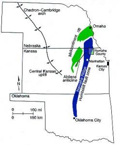
That location is about at the northern edge of the Nemaha Ridge. I found a document detailing a safety study done in 2004 for a mine to be located at the north end of Nemaha Ridge, which according to the study is a buried granite mountain range extending roughly from Omaha to Oklahoma City. The mountains were formed about 300 million years ago and have abrupt elevation changes. The complex fault system that bound the ridge is still active today, especially the Humboldt fault zone that forms the eastern boundary of the Nemaha Ridge. In places it breaks through to the surface, and that does not sound like a good characteristic for a fault to have.
Source
Interesting about the Rift Zone. Future maps drawn by psychics show the middle of the US as an Ocean dividing the US into two countries.
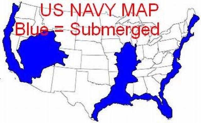
That looks almost exactly like this map:
From this source
www.cuttingedge.org...
Which is easily found using this ap
www.tineye.com...
Which would not be the US Navy.
new topics
-
Comparing the theology of Paul and Hebrews
Religion, Faith, And Theology: 7 minutes ago -
Pentagon acknowledges secret UFO project, the Kona Blue program | Vargas Reports
Aliens and UFOs: 1 hours ago -
Boston Dynamics say Farewell to Atlas
Science & Technology: 1 hours ago -
I hate dreaming
Rant: 1 hours ago -
Is the origin for the Eye of Horus the pineal gland?
Philosophy and Metaphysics: 3 hours ago -
Man sets himself on fire outside Donald Trump trial
Mainstream News: 3 hours ago -
Biden says little kids flip him the bird all the time.
2024 Elections: 3 hours ago -
The Democrats Take Control the House - Look what happened while you were sleeping
US Political Madness: 4 hours ago -
Sheetz facing racial discrimination lawsuit for considering criminal history in hiring
Social Issues and Civil Unrest: 4 hours ago -
In an Historic First, In N Out Burger Permanently Closes a Location
Mainstream News: 6 hours ago