It looks like you're using an Ad Blocker.
Please white-list or disable AboveTopSecret.com in your ad-blocking tool.
Thank you.
Some features of ATS will be disabled while you continue to use an ad-blocker.

"The sports facilities are the detention/relocation camps..." ?
page: 2share:
from a thread; "Something MAJOR going down in Denver!!"
www.abovetopsecret.com...
Haven't waded through the whole thread to find the pdf or info directly related to the stadium yet, but the exercise is "terrorism-based," and the national guard and a sports complex are involved...
Hopefully we'll get more details in a few days...
www.abovetopsecret.com...
Originally posted by Htrowklis82
...Friday there will be a full scale military and civilian agency operation going down in Denver, and they are cautioning residents to remain calm, no matter what they may see! ...
Please be advised that on Friday, 9/23/11, a terrorism-based, full-scale emergency exercise will take place in multiple locations around the Denver Metro area. The exercise will involve first responders from 81 different agencies, will be conducted at ten separate locations, and will include loud noises, simulated weapons, smoke, emergency vehicles and other equipment that will be audible and visible throughout the day. Please see the attached document for additional information. Two of the locations are Park Meadows Mall and Sky Ridge Medical Center so don’t be alarmed if you see a lot of activity in these locations.
I have a whole PDF of information, but I am not sure how to attach it.
Originally posted by Htrowklis82
reply to post by ThinkingCap
There are multiple locations listed on this PDF, including DIA, sports authority field (bronco's stadium) hospitals and light rail stations.
Originally posted by STEADFast
Operation Mountain Guardian Emergency Exercise
blogs.douglas.co.us...
www.douglas.co.us...
Haven't waded through the whole thread to find the pdf or info directly related to the stadium yet, but the exercise is "terrorism-based," and the national guard and a sports complex are involved...
Hopefully we'll get more details in a few days...
edit on 22-9-2011 by 1825114 because: (no reason given)
I wish ats would just allow pictures to resize, you have to use the pictures' scroll bars to see what I'm talking about. Or just right click and view
image or click the link to see the whole things.
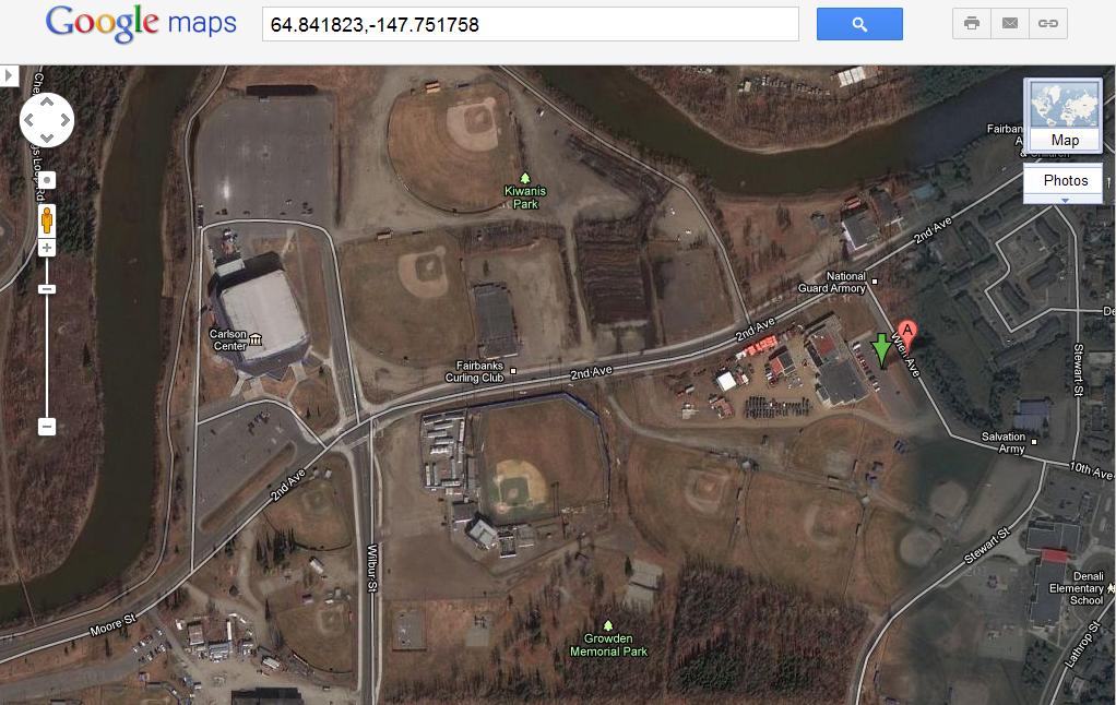
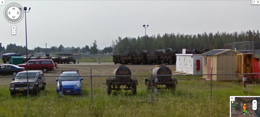
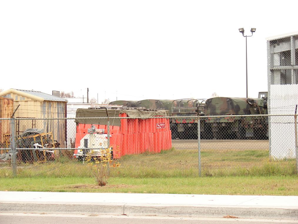
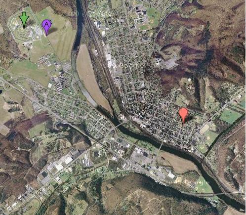
Here's MY local sports complex/national guard armory. It's on the right, by the arrow/marker. Those few-dozen dark things in rows are caravans and hummers, and there are a lot more than that there now. What's their purpose?


files.abovetopsecret.com...
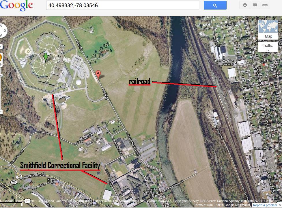
Here it is in relation to the prison and "juvenile hall." Not even a 2 minute drive.
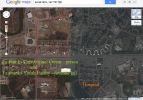
files.abovetopsecret.com...

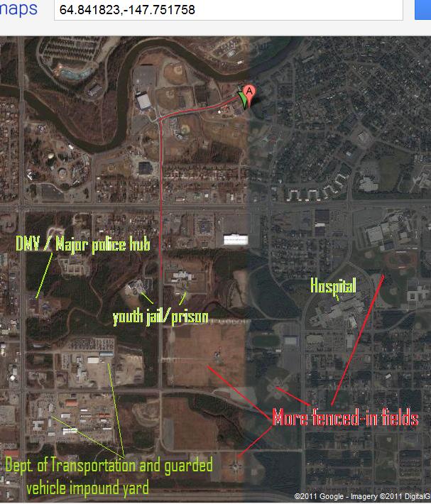
Here it is in relation to the prison, hospital (surrounded on one side by more fenced fields), the DMV (where there are usually more cops than most anywhere else in town), department of transportation, fenced/guarded lot where impounded cars are held, and other fenced fields

files.abovetopsecret.com...
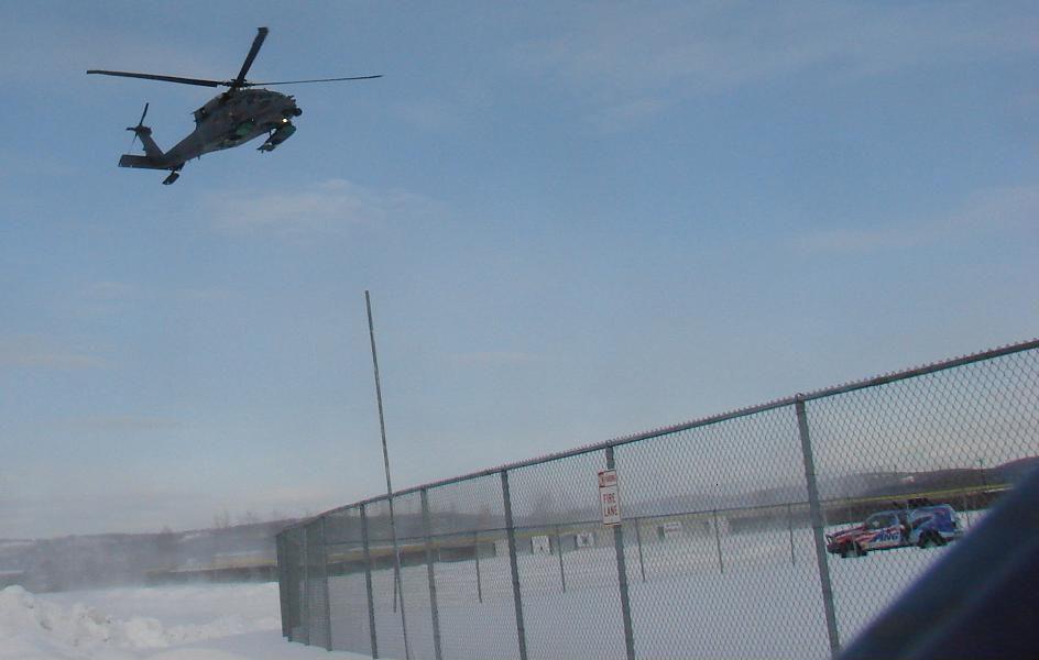
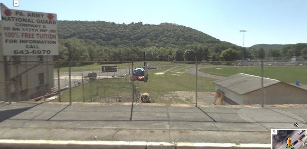
Here's a picture of an (Air National Guard?) helicopter taking off from the side of one of the fields next to the armory
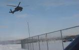
files.abovetopsecret.com...
Now keep in mind this is a huge military town. We've got a giant military base and a giant air force base.
In fact, If you look up locations for "fema camps," every single place says the same thing;
They say it's at Eilson air force base.
Well there are train tracks and a river leading DIRECTLY from the fields/armory I posted above to Fort Wainwright.
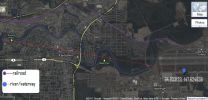
files.abovetopsecret.com...
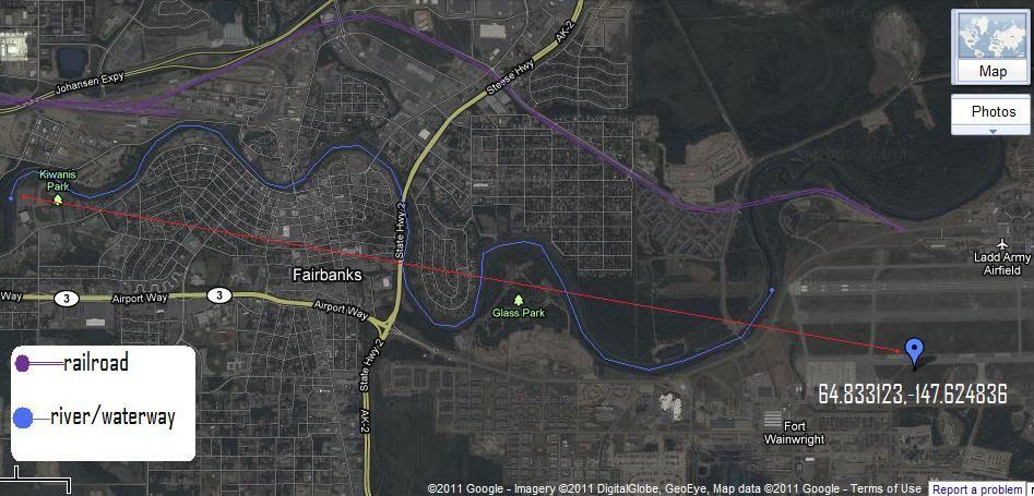
Those traintracks also go straight to Eilson AFB, where there is a large mental health facility...
At both bases there are more baseball fields within a minute's drive of the railway/the air fields.
What say you?
Here's MY local sports complex/national guard armory. It's on the right, by the arrow/marker. Those few-dozen dark things in rows are caravans and hummers, and there are a lot more than that there now. What's their purpose?
files.abovetopsecret.com...
Here it is in relation to the prison and "juvenile hall." Not even a 2 minute drive.
files.abovetopsecret.com...
Here it is in relation to the prison, hospital (surrounded on one side by more fenced fields), the DMV (where there are usually more cops than most anywhere else in town), department of transportation, fenced/guarded lot where impounded cars are held, and other fenced fields
files.abovetopsecret.com...
Here's a picture of an (Air National Guard?) helicopter taking off from the side of one of the fields next to the armory
files.abovetopsecret.com...
Now keep in mind this is a huge military town. We've got a giant military base and a giant air force base.
In fact, If you look up locations for "fema camps," every single place says the same thing;
The camps all have railroad facilities as well as roads leading to and from the detention facilities. Many also have an airport nearby. The majority of the camps can house a population of 20,000 prisoners. Currently, the largest of these facilities is just outside of Fairbanks, Alaska. The Alaskan facility is a massive mental health facility and can hold approximately 2 million people.
They say it's at Eilson air force base.
Well there are train tracks and a river leading DIRECTLY from the fields/armory I posted above to Fort Wainwright.
files.abovetopsecret.com...
Those traintracks also go straight to Eilson AFB, where there is a large mental health facility...
At both bases there are more baseball fields within a minute's drive of the railway/the air fields.
What say you?
edit on 22-9-2011 by maybehelpful because: (no reason given)
Exactly what I'm talking about. I'd like to know which came first, the NG armoury, or the fields?
Just came across this from the denver post...
Relax Denver metro area, it's just a drill - a loud, scary drill
I really, really hope there are some reports about what actually goes on there once it's over with...
Just came across this from the denver post...
Relax Denver metro area, it's just a drill - a loud, scary drill
More than 100 emergency agencies will take part in a terrorism response exercise that promises to attract attention throughout the metro area.
Simulated explosions will boom, smoke will rise, and emergency vehicles will blare warning signals as fake weapons are drawn.
The exercise, Operation Mountain Guardian, is scheduled to begin at 5 a.m. and end at 4:30 p.m. and will involve 14 separate locations.
The exercise is an opportunity for regional first responders to react to a mock terrorist-driven catastrophe...
...Most of the action will break out at five locations over the course of the day: Park Meadows Mall; Smedley Elementary School; Union Station; Community College of Aurora; and Denver International Airport.
Sky Ridge Medical Center; Denver Health Medical Center and University of Colorado Hospital, will test their ability to handle a surge of injured patients during the drill. And Sports Authority Field at Mile High Stadium "may have a small role in helping to process the (pretend) mass casualties," Kimbrough said.
Catholic Charities will serve as an evacuation center where children from Smedley will be taken.
I really, really hope there are some reports about what actually goes on there once it's over with...
edit on 22-9-2011 by 1825114 because:
color won't work
First report I've heard so far is that media isn't being allowed access to the stadium drill...
Originally posted by 1825114
First report I've heard so far...
Schoolbuses full of kids being brought to the stadium. Will we find out what kind of exercises they're running them through?
edit on 23-9-2011
by 1825114 because: (no reason given)
Martial Law drill evacuates children to FEMA stadium
Sep 23, 2011
A Homeland Security drill in Denver federalizes the response to terrorism, including operation to relocate students under siege by a shooter to a FEMA-led Sports Stadium center for ultimate reunification with parents.
Sep 24, 2011
Homeland Security terror drill in Denver revealed the ultimate goal was to relocate children and at risk populations to FEMA sport stadium relocation centers. Denver Police Victim Assistance Unit director Scott Snow admits in this clip.
A massive Terror Drill remarkably ignored by all but local media is now underway in Denver, Colorado.
BINGO - this is what i've been saying awhile( and getting funny looks..)
thank y'all for the intel.. so- there's where you will go..
guess where the elites will be?
at the luxury golf estates..scope out around commerce city colorado.
just west of the DIA. the new capitol, zoom in on the space theater mall.
see the alien in the all seeing eye over the kabala tree of life? ..pan straight north to
dicks sporting goods coliseum -dont laugh, dicks is a 4 billion dollar /fortune 500 corp.-in 42 states.
so its located on gateway road that goes into the arsenal refuge park..
look where the road curves round to enter the park- theres a round shape north off the road.
zoom in an see the nato emblem.
ok?
now the elites will be at Eagles Bend a ways south to Lone tree east to gun club road.
saddletree ,talyns reach, blackthorn. is there a dicks sporting goods/ammo dump? on the way?
you bet..
what do elites love besides guns and golf? thats right -god- punch up how many apostolic churches there are just south of commerce city..and theres one at the eagles bend complex.
the test for my theory was applied to colorado city..dicks sporting goods on n.power road...stroll east on carefree road and theres an apostolic church..keep going east to queen annes way. whats an english sounding enclave of luxury homes got to do with it? ask the police chief of Lonetree- steve hasler, he's a british constable from
hertfordshire- where they had all the riots, a stacking area for heathrow airport.
colorado is home to the 122d military police recently called back from iraq they were at columbine.
the silence apostolic church is on columbine st.
Take my template to an area near you- guns-golf -god
oh yeah -gold.. you'll need gold.
Well now we know not to follow the masses onto bridges if there are police at either end...
-It's official, #OccupyWallStreet seizes The Brooklyn Bridge!
-Police Arrest More Than 700 Protesters on Brooklyn Bridge
-People Rounded up Like Cattle @ NYC
Police Leading #OccupyWallStreet Protesters Onto The Brooklyn Bridge Traffic Lane

-It's official, #OccupyWallStreet seizes The Brooklyn Bridge!
-Police Arrest More Than 700 Protesters on Brooklyn Bridge
-People Rounded up Like Cattle @ NYC
Police Leading #OccupyWallStreet Protesters Onto The Brooklyn Bridge Traffic Lane
edit on 2-10-2011 by
1825114 because: (no reason given)
Originally posted by maybehelpful
Here's MY local sports complex/national guard armory. It's on the right, by the arrow/marker. Those few-dozen dark things in rows are caravans and hummers, and there are a lot more than that there now. What's their purpose?
not-so-good more recent picture-
Notice what those trucks are being used for in this video
Originally posted by 1825114Martial Law Can Happen New Orleans Got Iraqed
www.youtube.com...
Notice the plastic road barriers. They fill them up with water/sand and use them to divert/restrict traffic or for roadblocks. The place I recognize them from most is the checkpoints to get on base.
I was reminded to post that picture when I just saw this...
Operation Fairbanks: Fort Wainwright soldiers help make Afghan road safe for travel
Oct 09, 2011
FAIRBANKS — A company of Stryker soldiers recently helped re-open a dangerous road in Afghanistan in a mission named after Fairbanks, according to an Army news release.
Five months in the planning, Operation Fairbanks involved clearing roadside bombs and building checkpoints on a road to a district capital that recently was held by the Taliban.
There's also this...
Parnel l: Alaskans not prepared for disasters
Aug 24, 2011
...Earlier this year, in announcing he wanted to focus greater attention on readiness, Parnell told key staff that he wanted Alaska to be prepared not only for natural disasters but also for unemployment and "civil unrest" in the Lower 48 "that could lead to an influx here."
He said Wednesday that unrest could include dissatisfaction in urban areas...
edit on 10-10-2011 by maybehelpful because: (no reason
given)
I was looking at this thread...
Secret Detention Facility in swamps of Northern Virginia
And I remembered something I noticed last time I was looking around google maps.
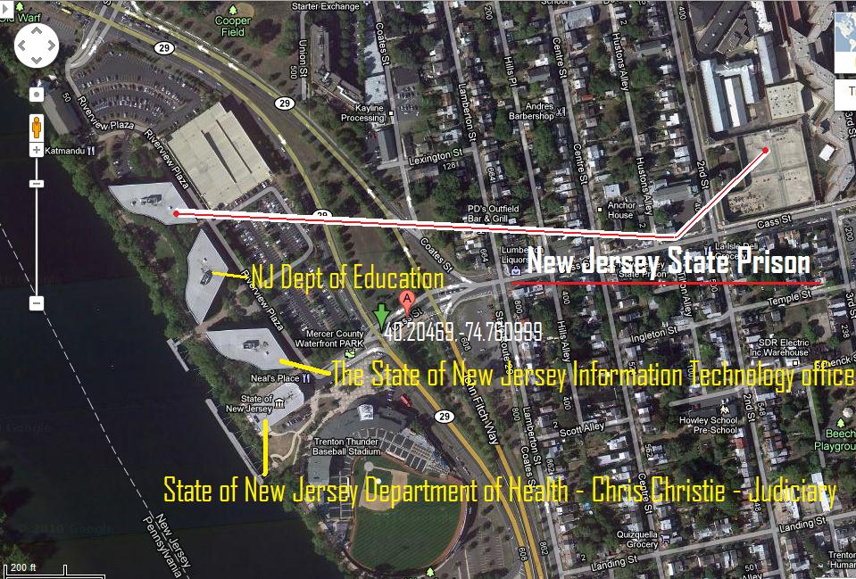
copy/paste these coordinates... 40.20469,-74.760999 ...on google maps maps.google.com...
That's Trenton Thunder Stadium, in Trenton, NJ. To the left of the stadium, along the river, there are four white-roofed buildings.
The smallest one closest to the stadium, is listed as "State of New Jersey department of health - chris christie - judiciary," and there's at least one listed Crisis/Screening Center in the complex...
nj.gov...
The first of the three weird shaped buildings is listed on google maps as "The State of New Jersey Information Technology office"
www.state.nj.us...
The next building is "NJ Dept of Education"
And the next one isn't listed as this now, but was the last time I looked, and an orange marker popped up in front of it when I searched for the prison (which got a purple marker) but it didn't provide any info this time... The New Jersey State Prison.
The actual state prison itself is literally right up the road, and I'm assuming this is just an administrative building, but I have a hard time not thinking there's more to it than that.
Secret Detention Facility in swamps of Northern Virginia
And I remembered something I noticed last time I was looking around google maps.
copy/paste these coordinates... 40.20469,-74.760999 ...on google maps maps.google.com...
That's Trenton Thunder Stadium, in Trenton, NJ. To the left of the stadium, along the river, there are four white-roofed buildings.
The smallest one closest to the stadium, is listed as "State of New Jersey department of health - chris christie - judiciary," and there's at least one listed Crisis/Screening Center in the complex...
nj.gov...
The first of the three weird shaped buildings is listed on google maps as "The State of New Jersey Information Technology office"
www.state.nj.us...
Who We Are
The New Jersey Office of GIS (OGIS) was formally established by Executive Order #122 on January 30, 2001, but has been fully functioning within New Jersey's Office of Information Technology since September 1999.
The mission of the Office of GIS is to promote the use of GIS technology among state agencies and to provide statewide leadership in the development of New Jersey's spatial data infrastructure.
The next building is "NJ Dept of Education"
And the next one isn't listed as this now, but was the last time I looked, and an orange marker popped up in front of it when I searched for the prison (which got a purple marker) but it didn't provide any info this time... The New Jersey State Prison.
The actual state prison itself is literally right up the road, and I'm assuming this is just an administrative building, but I have a hard time not thinking there's more to it than that.
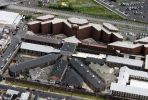
New Jersey State Prison, home of New Jersey's death row. The prison towers over residences. It is located near the city's Trenton Thunder baseball stadium and much of the traffic passes by. To make things look a little better, a beautiful mural of baseball spectators was painted on the side. Razor wire glows in the lights overhead.
edit on 17-10-2011 by 1825114 because: (no reason given)
New Jersey State Prison, formerly Trenton State Prison

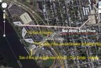
There are traintracks right near by, and Fort Dix isn't too long of a drive away
Originally posted by 1825114
copy/paste these coordinates... 40.20469,-74.760999 ...on google maps maps.google.com...
There are traintracks right near by, and Fort Dix isn't too long of a drive away
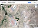
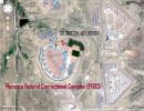
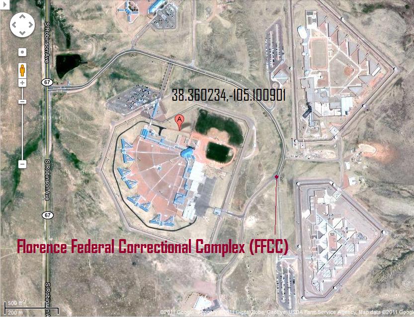
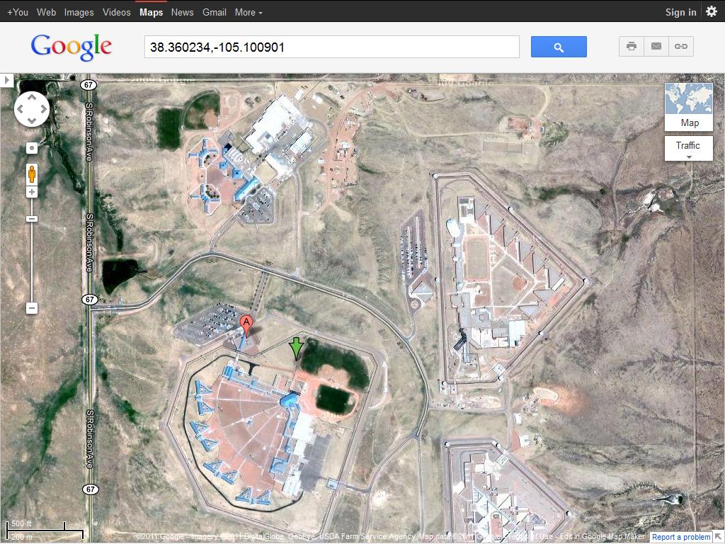
federal supermax prison in florence, colorado. 38.360234,-105.100901 on google maps.
See any similarities between it and some of the other facilities posted?
www.supermaxed.com...
Reporters get first look inside mysterious Supermax prison
...
See any similarities between it and some of the other facilities posted?
www.supermaxed.com...
en.wikipedia.org...
The United States Penitentiary Administrative Maximum Facility (ADX) is a supermax prison for men that is located in unincorporated Fremont County, Colorado, United States, south of Florence It is unofficially known as ADX Florence, Florence ADMAX, Supermax, or The Alcatraz of the Rockies It is operated by the Federal Bureau of Prisons, a division of the United States Department of Justice. ADX, a part of the Florence Federal Correctional Complex (FCC), houses the prisoners who are deemed the most dangerous and in need of the tightest control of all the prisoners within the United States Federal Prison System...
Prison facility
ADX Supermax
ADX Florence is a federal prison, comprising a 37-acre (15 ha), 490-bed complex at 5880 Highway 67, Florence, Colorado. It is one of three correctional facilities of the Florence Federal Correctional Complex (FFCC), each with a different overall security level
The prison houses several terrorists and spies who cannot be incarcerated in a normal prison due to national security concerns, as well as other criminals deemed too dangerous or too high-profile for even a maximum-security prison. However, 95 percent of the inmates have been sent to Florence from other prisons due to a history of violent behavior. These prisoners are kept in solitary confinement for 23 hours a day for at least the first year. Depending on their records, they can be let out for longer periods. The long-term goal is to transfer them to a less-restrictive prison to serve out the remainder of their terms
ADX Florence generally houses around 430 male prisoners, each assigned to one of six security levels. ADX Florence was designed jointly by DLR Group and LKA Partners of Colorado Springs.
Most cells' furniture is made almost entirely out of poured concrete, including the desk, stool, and bed. Each chamber contains a toilet that shuts off if plugged, a shower that runs on a timer to prevent flooding, and a sink missing a potentially dangerous trap. Rooms may also be fitted with polished steel mirrors bolted to the wall, an electric light, a radio, and a television that shows recreational, educational and religious programming.[These are considered privileges that may be taken away as punishment, so they are placed and remotely controlled such that the inmate does not actually come into contact with them. The 4 in (10 cm) by 4 ft (1.2 m) windows are designed to prevent the prisoner from knowing his specific location within the complex because he can see only the sky and roof through them. Additionally, inmates exercise in what has been described as an "empty swimming pool," so they do not know their location for possible escape. Telecommunication with the outside world is forbidden, and food is hand-delivered by correctional officers. The prison as a whole contains a multitude of motion detectors and cameras, 1,400 remote-controlled steel doors, and 12 ft (3.66 m) high razor wire fences. Laser beams, pressure pads, and attack dogs guard the area between the prison walls and razor wire.[citation needed]
Eric Rudolph, the Olympic Park bomber, lamented in a series of 2006 letters to a Colorado Springs newspaper that the ADX is meant to "inflict misery and pain." Charles Harrelson, who was sent to ADX after a failed attempt to escape from a Georgia prison, said "Part of the plan here is sensory deprivation," and "It could be infinitely worse." A former ADX warden described the place as "a cleaner version of Hell." There have been hundreds of "involuntary feedings" and four suicides. Most recently, in June 2009 Richard Reid, commonly known as the "shoe bomber", went on a hunger strike and was force-fed.
Reporters get first look inside mysterious Supermax prison
September 13, 2007
Visiting Supermax, the "Alcatraz of the Rockies," reveals nothing so much as an astonishing and eerie quiet.
It's not what one would expect of a place that houses 473 notorious terrorists, vicious murderers and violent, disruptive escape-prone inmates brought in from other federal penitentiaries.
I've visited noisy, boisterous state and federal prisons, where inmates scream for a visitor's attention or proclaim their innocence.
But at Supermax -- officially called "Administrative Maximum," or ADX -- everything is very tightly controlled, with nothing left to chance, so there is no particular sense of a threat, no feeling of vulnerability. View an explainer of Supermax's security
...
edit on 29-10-2011 by maybehelpful because: (no reason given)
central pennsylvania
maps.google.com...
This is a prison, on State Prison Road... 40.498332,-78.03546
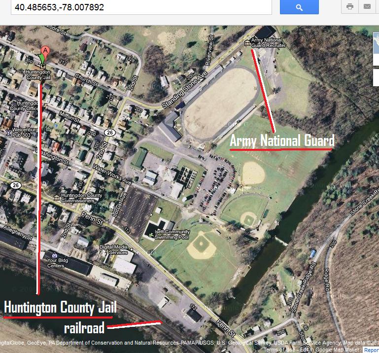
This is a jail (Huntington County Jail) just down the river/traintrack from that prison... 40.485653,-78.007892
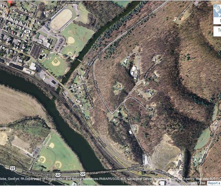
These are more fenced fields a few seconds down the street from that jail, bordering the river/railroad... 480904,-78.004518
This is an Army National Guard Recruiter literally touching those fenced fields with what amounts to trenches blocking them from farmland/a cemetery... 40.486159,-78.003294
maps.google.com...
This is a prison, on State Prison Road... 40.498332,-78.03546
This is a jail (Huntington County Jail) just down the river/traintrack from that prison... 40.485653,-78.007892
These are more fenced fields a few seconds down the street from that jail, bordering the river/railroad... 480904,-78.004518
This is an Army National Guard Recruiter literally touching those fenced fields with what amounts to trenches blocking them from farmland/a cemetery... 40.486159,-78.003294
edit on 4-11-2011 by 1825114 because: (no reason given)
Originally posted by 1825114
central pennsylvania
maps.google.com...
This is a prison, on State Prison Road... 40.498332,-78.03546
This is a jail (Huntington County Jail) just down the river/traintrack from that prison... 40.485653,-78.007892
The green/purple markers on the left are at the prison, the orange one on the right is at the county jail
This is the prison closer up, and in proximity to the railroad...
Originally posted by 1825114
These are more fenced fields and a national guard facility a few seconds down the street from the jail, bordering the river/railroad... 480904,-78.004518
There are fenced fields on the opposite riverbank too...
Originally posted by 1825114
This is an Army National Guard Recruiter literally touching those fenced fields... 40.486159,-78.003294
With tall, barbed-wire fences...
"Since when does Australia build compounds near sports arenas with 'Double 3m Razor wire to keep people in, and housed with compound
lighting and speakers, and security iron gates at the exit?"
Guy walks around the facility with a camera (and a member of parliament) in this first video, and points out how it doesn't just look like a prison facility, it's almost all it could be used for
Guy walks around the facility with a camera (and a member of parliament) in this first video, and points out how it doesn't just look like a prison facility, it's almost all it could be used for
edit on 12-11-2011 by 1825114 because: (no reason given)
DISASTER RECOVERY CENTER TO OPEN IN COUNCIL BLUFFS
maps.google.com... 41.268711,-95.866935
Sports complex on one side, railroad depot on the other.
West Des Moines, Ia.—The U.S. Department of Homeland Security’s Federal Emergency Management Agency (FEMA) and the Iowa Homeland Security and Emergency Management Division (HSEMD) announced that a Disaster Recovery Center (DRC) will open in Pottawattamie County on Wednesday, October 26, 2011...
...
705 North 16th Street, Council Bluffs, Iowa
maps.google.com... 41.268711,-95.866935
Sports complex on one side, railroad depot on the other.
Watch this video...
That facility is at -41.142952,175.047913 maps.google.com...
Right down Alexander Rd (west/left) is Trentham Military Camp, and directly connected to that is Rimutaka Prison
They're bordering a giant fenced-in racecourse, Trentham Racecourse, the other side of which is bordered by railroad tracks
That facility is at -41.142952,175.047913 maps.google.com...
Right down Alexander Rd (west/left) is Trentham Military Camp, and directly connected to that is Rimutaka Prison
They're bordering a giant fenced-in racecourse, Trentham Racecourse, the other side of which is bordered by railroad tracks
just posting these here to make future searches easier...
www.ice.gov...
www.detentionwatchnetwork.org...
www.ice.gov...
www.detentionwatchnetwork.org...
Elayn Hunt Correctional Center
maps.google.com... 30.264145,-91.088169
right down the road are the fenced sports facilities, bordered by traintracks on one side, river on the other.
maps.google.com... 30.264145,-91.088169
right down the road are the fenced sports facilities, bordered by traintracks on one side, river on the other.
Wow, same in my town! The main FEMA camp will be at an old army ammo plant. it has underground system capable of holding 20,000 people. with
traintracks right behind it. The minor league baseball field directly across the street from where the national guard stores military vehicles. Most
of them are gunner vehicles. To top it off, it has a river behind it, to prevent escape. Wow, great find! Walmarts would be used also. Look at the top
of the Walmarts, they all have holes in the top that would be perfect for sniper posts. The garden area is a detainment center with it's perimeters
locked down. Walmarts are also building Walmarts in the same towns and keeping the old one there, and still owning the properties. Why? So no other
competition can move in? Or is it to have an additional detainment center. My town got a new walmart, supposed to be a super wal mart. It isn't, now
the next city over is getting an additional wal mart. Interesting...
new topics
-
God's Righteousness is Greater than Our Wrath
Religion, Faith, And Theology: 2 hours ago -
Electrical tricks for saving money
Education and Media: 5 hours ago -
VP's Secret Service agent brawls with other agents at Andrews
Mainstream News: 7 hours ago -
Sunak spinning the sickness figures
Other Current Events: 7 hours ago -
Nearly 70% Of Americans Want Talks To End War In Ukraine
Political Issues: 8 hours ago -
Late Night with the Devil - a really good unusual modern horror film.
Movies: 9 hours ago -
Cats Used as Live Bait to Train Ferocious Pitbulls in Illegal NYC Dogfighting
Social Issues and Civil Unrest: 11 hours ago
top topics
-
VP's Secret Service agent brawls with other agents at Andrews
Mainstream News: 7 hours ago, 9 flags -
Cats Used as Live Bait to Train Ferocious Pitbulls in Illegal NYC Dogfighting
Social Issues and Civil Unrest: 11 hours ago, 8 flags -
Electrical tricks for saving money
Education and Media: 5 hours ago, 4 flags -
HORRIBLE !! Russian Soldier Drinking Own Urine To Survive In Battle
World War Three: 15 hours ago, 3 flags -
Nearly 70% Of Americans Want Talks To End War In Ukraine
Political Issues: 8 hours ago, 3 flags -
Sunak spinning the sickness figures
Other Current Events: 7 hours ago, 3 flags -
Late Night with the Devil - a really good unusual modern horror film.
Movies: 9 hours ago, 2 flags -
The Good News According to Jesus - Episode 1
Religion, Faith, And Theology: 13 hours ago, 1 flags -
God's Righteousness is Greater than Our Wrath
Religion, Faith, And Theology: 2 hours ago, 0 flags
active topics
-
New whistleblower Jason Sands speaks on Twitter Spaces last night.
Aliens and UFOs • 55 • : baablacksheep1 -
VP's Secret Service agent brawls with other agents at Andrews
Mainstream News • 40 • : ThatSmellsStrange -
Cats Used as Live Bait to Train Ferocious Pitbulls in Illegal NYC Dogfighting
Social Issues and Civil Unrest • 20 • : Asher47 -
Nearly 70% Of Americans Want Talks To End War In Ukraine
Political Issues • 12 • : Asher47 -
Electrical tricks for saving money
Education and Media • 4 • : Lumenari -
DONALD J. TRUMP - 2024 Candidate for President - His Communications to Americans and the World.
2024 Elections • 514 • : WeMustCare -
The Acronym Game .. Pt.3
General Chit Chat • 7744 • : bally001 -
Truth Social goes public, be careful not to lose your money
Mainstream News • 128 • : Astyanax -
Sunak spinning the sickness figures
Other Current Events • 5 • : glen200376 -
SETI chief says US has no evidence for alien technology. 'And we never have'
Aliens and UFOs • 44 • : MikeDeGrasseTyson