It looks like you're using an Ad Blocker.
Please white-list or disable AboveTopSecret.com in your ad-blocking tool.
Thank you.
Some features of ATS will be disabled while you continue to use an ad-blocker.

Compasses going crazy...Theories and Research
page: 45share:
Here are my latest readings from this morning. I made a picture with PS to clarify the difference. I used
NOAA Magnetic declination calculator to check what's the estimated difference between map north and magnetic north. I got a result of "Declination = 10° 4' E changing by 0° 10' E/year" .. (We use 10 degrees here all the time when doing hiking and other navigation in the nature.)
You can check out the estimated value for your location by finding your coordinates from Google earth or similar and then use the NOOA online calculator. (Notice that you need to input the numerical values only, separated with space).
I used 2 compasses (both made by Finnish Suunto company) and they're showing pretty much the same reading and have been reliable so far during the years. When you take into account the declination of about 10 degrees, my compass is showing north to be about 21 degrees east from where it "should" be. As I stated earlier, I've been following this for over a year now and sometimes my compass can show very extreme differences from 30-40 degrees and then return, usually after a day or something. I don't spend my whole day looking (I mostly check it maybe once a day, if I'm at home) so I can't say how sudden the change actually is. I would say from my experience that the average difference is about 15 degrees but it's just a hunch and as said, it varies a lot and I haven't taken the readings down on paper, which would have been helpful at the moment.
I'm gonna try to find out if there are some natural causes around here (other than space weather etc) which can explain the current difference.
(I removed the street names from the map to protect my privacy.) The big red ball with the arrow shows my exact location on the map. I wish to point out that the margin of error in here is pretty big as I used a local map and buildings when trying to figure out the assumed "magnetic north" and then compared it to my reading. So the actual difference can be maybe only 10 degrees or less - or maybe 30 degrees or more. Anyways, I hope all of you guys check out your assumed magnetic declination before jumping to your math and conclusions.
The image sharing site cropped my picture somewhat oddly, but it shows all that is relevant.
reply to post by SolarE-Souljah
Yes, me and about 8 other people ive talked to in the last two days, all woman except two. I had it last night really bad, especially if I tried to look up, my freind actually fell on my kitchen floor and said she was spinning, she dropped the water pitcher all over the floor, I helped her to the couch, wierded me out cause just a few hours before that I felt dizzy, my balance has been way off. This is no lie NO JOKE,
Marriah
Originally posted by Anokorok
Some people say they see a pattern forming between the January mass animal deaths and the compass anomalies. I made an animated overlay of the two maps which is embedded below. Green markers are correct compass readings, red markers are "off" compass readings, and blue markers are mass animal death incidents (that happened in January). The compass map is anecdotal whereas the mass animal death map was created from news reports.
[atsimg]http://files.abovetopsecret.com/images/member/528e2dad289d.gif[/atsimg]
Fullview
Sources: Compass Reading Map & Mass Animal Deaths
There's not really enough data to create a hypothesis yet. If anyone living near the cities of the January animal deaths could take a compass reading and add it to the compass reading map, we might be able to see a clearer pattern. If your compass reading seems off, double check using Polaris as a guide for true north (it's only 0.7° off from the Earth's rotational axis). There have also been more mass animal deaths since then like the one in Redondo Beach, California that happened before the Touhoku earthquake:
Source: latimesblogs.latimes.com...
Scientists are working to determine what caused oxygen levels to drop so steeply that fish estimated to be in the millions suffocated and deposited a silver sheen of carcasses, many of them sardines, among the rows of docked boats.
I've seen nothing extraordinary on my compass here so far, but I'm keeping an open mind and a watchful eye for any magnetic interference. Geomagnetic storms have been shown to affect compasses strongly before:
Source: news.bbc.co.uk...
The compass variation at the Lerwick geomagnetic observatory in Scotland changed by 5.1 degrees in only 25 minutes at about 0630 GMT.
(Last Updated: Thursday, 30 October, 2003, 08:34 GMT)
The maps shows only one thing, about 50% of the people can't read a compass. Trolling? No! Please zoom in that map and take a exact look.
Killeen - Bad Compass, but Piedras Negras and Huston are ok.
Baltimore - Bad Compass, but Frederick, New Jersey and Delaware is okey.
Hamilton - Bad, but the Lake Ontario has two measures, one okey, one not.
Chicago - Bad, but North Chicago is okey.
Agua Perieta - Bad, San Luis is okey.
Oneida is Bad, Auburn too, Simsonville too, and in the middle of them is Atlante, marked as okey.
Did you realized something? NO PATTERN
ps. oh, I see a pattern now, the people that life beachside can read compasses far better that "inlanders".
edit on 21-3-2011 by cushycrux because: (no reason given)
cant someone just take a picture of the rising sun and the compass pointing at it and end this hoax debate once and for all. once we establish that
peoples compasses are actually pointing NE or E then we can discuss why its happening.
with all this stupid name calling were not addressing any potential danger this might pose to people. so whoever it is thats experiencing compass anomalies please take a picture next to a sun dial or some other landmark that points to the "old" north with the compass pointing to where ever it is supposed to be pointing.
with all this stupid name calling were not addressing any potential danger this might pose to people. so whoever it is thats experiencing compass anomalies please take a picture next to a sun dial or some other landmark that points to the "old" north with the compass pointing to where ever it is supposed to be pointing.
This could be interesting for most of you:
Source:
www.physicalgeography.net...
www.eoearth.org...
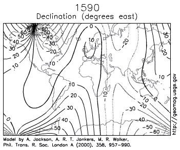
Direction on Maps Like distance, direction is difficult to measure on maps because of the distortion produced by projection systems. However, this distortion is quite small on maps with scales larger than 1:125,000. Direction is usually measured relative to the location of North or South Pole. Directions determined from these locations are said to be relative to True North or True South. The magnetic poles can also be used to measure direction.
However, these points on the Earth are located in spatially different spots from the geographic North and South Pole. The North Magnetic Pole is located at 78.3° North, 104.0° West near Ellef Ringnes Island, Canada. In the Southern Hemisphere, the South Magnetic Pole is located in Commonwealth Day, Antarctica and has a geographical location of 65° South, 139° East. The magnetic poles are also not fixed overtime and shift their spatial position overtime. Topographic maps normally have a declination diagram drawn on them (Figure 2b-8).
On Northern Hemisphere maps, declination diagrams describe the angular difference between Magnetic North and True North. On the map, the angle of True North is parallel to the depicted lines of longitude. Declination diagrams also show the direction of Grid North. Grid North is an angle that is parallel to the easting lines found on the Universal Transverse Mercator (UTM) grid system (Figure 2b-8).

(Figure 2b-8) This declination diagram describes the angular difference between Grid, True, and Magnetic North. This illustration also shows how angles are measured relative grid, true, and magnetic azimuth. (Source: PhysicalGeography.net)
Source:
www.physicalgeography.net...
www.eoearth.org...
edit on 21-3-2011 by cushycrux because: (no reason given)
edit on 21-3-2011 by cushycrux because: (no reason given)
Originally posted by tim3lord
cant someone just take a picture of the rising sun and the compass pointing at it and end this hoax debate once and for all. once we establish that peoples compasses are actually pointing NE or E then we can discuss why its happening.
with all this stupid name calling were not addressing any potential danger this might pose to people. so whoever it is thats experiencing compass anomalies please take a picture next to a sun dial or some other landmark that points to the "old" north with the compass pointing to where ever it is supposed to be pointing.
Good idea. If the sky is clear, I can take some video of the sun setting - as I already missed the sunrise by several hours - and include my compass. Sun should set somewhere between west and northwest in here, I'll find out the exact direction when I come from work.
Consider with whats going on in the global, I think its safe we opt to be keeping an opened mind on figuring what might be causing, or has caused
this. Pole shifts IMO are very possible, Einstein himself tells the relation of magnates and motion and does agree that pole shifts are very possible.
Although different theories suggesting a FAST or a increase in speed to the pole shift in the matter of short time, compared to a large scale of time,
hundreds of thousands of years.
Thus causing chaos to anything that relies on navigation with the poles, IE certain animals and again IMO even the human equilibrium. Of course only thinking out loud.
As were approaching sunrise in (Mountain Time) I have a bit over cast but I could capture via v(ideo) north with compass readings , then relate to sunrise, and even compare to full moon location, although I dont believe my location well be helpful as I am in the middle west of the US and readings are normal. But IF someone on the EAST could do it this AM ..?
In order to end this , I think proof or uploaded material can answer alot of questions. If indeed we can make a correlation of a change in our electromagnetic world, then we must consider other possibilities, and more or less what is about to become....
reply to post by Saintor
i understand you are simply replying to the other poster that suggested getting a video of the sun rising accompanied by a compass reading, but the nature of the thread is NOT trying to figure out whether or not the landmass has shifted but instead the magnetic field of the earth changing, significantly, in certain areas over a brief period of time, in which case, the only way the video would help is if the sun appeared to be rising in the north according to the compass (on the east coast of the US). this would show that a magnetic anomaly exists which is drawing the needle of the compass to a "false" reading of north (outside declination specified on a map) with regards to other areas where the needle is drawn to the magnetic north pole of the planet which will have a specific declination in degrees from grid north on a map. the best way to plot this data is to show the compass readings in degrees with the delination for that area listed along with the reading to show the margin of error for that area if one exists. a video simply isn't going to cut the cheese.
i understand you are simply replying to the other poster that suggested getting a video of the sun rising accompanied by a compass reading, but the nature of the thread is NOT trying to figure out whether or not the landmass has shifted but instead the magnetic field of the earth changing, significantly, in certain areas over a brief period of time, in which case, the only way the video would help is if the sun appeared to be rising in the north according to the compass (on the east coast of the US). this would show that a magnetic anomaly exists which is drawing the needle of the compass to a "false" reading of north (outside declination specified on a map) with regards to other areas where the needle is drawn to the magnetic north pole of the planet which will have a specific declination in degrees from grid north on a map. the best way to plot this data is to show the compass readings in degrees with the delination for that area listed along with the reading to show the margin of error for that area if one exists. a video simply isn't going to cut the cheese.
I asked pages ago for anyone to post a picture or video of their compass actually "going crazy" instead of just saying "me too", but alas...
reply to post by thegiftbearer
which is why I specified that a east coast user try the video process, only suggestions..
which is why I specified that a east coast user try the video process, only suggestions..
god forbid we actually try to get to the bottom of this instead of having a pissing contest. ok so all those reading this who have compasses that have
north pointing NE or E. some video footage to back up these claims please. so that we may once and for all put all doubt aside and venture into this
very interesting topic indeed.
reply to post by ConsentioExpono
I completely agree with you, the degree of interest in this thread and the intensity of the posters who try to marginalize contributers as being too ignorant to read a compass or hoaxers does seem to tell me just the opposite. I think it is fair to say, historically the more one shouts 'don't look there' the more reason there is to look.
I think not only should people NOT stop looking, they should intensify their efforts and start taking readings more often and keeping some sort of records, There used to be a site on the net called haarpwatch but when I googled it I can no longer find it. Anyone remember the site and know what happened to it and if it no longer exists. With all of the technology out there that seems able to affect the earths magnetic fields I would think this is a much more plausible scenario as to what may be affecting compass readings, than about any other. (not necessarily HAARP perse, which get's blamed for everything, but any similar system(s) capable of affecting magnetic fields).
Also as I mentioned before, the DOD tests affecting the SE U.S. only about a month previous to this (and any current uses) MAY have something to do with the pattern being observed (as unclear as it is at present), why any posters would feel this is out of the realm of possibility is beyond me, and as they try and shout hoax, I could just as easily suggest possible counter ulterior motives for them as well. (but let's stop going there)
Let's keep the data coming in, I might suggest a seperate thread simply to keep watch, one that could eliminate so much of the 'noise' on this one, that is set up strictly to deal more with measurement data. IF we are seeing the results of some type of intentionally applied magnetic currents whether they be from communications, weather mod., or even some type of 'weapons system' testing/use, I think it would be quite ironic if they could be monitored by many people simply using $5 compases. That other posters here have simply tried to frame what is being seen as ONLY possible with a true pole shift (yes I realize poles move around somewhat) and ONLY possible through 'natural' means I think is also potentially short sighted. There ARE other possilities.
Lastly, I took several compass readings last night in mid-Missouri, and though I am no compass expert, I believe as far as I am able to tell, my readings have not changed, and my compass still basically points to things aligned that appear north, so please put me on the map, in the center of Missouri as having accurate readings (as far as I can tell) but I will continue to try and refine my ability and take further periodic readings as I hope others will as well.
edit on 21-3-2011 by Tecumte because: (no reason given)
Hello, got my reading at local noon time here in South-West England again. The values are still correct, consistent with my last 5 readings. Can
someone keep on posting the link for the map too?
I am just curious how this is going to evolve today. So far it does not look like people would have consistent variation across the day in their readings, therefore I assume the cause of the anomalies is indeed local.It could be a weakening of the local magnetic field, this would sort of explain the results so far. The health issues mentioned above would also make sense - ladies would have a thinner skull , therefore a weaker magnetic field would have a quicker effect on them (mor radiation could reach the brain, bit like talking on the mobile phone). I will be watching this thread and continue with my readins every several hours.I will let you know if the reading is changing.
I am just curious how this is going to evolve today. So far it does not look like people would have consistent variation across the day in their readings, therefore I assume the cause of the anomalies is indeed local.It could be a weakening of the local magnetic field, this would sort of explain the results so far. The health issues mentioned above would also make sense - ladies would have a thinner skull , therefore a weaker magnetic field would have a quicker effect on them (mor radiation could reach the brain, bit like talking on the mobile phone). I will be watching this thread and continue with my readins every several hours.I will let you know if the reading is changing.
edit on 21-3-2011 by Romanian because: (no reason given)
Just for the heck of it, I turned on the GPS in my car, which is parked in a garage facing due south.
The GPS even retained the previous 'S' heading while it was searching for satellites.
As soon as it locked on to a sufficient number of satellites, the heading changed to 'SW'.
Bizarre. I'm convinced we're experiencing a magnetic pole shift.
How long before the MSM starts reporting these geomagnetic anomalies and what will be the public's reaction?
I am still amazed people have not figured this out....It is the chandler circle.....its been doing this forever
its so sad many of you jump to conclusions without any basic understanding of geography and science....This thread should of died at page 2 when I said this but mod blocked it.....True north and magnetic north change, CASE CLOSED....If your like me and you live in Illinois around the zero declination you will see that true north and magnetic north are the same
its so sad many of you jump to conclusions without any basic understanding of geography and science....This thread should of died at page 2 when I said this but mod blocked it.....True north and magnetic north change, CASE CLOSED....If your like me and you live in Illinois around the zero declination you will see that true north and magnetic north are the same
I found a link on this site yesterday, to a newspaper, which stated the chandlers wobble stopped on 11th march, will google and see if I can pull that
informaton up for you all
www.mayanmajix.com...
can't find the relevant article, but believe me, it was there, I didn't know the wobble had a name until I opened this link
www.mayanmajix.com...
can't find the relevant article, but believe me, it was there, I didn't know the wobble had a name until I opened this link
edit on 21-3-2011
by eccentriclady because: (no reason given)
All my compasses still reading normal as of now, will try again before I got to bed later.
Same here in Denver.... I read an article about pyramid power, and found a little pyramid box at a thrift store. So I put it on an old wood table, got
my compass out, calculated true north..I WEDGED THE TABLE INTO A CORNER, THEN TOOK A PAIR OF SCISSORS AND SCRATCHED THE LINE INTO THE TABLE. I
checked it again, threw an old razor in the box (Thursday March 17, 2011) and waited for the full moon. On the night of the full moon, we were
watching it threw the clouds went to grab my compass to make sure the pyramid box was aligned it was 8-9 degrees off.. I was PISSED.. I scratched a
new line in the table and moved the box. I have also been watching a star in the SE that rose here around 4:30am in the morning since before
thanksgiving 2010 it was always in the same place, near the pine tree. I decided to wait up and see if the star came up in the same place... Because
of the time change, the time was an hour later, and it TOO had moved about 15-20 degrees. I wish I had found this thread earlier...
reply to post by THEDUDE86
I would be highly unlikely that a small amount of change could have as a result the compass readings reported by some ATS-ers..
The Chandler wobble is a small motion in the Earth's axis of rotation relative to the Earth's surface, which was discovered by American astronomer Seth Carlo Chandler in 1891. It amounts to 20 feet (9 meters) on the Earth's surface and has a period of 433 days.
I would be highly unlikely that a small amount of change could have as a result the compass readings reported by some ATS-ers..
reply to post by Blazer
I could put a picture up of where I scratched my table for my pyramid box aligned to true north, and then on the full moon checked it and it was about 10 degrees off.. and scratched the table again.
I could put a picture up of where I scratched my table for my pyramid box aligned to true north, and then on the full moon checked it and it was about 10 degrees off.. and scratched the table again.
new topics
-
Las Vegas UFO Spotting Teen Traumatized by Demon Creature in Backyard
Aliens and UFOs: 34 minutes ago -
2024 Pigeon Forge Rod Run - On the Strip (Video made for you)
Automotive Discussion: 1 hours ago -
Gaza Terrorists Attack US Humanitarian Pier During Construction
Middle East Issues: 1 hours ago -
The functionality of boldening and italics is clunky and no post char limit warning?
ATS Freshman's Forum: 2 hours ago -
Meadows, Giuliani Among 11 Indicted in Arizona in Latest 2020 Election Subversion Case
Mainstream News: 3 hours ago -
Massachusetts Drag Queen Leads Young Kids in Free Palestine Chant
Social Issues and Civil Unrest: 3 hours ago -
Weinstein's conviction overturned
Mainstream News: 5 hours ago -
Supreme Court Oral Arguments 4.25.2024 - Are PRESIDENTS IMMUNE From Later Being Prosecuted.
Above Politics: 6 hours ago -
Krystalnacht on today's most elite Universities?
Social Issues and Civil Unrest: 6 hours ago -
Chris Christie Wishes Death Upon Trump and Ramaswamy
Politicians & People: 7 hours ago
top topics
-
Krystalnacht on today's most elite Universities?
Social Issues and Civil Unrest: 6 hours ago, 8 flags -
Weinstein's conviction overturned
Mainstream News: 5 hours ago, 6 flags -
University of Texas Instantly Shuts Down Anti Israel Protests
Education and Media: 9 hours ago, 6 flags -
Supreme Court Oral Arguments 4.25.2024 - Are PRESIDENTS IMMUNE From Later Being Prosecuted.
Above Politics: 6 hours ago, 5 flags -
Massachusetts Drag Queen Leads Young Kids in Free Palestine Chant
Social Issues and Civil Unrest: 3 hours ago, 4 flags -
Meadows, Giuliani Among 11 Indicted in Arizona in Latest 2020 Election Subversion Case
Mainstream News: 3 hours ago, 4 flags -
Chris Christie Wishes Death Upon Trump and Ramaswamy
Politicians & People: 7 hours ago, 2 flags -
Any one suspicious of fever promotions events, major investor Goldman Sachs card only.
The Gray Area: 11 hours ago, 2 flags -
Gaza Terrorists Attack US Humanitarian Pier During Construction
Middle East Issues: 1 hours ago, 2 flags -
2024 Pigeon Forge Rod Run - On the Strip (Video made for you)
Automotive Discussion: 1 hours ago, 1 flags
active topics
-
Las Vegas UFO Spotting Teen Traumatized by Demon Creature in Backyard
Aliens and UFOs • 3 • : FlyersFan -
Candidate TRUMP Now Has Crazy Judge JUAN MERCHAN After Him - The Stormy Daniels Hush-Money Case.
Political Conspiracies • 786 • : Annee -
University of Texas Instantly Shuts Down Anti Israel Protests
Education and Media • 189 • : CriticalStinker -
The functionality of boldening and italics is clunky and no post char limit warning?
ATS Freshman's Forum • 11 • : JonnyC555 -
Nearly 70% Of Americans Want Talks To End War In Ukraine
Political Issues • 89 • : Xtrozero -
Gaza Terrorists Attack US Humanitarian Pier During Construction
Middle East Issues • 19 • : Consvoli -
Sunak spinning the sickness figures
Other Current Events • 21 • : Xtrozero -
God's Righteousness is Greater than Our Wrath
Religion, Faith, And Theology • 30 • : confuzedcitizen -
Chris Christie Wishes Death Upon Trump and Ramaswamy
Politicians & People • 19 • : DontTreadOnMe -
Supreme Court Oral Arguments 4.25.2024 - Are PRESIDENTS IMMUNE From Later Being Prosecuted.
Above Politics • 60 • : Annee