It looks like you're using an Ad Blocker.
Please white-list or disable AboveTopSecret.com in your ad-blocking tool.
Thank you.
Some features of ATS will be disabled while you continue to use an ad-blocker.

Incredible and beautiful clouds!
page: 2share:
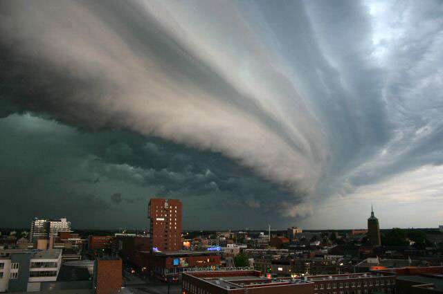
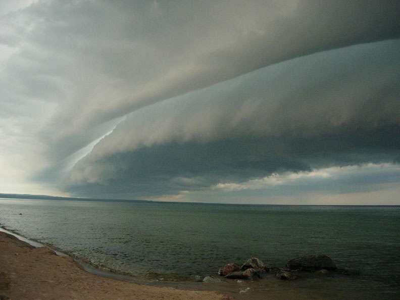
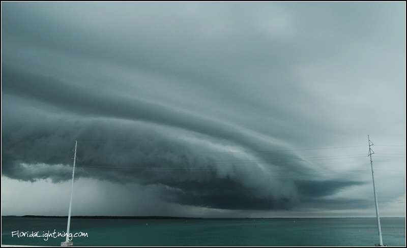
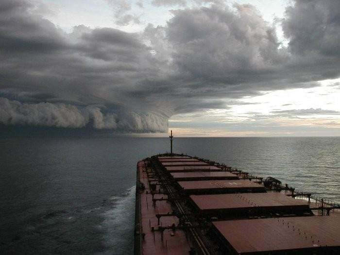
10- Shelf clouds
A shelf cloud is a low, horizontal wedge-shaped arcus cloud. Unlike a roll cloud, a shelf cloud is attached to the base of the parent cloud (usually a thunderstorm). Rising cloud motion often can be seen in the leading (outer) part of the shelf cloud, while the underside often appears turbulent and wind-torn. Cool, sinking air from a storm cloud's downdraft spreads out across the surface with the leading edge called a gust front. This outflow undercuts warm air being drawn into the storm's updraft. As the cool air lifts the warm moist air, water condenses creating a cloud which often rolls with the different winds above and below (wind shear).
Occasionally people seeing a shelf cloud may believe they have seen a wall cloud. This is a common mistake, since an approaching shelf cloud appears to form a wall made of cloud. Generally speaking, a shelf cloud appears on the leading edge of a storm, and a wall cloud will usually be at the rear of the storm. A sharp, strong gust front will cause the lowest part of the leading edge of an shelf cloud to be ragged and lined with rising fractus clouds. In a severe case there will be vortices along the edge with twisting masses of scud that may reach to the ground or be accompanied by rising dust. A very low shelf cloud accompanied by these signs is the best indicator that a potentially violent wind squall is approaching. An extreme example of this phenomenon looks almost like a tornado and is known as a gustnado.
SOURCE
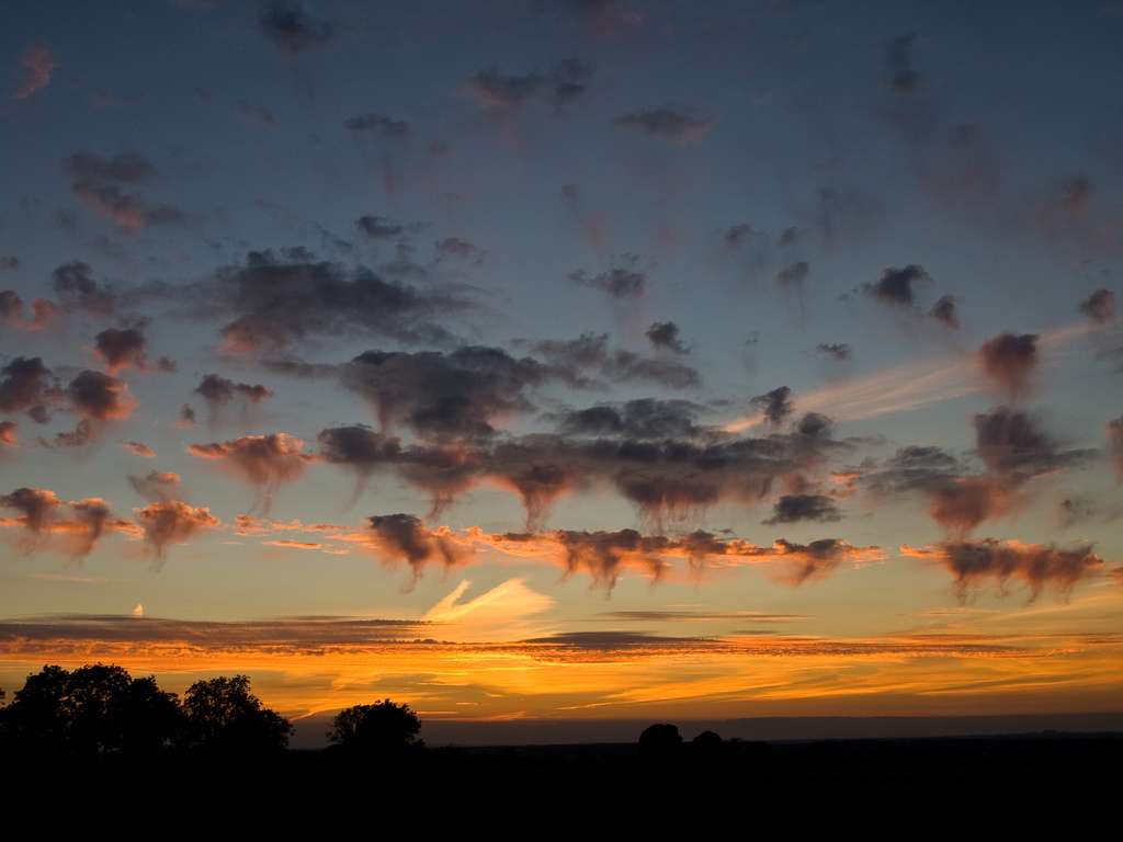
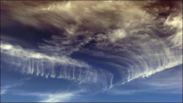
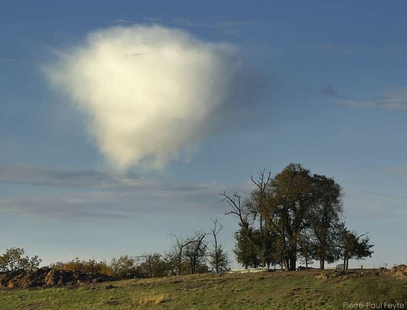
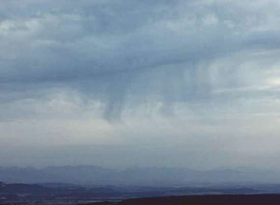
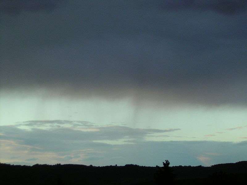
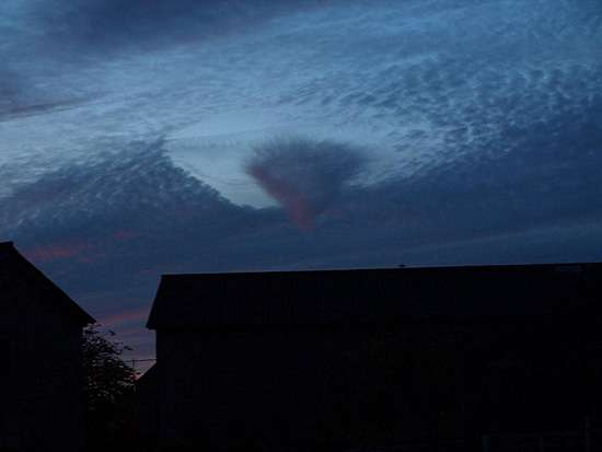
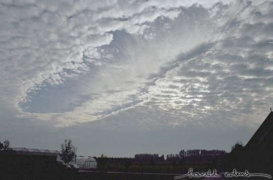
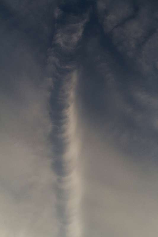
11- Virga clouds
In meteorology, virga is an observable streak or shaft of precipitation that falls from a cloud but evaporates before reaching the ground.[1] At high altitudes the precipitation falls mainly as ice crystals before melting and finally evaporating; this is usually due to compressional heating, because the air pressure increases closer to the ground. It is very common in the desert and in temperate climates. In North America, it is commonly seen in the Southern United States and the Canadian Prairies.
Virga can cause varying weather effects, because as rain is changed from liquid to vapor form, it removes heat from the air due to the high heat of vaporization of water. In some instances, these pockets of colder air can descend rapidly, creating a dry microburst which can be extremely hazardous to aviation. Conversely, precipitation evaporating at high altitude can compressionally heat as it falls, and result in a gusty downburst which may substantially and rapidly warm the surface temperature. This fairly rare phenomenon, a heat burst, also tends to be of exceedingly dry air.
Virga also has a role in seeding storm cells whereby small particles from one cloud are blown into neighboring supersaturated air and act as nucleation particles for the next thunderhead cloud to begin forming.[citation needed]
Virga can produce dramatic and beautiful scenes, especially during a red sunset. The red light can be caught by the streamers of falling precipitation, and winds may push the bottom ends of the virga so it falls at an angle, making the clouds appear to have commas attached.
The word virga is derived from Latin, twig or branch. A backronym sometimes found in amateur discussions of meteorology is "Variable Intensity Rain Gradient Aloft."
SOURCE

Cirrus Virga 1

Cirrus Virga 2
Altocumulus Virga 1

Altocumulus Virga 2

Altocumulus Virga 3
In meteorology, virga is an observable streak or shaft of precipitation that falls from a cloud but evaporates before reaching the ground.[1] At high altitudes the precipitation falls mainly as ice crystals before melting and finally evaporating; this is usually due to compressional heating, because the air pressure increases closer to the ground. It is very common in the desert and in temperate climates. In North America, it is commonly seen in the Southern United States and the Canadian Prairies.
Virga can cause varying weather effects, because as rain is changed from liquid to vapor form, it removes heat from the air due to the high heat of vaporization of water. In some instances, these pockets of colder air can descend rapidly, creating a dry microburst which can be extremely hazardous to aviation. Conversely, precipitation evaporating at high altitude can compressionally heat as it falls, and result in a gusty downburst which may substantially and rapidly warm the surface temperature. This fairly rare phenomenon, a heat burst, also tends to be of exceedingly dry air.
Virga also has a role in seeding storm cells whereby small particles from one cloud are blown into neighboring supersaturated air and act as nucleation particles for the next thunderhead cloud to begin forming.[citation needed]
Virga can produce dramatic and beautiful scenes, especially during a red sunset. The red light can be caught by the streamers of falling precipitation, and winds may push the bottom ends of the virga so it falls at an angle, making the clouds appear to have commas attached.
The word virga is derived from Latin, twig or branch. A backronym sometimes found in amateur discussions of meteorology is "Variable Intensity Rain Gradient Aloft."
SOURCE
Cirrus Virga 1
Cirrus Virga 2
Altocumulus Virga 1
Altocumulus Virga 2
Altocumulus Virga 3
This is greeeeeeeeeeeeeat. Thanks you for easing my mind for a little. SF !! x 100
I've only seen a few of these, I want to see hem all in person someday!
I've only seen a few of these, I want to see hem all in person someday!
Cirrus uncinus and Cirrocumulus virga
Altocumulus Flocus Virga
Altostratus Virga
Nimbostratus Virga
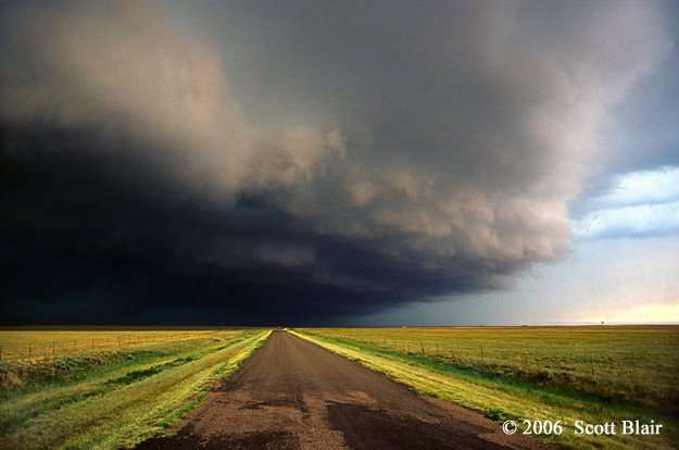
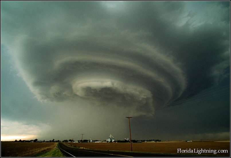
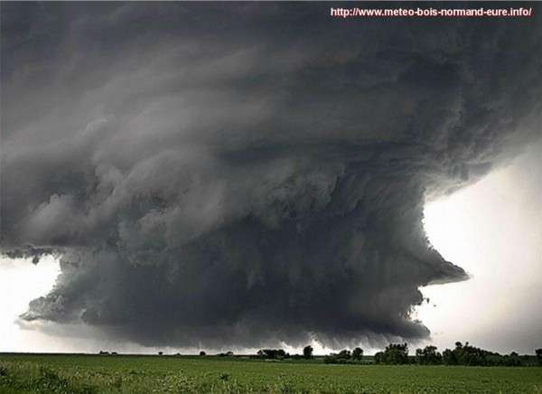
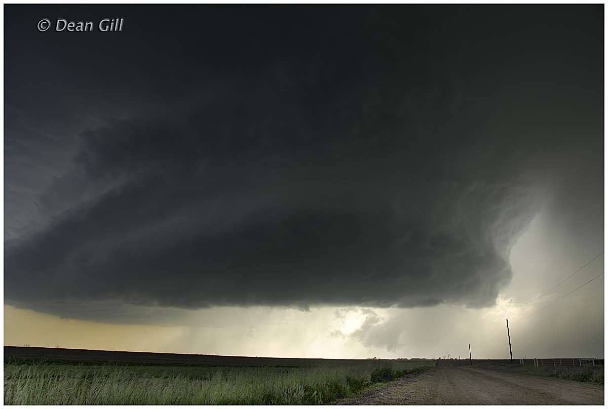
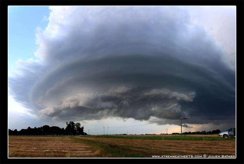
12- Supercells
Supercell storms are large, severe quasi-steady-state storms which feature wind speed and direction that vary with height ("wind shear"), separate downdrafts and updrafts (i.e., precipitation is not falling through the updraft) and a strong, rotating updraft (a "mesocyclone"). These storms normally have such powerful updrafts that the top of the cloud (or anvil) can break through the troposphere and reach into the lower levels of the stratosphere and can be 15 miles (24 km) wide. At least 90 percent of this type of thunderstorm bring severe weather.
These storms can produce destructive tornadoes, sometimes F3 or higher, extremely large hailstones (4 inches / 10 centimetres diameter), straight-line winds in excess of 80 mph (130 km/h), and flash floods. In fact, most tornadoes occur from this type of thunderstorm.
Supercells are the most powerful type of thunderstorm.
SOURCE

I already met one of these supercells, and this was one of the biggest fear of my life...
Supercell storms are large, severe quasi-steady-state storms which feature wind speed and direction that vary with height ("wind shear"), separate downdrafts and updrafts (i.e., precipitation is not falling through the updraft) and a strong, rotating updraft (a "mesocyclone"). These storms normally have such powerful updrafts that the top of the cloud (or anvil) can break through the troposphere and reach into the lower levels of the stratosphere and can be 15 miles (24 km) wide. At least 90 percent of this type of thunderstorm bring severe weather.
These storms can produce destructive tornadoes, sometimes F3 or higher, extremely large hailstones (4 inches / 10 centimetres diameter), straight-line winds in excess of 80 mph (130 km/h), and flash floods. In fact, most tornadoes occur from this type of thunderstorm.
Supercells are the most powerful type of thunderstorm.
SOURCE
I already met one of these supercells, and this was one of the biggest fear of my life...
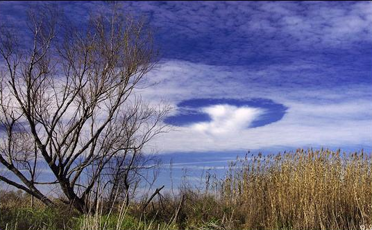
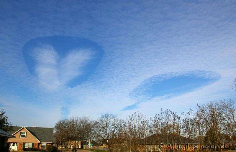
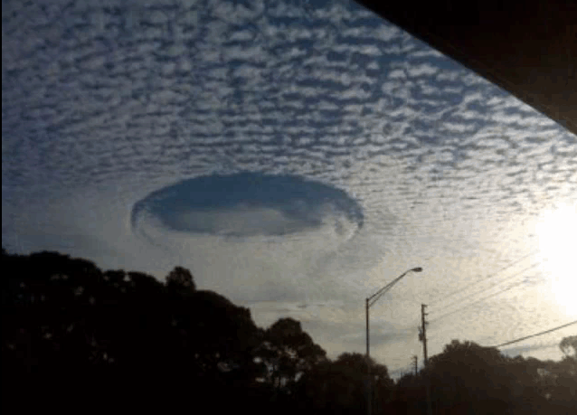
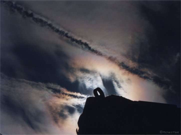
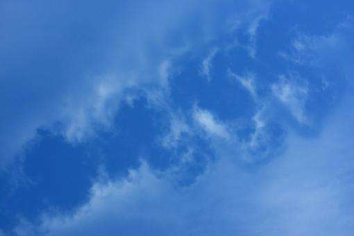
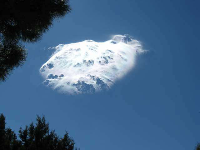
13- Punch hole clouds
A fallstreak hole, also known as a hole punch cloud, punch hole cloud, canal cloud or cloud hole, is a large circular gap that can appear in cirrocumulus or altocumulus clouds.
Such holes are formed when the water temperature in the clouds is below freezing but the water has not frozen yet due to the lack of ice nucleation particles. When a portion of the water does start to freeze it will set off a domino effect, due to the Bergeron process, causing the water vapor around it to freeze and fall to the earth as well. This leaves a large, often circular, hole in the cloud.
It is believed that a disruption in the stability of the cloud layer, such as that caused by a passing jet, may induce the domino process of evaporation which creates the hole. Such clouds are not unique to one geographic area and have been photographed from the United States to Russia.
Because of their rarity and unusual appearance, fallstreak holes are often mistaken for or attributed to unidentified flying objects
SOURCE
Punch hole clouds like distrails 1
Punch hole clouds like distrails 2
Punch hole clouds like distrails 3 from above
edit on 14-3-2011 by elevenaugust because: add bold in legend
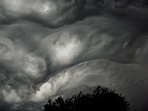
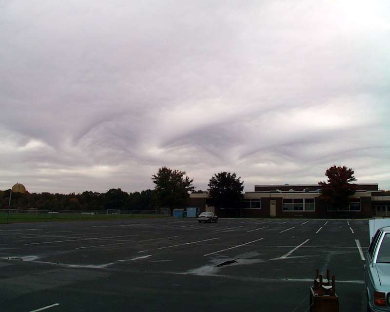
14- "Asperatus"
Everybody’s talking about a new cloud type called ‘asperatus’. The Royal Meteorological Society
has been inundated with international media requests and the story even made it onto ‘Have I Got News for You?’.
So just what is this cloud and is it really a new cloud type?
The story starts with Gavin Pretor-Pinney, the founder of the Cloud Appreciation Society, who over recent years has received a number of cloud images that he was unable to identify.
At the time, he gave the clouds the nickname ‘Jacques Cousteau’ since the cloud base resembled a choppy sea when viewed from below. As more and more images arrived with similar characteristics, Gavin decided to look for a more official-sounding name and choose ‘asperatus’ which is the Latin for ‘roughed up’.
Asperatus was used by Classical poets to describe the sea when it has been agitated by strong winds. Gavin is proposing that asperatus should be adopted as a new ‘variety’ of cloud.
The whole paper HERE
The following examples have likely been photoshopped to enhance contrast and luminosity, but according to the above, the shape and general appearance of these clouds were untouched.

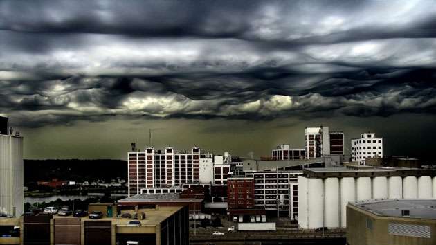
Cedar Rapids, USA (Jane Wiggins/Cloud Appreciation Society)

Hanmer Springs, New-Zeland (Merrick Davies/Cloud Appreciation Society)
Everybody’s talking about a new cloud type called ‘asperatus’. The Royal Meteorological Society
has been inundated with international media requests and the story even made it onto ‘Have I Got News for You?’.
So just what is this cloud and is it really a new cloud type?
The story starts with Gavin Pretor-Pinney, the founder of the Cloud Appreciation Society, who over recent years has received a number of cloud images that he was unable to identify.
At the time, he gave the clouds the nickname ‘Jacques Cousteau’ since the cloud base resembled a choppy sea when viewed from below. As more and more images arrived with similar characteristics, Gavin decided to look for a more official-sounding name and choose ‘asperatus’ which is the Latin for ‘roughed up’.
Asperatus was used by Classical poets to describe the sea when it has been agitated by strong winds. Gavin is proposing that asperatus should be adopted as a new ‘variety’ of cloud.
The whole paper HERE
The following examples have likely been photoshopped to enhance contrast and luminosity, but according to the above, the shape and general appearance of these clouds were untouched.
Cedar Rapids, USA (Jane Wiggins/Cloud Appreciation Society)
Hanmer Springs, New-Zeland (Merrick Davies/Cloud Appreciation Society)
edit on 14-3-2011 by elevenaugust because: (no reason
given)
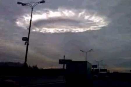
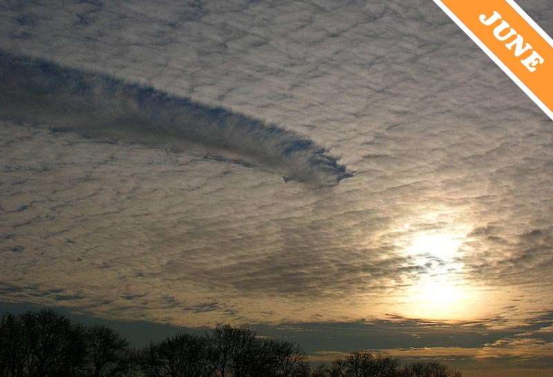
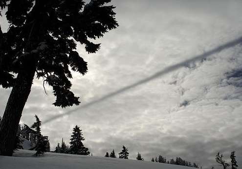
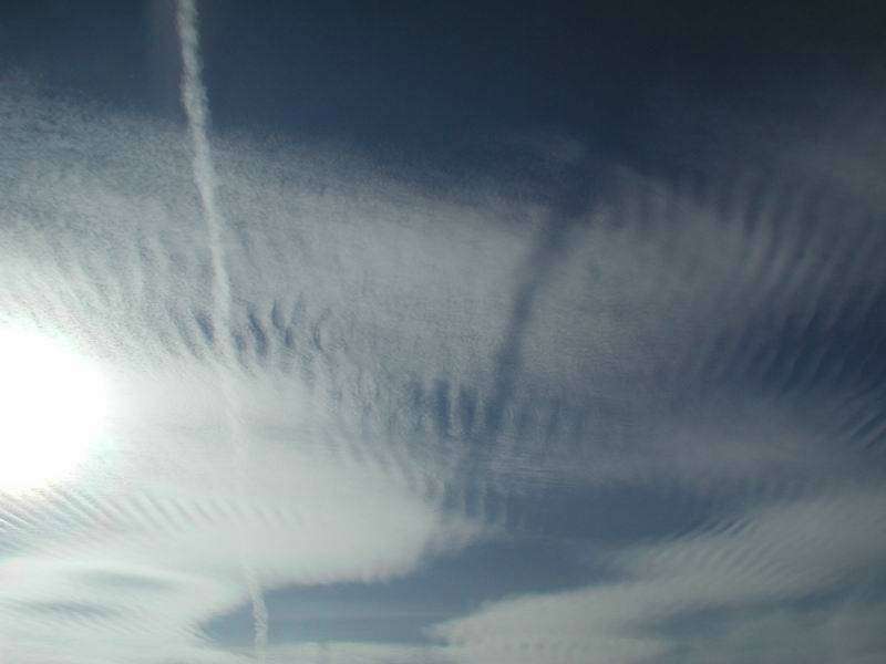
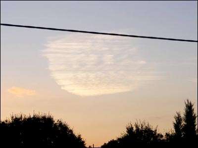
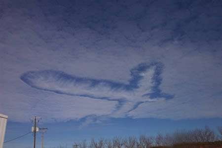
15- Distrails
A distrail, short for dissipation trail, forms when an aircraft flies through a supercooled cloud. The cloud freezes due to the disturbing airflow created by the aircraft, as well as by the addition of plenty of freezing nuclei due to the aircraft's exhaust gases. Altocumulus is usually either frozen or supercooled and can show distrails. They are uncommon, especially the clear distrails.
NOTE: punch hole clouds are a form of distrail
SOURCE
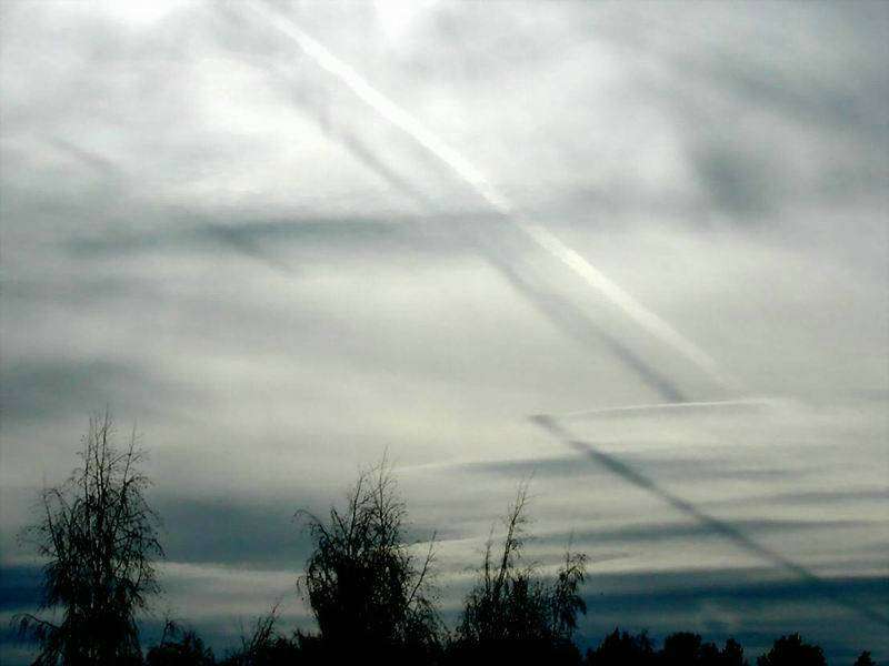
Not to be confused with contrail shadows:
A distrail, short for dissipation trail, forms when an aircraft flies through a supercooled cloud. The cloud freezes due to the disturbing airflow created by the aircraft, as well as by the addition of plenty of freezing nuclei due to the aircraft's exhaust gases. Altocumulus is usually either frozen or supercooled and can show distrails. They are uncommon, especially the clear distrails.
NOTE: punch hole clouds are a form of distrail
SOURCE
Not to be confused with contrail shadows:
edit on 14-3-2011 by elevenaugust because: (no reason given)
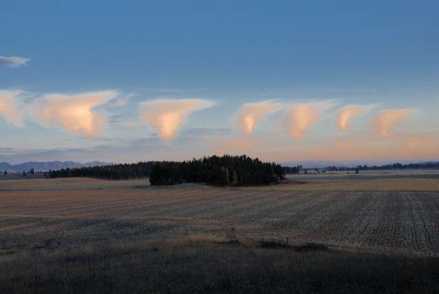
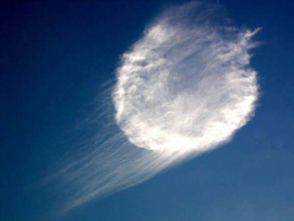
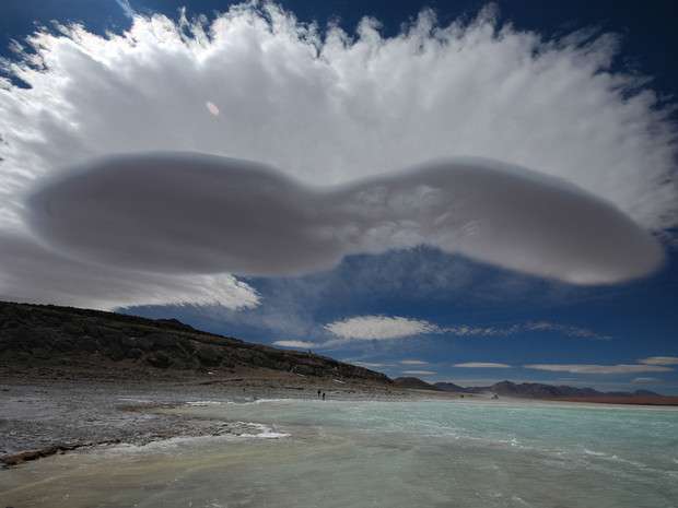
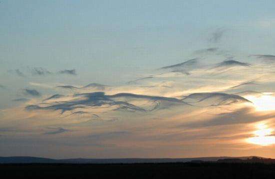
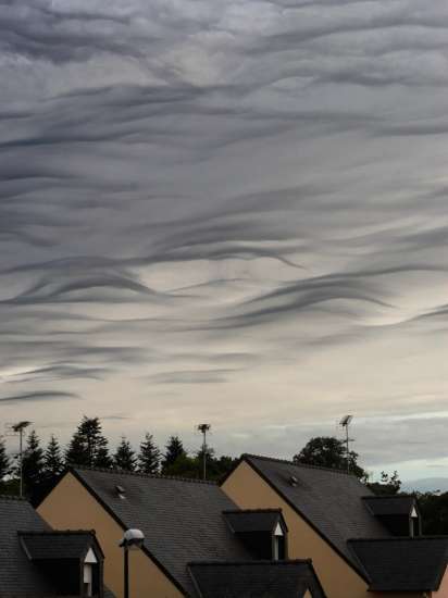
Now, here are some incredible and strange clouds that I had some difficulties to classify....
If you have any input on what kind of cloud it could be, you're welcome!

If you have any input on what kind of cloud it could be, you're welcome!

new topics
-
Geddy Lee in Conversation with Alex Lifeson - My Effin’ Life
People: 13 minutes ago -
God lived as a Devil Dog.
Short Stories: 29 minutes ago -
Happy St George's day you bigots!
Breaking Alternative News: 2 hours ago -
TLDR post about ATS and why I love it and hope we all stay together somewhere
General Chit Chat: 3 hours ago -
Hate makes for strange bedfellows
US Political Madness: 5 hours ago -
Who guards the guards
US Political Madness: 7 hours ago -
Has Tesla manipulated data logs to cover up auto pilot crash?
Automotive Discussion: 9 hours ago
top topics
-
Hate makes for strange bedfellows
US Political Madness: 5 hours ago, 14 flags -
whistleblower Captain Bill Uhouse on the Kingman UFO recovery
Aliens and UFOs: 14 hours ago, 11 flags -
Who guards the guards
US Political Madness: 7 hours ago, 10 flags -
1980s Arcade
General Chit Chat: 16 hours ago, 7 flags -
Deadpool and Wolverine
Movies: 17 hours ago, 4 flags -
TLDR post about ATS and why I love it and hope we all stay together somewhere
General Chit Chat: 3 hours ago, 3 flags -
Has Tesla manipulated data logs to cover up auto pilot crash?
Automotive Discussion: 9 hours ago, 2 flags -
Happy St George's day you bigots!
Breaking Alternative News: 2 hours ago, 2 flags -
God lived as a Devil Dog.
Short Stories: 29 minutes ago, 1 flags -
Geddy Lee in Conversation with Alex Lifeson - My Effin’ Life
People: 13 minutes ago, 0 flags
active topics
-
Happy St George's day you bigots!
Breaking Alternative News • 13 • : BedevereTheWise -
"We're All Hamas" Heard at Columbia University Protests
Social Issues and Civil Unrest • 243 • : FlyersFan -
Republican Voters Against Trump
2024 Elections • 284 • : some_stupid_name -
Candidate TRUMP Now Has Crazy Judge JUAN MERCHAN After Him - The Stormy Daniels Hush-Money Case.
Political Conspiracies • 725 • : Justoneman -
SC Jack Smith is Using Subterfuge Tricks with Donald Trumps Upcoming Documents Trial.
Dissecting Disinformation • 108 • : Threadbarer -
So this is what Hamas considers 'freedom fighting' ...
War On Terrorism • 226 • : FlyersFan -
-@TH3WH17ERABB17- -Q- ---TIME TO SHOW THE WORLD--- -Part- --44--
Dissecting Disinformation • 616 • : cherokeetroy -
Geddy Lee in Conversation with Alex Lifeson - My Effin’ Life
People • 0 • : gortex -
British TV Presenter Refuses To Use Guest's Preferred Pronouns
Education and Media • 114 • : Annee -
TLDR post about ATS and why I love it and hope we all stay together somewhere
General Chit Chat • 6 • : Mantiss2021