It looks like you're using an Ad Blocker.
Please white-list or disable AboveTopSecret.com in your ad-blocking tool.
Thank you.
Some features of ATS will be disabled while you continue to use an ad-blocker.

Something About the Long Valley Caldera - Harmonic Tremors?
page: 111
share:
I've discovered an anomoly located within reach of the Long Valley Caldera System that could possibly be a branch from it's Magma Chamber reaching
out!
Long Valley caldera, California
Long Valley Caldera and Mono-Inyo Craters
Volcanic Field, California
Long Valley Framework
[atsimg]http://files.abovetopsecret.com/images/member/b81226eb674a.jpg[/atsimg]
[atsimg]http://files.abovetopsecret.com/images/member/77edcafec037.gif[/atsimg]
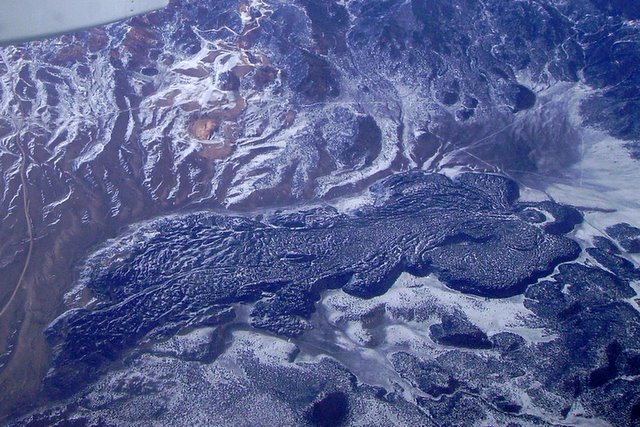
The Long Valley Caldera was produced by a catastrophic eruption about 730,000 years ago, forcing 150 cubic miles (600 cubic km) of rhyolitic magma to the surface. It's location exists in Central California, just East of the Sierra Nevada Mountain Range, and is roughly 17 x 32 km in area, which contains several active volcanic regions:
Mono Lake
[atsimg]http://files.abovetopsecret.com/images/member/a84563c0849b.jpg[/atsimg]
Inyo Craters
[atsimg]http://files.abovetopsecret.com/images/member/ecb476f8e380.jpg[/atsimg]
Hot Creek Gorge
Mammoth Mountain
Red Craters
Carbon Dioxide and Helium Discharge from Mammoth Mountain, Long Valley caldera, California
Jees! That's alot of CO2! Take a look at the killtree area...
Recent earthquake flurries have been recorded for the Long Valey Caldera System, as shown below:
1.0 2010/11/01 19:40:48 37.480 -118.843 7.3 17 km ( 11 mi) WSW of Toms Place, CA
2.6 2010/11/01 19:33:10 37.483 -118.844 9.3 17 km ( 11 mi) WSW of Toms Place, CA
1.3 2010/11/01 18:17:21 37.566 -118.772 9.0 8 km ( 5 mi) W of Toms Place, CA
1.0 2010/11/01 02:47:20 37.540 -118.894 3.3 13 km ( 8 mi) SE of Mammoth Lakes, CA
2.5 2010/10/31 19:24:51 36.278 -119.670 0.7 4 km ( 3 mi) SW of Home Garden, CA
1.3 2010/10/30 21:28:50 37.541 -118.835 6.9 14 km ( 9 mi) W of Toms Place, CA
1.3 2010/10/30 16:12:31 37.548 -118.884 5.8 13 km ( 8 mi) SE of Mammoth Lakes, CA
2.0 2010/10/30 06:56:58 37.492 -118.844 9.5 16 km ( 10 mi) WSW of Toms Place, CA
3.2 2010/10/30 06:00:21 37.491 -118.844 9.7 16 km ( 10 mi) WSW of Toms Place, CA
1.2 2010/10/28 21:19:10 37.624 -119.010 2.9 3 km ( 2 mi) WSW of Mammoth Lakes, CA
1.2 2010/10/26 20:45:59 37.410 -118.450 9.6 5 km ( 3 mi) N of West Bishop, CA
1.2 2010/10/26 18:10:47 37.410 -118.454 8.9 5 km ( 3 mi) N of West Bishop, CA
While earthquakes like this are commonplace for this region, it's interesting to note that a massive fault system stretches from the Caldera region Northward towards Lake Tahoe, where along that faultline exists the Mono Lake Volcanic region and Inyo Craters region. This is noteworthy in that the viscous magma associated with the region tends to seep through cracks generated by earthquakes in the region. Outside of the recent earthquake flurry associated with the Main Caldera system, another more frequent earthquake flurry has been rapidly generating shakers, in a Place along this faultline known as Markleeville:
2.4 2010/11/01 14:42:56 38.645 -119.552 7.5 22 km ( 14 mi) ESE of Markleeville, CA
1.2 2010/10/31 11:49:14 38.632 -119.555 16.0 22 km ( 14 mi) ESE of Markleeville, CA
1.1 2010/10/31 11:15:52 38.653 -119.530 0.0 24 km ( 15 mi) E of Markleeville, CA
2.7 2010/10/31 08:06:38 38.643 -119.577 0.0 20 km ( 12 mi) ESE of Markleeville, CA
1.0 2010/10/31 06:34:19 38.632 -119.555 16.0 22 km ( 14 mi) ESE of Markleeville, CA
1.0 2010/10/31 06:09:54 38.644 -119.538 7.0 23 km ( 14 mi) ESE of Markleeville, CA
1.7 2010/10/31 03:07:09 38.632 -119.555 4.0 22 km ( 14 mi) ESE of Markleeville, CA
1.1 2010/10/31 03:04:56 38.672 -119.556 0.0 21 km ( 13 mi) E of Markleeville, CA
1.0 2010/10/31 02:53:53 38.632 -119.555 16.0 22 km ( 14 mi) ESE of Markleeville, CA
2.6 2010/10/31 02:18:06 38.644 -119.579 9.3 20 km ( 12 mi) ESE of Markleeville, CA
2.9 2010/10/31 01:57:35 38.638 -119.591 11.0 19 km ( 12 mi) ESE of Markleeville, CA
1.2 2010/10/31 01:33:51 38.633 -119.529 12.0 24 km ( 15 mi) ESE of Markleeville, CA
1.1 2010/10/31 01:26:43 38.653 -119.530 0.0 24 km ( 15 mi) E of Markleeville, CA
2.5 2010/10/31 01:24:59 38.648 -119.551 1.0 22 km ( 14 mi) ESE of Markleeville, CA
1.6 2010/10/31 01:23:11 38.653 -119.530 8.0 24 km ( 15 mi) E of Markleeville, CA
2.9 2010/10/31 01:15:11 38.640 -119.567 8.7 21 km ( 13 mi) ESE of Markleeville, CA
1.1 2010/10/31 01:07:41 38.653 -119.530 2.0 24 km ( 15 mi) E of Markleeville, CA
4.3 2010/10/31 01:02:06 38.644 -119.571 7.5 20 km ( 13 mi) ESE of Markleeville, CA
What exactly are these tremors? Could they be heralding in a possible newly formed volcanic system related to Long Valey? After all, Long Valley has been shaking right along with this location as well!
Something to watch...
Related ATS Threads:
What's Going on at Long Valley?
Volcano watch 2010
Quake Watch 2010, page 218
Long Valley caldera, California
Long Valley Caldera and Mono-Inyo Craters
Volcanic Field, California
Long Valley Framework
[atsimg]http://files.abovetopsecret.com/images/member/b81226eb674a.jpg[/atsimg]
[atsimg]http://files.abovetopsecret.com/images/member/77edcafec037.gif[/atsimg]
The Long Valley Caldera was produced by a catastrophic eruption about 730,000 years ago, forcing 150 cubic miles (600 cubic km) of rhyolitic magma to the surface. It's location exists in Central California, just East of the Sierra Nevada Mountain Range, and is roughly 17 x 32 km in area, which contains several active volcanic regions:
Mono Lake
[atsimg]http://files.abovetopsecret.com/images/member/a84563c0849b.jpg[/atsimg]
Inyo Craters
[atsimg]http://files.abovetopsecret.com/images/member/ecb476f8e380.jpg[/atsimg]
Hot Creek Gorge
Mammoth Mountain
Red Craters
The caldera remains thermally active, with many hot springs and fumaroles, and has had significant deformation, seismicity, and other unrest in recent years.
Carbon Dioxide and Helium Discharge from Mammoth Mountain, Long Valley caldera, California
Measurements of the total discharge of carbon dioxide (CO2) gas at the Horseshoe Lake tree kill area range from 50-150 tons per day.
Jees! That's alot of CO2! Take a look at the killtree area...
Over the past 35,000 years, volcanic eruptions in the the Long Valley area has been confined to the Mono-Inyo Craters volcanic chain. About 20 small to moderate eruptions have occurred somewhere along the chain in the last 8,000 years, as shown in diagram above. Some of the eruptions occurred at about the same time and in close proximity. For example, the Inyo eruptions 550 to 600 years and the eruptions from the north end of the Mono Craters about 600 years ago. The intervals between eruptions or eruption clusters ranges from 250 years to 750 years
Recent earthquake flurries have been recorded for the Long Valey Caldera System, as shown below:
1.0 2010/11/01 19:40:48 37.480 -118.843 7.3 17 km ( 11 mi) WSW of Toms Place, CA
2.6 2010/11/01 19:33:10 37.483 -118.844 9.3 17 km ( 11 mi) WSW of Toms Place, CA
1.3 2010/11/01 18:17:21 37.566 -118.772 9.0 8 km ( 5 mi) W of Toms Place, CA
1.0 2010/11/01 02:47:20 37.540 -118.894 3.3 13 km ( 8 mi) SE of Mammoth Lakes, CA
2.5 2010/10/31 19:24:51 36.278 -119.670 0.7 4 km ( 3 mi) SW of Home Garden, CA
1.3 2010/10/30 21:28:50 37.541 -118.835 6.9 14 km ( 9 mi) W of Toms Place, CA
1.3 2010/10/30 16:12:31 37.548 -118.884 5.8 13 km ( 8 mi) SE of Mammoth Lakes, CA
2.0 2010/10/30 06:56:58 37.492 -118.844 9.5 16 km ( 10 mi) WSW of Toms Place, CA
3.2 2010/10/30 06:00:21 37.491 -118.844 9.7 16 km ( 10 mi) WSW of Toms Place, CA
1.2 2010/10/28 21:19:10 37.624 -119.010 2.9 3 km ( 2 mi) WSW of Mammoth Lakes, CA
1.2 2010/10/26 20:45:59 37.410 -118.450 9.6 5 km ( 3 mi) N of West Bishop, CA
1.2 2010/10/26 18:10:47 37.410 -118.454 8.9 5 km ( 3 mi) N of West Bishop, CA
While earthquakes like this are commonplace for this region, it's interesting to note that a massive fault system stretches from the Caldera region Northward towards Lake Tahoe, where along that faultline exists the Mono Lake Volcanic region and Inyo Craters region. This is noteworthy in that the viscous magma associated with the region tends to seep through cracks generated by earthquakes in the region. Outside of the recent earthquake flurry associated with the Main Caldera system, another more frequent earthquake flurry has been rapidly generating shakers, in a Place along this faultline known as Markleeville:
2.4 2010/11/01 14:42:56 38.645 -119.552 7.5 22 km ( 14 mi) ESE of Markleeville, CA
1.2 2010/10/31 11:49:14 38.632 -119.555 16.0 22 km ( 14 mi) ESE of Markleeville, CA
1.1 2010/10/31 11:15:52 38.653 -119.530 0.0 24 km ( 15 mi) E of Markleeville, CA
2.7 2010/10/31 08:06:38 38.643 -119.577 0.0 20 km ( 12 mi) ESE of Markleeville, CA
1.0 2010/10/31 06:34:19 38.632 -119.555 16.0 22 km ( 14 mi) ESE of Markleeville, CA
1.0 2010/10/31 06:09:54 38.644 -119.538 7.0 23 km ( 14 mi) ESE of Markleeville, CA
1.7 2010/10/31 03:07:09 38.632 -119.555 4.0 22 km ( 14 mi) ESE of Markleeville, CA
1.1 2010/10/31 03:04:56 38.672 -119.556 0.0 21 km ( 13 mi) E of Markleeville, CA
1.0 2010/10/31 02:53:53 38.632 -119.555 16.0 22 km ( 14 mi) ESE of Markleeville, CA
2.6 2010/10/31 02:18:06 38.644 -119.579 9.3 20 km ( 12 mi) ESE of Markleeville, CA
2.9 2010/10/31 01:57:35 38.638 -119.591 11.0 19 km ( 12 mi) ESE of Markleeville, CA
1.2 2010/10/31 01:33:51 38.633 -119.529 12.0 24 km ( 15 mi) ESE of Markleeville, CA
1.1 2010/10/31 01:26:43 38.653 -119.530 0.0 24 km ( 15 mi) E of Markleeville, CA
2.5 2010/10/31 01:24:59 38.648 -119.551 1.0 22 km ( 14 mi) ESE of Markleeville, CA
1.6 2010/10/31 01:23:11 38.653 -119.530 8.0 24 km ( 15 mi) E of Markleeville, CA
2.9 2010/10/31 01:15:11 38.640 -119.567 8.7 21 km ( 13 mi) ESE of Markleeville, CA
1.1 2010/10/31 01:07:41 38.653 -119.530 2.0 24 km ( 15 mi) E of Markleeville, CA
4.3 2010/10/31 01:02:06 38.644 -119.571 7.5 20 km ( 13 mi) ESE of Markleeville, CA
What exactly are these tremors? Could they be heralding in a possible newly formed volcanic system related to Long Valey? After all, Long Valley has been shaking right along with this location as well!
Something to watch...
Related ATS Threads:
What's Going on at Long Valley?
Volcano watch 2010
Quake Watch 2010, page 218
edit on 2-11-2010 by Heyyo_yoyo because: (no
reason given)
lol, nobody considers this alarming? Remember folks, We're talking about a system of intense volcanic origin... one comparable to the likes of
YELLOWSTONE, and LAKE TOBA.
producing a vei 8 eruption that blew over 600 km of volcanic material into the sky, and who's ash cloud covered half of the mainland of the United States is pretty alarming imho...
I'll post more info as soon as it makes itself available. The Markleeville tremor flurry happened yesterday... that's alot of tremors for one day !!
Well i found that to be very interesting, ive got a feeling this isnt getting ignored. The ATSers who are more likely to be in the know are probably
giving this a good once over as i type, expect this thread to get very busy as they start to delve into it.
reply to post by Heyyo_yoyo
all tho we do appreciate the work that went into this thread , only one thread is needed and that is the whats going on at long valley caldera thread .
all tho we do appreciate the work that went into this thread , only one thread is needed and that is the whats going on at long valley caldera thread .
reply to post by Heyyo_yoyo
You have done a great job with the pictures a star for you for that. I am i agreement with AA in that we should keep it on the existing thread - otherwise thigs get all jumbled and people have to bounce back an forth from different threads on the same subject and scroll multipal pages when they are like - i know I read that somewhere read that somewhere - but where. In my opinion anyway.
You have done a great job with the pictures a star for you for that. I am i agreement with AA in that we should keep it on the existing thread - otherwise thigs get all jumbled and people have to bounce back an forth from different threads on the same subject and scroll multipal pages when they are like - i know I read that somewhere read that somewhere - but where. In my opinion anyway.
Originally posted by alysha.angel
reply to post by Heyyo_yoyo
all tho we do appreciate the work that went into this thread , only one thread is needed and that is the whats going on at long valley caldera thread .
I'm glad you appreciate my efforts, but unfortunately I'm afraid that thread's author doesn't have copyright deeds to Long Valley, or reports on topics related to it. This thread is about a possible connection with a weak fault system in Eastern California and it's relation to Long Valley - not the Caldera - which If you'll notive has become a system of volcanic events that have spread away from the main caldera system, to form other systems such as mono lake and inyo craters... possibly even Lake Tahoe, which is about as big imho as long valley itself...
That's correct, I'm hypothesizing that Lake Tahoe - a lake similar in design to Lake Toba and that has a depth only rivaled by a volcanic lake known as Crater Lake, Oregon here in North America... could possibly be an ancient caldera itself...
[atsimg]http://files.abovetopsecret.com/images/member/a20e0fef6146.jpg[/atsimg]
Is Lake Tahoe volcanic? If possible, is it part of a larger caldera System, which includes Long Valley?
Wizard Island, Emerald Bay:
[atsimg]http://files.abovetopsecret.com/images/member/ce97068cc682.jpg[/atsimg]
Emerald Bay is part of Lake Tahoe. Could it be an additional Caldera, with wizard island being a child cone to the Emerald Bay caldera?
Suddely, the possibilities are there. The earthquake flurries at Markleesville then, now, contains possibility...
Perhaps the author of 'What's Going on at Long Valley' therefore should feel honored to be included in this theisis, as it provides info supporting it.
edit on 16-11-2010 by Heyyo_yoyo because: (no reason given)
An addendum to the Earthquake listings:
California-Nevada Fault Map centered at 38°N,119°W
Earthquake list for map centered at 38°N,119°W
2.3 2010/11/16 05:32:43 37.408N 118.564W 13.7 3 km ( 2 mi) ESE of Round Valley, CA
1.3 2010/11/15 21:13:18 38.672N 119.598W 5.1 17 km (11 mi) E of Markleeville, CA
1.6 2010/11/15 20:09:45 38.668N 119.597W 6.7 17 km (11 mi) E of Markleeville, CA
1.5 2010/11/15 08:21:31 38.674N 119.592W 7.0 18 km (11 mi) E of Markleeville, CA
2.1 2010/11/15 07:53:51 38.658N 119.621W 2.3 16 km (10 mi) ESE of Markleeville, CA
2.6 2010/11/15 07:40:32 38.659N 119.622W 1.9 16 km (10 mi) ESE of Markleeville, CA
1.5 2010/11/15 05:12:12 38.660N 119.606W 10.6 17 km (11 mi) E of Markleeville, CA
1.5 2010/11/15 04:24:51 38.663N 119.606W 9.8 17 km (10 mi) E of Markleeville, CA
1.7 2010/11/15 03:43:43 38.660N 119.606W 11.1 17 km (11 mi) E of Markleeville, CA
2.1 2010/11/15 02:59:34 38.657N 119.636W 0.6 14 km ( 9 mi) ESE of Markleeville, CA
1.8 2010/11/15 02:38:25 38.673N 119.595W 5.1 18 km (11 mi) E of Markleeville, CA
2.5 2010/11/15 02:36:11 38.652N 119.624W 0.0 16 km (10 mi) ESE of Markleeville, CA
2.9 2010/11/15 02:35:27 38.657N 119.615W 0.2 16 km (10 mi) ESE of Markleeville, CA
2.7 2010/11/15 02:23:03 38.652N 119.625W 0.0 16 km (10 mi) ESE of Markleeville, CA
2.0 2010/11/15 00:54:01 38.662N 119.646W 8.3 13 km ( 8 mi) ESE of Markleeville, CA
2.3 2010/11/15 00:50:01 38.671N 119.595W 7.0 18 km (11 mi) E of Markleeville, CA
3.2 2010/11/15 00:43:35 38.659N 119.632W 0.2 15 km ( 9 mi) ESE of Markleeville, CA
3.5 2010/11/15 00:41:15 38.660N 119.624W 3.2 15 km (10 mi) ESE of Markleeville, CA
2.4 2010/11/14 23:58:33 38.654N 119.621W 0.2 16 km (10 mi) ESE of Markleeville, CA
1.7 2010/11/14 23:13:06 37.313N 119.383W 33.4 15 km ( 9 mi) NE of North Fork, CA
1.3 2010/11/14 10:10:40 37.482N 118.948W 13.0 17 km (11 mi) S of Mammoth Lakes, CA
1.1 2010/11/13 23:57:08 37.473N 118.944W 12.2 19 km (12 mi) S of Mammoth Lakes, CA
1.4 2010/11/13 15:04:08 38.632N 119.555W 8.0 22 km (14 mi) ESE of Markleeville, CA
1.4 2010/11/13 02:46:53 38.652N 119.607W 8.0 17 km (11 mi) ESE of Markleeville, CA
2.2 2010/11/13 01:37:02 38.651N 119.653W 1.4 13 km ( 8 mi) ESE of Markleeville, CA
1.3 2010/11/12 23:45:32 38.672N 119.582W 8.0 19 km (12 mi) E of Markleeville, CA
1.3 2010/11/12 23:44:14 38.671N 119.633W 4.0 14 km ( 9 mi) E of Markleeville, CA
3.2 2010/11/12 23:32:04 38.659N 119.628W 0.3 15 km ( 9 mi) ESE of Markleeville, CA
2.3 2010/11/12 16:46:19 38.659N 119.626W 0.5 15 km ( 9 mi) ESE of Markleeville, CA
1.4 2010/11/12 09:03:30 37.502N 119.015W 17.5 15 km (10 mi) SSW of Mammoth Lakes, CA
1.2 2010/11/12 08:12:32 37.611N 119.389W 18.1 22 km (14 mi) SE of Yosemite Valley, CA
1.7 2010/11/12 05:07:58 37.677N 119.439W 27.7 14 km ( 9 mi) ESE of Yosemite Valley, CA
1.1 2010/11/12 03:23:12 37.450N 118.695W 10.1 9 km ( 6 mi) WNW of Round Valley, CA
1.4 2010/11/12 03:12:59 37.486N 118.951W 13.3 17 km (11 mi) S of Mammoth Lakes, CA
1.4 2010/11/12 01:08:15 38.678N 119.595W 0.0 18 km (11 mi) E of Markleeville, CA
1.2 2010/11/11 08:37:15 37.423N 118.534W 12.9 6 km ( 4 mi) E of Round Valley, CA
1.0 2010/11/11 00:45:16 37.630N 119.334W 12.6 25 km (15 mi) ESE of Yosemite Valley, CA
1.4 2010/11/10 23:14:15 37.629N 119.033W 2.1 5 km ( 3 mi) W of Mammoth Lakes, CA
1.2 2010/11/10 21:46:39 37.626N 119.030W 2.1 5 km ( 3 mi) WSW of Mammoth Lakes, CA
1.0 2010/11/10 14:33:30 37.402N 118.683W 12.4 8 km ( 5 mi) W of Round Valley, CA
1.1 2010/11/10 11:55:37 37.477N 118.837W 5.9 17 km (10 mi) SW of Toms Place, CA
2.0 2010/11/09 07:58:42 37.546N 118.836W 2.1 14 km ( 9 mi) W of Toms Place, CA
One should ask, looking at the relative depths, and frequencies of this map:
A combined listing...
2.3 2010/11/16 05:32:43 37.408N 118.564W 13.7 3 km ( 2 mi) ESE of Round Valley, CA
1.3 2010/11/15 21:13:18 38.672N 119.598W 5.1 17 km (11 mi) E of Markleeville, CA
1.6 2010/11/15 20:09:45 38.668N 119.597W 6.7 17 km (11 mi) E of Markleeville, CA
1.5 2010/11/15 08:21:31 38.674N 119.592W 7.0 18 km (11 mi) E of Markleeville, CA
2.1 2010/11/15 07:53:51 38.658N 119.621W 2.3 16 km (10 mi) ESE of Markleeville, CA
2.6 2010/11/15 07:40:32 38.659N 119.622W 1.9 16 km (10 mi) ESE of Markleeville, CA
1.5 2010/11/15 05:12:12 38.660N 119.606W 10.6 17 km (11 mi) E of Markleeville, CA
1.5 2010/11/15 04:24:51 38.663N 119.606W 9.8 17 km (10 mi) E of Markleeville, CA
1.7 2010/11/15 03:43:43 38.660N 119.606W 11.1 17 km (11 mi) E of Markleeville, CA
2.1 2010/11/15 02:59:34 38.657N 119.636W 0.6 14 km ( 9 mi) ESE of Markleeville, CA
1.8 2010/11/15 02:38:25 38.673N 119.595W 5.1 18 km (11 mi) E of Markleeville, CA
2.5 2010/11/15 02:36:11 38.652N 119.624W 0.0 16 km (10 mi) ESE of Markleeville, CA
2.9 2010/11/15 02:35:27 38.657N 119.615W 0.2 16 km (10 mi) ESE of Markleeville, CA
2.7 2010/11/15 02:23:03 38.652N 119.625W 0.0 16 km (10 mi) ESE of Markleeville, CA
2.0 2010/11/15 00:54:01 38.662N 119.646W 8.3 13 km ( 8 mi) ESE of Markleeville, CA
2.3 2010/11/15 00:50:01 38.671N 119.595W 7.0 18 km (11 mi) E of Markleeville, CA
3.2 2010/11/15 00:43:35 38.659N 119.632W 0.2 15 km ( 9 mi) ESE of Markleeville, CA
3.5 2010/11/15 00:41:15 38.660N 119.624W 3.2 15 km (10 mi) ESE of Markleeville, CA
2.4 2010/11/14 23:58:33 38.654N 119.621W 0.2 16 km (10 mi) ESE of Markleeville, CA
1.7 2010/11/14 23:13:06 37.313N 119.383W 33.4 15 km ( 9 mi) NE of North Fork, CA
1.3 2010/11/14 10:10:40 37.482N 118.948W 13.0 17 km (11 mi) S of Mammoth Lakes, CA
1.1 2010/11/13 23:57:08 37.473N 118.944W 12.2 19 km (12 mi) S of Mammoth Lakes, CA
1.4 2010/11/13 15:04:08 38.632N 119.555W 8.0 22 km (14 mi) ESE of Markleeville, CA
1.4 2010/11/13 02:46:53 38.652N 119.607W 8.0 17 km (11 mi) ESE of Markleeville, CA
2.2 2010/11/13 01:37:02 38.651N 119.653W 1.4 13 km ( 8 mi) ESE of Markleeville, CA
1.3 2010/11/12 23:45:32 38.672N 119.582W 8.0 19 km (12 mi) E of Markleeville, CA
1.3 2010/11/12 23:44:14 38.671N 119.633W 4.0 14 km ( 9 mi) E of Markleeville, CA
3.2 2010/11/12 23:32:04 38.659N 119.628W 0.3 15 km ( 9 mi) ESE of Markleeville, CA
2.3 2010/11/12 16:46:19 38.659N 119.626W 0.5 15 km ( 9 mi) ESE of Markleeville, CA
1.4 2010/11/12 09:03:30 37.502N 119.015W 17.5 15 km (10 mi) SSW of Mammoth Lakes, CA
1.2 2010/11/12 08:12:32 37.611N 119.389W 18.1 22 km (14 mi) SE of Yosemite Valley, CA
1.7 2010/11/12 05:07:58 37.677N 119.439W 27.7 14 km ( 9 mi) ESE of Yosemite Valley, CA
1.1 2010/11/12 03:23:12 37.450N 118.695W 10.1 9 km ( 6 mi) WNW of Round Valley, CA
1.4 2010/11/12 03:12:59 37.486N 118.951W 13.3 17 km (11 mi) S of Mammoth Lakes, CA
1.4 2010/11/12 01:08:15 38.678N 119.595W 0.0 18 km (11 mi) E of Markleeville, CA
1.2 2010/11/11 08:37:15 37.423N 118.534W 12.9 6 km ( 4 mi) E of Round Valley, CA
1.0 2010/11/11 00:45:16 37.630N 119.334W 12.6 25 km (15 mi) ESE of Yosemite Valley, CA
1.4 2010/11/10 23:14:15 37.629N 119.033W 2.1 5 km ( 3 mi) W of Mammoth Lakes, CA
1.2 2010/11/10 21:46:39 37.626N 119.030W 2.1 5 km ( 3 mi) WSW of Mammoth Lakes, CA
1.0 2010/11/10 14:33:30 37.402N 118.683W 12.4 8 km ( 5 mi) W of Round Valley, CA
1.1 2010/11/10 11:55:37 37.477N 118.837W 5.9 17 km (10 mi) SW of Toms Place, CA
2.0 2010/11/09 07:58:42 37.546N 118.836W 2.1 14 km ( 9 mi) W of Toms Place, CA
1.0 2010/11/01 19:40:48 37.480 -118.843 7.3 17 km ( 11 mi) WSW of Toms Place, CA
2.6 2010/11/01 19:33:10 37.483 -118.844 9.3 17 km ( 11 mi) WSW of Toms Place, CA
1.3 2010/11/01 18:17:21 37.566 -118.772 9.0 8 km ( 5 mi) W of Toms Place, CA
1.0 2010/11/01 02:47:20 37.540 -118.894 3.3 13 km ( 8 mi) SE of Mammoth Lakes, CA
2.5 2010/10/31 19:24:51 36.278 -119.670 0.7 4 km ( 3 mi) SW of Home Garden, CA
2.4 2010/11/01 14:42:56 38.645 -119.552 7.5 22 km ( 14 mi) ESE of Markleeville, CA
1.2 2010/10/31 11:49:14 38.632 -119.555 16.0 22 km ( 14 mi) ESE of Markleeville, CA
1.1 2010/10/31 11:15:52 38.653 -119.530 0.0 24 km ( 15 mi) E of Markleeville, CA
2.7 2010/10/31 08:06:38 38.643 -119.577 0.0 20 km ( 12 mi) ESE of Markleeville, CA
1.0 2010/10/31 06:34:19 38.632 -119.555 16.0 22 km ( 14 mi) ESE of Markleeville, CA
1.0 2010/10/31 06:09:54 38.644 -119.538 7.0 23 km ( 14 mi) ESE of Markleeville, CA
1.7 2010/10/31 03:07:09 38.632 -119.555 4.0 22 km ( 14 mi) ESE of Markleeville, CA
1.1 2010/10/31 03:04:56 38.672 -119.556 0.0 21 km ( 13 mi) E of Markleeville, CA
1.0 2010/10/31 02:53:53 38.632 -119.555 16.0 22 km ( 14 mi) ESE of Markleeville, CA
2.6 2010/10/31 02:18:06 38.644 -119.579 9.3 20 km ( 12 mi) ESE of Markleeville, CA
2.9 2010/10/31 01:57:35 38.638 -119.591 11.0 19 km ( 12 mi) ESE of Markleeville, CA
1.2 2010/10/31 01:33:51 38.633 -119.529 12.0 24 km ( 15 mi) ESE of Markleeville, CA
1.1 2010/10/31 01:26:43 38.653 -119.530 0.0 24 km ( 15 mi) E of Markleeville, CA
2.5 2010/10/31 01:24:59 38.648 -119.551 1.0 22 km ( 14 mi) ESE of Markleeville, CA
1.6 2010/10/31 01:23:11 38.653 -119.530 8.0 24 km ( 15 mi) E of Markleeville, CA
2.9 2010/10/31 01:15:11 38.640 -119.567 8.7 21 km ( 13 mi) ESE of Markleeville, CA
1.1 2010/10/31 01:07:41 38.653 -119.530 2.0 24 km ( 15 mi) E of Markleeville, CA
4.3 2010/10/31 01:02:06 38.644 -119.571 7.5 20 km ( 13 mi) ESE of Markleeville, CA
1.3 2010/10/30 21:28:50 37.541 -118.835 6.9 14 km ( 9 mi) W of Toms Place, CA
1.3 2010/10/30 16:12:31 37.548 -118.884 5.8 13 km ( 8 mi) SE of Mammoth Lakes, CA
2.0 2010/10/30 06:56:58 37.492 -118.844 9.5 16 km ( 10 mi) WSW of Toms Place, CA
3.2 2010/10/30 06:00:21 37.491 -118.844 9.7 16 km ( 10 mi) WSW of Toms Place, CA
1.2 2010/10/28 21:19:10 37.624 -119.010 2.9 3 km ( 2 mi) WSW of Mammoth Lakes, CA
1.2 2010/10/26 20:45:59 37.410 -118.450 9.6 5 km ( 3 mi) N of West Bishop, CA
1.2 2010/10/26 18:10:47 37.410 -118.454 8.9 5 km ( 3 mi) N of West Bishop, CA
Long Valley Caldera and Mono-Inyo Craters Volcanic Field, California
Notice, the region, which includes Long Valley, is known as a 'volcanic field'?
what is that? look at These Fault Lines. Red ones are named faults - notice the orange ones too?... The entire region appears shattered!
These systems, part of the 'volcanic field' marched northward...
Could Markleeville be the next chain in the Long Valley link?!
California-Nevada Fault Map centered at 38°N,119°W
Earthquake list for map centered at 38°N,119°W
2.3 2010/11/16 05:32:43 37.408N 118.564W 13.7 3 km ( 2 mi) ESE of Round Valley, CA
1.3 2010/11/15 21:13:18 38.672N 119.598W 5.1 17 km (11 mi) E of Markleeville, CA
1.6 2010/11/15 20:09:45 38.668N 119.597W 6.7 17 km (11 mi) E of Markleeville, CA
1.5 2010/11/15 08:21:31 38.674N 119.592W 7.0 18 km (11 mi) E of Markleeville, CA
2.1 2010/11/15 07:53:51 38.658N 119.621W 2.3 16 km (10 mi) ESE of Markleeville, CA
2.6 2010/11/15 07:40:32 38.659N 119.622W 1.9 16 km (10 mi) ESE of Markleeville, CA
1.5 2010/11/15 05:12:12 38.660N 119.606W 10.6 17 km (11 mi) E of Markleeville, CA
1.5 2010/11/15 04:24:51 38.663N 119.606W 9.8 17 km (10 mi) E of Markleeville, CA
1.7 2010/11/15 03:43:43 38.660N 119.606W 11.1 17 km (11 mi) E of Markleeville, CA
2.1 2010/11/15 02:59:34 38.657N 119.636W 0.6 14 km ( 9 mi) ESE of Markleeville, CA
1.8 2010/11/15 02:38:25 38.673N 119.595W 5.1 18 km (11 mi) E of Markleeville, CA
2.5 2010/11/15 02:36:11 38.652N 119.624W 0.0 16 km (10 mi) ESE of Markleeville, CA
2.9 2010/11/15 02:35:27 38.657N 119.615W 0.2 16 km (10 mi) ESE of Markleeville, CA
2.7 2010/11/15 02:23:03 38.652N 119.625W 0.0 16 km (10 mi) ESE of Markleeville, CA
2.0 2010/11/15 00:54:01 38.662N 119.646W 8.3 13 km ( 8 mi) ESE of Markleeville, CA
2.3 2010/11/15 00:50:01 38.671N 119.595W 7.0 18 km (11 mi) E of Markleeville, CA
3.2 2010/11/15 00:43:35 38.659N 119.632W 0.2 15 km ( 9 mi) ESE of Markleeville, CA
3.5 2010/11/15 00:41:15 38.660N 119.624W 3.2 15 km (10 mi) ESE of Markleeville, CA
2.4 2010/11/14 23:58:33 38.654N 119.621W 0.2 16 km (10 mi) ESE of Markleeville, CA
1.7 2010/11/14 23:13:06 37.313N 119.383W 33.4 15 km ( 9 mi) NE of North Fork, CA
1.3 2010/11/14 10:10:40 37.482N 118.948W 13.0 17 km (11 mi) S of Mammoth Lakes, CA
1.1 2010/11/13 23:57:08 37.473N 118.944W 12.2 19 km (12 mi) S of Mammoth Lakes, CA
1.4 2010/11/13 15:04:08 38.632N 119.555W 8.0 22 km (14 mi) ESE of Markleeville, CA
1.4 2010/11/13 02:46:53 38.652N 119.607W 8.0 17 km (11 mi) ESE of Markleeville, CA
2.2 2010/11/13 01:37:02 38.651N 119.653W 1.4 13 km ( 8 mi) ESE of Markleeville, CA
1.3 2010/11/12 23:45:32 38.672N 119.582W 8.0 19 km (12 mi) E of Markleeville, CA
1.3 2010/11/12 23:44:14 38.671N 119.633W 4.0 14 km ( 9 mi) E of Markleeville, CA
3.2 2010/11/12 23:32:04 38.659N 119.628W 0.3 15 km ( 9 mi) ESE of Markleeville, CA
2.3 2010/11/12 16:46:19 38.659N 119.626W 0.5 15 km ( 9 mi) ESE of Markleeville, CA
1.4 2010/11/12 09:03:30 37.502N 119.015W 17.5 15 km (10 mi) SSW of Mammoth Lakes, CA
1.2 2010/11/12 08:12:32 37.611N 119.389W 18.1 22 km (14 mi) SE of Yosemite Valley, CA
1.7 2010/11/12 05:07:58 37.677N 119.439W 27.7 14 km ( 9 mi) ESE of Yosemite Valley, CA
1.1 2010/11/12 03:23:12 37.450N 118.695W 10.1 9 km ( 6 mi) WNW of Round Valley, CA
1.4 2010/11/12 03:12:59 37.486N 118.951W 13.3 17 km (11 mi) S of Mammoth Lakes, CA
1.4 2010/11/12 01:08:15 38.678N 119.595W 0.0 18 km (11 mi) E of Markleeville, CA
1.2 2010/11/11 08:37:15 37.423N 118.534W 12.9 6 km ( 4 mi) E of Round Valley, CA
1.0 2010/11/11 00:45:16 37.630N 119.334W 12.6 25 km (15 mi) ESE of Yosemite Valley, CA
1.4 2010/11/10 23:14:15 37.629N 119.033W 2.1 5 km ( 3 mi) W of Mammoth Lakes, CA
1.2 2010/11/10 21:46:39 37.626N 119.030W 2.1 5 km ( 3 mi) WSW of Mammoth Lakes, CA
1.0 2010/11/10 14:33:30 37.402N 118.683W 12.4 8 km ( 5 mi) W of Round Valley, CA
1.1 2010/11/10 11:55:37 37.477N 118.837W 5.9 17 km (10 mi) SW of Toms Place, CA
2.0 2010/11/09 07:58:42 37.546N 118.836W 2.1 14 km ( 9 mi) W of Toms Place, CA
One should ask, looking at the relative depths, and frequencies of this map:
What's really going on in Markleeville !?
A combined listing...
2.3 2010/11/16 05:32:43 37.408N 118.564W 13.7 3 km ( 2 mi) ESE of Round Valley, CA
1.3 2010/11/15 21:13:18 38.672N 119.598W 5.1 17 km (11 mi) E of Markleeville, CA
1.6 2010/11/15 20:09:45 38.668N 119.597W 6.7 17 km (11 mi) E of Markleeville, CA
1.5 2010/11/15 08:21:31 38.674N 119.592W 7.0 18 km (11 mi) E of Markleeville, CA
2.1 2010/11/15 07:53:51 38.658N 119.621W 2.3 16 km (10 mi) ESE of Markleeville, CA
2.6 2010/11/15 07:40:32 38.659N 119.622W 1.9 16 km (10 mi) ESE of Markleeville, CA
1.5 2010/11/15 05:12:12 38.660N 119.606W 10.6 17 km (11 mi) E of Markleeville, CA
1.5 2010/11/15 04:24:51 38.663N 119.606W 9.8 17 km (10 mi) E of Markleeville, CA
1.7 2010/11/15 03:43:43 38.660N 119.606W 11.1 17 km (11 mi) E of Markleeville, CA
2.1 2010/11/15 02:59:34 38.657N 119.636W 0.6 14 km ( 9 mi) ESE of Markleeville, CA
1.8 2010/11/15 02:38:25 38.673N 119.595W 5.1 18 km (11 mi) E of Markleeville, CA
2.5 2010/11/15 02:36:11 38.652N 119.624W 0.0 16 km (10 mi) ESE of Markleeville, CA
2.9 2010/11/15 02:35:27 38.657N 119.615W 0.2 16 km (10 mi) ESE of Markleeville, CA
2.7 2010/11/15 02:23:03 38.652N 119.625W 0.0 16 km (10 mi) ESE of Markleeville, CA
2.0 2010/11/15 00:54:01 38.662N 119.646W 8.3 13 km ( 8 mi) ESE of Markleeville, CA
2.3 2010/11/15 00:50:01 38.671N 119.595W 7.0 18 km (11 mi) E of Markleeville, CA
3.2 2010/11/15 00:43:35 38.659N 119.632W 0.2 15 km ( 9 mi) ESE of Markleeville, CA
3.5 2010/11/15 00:41:15 38.660N 119.624W 3.2 15 km (10 mi) ESE of Markleeville, CA
2.4 2010/11/14 23:58:33 38.654N 119.621W 0.2 16 km (10 mi) ESE of Markleeville, CA
1.7 2010/11/14 23:13:06 37.313N 119.383W 33.4 15 km ( 9 mi) NE of North Fork, CA
1.3 2010/11/14 10:10:40 37.482N 118.948W 13.0 17 km (11 mi) S of Mammoth Lakes, CA
1.1 2010/11/13 23:57:08 37.473N 118.944W 12.2 19 km (12 mi) S of Mammoth Lakes, CA
1.4 2010/11/13 15:04:08 38.632N 119.555W 8.0 22 km (14 mi) ESE of Markleeville, CA
1.4 2010/11/13 02:46:53 38.652N 119.607W 8.0 17 km (11 mi) ESE of Markleeville, CA
2.2 2010/11/13 01:37:02 38.651N 119.653W 1.4 13 km ( 8 mi) ESE of Markleeville, CA
1.3 2010/11/12 23:45:32 38.672N 119.582W 8.0 19 km (12 mi) E of Markleeville, CA
1.3 2010/11/12 23:44:14 38.671N 119.633W 4.0 14 km ( 9 mi) E of Markleeville, CA
3.2 2010/11/12 23:32:04 38.659N 119.628W 0.3 15 km ( 9 mi) ESE of Markleeville, CA
2.3 2010/11/12 16:46:19 38.659N 119.626W 0.5 15 km ( 9 mi) ESE of Markleeville, CA
1.4 2010/11/12 09:03:30 37.502N 119.015W 17.5 15 km (10 mi) SSW of Mammoth Lakes, CA
1.2 2010/11/12 08:12:32 37.611N 119.389W 18.1 22 km (14 mi) SE of Yosemite Valley, CA
1.7 2010/11/12 05:07:58 37.677N 119.439W 27.7 14 km ( 9 mi) ESE of Yosemite Valley, CA
1.1 2010/11/12 03:23:12 37.450N 118.695W 10.1 9 km ( 6 mi) WNW of Round Valley, CA
1.4 2010/11/12 03:12:59 37.486N 118.951W 13.3 17 km (11 mi) S of Mammoth Lakes, CA
1.4 2010/11/12 01:08:15 38.678N 119.595W 0.0 18 km (11 mi) E of Markleeville, CA
1.2 2010/11/11 08:37:15 37.423N 118.534W 12.9 6 km ( 4 mi) E of Round Valley, CA
1.0 2010/11/11 00:45:16 37.630N 119.334W 12.6 25 km (15 mi) ESE of Yosemite Valley, CA
1.4 2010/11/10 23:14:15 37.629N 119.033W 2.1 5 km ( 3 mi) W of Mammoth Lakes, CA
1.2 2010/11/10 21:46:39 37.626N 119.030W 2.1 5 km ( 3 mi) WSW of Mammoth Lakes, CA
1.0 2010/11/10 14:33:30 37.402N 118.683W 12.4 8 km ( 5 mi) W of Round Valley, CA
1.1 2010/11/10 11:55:37 37.477N 118.837W 5.9 17 km (10 mi) SW of Toms Place, CA
2.0 2010/11/09 07:58:42 37.546N 118.836W 2.1 14 km ( 9 mi) W of Toms Place, CA
1.0 2010/11/01 19:40:48 37.480 -118.843 7.3 17 km ( 11 mi) WSW of Toms Place, CA
2.6 2010/11/01 19:33:10 37.483 -118.844 9.3 17 km ( 11 mi) WSW of Toms Place, CA
1.3 2010/11/01 18:17:21 37.566 -118.772 9.0 8 km ( 5 mi) W of Toms Place, CA
1.0 2010/11/01 02:47:20 37.540 -118.894 3.3 13 km ( 8 mi) SE of Mammoth Lakes, CA
2.5 2010/10/31 19:24:51 36.278 -119.670 0.7 4 km ( 3 mi) SW of Home Garden, CA
2.4 2010/11/01 14:42:56 38.645 -119.552 7.5 22 km ( 14 mi) ESE of Markleeville, CA
1.2 2010/10/31 11:49:14 38.632 -119.555 16.0 22 km ( 14 mi) ESE of Markleeville, CA
1.1 2010/10/31 11:15:52 38.653 -119.530 0.0 24 km ( 15 mi) E of Markleeville, CA
2.7 2010/10/31 08:06:38 38.643 -119.577 0.0 20 km ( 12 mi) ESE of Markleeville, CA
1.0 2010/10/31 06:34:19 38.632 -119.555 16.0 22 km ( 14 mi) ESE of Markleeville, CA
1.0 2010/10/31 06:09:54 38.644 -119.538 7.0 23 km ( 14 mi) ESE of Markleeville, CA
1.7 2010/10/31 03:07:09 38.632 -119.555 4.0 22 km ( 14 mi) ESE of Markleeville, CA
1.1 2010/10/31 03:04:56 38.672 -119.556 0.0 21 km ( 13 mi) E of Markleeville, CA
1.0 2010/10/31 02:53:53 38.632 -119.555 16.0 22 km ( 14 mi) ESE of Markleeville, CA
2.6 2010/10/31 02:18:06 38.644 -119.579 9.3 20 km ( 12 mi) ESE of Markleeville, CA
2.9 2010/10/31 01:57:35 38.638 -119.591 11.0 19 km ( 12 mi) ESE of Markleeville, CA
1.2 2010/10/31 01:33:51 38.633 -119.529 12.0 24 km ( 15 mi) ESE of Markleeville, CA
1.1 2010/10/31 01:26:43 38.653 -119.530 0.0 24 km ( 15 mi) E of Markleeville, CA
2.5 2010/10/31 01:24:59 38.648 -119.551 1.0 22 km ( 14 mi) ESE of Markleeville, CA
1.6 2010/10/31 01:23:11 38.653 -119.530 8.0 24 km ( 15 mi) E of Markleeville, CA
2.9 2010/10/31 01:15:11 38.640 -119.567 8.7 21 km ( 13 mi) ESE of Markleeville, CA
1.1 2010/10/31 01:07:41 38.653 -119.530 2.0 24 km ( 15 mi) E of Markleeville, CA
4.3 2010/10/31 01:02:06 38.644 -119.571 7.5 20 km ( 13 mi) ESE of Markleeville, CA
1.3 2010/10/30 21:28:50 37.541 -118.835 6.9 14 km ( 9 mi) W of Toms Place, CA
1.3 2010/10/30 16:12:31 37.548 -118.884 5.8 13 km ( 8 mi) SE of Mammoth Lakes, CA
2.0 2010/10/30 06:56:58 37.492 -118.844 9.5 16 km ( 10 mi) WSW of Toms Place, CA
3.2 2010/10/30 06:00:21 37.491 -118.844 9.7 16 km ( 10 mi) WSW of Toms Place, CA
1.2 2010/10/28 21:19:10 37.624 -119.010 2.9 3 km ( 2 mi) WSW of Mammoth Lakes, CA
1.2 2010/10/26 20:45:59 37.410 -118.450 9.6 5 km ( 3 mi) N of West Bishop, CA
1.2 2010/10/26 18:10:47 37.410 -118.454 8.9 5 km ( 3 mi) N of West Bishop, CA
Long Valley Caldera and Mono-Inyo Craters Volcanic Field, California
Notice, the region, which includes Long Valley, is known as a 'volcanic field'?
what is that? look at These Fault Lines. Red ones are named faults - notice the orange ones too?... The entire region appears shattered!
The Mono-Inyo Craters volcanic field developed along a 30-mile-long (50 km) fissure system that extends northward from Mammoth Mountain on the southwestern rim of the caldera to Mono Lake
Mafic eruptions began ... within the caldera and migrated to the north...
Rhyolitic volcanism began on the Mono Craters chain northwest of the caldera about 35,000 years ago. Mono Craters consists of a chain of at least 30 coalesced domes, flows, and craters. The youngest feature is only 600 years old.
These systems, part of the 'volcanic field' marched northward...
Could Markleeville be the next chain in the Long Valley link?!
edit on 16-11-2010 by Heyyo_yoyo because: (no reason
given)
edit on 16-11-2010 by Heyyo_yoyo because: (no reason given)
heh... add another one:
1.9 2010/11/16 06:06:29 37.408N 118.567W 13.2 3 km ( 2 mi) ESE of Round Valley, CA
1.9 2010/11/16 06:06:29 37.408N 118.567W 13.2 3 km ( 2 mi) ESE of Round Valley, CA
It's not a matter of "feeling honored" or holding copyright deed or whatever, it's just neater to keep things to one thread if it's reasonably
on-topic. (Which I think this is, but whatever man, I'm not the boss of you.)
I will say however, that there are hundreds of little quakes at/around Long Valley, and probably into the thousands if you include all quakes up to Tahoe, every month. If you list all of them in this thread it is going to be very, very long.
I will say however, that there are hundreds of little quakes at/around Long Valley, and probably into the thousands if you include all quakes up to Tahoe, every month. If you list all of them in this thread it is going to be very, very long.
reply to post by quakewatcher
True. And rather than look at this as a diversion from the Long Valley thread per say, why not entertain this as a thread on something bigger than Long Valley... Not just about long valley?
Then you'll understand the reason for a thread separate from a notion of a Caldera known as Long Valley and understand HOW LONG Long Valley may actually be, as well as it's relation to YELLOWSTONE... LAKE TAHOE ....
and right now... MARKLEEVILLE ....
For instance I just now noticed this:
The earthquake flurries from 10/31 - 11/01 were rounded off at a depth of 23 kilometers. The earthquake flurries from 11/12 - 11/13 were rounded off at a depth of 19 kilometers. These recent flurries are at a depth of roughly 16 kilometers.
is something pushing through? Is it about to pop? with Long Valley rumbling right along with Markleeville... I believe it's a very good possibility.
edit on 16-11-2010 by Heyyo_yoyo because: (no reason given)
Long Valley is actually pretty darned quiet right now, in comparison to how shaky it can get at times. The Western United States is geologically
active. You could say the entire thing is connected if you wanted, and you wouldn't be wrong but you wouldn't be raising some amazing new theory,
either. Really, if you want to get macrocosmic about it, the entire earth is a geologic system.
Lake Tahoe was created by faulting, and is in a very active fault zone. You will see a lot of earthquakes in the region. Posting them all is just going to give you carpal tunnel syndrome.
Lake Tahoe was created by faulting, and is in a very active fault zone. You will see a lot of earthquakes in the region. Posting them all is just going to give you carpal tunnel syndrome.
reply to post by quakewatcher
Posting them all is just going to give you carpal tunnel syndrome.
EEK! isn't that the persistant visual of a bad smelling fish at the end of the tunnel?!
Ah well, faulting - yes, that's the understood theory on the region - I wonder however... If a rhyolitic, basaltic disturbance or two could be found around the lake... or emerald bay... that would make the lake not only the by product of faulting - but also a by product of volcanism?
After all, Inyo, Mono, as well as Mammoth all have fissure activity...
[atsimg]http://files.abovetopsecret.com/images/member/d4a828bbff3f.jpg[/atsimg]
A Good Example of a Volcanic Fissure
Could Long Valley be a rift zone in the making, as a by product of the Snake River Plain uplift?
hmmm....
edit on 16-11-2010 by Heyyo_yoyo because: (no reason given)
ok, I know, new post on an old thread... but now there's a new flurry of what appears to be earthquake flurries (resembling a harmonic tremor?)
comming from the Hawthorne, Nevada area... not exactly within the LV Caldera 'zone' but damn close enough to consider it a L.V. Caldera magma
chamber extention possibility!
Here's the U.S.G.S. data:
1.1 2011/04/14 21:55:08 38.397N 118.745W 5.8 18 km (11 mi) SW of Hawthorne, NV
1.2 2011/04/14 20:55:28 38.401N 118.742W 6.3 17 km (11 mi) SW of Hawthorne, NV
1.2 2011/04/14 20:08:02 38.404N 118.728W 7.0 16 km (10 mi) SW of Hawthorne, NV
1.4 2011/04/14 19:51:14 38.392N 118.754W 0.9 19 km (12 mi) SW of Hawthorne, NV
1.2 2011/04/14 19:28:13 38.373N 118.768W 0.5 21 km (13 mi) SW of Hawthorne, NV
1.3 2011/04/14 18:46:13 38.477N 118.314W 0.0 12 km ( 8 mi) WSW of Luning, NV
1.3 2011/04/14 17:03:16 38.404N 118.781W 0.4 19 km (12 mi) SW of Hawthorne, NV
1.3 2011/04/14 16:09:25 38.380N 118.742W 7.4 19 km (12 mi) SSW of Hawthorne, NV
1.5 2011/04/14 15:18:06 38.393N 118.734W 4.6 18 km (11 mi) SSW of Hawthorne, NV
1.8 2011/04/14 15:14:08 38.396N 118.743W 7.1 18 km (11 mi) SW of Hawthorne, NV
1.4 2011/04/14 12:14:36 38.379N 118.781W 1.7 21 km (13 mi) SW of Hawthorne, NV
1.8 2011/04/14 11:59:17 38.373N 118.762W 0.5 21 km (13 mi) SW of Hawthorne, NV
1.1 2011/04/14 10:44:57 38.397N 118.732W 17.7 17 km (11 mi) SW of Hawthorne, NV
1.4 2011/04/14 10:27:22 38.400N 118.781W 0.6 20 km (12 mi) SW of Hawthorne, NV
1.5 2011/04/14 10:25:37 38.065N 118.945W 3.8 17 km (11 mi) SSE of Bodie, CA
1.1 2011/04/14 09:34:56 38.392N 118.739W 18.4 18 km (11 mi) SW of Hawthorne, NV
2.0 2011/04/14 09:08:09 38.393N 118.728W 18.9 17 km (11 mi) SSW of Hawthorne, NV
1.0 2011/04/14 08:23:12 38.401N 118.698W 5.0 15 km ( 9 mi) SSW of Hawthorne, NV
2.6 2011/04/14 07:59:58 38.390N 118.728W 14.4 18 km (11 mi) SSW of Hawthorne, NV
1.5 2011/04/14 07:01:34 38.368N 118.727W 23.4 19 km (12 mi) WNW of Qualeys Camp, NV
1.7 2011/04/14 06:42:25 38.355N 118.759W 4.5 21 km (13 mi) WNW of Qualeys Camp, NV
1.1 2011/04/14 06:21:21 38.380N 118.742W 18.6 19 km (12 mi) SSW of Hawthorne, NV
1.6 2011/04/14 06:02:46 38.383N 118.747W 17.8 19 km (12 mi) SW of Hawthorne, NV
3.1 2011/04/14 05:05:56 38.381N 118.748W 13.5 19 km (12 mi) SW of Hawthorne, NV
3.0 2011/04/14 04:58:08 38.380N 118.746W 13.9 19 km (12 mi) SW of Hawthorne, NV
2.0 2011/04/14 04:48:38 38.393N 118.743W 7.4 18 km (11 mi) SW of Hawthorne, NV
1.3 2011/04/14 04:35:33 38.386N 118.789W 1.9 21 km (13 mi) SW of Hawthorne, NV
1.1 2011/04/14 04:16:33 38.376N 118.751W 28.2 20 km (12 mi) SW of Hawthorne, NV
1.5 2011/04/14 03:48:25 38.083N 118.902W 3.5 17 km (11 mi) SE of Bodie, CA
1.4 2011/04/14 03:44:45 38.401N 118.720W 5.8 16 km (10 mi) SSW of Hawthorne, NV
1.5 2011/04/14 03:18:29 38.370N 118.836W 1.7 23 km (15 mi) NE of Bodie, CA
1.8 2011/04/14 02:51:42 38.387N 118.734W 5.7 18 km (11 mi) SSW of Hawthorne, NV
1.4 2011/04/14 02:41:15 38.368N 118.761W 5.8 21 km (13 mi) SW of Hawthorne, NV
1.1 2011/04/14 02:30:38 38.405N 118.724W 17.1 16 km (10 mi) SSW of Hawthorne, NV
1.4 2011/04/14 02:11:17 38.404N 118.739W 0.5 17 km (10 mi) SW of Hawthorne, NV
1.2 2011/04/14 01:55:31 38.373N 118.816W 2.5 24 km (15 mi) SW of Hawthorne, NV
2.1 2011/04/14 01:31:45 38.389N 118.744W 18.0 18 km (11 mi) SW of Hawthorne, NV
1.4 2011/04/14 01:02:58 38.397N 118.753W 6.0 18 km (11 mi) SW of Hawthorne, NV
1.2 2011/04/13 23:54:05 38.375N 118.760W 6.0 21 km (13 mi) SW of Hawthorne, NV
1.5 2011/04/13 23:00:33 38.386N 118.772W 0.3 20 km (13 mi) SW of Hawthorne, NV
1.3 2011/04/13 22:01:30 38.384N 118.756W 15.2 19 km (12 mi) SW of Hawthorne, NV
1.3 2011/04/13 22:00:35 38.383N 118.772W 0.8 20 km (13 mi) SW of Hawthorne, NV
2.8 2011/04/13 19:28:21 38.387N 118.734W 16.0 18 km (11 mi) SSW of Hawthorne, NV
1.8 2011/04/13 18:24:04 38.378N 118.764W 0.5 21 km (13 mi) SW of Hawthorne, NV
1.5 2011/04/13 17:52:51 39.071N 119.290W 8.0 14 km ( 9 mi) NW of Yerington, NV
1.9 2011/04/13 17:52:31 38.317N 118.353W 0.8 15 km ( 9 mi) E of Qualeys Camp, NV
1.1 2011/04/13 17:51:31 38.392N 118.746W 2.0 18 km (11 mi) SW of Hawthorne, NV
2.3 2011/04/13 17:25:33 38.385N 118.750W 9.2 19 km (12 mi) SW of Hawthorne, NV
1.7 2011/04/13 16:39:41 38.412N 118.757W 0.9 17 km (11 mi) SW of Hawthorne, NV
3.1 2011/04/13 15:59:19 38.382N 118.737W 16.6 19 km (12 mi) SSW of Hawthorne, NV
1.4 2011/04/13 15:37:55 38.385N 118.745W 18.2 19 km (12 mi) SW of Hawthorne, NV
4.2 2011/04/13 15:16:08 38.386N 118.742W 15.4 19 km (12 mi) SW of Hawthorne, NV
3.6 2011/04/13 15:15:20 38.379N 118.752W 12.0 20 km (12 mi) SW of Hawthorne, NV
4.4 2011/04/13 15:10:08 38.371N 118.748W 13.1 20 km (13 mi) SSW of Hawthorne, NV
1.1 2011/04/12 20:12:23 38.358N 118.750W 4.7 20 km (13 mi) WNW of Qualeys Camp, NV
1.5 2011/04/12 12:00:28 38.373N 118.725W 16.7 19 km (12 mi) WNW of Qualeys Camp, NV
1.3 2011/04/12 00:01:09 38.401N 118.724W 16.3 16 km (10 mi) SSW of Hawthorne, NV
1.8 2011/04/11 23:27:51 38.365N 118.746W 11.0 20 km (13 mi) WNW of Qualeys Camp, NV
1.0 2011/04/11 09:26:33 38.387N 118.746W 14.1 19 km (12 mi) SW of Hawthorne, NV
1.3 2011/04/11 07:51:02 38.393N 118.716W 7.5 17 km (10 mi) SSW of Hawthorne, NV
1.5 2011/04/11 06:55:58 39.505N 119.936W 5.4 2 km ( 1 mi) ESE of Verdi-Mogul, NV
1.2 2011/04/11 05:26:57 38.377N 118.769W 1.4 21 km (13 mi) SW of Hawthorne, NV
1.2 2011/04/11 04:29:51 38.379N 118.755W 0.1 20 km (12 mi) SW of Hawthorne, NV
1.4 2011/04/11 04:02:08 38.387N 118.779W 1.7 21 km (13 mi) SW of Hawthorne, NV
1.8 2011/04/11 02:33:39 38.389N 118.748W 7.2 19 km (12 mi) SW of Hawthorne, NV
1.3 2011/04/11 02:20:46 38.389N 118.730W 6.8 18 km (11 mi) SSW of Hawthorne, NV
1.9 2011/04/11 01:18:12 38.388N 118.742W 14.6 18 km (11 mi) SW of Hawthorne, NV
1.5 2011/04/11 01:14:33 38.391N 118.749W 6.6 19 km (12 mi) SW of Hawthorne, NV
2.4 2011/04/11 00:56:34 38.385N 118.749W 9.8 19 km (12 mi) SW of Hawthorne, NV
1.2 2011/04/11 00:18:12 38.408N 118.713W 0.2 15 km ( 9 mi) SSW of Hawthorne, NV
1.4 2011/04/10 23:46:45 38.385N 118.740W 12.1 19 km (12 mi) SSW of Hawthorne, NV
2.6 2011/04/10 23:25:19 38.387N 118.734W 12.5 18 km (11 mi) SSW of Hawthorne, NV
1.6 2011/04/10 23:08:03 38.381N 118.733W 12.4 19 km (12 mi) SSW of Hawthorne, NV
2.1 2011/04/10 23:00:59 38.384N 118.739W 10.9 19 km (12 mi) SSW of Hawthorne, NV
1.7 2011/04/10 22:21:39 38.377N 118.748W 14.2 20 km (12 mi) SSW of Hawthorne, NV
2.3 2011/04/10 22:10:20 38.385N 118.726W 15.2 18 km (11 mi) SSW of Hawthorne, NV
2.6 2011/04/10 21:48:07 38.386N 118.732W 9.6 18 km (11 mi) SSW of Hawthorne, NV
1.2 2011/04/10 21:33:13 38.396N 118.715W 12.1 16 km (10 mi) SSW of Hawthorne, NV
2.1 2011/04/10 21:15:36 38.395N 118.714W 14.4 17 km (10 mi) SSW of Hawthorne, NV
1.9 2011/04/10 20:49:58 38.380N 118.748W 16.9 19 km (12 mi) SW of Hawthorne, NV
1.9 2011/04/10 20:14:26 38.376N 118.746W 13.2 20 km (12 mi) SSW of Hawthorne, NV
1.6 2011/04/10 20:09:47 38.378N 118.745W 16.5 19 km (12 mi) SSW of Hawthorne, NV
1.7 2011/04/10 20:08:14 38.385N 118.736W 16.2 18 km (11 mi) SSW of Hawthorne, NV
2.9 2011/04/10 19:54:58 38.382N 118.731W 9.4 18 km (11 mi) SSW of Hawthorne, NV
1.9 2011/04/10 19:33:03 38.343N 118.863W 1.4 20 km (12 mi) NE of Bodie, CA
1.6 2011/04/10 19:00:17 38.386N 118.733W 13.8 18 km (11 mi) SSW of Hawthorne, NV
1.2 2011/04/10 18:35:31 38.384N 118.736W 4.9 19 km (12 mi) SSW of Hawthorne, NV
1.4 2011/04/10 18:31:02 38.385N 118.730W 14.8 18 km (11 mi) SSW of Hawthorne, NV
1.6 2011/04/10 18:29:50 38.384N 118.731W 12.8 18 km (11 mi) SSW of Hawthorne, NV
1.3 2011/04/10 18:27:12 38.386N 118.731W 16.8 18 km (11 mi) SSW of Hawthorne, NV
2.3 2011/04/10 18:11:29 38.370N 118.748W 12.3 20 km (13 mi) SSW of Hawthorne, NV
3.3 2011/04/10 18:05:00 38.375N 118.739W 6.0 20 km (12 mi) SSW of Hawthorne, NV
1.6 2011/04/10 17:52:10 38.385N 118.734W 12.2 18 km (11 mi) SSW of Hawthorne, NV
3.0 2011/04/10 17:31:09 38.384N 118.745W 12.4 19 km (12 mi) SW of Hawthorne, NV
2.6 2011/04/10 17:27:00 38.372N 118.736W 16.1 20 km (12 mi) WNW of Qualeys Camp, NV
4.2 2011/04/10 17:22:21 38.379N 118.735W 13.8 19 km (12 mi) SSW of Hawthorne, NV
4.0 2011/04/10 17:21:16 38.374N 118.739W 15.3 20 km (12 mi) SSW of Hawthorne, NV
3.5 2011/04/10 17:20:17 38.363N 118.741W 9.4 20 km (12 mi) WNW of Qualeys Camp, NV
3.3 2011/04/10 17:13:11 38.337N 118.746W 10.2 19 km (12 mi) W of Qualeys Camp, NV
1.3 2011/04/10 17:05:09 38.384N 118.733W 13.2 18 km (11 mi) SSW of Hawthorne, NV
2.8 2011/04/10 17:01:08 38.374N 118.732W 15.2 19 km (12 mi) SSW of Hawthorne, NV
2.4 2011/04/10 16:59:36 38.373N 118.737W 13.7 20 km (12 mi) SSW of Hawthorne, NV
1.4 2011/04/10 16:51:51 38.373N 118.740W 12.3 20 km (12 mi) SSW of Hawthorne, NV
2.1 2011/04/10 16:45:26 38.369N 118.739W 12.1 20 km (12 mi) WNW of Qualeys Camp, NV
3.5 2011/04/10 16:06:00 38.374N 118.741W 9.7 20 km (12 mi) SSW of Hawthorne, NV
3.0 2011/04/10 16:02:16 38.373N 118.738W 10.1 20 km (12 mi) SSW of Hawthorne, NV
1.3 2011/04/10 15:57:34 38.377N 118.743W 11.0 19 km (12 mi) SSW of Hawthorne, NV
1.7 2011/04/10 10:04:55 39.038N 118.804W 5.6 8 km ( 5 mi) NNE of Schurz, NV
1.8 2011/04/08 02:21:00 39.924N 118.158W 0.0 27 km (17 mi) NNW of Dixie Valley, NV
So what occurred at Markleeville, CA. (which is now quiet) is apparently now occurring at Hawthorne, NV.
Your comments?...
Originally posted by alysha.angel
reply to post by Heyyo_yoyo
all tho we do appreciate the work that went into this thread , only one thread is needed and that is the whats going on at long valley caldera thread .
I personally think the idea of "The Official This and That Thread" is out of hand on ATS, it creates an elitist mindset, and who the hell wants to read through 700+ pages? Who decides a thread is the 'official' thread anyway? I could get on here and post an "Official Obama Thread" and could live off the interest from the ATS points for the rest of my life, do we need that sort of farming going on? I understand the desire to collect information into one concise source, but that's what the entirety of ATS is isn't it? We should be encouraging new threads here, no offense but if I have to read 700 pages to find out 'what's going on at yellowstone' before I can post information about about the latest tremors there, I'm going to burn out pretty quickly.
reply to post by twitchy
lol, I couldn't have said it better myself! I mean the context of this thread is absolutely ignored by these people who instead want to try to supress individual contribution here on ATS - really It borders on a comment taken out of context and inappropriate for posting imho... Thanks for supporting my position twitchy!
lol, I couldn't have said it better myself! I mean the context of this thread is absolutely ignored by these people who instead want to try to supress individual contribution here on ATS - really It borders on a comment taken out of context and inappropriate for posting imho... Thanks for supporting my position twitchy!
DEPT. OF CONSERVATION’S CALIFORNIA GEOLOGICAL SURVEY ISSUES EARTHQUAKE SHAKING POTENTIAL MAP FOR RENO-TAHOE
April 26, 2005
read more
www.conservation.ca.gov...
came across this as I was doing a little research on Markleeville
ETA
www.earthchangesmedia.com...
April 26, 2005
INCLINE VILLAGE, Nev. – California and Nevada share more than just a border. They share faults. A map unveiled by the Department of Conservation’s California Geological Survey today shows earthquake shaking potential in the Reno-Tahoe area.
“The seismic hazard in the Tahoe area is related to faults on both sides of the California-Nevada border, which is why we’re involved,” said California State Geologist John Parrish, head of CGS. “Fault lines don’t care about state lines. We’re happy to work with our partners in this growing region of Nevada.”
The map covers Washoe, Storey, Carson City, Douglas, Lyon, Churchill and Mineral counties in Nevada, as well as parts of Nye and Esmeralda counties. Also included are all or parts of the following California counties: Lassen, Plumas, Sierra, Nevada, Placer, El Dorado, Amador, Alpine, Calaveras, Tuolumne, Mono, Mariposa, Madera, Fresno, Stanislaus, Merced and Inyo.
read more
www.conservation.ca.gov...
came across this as I was doing a little research on Markleeville
ETA
UNR Scientists Study Earthquake Faults at Tahoe Basin
By North Lake Tahoe Bonanza Jul 23, 2005
www.earthchangesmedia.com...
Schweickert and his colleagues have also found evidence of landslides and tsunamis in the Lake Tahoe Basin. Computer modeling shows that magnitude 7 earthquakes on submerged faults could generate tsunamis.
edit on 15-4-2011 by berkeleygal because: (no reason given)
Originally posted by Heyyo_yoyo
ok, I know, new post on an old thread... but now there's a new flurry of what appears to be earthquake flurries (resembling a harmonic tremor?) comming from the Hawthorne, Nevada area... not exactly within the LV Caldera 'zone' but damn close enough to consider it a L.V. Caldera magma chamber extention possibility!
So what occurred at Markleeville, CA. (which is now quiet) is apparently now occurring at Hawthorne, NV.
Your comments?...
Well it could be the US NAVY blasting out some tunnels for that Underwater Warfare Center submarine base at Hawthorne...
But I did post this in that other thread and it got missed in the ego war...
Quakes are here (box) near Mud Springs Volcano and Aurora Crater

Thoughts? extra DIV
reply to post by zorgon
Could it be the munitions bunkers being detonated Zorg?!
God knows there's miles of endless bunker rows out there, all loaded with munitions!
Could it be the munitions bunkers being detonated Zorg?!
God knows there's miles of endless bunker rows out there, all loaded with munitions!
Lets see Hawthorne Ammo dump... check
NAVY Undersea Warfare Center submarine base Hawthorne... check
Multiple tremors in a tight area near Hawthorne on an unknown fault... check
Weird tremors on the charts... check
Hmmmm nah nothing to see here... move along now... its just normal activities
NAVY Undersea Warfare Center submarine base Hawthorne... check
Multiple tremors in a tight area near Hawthorne on an unknown fault... check
Weird tremors on the charts... check
Hmmmm nah nothing to see here... move along now... its just normal activities
new topics
-
Who guards the guards
US Political Madness: 2 hours ago -
Has Tesla manipulated data logs to cover up auto pilot crash?
Automotive Discussion: 3 hours ago -
whistleblower Captain Bill Uhouse on the Kingman UFO recovery
Aliens and UFOs: 8 hours ago -
1980s Arcade
General Chit Chat: 11 hours ago -
Deadpool and Wolverine
Movies: 11 hours ago
top topics
-
Lawsuit Seeks to ‘Ban the Jab’ in Florida
Diseases and Pandemics: 16 hours ago, 20 flags -
whistleblower Captain Bill Uhouse on the Kingman UFO recovery
Aliens and UFOs: 8 hours ago, 9 flags -
CIA botched its handling of sexual assault allegations, House intel report says
Breaking Alternative News: 13 hours ago, 8 flags -
Deadpool and Wolverine
Movies: 11 hours ago, 4 flags -
1980s Arcade
General Chit Chat: 11 hours ago, 4 flags -
Teenager makes chess history becoming the youngest challenger for the world championship crown
Other Current Events: 12 hours ago, 3 flags -
Who guards the guards
US Political Madness: 2 hours ago, 1 flags -
Has Tesla manipulated data logs to cover up auto pilot crash?
Automotive Discussion: 3 hours ago, 0 flags
active topics
-
Mood Music Part VI
Music • 3085 • : TheWoker -
The Democrats Take Control the House - Look what happened while you were sleeping
US Political Madness • 106 • : Annee -
They Killed Dr. Who for Good
Rant • 65 • : grey580 -
House Overwhelmingly Passes Funding for Ukraine, Israel and Taiwan
US Political Madness • 60 • : Justoneman -
Candidate TRUMP Now Has Crazy Judge JUAN MERCHAN After Him - The Stormy Daniels Hush-Money Case.
Political Conspiracies • 628 • : FlyersFan -
I Guess Cloud Seeding Works
Fragile Earth • 38 • : seekshelter -
"We're All Hamas" Heard at Columbia University Protests
Social Issues and Civil Unrest • 203 • : Xtrozero -
Another person lights themselves on fire and dies on College campus, happened in Red Deer, Canada
Mainstream News • 28 • : seekshelter -
23,000 Dead People Registered Within a Two Week Period In One State
US Political Madness • 41 • : Xtrozero -
Deadpool and Wolverine
Movies • 2 • : chiefsmom
11