It looks like you're using an Ad Blocker.
Please white-list or disable AboveTopSecret.com in your ad-blocking tool.
Thank you.
Some features of ATS will be disabled while you continue to use an ad-blocker.

Strange circles on Weather radar maps
page: 11
share:
I have never noticed this until lately and haven't been able to find much information on it.
When looking at the local radar sometimes at night I will notice these circle rings that look like rainfall but the inside of the circle is blank and these pop up in some strange places.
Here is a screen shot of tonight's map I looked at...

And here are two I seen a short while back of Wisconsin...


Now I can see if this were some glitch or testing being done on local radar systems but I have seen this from numerous radar sources around the US so I know it's not just our local radar that shows these blips.
Right now no matter what website I go to that shows the radar for the US looks like the top picture. Doesn't matter if it's a local radar or not.
So could someone please explain what causes this? Why all the radars in the US show these circles at the same time?
It looks really odd and I am not sure what to make of it. I did some google searches on "circles in weather radar pictures" and it only made me more confused since I stumbled on to some sites saying it's weather modification and other odd conspiracies.
Thanks for your input.
When looking at the local radar sometimes at night I will notice these circle rings that look like rainfall but the inside of the circle is blank and these pop up in some strange places.
Here is a screen shot of tonight's map I looked at...
And here are two I seen a short while back of Wisconsin...
Now I can see if this were some glitch or testing being done on local radar systems but I have seen this from numerous radar sources around the US so I know it's not just our local radar that shows these blips.
Right now no matter what website I go to that shows the radar for the US looks like the top picture. Doesn't matter if it's a local radar or not.
So could someone please explain what causes this? Why all the radars in the US show these circles at the same time?
It looks really odd and I am not sure what to make of it. I did some google searches on "circles in weather radar pictures" and it only made me more confused since I stumbled on to some sites saying it's weather modification and other odd conspiracies.
Thanks for your input.
with the uniformity, i would lean to weather mods, or statistical anomalies. but, as any true shadow government knows, if you tell everyone you will
summon the rain, and it happens promptly, ppl will follow you blindly the next time u "predict" something, you tell them its a machine agitating the
atmosphere using radio frequencies to create a desired effect, and you lose the magic. its odd, i give you that, but with the weather the way its
been(all of earth rlly), i wouldnt be surprised to find it as just that, odd
reply to post by darklife
Darklife.....
I have seen many different types of radar effects caused by unusual weather, technical issues, etc...
Whenever I have any questions about weather radar, I always ask OzWeatherman.
Kind regards
Maybe...maybe not
Darklife.....
I have seen many different types of radar effects caused by unusual weather, technical issues, etc...
Whenever I have any questions about weather radar, I always ask OzWeatherman.
Kind regards
Maybe...maybe not
edit on 13-10-2010 by Maybe...maybe not because: Added link
This one is quite odd. Pardon my lack of embedding. Am new and just about to go find out how to do it.
radar.weather.gov...
Cheers
radar.weather.gov...
Cheers
Simplified, the radar stations are looking up at an angle. Close to the station it's looking at a lower level than more distant. What the circles
represent is a layer at a particular range of altitudes.
I think what you are seeing is a thin (in depth) but dense and moist cloud layer covering the eastern half of the US.
I think what you are seeing is a thin (in depth) but dense and moist cloud layer covering the eastern half of the US.
edit on 10/13/2010 by
Phage because: (no reason given)
hey, first post here!
what your pics is showing isn't the same as my link but its similar in a way.
www.news.com.au...
this site here also explains alot - www.colinandrews.net...
i believe it may be something to do with HAARP and experimental weather modification, i suspect you may have already thought of this, this is just my 2 cents worth.
peace
Originally posted by Phage
Simplified, the radar stations are looking up at an angle. Close to the station it's looking at a lower level than more distant. What the circles represent is a layer at a particular range of altitudes.
I think what you are seeing is a thin (in depth) but dense and moist cloud layer covering the eastern half of the US.edit on 10/13/2010 by Phage because: (no reason given)
Exactly what he said. In short each area is where the doppler stations are located and being that we have a dry pressure system moving through there isn't much moisture to pick up, matter of fact it's so faint that it shows really well close to the radar but the return is less the further away you get. A rain producing system would have so much reflectivity it will over shadow typical atmosphere noise like we are seeing now.
Notice in the first post the areas where we are actually having storm systems all the radar picks up is the storm cell. When there is no storm around you get that bubble look you see everywhere else the dry system is moving through.
edit on 14-10-2010 by CaptSplatter because: (no reason
given)
Here is the latest Australian radar ,also shows a couple of swirling storms ,the reason i am posting this is it looks unusual to me as i watch this
radar everyday.One of these storms is over Pine gap area the other around Woomera /Roxby Downs both of these areas have military ties.Maybe nothing
but here it is anyway.
www.bom.gov.au...
www.bom.gov.au...
It does look unusual but does have a simple answer. They are main Radar stations located throughout the country linked together. Their circular
appearance is due to the range of the radar itself and a lack of coverage in between stations. The "Spoking" effect is caused by interference with
the Radar station.
It is very common to see radar images like this. I believe 10 or 20 years ago, you always saw radar images like this towards evening but the radar
images are cleaned up now so you may not see these images as often. It was explained to me on the regular news one night. I've seen where it was
even explained how mass swarms of bugs can be picked up on radar. One explanation was that the radar was picking up ground clutter. That may have
been a real quick simple explanation that may or may not have been correct.
reply to post by darklife
indeed something is going on. I recorded this earlier tonight, saw what looks like an orb over Wisconsin, and another over grand rapids michigian. if you go to www.wunderground.com and look in the areas, you still might see 2 small orbs sitting there.. but here is a link to one of my videos I put up on you tube, ive been trying to get answers all night like a chickin with its head cut off!! haha.
www.youtube.com...
reply to post by drummerguy30243
FYI, look up unusual weather pattern on youtube, they both will be there. hope they help.
FYI, look up unusual weather pattern on youtube, they both will be there. hope they help.
Greetings from Scandinavia, where there is no "shadow goverments" or whatnot. You should simply learn the basics of weather radar technology and the
atmosphere and what these two combined can produce in a radar image. Those kinds of things happen everywhere in the world, almost all the time. I just
cannot see any effing reason for you to get all bent over about that?
EDIT: I work as a trained storm spotter for Finnish meteorogical institute, so i'd know since i rely on radar images for that. In the severe weather season like 24/7.
EDIT: I work as a trained storm spotter for Finnish meteorogical institute, so i'd know since i rely on radar images for that. In the severe weather season like 24/7.
edit on 21-9-2011 by Amuoner because: (no reason given)
Originally posted by darklife
So could someone please explain what causes this? Why all the radars in the US show these circles at the same time?
A bit of a stretch on the "all" statement but if you overlay the locations of NWS radars and the center of those circles they will match up -- minus all the other radars that are located elsewhere.
On the WSR-88D (NEXRAD Weather Radar) the radar runs through different programmed "sweeps" (VCPs) of the sky. The radar antenna will look at sections of elevation angles. After it does that section of the sky, it will go on to another section. This happens in "clear-air" mode and is basically searching for weather and is highly sensitive.
Under certain cloud cover and depending on the "pattern" (VCP) the radar is in, certain sections of the sky are only seen to a certain distance from the radar and what we get are these circles. Most likely the radar was in "precipitation" mode, but haven't looked at the data from NWS yet.
The best site I've seen online for this type of thing is found here:
NEXRAD Hoax
NEXRAD has been conspiracy fodder for 14 years; this site shows how it works and what each weird image is really showing. This first myth has been resurrected to a new internet age almost verbatim. The people who believe it seem to believe that a sincere but technically-challenged amateur is somehow able to better forecast severe weather better than the people who have actually gone to school, post-grad, and employment as experts.
You also should know that a national radar map is a mosaic of many different radar installations. Each uses different math (I think it's different algorithms) to overcome known obstacles and local issues. It takes time to get a good read from all feeds into a whole picture. During that time, you will get circles and even squares.
It's normal. And fascinating to learn about.
Got that two and a half years ago, just inverted:
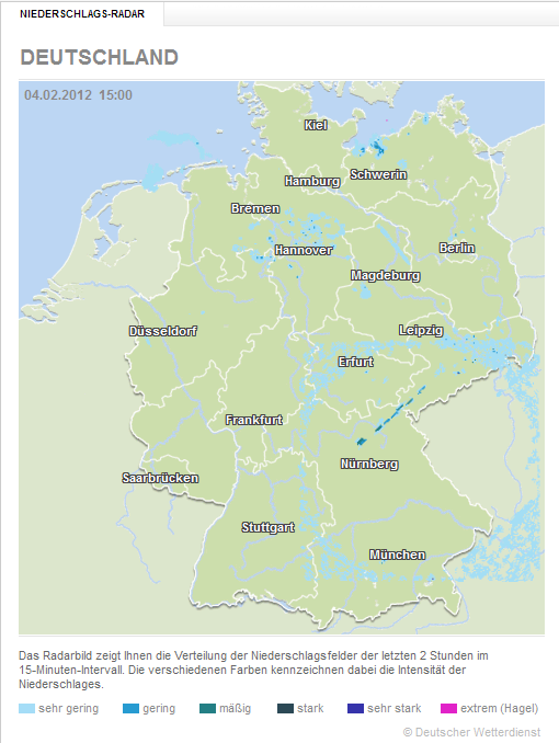
It shows rainfall
The image was back to normal a few hours later.
It shows rainfall
The image was back to normal a few hours later.
edit on 18-9-2014 by verschickter because: (no reason given)
new topics
-
God's Righteousness is Greater than Our Wrath
Religion, Faith, And Theology: 2 minutes ago -
Electrical tricks for saving money
Education and Media: 3 hours ago -
VP's Secret Service agent brawls with other agents at Andrews
Mainstream News: 4 hours ago -
Sunak spinning the sickness figures
Other Current Events: 5 hours ago -
Nearly 70% Of Americans Want Talks To End War In Ukraine
Political Issues: 5 hours ago -
Late Night with the Devil - a really good unusual modern horror film.
Movies: 7 hours ago -
Cats Used as Live Bait to Train Ferocious Pitbulls in Illegal NYC Dogfighting
Social Issues and Civil Unrest: 8 hours ago -
The Good News According to Jesus - Episode 1
Religion, Faith, And Theology: 10 hours ago
top topics
-
Florida man's trip overseas ends in shock over $143,000 T-Mobile phone bill
Social Issues and Civil Unrest: 15 hours ago, 8 flags -
Cats Used as Live Bait to Train Ferocious Pitbulls in Illegal NYC Dogfighting
Social Issues and Civil Unrest: 8 hours ago, 8 flags -
VP's Secret Service agent brawls with other agents at Andrews
Mainstream News: 4 hours ago, 8 flags -
Former Labour minister Frank Field dies aged 81
People: 17 hours ago, 4 flags -
Bobiverse
Fantasy & Science Fiction: 15 hours ago, 3 flags -
HORRIBLE !! Russian Soldier Drinking Own Urine To Survive In Battle
World War Three: 12 hours ago, 3 flags -
Electrical tricks for saving money
Education and Media: 3 hours ago, 3 flags -
Nearly 70% Of Americans Want Talks To End War In Ukraine
Political Issues: 5 hours ago, 3 flags -
Sunak spinning the sickness figures
Other Current Events: 5 hours ago, 3 flags -
Late Night with the Devil - a really good unusual modern horror film.
Movies: 7 hours ago, 2 flags
active topics
-
The Reality of the Laser
Military Projects • 46 • : Zaphod58 -
God's Righteousness is Greater than Our Wrath
Religion, Faith, And Theology • 0 • : randomuser2034 -
President BIDEN Vows to Make Americans Pay More Federal Taxes in 2025 - Political Suicide.
2024 Elections • 136 • : ImagoDei -
Electrical tricks for saving money
Education and Media • 3 • : Mike72 -
TLDR post about ATS and why I love it and hope we all stay together somewhere
General Chit Chat • 10 • : theshadowknows -
VP's Secret Service agent brawls with other agents at Andrews
Mainstream News • 31 • : WeMustCare -
Why to avoid TikTok
Education and Media • 20 • : 5thHead -
How ageing is" immune deficiency"
Medical Issues & Conspiracies • 32 • : annonentity -
-@TH3WH17ERABB17- -Q- ---TIME TO SHOW THE WORLD--- -Part- --44--
Dissecting Disinformation • 657 • : daskakik -
HORRIBLE !! Russian Soldier Drinking Own Urine To Survive In Battle
World War Three • 30 • : DaRAGE
1