It looks like you're using an Ad Blocker.
Please white-list or disable AboveTopSecret.com in your ad-blocking tool.
Thank you.
Some features of ATS will be disabled while you continue to use an ad-blocker.

Above Ground Landmarks for Underground Bases
page: 1,1
share:
I am providing a map of the underground tunnel system, if somebody could ever find the other half and post it here that would greatly be appreciated.
Anyhow to further understand the undeground tunnel system we have to better understand the landmarks that are above ground. This system is dependent
on ventilation, waste disposal water etc. So the purpose of this thread is to provide details about the underground surface and the different above
ground facilities it is dependent on.
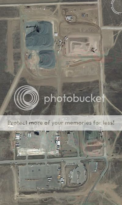
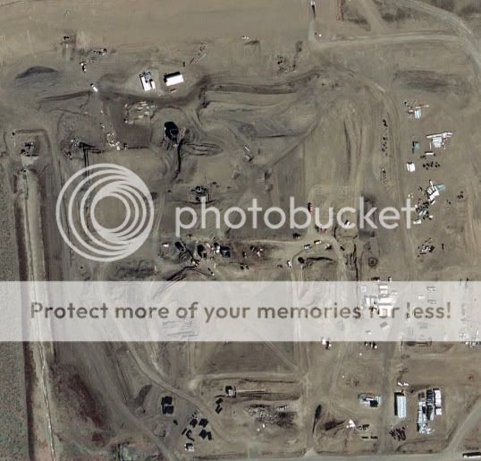
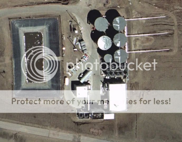
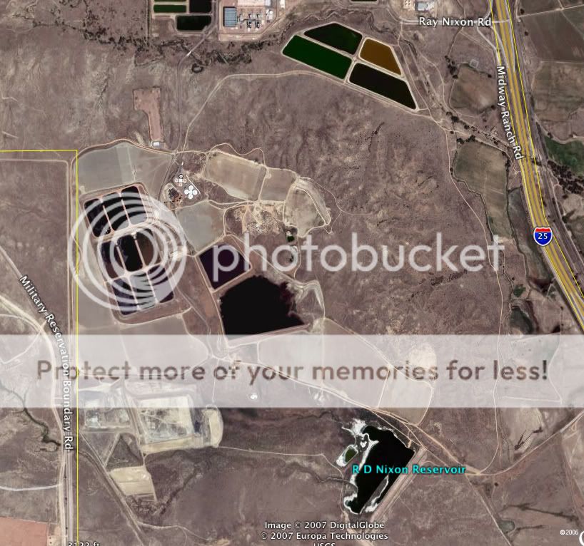
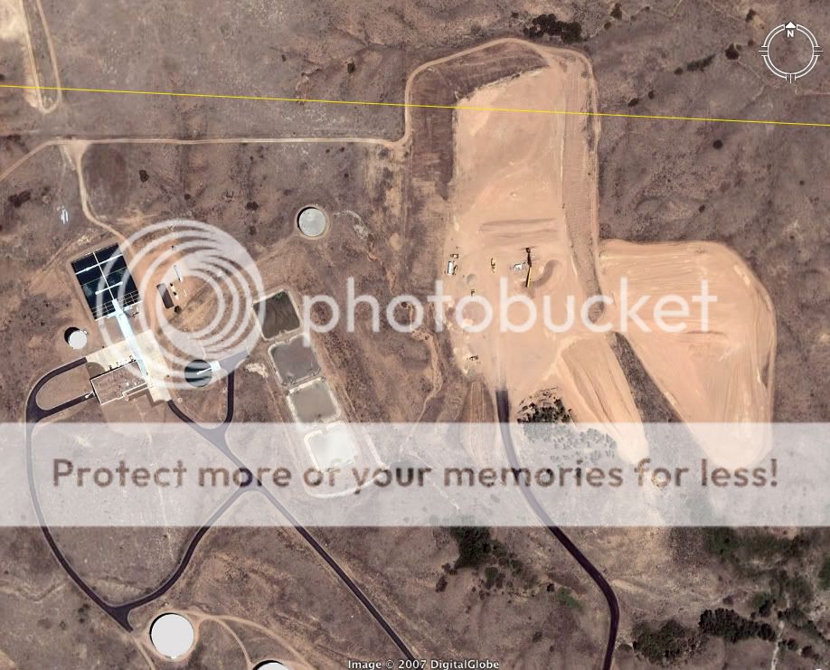
This is Nixon Powerplant. It is located south of Colorado Springs, CO on I-25. I believe this Powers NORAD as well as Ft. Carson, NORTHCOMM and
Peterson AFB. This also appears to supply the underground portion on this map posted above with adequate ventilation etc.

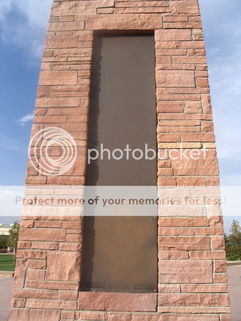
This is America the Beautiful Park located in Downtown Colorado Springs, CO. No word yet whether this indeed links up with the underground tunnel
system but I have no reason do doubt that it does. There is some ongoing research about this park loceted here,
www.abovetopsecret.com...' Although we don't really understand what this Park really is, it has clear ties to NORAD,
Montauk, Tesla and Hydro-Energy.


Of course we all know about DIA here are some very important articles.
www.westword.com...
www.theforbiddenknowledge.com...
www.anomalies-unlimited.com...
www.mt.net...
www.masonicinfo.com...
www.stewwebb.com...
www.westword.com...
www.theforbiddenknowledge.com...
www.anomalies-unlimited.com...
www.mt.net...
www.masonicinfo.com...
www.stewwebb.com...
Recently they have duplicated NORAD and combined it with Peterson AirForce Base. I had the priveledge of going to NORTHCOMM and previewing their GPS
software. Their plan is to have every police vehicle, FireTruck, Ambulance and Military Vehicle tracked VIA GPS. They can track every GPS vehicle on
their system as well as know what areas would be effected even with current weather conditions in the event of a "Dirty Bomb."
Just today I read a post about HWY 93 in Arizona. I double checked it on my map ironically enough this was a very important find in Wikieup as posted
here, www.abovetopsecret.com...'
Engraved in the tile at DIA reads "DZIT DIT GAII" it is anasazi for Mount Blanca which is one of four Sacred Mountains that form a cross. It is
located near the Great Sand Dunes National Park in Colorado and Alamosa, CO a place very frequently having UFO sighting and other strange
phenomenon.
from www.lapahie.com...
[edit on 5-5-2008 by 12.21.12]
from www.lapahie.com...
The Navajos belief is that their Creator placed them on the land between the following 4 mountains representing the 4 cardinal directions:
Mount Blanca (Tsisnaasjini' - Dawn or White Shell Mountain)
Sacred Mountain of the East
near Alamosa in San Luis Valley, Colorado
Mount Taylor (Tsoodzil - Blue Bead or Turquoise Mountain)
Sacred Mountain of the South
north of Laguna, New Mexico
San Francisco Peaks (Doko'oosliid - Abalone Shell Mountain)
Sacred Mountain of the West
near Flagstaff, Arizona
Mount Hesperus Dibé Nitsaa (Big Mountain Sheep) - Obsidian Mountain
Sacred Mountain of the North
La Plata Mountains, Colorado
The following inner mountains within the borders formed by the 4 sacred mountains are also held as sacred because of their importance in Navajo mythology:
Huerfano Mesa
Dzil Na'oodilii - Holy People (Navajo Deities) Encircling Mountain
Sacred Mountain of the Center
60 miles southeast of Bloomfield, New Mexico. This is where Changing Woman received her puberty, gave birth to her warrior twins, and lived in the first hogan. It is considered to be the "lungs" of Navajo country.
Governador Knob (Ch'oolii)
Sacred Mountain East of Center
in Old Navajoland (Dinetah), near and southeast of the Navajo Dam. This is where Changing Woman was found. It is considered to be the "heart" of Navajo country.
Navajo Mountain
Naatsis'áán - Head of the Earth
southeast Utah
These mountains represent the major parts of the traditional Navajo religious beliefs, helping them to live in harmony with both nature and their Creator.
In the Blessingway, we can see numerous references to such sacred places that are still identifiable today: Blanca Peak, Now Gobernador Knob, gazing upon one another, appear.
Now Gobernador Knob, Blanca peak, regularly speaking to one another by means of rock
crystal rainbow, appear,
Long life appears, happiness appears, that one appears holaghi.
Mount Taylor, now Yucca Mountain, gazing upon one another, appear.
Now Yucca Mountain, Mount Taylor, regularly speaking to one another by means of rock
crystal rainbow, appear,
Long life appears, happiness appears, that one appears holaghi.
San Francisco Peak, Huerfano Mountain, gazing upon one another, appear.
Now Huerfano Mountain, now San Francisco Peak, regularly speaking to one another by
means of rock crystal rainbow, appear,
Long life appears, happiness appears, that one appears holaghi.
Below are the 4 directional sacred mountains and the 3 inner sacred mountains.
Mount Blanca, near the town of Alamosa, in southern Colorado. This is known to the Navajo as the Sacred Mountain of the East.
Mount Blanca, the tallest mountain in the Sangre de Cristos, in San Luis Valley, in southern Colorado, rises 14,317 feet at the center of a towering trio.
Mount Taylor, New Mexico. This is known to the Navajo as the Sacred Mountain of the South.
San Francisco Peak, Arizona. This is known to the Navajo as the Sacred Mountain of the West.
Another picture of San Francisco Peak.
Mount Hesperus, La Plata Mountains, Colorado. This is known to the Navajo as the Sacred Mountain of the North.
Dzil Ná'oodilii (Holy People (Navajo Deities) Encircling Mountain), in northwest New Mexico is about 50 miles west of Gobernador Knob. This is the location where Navajo mythology says that the first hogan was built, where the 2nd ceremony was performed on earth after Changing Woman had her first and second menstral periods of flow, where the hogan was consecrated with the Leaders' House Songs (12 of them with the help of Coyote), and where her warrior twins would leave to kill (cleanse the earth of) the Monsters. Dzil Ná'oodilii is located in a very sparsely populated and isolated location about 60 miles from the nearest towns of Bloomfield to the west and Cuba to the east. It also lies about 60 miles north of Chaco Canyon National Park and about 60 miles south-east of Mesa Verde National Park. This mesa is considered to be the lungs of Navajo country, and its shape is identified with the perpendicular sides and round roof of the 6 or 8 sided hogan. Dzil Ná'oodilii is also the location where mom Lillie Todychini, and her son, Harrison Lapahie Jr. were born.
After Changing Woman's initiation to womanhood was complete, the form of the Navajo girls' ceremony was established at Dzil Ná'oodilii for all time. Traditional Navajo families hold this same ceremonial celebration for a girl's 1st and 2nd menses today. The usual practice is to consecrate the hogan with the Leaders' hogan songs for the 1st, and Talking God's hogan songs for the 2nd. There is a story that Coyote, who had attended the puberty ceremony uninvited, objected to Talking God's plan to sing only 4 house songs. Coyote said, "Now there on the east side Talking God had set 12 white tail-feathers in a row, at the south side he set 12 turquoise tail-feathers, at the west side he had set 12 abalone shell tail-feather figures, at the north side he had set 12 jet tail-feathers figures in a row." Coyote pointed out that the inner forms of the 4 sacred mountains of the 4 cardinal directions also had the same number of tail feathers and said that these powerful deities already knew that there should likewise be 12 songs. So it was decided that there should be 12 songs in Talking God's set of house songs. Dzil Ná'oodilii is shown dark above because of the many clouds above it at the time the photograph was taken. The photo was taken about 20 miles from Dzil Ná'oodilii.
"Dzil Ná'oodilii" is also referred to as "El Huerfano" (Spanish) or Huerfano Mountain (English). On documents that as
[edit on 5-5-2008 by 12.21.12]
Anyways thats all I have for now. Feel free to add on. Also if you care to post locations of secret prison camps please feel free to do so. Let's
keep this thread nice and tidy please!!!!!
www.geocities.com...
What follows is both a compendium of my observations, and a do-it-your-self field guide for those who wish discover the true extent of the American covert underground infrastructure.
I believe one exist in Ellijay, Georgia and began a thread www.abovetopsecret.com...'; however, it seemed to have just died as all other thread pertaining to underground infrastructures that exist outside those listed in ATS.
A point of interest, Ellijay, Ga. is part of the beginning of "Trail of Tears" march of the Cherokee Nation.www.rootsweb.ancestry.com...
www.signaturebookslibrary.org...
5.
The Indians' Lost Book of God
They [the American Indians] have two flat sticks about one foot long, tied together, on which are several characters, which they say, the Great Father gave to their prophet, and mean as much as a large book.
—W. W. Phelps,1 an early Mormon apologist
The Cherokee Nation set a marker in Hartwell Georgia called "The Center of the World."
web.georgia.org...
The "Center of the World" historic site/monument honors the location of the Cherokee Indian assembly ground. It was there that the Cherokees met to hold their tribal council. The area was inhabited by Native Americans until a treaty with the Cherokee Indians was signed.
It is said when the tablets of stone are returned to the Center of the World the 5th age will begin.
www.luckymojo.com...
The Hopi Indians and their ancient shamans say "signs" willThe Hopi Indians and their ancient shamans say "signs" will
foretell the time when the fifth world, a new age, will
begin. Many believe we now stand on the threshold of
changing events which will bring about the end of one world
period and the beginning of another. Ancient prophecies
state that when stone tablets are returned to the center of
the world the new age will begin. There are varied
interpretations in many different cultures regarding what
"the center of the world" means and where it is.
Northeast Georgia was an assembly ground for the great
Cherokee Indian Nation before the white man's greed for gold
brought about the Trail of Tears. Cherokee Indian trails
radiated in all directions from what is now Elberton,
Georgia, and the Cherokee Indians held their Councils, their
dances and their worship services of the Great Spirit there.
They called the area Al-yeh-li-A-lo-Hee, the Center of the
World.
[edit on 27-5-2008 by musselwhite]
Though much of this is encoded in the murals at Denver International Airport, we have to take a look at Mt. Blanca one of four sacred mountains of the
Navajo Region.
www.lapahie.com...
It is said that there is an underground alien base here. Whether that is true or not there are some interesting things about the area outside of Mt. Blanca
One that I am most curious in, is the Great Sand Dunes National Park near Alamosa in Southern Colorado. I find it quite odd to find a sand dune region in an area that is sirrounded by the great planes and Rocky Mouontains.
These are both also very close to Dulce, NM. I for one am not familiar with any aboveground landmarks around Dulce, NM.
We All Know of An Underground Facility in our town..
I live in a small town, Where the 33rd Degree mason Building was tobe used in the case of a nuclear incident.. The Heads of Freemasonrey would ALL come too my small town in the event of a disaster.. They would plan how they would deal with the farmers in order to get the Crops in production.. and to maintain buisness in the town.. So the Town would remain running..
Anyway, We All Know of An Underground Facility in our town..
There are many entrances.. But Hard to Find..
Theres one on college campus.
One at the hospital..
And One Downtown under the Masonic Lodge..
One is in the Catacombs..
This is the one me and my friends KNOW exist..
Its Like an elevator..
The Doors are Metal and Number Keypad Protected..
None of The Stores above it have elevators.. either..
The Catacombs came from the 1800s.
It was a way for Downtown shops to store items..\
Eventualy the Catacombs became a couple blocks long..
Its Very Scarey to go down there... in all directions its darkness..
We were only able to go downthere because a friend was working for a local restauraunt/Micro brewery.
If you want to find Underground Facilitys, try some of these..
The Old Bunkers and stuff..
And maybe you'll get lucky and find a mutant zoo..
new topics
-
Former Labour minister Frank Field dies aged 81
People: 51 minutes ago -
SETI chief says US has no evidence for alien technology. 'And we never have'
Aliens and UFOs: 2 hours ago -
This is our Story
General Entertainment: 5 hours ago -
President BIDEN Vows to Make Americans Pay More Federal Taxes in 2025 - Political Suicide.
2024 Elections: 7 hours ago -
Ode to Artemis
General Chit Chat: 8 hours ago -
Ditching physical money
History: 11 hours ago -
One Flame Throwing Robot Dog for Christmas Please!
Weaponry: 11 hours ago
top topics
-
University student disciplined after saying veganism is wrong and gender fluidity is stupid
Education and Media: 16 hours ago, 14 flags -
President BIDEN Vows to Make Americans Pay More Federal Taxes in 2025 - Political Suicide.
2024 Elections: 7 hours ago, 12 flags -
One Flame Throwing Robot Dog for Christmas Please!
Weaponry: 11 hours ago, 6 flags -
Should Biden Replace Harris With AOC On the 2024 Democrat Ticket?
2024 Elections: 13 hours ago, 6 flags -
SETI chief says US has no evidence for alien technology. 'And we never have'
Aliens and UFOs: 2 hours ago, 4 flags -
Don't take advantage of people just because it seems easy it will backfire
Rant: 12 hours ago, 4 flags -
Ditching physical money
History: 11 hours ago, 4 flags -
Ode to Artemis
General Chit Chat: 8 hours ago, 3 flags -
God lived as a Devil Dog.
Short Stories: 17 hours ago, 3 flags -
VirginOfGrand says hello
Introductions: 13 hours ago, 2 flags
active topics
-
15 Unhealthiest Sodas On The Market
Health & Wellness • 41 • : confuzedcitizen -
British TV Presenter Refuses To Use Guest's Preferred Pronouns
Education and Media • 134 • : AllisVibration -
President BIDEN Vows to Make Americans Pay More Federal Taxes in 2025 - Political Suicide.
2024 Elections • 6 • : CriticalStinker -
Don't take advantage of people just because it seems easy it will backfire
Rant • 5 • : seekshelter -
University student disciplined after saying veganism is wrong and gender fluidity is stupid
Education and Media • 35 • : KrustyKrab -
SETI chief says US has no evidence for alien technology. 'And we never have'
Aliens and UFOs • 14 • : CosmicFocus -
Breaking Baltimore, ship brings down bridge, mass casualties
Other Current Events • 472 • : Justoneman -
Election Year 2024 - Interesting Election-Related Tidbits as They Happen.
2024 Elections • 69 • : Threadbarer -
Former Labour minister Frank Field dies aged 81
People • 2 • : Freeborn -
Terrifying Encounters With The Black Eyed Kids
Paranormal Studies • 72 • : Consvoli
1