It looks like you're using an Ad Blocker.
Please white-list or disable AboveTopSecret.com in your ad-blocking tool.
Thank you.
Some features of ATS will be disabled while you continue to use an ad-blocker.

Nasa images show Absolute proof of Life on Mars. Huge cities
page: 5share:
dude, are you serious? I saw a very, very large image of this. looked at every coordinate. didn't see any huge cities. you know if there were huge
cities like you claim we would see them here right?
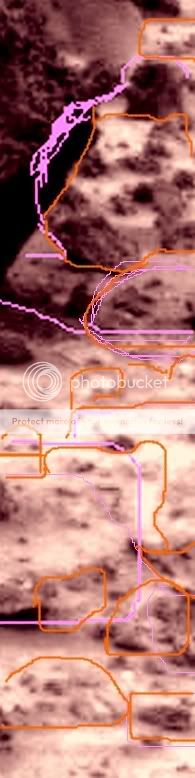
Could anyone please tell me if they see anything peculiar(shapes) in eithe Pos or Neg images? That would be helpful,especially if you could mark
it/highlight it. Thanks.
Originally posted by vze2xjjk
Could anyone please tell me if they see anything peculiar(shapes) in eithe Pos or Neg images? That would be helpful,especially if you could mark it/highlight it. Thanks.
Reading the thread would be a good idea....but in a nutshell...apparently it's primarily the OP that can see them. Nearly all other responses have been on the "nope, can't see 'em" variety.
reply to post by vze2xjjk
Which image are you talking about, the image that was the reason for the creation of this thread or the image posted by Silversurfer6161?
That is why I don't like the introduction of photos that are not directly related to the original photos in a thread where we are discussing a specific photo, at least until we reach some conclusion and the conversation shifts naturally to other photos.
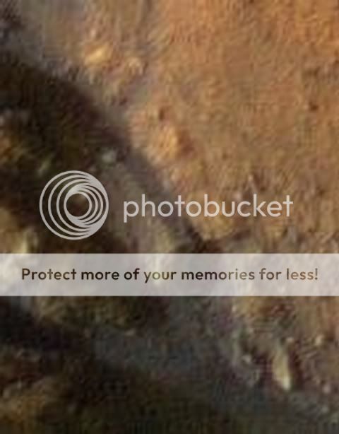
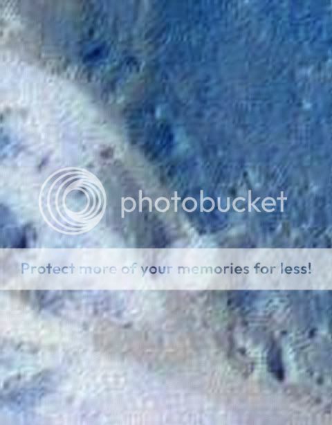
For those that think that those shapes are not natural, here are two images from Canada.
Stone circles on Melville Island
Ice-wedge polygons in peatland
Remember that according to the scale of that Mars photo, the polygonal shapes are more or less 4 metres wide.
Stone circles on Melville Island
Ice-wedge polygons in peatland
Remember that according to the scale of that Mars photo, the polygonal shapes are more or less 4 metres wide.
i see people waving their hands lol but sorry i just dont see the city
reply to post by ArMaP
I was refering to the silversurfer photo,hoping that the positive/neg aspect would help someone nail down what they saw by a few seeing it or
just more sure of it seeing it both pos and neg images. Co-incidentally I figured out a possible remedy for those who cant see details in my
images due to a variety of factors including "noise" introduced by fuzziness from posting low res images under limiting factors here such as size.
If someone were to download my images,perhaps 5 or so,they could try reducing the size of the images to condense them and increase clarity with
most.That's one of my tricks is to reduce size to make compression work for me.
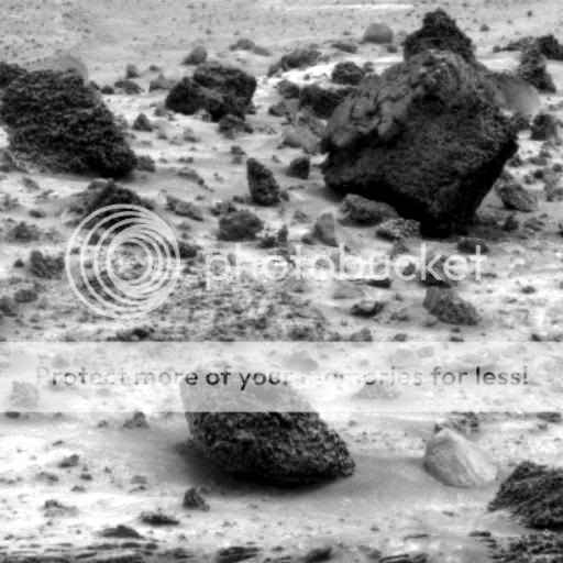
 Now here's a pic similar to how the Mars Man looks.
reply to post by Localjoe3
Hi Joe,this may not be the explanation you wanted about why it looks like you are seeing recognizable patterns on the sat pics. I'm pretty sure you are seeing patterns,but when I explain why,you may not believe me or if you do you may wish I hadn't told you.But If you decide to figure it out sooner or later,here's my pitch. Back in 1987 I had an idea about how to send "packets" of info the most efficient way possible across vast distances,to compress the time and energy it takes to send a data stream. Keep in mind that I was far from a computer geek at the time,but my friends were and I knew they had problems with corrupt files.It made them crazy. I was more into photography and artsy stuff and music,sci-fi,live bands.I collected so many pictures I had stacks of them all over the house(very messy,boxes all over the place). I thought of STACKING IMAGES on top of one another electronically. The short answer for you is that since the data stream is NOT JUST the image you see,but what is also simultaneously transmitted in packets effecting your final image. In other words you may or may not believe that Nasa masks images,but you have fallen victim without knowing it by seeing patterns that are simultaneously transmitted and not filtered out.I will probably have to show you rather than just have you understand and figure out the extent of this corruption of what Nasa is putting out as "the good stuff". You are seeing patterns alright,but they are not what you think they are. The onion unpeeled one more layer.
Hi Joe,this may not be the explanation you wanted about why it looks like you are seeing recognizable patterns on the sat pics. I'm pretty sure you are seeing patterns,but when I explain why,you may not believe me or if you do you may wish I hadn't told you.But If you decide to figure it out sooner or later,here's my pitch. Back in 1987 I had an idea about how to send "packets" of info the most efficient way possible across vast distances,to compress the time and energy it takes to send a data stream. Keep in mind that I was far from a computer geek at the time,but my friends were and I knew they had problems with corrupt files.It made them crazy. I was more into photography and artsy stuff and music,sci-fi,live bands.I collected so many pictures I had stacks of them all over the house(very messy,boxes all over the place). I thought of STACKING IMAGES on top of one another electronically. The short answer for you is that since the data stream is NOT JUST the image you see,but what is also simultaneously transmitted in packets effecting your final image. In other words you may or may not believe that Nasa masks images,but you have fallen victim without knowing it by seeing patterns that are simultaneously transmitted and not filtered out.I will probably have to show you rather than just have you understand and figure out the extent of this corruption of what Nasa is putting out as "the good stuff". You are seeing patterns alright,but they are not what you think they are. The onion unpeeled one more layer.
Here's what I'm proposing,Joe. Just simply look at the image again that you marked with shapes and dots.But this time really MARK it up good with 5
to 10 times as many contour lines especially.Just go to town with the contour lines you see,and after it's marked up that way and you post it I'll
in the best way I can show you what's behind the veil.
The only thing I see in all of the pictures so far are natural land formations caused by erosion. Mars gets a lot of huge wind and sand storms which
can violently change the landscape in a matter of hours even to the point of making areas look man made not to forget the erosion of the land from the
water and ice sheets that was once there a long time ago (like how the ice age and its eventual end) carved our world into what it looks like today)
or the dry, cracked river or lake beds.
new topics
-
Former Labour minister Frank Field dies aged 81
People: 49 minutes ago -
SETI chief says US has no evidence for alien technology. 'And we never have'
Aliens and UFOs: 2 hours ago -
This is our Story
General Entertainment: 5 hours ago -
President BIDEN Vows to Make Americans Pay More Federal Taxes in 2025 - Political Suicide.
2024 Elections: 7 hours ago -
Ode to Artemis
General Chit Chat: 8 hours ago -
Ditching physical money
History: 11 hours ago -
One Flame Throwing Robot Dog for Christmas Please!
Weaponry: 11 hours ago
top topics
-
University student disciplined after saying veganism is wrong and gender fluidity is stupid
Education and Media: 16 hours ago, 14 flags -
President BIDEN Vows to Make Americans Pay More Federal Taxes in 2025 - Political Suicide.
2024 Elections: 7 hours ago, 12 flags -
One Flame Throwing Robot Dog for Christmas Please!
Weaponry: 11 hours ago, 6 flags -
Should Biden Replace Harris With AOC On the 2024 Democrat Ticket?
2024 Elections: 13 hours ago, 6 flags -
SETI chief says US has no evidence for alien technology. 'And we never have'
Aliens and UFOs: 2 hours ago, 4 flags -
Don't take advantage of people just because it seems easy it will backfire
Rant: 12 hours ago, 4 flags -
Ditching physical money
History: 11 hours ago, 4 flags -
Ode to Artemis
General Chit Chat: 8 hours ago, 3 flags -
God lived as a Devil Dog.
Short Stories: 17 hours ago, 3 flags -
VirginOfGrand says hello
Introductions: 13 hours ago, 2 flags
active topics
-
15 Unhealthiest Sodas On The Market
Health & Wellness • 41 • : confuzedcitizen -
British TV Presenter Refuses To Use Guest's Preferred Pronouns
Education and Media • 134 • : AllisVibration -
President BIDEN Vows to Make Americans Pay More Federal Taxes in 2025 - Political Suicide.
2024 Elections • 6 • : CriticalStinker -
Don't take advantage of people just because it seems easy it will backfire
Rant • 5 • : seekshelter -
University student disciplined after saying veganism is wrong and gender fluidity is stupid
Education and Media • 35 • : KrustyKrab -
SETI chief says US has no evidence for alien technology. 'And we never have'
Aliens and UFOs • 14 • : CosmicFocus -
Breaking Baltimore, ship brings down bridge, mass casualties
Other Current Events • 472 • : Justoneman -
Election Year 2024 - Interesting Election-Related Tidbits as They Happen.
2024 Elections • 69 • : Threadbarer -
Former Labour minister Frank Field dies aged 81
People • 2 • : Freeborn -
Terrifying Encounters With The Black Eyed Kids
Paranormal Studies • 72 • : Consvoli