It looks like you're using an Ad Blocker.
Please white-list or disable AboveTopSecret.com in your ad-blocking tool.
Thank you.
Some features of ATS will be disabled while you continue to use an ad-blocker.

Can you help me identify this Huey variant?
page: 17
share:
One of my coworkers shared this picture with me, he said it was grom late 1983 in an oversea military base. He thinks it was some sort of reconnosence
variant.
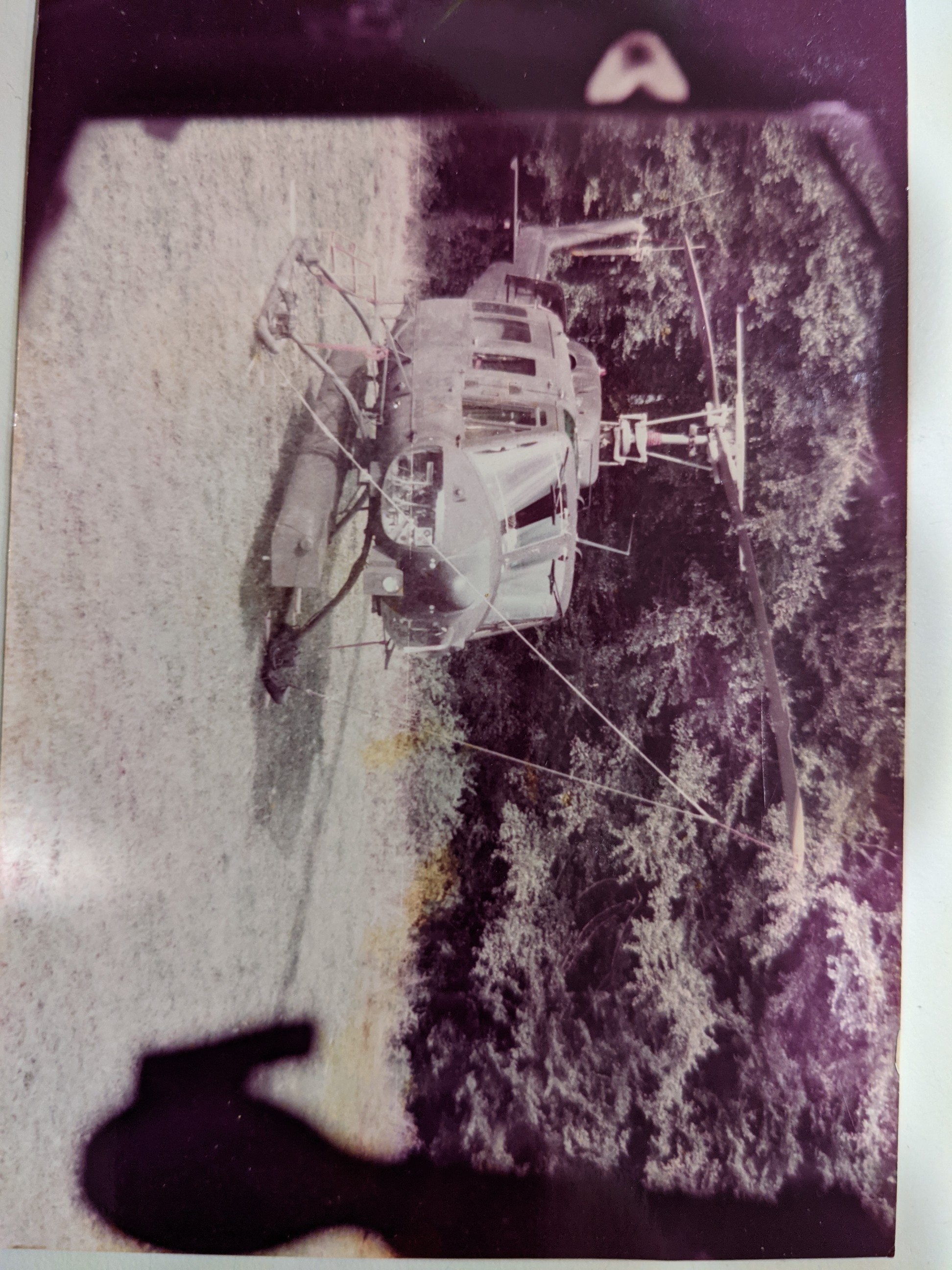
edit on 2-3-2021 by turbo8 because: pic added
As a guess, I would say delivering main rotor blades to another one that is damaged. Field repair.
a reply to: turbo8
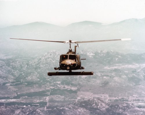
Looks like a Bell UH-1 "Iroquois" variant.
Hard to say what's attached underneath the fuselage. I was thinking some type of ground mapping radar array or perhaps just an external fuel cell/tank.🤷🏾♂️
Looks like a Bell UH-1 "Iroquois" variant.
Hard to say what's attached underneath the fuselage. I was thinking some type of ground mapping radar array or perhaps just an external fuel cell/tank.🤷🏾♂️
edit on 3/2/2021 by EternalShadow because: eta/correction
He also said "If you look close it had high freq antennas right under the doors, they look like outlines of hour glasses whole bunch of wierd details
for the time."
originally posted by: turbo8
One of my coworkers shared this picture with me, he said it was grom late 1983 in an oversea military base. He thinks it was some sort of reconnosence variant.
Probably a Side Looking Airborne Radar (SLAR) pod on a regular Huey. Looks like a first generation Huey. An educated guess.
a reply to: turbo8
Is it possible that the U.S. Army was using LIDAR in the Asian jungles long before we knew about it?
en.m.wikipedia.org...
That is interesting, anybody here serve in Vietnam?
Thanks for sharing this.
Is it possible that the U.S. Army was using LIDAR in the Asian jungles long before we knew about it?
en.m.wikipedia.org...
Under the direction of Malcolm Stitch, the Hughes Aircraft Company introduced the first lidar-like system in 1961,[9][10] shortly after the invention of the laser. Intended for satellite tracking, this system combined laser-focused imaging with the ability to calculate distances by measuring the time for a signal to return using appropriate sensors and data acquisition electronics. It was originally called "Colidar" an acronym for "COherent Light Detecting And Ranging,"[11] derived from the term "radar", itself an acronym for "Radio Detection And Ranging
That is interesting, anybody here serve in Vietnam?
Thanks for sharing this.
edit on 2-3-2021 by Bigburgh because: (no reason given)
a reply to: 1947boomer
en.m.wikipedia.org...
Looking for old pics of hueys with SLAR, not having much luck.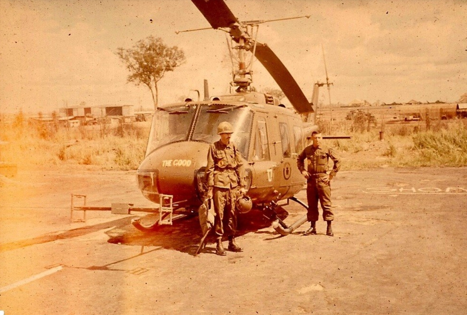
Edit: and here we have something I never even heard of...
www.mdpi.com...
en.m.wikipedia.org...
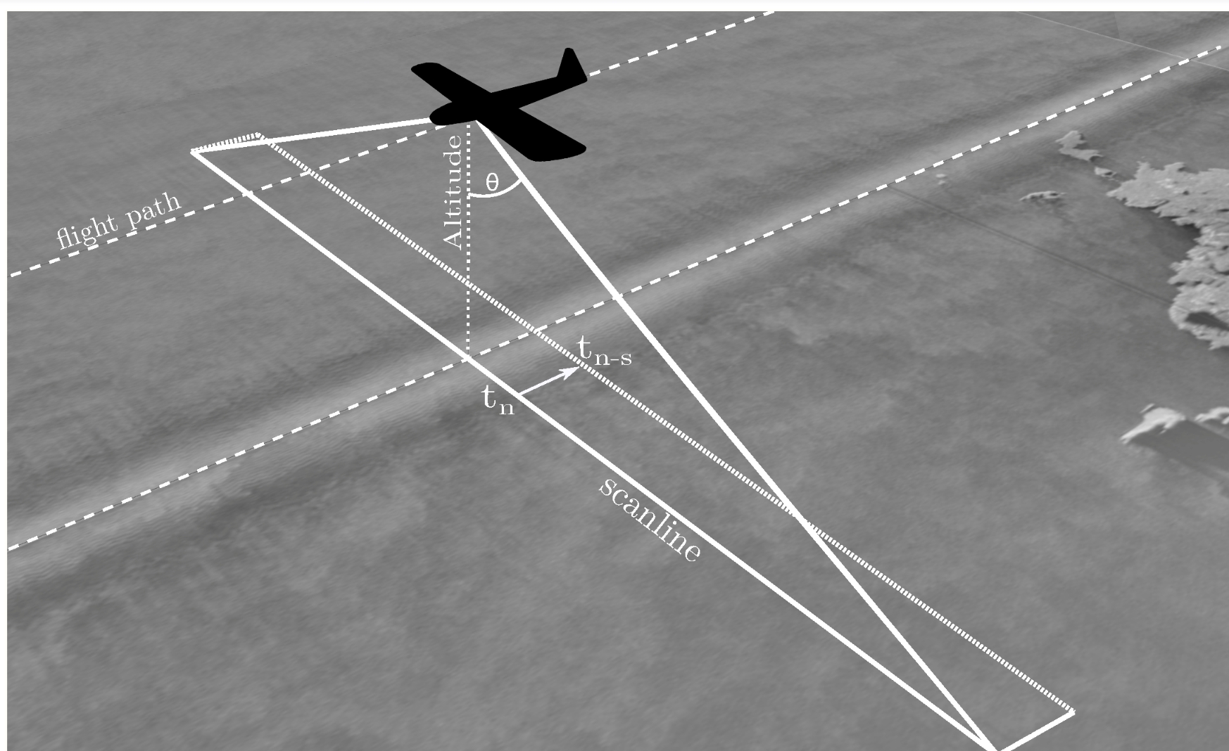
Side-looking airborne radar (SLAR) is an aircraft- or satellite-mounted imaging radar pointing perpendicular to the direction of flight (hence side-looking).[1] A squinted (nonperpendicular) mode is possible also. SLAR can be fitted with a standard antenna (real aperture radar) or an antenna using synthetic aperture.
Looking for old pics of hueys with SLAR, not having much luck.
Edit: and here we have something I never even heard of...
Semantic Segmentation of SLAR Imagery with Convolutional LSTM Selectional AutoEncoders
www.mdpi.com...
edit on 2-3-2021 by Bigburgh because: (no reason given)
a reply to: turbo8
It's the JUH-1 SOTAS (Stand Off Target Acquisition System). The skids were retractable, and the AN/APS-94 radar rotated under the aircraft. The AN/APS-94 was initially used in Vietnam to track vehicles at night.
It's the JUH-1 SOTAS (Stand Off Target Acquisition System). The skids were retractable, and the AN/APS-94 radar rotated under the aircraft. The AN/APS-94 was initially used in Vietnam to track vehicles at night.
edit on 3/2/2021 by Zaphod58 because: (no reason given)


originally posted by: EternalShadow
a reply to: Zaphod58
Close but no cigar..lol
Thx Zaphod.
Well I thought you were close🤷♂️
While the rest of us were still un-sticking stuck butterfly valves in our carburetors ...
Source: TM 11-5895-284-12, 8 May 1970
Cheers
1-4. Purpose and Use
a. Basic Use.
Radar Surveillance Sets AN/APS-94B and AN/APS-94C are side-looking airborne radar (SLAR) sets. The sets provide permanent aerial photoradar maps of terrestrial (ground) targets to ranges of 25, 50, or 90 kilometers (km) on either or both sides of the flight path of the aircraft in which the set is installed. The aerial photoradar maps provide information on fixed and moving targets within the maximum range of 90 kilometers. The AN/APS-94(*) provides photographic maps which are recorded by Recorder, Radar Mapping RO-225A/APS-94A on 5-inch strip film (standard film only) or by Recorder-Processor-Viewer, Radar Mapping RO-166(*)/UP (TM 11-5820-680-12), which records maps on 9-inch film (standard film only).
Source: TM 11-5895-284-12, 8 May 1970
Cheers
a reply to: F2d5thCavv2
They also mounted an AN/APS-94 on the OV-1 Mohawk during Vietnam, and was used into the 90s, after upgrades. It had a 60 mile range, but a huge blind spot directly underneath the aircraft. They also looked at a roll-on system for the Coast Guard for search and rescue and enforcement missions. It's a pretty interesting system.
They also mounted an AN/APS-94 on the OV-1 Mohawk during Vietnam, and was used into the 90s, after upgrades. It had a 60 mile range, but a huge blind spot directly underneath the aircraft. They also looked at a roll-on system for the Coast Guard for search and rescue and enforcement missions. It's a pretty interesting system.
new topics
-
Is the origin for the Eye of Horus the pineal gland?
General Conspiracies: 1 hours ago -
Man sets himself on fire outside Donald Trump trial
Mainstream News: 1 hours ago -
Biden says little kids flip him the bird all the time.
2024 Elections: 1 hours ago -
The Democrats Take Control the House - Look what happened while you were sleeping
US Political Madness: 2 hours ago -
Sheetz facing racial discrimination lawsuit for considering criminal history in hiring
Social Issues and Civil Unrest: 2 hours ago -
In an Historic First, In N Out Burger Permanently Closes a Location
Mainstream News: 4 hours ago -
MH370 Again....
Disaster Conspiracies: 5 hours ago -
Are you ready for the return of Jesus Christ? Have you been cleansed by His blood?
Religion, Faith, And Theology: 7 hours ago -
Chronological time line of open source information
History: 8 hours ago -
A man of the people
Medical Issues & Conspiracies: 9 hours ago
top topics
-
In an Historic First, In N Out Burger Permanently Closes a Location
Mainstream News: 4 hours ago, 14 flags -
The Democrats Take Control the House - Look what happened while you were sleeping
US Political Madness: 2 hours ago, 9 flags -
A man of the people
Medical Issues & Conspiracies: 9 hours ago, 8 flags -
Thousands Of Young Ukrainian Men Trying To Flee The Country To Avoid Conscription And The War
Other Current Events: 15 hours ago, 7 flags -
Biden says little kids flip him the bird all the time.
2024 Elections: 1 hours ago, 6 flags -
Man sets himself on fire outside Donald Trump trial
Mainstream News: 1 hours ago, 5 flags -
12 jurors selected in Trump criminal trial
US Political Madness: 17 hours ago, 4 flags -
4 plans of US elites to defeat Russia
New World Order: 11 hours ago, 4 flags -
Are you ready for the return of Jesus Christ? Have you been cleansed by His blood?
Religion, Faith, And Theology: 7 hours ago, 3 flags -
Sheetz facing racial discrimination lawsuit for considering criminal history in hiring
Social Issues and Civil Unrest: 2 hours ago, 3 flags
active topics
-
Thousands Of Young Ukrainian Men Trying To Flee The Country To Avoid Conscription And The War
Other Current Events • 27 • : Xtrozero -
Is the origin for the Eye of Horus the pineal gland?
General Conspiracies • 2 • : nugget1 -
12 jurors selected in Trump criminal trial
US Political Madness • 86 • : ImagoDei -
911 emergency lines are DOWN across multiple states
Breaking Alternative News • 8 • : nugget1 -
Marjorie Taylor Greene Files Motion to Vacate Speaker Mike Johnson
US Political Madness • 64 • : interupt42 -
The Democrats Take Control the House - Look what happened while you were sleeping
US Political Madness • 20 • : CriticalStinker -
Man sets himself on fire outside Donald Trump trial
Mainstream News • 17 • : FlyersFan -
Biden says little kids flip him the bird all the time.
2024 Elections • 8 • : Astrocometus -
Are you ready for the return of Jesus Christ? Have you been cleansed by His blood?
Religion, Faith, And Theology • 18 • : mysterioustranger -
Israeli Missile Strikes in Iran, Explosions in Syria + Iraq
World War Three • 101 • : CarlLaFong
7