It looks like you're using an Ad Blocker.
Please white-list or disable AboveTopSecret.com in your ad-blocking tool.
Thank you.
Some features of ATS will be disabled while you continue to use an ad-blocker.

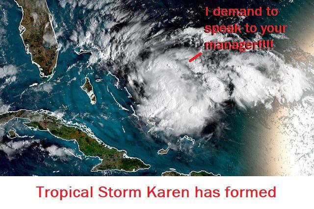
Trouble brewing in the Tropical Atlantic, Karen has formed
page: 2share:
Serious flooding is being reported in Trinadad and Tobago.
mobile.twitter.com...
A weak storm can dump just as much rain as a major one, as we saw with Imelda in Texas and Louisiana.
The NHC will have a full advisory in a few minutes. The storm has weakened since early this morning and may be downgraded to a depression.
mobile.twitter.com...
A weak storm can dump just as much rain as a major one, as we saw with Imelda in Texas and Louisiana.
The NHC will have a full advisory in a few minutes. The storm has weakened since early this morning and may be downgraded to a depression.
As of 5pm, Karen is still a minimum Tropical Storm with winds near 40mph. She is located about 85 miles northwest of Grenada.
The storm will be in a hostile environment for a few days and may weaken further until it goes north of Puerto Rico, then strengthening is likely.
No changes in watches or warnings nor the official forecast track.
The storm will be in a hostile environment for a few days and may weaken further until it goes north of Puerto Rico, then strengthening is likely.
No changes in watches or warnings nor the official forecast track.
edit on 22-9-2019 by jrod because: (no reason given)
Joking aside, they still are reeling from the last one. I wonder if we will see any weird behavior from this one, like a 2 day stall out there.
Keeping my eye on it!
Karen is still a disorganized system that is being sheared by upper level winds. This hostile environment is expected for the next 48 hours. After
that when(and possibly if the storm survives) it will be in a much more favorable environment and strengthening is likely.
Tropical storm warnings are in effect for Puerto Rico and the US Virgin Islands, and the British Virgin Islands are under a tropical storm watch. Warnings have been discontinued for Grenada, Trinadad and Tobago, and the southern Windward Islands.
Late in the forecast, the National Hurricane Center is forecasting a turn to the west toward the Bahamas and Southeast US. Most of the computer models agree this turn will happen in the next 3 to 5 days. Even though Karen is currently a weak disorganized storm, it bares watching as a potential threat to the Bahamas and Florida by the end of the week and into next week.
As of 8am Karen is about 245 miles South of St. Croix with top sustained winds near 40 mph. It is moving NW around 8 mph with a pressure of 1007mb.
edit on 23-9-2019 by jrod because: .
Karen has weakened to a tropical depression with winds of 35mph. It is located 135 miles south of St. Croix moving NNW at 13 mph.
A tropical storm warning is still in effect for Puerto Rico, and the US and British Virgin Islands. It will not take much for Karen to restrengthen so the warnings are staying up.
Not much has changed with the overall forecast, no further stregthening is expected until the storm is north of Puerto Rico. It is then expected to still in the next 3 to 4 days. Many computer models suggest it will then start moving west toward the Bahamas and SE CONUS.
Karen is back to a tropical storm. As of 5am it was 90 miles southwest of St. Croix with winds of 40 mph, moving north at 7mph.
Karen does appear to be going through a strengthening phase as she approaches Puerto Rico. Also the last couple of hours the storm has jogged more west. If this trend continues a tropical storm warning will be needed for the Dominican Republic.
The next update is at 8am EDT from the NHC.
Karen does appear to be going through a strengthening phase as she approaches Puerto Rico. Also the last couple of hours the storm has jogged more west. If this trend continues a tropical storm warning will be needed for the Dominican Republic.
The next update is at 8am EDT from the NHC.
edit on 24-9-2019 by jrod because: A
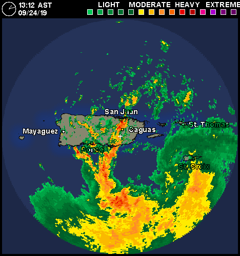
Karen is approaching Puerto Rico, heavy rains and me flooding is likely in PR and the Virgin Islands later today and throughout tomorrow.
Not much has changed with Karen. It is currently 110 miles south of San Juan and moving north around 8 mph. It is expected to continue moving north to NNE for the 72 hours, then stall. The NHC is using mostly the EURO computer model that then suggests a west turn 96 to 120 hours. Some of the models keep Karen near stationary during this time. That said after 96 hours there is a great deal of uncertainty in the forecast.
Once Karen moves north of Puerto Rico, it is expected to strengthen and be near hurricane strength in 96 hours.
Karen has strengthened as it approaches Puerto Rico especially in terms of rainfall potential. Heavy rains, life threatening flooding and mudslides
are likely for Puerto Rico and the Virgin Islands. Also strong wind gusts close to hurricane strength are likely, especially in higher elevations.
I have to give the NHC credit for keeping the Tropical Storm warnings yesterday even though Karen looked like it could dissipate. Hopefully their vigilance will help save lives in what has escalated into a major flooding and mudslide threat.
The next 72 hours Karen is still expected to move north to NNE, after that a stall is expected. The forecast becomes much more complicated after that. In the next 24 to 48 hours there will be much more input data for the computer models and that should help with the uncertainty. The scenarios include the storm turning west toward the Bahamas and SE CONUS, to remaining stalled or looping around in the open Atlantic for the next 100 to 200 hours. As of right now, there is no not a significant trough forecast to steer Karen to the northeast for the next 192. This makes the westward track scenerio a problem for the Bahamas and CONUS.
As of 2pm Karen has sustained winds of 45mph with higher gusts, the pressure had dropped to 1005mb. The center is located about 65 miles south of San Juan and moving north around 8mph. Tropical atorm force winds extend about 80 miles, mostly Southeast of the center.
Karen appears to be on a strengthening trend, however further strengthening later tonight and early tomorrow will likely be inhibited by land interaction with the mountainous terrain of Puerto Rico.
The next full advisory will be a 5pm EDT.
Karen is holding steady in strength. As of 5pm she was about 35 Southeast of San Juan and moving north at 8 mph.
Flash floods, mudslides, and tropical storm force wind gusts are occurring in the warning areas(PR and the Virgin Islands). Heavier rain and stronger winds are expected this evening and over night in Puerto Rico.
Not much has changed in the forecast reasoning except most of the global computer models are forecasting a west turn in about 96 hours. When and how fast Karen goes is crucial for potential impacts in the Bahamas and the SE CONUS.
Karen is expected to be near hurricane strength in about 96 hours.

Karen has moved north of Puerto Rico and has remained disorganized. All warnings have been dropped. The forecast calls for only modest strengthening
in the next 72 hours.
The forecast has changed, showing a weaker and slower storm. It is expected to continue N to NNE for the next 48 hours, then stall or loop, after that it is expected to turn west at a slower speed. The timing and forward speed is crucial in determining a potential landfall in the Bahamas or Florida. A slower storm will not make it as far west before being pulled to the NE by a cold front in about 216 hours. A faster storm will make it further west posing a threat to the Bahamas and possibly the SE CONUS.
As of 11am AST, Karen was about 240 miles north of San Juan, moving north around 15mph. Top winds are 45 mph.
The official NHC cone of 'uncertainty':
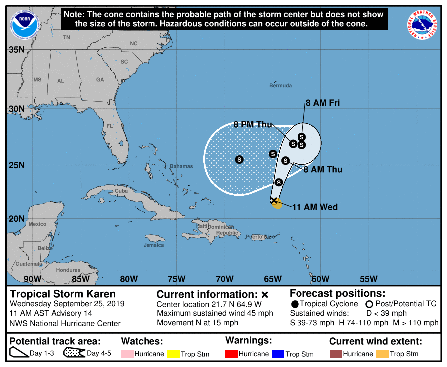
As you can see there is some concern Karen could pose a threat to the Bahamas and the SE CONUS next week. The crucial key is how fast Karen when/if she begins a westward to WSW track in the next 96-120hours.
As you can see there is some concern Karen could pose a threat to the Bahamas and the SE CONUS next week. The crucial key is how fast Karen when/if she begins a westward to WSW track in the next 96-120hours.
Karen has been facing a hostile environment and conditions are not forecast to be conducive for further strengthen. The NHC is forecasting Karen to
weaken to a remnant low or tropical wave. The remnants are still expected to impact Florida next week as a tropical wave.
It is currently a weak tropical storm located between Puerto Rico and Bermuda. Karen is currently moving northeasterly and expected to do a slow clockwise loop then head west to WSW in the next 48 to 72 hours.
I will update this if anything changes.
It is currently a weak tropical storm located between Puerto Rico and Bermuda. Karen is currently moving northeasterly and expected to do a slow clockwise loop then head west to WSW in the next 48 to 72 hours.
I will update this if anything changes.
edit on 26-9-2019 by jrod because: (no reason given)
Karen apparently asked for the manager of the Bermuda Triangle, now there's not much left of her.
Officially she's still classified as a tropical storm, but will be downgraded to a depression at the next advisory and more than likely will be downgraded to a remnant low by the end of the day.
The remnants will move toward the Bahamas and Florida and will be watched. There is a very slim chance Karen will re-develop.
a reply to: jrod
I hate it when that happens.
Hell hath no fury like a woman scorned - or not taken seriously anymore. Like other women of that tribe, she definitely bears watching lest she bites in the ass just for spite.
On a serious note - thanks for the updates. Keep 'em coming - especially if she re-develops.
Karen apparently asked for the manager of the Bermuda Triangle, now there's not much left of her.
I hate it when that happens.
The remnants will move toward the Bahamas and Florida and will be watched. There is a very slim chance Karen will re-develop.
Hell hath no fury like a woman scorned - or not taken seriously anymore. Like other women of that tribe, she definitely bears watching lest she bites in the ass just for spite.
On a serious note - thanks for the updates. Keep 'em coming - especially if she re-develops.
new topics
-
Russian intelligence officer: explosions at defense factories in the USA and Wales may be sabotage
Weaponry: 44 minutes ago -
African "Newcomers" Tell NYC They Don't Like the Free Food or Shelter They've Been Given
Social Issues and Civil Unrest: 1 hours ago -
Russia Flooding
Other Current Events: 3 hours ago -
MULTIPLE SKYMASTER MESSAGES GOING OUT
World War Three: 3 hours ago -
Two Serious Crimes Committed by President JOE BIDEN that are Easy to Impeach Him For.
US Political Madness: 4 hours ago -
911 emergency lines are DOWN across multiple states
Breaking Alternative News: 4 hours ago -
Former NYT Reporter Attacks Scientists For Misleading Him Over COVID Lab-Leak Theory
Education and Media: 6 hours ago -
Why did Phizer team with nanobot maker
Medical Issues & Conspiracies: 6 hours ago -
Pro Hamas protesters at Columbia claim hit with chemical spray
World War Three: 7 hours ago -
Elites disapearing
Political Conspiracies: 9 hours ago
top topics
-
British TV Presenter Refuses To Use Guest's Preferred Pronouns
Education and Media: 17 hours ago, 17 flags -
Go Woke, Go Broke--Forbes Confirms Disney Has Lost Money On Star Wars
Movies: 11 hours ago, 13 flags -
Pro Hamas protesters at Columbia claim hit with chemical spray
World War Three: 7 hours ago, 11 flags -
Elites disapearing
Political Conspiracies: 9 hours ago, 8 flags -
Freddie Mercury
Paranormal Studies: 11 hours ago, 7 flags -
Nirvana - Immigrant Song
Music: 16 hours ago, 5 flags -
A Personal Cigar UFO/UAP Video footage I have held onto and will release it here and now.
Aliens and UFOs: 9 hours ago, 5 flags -
African "Newcomers" Tell NYC They Don't Like the Free Food or Shelter They've Been Given
Social Issues and Civil Unrest: 1 hours ago, 5 flags -
Two Serious Crimes Committed by President JOE BIDEN that are Easy to Impeach Him For.
US Political Madness: 4 hours ago, 5 flags -
Former NYT Reporter Attacks Scientists For Misleading Him Over COVID Lab-Leak Theory
Education and Media: 6 hours ago, 4 flags
active topics
-
Russian intelligence officer: explosions at defense factories in the USA and Wales may be sabotage
Weaponry • 8 • : andy06shake -
Why did Phizer team with nanobot maker
Medical Issues & Conspiracies • 5 • : daskakik -
African "Newcomers" Tell NYC They Don't Like the Free Food or Shelter They've Been Given
Social Issues and Civil Unrest • 4 • : GENERAL EYES -
The Acronym Game .. Pt.3
General Chit Chat • 7722 • : bally001 -
Two Serious Crimes Committed by President JOE BIDEN that are Easy to Impeach Him For.
US Political Madness • 7 • : Disgusted123 -
Russia Flooding
Other Current Events • 1 • : ksihkahe -
Running Through Idiot Protestors Who Block The Road
Rant • 107 • : FlyersFan -
Russia Ukraine Update Thread - part 3
World War Three • 5694 • : F2d5thCavv2 -
-@TH3WH17ERABB17- -Q- ---TIME TO SHOW THE WORLD--- -Part- --44--
Dissecting Disinformation • 518 • : Guyfriday -
British TV Presenter Refuses To Use Guest's Preferred Pronouns
Education and Media • 50 • : sine.nomine