It looks like you're using an Ad Blocker.
Please white-list or disable AboveTopSecret.com in your ad-blocking tool.
Thank you.
Some features of ATS will be disabled while you continue to use an ad-blocker.

Hurricane Dorian taking aim at Florida
page: 6share:
Now at 180mph with 913mb. The strongest ever recorded to hit the Bahamas.
Hurricane watches are now up from Deerfield Beach to the Brevard/Volusia County line.
Hurricane watches are now up from Deerfield Beach to the Brevard/Volusia County line.
Reconnaissance plane and satellite fixes indicate that Dorian, as
anticipated, has slowed down and is moving toward the west or 270
degrees at 6 kt. The steering currents are collapsing and Dorian is
expected to slow down even more, prolonging its catastrophic effects
in the northwestern Bahamas. The NHC forecast calls for a slow west
to west-northwest motion during the next 48 hours, with a turn to
the north and an increase in forward speed as the mid-level trough
along the eastern United States deepens and becomes the dominant
steering feature.
Link
Movement slowing down for a day or two.
a reply to: dragonlover12
Thank you! Was looking for one earlier.
The camera keeps panning back and forth... I can only assume that's the winds moving whatever it is attached to; no human could remain standing in that!
TheRedneck
Thank you! Was looking for one earlier.
The camera keeps panning back and forth... I can only assume that's the winds moving whatever it is attached to; no human could remain standing in that!
TheRedneck
Just want to say thank you to Jrod and everyone else giving updates on this thread.
a reply to: TheRedneck
I`m not sure that it is live anymore ... starting to look looped.
I`ll keep looking for more , not too hopeful I`ll find any with 200 mph gusts going on.
If I find any I`ll post links here .
I`m not sure that it is live anymore ... starting to look looped.
I`ll keep looking for more , not too hopeful I`ll find any with 200 mph gusts going on.
If I find any I`ll post links here .
a reply to: roadgravel
Key info from your 11:00am EDT NHC link..
Key info from your 11:00am EDT NHC link..
Both the deterministic and consensus tracks have shown the usual variability to the right or to the left from run to run, but the overall trend is for the hurricane to turn northward offshore, but very close to the Florida peninsula..
Landfall at Elbow Cay. 185mph wind, gusts to 220mph. Pressure at 911mb.
Here is some video of Marsh Harbor near the eye with lighter winds. Obvious severe structural damage and surge.
twitter.com...
twitter.com...
Another Twitter feed from the eye in Abaco. Obviously they are on a high spot but over turned cars all over.
twitter.com...
twitter.com...
I keep checking the weather blog on Weather Underground now and then, impressive storm to say the least. And a very beautiful one on satellite
imagery. Yeah, someone's going to complain that's inappropriate for the current situation, but if you can't marvel at the beauty of nature at it's
worst, then it's benign beauty is just as lost on ya.
Personally, intuition being what it is for growing up in FL myself, I say this one's going to hug the coast and not actually make landfall there, with the HF wind wall just offshore. Bahamas are going to get the bulk of the whipping, obviously.
I also could be wrong. I hunkered down for Charley thinking "Huh, this'll be interesting" in Tampa, and was totally not expecting the right hook into Punta Gorda he did back then (nobody expected that except ONE local meteorologist who didn't back off the prediction)
Edit: Clicky here for the current blog on WU. It's a good central location for all kinds of meteorology goodies for the hurricane, as well as any images from locations in the path. New blogs are linked in at the top of the comments section, it's not hard to spot.
edit on 9/1/2019 by Nyiah because: (no reason given)
More from Abacos.
twitter.com...
twitter.com...
twitter.com...
twitter.com...
twitter.com...
twitter.com...
edit on 1-9-2019 by jrod because: (no reason given)
originally posted by: jrod
More from Abacos.
twitter.com...
twitter.com...
twitter.com...edit on 1-9-2019 by jrod because: (no reason given)
Freeport is just west of the the storm, if it doesn't wobble a little more WNW they will get those 200 mph winds in the southern eyewall.
a reply to: RexKramerPRT
I see you are the expert on classified technology.
Do you need a special authorization to fire up HAARP and steer Dorian north of Freeport Bahamas?
I see you are the expert on classified technology.
Do you need a special authorization to fire up HAARP and steer Dorian north of Freeport Bahamas?
originally posted by: Slichter
a reply to: RexKramerPRT
I see you are the expert on classified technology.
Do you need a special authorization to fire up HAARP and steer Dorian north of Freeport Bahamas?
Not sure if I'm an expert in anything.
originally posted by: RexKramerPRT
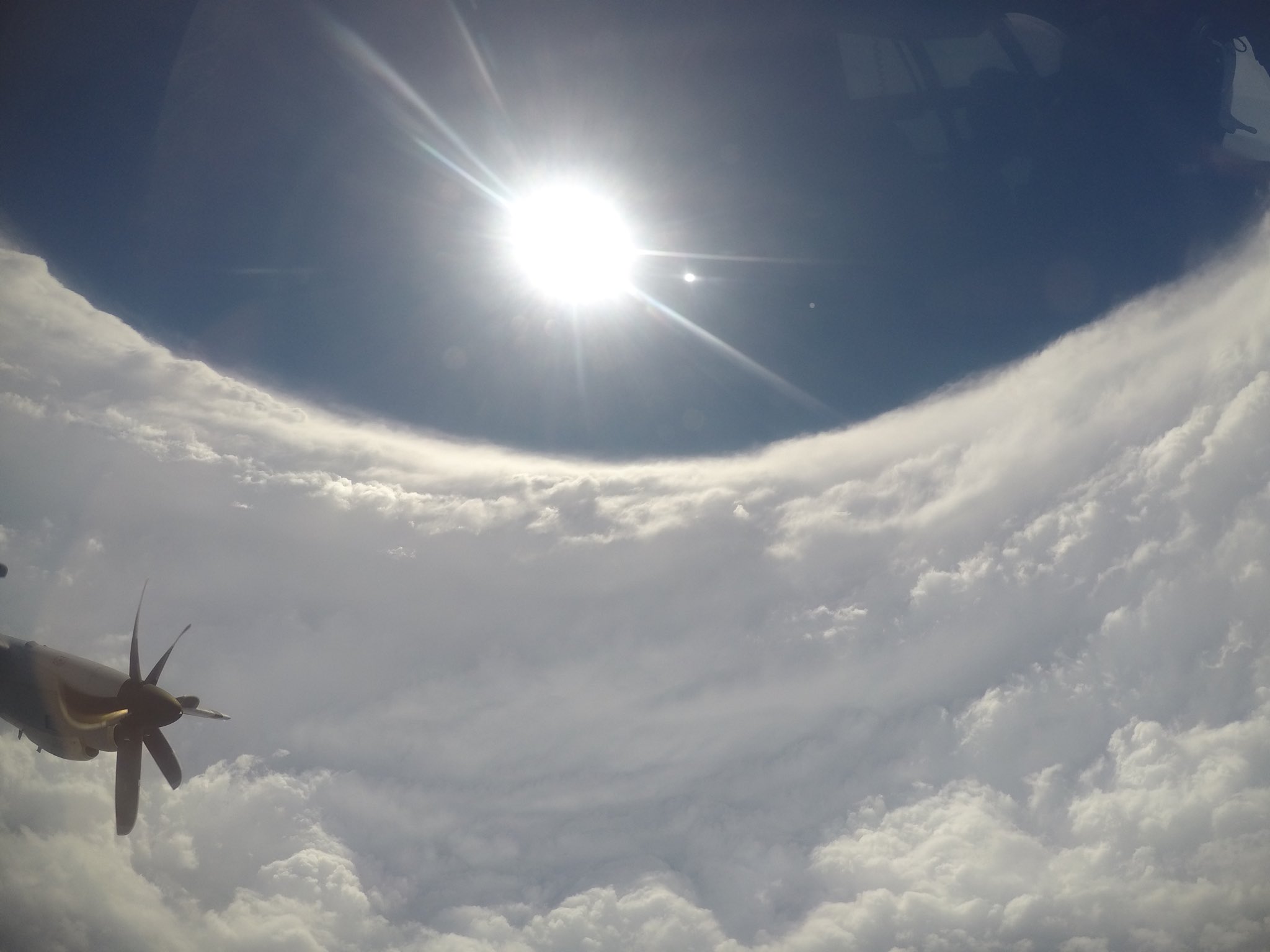
Inside the eye
The stadium effect is absolutely stunning when it sets up perfectly, Dorian's is definitely bound to become an iconic photo representation
new topics
-
Late Night with the Devil - a really good unusual modern horror film.
Movies: 29 minutes ago -
Cats Used as Live Bait to Train Ferocious Pitbulls in Illegal NYC Dogfighting
Social Issues and Civil Unrest: 1 hours ago -
The Good News According to Jesus - Episode 1
Religion, Faith, And Theology: 3 hours ago -
HORRIBLE !! Russian Soldier Drinking Own Urine To Survive In Battle
World War Three: 5 hours ago -
Bobiverse
Fantasy & Science Fiction: 8 hours ago -
Florida man's trip overseas ends in shock over $143,000 T-Mobile phone bill
Social Issues and Civil Unrest: 8 hours ago -
Former Labour minister Frank Field dies aged 81
People: 11 hours ago
top topics
-
President BIDEN Vows to Make Americans Pay More Federal Taxes in 2025 - Political Suicide.
2024 Elections: 17 hours ago, 20 flags -
Florida man's trip overseas ends in shock over $143,000 T-Mobile phone bill
Social Issues and Civil Unrest: 8 hours ago, 8 flags -
SETI chief says US has no evidence for alien technology. 'And we never have'
Aliens and UFOs: 12 hours ago, 7 flags -
Cats Used as Live Bait to Train Ferocious Pitbulls in Illegal NYC Dogfighting
Social Issues and Civil Unrest: 1 hours ago, 5 flags -
This is our Story
General Entertainment: 15 hours ago, 4 flags -
Former Labour minister Frank Field dies aged 81
People: 11 hours ago, 4 flags -
Bobiverse
Fantasy & Science Fiction: 8 hours ago, 3 flags -
HORRIBLE !! Russian Soldier Drinking Own Urine To Survive In Battle
World War Three: 5 hours ago, 2 flags -
Late Night with the Devil - a really good unusual modern horror film.
Movies: 29 minutes ago, 1 flags -
The Good News According to Jesus - Episode 1
Religion, Faith, And Theology: 3 hours ago, 0 flags
active topics
-
President BIDEN Vows to Make Americans Pay More Federal Taxes in 2025 - Political Suicide.
2024 Elections • 90 • : grey580 -
HORRIBLE !! Russian Soldier Drinking Own Urine To Survive In Battle
World War Three • 21 • : Justoneman -
"We're All Hamas" Heard at Columbia University Protests
Social Issues and Civil Unrest • 279 • : KrustyKrab -
How ageing is" immune deficiency"
Medical Issues & Conspiracies • 29 • : rickymouse -
Silent Moments --In Memory of Beloved Member TDDA
Short Stories • 70 • : zosimov -
-@TH3WH17ERABB17- -Q- ---TIME TO SHOW THE WORLD--- -Part- --44--
Dissecting Disinformation • 650 • : angelchemuel -
Thousands Of Young Ukrainian Men Trying To Flee The Country To Avoid Conscription And The War
Other Current Events • 135 • : twistedpuppy -
Late Night with the Devil - a really good unusual modern horror film.
Movies • 0 • : devilhunter69 -
New whistleblower Jason Sands speaks on Twitter Spaces last night.
Aliens and UFOs • 52 • : 0bserver1 -
SETI chief says US has no evidence for alien technology. 'And we never have'
Aliens and UFOs • 33 • : 0bserver1