It looks like you're using an Ad Blocker.
Please white-list or disable AboveTopSecret.com in your ad-blocking tool.
Thank you.
Some features of ATS will be disabled while you continue to use an ad-blocker.

DNWR, Corn Creek Road, Alamo Road, "Gotham City"
page: 110
share:
I made the trek up this trail about a month ago. VERY rough road, big rocks. I deflated my tires down to 30psi, otherwise my truck would have rattled
apart. Don't expect cell service, or any services for that matter, on this road. I did pass a DNWR truck and a few tourists. If you make this trek, BE
PREPARED. It's roughly 40 miles to the dry lake.
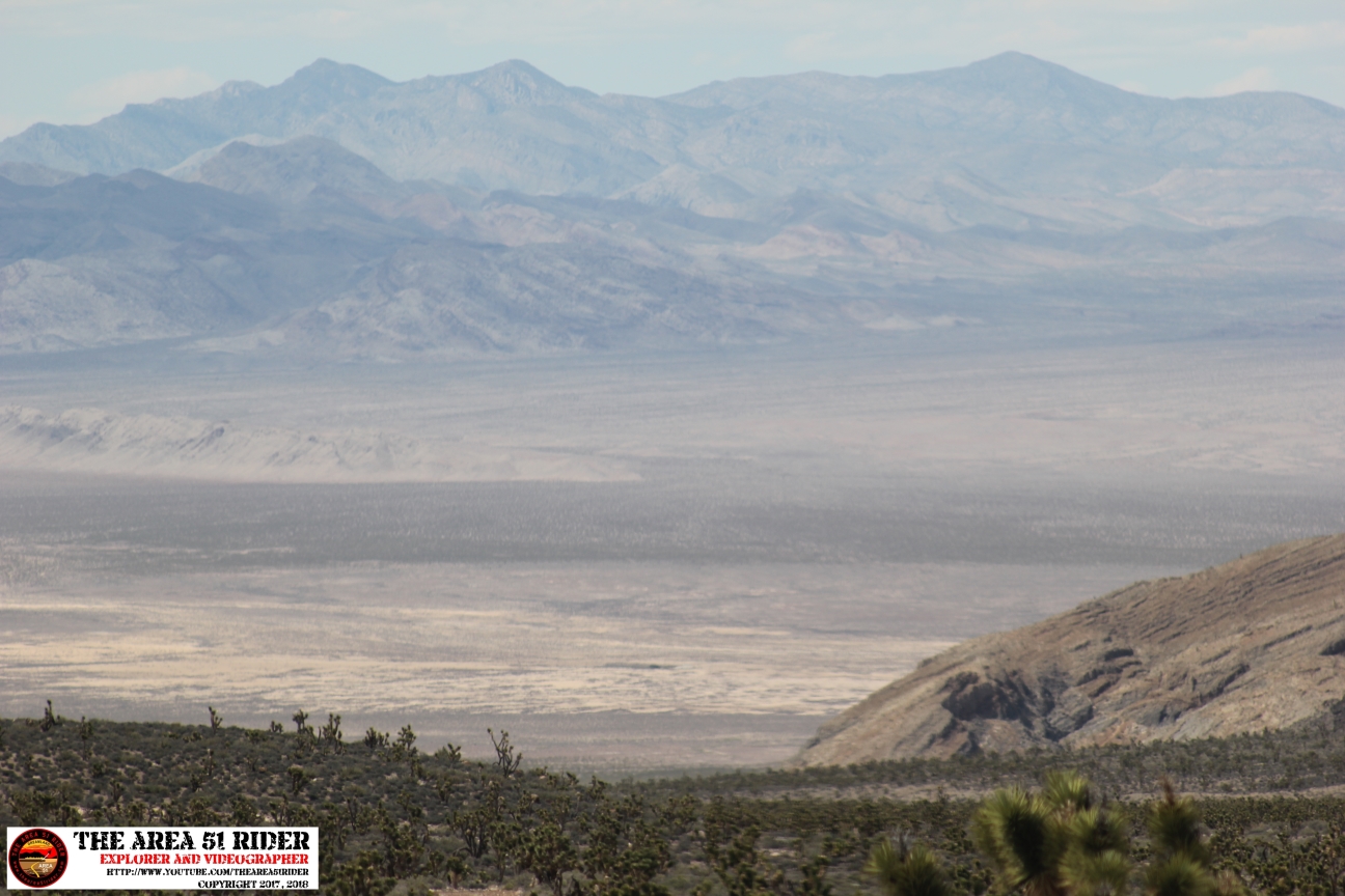
I've never been up this way, and if things go according to the DoD's plans, this whole area will be annexed in a few years. I wanted to go there before it becomes off-limits. Realistically you can only go as far as the dry lake. I drove far enough to see it, but didn't bother driving all the way.
www.fws.gov...
www.nevadawilderness.org...
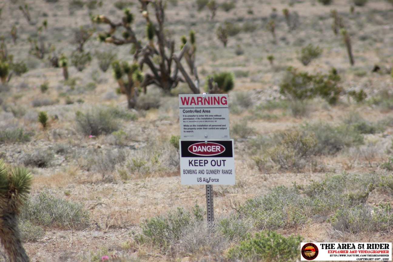
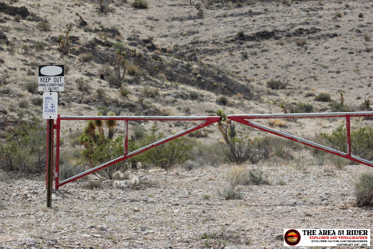
According to Google Earth and coordinates of the restricted area, you actually drive through part of the restricted area. Not much marks it other than these signs:
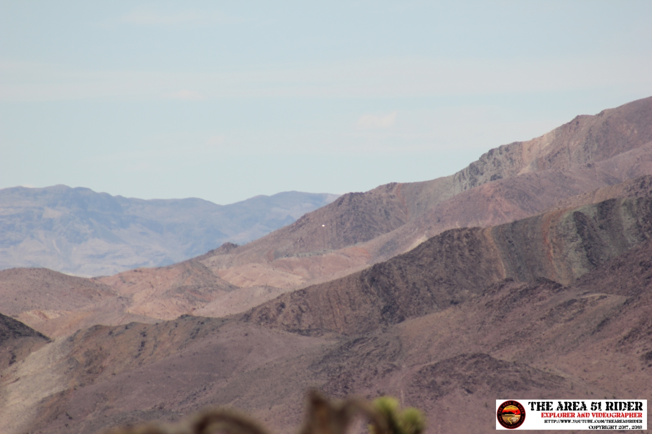
At one point to the west there is some type of reflector on a hillside. I tried to find it on my return trip so I could get a closeup picture with my big lens, but the sun had almost gone down. It could be some kind of passive reflector for bouncing radio signals. I can't find it on GE:
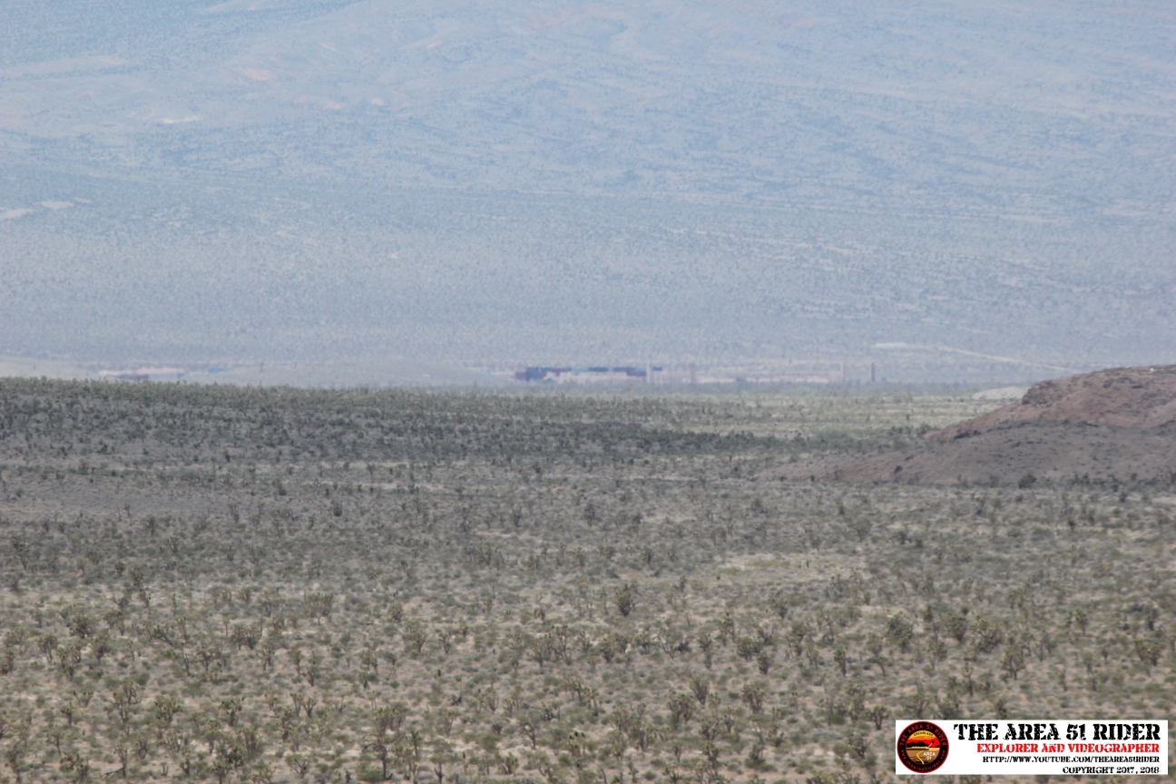
The other main reason I wanted to go, is you can see part of "Gotham City", the urban training environment they built out there with shipping containers. At a certain spot on the trail, to the west you can see part of this complex. I took some pics with my 400 mm lens:
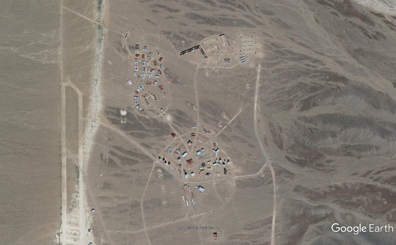
You can see the whole complex here on Google Earth:
36.784535°, -115.443297°
I couldn't find a whole lot of info about it, just doing a Google search. I did find this interesting article, which mentions it:
www.leg.state.nv.us...
For those interested, I will be posting a video of my journey on Youtube, sometime soon.
I've never been up this way, and if things go according to the DoD's plans, this whole area will be annexed in a few years. I wanted to go there before it becomes off-limits. Realistically you can only go as far as the dry lake. I drove far enough to see it, but didn't bother driving all the way.
www.fws.gov...
www.nevadawilderness.org...
According to Google Earth and coordinates of the restricted area, you actually drive through part of the restricted area. Not much marks it other than these signs:
At one point to the west there is some type of reflector on a hillside. I tried to find it on my return trip so I could get a closeup picture with my big lens, but the sun had almost gone down. It could be some kind of passive reflector for bouncing radio signals. I can't find it on GE:
The other main reason I wanted to go, is you can see part of "Gotham City", the urban training environment they built out there with shipping containers. At a certain spot on the trail, to the west you can see part of this complex. I took some pics with my 400 mm lens:
You can see the whole complex here on Google Earth:
36.784535°, -115.443297°
I couldn't find a whole lot of info about it, just doing a Google search. I did find this interesting article, which mentions it:
www.leg.state.nv.us...
For those interested, I will be posting a video of my journey on Youtube, sometime soon.
edit on 17-6-2018 by FosterVS because: Forgot
picture
edit on 17-6-2018 by FosterVS because: (no reason given)
Nothing makes me happier then when a member has field experience to contribute.
S%F
S%F
a reply to: FosterVS
You will have cell phone coverage all along the portion of the road that parallels 95, and even then after the turn towards the east.
I didn't have my Cricket sim enabled, but I was getting some AT&T tower as I got close to the dry lake.
For best coverage, you want the phone mounted to the window.
Often phones will indicate a connection and reasonable signal strength, but still not connect. A good example is Commnet service while on Brainwash Butte.
www.lazygranch.com...
Next time I'm bringing a can of gas. Not that I will need it, but rather for the fool that doesn't fill up. If you have a large SUV in low range, expect less than 10mpg. Your next gas is in Vegas or I suppose Indian Springs. Plan accordingly.
You will have cell phone coverage all along the portion of the road that parallels 95, and even then after the turn towards the east.
Cell phone service ends around N36 37 6.67 W115 21 45.13 (about a mile west of Hidden Forrest Road) That is about 13 miles line of sight from the tower.
I didn't have my Cricket sim enabled, but I was getting some AT&T tower as I got close to the dry lake.
For best coverage, you want the phone mounted to the window.
Often phones will indicate a connection and reasonable signal strength, but still not connect. A good example is Commnet service while on Brainwash Butte.
www.lazygranch.com...
Next time I'm bringing a can of gas. Not that I will need it, but rather for the fool that doesn't fill up. If you have a large SUV in low range, expect less than 10mpg. Your next gas is in Vegas or I suppose Indian Springs. Plan accordingly.
originally posted by: Subrosabelow
a reply to: FosterVS
Man, that would be really cool to see. I wonder what that area will be used for once the annexing occurs.
The land grab is in this link:
www.abovetopsecret.com...
No big secret. The USAF claims they need more room for the F-35. In practice, this location isn't particularly useful for training since the Janet's use this airspace.
While it is best not to cross the dry lake without a chase car, I have driven most of the lake from the Alamo side. These are the sand dunes.
www.lazygranch.com...
I didn't bother to photograph them, but there are "number barrels" by the Nellis side of the dry lake. (Or at least there were. I haven't done that trip in years.) Number barrels are just markers for contractors. In theory they are found where the roads are "wired." If you are a contractor, you get on the radio and report the number on the barrel. Then when the alarm is tripped, security doesn't bother to investigate.
new topics
-
Hate makes for strange bedfellows
US Political Madness: 6 minutes ago -
Who guards the guards
US Political Madness: 2 hours ago -
Has Tesla manipulated data logs to cover up auto pilot crash?
Automotive Discussion: 4 hours ago -
whistleblower Captain Bill Uhouse on the Kingman UFO recovery
Aliens and UFOs: 9 hours ago -
1980s Arcade
General Chit Chat: 11 hours ago
top topics
-
Lawsuit Seeks to ‘Ban the Jab’ in Florida
Diseases and Pandemics: 17 hours ago, 21 flags -
CIA botched its handling of sexual assault allegations, House intel report says
Breaking Alternative News: 14 hours ago, 10 flags -
whistleblower Captain Bill Uhouse on the Kingman UFO recovery
Aliens and UFOs: 9 hours ago, 9 flags -
Deadpool and Wolverine
Movies: 12 hours ago, 4 flags -
1980s Arcade
General Chit Chat: 11 hours ago, 4 flags -
Teenager makes chess history becoming the youngest challenger for the world championship crown
Other Current Events: 13 hours ago, 3 flags -
Who guards the guards
US Political Madness: 2 hours ago, 3 flags -
Has Tesla manipulated data logs to cover up auto pilot crash?
Automotive Discussion: 4 hours ago, 1 flags -
Hate makes for strange bedfellows
US Political Madness: 6 minutes ago, 1 flags
10