It looks like you're using an Ad Blocker.
Please white-list or disable AboveTopSecret.com in your ad-blocking tool.
Thank you.
Some features of ATS will be disabled while you continue to use an ad-blocker.

North Texas Tornado watch issued: Increasing likely-hood of a severe weather outbreak
page: 3share:
a reply to: TechniXcality
Please be safe! You're doing an awesome job keeping us up to date on the analysis but please also let us know how you are doing as well brother.
Please be safe! You're doing an awesome job keeping us up to date on the analysis but please also let us know how you are doing as well brother.
Folks camped at Tx Motor Speedway about to be hit with some very bad weather. Some in RV's and tents
Thoughts with them
Thoughts with them
a reply to: SonOfThor
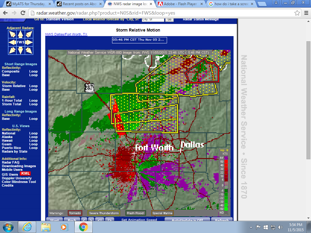
K guys current this storm is not tornado warned but i expect it to be any moment notice the helicity ( a combination of the spin and the linear motion ) which is shown in red and green colors where the red and green meet is indicating rotation..
Currently in southeast Decatur county moving into Southwest Denton county i expect this area to be tornado warned shortly.
and thank you sir, i am safe hoping i can get some pics for you all soon!
Once again you have not got action yet the line is still forming will post more radar pics stay safe everyone!
edit on 5-11-2015 by
TechniXcality because: (no reason given)
Brandon's feed is looking pretty hairy right now
Edit: strong winds passed him, he's going back after it now.
Edit: strong winds passed him, he's going back after it now.
edit on 5/11/15 by OpenEars123 because: (no reason given)
a reply to: liveandlearn
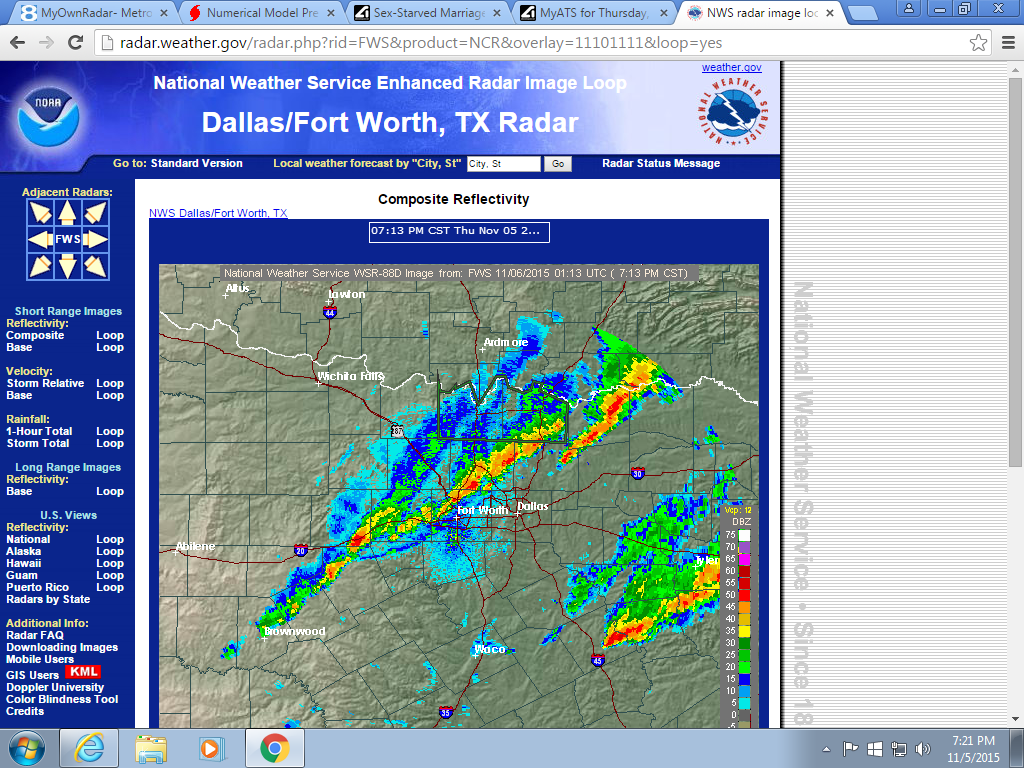
Here is a pic of the current radar, as the sun sets and heating is lost we can hope these storms may die down, as many are now showing characteristic weakening (and some redeveloping), this may NOT be the case, but i hope it is. However as the radar depicts and because of a extremely strong LLJ (low level jet) we will all continue to see storms and beneficial rain tonight.
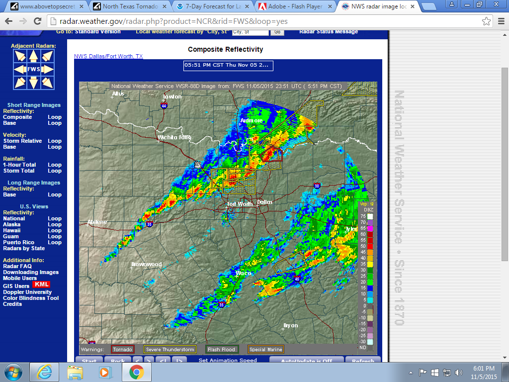
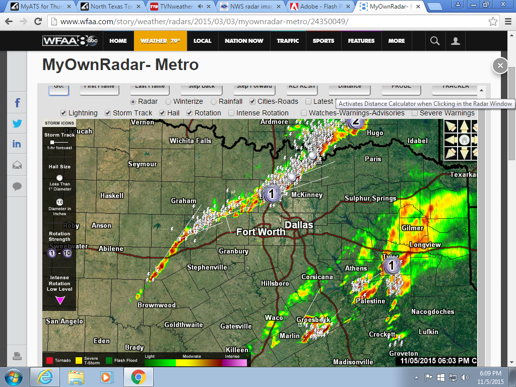
and a better shot to show you more redevelepment off to the west, i have rotation markers toggled lighting and storm track, WE are NOT in the clear yet...
Here is a pic of the current radar, as the sun sets and heating is lost we can hope these storms may die down, as many are now showing characteristic weakening (and some redeveloping), this may NOT be the case, but i hope it is. However as the radar depicts and because of a extremely strong LLJ (low level jet) we will all continue to see storms and beneficial rain tonight.
and a better shot to show you more redevelepment off to the west, i have rotation markers toggled lighting and storm track, WE are NOT in the clear yet...
edit on 5-11-2015 by TechniXcality because: (no reason given)
Geat thread TechniXcality- I always enjoy your posts!
Thanks so much for putting this together, I am near Denton/Little Elm and having some hairy wind/rain right now but nothing too serious yet.
I met a storm chaser at college a few semesters ago but can't remember his name! He might have been with KC chasers. Very cool. I was watching Brandon's feed earlier- really clear and good views! (maybe TOOO good) o-O lol
a reply to: Starcrossd
Hey, thank you for your kind words stay safe, the storms above you have weakened significantly however they are not done firing so stay vigilant, looks like you have a nice lighting show, mine is coming soon will continue to update. We are not in the clear yet, but we can hope with the loss of heating these storms continue to take on the more characteristic MCS structures instead of super-cellular.
I used to chase, i don't have the time anymore i love weather kind of sucks.. Anyway thanks
double
edit on 5-11-2015 by TechniXcality because: (no reason given)
a reply to: SonOfThor
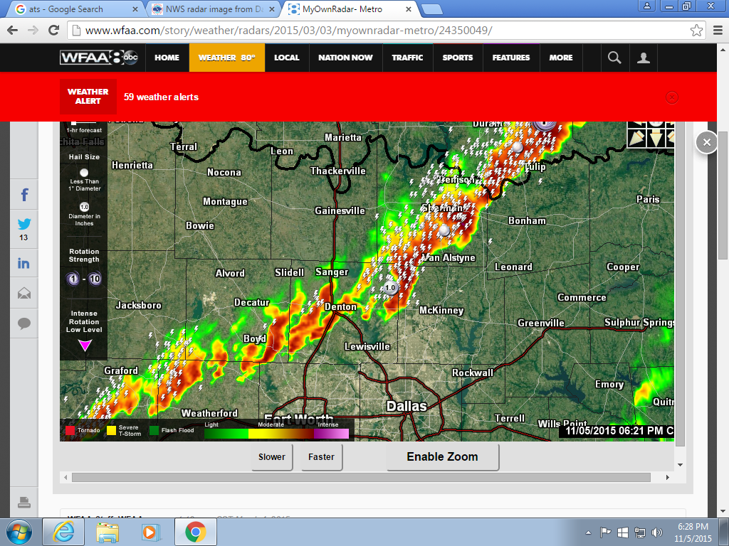
The storms have ingested rain cooled air from outflow boundaries, that combined with the loss of heating has led to a diminishing of intensity we will still see beneficial rain but it appears now that the severe weather threat has passed.
i am happy that all of us were safe, till next time everyone
The storms have ingested rain cooled air from outflow boundaries, that combined with the loss of heating has led to a diminishing of intensity we will still see beneficial rain but it appears now that the severe weather threat has passed.
i am happy that all of us were safe, till next time everyone
edit on 5-11-2015 by TechniXcality because: (no reason given)
new topics
-
Is the origin for the Eye of Horus the pineal gland?
General Conspiracies: 1 hours ago -
Man sets himself on fire outside Donald Trump trial
Mainstream News: 1 hours ago -
Biden says little kids flip him the bird all the time.
2024 Elections: 1 hours ago -
The Democrats Take Control the House - Look what happened while you were sleeping
US Political Madness: 2 hours ago -
Sheetz facing racial discrimination lawsuit for considering criminal history in hiring
Social Issues and Civil Unrest: 2 hours ago -
In an Historic First, In N Out Burger Permanently Closes a Location
Mainstream News: 4 hours ago -
MH370 Again....
Disaster Conspiracies: 5 hours ago -
Are you ready for the return of Jesus Christ? Have you been cleansed by His blood?
Religion, Faith, And Theology: 7 hours ago -
Chronological time line of open source information
History: 8 hours ago -
A man of the people
Medical Issues & Conspiracies: 9 hours ago
top topics
-
In an Historic First, In N Out Burger Permanently Closes a Location
Mainstream News: 4 hours ago, 14 flags -
The Democrats Take Control the House - Look what happened while you were sleeping
US Political Madness: 2 hours ago, 9 flags -
A man of the people
Medical Issues & Conspiracies: 9 hours ago, 8 flags -
Thousands Of Young Ukrainian Men Trying To Flee The Country To Avoid Conscription And The War
Other Current Events: 15 hours ago, 7 flags -
Biden says little kids flip him the bird all the time.
2024 Elections: 1 hours ago, 5 flags -
Man sets himself on fire outside Donald Trump trial
Mainstream News: 1 hours ago, 5 flags -
12 jurors selected in Trump criminal trial
US Political Madness: 17 hours ago, 4 flags -
4 plans of US elites to defeat Russia
New World Order: 11 hours ago, 4 flags -
Are you ready for the return of Jesus Christ? Have you been cleansed by His blood?
Religion, Faith, And Theology: 7 hours ago, 3 flags -
Sheetz facing racial discrimination lawsuit for considering criminal history in hiring
Social Issues and Civil Unrest: 2 hours ago, 3 flags
active topics
-
The Democrats Take Control the House - Look what happened while you were sleeping
US Political Madness • 20 • : CriticalStinker -
Man sets himself on fire outside Donald Trump trial
Mainstream News • 17 • : FlyersFan -
Biden says little kids flip him the bird all the time.
2024 Elections • 8 • : Astrocometus -
12 jurors selected in Trump criminal trial
US Political Madness • 82 • : Xtrozero -
Are you ready for the return of Jesus Christ? Have you been cleansed by His blood?
Religion, Faith, And Theology • 18 • : mysterioustranger -
Israeli Missile Strikes in Iran, Explosions in Syria + Iraq
World War Three • 101 • : CarlLaFong -
Thousands Of Young Ukrainian Men Trying To Flee The Country To Avoid Conscription And The War
Other Current Events • 26 • : Lazy88 -
George Knapp AMA on DI
Area 51 and other Facilities • 27 • : TheValeyard -
4 plans of US elites to defeat Russia
New World Order • 35 • : Oldcarpy2 -
Sheetz facing racial discrimination lawsuit for considering criminal history in hiring
Social Issues and Civil Unrest • 6 • : chiefsmom