It looks like you're using an Ad Blocker.
Please white-list or disable AboveTopSecret.com in your ad-blocking tool.
Thank you.
Some features of ATS will be disabled while you continue to use an ad-blocker.

Mysterious Underwater Structures Near Malibu Anomaly
page: 15
share:
Hello ATSers
While listening to Jimmy Church's program discussing the recent Malibu anomaly, I decided to look around on Google Earth to find any correlating structures off the southern coast of California. Church discussed how the Chumash tribe discussed an ancient people who inhabited the region, but were wiped out due to flooding. I have many friends who live on Catalina Island/LA who have seen many UFO's coming and going out of the water as well. I am in no way an expert, however some of the images I found were intriguing enough for me to post them on here, with the hopes of an expert giving some more info on these pictures. Hope you all enjoy..
33.704861877°
-118.534845494°
Notice the right angles and these mysterious mounds(could be underwater volcanoes, however I could not find any other structures around this area) as well as what could be seen as roads in between the structures.
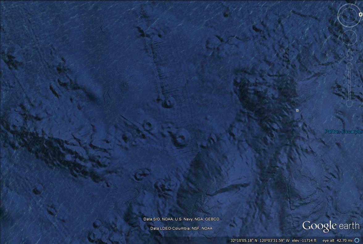
This is the island off of the backside of Catalina(a bit north as well)
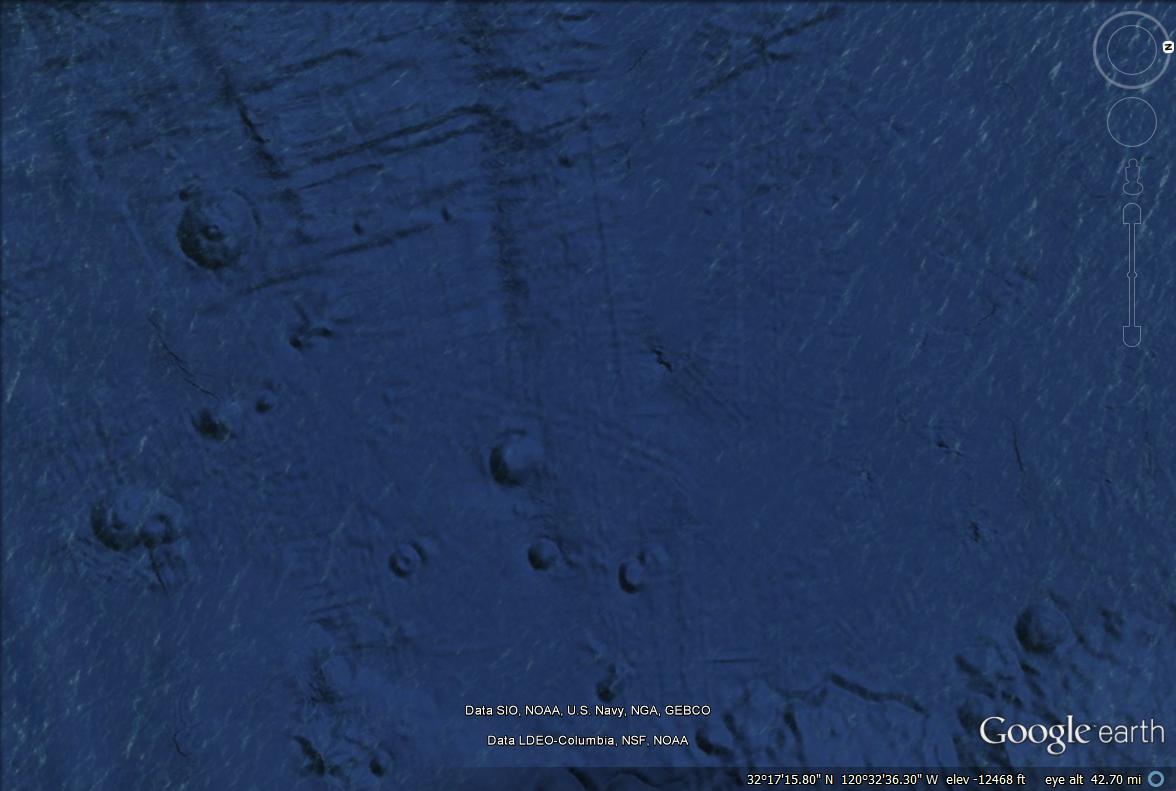
I first noticed the similar shape to the Malibu structure as well as a square like shape surrounding the island(could well be google earth pixelation issue)...however when I zoomed into the island I noticed columns and what could be a door and stair like structure.
33.704861877°
-118.534845494°
possibly a staircase
door like structure
I understand that these structures could be nothing to do with aliens at all and they could very well be natural objects. However, the possibility of these being linked to an ancient civilization is intriguing. I also was pondering the door like structure being the navy's submarine entrance to travelling under the continental plates.
While listening to Jimmy Church's program discussing the recent Malibu anomaly, I decided to look around on Google Earth to find any correlating structures off the southern coast of California. Church discussed how the Chumash tribe discussed an ancient people who inhabited the region, but were wiped out due to flooding. I have many friends who live on Catalina Island/LA who have seen many UFO's coming and going out of the water as well. I am in no way an expert, however some of the images I found were intriguing enough for me to post them on here, with the hopes of an expert giving some more info on these pictures. Hope you all enjoy..
33.704861877°
-118.534845494°
Notice the right angles and these mysterious mounds(could be underwater volcanoes, however I could not find any other structures around this area) as well as what could be seen as roads in between the structures.
This is the island off of the backside of Catalina(a bit north as well)
I first noticed the similar shape to the Malibu structure as well as a square like shape surrounding the island(could well be google earth pixelation issue)...however when I zoomed into the island I noticed columns and what could be a door and stair like structure.
33.704861877°
-118.534845494°
possibly a staircase
door like structure
I understand that these structures could be nothing to do with aliens at all and they could very well be natural objects. However, the possibility of these being linked to an ancient civilization is intriguing. I also was pondering the door like structure being the navy's submarine entrance to travelling under the continental plates.
edit on 26-7-2014 by kevinp2300 because: (no reason given)
edit on 26-7-2014 by kevinp2300 because: (no reason
given)
edit on 7/26/2014 by tothetenthpower because: --Mod Edit--All Caps, don't use 'em!
edit on 26-7-2014 by
kevinp2300 because: (no reason given)
edit on 26-7-2014 by kevinp2300 because: (no reason given)
edit on 26-7-2014 by
kevinp2300 because: (no reason given)
a reply to: kevinp2300
Ah thanks OP
But it have been discussed many times on ATS
www.abovetopsecret.com...
I think Phage was right on this one..
Ah thanks OP
But it have been discussed many times on ATS
www.abovetopsecret.com...
I think Phage was right on this one..
difference i the resolution of the sounding data is plain as day.
Low resolution data = vertical
High resolution data = slope
Interesting.
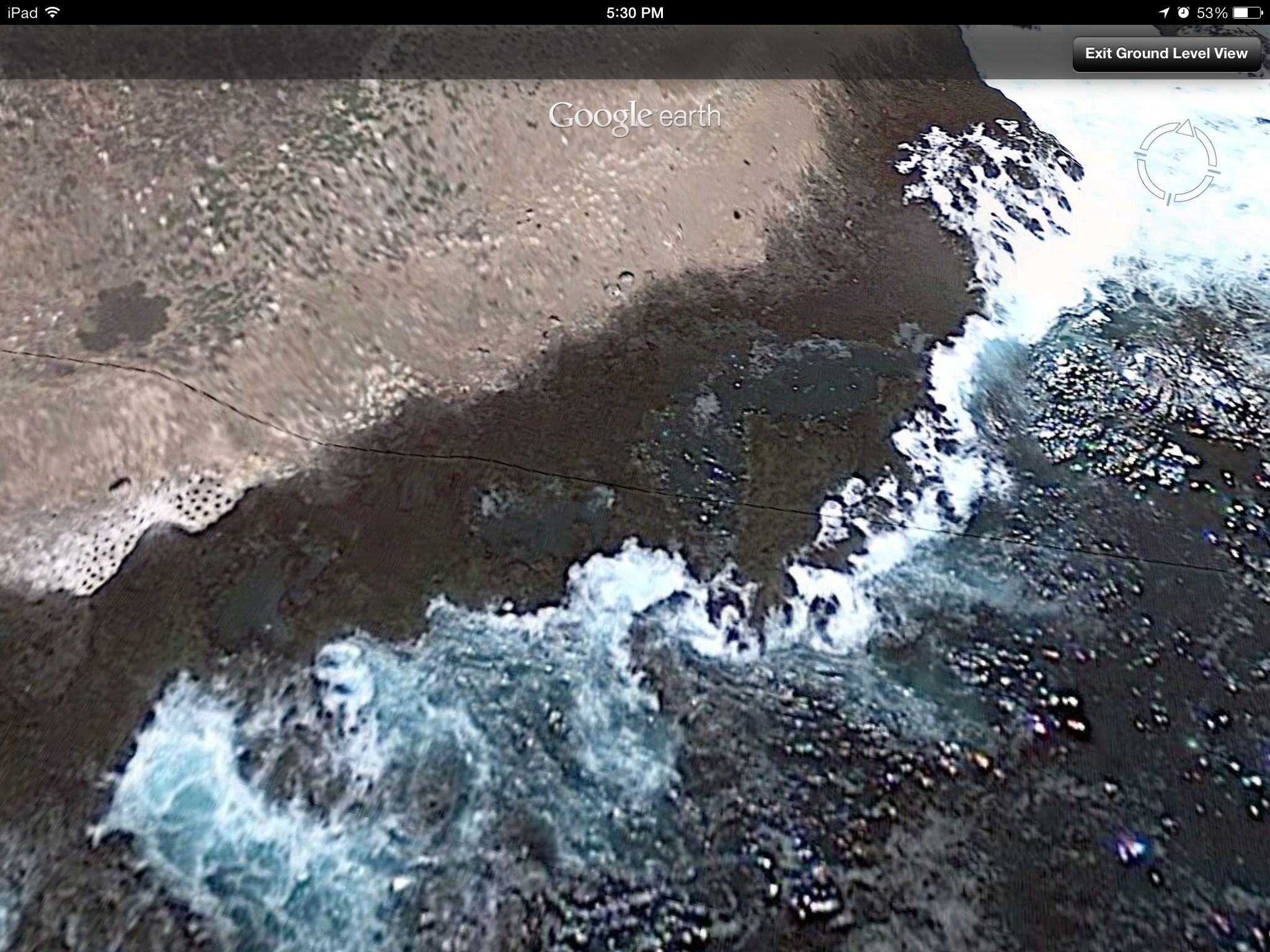
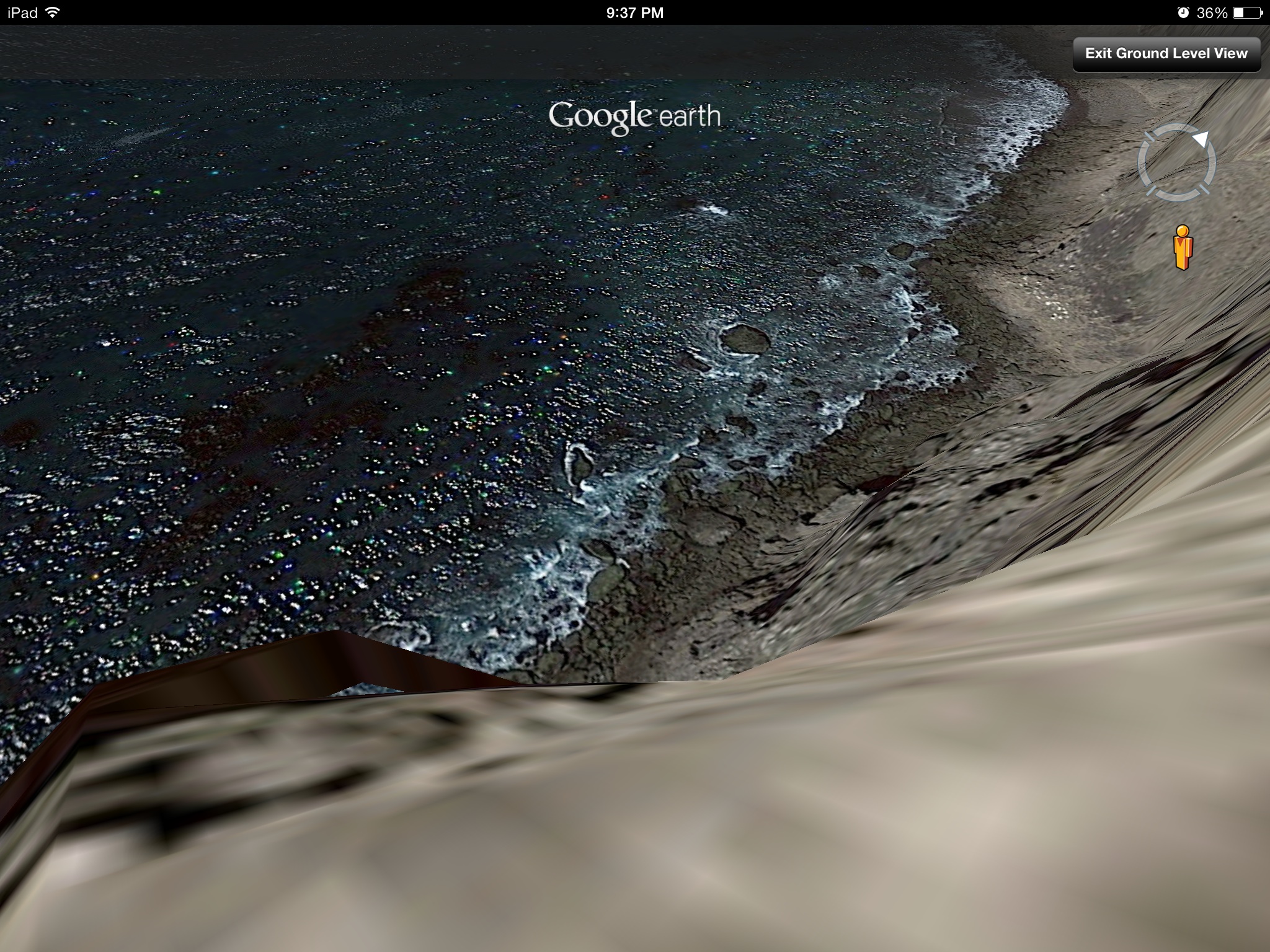
I'm thick. I don't know how google earth ocean works. I thought it went underwater. So you just zoom in on the surface?
If that's how it works. Here's my screenshot
I'm thick. I don't know how google earth ocean works. I thought it went underwater. So you just zoom in on the surface?
If that's how it works. Here's my screenshot
edit on 26-7-2014 by violet because: (no reason given)
a reply to: Spacespider
I agree. After a few hours of searching underwater, I noticed the pillars were common in a lot of the geography around this area, therefore probably something to do with Google's mapping system. Could this could be applied to the Malibu "base", therefore making it less credible? I believe so...However, the possible set of stairs and doorway in the Google Earth images I posted, combined with the the supposed "alien base" on the backside of Catalina and the reports of our gov't meeting with ET's on one of those islands(I heard it on Jimmy Church's program as well as from Project Camelot, doesn't mean it is true) and made me want to post these images. Hopefully other people take a look around and see if they find something interesting.
I agree. After a few hours of searching underwater, I noticed the pillars were common in a lot of the geography around this area, therefore probably something to do with Google's mapping system. Could this could be applied to the Malibu "base", therefore making it less credible? I believe so...However, the possible set of stairs and doorway in the Google Earth images I posted, combined with the the supposed "alien base" on the backside of Catalina and the reports of our gov't meeting with ET's on one of those islands(I heard it on Jimmy Church's program as well as from Project Camelot, doesn't mean it is true) and made me want to post these images. Hopefully other people take a look around and see if they find something interesting.
edit on 26-7-2014 by kevinp2300 because: (no reason given)
From Huffington Post
The video
A little more than 6 miles off the coast of Point Dume in Malibu, California, an unusual-looking structure sits on the sea bed floor. Based on images obtained on Google Earth, the oval-shaped object has a huge flat top and what appear to be pillars or columns that seem to reveal the entrance to a darker, inner place. The anomaly -- for the moment, we'll call it that -- is approximately 2,000 feet below the surface of the water, measuring nearly 3 miles wide. What exactly is this thing?
The video
edit on 26-7-2014 by violet because: (no reason given)
Interesting.
I'm thick. I don't know how google earth ocean works. I thought it went underwater. So you just zoom in on the surface?
If that's how it works. Here's my screenshot
It seems as if you do not have the latest Google Earth installed. The slider(the right hand side of my images I posted, below the compass) is what you are missing and if you download Google Earth 5.0 or above, it should work for you. It allows you to zoom in and out for closer images.
edit on
26-7-2014 by kevinp2300 because: (no reason given)
a reply to: kevinp2300
Ok thanks. I'm on iPad. It's the latest app version being offered for it. I see no updates available
I have ocean layer turned on though.
It doesn't really come with a slider. I zoom in by pinching out.
Ok thanks. I'm on iPad. It's the latest app version being offered for it. I see no updates available
I have ocean layer turned on though.
It doesn't really come with a slider. I zoom in by pinching out.
edit on 26-7-2014 by violet because: (no reason given)
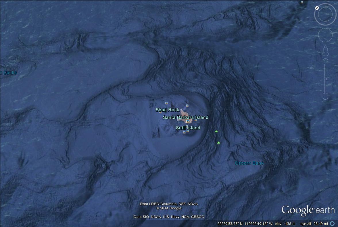
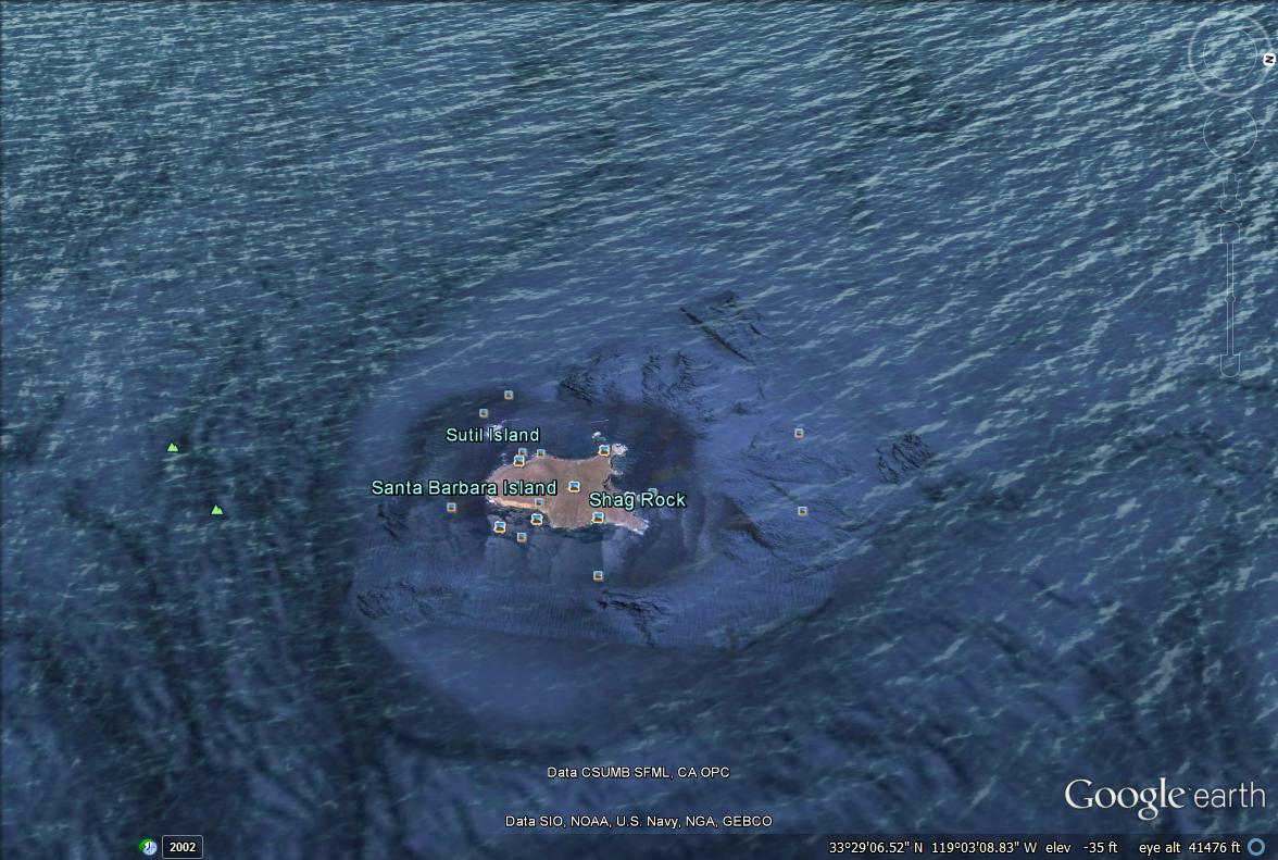
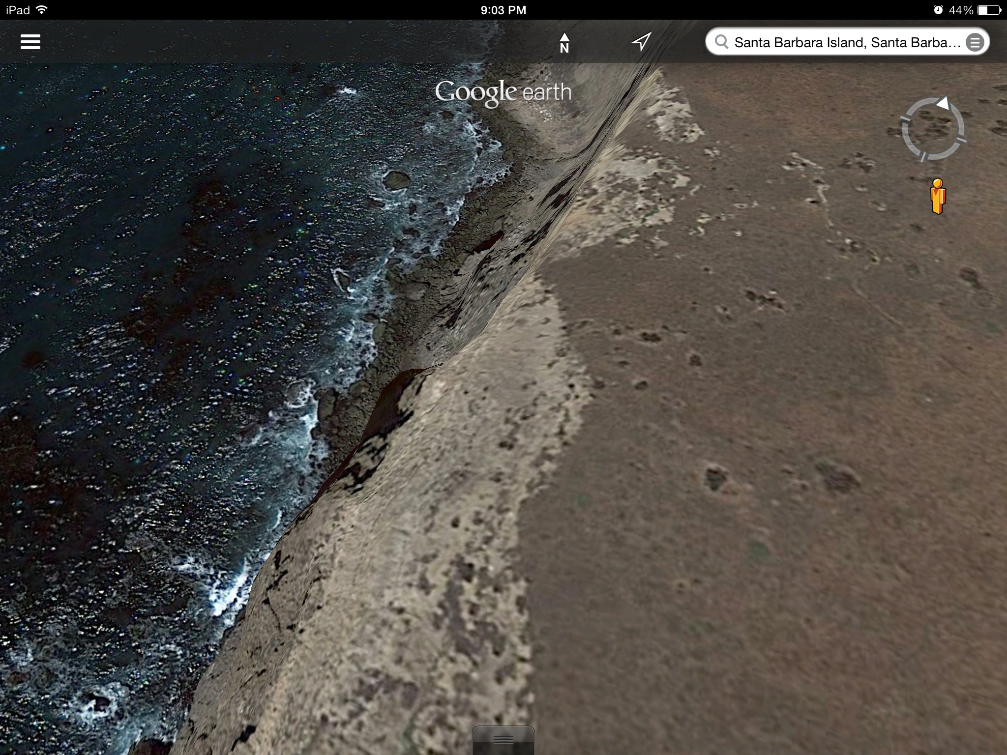
It went all 3D on me. Looks to be lots of caverns under that Santa Barbara island
I thought this line or road, going across part of that island and continuing into or over the water looks strange. What is that?
A big crack from an EQ maybe
I thought this line or road, going across part of that island and continuing into or over the water looks strange. What is that?
A big crack from an EQ maybe
edit on 26-7-2014 by violet because: (no reason given)
edit on 26-7-2014 by violet because: (no
reason given)
a reply to: violet
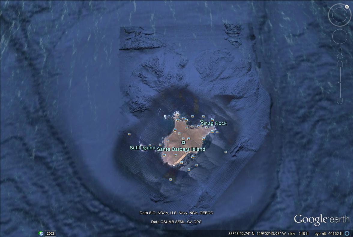
Yea, that is a weird line. It curves in places as well which means it probably isnt from google's end. sea caves are the result of numerous sea level changes...the largest sea cave in the world is on Santa Cruz island, which is one of the Channel Islands. Maybe since there is evidence of sea level changes, there was also a lost civilization in the area as well.
Yea, that is a weird line. It curves in places as well which means it probably isnt from google's end. sea caves are the result of numerous sea level changes...the largest sea cave in the world is on Santa Cruz island, which is one of the Channel Islands. Maybe since there is evidence of sea level changes, there was also a lost civilization in the area as well.
a reply to: kevinp2300
Yes it's odd, unfortunately when I went to un zoom to get another pic, it crashed, so not sure where the exact area was but it had that little blotch spot there as a clue. It doesn't show the coordinates. . I didn't crop those off. I'm not too good with google earth. Hardly use it.
Yes it's odd, unfortunately when I went to un zoom to get another pic, it crashed, so not sure where the exact area was but it had that little blotch spot there as a clue. It doesn't show the coordinates. . I didn't crop those off. I'm not too good with google earth. Hardly use it.
edit on 26-7-2014 by violet because: (no reason given)
edit on 26-7-2014 by violet because: (no reason given)
a reply to: irgust
Yeah, but usually the seams where they get stitched together are straight lines.
ETA
I suppose it could be a wire or hair on the camera lens, but is that possible when taken from space?
I'll see if I can find it again to take another pic
ETA
Might be because it was in 3D when I was viewing it and the stitching lines are rendered curved once that happens
Yeah, but usually the seams where they get stitched together are straight lines.
ETA
I suppose it could be a wire or hair on the camera lens, but is that possible when taken from space?
I'll see if I can find it again to take another pic
edit on 26-7-2014 by violet because: (no reason given)
ETA
Might be because it was in 3D when I was viewing it and the stitching lines are rendered curved once that happens
edit on 26-7-2014 by
violet because: (no reason given)
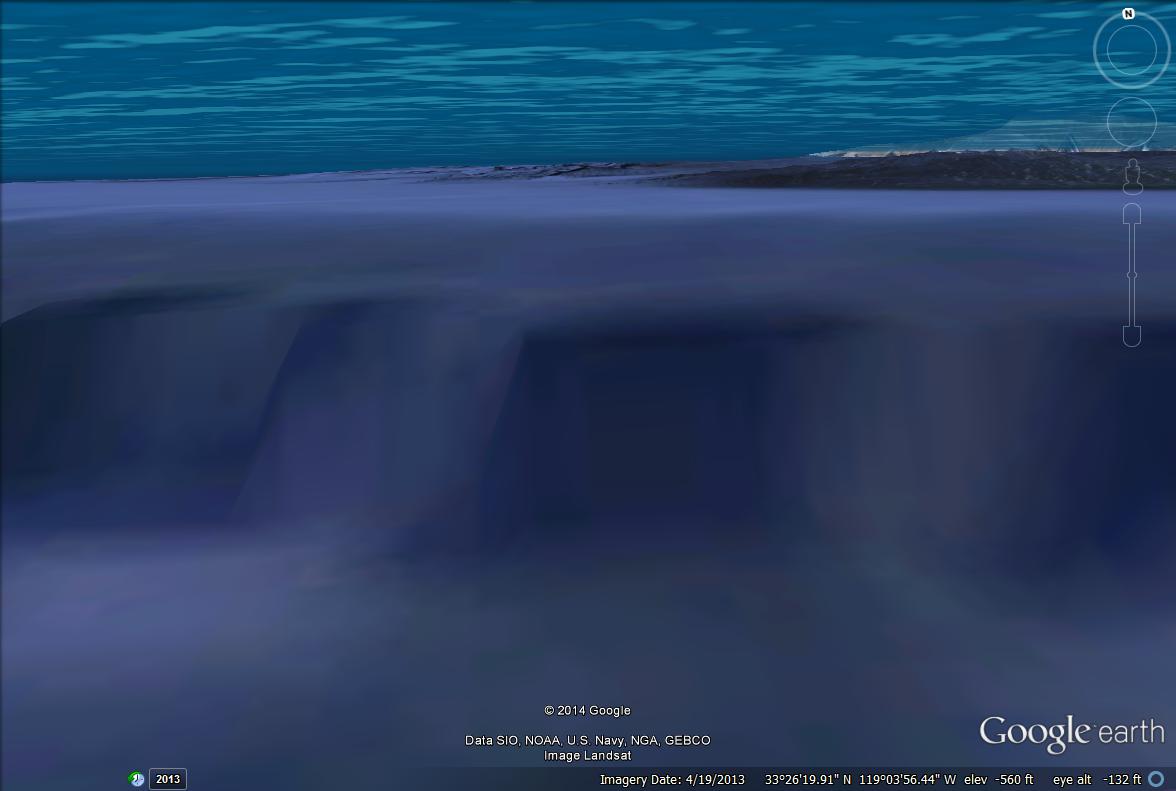
Well I found the spot where I was but couldn't get a look at it without 3D . I can't get that off now. Turned it off and even closed the app down.
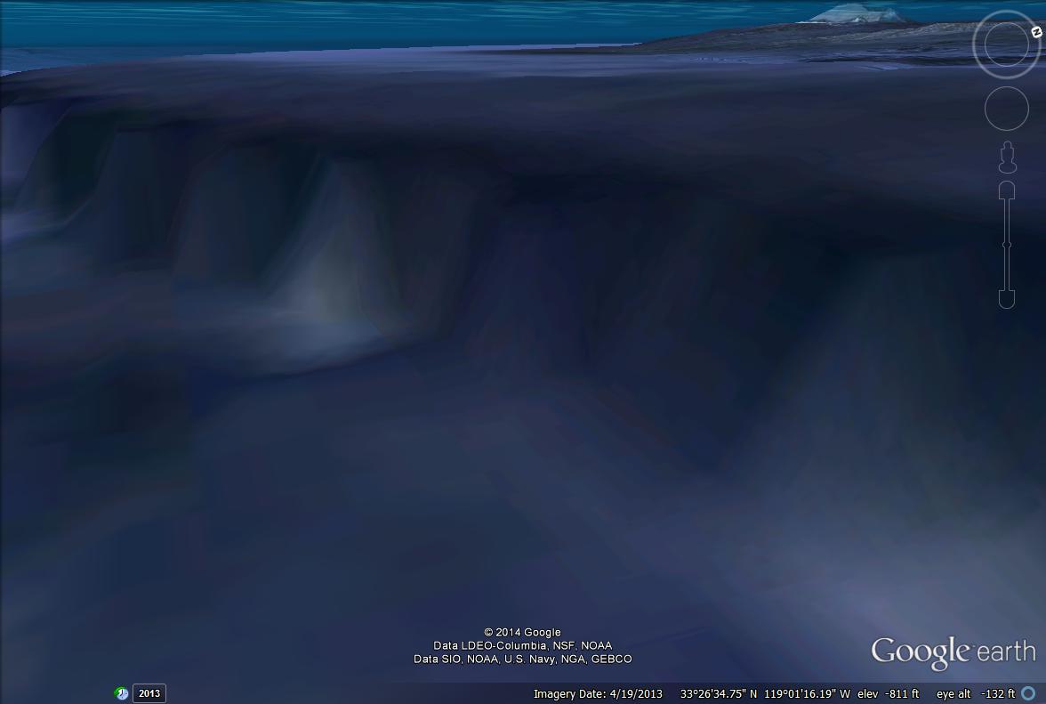
I'm stuck in this 3D, but I found something on the islznd I don't quite understand. Will upload in a sec.
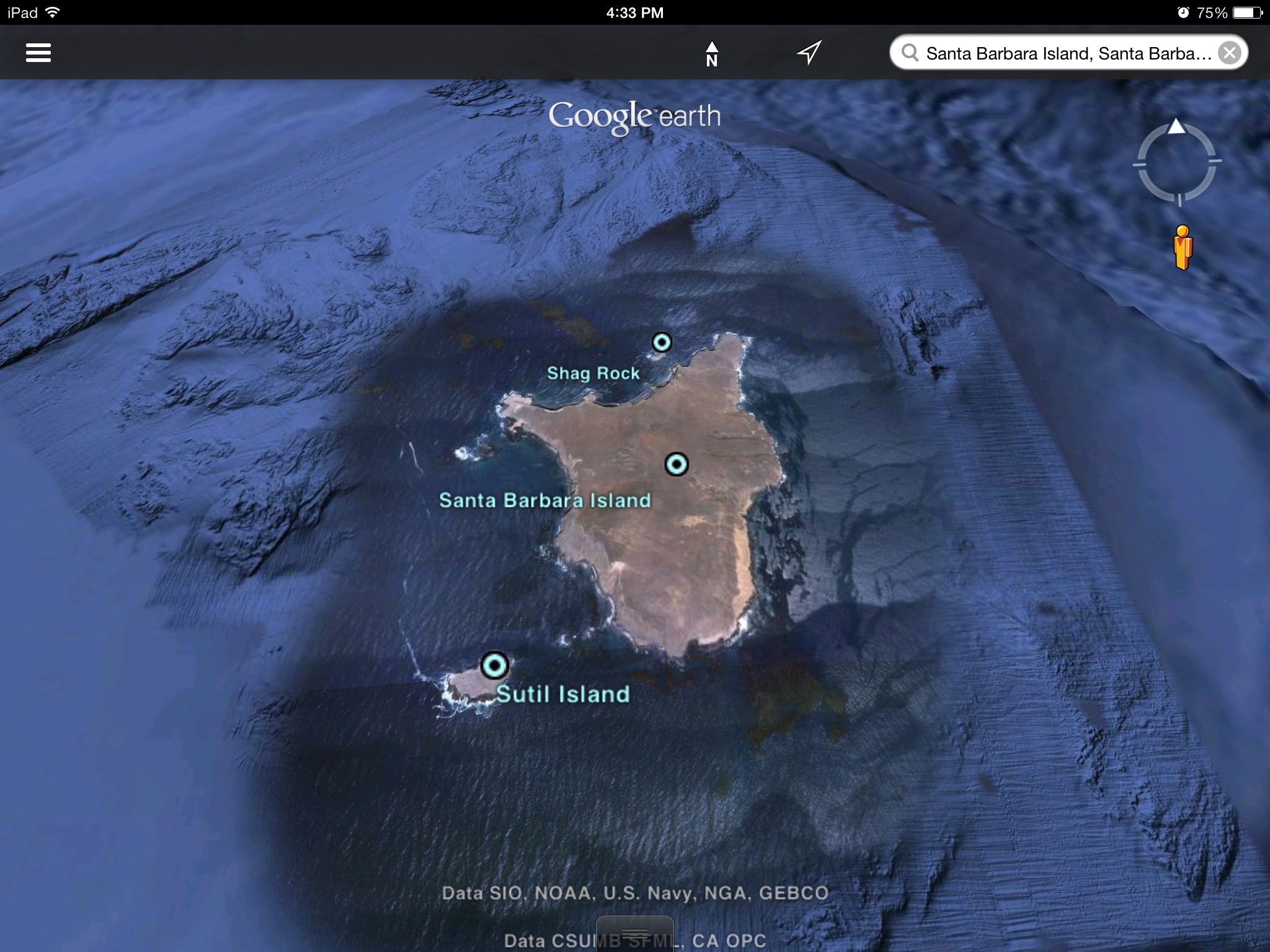
I thought this was odd.
The same Santa Barbara island
As viewed in 3D
Looks like dark rock. This island looks to be all jagged rock.
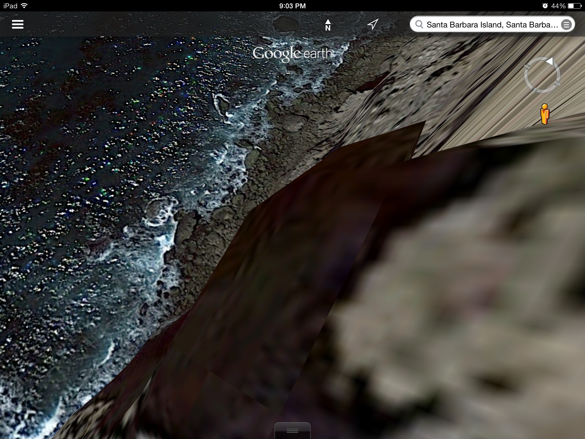
As I turn and move around
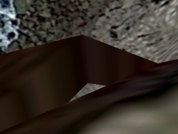
Would this be a natural formation with a triangular straight lined hole like this?
A closer look.
Keep in mind I'm not very good with google earth. Rarely do I use the 3D. I can never even get that to work, but it went that way by accident
To mark where this was, it's the dark area on the cliff where the street view icon man is
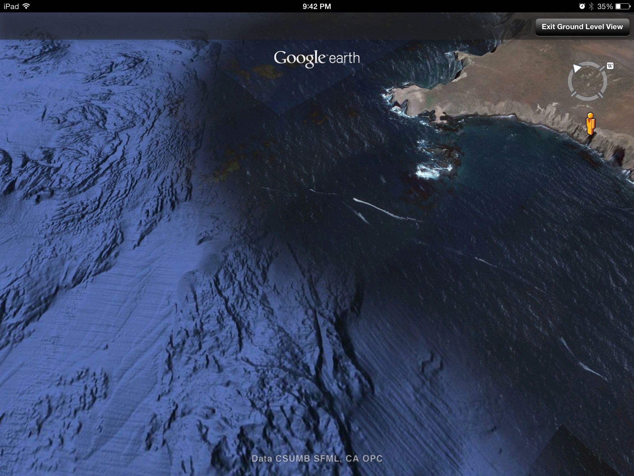
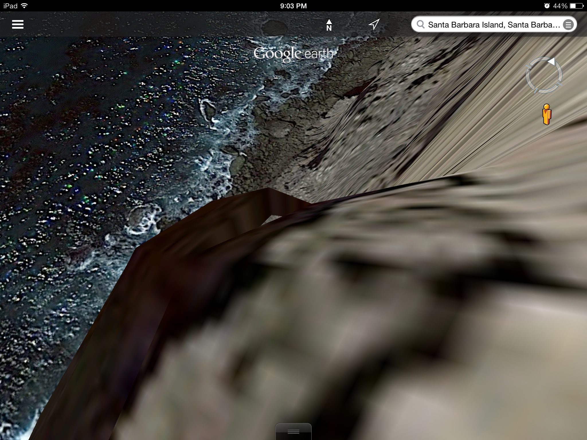
From another angle, or other side, where you can see the water through it
The same Santa Barbara island
As viewed in 3D
Looks like dark rock. This island looks to be all jagged rock.
As I turn and move around
Would this be a natural formation with a triangular straight lined hole like this?
A closer look.
Keep in mind I'm not very good with google earth. Rarely do I use the 3D. I can never even get that to work, but it went that way by accident
To mark where this was, it's the dark area on the cliff where the street view icon man is
edit on 26-7-2014 by violet because: (no reason given)
edit on 26-7-2014 by violet because: (no
reason given)
From another angle, or other side, where you can see the water through it
edit on 26-7-2014 by violet because: Adding stuff
new topics
-
George Knapp AMA on DI
Area 51 and other Facilities: 5 hours ago -
Not Aliens but a Nazi Occult Inspired and then Science Rendered Design.
Aliens and UFOs: 5 hours ago -
Louisiana Lawmakers Seek to Limit Public Access to Government Records
Political Issues: 7 hours ago -
The Tories may be wiped out after the Election - Serves them Right
Regional Politics: 9 hours ago -
So I saw about 30 UFOs in formation last night.
Aliens and UFOs: 10 hours ago -
Do we live in a simulation similar to The Matrix 1999?
ATS Skunk Works: 11 hours ago
top topics
-
BREAKING: O’Keefe Media Uncovers who is really running the White House
US Political Madness: 12 hours ago, 24 flags -
George Knapp AMA on DI
Area 51 and other Facilities: 5 hours ago, 19 flags -
Biden--My Uncle Was Eaten By Cannibals
US Political Madness: 13 hours ago, 18 flags -
Louisiana Lawmakers Seek to Limit Public Access to Government Records
Political Issues: 7 hours ago, 7 flags -
"We're All Hamas" Heard at Columbia University Protests
Social Issues and Civil Unrest: 13 hours ago, 7 flags -
Russian intelligence officer: explosions at defense factories in the USA and Wales may be sabotage
Weaponry: 17 hours ago, 6 flags -
So I saw about 30 UFOs in formation last night.
Aliens and UFOs: 10 hours ago, 5 flags -
The Tories may be wiped out after the Election - Serves them Right
Regional Politics: 9 hours ago, 3 flags -
Not Aliens but a Nazi Occult Inspired and then Science Rendered Design.
Aliens and UFOs: 5 hours ago, 3 flags -
Do we live in a simulation similar to The Matrix 1999?
ATS Skunk Works: 11 hours ago, 3 flags
active topics
-
Two Serious Crimes Committed by President JOE BIDEN that are Easy to Impeach Him For.
US Political Madness • 16 • : WeMustCare -
911 emergency lines are DOWN across multiple states
Breaking Alternative News • 6 • : nugget1 -
BREAKING: O’Keefe Media Uncovers who is really running the White House
US Political Madness • 12 • : Kaiju666 -
Biden--My Uncle Was Eaten By Cannibals
US Political Madness • 46 • : CarlLaFong -
"We're All Hamas" Heard at Columbia University Protests
Social Issues and Civil Unrest • 126 • : marg6043 -
Do we live in a simulation similar to The Matrix 1999?
ATS Skunk Works • 21 • : ByeByeAmericanPie -
Not Aliens but a Nazi Occult Inspired and then Science Rendered Design.
Aliens and UFOs • 8 • : theatreboy -
I Guess Cloud Seeding Works
Fragile Earth • 25 • : Degradation33 -
-@TH3WH17ERABB17- -Q- ---TIME TO SHOW THE WORLD--- -Part- --44--
Dissecting Disinformation • 534 • : cherokeetroy -
The US Supreme Court Appears to Side With the January 6th 2021 Capitol Protestors.
Political Conspiracies • 48 • : hoobah
5