It looks like you're using an Ad Blocker.
Please white-list or disable AboveTopSecret.com in your ad-blocking tool.
Thank you.
Some features of ATS will be disabled while you continue to use an ad-blocker.

Severe Weather Outbreaks 2014
page: 27share:
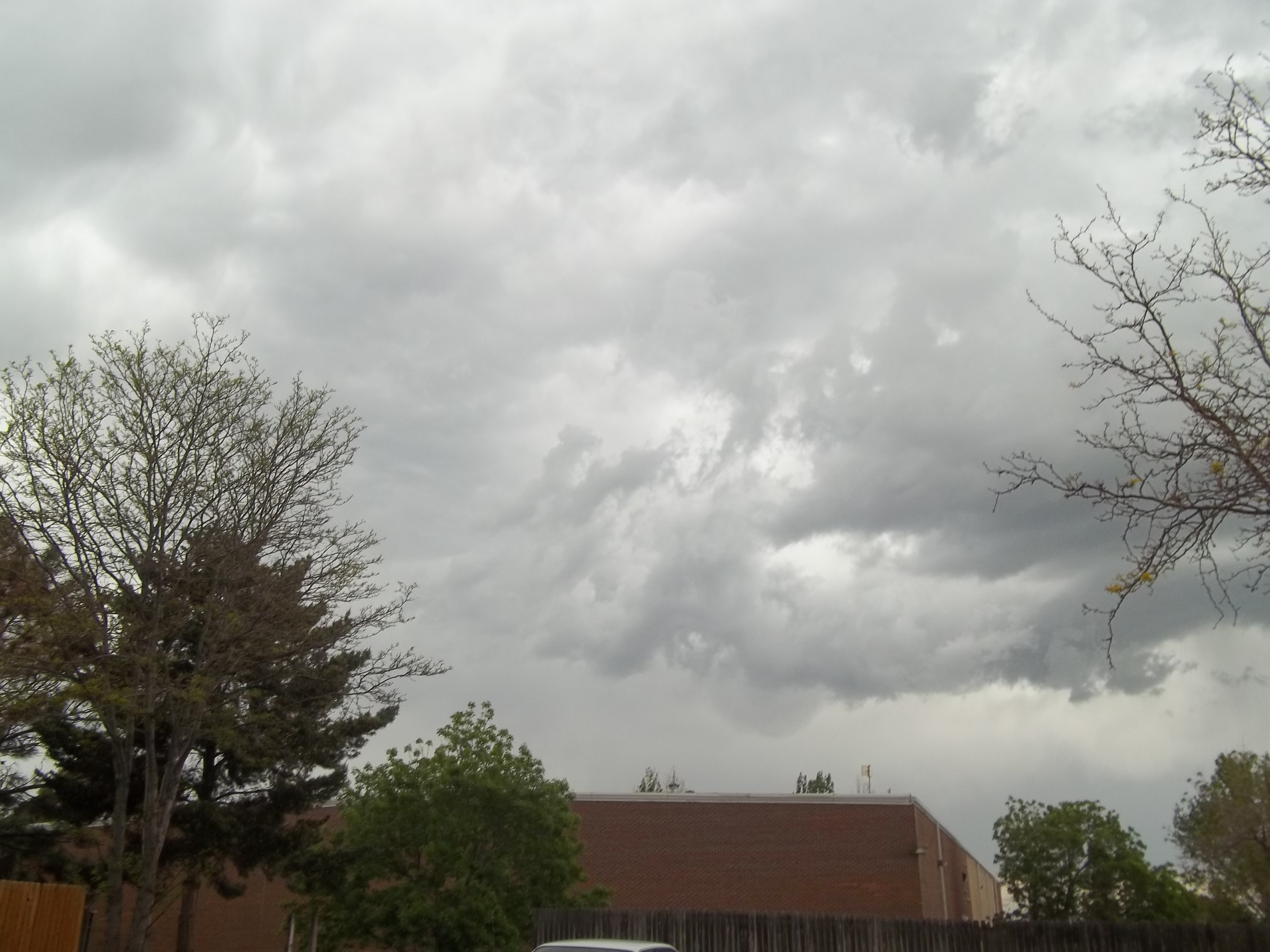
We just had a Tornado warning here in Colorado in the Larimer county that just expired. The clouds are building up. Keeping a close eye this
afternoon. My area, as well as the whole front range is under a severe thunderstorm watch with more and more warnings popping up. Just like yesterday
and the day before. Stay safe guys. =)
Multiple tornados right now .... Dover Delaware up through Philadelphia.
I watched one go just to the East of the house about 10 minutes ago.
Lots of rotation .... hail from golf ball size up to tennis ball size (Tennis size by Chester PA)
ETA .... tv just broke in to say another tornado coming in from Reading PA toward Philly ...
I watched one go just to the East of the house about 10 minutes ago.
Lots of rotation .... hail from golf ball size up to tennis ball size (Tennis size by Chester PA)
ETA .... tv just broke in to say another tornado coming in from Reading PA toward Philly ...
edit on 5/22/2014 by FlyersFan because: (no reason given)
originally posted by: thesaneone
Stay safe FF.
The good news ... the temp just dropped dramatically.
OOOPS ... TV saying multiple tornados now near Dover and in East Maryland ....
Tornado that went East of my house just hit New Jersey ... Near Camden.
ETA .... They are saying a tornado is now following the PA Turnpike ... N.W. of Philly
edit on 5/22/2014 by FlyersFan because: (no reason given)
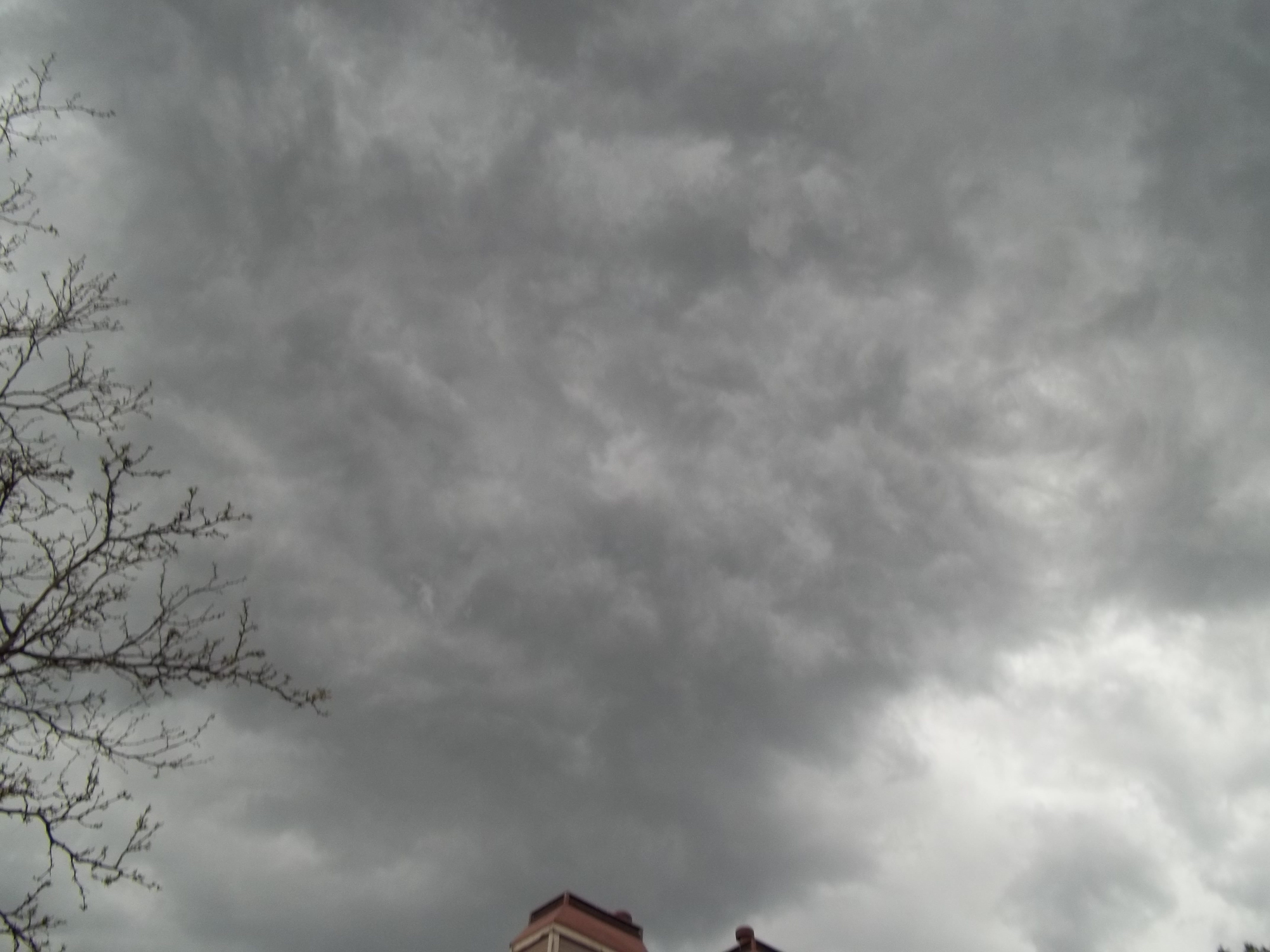
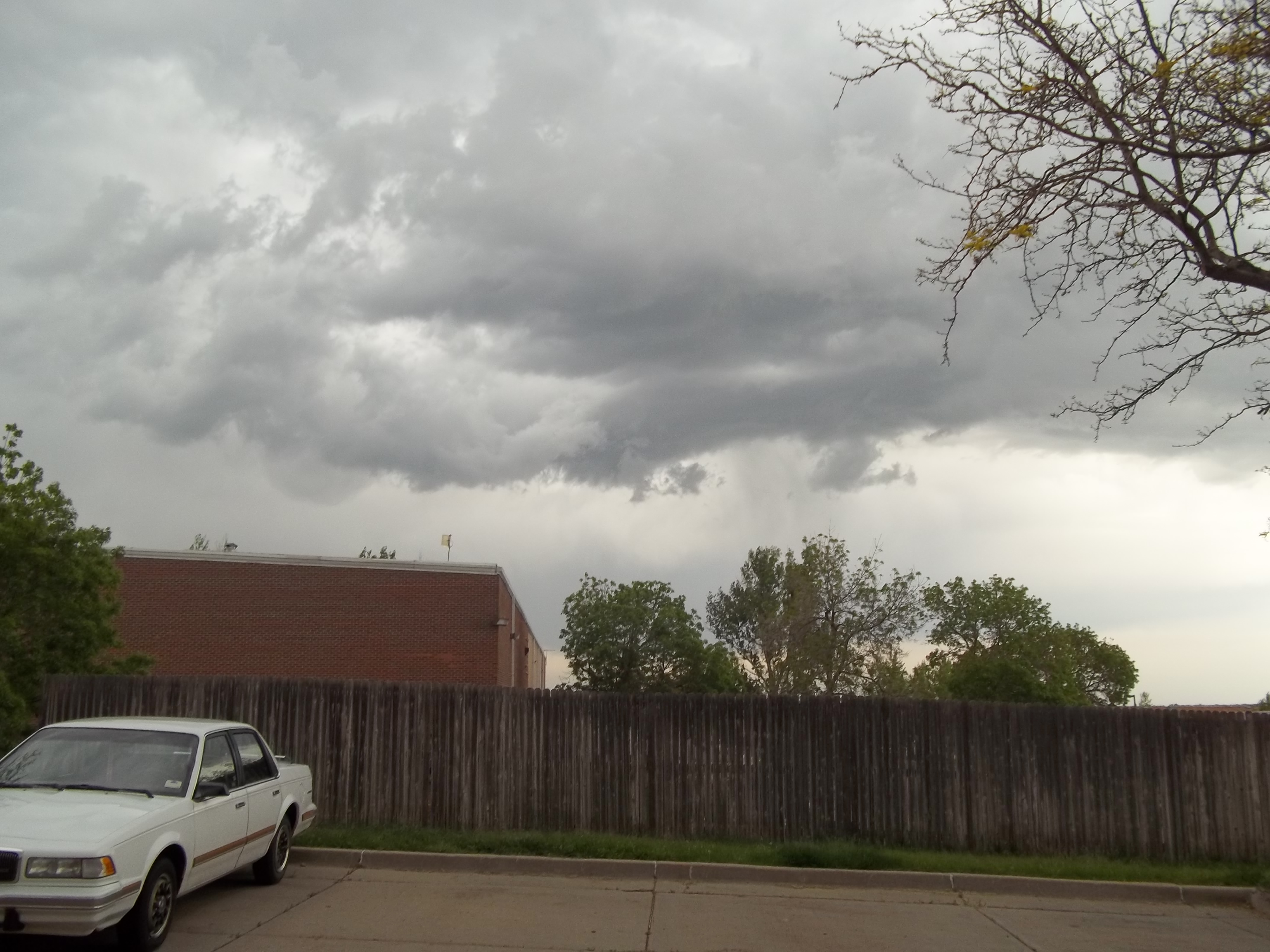
My area was just under a tornado warning. It's expired now but I went out and got some pics. Enjoy guys. =)
Friday, May 23
Scattered severe thunderstorms in east, south-central and southwest NC, middle and southeast TN, extreme north GA, SC, southwest MO, northwest AR, south and west KS, OK, north-central and west TX, east NM, east CO, southeast WY, southwest NE, northwest SD, southwest and south-central ND. TOR:CON - 2.
Scattered severe thunderstorms in east, south-central and southwest NC, middle and southeast TN, extreme north GA, SC, southwest MO, northwest AR, south and west KS, OK, north-central and west TX, east NM, east CO, southeast WY, southwest NE, northwest SD, southwest and south-central ND. TOR:CON - 2.
Tornado Warning for Chaves and Lincoln Counties in NM until 6:00 PM MDT
Storm in eastern Pacific, Amanda, now a major hurricane; additional strengthening expected
May 25th
A severe thunderstorm warning is issued for Denver's western suburbs.
Severe thunderstorm warning until 545 pm ET for Jenkins County, Ga., and Screven and Allendale counties in South Carolina.
Tornado warning issued for Charlton and Ware counties in Georgia until 6:15 pm ET -
A severe thunderstorm warning is issued for Denver's western suburbs.
Severe thunderstorm warning until 545 pm ET for Jenkins County, Ga., and Screven and Allendale counties in South Carolina.
Tornado warning issued for Charlton and Ware counties in Georgia until 6:15 pm ET -
edit on 25-5-2014 by MrLimpet because: (no reason given)
My ol' man and I went to Portage Indiana yesterday, and on Mothers Day they had a real bad storm. I could not believe the
damage done to the siding of homes on the West side. It was just obliterated.
Trees snapped a few feet off the ground. It was wild looking.
I guess there is a debate whether it was a microburst, or straightline winds.
damage done to the siding of homes on the West side. It was just obliterated.
Trees snapped a few feet off the ground. It was wild looking.
I guess there is a debate whether it was a microburst, or straightline winds.
Yesterday evening just north of my place here in Colorado they had a mudslide 2 miles wide and 4 miles long due to the heavy rains we had
www.abovetopsecret.com...
www.abovetopsecret.com...
6:22p ET: PECO reports 13,000+ customers w/o power in Montgomery Co PA; storms w/50+ mph gusts whipping through.
Nine people were hurt and one sustained critical injuries when a tornado roared through a camp near Watford City, North Dakota, Monday night,
destroying at least 15 trailers where oil workers had been living. The National Service said Tuesday that the twister packed winds that peaked at 120
mph.
3:40p CT: Folks in Morningside area of Sioux City IA should be in shelter - 64mph gusts reported at airport.
Monday: Severe thunderstorms will probably not be as rampant as Sunday, but may pop up in some parts of the Central Plains and the Great Lakes region.
Damaging winds and large hail would be the main threats.
Isolated to scattered severe thunderstorms in south and east WI, MI, northwest OH, north and central IN, north and central IL, MO, southeast KS, southwest, north-central and northeast OK. TOR:CON - 3 central MO, north and central IL, north IN, south MI; 2 to 3 rest of area
Isolated to scattered severe thunderstorms in south and east WI, MI, northwest OH, north and central IN, north and central IL, MO, southeast KS, southwest, north-central and northeast OK. TOR:CON - 3 central MO, north and central IL, north IN, south MI; 2 to 3 rest of area
Severe thunderstorms along a frontal boundary in northeast WY, southwest and south-central SD, NE, north-central and northeast KS, and spreading into
south IA and north MO by overnight. There could be one or more thunderstorm clusters (MCS) and possibly a derecho (widespread damaging windstorm
associated with a bow echo). Probably the highest tornado threat would be along the warm front in southern/southeast NE perhaps into northernmost
KS.
TOR:CON by state Tuesday (daytime):
IA south - 4
IL south - 2 to 3
IN south - 2 to 3
KS north-central, northeast - 4
KY west, north - 2 to 3
MO north - 4
MO southeast - 2 to 3
NE south - 7
NE north - 3
NY west - 2 to 3
OH east, central, southwest - 2 to 3
PA west, central - 2 to 3
SD southwest, south-central - 2 or less
WV north - 2 to 3
WY northeast - 2 to 3
Tuesday Night, June 3-4
Severe weather through the overnight hours. Tornado threat lessens if a derecho forms but there is a decent chance of a long track derecho with damaging winds from southern IA to northern MO then toward the Ohio Valley by early AM Wednesday. Localized flooding, as well.
TOR:CON by state Tuesday night:
IA south - 6
IL central - 2 to 3
KS north-central, northeast - 5
KY west, north - 2 to 3
MO north - 6
NE southeast - 7
NE north - 3
SD southwest, south-central - 2 to 3
WY northeast - 2
a reply to: Havox
What the...
In addition to your warning I found this on NOAA Storm Prediction Center
Wide spread possibly baseball size hail, that is huge...
What the...
In addition to your warning I found this on NOAA Storm Prediction Center
ZCZC SPCPWOSPC ALL
WOUS40 KWNS 030827
IAZ000-MOZ000-NEZ000-031800-
PUBLIC SEVERE WEATHER OUTLOOK
NWS STORM PREDICTION CENTER NORMAN OK
0327 AM CDT TUE JUN 03 2014
...Severe thunderstorms expected over parts of the middle and lower
Missouri Valley into the middle Mississippi Valley this afternoon
and tonight...
* LOCATIONS...
North-central through eastern Nebraska
Western through southern Iowa
Northern Missouri
* HAZARDS...
Widespread damaging winds, some hurricane force
A few intense tornadoes
Widespread large hail, some baseball size
* SUMMARY...
An outbreak of severe storms is forecast this afternoon through
tonight from parts of Nebraska through Iowa, northern Missouri,
and into Illinois. Very large hail, tornadoes, and widespread,
destructive winds are likely. A few of the tornadoes could be
strong.
Preparedness actions...
Review your severe weather safety procedures for the possibility
of dangerous weather today. Stay tuned to NOAA Weather Radio,
weather.gov, or other media for watches and warnings. A watch
means that conditions are favorable for severe thunderstorms
over the next several hours. If a severe thunderstorm warning is
issued for your area, move to a place of safety, ideally in an
interior room on the lowest floor of a sturdy building.
Wide spread possibly baseball size hail, that is huge...
a reply to: whatnext21
Yep, and hurricane-like winds. There is definitely a legitimate threat today. Hopefully everyone is aware and prepared.
Yep, and hurricane-like winds. There is definitely a legitimate threat today. Hopefully everyone is aware and prepared.
Something to keep an eye on.
First Tropical Development In The Gulf Detected, Area To Watch Soon

First Tropical Development In The Gulf Detected, Area To Watch Soon
JUNE 6, 2014 OUTLOOK … Long range models are zoning in on the first tropical development in the Gulf Of Mexico. Some take it to Florida, others to the Northern Gulf where Katrina hit. It could even go west into Mexico or Texas. The fact of the matter is this is going to be a zone of interest I’ll be watching over the next several days .
Severe thunderstorms hitting England on Saturday. Could be 7 hours plus of continuous thunderstorms!
That this Saturday June 7th. And its going to be 25c.
That this Saturday June 7th. And its going to be 25c.
new topics
-
Comparing the theology of Paul and Hebrews
Religion, Faith, And Theology: 16 minutes ago -
Pentagon acknowledges secret UFO project, the Kona Blue program | Vargas Reports
Aliens and UFOs: 1 hours ago -
Boston Dynamics say Farewell to Atlas
Science & Technology: 1 hours ago -
I hate dreaming
Rant: 2 hours ago -
Is the origin for the Eye of Horus the pineal gland?
Philosophy and Metaphysics: 3 hours ago -
Man sets himself on fire outside Donald Trump trial
Mainstream News: 4 hours ago -
Biden says little kids flip him the bird all the time.
2024 Elections: 4 hours ago -
The Democrats Take Control the House - Look what happened while you were sleeping
US Political Madness: 4 hours ago -
Sheetz facing racial discrimination lawsuit for considering criminal history in hiring
Social Issues and Civil Unrest: 4 hours ago -
In an Historic First, In N Out Burger Permanently Closes a Location
Mainstream News: 6 hours ago
top topics
-
In an Historic First, In N Out Burger Permanently Closes a Location
Mainstream News: 6 hours ago, 14 flags -
The Democrats Take Control the House - Look what happened while you were sleeping
US Political Madness: 4 hours ago, 11 flags -
Thousands Of Young Ukrainian Men Trying To Flee The Country To Avoid Conscription And The War
Other Current Events: 17 hours ago, 8 flags -
A man of the people
Medical Issues & Conspiracies: 12 hours ago, 8 flags -
Man sets himself on fire outside Donald Trump trial
Mainstream News: 4 hours ago, 7 flags -
Biden says little kids flip him the bird all the time.
2024 Elections: 4 hours ago, 6 flags -
4 plans of US elites to defeat Russia
New World Order: 13 hours ago, 4 flags -
Pentagon acknowledges secret UFO project, the Kona Blue program | Vargas Reports
Aliens and UFOs: 1 hours ago, 4 flags -
Is the origin for the Eye of Horus the pineal gland?
Philosophy and Metaphysics: 3 hours ago, 4 flags -
Sheetz facing racial discrimination lawsuit for considering criminal history in hiring
Social Issues and Civil Unrest: 4 hours ago, 3 flags
active topics
-
The defamation of Mary Magdalene
Religion, Faith, And Theology • 15 • : Solvedit -
A man of the people
Medical Issues & Conspiracies • 9 • : tarantulabite1 -
Silent Moments --In Memory of Beloved Member TDDA
Short Stories • 47 • : Naftalin -
Thousands Of Young Ukrainian Men Trying To Flee The Country To Avoid Conscription And The War
Other Current Events • 38 • : DBCowboy -
George Knapp AMA on DI
Area 51 and other Facilities • 28 • : theshadowknows -
Pentagon acknowledges secret UFO project, the Kona Blue program | Vargas Reports
Aliens and UFOs • 4 • : Ophiuchus1 -
Comparing the theology of Paul and Hebrews
Religion, Faith, And Theology • 0 • : DISRAELI2 -
12 jurors selected in Trump criminal trial
US Political Madness • 107 • : Xtrozero -
Man sets himself on fire outside Donald Trump trial
Mainstream News • 30 • : HatesFreshAir -
The Democrats Take Control the House - Look what happened while you were sleeping
US Political Madness • 36 • : DBCowboy