It looks like you're using an Ad Blocker.
Please white-list or disable AboveTopSecret.com in your ad-blocking tool.
Thank you.
Some features of ATS will be disabled while you continue to use an ad-blocker.

Did Malaysian Airlines 370 disappear using SIA68 (another 777)?
page: 12share:
stormcell
Thought this may be of interest .... investigators have found that there were five Indian Ocean practice runways in the flight simulator databases on his home PC. These were the following locations:
o Maldives x1
o Diego Garcia x1
o India x 1-2
o Sri Lanka x 1-2
The fact that the aircraft was carrying a large shipment of fruit (coincidence?) suggests that the destination was somewhere where supplies have to be brought in and not grown. There are already eyewitnesses in the Maldives who say they saw a low flying jet.
www.telegraph.co.uk...
I used to play flight simulator games when I was younger (F117 stealth fighter), and flying low was the best way to avoid radar, as well as make an easy landing. Definitely looks like they have been taken somewhere.edit on 18-3-2014 by stormcell because: (no reason given)
OMG as I suspected... Maldives is on the list! God I hope they're keeping the passengers alive
reply to post by Ivar_Karlsen
And it may turn out that they put it out, or thought they did, and decided they were ok to press to a landing. Or they decided that the risk was as great ditching as flying. If they find the boxes we'll find out.
And it may turn out that they put it out, or thought they did, and decided they were ok to press to a landing. Or they decided that the risk was as great ditching as flying. If they find the boxes we'll find out.
Zaphod58
Would YOU fly coms out, transponder out through busy airspace, or would you head for a low traffic area where there is almost no chance of a traffic conflict?
Me? I would cross my fingers with anti-collision lights and landing lights and take the chance that ATC could do their job and handle unexpected traffic and recognize an emergency and put that thing straight into the nearest suitable field as fast as I could. Traffic be damned. Barring that, I'd try to put it on the beach like they did in Ethiopia because a fire is the last thing I want to take chances with. Anything more severe and you take your chances asea in an area they will be looking for you.
What I definitely wouldn't do is overfly the peninsula and several potential emergency landing sites then use normal traffic corridors and head out over the Indian Ocean 1500 miles toward Bangalore trusting I would be able to control the plane for more than 10 minutes while there is or was a fire smouldering somewhere aboard.
reply to post by _Del_
And if it was out they may have made that choice. I've seen a lot of accidents where the crew made what turned out to be a bad choice.
And if it was out they may have made that choice. I've seen a lot of accidents where the crew made what turned out to be a bad choice.
reply to post by PeterMcFly
UPDATE:
Upon further analysis, I now consider data from Inmarsat very suspect. It apear those trajectory arcs are simple projection at constant distance of the satellite to surface of Earth, in other words, the satellite's cone of constant Time Of Flight for a pulse. Other Inmarsat bird at 178degE is nearly at horizon or below for this region, TOF triangulation is improbable.
Unless Inmarsat release exactly how they generated these arcs, I no longer consider it as fact.
reply to post by Zaphod58
At the point of deviation, the crew was about equidistant from Vietnam and Malaysia. We'll say that is the point of recognized emergency for the sake of argument. Trying to make it all the way back to Langkawi and off the course where people would expect you would be a poor choice perhaps (I've never flown the region, I don't have charts for the area, and I'm lazy -- perhaps otherthings being unequal that is the nearest suitable field and a better choice than continuing to Vietnam or Cambodia). Overflying Langkawi and avoiding Phuket by roughly a hundred miles and then heading on a course out to sea 1500 miles toward Bangalore after a fire is not a "bad choice". It's comically implausible.
At the point of deviation, the crew was about equidistant from Vietnam and Malaysia. We'll say that is the point of recognized emergency for the sake of argument. Trying to make it all the way back to Langkawi and off the course where people would expect you would be a poor choice perhaps (I've never flown the region, I don't have charts for the area, and I'm lazy -- perhaps otherthings being unequal that is the nearest suitable field and a better choice than continuing to Vietnam or Cambodia). Overflying Langkawi and avoiding Phuket by roughly a hundred miles and then heading on a course out to sea 1500 miles toward Bangalore after a fire is not a "bad choice". It's comically implausible.
Here is something that I hadn't seen yet.
jihadwatch
At the link you will find a photo purportedly of the pilot wearing a 'democracy is dead' T-shirt. He is said to have been a follower of a fanatical Muslim leader that supports jihad.
jihadwatch
At the link you will find a photo purportedly of the pilot wearing a 'democracy is dead' T-shirt. He is said to have been a follower of a fanatical Muslim leader that supports jihad.
reply to post by _Del_
It's a 13,000 foot runway with a straight in approach, and no obstacles. Anywhere near them had mountain turbulence and obstacles.
But hell let's go with the more outrageous theories that require a lot of luck, and everything to go perfectly. Makes sense to me.
It's a 13,000 foot runway with a straight in approach, and no obstacles. Anywhere near them had mountain turbulence and obstacles.
But hell let's go with the more outrageous theories that require a lot of luck, and everything to go perfectly. Makes sense to me.
At least the sat pings are real data that can be input into known formulas based on science. They might be the only correct thing in all of this.
Given the north path is on the China side of the mountains and India believe it has no radar contact, I tend to trust it. Although I really no longer trust governments. I also think there are many people who are not competent in their position in this world.
Given the north path is on the China side of the mountains and India believe it has no radar contact, I tend to trust it. Although I really no longer trust governments. I also think there are many people who are not competent in their position in this world.
edit on 3/18/2014 by roadgravel
because: typo
reply to post by butcherguy
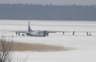
Plane has probably landed on a frozen lake around the Afghanistan & Tajikistan border. Possibly lake Zorkul.
Most probably did shadow SQ68 or possibly KLM 836, all the time keeping an eye on its ACAS heading, altitude & airspeed, probably 1000 feet or more below it as airliners generally rise a little during flight.
If you want to see the plane disappear follow this link
www.flightradar24.com...:50/12x/4.46,102.41/7
playback 7th March 2014 UTC 1650
edit on 18-3-2014 by mongrelpom because: link
edit on 18-3-2014 by mongrelpom because:
image

edit, sorry, don't worry about it. Mods feel free to delete.
edit on 18-3-2014 by markymint because: decided to keep opinion to myself
Technically this theory is possible, but highly improbable. Then again, losing a 777 is highly improbable.
The reason I say it is highly improbably is this: range and azimuth resolution on the many military radar systems is pretty good. I was formerly a radar guy for the military, mostly upgrading and maintaining their systems, so I know a little bit about radar. These planes would have had to be flying extremely close to one another, easily within viewing distance. Military systems use both iff/sif and radar height (Geometry) for elevation.So the controllers display would show two elevations for the same blip. The minute he slipped too far from the other flight and his blip was there without any sif paint, he would have been tracked. All it would take is one mistake on his part. If he flew too near the other plane, he risked blanking both planes on the radar screen.
It's possible, but again, highly improbable and very difficult.
just my thoughts.
edit on 18-3-2014 by Dfairlite because: Rephrasing
edit on 18-3-2014 by Dfairlite because: (no reason
given)
Zaphod58
reply to post by _Del_
It's a 13,000 foot runway with a straight in approach, and no obstacles. Anywhere near them had mountain turbulence and obstacles.
I'm fine with the choice of Langkawi. I just said that. What you have to explain to me is why they would then overfly Langkawi potentially within visual distance of that 13,000' runway, skip it, then enter a way point "Gival" bringing it by Phuket Island 150 miles away, skip the airfield 9000' runway there, and then apparently manually input nav point "Igrex" to lead them across the ocean to ... wherever... all in the middle of an inflight emergency.
The closest point using "Igrex" will be the Andamans more than 450 miles away which has a 10,800' runway. So assuming our last track is MH370, our last point of contact has them flying away from the safety of dry land. It doesn't make sense.
That fire scenario bringing them to Langkawi makes sense in the absence of the facts that they then overflew that area and proceeded on normal corridors toward India according to manual inputs to the nav points and the latest information on the primary radar plots. With those facts, the decompression or fire emergency scenarios make little sense. You don't go on flying for three or four hours after a fire. If it's hypoxia, you don't go inputting nav points following common air corridors.
The eye-witness reports are worthless. Let's throw them out. What we have left is: A) the plane is not where it was supposed to be, B) someone was in control of the plane flying along organized corridors, C) the plane was not piloted in a manner consistent with an inflight emergency
The investigation is something of a Keystone Kops affair so far. I think the idea in the OP is awfully far-fetched and "outrageous", but I think the "mundane" explanations sound far-fetched so far too. I think we'll find it was a hijacking. I doubt anything as complicated as deliberate radar evasion (outside of shutting off the transponders) took place. Pilot-suicide, is possible as well, I suppose. All[i/] the potential scenarios are outside the normal box. Previous commercial flights where the flight crew failed to recognize decompression? A handful in the last 60 years. An onboard fire that takes out all communication and becomes catastrophic before the flight crew communicates a problem? Hasn't ever happened to my knowledge. The simple idea that someone deliberately shut off the transponders is way higher and less "outrageous" in my mind.
Plus...if you're going to divert to Langkawi, and you've had the wherewithal to get a course set in that direction, chances are very good that you
would have also called them on the VHF to let them know you were diverting there on an Emergency. In a fire scenario you might turn off a lot of
things, but the radios are going to be one of the very last things, if ever, you would shut down. Further, you would probably hail a few "Maydays"
on your existing ATC control frequency and state your intentions there as well. If you were on fire, with smoke on the flight deck, you wouldn't
just calmly say "okay, good night"....and then silence.
BTW, Langkawi is a very cool place. I've been there personally many times. (totally off topic, but thought I'd share).
BTW, Langkawi is a very cool place. I've been there personally many times. (totally off topic, but thought I'd share).
DrHammondStoat
But they weren't.
No-one on that list of 'freescale patent holders' was actually on the passenger list. A very simple piece of cross checking that anyone can do before posting this freescale patent stuff all over the place.
I don't say that it's the case, probably not, but what if it's only a difference in the Chinese/American translation ?? I don't talk Chinese, but maybe someone who speaks it can confirm that ??
edit on 18 3 2014 by Nitzz321 because: (no reason given)
Right now I'm leaning towards Diego Garcia
I wish we could get more from the eye-witnesses in the Maldiv Islands.....the MSM seems so concerned, perhaps they'll send someone to ask the eye-witnesses more information
I wish we could get more from the eye-witnesses in the Maldiv Islands.....the MSM seems so concerned, perhaps they'll send someone to ask the eye-witnesses more information
FOX Hannity just plunked this OP theory down on the mainstream table. Implications were that the US, Israel already know where the plane
is.
edit on 18-3-2014 by zayonara because: (no reason given)
reply to post by _Del_
They may have set a destination that would head them where they needed to be, instead of taking the time to program Langkwi in so they could fight the fire and were overcome before they could change anything.
They may have set a destination that would head them where they needed to be, instead of taking the time to program Langkwi in so they could fight the fire and were overcome before they could change anything.
The objective being the "other" black boxes in the cargo hold???
new topics
-
WF Killer Patents & Secret Science Vol. 1 | Free Energy & Anti-Gravity Cover-Ups
General Conspiracies: 4 minutes ago -
Hurt my hip; should I go see a Doctor
General Chit Chat: 53 minutes ago -
Israel attacking Iran again.
Middle East Issues: 2 hours ago -
Michigan school district cancels lesson on gender identity and pronouns after backlash
Education and Media: 2 hours ago -
When an Angel gets his or her wings
Religion, Faith, And Theology: 2 hours ago -
Comparing the theology of Paul and Hebrews
Religion, Faith, And Theology: 3 hours ago -
Pentagon acknowledges secret UFO project, the Kona Blue program | Vargas Reports
Aliens and UFOs: 4 hours ago -
Boston Dynamics say Farewell to Atlas
Science & Technology: 4 hours ago -
I hate dreaming
Rant: 5 hours ago -
Man sets himself on fire outside Donald Trump trial
Mainstream News: 7 hours ago
top topics
-
The Democrats Take Control the House - Look what happened while you were sleeping
US Political Madness: 8 hours ago, 18 flags -
In an Historic First, In N Out Burger Permanently Closes a Location
Mainstream News: 10 hours ago, 16 flags -
A man of the people
Medical Issues & Conspiracies: 15 hours ago, 11 flags -
Biden says little kids flip him the bird all the time.
Politicians & People: 7 hours ago, 8 flags -
Man sets himself on fire outside Donald Trump trial
Mainstream News: 7 hours ago, 7 flags -
Pentagon acknowledges secret UFO project, the Kona Blue program | Vargas Reports
Aliens and UFOs: 4 hours ago, 6 flags -
Israel attacking Iran again.
Middle East Issues: 2 hours ago, 5 flags -
Michigan school district cancels lesson on gender identity and pronouns after backlash
Education and Media: 2 hours ago, 4 flags -
4 plans of US elites to defeat Russia
New World Order: 17 hours ago, 4 flags -
Boston Dynamics say Farewell to Atlas
Science & Technology: 4 hours ago, 4 flags
active topics
-
Thousands Of Young Ukrainian Men Trying To Flee The Country To Avoid Conscription And The War
Other Current Events • 53 • : ghandalf -
WF Killer Patents & Secret Science Vol. 1 | Free Energy & Anti-Gravity Cover-Ups
General Conspiracies • 0 • : 727Sky -
Boston Dynamics say Farewell to Atlas
Science & Technology • 5 • : Caver78 -
Hurt my hip; should I go see a Doctor
General Chit Chat • 7 • : randomtangentsrme -
Biden says little kids flip him the bird all the time.
Politicians & People • 16 • : stelth2 -
When an Angel gets his or her wings
Religion, Faith, And Theology • 2 • : stelth2 -
MULTIPLE SKYMASTER MESSAGES GOING OUT
World War Three • 51 • : Zaphod58 -
Israel attacking Iran again.
Middle East Issues • 19 • : stelth2 -
Pentagon acknowledges secret UFO project, the Kona Blue program | Vargas Reports
Aliens and UFOs • 7 • : Ophiuchus1 -
-@TH3WH17ERABB17- -Q- ---TIME TO SHOW THE WORLD--- -Part- --44--
Dissecting Disinformation • 549 • : cherokeetroy